Evidence of water management exists in some of the earliest large settlements in the lowland Maya region, as well in the Olmec region. At Nixtun-Ch'ich', a gridded city on the western edge of Lake Peten Itza in Peten, northern Guatemala, a water management system of reservoirs/pools and directed drainage dates to the Middle Preclassic period (800–400/300 b.c.). Here, we argue that water management and hydrology were central considerations in planning the city's unusual layout, and that Nixtun-Ch'ich' was, like most Middle Preclassic Maya polities, cooperative in sociopolitical organization.
WATER MANAGEMENT AND PUBLIC GOODS
Considered in terms of political organization, Wittfogel (Reference Wittfogel1957) famously examined how despotic rulers established “total power” by managing hydraulic and other types of constructions as well as the economic surplus. He argued that such rulers were absolute, with no checks on their power. They maintained authority through terror, control of surplus produce, and centrality in the religious system (deification, worship of dynastic ancestors, and so on). Wittfogel (Reference Wittfogel1957:101–103) downplayed conflicts between despotic rulership and other aspects of society (Eisenstadt Reference Eisenstadt1958:441), but such tensions are fertile ground for political transformations leading to societies that are more despotic/exclusive versus more cooperative (Chase Reference Chase2019). Societies that are more cooperative often have a monarch, but that individual is accountable and has substantial checks limiting their control. Such societies display fewer representations of sovereigns and less investment in monumentalizing them through palaces and tombs; they tend to permit wider access to luxury goods and central spaces for the masses. Most important for present purposes, they also invest far more in public goods, such as roads and drainage systems (Blanton and Fargher Reference Blanton, Fargher and Carballo2012; Blanton et al. Reference Blanton, Feinman, Kowalewski and Peregrine1996; Feinman and Carballo Reference Feinman and Carballo2018).
Public goods are highly “non-excludable” (i.e., inclusive) and “non-rivalrous” resources. Non-rivalrous indicates that one person's consumption of such resources does not infringe on or decrease their benefit to another person. Non-excludability and non-rivalrousness of resources are matters of degree; they are not absolute (Cowen Reference Cowen1985). Public goods help to make cities desirable places to live. Some public goods, such as plazas and roads, facilitate social interactions and economic exchange. Others, such as drainage systems, help to create a pleasant atmosphere and lower the load of waterborne parasites. Before the nineteenth century, cities were generally “entropic,” as poor sanitation and disease stifled growth and increased mortality, meaning that successful cities require continuous in-migration (Algaze Reference Algaze2018; Dyson Reference Dyson2011). “Local public goods” of modern cities attract inhabitants, particularly those in creative occupations—artists, engineers, and the highly educated (Batabyal et al. Reference Batabyal, Kourtit and Nijkamp2019; Florida Reference Florida2014). In ancient times, they might have drawn craft producers or intellectuals from cities that were less inviting.
NIXTUN-CH'ICH’
Nixtun-Ch'ich' was first described by Morley (Reference Morley1937–1938:Plate 181). It was later visited by Cowgill (Reference Cowgill1963:60–61), whose limited surface collection discerned Classic period and earlier occupations. Chase (Reference Chase1983:1164–1168) visited the site in 1977 and surface-collected Preclassic, Late Classic, and Postclassic ceramics uncovered by looters.
The immense size and peculiar layout at Nixtun-Ch'ich' were unknown to archaeologists until Proyecto Maya Colonial, directed by Prudence Rice and Don Rice, surveyed the site and conducted preliminary excavations in 1995. From 2006 to 2007, Proyecto Arqueológico Itzá del Petén, also directed by the Rices, excavated on the eastern side of the site and discerned substantial Middle Preclassic period constructions. The work also revealed Late Preclassic, Early Classic, Late Postclassic, and Colonial period occupations (Rice Reference Rice2009). Work began again in 2013–2014, when Proyecto Arqueológico Itzá investigated Late Postclassic occupations on the western side of the site and remapped the site (Pugh et al. Reference Pugh, Rice, Nieto and Rice2016).
From 2015 until present, the focus of the project shifted to documenting Middle Preclassic period constructions at Nixtun-Ch'ich'—particularly its streets (Pugh and Rice Reference Pugh and Rice2017; Pugh Reference Pugh2019). The investigation of hydrology was not a primary focus initially. However, we mostly work from June until August in the rainy season, so hydrology revealed itself during our investigations of the streets. After heavy rains, we observed surface drainage and heard groundwater percolating between the surface and buried plaster floors. We observed aguadas filling during the rainy season as well. Thus, excavations examined three aguadas and some streets that seemed to channel water. We also conducted a high-resolution survey of most of the site, with a total station that allowed for the watershed analysis and excavations to investigate the watershed. Future work will investigate hydrology at Nixtun-Ch'ich' in a more systematic manner.
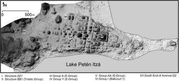
The new map indicated that Nixtun-Ch'ich' differs from most Maya settlements in that it was arranged in an orthogonal urban grid (Figures 1 and 2; Pugh and Rice Reference Pugh and Rice2017; Pugh et al. Reference Pugh, Chan Nieto and Zygadło2020; Rice and Pugh Reference Rice and Pugh2021). The grid, which facilitated movement as well as drainage within the city, was established in the Middle Preclassic (800–400/300 b.c.) and maintained into the Late Preclassic period (400/300 b.c.–a.d. 200), when the site experienced its greatest growth. Apart from this unusual urban layout, Nixtun-Ch'ich' displays typical Preclassic period Peten characteristics: an east–west central axis (Estrada-Belli Reference Estrada-Belli2011:67), three E-Groups, a triadic group, and evidence of water management. Even today, pedestrian and cattle traffic and water runoff are still heavily influenced by the city planning implemented 2,500 years ago (Pugh and Rice Reference Pugh and Rice2017:599). We contend that hydrology/water management was a central consideration in this planning.
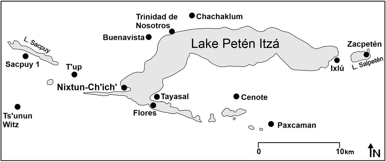
Map of select sites on Lake Peten Itza, with Preclassic period occupations, Peten, Guatemala. Image by Pugh.

Nixtun-Ch'ich', Peten, Guatemala. Image by Pugh and Gabriela Zygadło.

Many studies of Classic lowland Maya rulership have focused on kings’ roles in water management, even suggesting that this was the basis of their power. These studies (e.g., Lucero et al. Reference Lucero, Gunn and Scarborough2011; Scarborough Reference Scarborough1998) highlight the sharp contrasts in tropical weather patterns, with the rainy season bringing in too much water too fast, and the dry season causing droughts. Maya sovereigns would have had to implement hydraulic engineering solutions, directing excess rainfall to reservoirs for storage to meet the dry season needs of the populace for safe, potable drinking and cooking water, and also for hygiene (see Scarborough and Gallopin Reference Scarborough and Gallopin1991; Silverstein et al. Reference Silverstein, Webster, Martínez and Soto2009; Weiss-Krejci and Sabbas Reference Weiss-Krejci and Sabbas2002). Such engineering would have required management personnel to construct and maintain appropriate facilities, with significant costs in labor and resources.
Water system engineering does not necessitate management by a despot. This narrative of Maya social complexity seems detached from facts and is lacking in nuance (Chase Reference Chase2016, Reference Chase2019). We appreciate the salience of water control in most of the interior karstic plateau of the Yucatan Peninsula, which lacks reliable surface waters provided by rivers and lakes. But such control is not a compelling explanation for kingly power and authority in the central Peten lakes area. This region reliably experiences the torrential rainy season downpours known throughout Mesoamerica, but the management problem is mostly one of quickly eliminating the excess water and less a matter of storing it against the dry season. Ancient Maya cities in the lakes region tend to be located on the easily drained, higher terrain north of the lake basins or on islands and peninsulas in the lakes, instead of on the low, poorly drained and gradually sloping terrain that forms the lakes’ southern shores.
Here we discuss surface drainage patterns and water-retaining ponds (aguadas) at Nixtun-Ch'ich' in terms of their planning as part of its sacred landscape—its cityscape. Drawing analogies with contemporaneous features at Gulf Coast sites, we see the roles of the city's hydraulic features as equally ritual and symbolic, as secular and functional.
CITY PLANNING AT NIXTUN-CH'ICH'
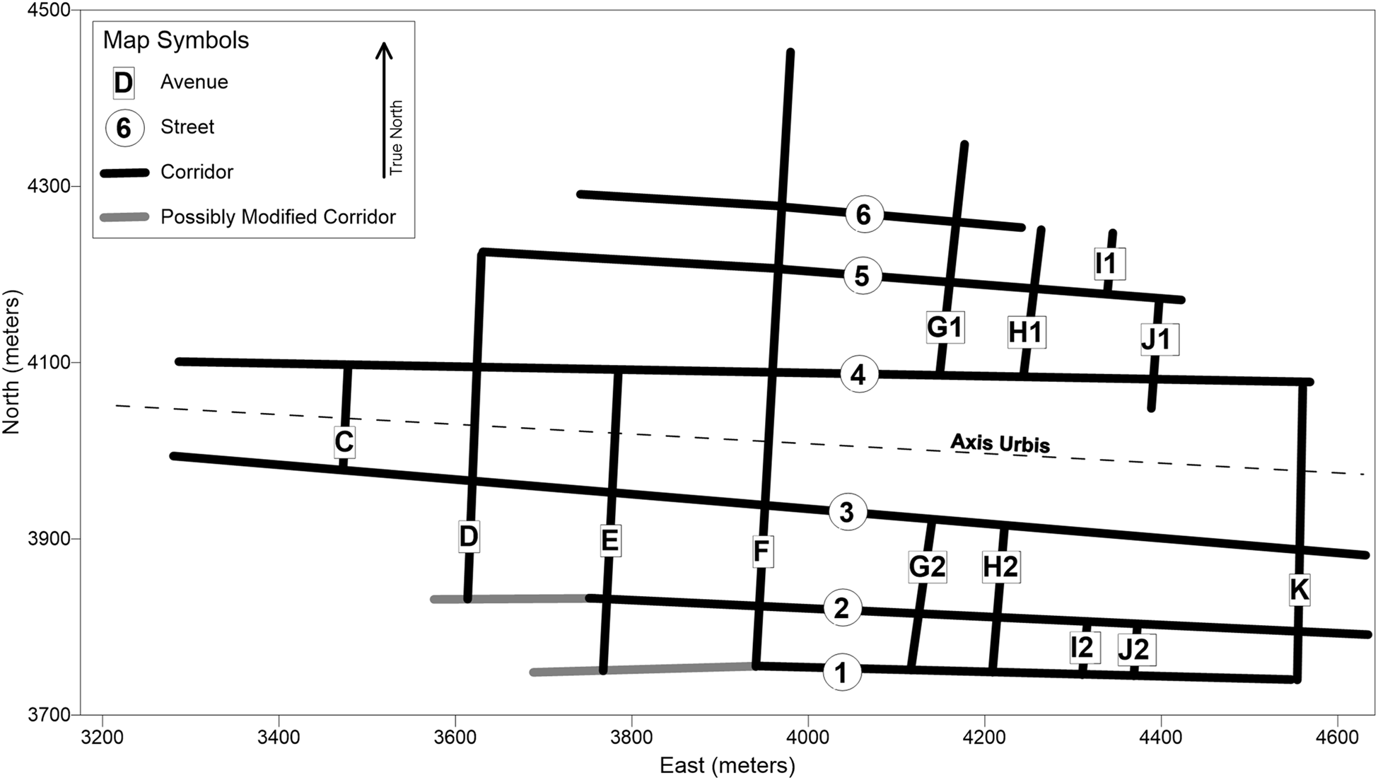
The urban layout of Nixtun-Ch'ich' is formed by six east–west “streets” intersecting seven north–south “avenues” (Figure 3). Five radiocarbon assays of plant charcoal from fills in the corridors indicate that the grid was constructed between 798 and 416 cal b.c. Although this grid is not clearly visible to those on the ground, the city's central axis urbis is visible (Pugh Reference Pugh2019:990). An axis urbis is a visible foundational line in the cityscape—whether a central avenue or a row of buildings—that is a clearly dominant element in a city's plan. Such axes are more than just planning tools—they dominate the cityscape and call attention to themselves, thus frequently serving as reference points (Pugh et al. Reference Pugh, Chan Nieto and Zygadło2020:251). Preclassic architectural features along the axis include three E-Groups and a triadic group: the axis is bounded on the west by an E-Group, while the triadic group is an eastern endpoint bounding an unbroken line of buildings.
Plan of gridded corridors, Nixtun-Ch'ich', Peten, Guatemala. Image by Pugh.

E-Groups vary in form, but include a long, low platform on the eastern side of the plaza and a radial temple (with four cardinally located stairways and lacking a superstructure) on the western side. They may have originated as naked-eye solar observatories marking the solstices and equinoxes; however, many would not have accurately fulfilled this function after later remodeling. They likely served calendrical, political, and administrative functions (Aimers and Rice Reference Aimers and Rice2006:93; Doyle Reference Doyle2012:369; Freidel et al. Reference Freidel, Chase, Dowd and Murdock2017).
Triadic groups consist of a large temple and two smaller buildings arranged in a triangle on a platform, possibly representing the three-stone hearth of creation (Hansen Reference Hansen and Houston1998:77–81). Recent analysis suggests that they may be associated with the resurrection of the Maize God, the Hero Twins, fertility, and cyclical time (Szymański Reference Szymański2014:158). The triadic group at Nixtun-Ch'ich' (Structure BB1) was built during a Late Preclassic period construction boom. This complex had Middle Preclassic antecedents, but we do not know if they formed a triadic group.
Besides the axis urbis, order in the site plan was enhanced by Avenue F, which extends from north to south, nearly perfectly perpendicular to the centerline as well as to two secondary east–west axes. Furthermore, the site includes three north–south axes, which border Avenues F and G. For example, the axis of urban blocks west of Avenue F was formed by the alleyway of the large ballcourt in Group I, the western building of the E-Group in Group Y, and a lone temple in Sector RR.
Although the site plan presented in Figure 2 appears static, its construction history was not. Excavation has revealed that the layout changed over time, though the axis urbis seems to have been established at the founding of the city—which also seems to have involved the destruction of pre-existing (pre-Mamom) communities (Obrist-Farner and Rice Reference Obrist-Farner and Rice2019; Pugh Reference Pugh2019). Nevertheless, at least some of the buildings of the earlier communities were preserved beneath structures along the axis (Rice Reference Rice2009, Reference Rice2019). Even after the city was established, the edifices of the central axis experienced major modification and enlargement, and the streets and avenues became increasingly narrow over time.
HYDROLOGIC FEATURES: THE “FOSAS”
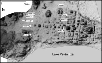
Planning of the built environment of Nixtun-Ch'ich' necessarily involved consideration of hydraulics, to accommodate both the existing hydrological features and the new city buildings. In particular, the axis urbis included two aguadas and the grid corridors drained water from the site. The landscape includes a number of surface depressions, which we refer to as fosas (Figure 4). Some of these (identified by their alphabetically named grid sectors as Fosas B, C, U1, U2, U3, and V) still fill with water during the rainy season and others appear to have done so in antiquity. The early Mayas may have referred to such a water-filled feature as a nahb'/naab' (Ch'olan/Yukatekan, respectively), a long-lived word for a body of water: a lake, pond, or pool (also waterlily; Houston Reference Houston, Finamore and Houston2010:73–74).
Plan showing the aguadas at Nixtun-Ch'ich', Petén, Guatemala. Image by Pugh and Gabriela Zygadło.

Several of the Nixtun-Ch'ich' fosas (I, Q, and Y) were accentuated with human constructions. Two (Fosas V and Y), 650 m apart, lie on the site's axis urbis. If these two axial fosas were natural, then they likely served as the original basis for the orientation of this centerline (Rice and Pugh Reference Rice and Pugh2017:2). Fosa I lies 290 m north of Fosa Y, and a line between the two parallels Avenue F, orthogonal to the central axis. Fosa Q is about 175 m equidistant to the west from I and Y; together they form a shallow triangle. Fosa C, 130 m north of Fosa I, is also roughly in line with Fosas I and Y, which seem to have been natural depressions. Thus, natural features may have helped to shape the site layout. Nevertheless, we must be cautious in assuming that the depressions were natural, as the construction of the city involved leveling of some bedrock and massive reconstruction, which may have transformed the watershed.
Sector Y, Fosa Y (Central Axial Fosa)
Fosa Y has been considered in detail in previous publications (Rice and Pugh Reference Rice and Pugh2017; Rice et al. Reference Rice, Pugh and Chan Nieto2019). This surface depression, measuring 46 m north–south, 31 m east–west, and 2.5 m deep, borders the eastern edge of the Sector Y E-Group (Rice and Pugh Reference Rice and Pugh2017:3). We have argued that it was the centering point of the axis urbis and the early ritual landscape of Nixtun-Ch'ich'.
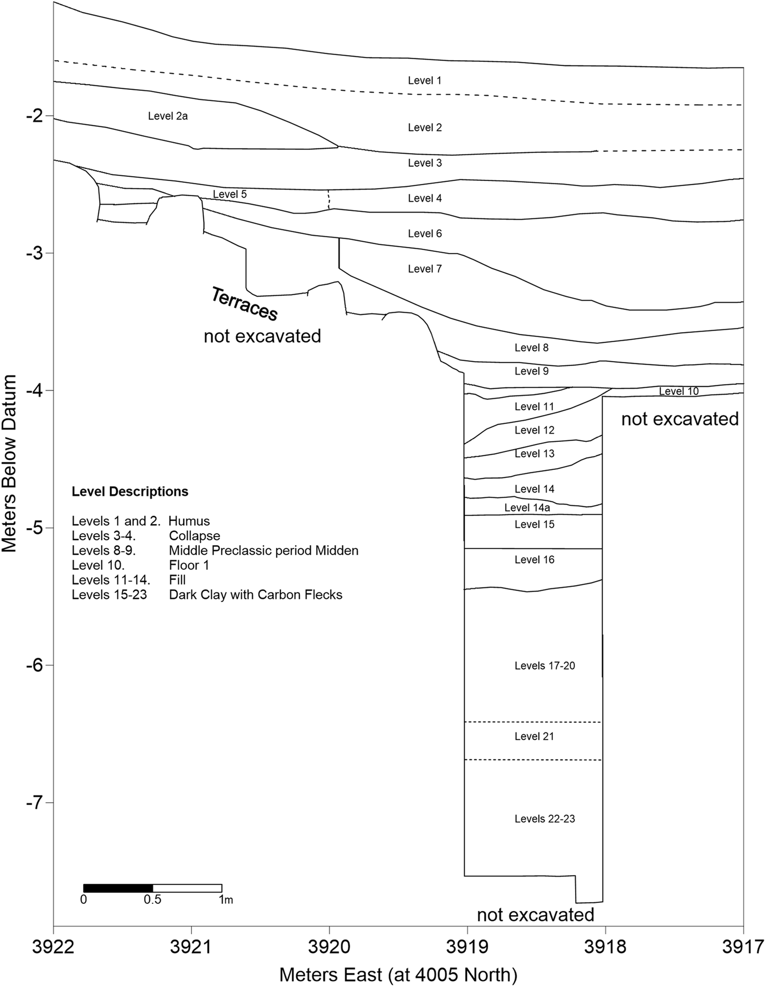
Excavations on its east and west sides revealed stepped terraces dated to the Middle Preclassic period that appear as “amphitheater-like” seating (Figures 4 and 5; Rice et al. Reference Rice, Pugh and Chan Nieto2019:560). The terraces were variously composed: some were built of large stones, while others were formed with a stone facing that supported soil fill. The center of the Fosa Y amphitheater was surfaced with a plaster floor. At the end of their use, the terraces were covered with a massive deposit of refuse, including large Middle Preclassic period ceramic sherds, animal bones, and various other objects. This deposition has been interpreted as a termination event following a large feast (Rice and Pugh Reference Rice and Pugh2017:8; Rice et al. Reference Rice, Pugh and Chan Nieto2019:11). Excavations also revealed that the fosa experienced caching activities during the Late Preclassic period, which is not surprising, as the adjacent E-Group experienced a major renovation event at that time. One cache included two well-made limestone manos and three limestone beehive stoppers, perhaps also relating to feasting (Rice et al. Reference Rice, Pugh and Chan Nieto2019:12).
South Profile, Unit 4010, 3922, Fosa Y, Nixtun-Ch'ich', Peten, Guatemala. Image by Pugh.

Excavations continued 3.75 m beneath the floor at the base of the terraces and encountered about a meter of fill from various constructions above 2.75 m of dark wet clay, with substantial carbon, sherds, and animal bones. At 6.1 m below surface, the excavation could not be safely continued and was ended. We suspect that the dark clay was likely deposited by seasonal spilling of effluent into Fosa Y. A cache that included the majority of a red-slipped platter (Juventud Red: Chapo variety) and a human temporal bone encountered 5 m below surface indicates that the area had ceremonial importance long before the terraces were built.
Sector V, Fosa V (Axial Fosa)
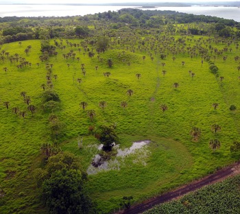
Fosa V, a 41 × 30 m aguada in the western portion of the city, fills yearly from July to January. Along with another to its south (Fosa C) and several others (Fosas U1, U2, U3) to its north, it is fed by runoff from karstic hills to the north and west (Figure 4). We have not yet excavated into Fosa V to discern whether it contains offerings or constructions. In particular, one wonders if it includes artificial surfaces meant to accentuate the retention of water similar to Fosas I and Q. The yearly filling of this feature could have added an annual cycle to symbolism of the axis urbis, a cycle that was also likely commemorated by the E-Groups (Figure 6). Nearby fosas have not yet been investigated and are not further considered here.
Drone image of Fosa V and the axis urbis, Nixtun-Ch'ich', Peten, Guatemala. Photograph by Pugh.

Sector Q, Fosa Q (Non-Axial Fosa)
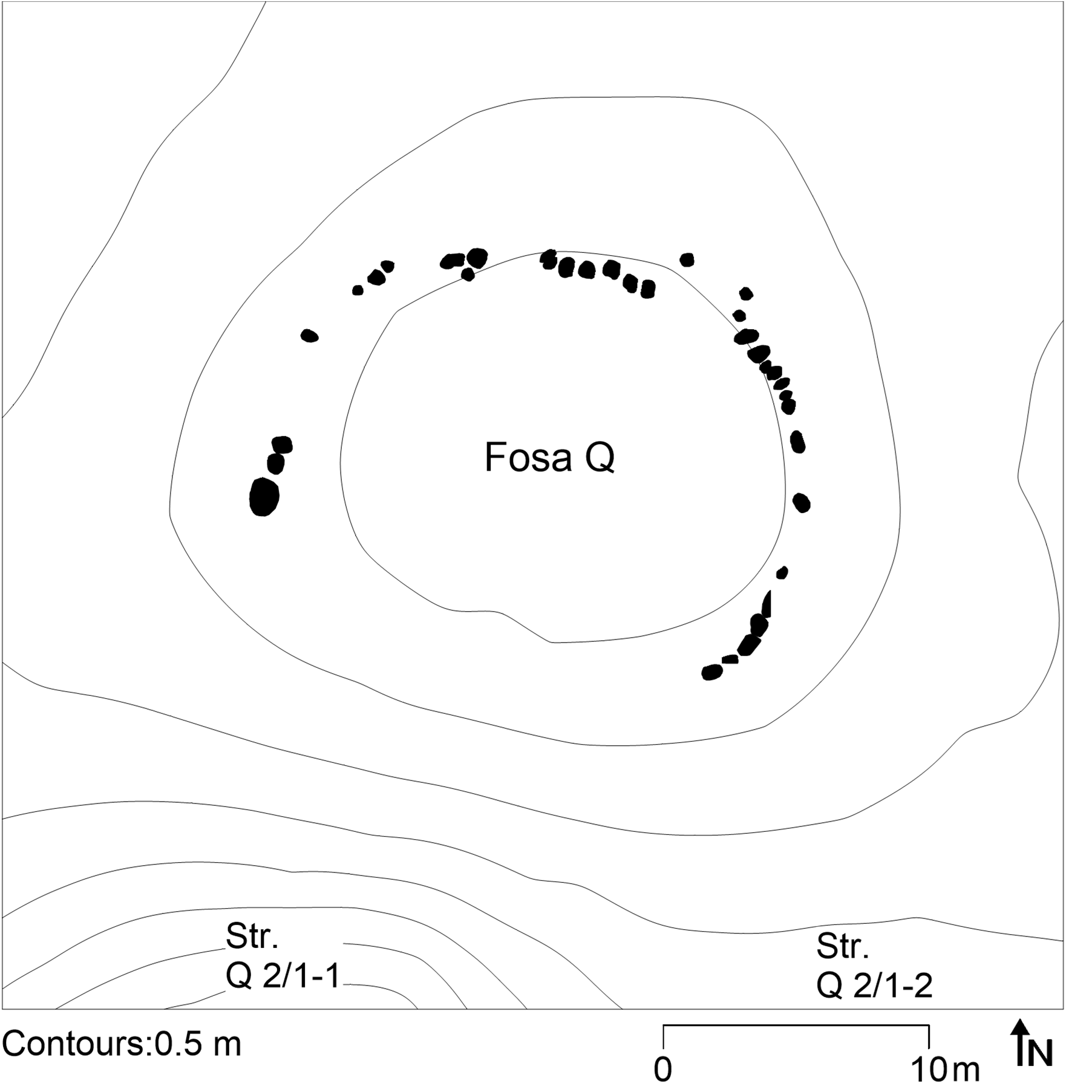
Fosa Q lies north of Structure Q2/1-2 and east of Structure Q1/2-2 (Figures 4 and 7). We do not know the function or chronology of the large buildings in the area (Q1/2-2 and Q2/1-1), but a number of low structures, such as Structure Q2/1-2, date to the Terminal Classic period. Fosa Q was initially visible as the tops of a ring of buried stones, 20 m in diameter, encircling an area of grass with stunted growth. The southern edge of the ring was covered by collapse from Structure Q2/1-1. As we were familiar with the appearance of Fosa V when it was dry, we assumed that this feature was also an aguada, though we have never observed the area with standing water.
Plan of Fosa Q, Nixtun-Ch'ich', Peten, Guatemala. Image by Pugh.

Initial levels in the excavations around Fosa Q included Terminal Classic period diagnostics. However, the first plaster surface (Floor 1) dated to the Late Preclassic period. This floor sloped to the north, which would have allowed drainage toward Fosa Q. Below the first floor were two others (Floors 2 and 3), though we do not know if they were also inclined. Beneath Floor 3 were several strata of “fill,” with Late Preclassic diagnostic sherds. While we believe this was fill, the material seems to have been fairly “fresh” refuse at the time of its deposition, as the sherds were large and not very eroded. This fill also included faunal refuse, obsidian blades, and worked marine shells, including the spires of two conch (Strombus) shells that had been cut from their bases.
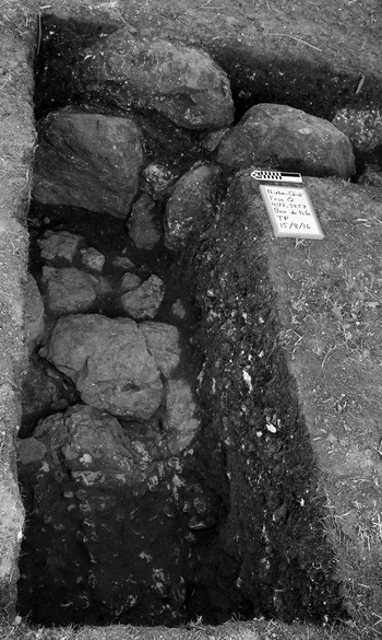
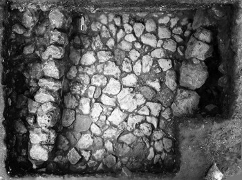
The sides of Fosa Q were vaguely similar to those of Fosa Y, but were composed of only two terraces of large, hard, limestone rubble above a third, wider, terrace of smaller rubble (Figure 8). At the base of the terraces was a pavement of small caliza limestone rubble. No heavy concentrations of artifacts were found in Fosa Q, which was filled with soil with Late Preclassic diagnostic sherds.
Fosa Q excavation displaying fosa edge (background) and base (foreground), Nixtun-Ch'ich', Peten, Guatemala. Photograph by Pugh.

The low position, form, and sloped floor adjacent to Fosa Q suggest that it was once an aguada. Its stone borders are similar to the stepped terraces in Fosa Y, although they seem to have been built in the Late Preclassic period. Although we lack evidence that Fosa Q actually held pooled water, modern plant growth within the feature seems stunted by excessive soil moisture. Thus, the area likely contains a natural concentration of groundwater, which the Late Preclassic occupants exposed and displayed in the fosa. The refuse to the south was likely the result of some sort of ceremonial event, but it is unlikely to have been a primary deposit.
Sector I, Fosa I (Ballcourt Fosa)
Fosa I is a 32 m north–south by 28 m east–west oval depression immediately south of Structure I2/1, a Late Postclassic period construction, and 35 m east of Ballcourt 1 (Figure 4). Ballcourt 1 is a large, 137 m long, I-shaped ballcourt, possibly the second largest in Mesoamerica. Thus, this group was a vital monument and ritual space at Nixtun-Ch'ich'. Preliminary findings indicate that most of the construction of the ballcourt occurred in the Late Preclassic, but it was re-used in the Late/Terminal Classic period and possibly in the Postclassic. It also includes Middle Preclassic and terminal Early Preclassic constructions. However, we have not tested both sides of the court; consequently, we do not know if these very early structures formed a ballcourt.
Fosa I once filled with water seasonally: the first author observed horses drinking water there in the summer of 2013, and the landowner noted that prior to 2009 it filled with a few feet of water yearly. However, we observed no standing water or mud there between 2016 and 2019. We assume that recent construction has hindered groundwater flow into Fosa I.
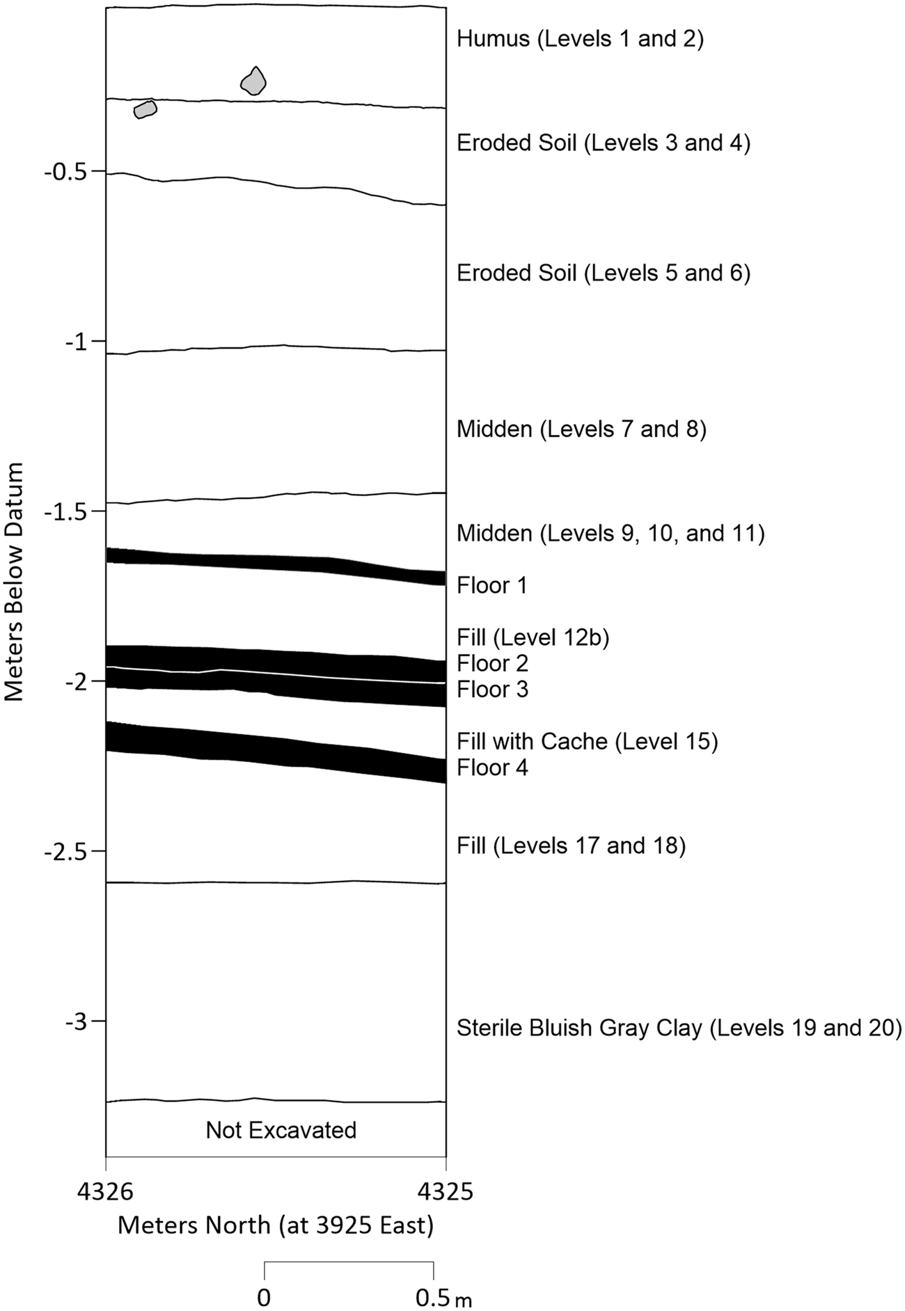
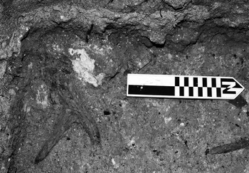
A 1 × 1 m test unit investigated the northeast corner of Fosa I and found higher frequencies of artifacts in most levels (Figure 9). The first few levels included Late Postclassic artifacts from Structure I2/1. Artifact frequency picked up dramatically in Levels 7 to 11, about a meter below surface, when the excavation encountered a refuse deposit dated to the Middle Preclassic period. This refuse included large ceramic sherds, chert, obsidian, and animal bone. Below was a possible Middle Preclassic floor that sloped to the southeast. We encountered three other Middle Preclassic period surfaces or floors within Fosa I, all of which were inclined to the southeast, toward the center of the depression. All were composed of a sandier mix than the usual plaster floors at Nixtun-Ch'ich' and each contained a high frequency of ceramics and obsidian. In Level 15, between the third and fourth floors, we encountered an offering including a complete deer antler (Figure 10), two incised marine-shell pendants, and a Desvario Chamfered vessel. The vessel rested roughly top-down upon Floor 4 and contained no preserved offering. Below Floor 4 was fill (Levels 17 and 18), which rested upon a sterile, bluish-gray, hard wet clay. We assume this sterile clay was deposited by pooled water. Although we could not safely excavate to bedrock in this area, bedrock in Fosa I was much deeper than that beneath the ballcourt or Group J to the east. We assume that Fosa I, like Fosa Y, was originally formed by a natural sinkhole (doline) in bedrock.
East profile, Fosa I, Nixtun-Ch'ich', Peten, Guatemala. Image by Pugh.

Deer antler on Floor 4 and below Floor 3, Fosa I, Nixtun-Ch'ich', Peten, Guatemala (scale: 20 cm). Photograph by Pugh.

Fosa I appears to have been a natural pool prior to human occupation of the site, and this function was apparently artificially enhanced during the Middle Preclassic period with the construction of the two floors. The offering between Floors 3 and 4 suggests that the remodeled pond was dedicated in the Middle Preclassic, the abundant refuse above Floor 1 clearly reminiscent of that encountered in Fosa Y and possibly resulting from a termination rite. The lack of substantial Late Preclassic period refuse is puzzling, given that the majority of the nearby ballcourt seems to have been constructed at that time. Nevertheless, this material may have been reused for fill in that or in a later construction of the ballcourt.
WATERSHED ANALYSIS
Elevations of Nixtun-Ch'ich' today, measured by the present surfaces of the streets and avenues, decrease from west (currently ca. 17 m above lake level) to east (currently ca. 10 m above lake level) and from the center (axis urbis) to north and south. These corridor surfaces vary in height above bedrock, but generally by only 1 m or less. Paleolimnological data suggest decreasing precipitation and drought in central Peten peaking around 1150–950 cal b.c. (Douglas et al. Reference Douglas, Demarest, Brenner and Canuto2016:625; Rosenmeier et al. Reference Rosenmeier, Brenner, Hodell, Martin, Curtis and Binford2016), which would have led to a drop in lake levels. The Middle Preclassic returned to more favorable moist conditions (e.g., Ebert et al. Reference Ebert, May, Culleton, Awe and Kennett2017) and there would have been no shortage of potable water requiring dry season storage facilities. Depending on exactly how high the lake stage was during the late Early Preclassic and early Middle Preclassic, the foundations of the Nixtun-Ch'ich' settlement may not have been much above the water level.
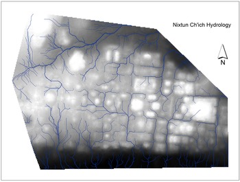
A hydrological model was created to observe the movement of water through the Nixtun-Ch'ich' gridded streets (Figure 11), but it does not consider drainage from areas north and west of this area. The model was created in ArcGIS 10.5, based on a digital elevation model that was extrapolated, with the software's built-in kriging algorithm, from a total station point-cloud. The model suggests that the streets and avenues of Nixtun-Ch'ich' functioned as a hydraulic system that redirected surface water from south of the central axis to drain into Lake Peten Itza, and from north of the central axis into a large channel. This channel can be seen on the model, where it extends from the western boundary diagonally northwest to the northern boundary.

South of the central axis, the model clearly illustrates that water flows from 1st, 2nd, and 3rd Streets both west and east toward Avenue H2, where the course turns 90 degrees and travels south along the avenue and into the lake. A similar drainage flow-pattern exists between 1st, 2nd, and 3rd Streets and Avenue G2. Correspondingly, north of the central axis, water flows from 4th Street west and from 5th and 6th Streets east toward Avenue G1, where the course turns 90 degrees and travels north along the avenue and out of the city grid. Although it is not visible owing to the limits of the digital elevation model, this flow from Avenue G1 likely merges with the large channel. This channel appears to collect water draining out of the northernmost avenue and down off the steep escarpment to the north, which it then carries east and debouches into the Ensenada San Jerónimo of Lake Peten Itza. In Avenue F, water flows from 4th Street to the south. North of 4th Street, Avenue F drains to the north, mimicking the general contour of the terrain.
The hydrological model of the modern site surface clearly demonstrates that water flow in the gridded portions of the site tended to be linear and angular—that is, channeled by human efforts—whereas areas outside the grid were curvilinear. Some water was diverted into the aguadas, but most was ultimately directed toward the lake. However, the model actually underestimates Middle Preclassic period water flow because of several uncontrollable variables. First, Late Preclassic, Late/Terminal Classic, Postclassic, and modern constructions have modified the ground surface above the corridors. We expect that water would have drained more efficiently in the paved corridors during the Middle Preclassic period. Second, during field work at Nixtun-Ch'ich', we observed that subsurface plaster pavements artificially modified the water table—the manner in which water moves below the surface. Third, the water table is also influenced by karstic hills to the west and north of the site: excavations into the Sector W platform encountered a spring-like flow of water emerging from bedrock. The karstic hills also contribute to the water that pools seasonally in Fosas B, C, U1, U2, U3, and V. Finally, some corridors were shaped differently below surface than the current ground surface. For example, the current surface of Avenue F is flat, but the plaster surface below is concave and water would have flowed in its center.
Sector BB, Structure BB1 (Triadic Group)
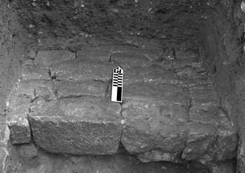
Excavations on a sloped corridor along the northern edge of Structure BB1, the triadic group, encountered a surface paved with tightly fitted, hard limestone flagstones (Figure 12). The surface had a significant south-to-north gradient and intersected with 4th Street, which was paved with plaster. The two corridors were flush at their juncture. As the watershed analysis shows, drainage from Structure BB1 flowed through the steep corridor and another drainage corridor lay on the opposite (south) side of Structure BB1. The flow must have been significant to warrant construction of the flagstone-paved canal. The construction dated to the Middle Preclassic period (Pugh Reference Pugh2019:978–981; Pugh and Rice Reference Pugh and Rice2017:588).
Flagstone surface on the northern edge of Structure BB1, Nixtun-Ch'ich', Peten, Guatemala (scale: 20 cm). Photograph by Melissa Darroch.

Sector SS (A Site Entry Point)
Avenues G and H are the widest avenues of Nixtun-Ch'ich' and led directly north into the city from the lake; many of the other avenues were blocked on the ends. These two avenues directed traffic toward an E-Group in Sector AA (Figure 2): Avenue G was bisected by the western structure of the group and Avenue H by the eastern structure. This E-Group, immediately west of the BB1 triadic group, highlights the area's importance and suggests that Avenues G and H constituted formal entrances to the site (Pugh and Rice Reference Pugh and Rice2017:584; Pugh Reference Pugh2019:978).
The watershed analysis illustrates that the two avenues continue to drain water from the site (Figure 11), a phenomenon easily visible during the rainy season. An excavation (N3689, E4116) into the center of Avenue G2 encountered a drainage canal predictably sloping from north to south (Figure 13). The canal was bordered by walls on its east and west sides and surfaced by a pavement of tightly fitted, hard limestone flagstones, reminiscent of the drain on the northern edge of Sector BB. Whereas most corridors did not have such features, a formal drainage canal would have been required at the end of Avenue G2, as the confluence of discharge from several corridors would have produced a large quantity of fast-moving water during the rainy season. Excavations into the canal revealed that it dated to the Middle Preclassic period. A massive amount of refuse was deposited upon the canal: Middle Preclassic ceramics, faunal refuse, a few shattered greenstone artifacts, and a serpentine axe. These artifacts, like those around Fosa Y, probably constituted the results of a termination event and perhaps a feast at the entrance to the city's ceremonial core. In all likelihood, we will never know if the Sector SS and Fosa Y termination events occurred simultaneously. Both, however, were located in prominent locations associated with water.
Flagstone canal at the south end of Avenue G2, Nixtun-Ch'ich', Peten, Guatemala. Photogrammetry by Pugh.

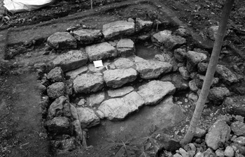
Excavations along the western edge of Avenue G2 encountered a stairway composed of massive hard limestone slabs (Figure 14). We initially excavated the top stair as we believed that it was a monument potentially denoting the city entrance near today's port of entry for canoe traffic. Instead, our work revealed a staircase approximately 3 m wide that extended 1.6 m below the ground surface, its four steps ranging from 40 to 50 cm in height. The uppermost two are narrower and consist of three large stones of similar size and shape (1.0 × 0.5 × 0.5 m). The two lower steps are slightly wider and composed of various stone sizes—that is, the rise of the two terminal steps was constructed using smaller stones adjoined to large stones. The base of the stairway was paved with gravel. Two balustrades, composed of large rubble, frame each side of the stairway, similar to the edges of the canal. The base of the stairway would have met the lakeshore when the lake level was high, as it must have been at the time of construction. The soil surrounding the stairway yielded ceramics, shells, and bone, as well as chert and obsidian, but not in the same quantity as that recovered from the drainage canal.
Stairway at the south end of Avenue G2, Nixtun-Ch'ich', Peten, Guatemala. Photograph by Meranda.

Although we have not dated the stairway, we assume that it and the canal were contemporary with one another and dated to the later part of the Middle Preclassic period. One served as the pedestrian entrance to the city and the other as the exit for water. While drainage might seem mundane, the water surging through the canal must have been impressive after a hard rain. The directed water flow and its separation from foot traffic would have monumentalized hydraulic planning and water management in the city.
ANALOGY: THE GULF COAST OLMECS
Water management was a major concern of the earliest sedentary lowland inhabitants in many areas of Mesoamerica, particularly the Olmecs in the Gulf of Mexico region (Cyphers Reference Cyphers, Grove and Joyce1999). Water management, including aqueducts, canals, conduits, dams, dikes, and reservoirs, became even more prevalent in the Late Preclassic period (Kaplan and Paredes Umaña Reference Kaplan and Umaña2018:264–286; Scarborough Reference Scarborough2003:112–115).
In the wetland environment of the Olmec Gulf heartland, late Early and Middle Preclassic sites, such as San Lorenzo and La Venta, featured major waterworks of basalt slab-lined canals and artificial ponds or lagunas, and arrangements of platforms surrounding an interior sunken patio. These can be seen as early recreations of the sacred Mesoamerican landscape, consisting of a hill and a pooled spring, or “sky-earth, lake-sea” (Tedlock Reference Tedlock1996:64). Conceptually, both the Olmecs and Maya envisioned the terrestrial world as a turtle or crocodile floating atop a watery Underworld, with lakes, caves, and sinkholes breaking through the earthly surface. These portals to and from the Underworld became pivots or “centering points” of ritual landscapes (Dunning et al. Reference Dunning, Beach, Luzzadder-Beach, Lucero and Fash2011:95; see Brady Reference Brady1997, Reference Brady2004; Reilly Reference Reilly1994).
Although the specific functions and symbolism of the Olmec water features are not yet well-understood, these ponds (at least 20 at San Lorenzo) and sunken patios suggest an impetus to recreate and control such liminal phenomena breaching two worlds in constructed landscapes of creation. They are typically associated with elite residences or “palaces,” and may symbolize a “conceptual unity of sovereignty, genealogy” (or ancestors), and the Underworld (Cyphers et al. Reference Cyphers, Hernández-Portilla, Varela-Gómez, Grégor-López, Lucero and Fash2006:30; see also Cyphers and Zurita-Noguera Reference Cyphers, Zurita-Noguera, Lucero and Fash2011; Diehl Reference Diehl2004:106). Moreover, deposits of greenstone axes, wooden sculptures, rubber balls, and human infants in ponds, natural (e.g., El Manatí, Veracruz; Ortiz and Rodríguez Reference Ortiz, Rodríguez, Clark and Pye2006) and artificial, are interpreted as offerings to the “Lord of the Mountain” and to water supernaturals, who bring rains as part of a “cult of fertility, water, and hills” (Ortiz and Rodríguez Reference Ortiz, Rodríguez, Clark and Pye2006:84, 91). The rubber balls in the ponds specifically equated these locations with ballcourts (Taube Reference Taube, Renfrew, Morley and Boyd2018:266).Given this broader cultural context, the multiple fosas at Nixtun-Ch'ich' are hardly surprising, although their incorporation into the cityscape is quite revealing.
The Gulf Olmec examples are the best-known, but recent work at Aguada Fénix, a Maya site in eastern Tabasco, Mexico, has revealed large reservoirs dated to 800 b.c. (Inomata et al. Reference Inomata, Triadan, Vázquez López, Fernandez-Diaz, Omori, Méndez Bauer, Hernández, Beach, Cagnato, Aoyama and Nasu2020). Later evidence from the Mirador Basin also includes agricultural systems with canals and dikes (Hansen et al. Reference Hansen, Forsyth, Woods, Schreiner, Titmus, Kathryn Brown and Bey2018:187) and the channeling of plaza surface runoff into reservoirs. Several reservoirs collected plaza runoff at El Mirador. One reservoir at Nakbe stood near a ballcourt (Hansen Reference Hansen, Traxler and Sharer2016:363), not unlike the arrangement at Nixtun-Ch'ich' Sector I. Late Preclassic Tintal included a moat-like “perimetric canal,” as well as a 2.4 km long canal linking the settlement with the San Pedro Mártir River (Acuña and Chiriboga Reference Acuña and Chiriboga2019). Canals at Zacpetén and Muralla de León also detached these peninsular sites from adjacent areas (Bracken Reference Bracken2019; Rice et al. Reference Rice, Rice, Pugh, Polo, Rice and Rice2009:132–134). Evidence from these sites and Nixtun-Ch'ich' indicate that Maya water management systems evolved contemporaneously with those of the Olmecs.
DISCUSSION AND CONCLUSIONS
Some of the hydrological characteristics of Nixtun-Ch'ich' predated its habitation and one wonders if these natural features had a role in the original decision to settle in this particular location. The site rests upon a natural ridge of bedrock that provided the inclines from east to west and from the midline to north and south. We do not know how the initial occupants of the area used natural water sources, but when the city planners established the urban grid, the construction of buildings with less permeable surfaces dramatically increased surface runoff. The founders redirected surface and subsurface flow into the corridors and incorporated ponds or nahb's into the cityscape, making some of them into central civic-ceremonial features. They also modified some aguadas by increasing the flow of runoff into them or adding floors, perhaps to decrease the loss of water to the water table. The construction of relatively impermeable surfaces and the presence of stratified ancient surfaces would have transformed the flow of subsurface water. Some changes were likely unintentional.
Colleagues frequently question how the streets and avenues of Nixtun-Ch'ich' could have possibly held both drainage and pedestrians, as the former would have prevented the latter. Nevertheless, one need only observe the cobbled streets of nearby Flores Island, Guatemala, after a hard rain, to realize that the dual functions are not incompatible. The center of Flores rises about 15 m, and many of its streets leading away from the center are much steeper and narrower than those of Nixtun-Ch'ich', so the flow of water is actually more intense. Although crossing some streets in Flores during a rainstorm can result in soaked shoes, the streets’ drainage characteristics help keep these paths clean and prevent the pooling of water, which is a major issue with respect to mosquito-borne illness such as malaria, yellow fever, and dengue fever. Of course, Nixtun-Ch'ich' differs from Flores as its construction incorporated pooled water into its layout. But in both cities, ancient and modern, streams of fresh water and alluvium brought by torrential rainy season downpours are efficiently drained out of the center and into the lake by the corridors.
While hydraulics has long been considered one of the possible sources for the emergence of despotic rulers (Wittfogel Reference Wittfogel1957), we also observe it in areas without despots, such as Teotihuacan and the Harappan civilization. As mentioned, the investment of resources to properly drain cities is (and creates) a public good, as are roads (Blanton and Fargher Reference Blanton, Fargher and Carballo2012:105). Like Harappa and Teotihuacan, Middle Preclassic Nixtun-Ch'ich' was “faceless”—it included no images of kings and the overall theme of its symbolism was cosmogenesis and fertility (Pugh et al. Reference Pugh, Chan Nieto and Zygadło2020; Rice Reference Rice2015:31, Reference Rice2018; Rice and Pugh Reference Rice and Pugh2021). Absent imagery of rulers, we know little about political organization at the city. The Maya Preclassic period has been characterized as having a generally more collective (or cooperative, collaborative, group-oriented) ethos than the Classic period (Blanton et al. Reference Blanton, Feinman, Kowalewski and Peregrine1996; Feinman and Carballo Reference Feinman and Carballo2018:11), and Nixtun-Ch'ich' seems to have been very collective in its organization. The early presence of three E-Groups along the Nixtun-Ch'ich' axis urbis, and the triangular arrangement of three Middle Preclassic functioning aguadas perpendicular to it, raises the possibility of ritual activities organized by three social collectivities, such as founders, or leading kin groups or lineages, or separate administrative districts (Pugh Reference Pugh2019:977). The fact they were aligned by the axis may reflect centralization and attempts at building solidarity.
Thus, we do not believe—and no evidence suggests—that Middle Preclassic kings created hydraulic systems to add to their power. Instead, we argue that water management systems reflected a belief system emphasizing creation and fertility. The water moving through the canals and pooled in the aguadas represented human control over potentially destructive, uncontained water. For example, in Sector SS and Avenue G2, the controlled water pouring from the canal into the Underworld (the lake) and separated from the monumental stairway at the site's formal entrance illustrates a basic principle of Maya cosmology: the separation of flood waters from the earth necessary for the emergence of a fertile world, and the creation of order out of primordial chaos. According to some interpretations of Maya myth, the world was fashioned from the remains of a slain, reptilian, flood monster—Itzam Cab Ain (ain, ayin, crocodile). The flood event also represented the destruction of an earlier creation—failed proto-humans (Taube Reference Taube1988:138–142). Humans must also conduct the proper rituals at the end of calendrical cycles to maintain this ordered world, though the world will ultimately be destroyed, perhaps by a flood (Taube Reference Taube1988:171, 310–311). The fact that the flood marked world creation and destruction as well as the end of cycles indicates its periodicity—its control within the context of the calendar. With each calendrical ending, the flood/chaos/change was revisited, but also vanquished (Sullivan Reference Sullivan1988:226–227). Likewise, spatial boundaries could be composed of water and represent both potential destruction (Sosa Reference Sosa1985:428) and the containment of destruction. Thus, boundaries in time/space are fragments of the dismembered/ordered flood monster (Sullivan Reference Sullivan1988:82–83, 141). In the context of myth and ritual, water management is action to maintain the balance of the cosmos. It is quite possible that later kings appropriated the pre-existing belief system and used it to help bolster their power, but they did not do so at Middle Preclassic Nixtun-Ch'ich'.
On the other hand, the neighboring Olmecs, who seem to have had a more despotic system of governance (Feinman and Carballo Reference Feinman and Carballo2018:12), also invested heavily into water management. Olmec ideas of divine kingship may have begun to take hold in the Maya region at the end of the Middle Preclassic period (Freidel Reference Freidel, Brown and Bey2018:372). Yet we cannot assume that Olmec rulers managed these water systems.
The ancient Maya were no strangers to subsurface water, as many lived in karstic environments where such water was clearly visible. This is particularly true in modern Yucatán, where water-retaining depressions are sometimes used as gardens. In Yukateko, an “underground water current” is called sayab' (Sosa Reference Sosa1985:307), the ultimate origin of all water and the place from which the rain gods obtain water (Sosa Reference Sosa1985:396, 463). They also paralleled the subsurface flow of water with blood coursing through veins (Taube Reference Taube, Renfrew, Morley and Boyd2018:265). Furthermore, evil winds, which can cause people to become sick, can enter a community through pedestrian entrances as well as through wells via the underground current. Thus, these locations are the subject of protective rituals and objects (Sosa Reference Sosa1985:243, 488). While it might be a stretch of the direct historical approach to apply modern Yucatec beliefs and practices to the Middle Preclassic period Maya of Peten, the notion that both pedestrian entrances and pools of water were spiritual entrances to the community may help to explain the similar deposits in Fosa Y and at the end of Avenue G2.
A juxtaposition of ponds—entrances to the “watery Underworld”—with ballcourts carries deep mythological significance among the Maya, as seen in the Popol Vuh. Ballcourts were associated with rain, water, and therefore fertility (Taube Reference Taube, Renfrew, Morley and Boyd2018:281–286). As at Nakbe and Yaxnohcah, a pool stands near Ballcourt 1 at Nixtun-Ch'ich', though at the former two sites the ballcourt is to the east and the reservoir to the west (Reese-Taylor Reference Reese-Taylor, Freidel, Chase, Dowd and Murdock2017:501–503). At Nixtun-Ch'ich' the arrangement is reversed. Similarly, a seasonal water-retention pond is also found to the southeast of a ballcourt at Tayasal. Reese-Taylor (Reference Reese-Taylor, Freidel, Chase, Dowd and Murdock2017:502) argues that the connection between ballcourts and reflective pools of water concerns the celebration and observance of the “resurrection of the Maize God in the underworld.” The aguadas along the central axis of Nixtun-Ch'ich' also likely carried Underworld significance. The presence of one near an E-Group—a pattern that may also have been present at nearby Paxcamán—signifies the cosmos, including its horizontal quadripartition and vertical tripartition (Reese-Taylor Reference Reese-Taylor, Freidel, Chase, Dowd and Murdock2017:501; Rice and Pugh Reference Rice and Pugh2017).
The Nixtun-Ch'ich' axis urbis and, therefore, its urban grid were oriented toward sunrise (Pugh and Rice Reference Pugh and Rice2017:592). Axes are special kinds of centers as they are elongated, which can add to their meaning. In this context, the east–west axis, with various centers along its length, constitutes a center in motion. It repeats the movement of the sun across the sky during the day and through the Underworld at night and thus represents time as well as space. Pooled water on earth can represent the primordial flood event (Sullivan Reference Sullivan1988:63). However, seasonal pools situated within a controlled context (the axis) and separated from one another symbolize periodicity—temporal cycles with beginnings and endings (Sullivan Reference Sullivan1988:59). Just as despotic kings, who emerged in the Late Preclassic period were modeled after gods (following Graeber and Sahlins Reference Graeber and Sahlins2017:3), the built environment of Nixtun-Ch'ich' embodied ordered time, space, and creation itself, the work of the gods.
A city built to replicate the world created by the gods was, for that reason alone, a public good. However, this model of primordial order also pragmatically provided its inhabitants with a well-drained settlement as well as controlled pools of water, which added to its attractiveness. We expect that these features, as well as the streets, massive constructions, and opportunities acted as pull factors for immigration into Nixtun-Ch'ich'. The public goods and emphasis on cosmogenesis reflect a more cooperatively focused city.
RESUMEN
Nixtun-Ch'ich', ubicado en la orilla occidental del Lago Petén Itzá en Petén, Guatemala, se ha destacado por su extensa planificación urbana. Investigaciones previas han detallado que el axis urbis, orientado este–oeste y con más de 3.000 m de largo, está formado por una alineación de edificios ceremoniales, además de algunos reservorios. Sus calzadas forman un trazo urbano que se extiende a lo largo y desde el eje central de manera bilateral. Estos elementos planificados fueron construidos entre los 800 y 500 a.C. Una investigación reciente reveló que el sitio también contiene varias construcciones que facilitaron o impidieron el flujo de agua las cuales datan del período preclásico medio. Estas construcciones hidráulicas incluyen piscinas artificiales y drenaje superficial planificado. Las piscinas varían en forma, pero generalmente son circulares u ovaladas. Grandes escombros de piedra caliza fueron cuidadosamente colocados para formar escaleras o terrazas; recubren al menos dos de las cinco piscinas (o aguadas) en el centro del sitio. Dos de las piscinas están ubicadas en el axis urbis de Nixtun-Ch'ich', demostrando que eran construcciones ceremoniales centrales. Una de estas aun se llena de agua anualmente durante la temporada de lluvias.
Las calzadas en forma de cuadrícula, que cubren aproximadamente el 25 por ciento del núcleo urbano de Nixtun-Ch'ich', también fueron diseñadas para facilitar el drenaje. Se inclinan de oeste a este y desde el centro (axis urbis) hacia el norte y el sur. Además, se ha encontrado evidencia de rampas que ayudan a drenar el agua de las plataformas ceremoniales más grandes. En algunas áreas con intenso flujo de agua, las calzadas se dividen en vías fluviales y peatonales.
Muchos investigadores sostienen que el control temprano del agua contribuyó al poder de los reyes despóticos. Sin embargo, no existe evidencia de tales gobernantes entre los mayas del período preclásico medio. Por otro lado, se cree que Karl Wittfogel tenía razón al sugerir que tales métodos surgieron en sistemas con burocracias de extensión. Como la mayoría de las ciudades mayas del preclásico medio, Nixtun-Ch'ich' parece haber sido más cooperativa en su organización y sus sistemas hidráulicos parecen haber sido un bien público que contribuyó a la calidad de vida dentro de la ciudad.
ACKNOWLEDGMENTS
We thank the coordinators of this special section, as well as the reviewers. The National Science Foundation (NSF Grant # BCS 1734036 and BCS 2020668), the Wenner Gren Foundation, and the City University of New York provided funding to Proyecto Itza. Most of the ceramics were analyzed by Sheily Hernández Constanza. We also thank the Vergara family and IDAEH for their support.