Water supply systems in Greco-Roman Cyrenaica
During the Greek period, Cyrenaican cities received their water mainly from natural springs and rainwater, especially over the winter (Gregory Reference Gregory1916, 334). Water was transferred from the springs via channels built or cut into the rock that fed different areas and buildings in the cities. This explains why so many cities were founded next to or near natural water resources. For instance, the Ain Shahat or the Fountain of Apollo is one of the chief springs in Cyrenaica and was a fundamental water resource at Cyrene. This was particularly vital for the Sanctuary of Apollo.
Apart from springs, the region of Cyrenaica had no permanent water sources. The area contains no rivers, and its water supply in ancient times was most likely scanty and largely dependant on rainfall (Goodchild Reference Goodchild and Barr1968b, 23). One can therefore assume that water was collected and stored primarily to fulfil essential needs during the Greek period in Cyrenaic: a reliable and regular supply of fresh drinking water; water for manufacturing activities such as pottery, olive oil and wine production; and water for certain religious rites.
Cyrenaica's water supply system received more attention with the rise of the Roman Empire (Gregory Reference Gregory1916, 322). Several studies have been conducted on this issue, especially on the aqueducts of Berenice, Hadrianopolis and Ptolemais (Lloyd and Lewis Reference Lloyd and Lewis1977, 36; Jones and Little Reference Jones and Little1971b; Arthur Reference Arthur1973; Fadel Reference Fadel1997). For example, in Berenice there was a channel aqueduct dating probably to the Augustan period which consisted of a central mortar channel with a flattened U-shape carried between two parallel walls of roughly hewn blocks. The channel's maximum preserved dimensions were 20 x 20 cm, and its daily discharge rate was 3,136,802 litres at full flow.
The Hadrianopolis aqueduct was probably constructed to serve the newly founded city. This was smaller than the example at Berenice, with channel dimensions of 12 x 12 cm, although both were similar in structure (Jones and Little Reference Jones and Little1971b, 53–9). The aqueduct at Ptolemais was the largest of the three, with channel maximum dimensions of 35 x 40 cm. However, its date of construction is not exactly known, although the large storage tank into which it flowed has been dated to the early Roman period (Arthur Reference Arthur1973, 7–8; Lloyd and Lewis Reference Lloyd and Lewis1977, 36). In addition to the aqueducts, some studies and excavations of Roman townhouses at Berenice and Ptolemais have found that these contained at least one water cistern, and sometimes two in large houses. Such rock-cut cisterns were used to collect rainwater from roofs and courtyards (Lloyd and Lewis Reference Lloyd and Lewis1977, 38; Ward-Perkins et al. Reference Ward-Perkins, Little and Mattingly1986, 118).
Aqueducts and water cisterns at Cyrene and its environs
Aqueducts
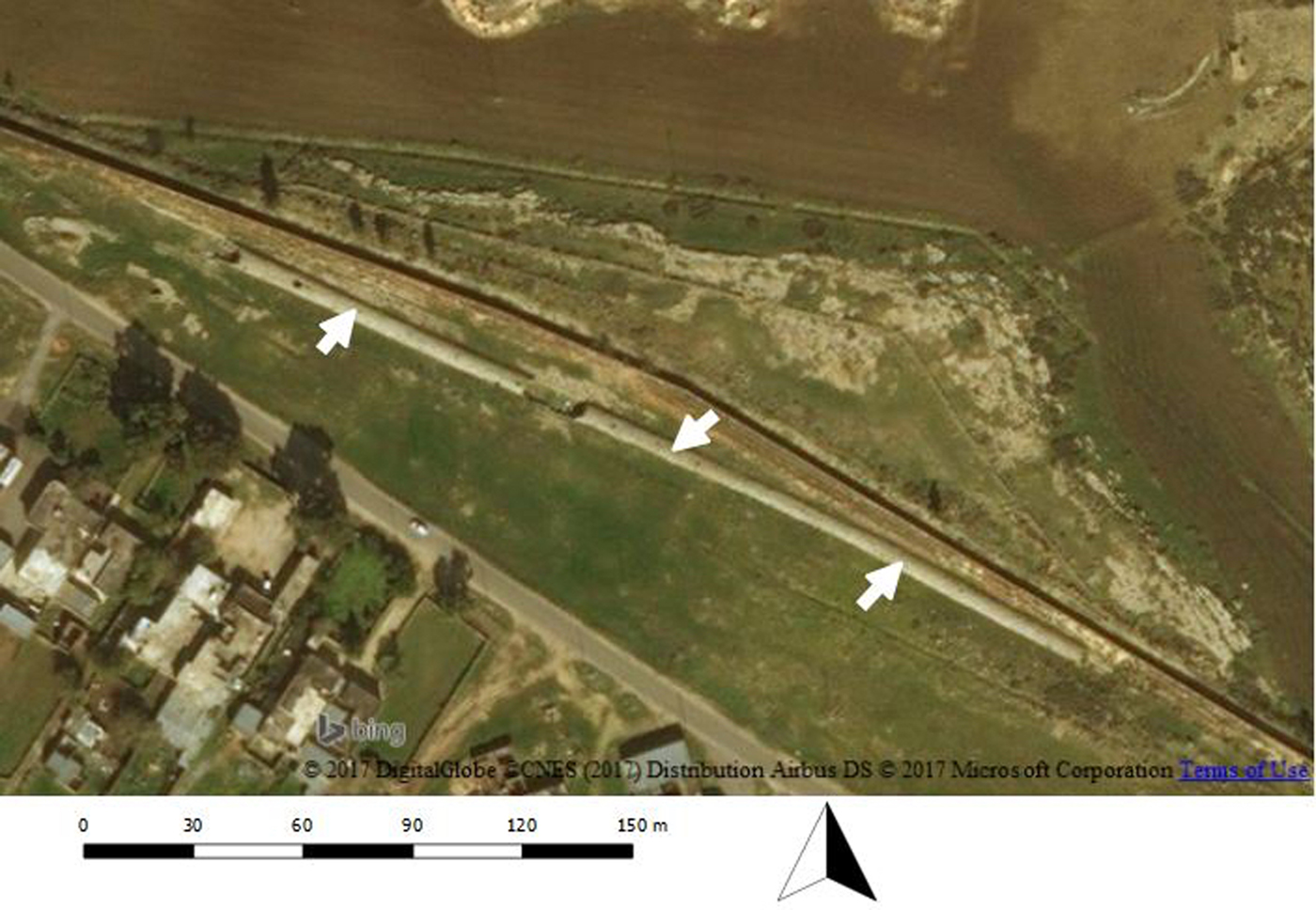
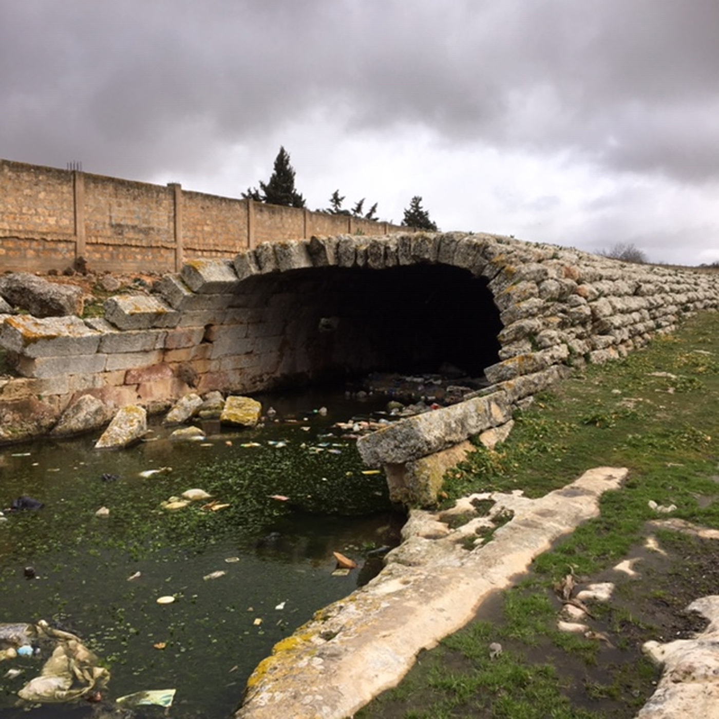
To the south-east of Cyrene's urban core are the remains of a ruined Roman aqueduct. This extended from the south and carried water to the city's huge reservoirs from a number of cisterns in the area known as Safsaf, c. 9 km south-east of Cyrene. The cisterns of Safsaf measure 350 m long, 5 m high and 5.50 m wide, with openings in their tops for ventilation (Figures 1 and 2). They have a capacity of more than 10,000 m3 of water (Fadel Reference Fadel1997, 190), and would have provided c. 4.5 litres a day for three months to 15,000 people (Gregory Reference Gregory1916, 327).
The known cisterns of Safsaf (Author).

A general view of the cisterns of Safsaf, looking north-west (Author).

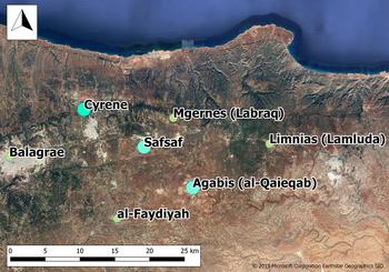
Stucchi (Reference Stucchi1975, 484–5) argued that the cisterns of Safsaf were possibly only used to irrigate and supply the area surrounding Safsaf itself, and not to provide water to Cyrene's reservoirs. But Fadel (Reference Fadel1997, 190) questioned Stucchi's opinion using a variety of evidence. He stated that most of the water collected by these cisterns came from an area known as Agabis (now al-Qaieqab), located c. 20 km to the south-east of Cyrene (Figure 3); he added that this area and its surroundings contained crucial water resources, and that it was chosen to supply Cyrene due to the high amount of water available from neighbouring catchments, especially during the winter.
Map showing the location of Safsaf, Agabis, and some other sites around Cyrene (Author).

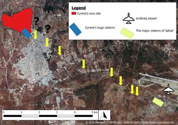
The natural slopes in these areas helped collect the water into the reservoirs of Safsaf. The water from these reservoirs and from a number of cisterns which had been dug in a limestone hill at Safsaf was transferred by aqueduct to a similar cistern complex at Cyrene, which then supplied the city. Remains of this channel, which was cut into the rock, can still be traced in several places in the area between these reservoirs (Figure 4), while many parts of the channel were destroyed and/or are buried under the modern buildings. The high location of Agabis and the feasibility of flow from Safsaf helped the water to flow to Cyrene via gravity.
The course of the aqueduct between the cisterns of Safsaf and Cyrene (Author).

Water cisterns
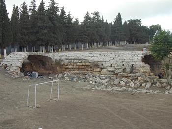
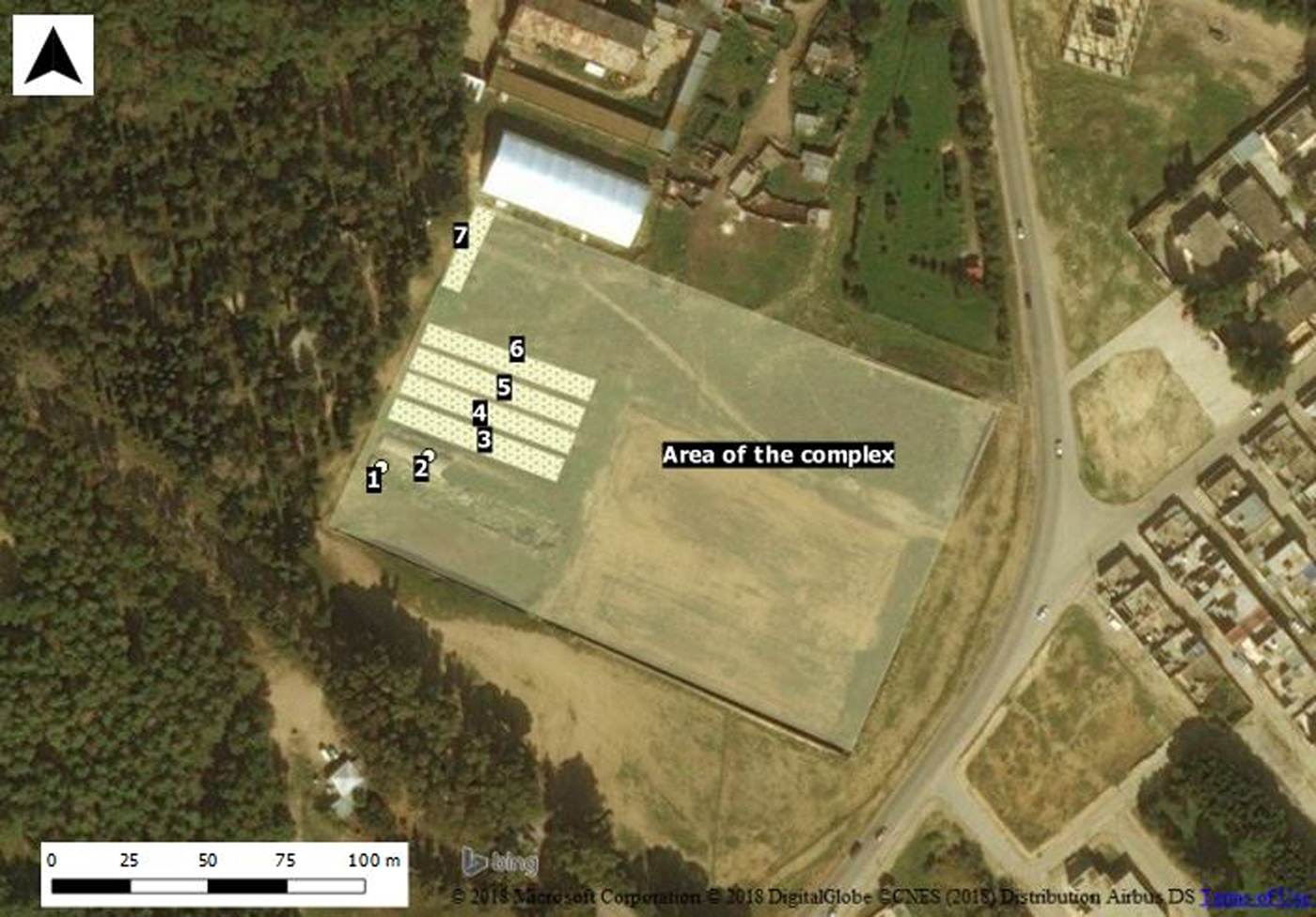
Cyrene's cisterns can be classified into three main types. The first is a set of major tanks of public cisterns with barrel-vaulted roofs. In addition to the Safsaf example, the only prominent examples of this type in Cyrene are the big cisterns in the south-eastern part of the city. A total of seven oblong cisterns were built in this area. Six of them are located beside each other aligned east-west and one north-south (Rekowska Reference Rekowska and Kijak2016, 132–33), though only two can be clearly seen today, both with barrel-vaulted roofs (Figure 5). The other cisterns can only be traced by the foundations of their walls (Figure 6). The existing parts of the two vaulted cisterns and traces of the ruined parts reveal that each one of the seven cisterns was about 65.50 m long and 7.20 m wide.
A view of the two huge cisterns south-west of Cyrene, looking south (Author).

Seven large cisterns and the huge complex south-east of Cyrene (Author).

It is estimated that these cisterns had a capacity of 6.8 million litres, and provided roughly 45.47 litres per head per day for three months to 18,000 people (Gregory Reference Gregory1916, 327; Stucchi Reference Stucchi1975, 484). However, the amount of water used per person cannot be reliably estimated, and at the same time aqueduct capacity is not the key to calculating the population size of a Roman-period city (Lloyd and Lewis Reference Lloyd and Lewis1977, 39; Duncan-Jones Reference Duncan-Jones1978, 51).
These cisterns were part of a huge complex enclosed by a wall. The complex was trapezoidal in plan and its sides measured W: 120 m; E: 108 m; S: 175 m; N: 180 m (Figure 6). It seems that its plan was dictated by the lie of the land and the need to adapt the structure to the existing city walls, which were built in the third century BC (Rekowska Reference Rekowska and Kijak2016, 133; Stucchi Reference Stucchi1975, 137). The location of this huge complex outside the city walls suggests that it was a caravanserai, a place where visiting merchants could make camp and gather together their travelling parties and beasts of burden before entering the main gate of the city (Rekowska Reference Rekowska and Kijak2016, 133; Kenrick Reference Kenrick2013, 153).
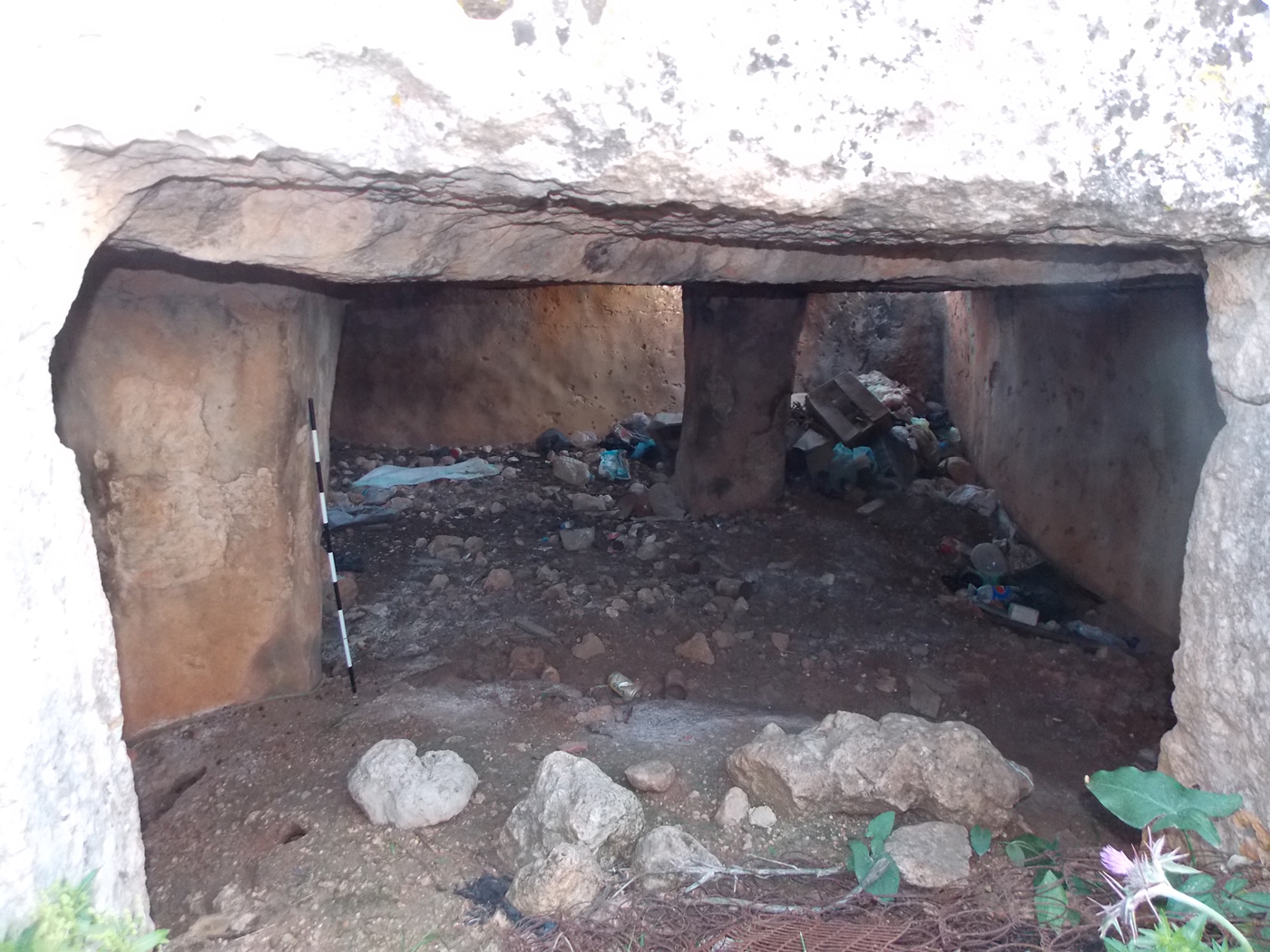
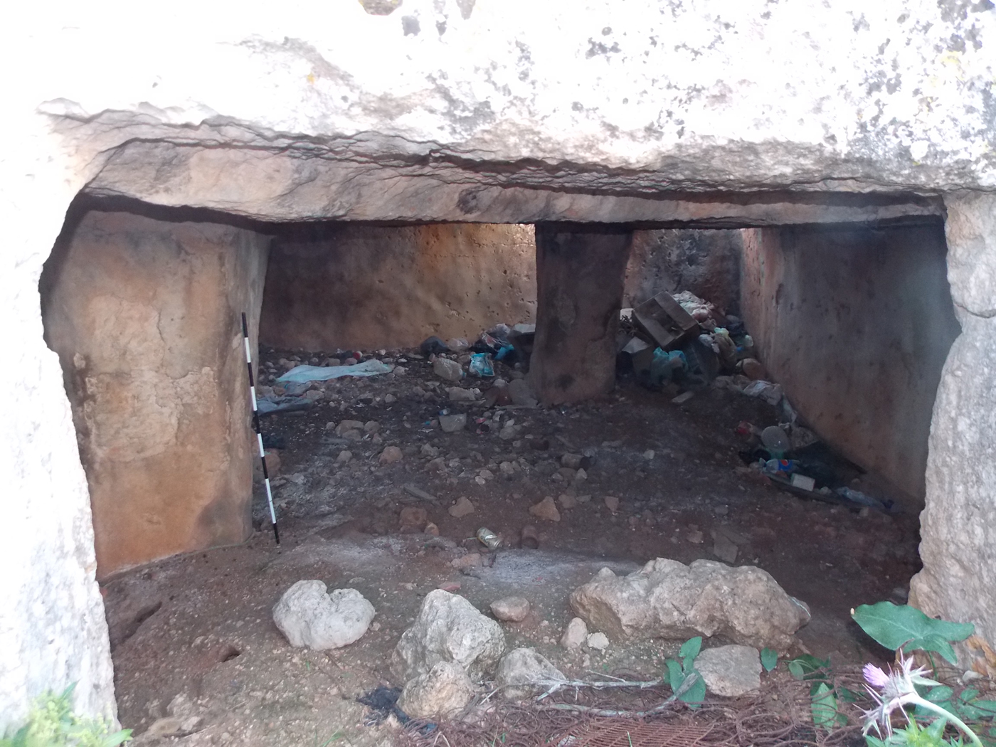
The second main kind of cistern found at Cyrene is the rock-cut type with no specific shape: it can be split into two sub-groups. The first sub-group were often cut at the mouth of the wadi, had flat roofs supported by rock-cut pillars, and possessed interior walls coated with a layer of waterproof material (Figure 7). Typically, these cisterns are 3.50 x 2.80 m and 3.10 m in depth, and while they are not associated with public buildings or individual houses they are spread through the suburbs sporadically.
A view of the first type of rock-cut cistern, looking north (Author).
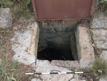
The second sub-group of the second type includes underground cisterns with relatively narrow openings, possibly intended to reduce water evaporation (Figure 8). The cisterns of this type, which formed the majority of the second type, were dug either in the wadis or slopes to collect and store rainwater. Some were associated with different buildings such as private houses, qsur, fortified farms, churches, to collect water from their roofs and courtyards. These cisterns were typically 3.50 x 1.80 m and 2.50 m in depth, and most of them in fact continue to be used by the modern landowners for their original purpose.
A view of the second type of rock-cut cistern with a narrow opening (Author).

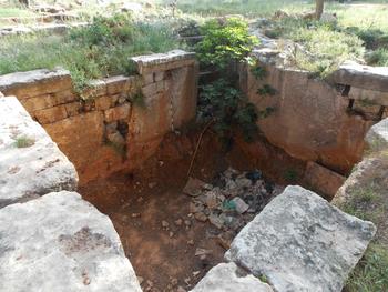
The third type is open-air, sunk into the ground and generally rectangular in shape (Cherstich Reference Cherstich2009, 225). The cistern located during my CAS survey in the area known as the Katiba is a good example of an open-air cistern, or the third main type of cisterns (Figure 9). It measures 5.50 x 4.80 m and 3.00 m in depth. The four internal sides of this cistern were built-up courses of stone slabs covered by a thick layer of waterproof material. The outer borders were also regularised by at least one course of slabs. Several steps were cut at the south-western corner, and these may have been used to inspect and clean the cistern. This type of cistern appears linked to several different types of private and public buildings, including houses, qsur or fortified buildings, and churches.
A view of the open-air cistern type, looking north-east (Author).

These water cisterns were especially useful during the period of profuse rainfall in the winter, for collecting water from the wadis, springs, as well as from the roofs of the different buildings (Gregory Reference Gregory1916, 327). If the winter flows were stored then more use could be made of the water in the summer, but the total amount of water from all these resources was most likely not enough to supply the needs of extensive irrigation.
Discussion
Water distribution in Cyrene in the Greek period
Water was mainly delivered to the city of Cyrene via aqueducts and channels, whose function was to supply fountains and public baths as well as to provide drinking water. Water was also supplied by cisterns and wells in many different places around the city (Figure 10). Some public buildings were supplied with water directly from the local natural fountains, such as the Fountain of Apollo; this provided water to most of the buildings located within the sacred sanctuary by aqueduct mostly dug into the bedrock. However, although the presence of the Fountain of Apollo was an advantage for Cyrene, its location below the escarpment was a disadvantage. Its running water supplied only a limited area, and it was not possible to transfer the water via channels to the upper areas of the city. It was also not abundant enough to meet the needs of water-intensive activities, such as crop cultivation and livestock farming.
Distribution of water cisterns around Cyrene (Author).

Cyrene, especially in the Greek times, depended mainly on nearby natural springs. Rainwater was also important, and was stored in cisterns and basins cut into the ground of many buildings. In addition to the fountain of Apollo to the north of Cyrene, Weld-Blundell (Reference Weld-Blundell1896, 127–7) states that the only sources of water in the neighbourhood were four springs: Ain Lebueda, Ain Bilghadir, Ain al Agara, and Ain el Legrain. He adds that these four springs lie roughly to the north-west and south-west of the western hill, and were used to supply water to channels and fountains. However, these springs were also too weak to meet the needs of intensive cultivation and livestock farming.
Roman water supply in Cyrene
Vitruvius (Reference Morgan1960, viii. 6. 1–3) explained how water was distributed via an aqueduct system. He stated that once the water reached a town, it was transferred from the central tank by pipes to supply three main parts of the city: basins and fountains, public baths, and private houses. However, no clear evidence has been found to confirm how water was divided within Cyrenaica's cities (Lloyd and Lewis Reference Lloyd and Lewis1977, 37).
With the expansion of Cyrene across its agricultural lands in the Hellenistic and Roman periods, the city needed more water. Thus, the Romans built a huge complex of distribution tanks in order to store both rainwater and water brought from more remote sources. The so-called Square of the Cisterns in Ptolemais is a prominent example, measuring approximately 60 x 70 m. Indeed, the Romans used every available source of water to promote the prosperity of the region, which why they had to provide and transfer water from distant places.
In Cyrene, the Romans constructed the huge cisterns located south-east of the city to store water brought from Safsaf. It is thought that the huge complex in which the previously-mentioned seven public cisterns were situated was probably unfinished, and if so it is possible that more cisterns originally existed; this may explain why the eastern part of the complex is empty while seven oblong reservoirs occupy the western part (Rekowska Reference Rekowska and Kijak2016, 133).
Water cisterns were thus constructed underground in different places in both Greek and Roman times in order to collect and store as much rain water as possible. Some water cisterns have also been found inside or near to the sacred sanctuaries, for example, the underground cistern discovered within the sanctuary of Demeter (Cherstich Reference Cherstich2009, 225), and were possibly involved in rituals that required the use of water. Some buildings, particularly the qsur and farms, usually had one or two cisterns inside or outside their walls for water storage; for example, qasr al-Raged, which was located c. 2 km south of Cyrene, has two cisterns (one rock-cut and one open-air). In some cases, these were fed by an outer channel such as the cistern linked to Farm 2 in the area of the Katiba.
Date
In general terms, Cyrene's aqueduct dates to the Roman period. However, it is not possible to determine which emperor ordered its construction. The only accurate source for this information would be inscriptions, which usually convey information on the emperor who authorised the construction of any important civic buildings. Although some inscriptions have been discovered in Cyrenaica that record the name of the emperor who ordered construction, most of these do not give complete enough details about which aqueduct they refer to or where these aqueducts were built.
An inscription found at Cyrene during the Italian excavations before 1941 has been dated to 67 BC, and refers clearly to some of Pompey the Great's (Gnaeus Pompeius Magnus, 106–48 BC) reforms in Cyrenaica following his victory over the pirates (Reynolds Reference Reynolds1962, 99–100). According to the inscription one of these reforms was his contribution to building aqueducts, but it does not reveal exactly where this work was done. Unfortunately, most of the other details have been lost as the text has been damaged. However, the fact that the inscription was set up at Cyrene, the leading city, is suggestive.
Another inscription, dated to AD 109, informs us that Trajan ordered the construction of new aqueducts in the cities of Cyrenaica to serve industrial activity (Lloyd and Lewis Reference Lloyd and Lewis1977, 37), but there is no information on where these aqueducts were built. A third inscription dated to AD 166 tells us that Marcus Aurelius and Lucius Verus commanded the city authorities at Cyrene to build aqueducts using public funds (SEG 1923, 18.740). This text was engraved on two faces of a marble stele of a funerary type, which was re-used as a threshold in the south-west entrance to the Cathedral. Although only one face is in good condition, it is also badly damaged and the rest of the information it contained has been lost, especially from the middle of the text (Reynolds Reference Reynolds1959, 98–100).
One may suggest that the cisterns and aqueduct located to the south-east of Cyrene related to maintenance work in the second century AD, probably during the era of Marcus Aurelius and Lucius Verus. The date of the original construction was most likely earlier, as the second century AD seems late for the city's first aqueduct and huge cisterns. However, this is only an assumption given the absence of conclusive archaeological evidence; this aspect would of course benefit from further study.
It is also difficult to date the smaller cisterns in Cyrene because they do not have any specific characteristics which could help to date them, and because they were cut and used in both Greek and Roman times. However, according to Stucchi (Reference Stucchi1975, 484–7), the second main type of cistern (the rock-cut type) most likely dates to the second century AD, or possibly after this date. The third type of cistern (the open-air type) can be dated to the Hellenistic era by comparison with nearby Hellenistic tombs (Cherstich Reference Cherstich2009, 226).