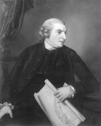


—Portrait of John Gwynn by an unknown artist, a. 1765–75. By courtesy of the National Portrait Gallery, London.

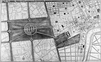
—“A Plan of Hyde-Park with the City and Liberties of Westminster &c. shewing the several Improvements propos'd.” Plate I from John Gwynn, London and Westminster Improved (1766). By permission of the British Library: 191.a.19.

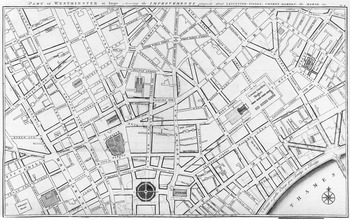
—“Part of Westminster at large shewing the Improvements propos'd about Leicester-Fields, Covent-Garden, the Mewse &c.” Plate II from John Gwynn, London and Westminster Improved (1766). By permission of the British Library: 191.a.19.

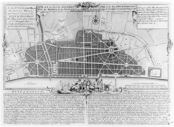
—A Plan of the City of London after the Great Fire in the Year of Our Lord 1666 (London, 1749). By permission of Guildhall Library, Corporation of London.

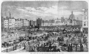
—“The Last Day of Old Smithfield Market,” Illustrated London News (16 June 1855), p. 600. Reproduced with the permission of the Library of the University of California, Berkeley.

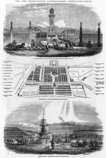
—“The New Metropolitan Cattle-Market, Copenhagen-Fields,” Illustrated London News (16 June 1855), p. 601. Reproduced with the permission of the Library of the University of California, Berkeley.

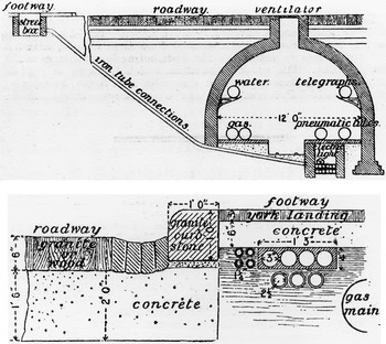
—Top, “Subway, Charterhouse Square, with Street Box,” Electrical Review (23 February 1894), p. 224. Reproduced with the permission of the Library of the University of California, Berkeley. Bottom, “Section of Road,” Electrical Review (23 February 1894), p. 224. Reproduced with the permission of the Library of the University of California, Berkeley.

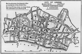
—“Map of Whole City, Showing Transformer Points,” Electrical Review (23 February 1894), p. 226. Reproduced with the permission of the Library of the University of California, Berkeley.

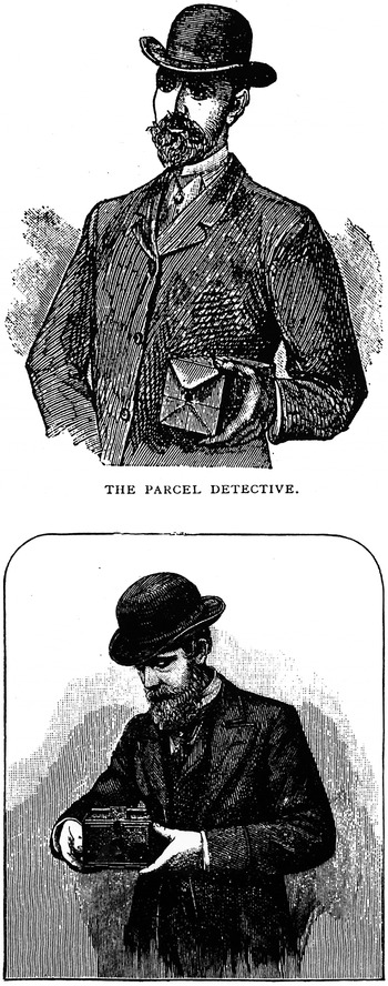
—Top, From Walter D. Welford, comp., The Photographer's Indispensable Handbook: A Complete Cyclopaedia upon the Subject of Photographic Apparatus, Material and Processes (London, 1887), p. 63. —Bottom, From Walter D. Welford, The Hand Camera Manual: A Beginner's Guide to Photography in Its Connection with the Hand Camera (London, 1893), p. 72.

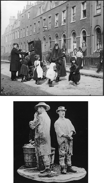
—Top, Paul Martin, Dancing to the Organ, 1893. Courtesy of Harry Ransom Humanities Research Center, University of Texas at Austin. —Bottom, Paul Martin, Loading Up at Billingsgate Market: Cut-Out Figures, n.d. Courtesy of Harry Ransom Humanities Research Center, University of Texas at Austin.

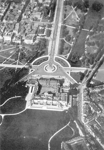
—The Heart of the Empire. Frontispiece of Aston Webb, ed., London of the Future (London, 1921), showing Webb's early twentieth-century improvements to London's ceremonial center.

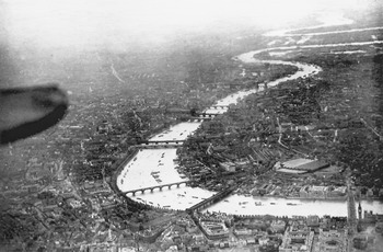
—The Problem of Central London Viewed from the Air. Aerial photography reveals London's sprawl and incoherence. From Aston Webb, ed., London of the Future (London, 1921), facing p. 24.

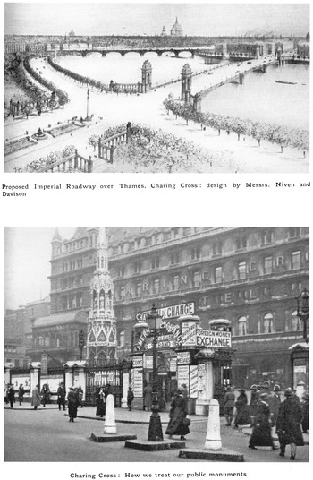
—The order of an imagined future London is contrasted with the clutter and “inappropriate” commercialism of contemporary London. Illustrations from Aston Webb's 1918 lecture to the Royal Geographical Society, Geographical Journal 51 (1918), facing p. 292.

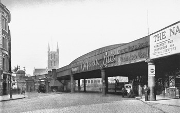
—A Lost Opportunity: How We Allowed the Well-Designed Approaches to London Bridge to be Spoiled, in Aston Webb, ed., London of the Future (London, 1921), facing p. 44.

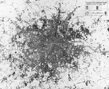
—The London Sprawl and Density of Development, in J. H. Forshaw and Patrick Abercrombie, County of London Plan (London, 1943), plate 3. By permission of the London Metropolitan Archives.

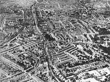
—Camberwell, in J. H. Forshaw and Patrick Abercrombie, County of London Plan (London, 1943), plate 8. By permission of the London Metropolitan Archives.

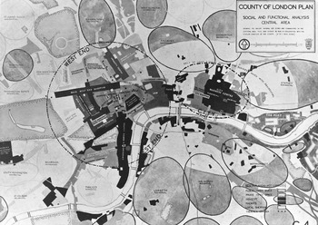
—The Centre of the Metropolis, in J. H. Forshaw and Patrick Abercrombie, County of London Plan (London, 1943), plate 6, facing p. 24. The original caption read: “The plan below gives a diagrammatic analysis of the central area as existing with its zones for Government, business, shopping, law, press, university, and the surrounding residential communities.” By permission of the London Metropolitan Archives.

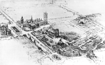
—Westminster Precinct, black-and-white sketch by an unknown artist, in J. H. Forshaw and Patrick Abercrombie, County of London Plan (London, 1943), plate 52, facing p. 137. Part of the original caption read: “This would… provide an improved setting for the Abbey and Houses of Parliament, the Central Hall and other buildings, with a spacious reservation for ceremonies of state.” By permission of the London Metropolitan Archives.

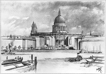
—Eye Level View of St. Paul's Cathedral from the Proposed Embankment on the Southwark Side of the River, black-and-white perspective drawing no. 3 by J. D. Harvey, Corporation of London, Court of Common Council, in Report of the Preliminary Draft Proposals for Post War Reconstruction in the City of London (London, 1944), facing p. 13. By permission of the Corporation of London Records Office.

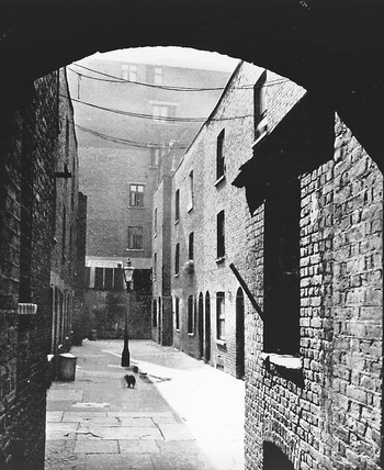
—The Look In and the Outlook, in J. H. Forshaw and Patrick Abercrombie, County of London Plan (London, 1943), plate 26, facing p. 76. By permission of the London Metropolitan Archives.