

Much of the recent scholarly literature on Buddhism in Myanmar has focused on how people have drawn upon Buddhist discourses and transformed practices to respond to the changing conditions of colonialism and the contemporary period of transition.Footnote 1 We have focused on Buddhism as a dynamic source for the construction of identity, work that has become all the more urgent to understand the contemporary rise of movements explicitly linking Buddhism to xenophobic and nationalist politics and fomenting violence to reify religious difference.Footnote 2 While key pioneers have long pushed us to broaden our ideas of what constitutes Buddhism and religion in Myanmar,Footnote 3 the new wave of scholars brought to the field by the opportunities of the ‘transition’ period have presented a more complex picture of the ethnic and religious diversity and hybridity of the country.Footnote 4
This article, as part of understanding the genealogy of religious difference and division in Myanmar, investigates colonial secularism as a way of ordering the world in Burma and one response to categories and constraints that secularism produced. My focus here is on the built environment in colonial Rangoon — and the role of secularism in the British re-construction of the city in 1854 and its aftermath. The colonial reconfiguration of space in Rangoon taught separations and grammars of difference through the built environment, but it also created contingent ways of overcoming and redefining such divisions.
To understand the impact of colonial secularism in Burma requires not only investigating the history of Rangoon's architecture, but reflecting on the history of conceptual architectures of thought, including those that structure our current ways of knowing. We need to set aside the commonsensical idea of secularism as the withdrawal of religion from public life and politics or as a state policy of neutrality with regard to religion. Instead we need to look at how colonial secularism produced a new way of seeing and ordering the world, one that constructed the categories of religion, public and private themselves. As Saba Mahmood explains, recent scholarship has
challenged the conventional account of secularism as the separation between church and state, religion and law, ecclesiastical and political authority. Scholars from a variety of disciplines have argued that modern secularism is far more than this minimalist formulation allows; it entails fundamental shifts in concepts of self, time, space, ethics, and morality as well as a reorganization of the social, political and religious life. The secular, in other words, is not the natural bedrock from which religion emerges, nor is it what remains when religion is taken away. Instead, it is a historical product with specific epistemological, political and moral entanglements — none of which can be adequately grasped through a nominal account of secularism as the modern state's retreat from religion.Footnote 5
This perspective is vital to enable us to see how the British colonial project of secularism in Burma constructed a new worldview and new conceptual architecture of categories like religion, public, private, commerce, and society, which came to inflect and order local practices and discourses. The projects of colonial state secularism, all presented as offering a neutral and disinterested approach to religious practices, actually constructed the category of religion and naturalised and enforced the idea of religious difference and identity. As Mahmood explains, following in the work of Talal Asad,
Secularism in this understanding is not simply the organizing structure for what are regularly taken to be a priori elements on social organization — public, private, political, religion — but a discursive operation of power that generates these very spheres, establishes their boundaries, and suffuses them with content, such that they come to acquire a natural quality for those living within its terms.Footnote 6
The British construction of Rangoon following the Second Anglo-Burmese War in 1852 was presented as a neutral project of creating an ordered space where a religiously and ethnically heterogeneous population could come together for commerce. However, this idealised neutral space of the secular colonial city, the ‘clean slate’ that colonial planners assumed when creating their city, was only possible because of either a blindness or a violence to both the physical and conceptual architectures that came before. The plan of the new, secular city sought to mould and educate the population in the categories of colonial rule. The ordered city they created constructed religions on particular terms, ones that enforced religious difference and ethnic divisions. However, the secularism of the colonial city, like all such colonial projects, was never completely successful.Footnote 7 It held spaces where different ways of understanding religion and coming together were possible. In contrast to the ordered grid that colonial planners created for Rangoon, the Thayettaw monastery complex is a maze of winding, confusing paths. It is a particularly good place for disrupting clarity and order, playing this role in the life of the city historically — but also perhaps conceptually — disrupting ideas and categories. Investigating this monastery in relation to the colonial secular city offers an amble through a set of entangled and contrasting conceptual grammars of colonial Rangoon in the nineteenth to early twentieth century.
An urban colonial pedagogy of the secular
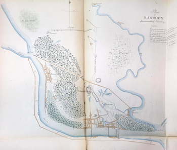
Rangoon existed as a Mon and Burmese town, part of the network of trading ports on the Bay of Bengal, before the First Anglo-Burmese War in 1824. However, after the war and the British occupation, King Tharawaddy ordered the town rebuilt with fortifications closer to the Shwedagon Pagoda and further from the river.Footnote 8 While the official Burmese town moved, most of the non-Burmese traders remained in the town by the river.Footnote 9 Both settlements had their own grammar and sets of values built into the landscape. (Fig. 3 offers a sense of the relation between the two towns.) The newer town closer to the Shwedagon, was built with walls and gates as organising principles, indicating a zone where the Burmese state offered protection/control and marking the forest/town divide central to much of the physical and imaginative landscape of pre- and early modern Southeast Asia.Footnote 10 The old port town, in contrast, while originally built with a stockade and towers for protection, was now understood as too porous and vulnerable to naval attack; its landscape was dominated by connections to outside: the jetties to the river leading to maritime trade and houses and warehouses for traders.Footnote 11
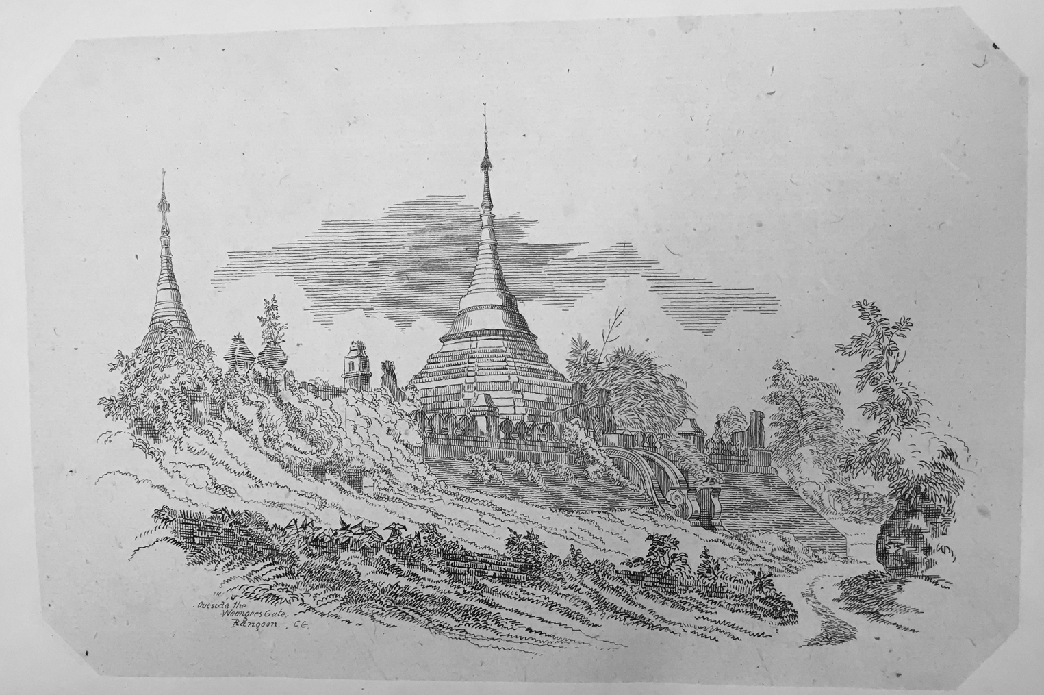
The gates of both towns (see fig. 1) were placed inside a larger Buddhist landscape. In the pre-colonial framework, the most important structures in both locations were the pagodas and the monasteries. In Tharawaddy's town, the Shwedagon clearly dominated, but the landscape was dotted with numerous other pagodas and large monasteries. The road that led up to the Shwedagon from the older town included three monasteries run by important monastic figures as well as the Sakyawun Pagoda.
‘Pagoda outside the Woongyee's gate’, Colesworth Grant, Rough pencilings of a rough trip to Rangoon in 1846 (Calcutta: Thacker, Spink & Co., 1853), p. 33. Rare Books and Special Collections, Northern Illinois University Library.

In the older town near the river, on the site of the current Theingyi market was a large gilded monastic complex that housed a pagoda and the monastery of a Gaingtauk, a regional head of the sangha for the royal monastic sect. The area around the Sule Pagoda, what would become the centre of the colonial city, was filled with monasteries, including U Kala's monastery and Gaingtauk U Ma (Pegu Sayadaw)'s monastery. Near the site of the colonial Ganesha temple was the monastery of Duyin Sayadaw, who was Gaingtok of the sangha for pre-colonial Rangoon. What would become the site of the railway building housed another monastic complex.Footnote 12 As early as 1794 Rangoon was home to an estimated 1,500 Buddhist monks.Footnote 13 As Fraser describes, ‘The greater part of the country between the Shwe Dagon and the town was thickly wooded in its higher part. … In the woods there were many kyaungs [monasteries]. Thus where the High School now stands, there were then several large buildings known as the King's Kyoungs.’Footnote 14 (Fig. 2 offers an idea of the wooded spaces in the mid-nineteenth century.) It was not simply that Buddhism was located in these places, but that the places themselves gained significance as nodes in a network of Buddhist learning, monastic hierarchies and acts of merit, such as donations from queens and kings.
‘Plan of Rangoon and surrounding country’, Phayre's Letter to Government, 16 Sept. 1853 no. 124, India Office Records P/200/38 British Library. By permission of the British Library.

Moreover, the town by the river was not simply a Buddhist space. Rangoon, like other port cities on the Bay of Bengal, flourished through its diversity. Symes describes Rangoon at the end of the eighteenth century in which ‘Malabars, Moguls, Persians, Parsees, Armenians, Portuguese, French, and English, all mingle here.’ This ethnic diversity was matched with a religious diversity that gave life and interaction to the communities. Symes continues,
The members of this discordant multitude are not only permitted to reside under the protection of government, but likewise enjoy the most liberal toleration in matters of religion; they celebrate their several rites and festivals. … In the same street may be heard the solemn voice of the Muezzin, calling pious Islamites to daily prayers, and the bell of the Portuguese chapel tinkling a summons to Romish Christians. Processions meet and pass each other without giving or receiving cause of offence.Footnote 15
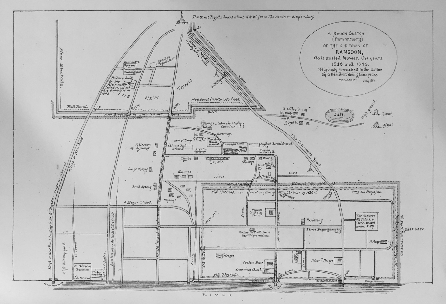
Thus, multiple traditions had a life and space in the pre-colonial town of Rangoon. Moreover, people of multiple religious identities played a key role in the life and order of the town: the post of shawbunder, in charge of the port and customs, was held by Portuguese and Spanish Christians, who paved streets and constructed bridges in the town, and two roads from the old town by the river to the Shwedagon were paved by a Muslim merchant in the 1810s.Footnote 16 Colesworth Grant drew Rangoon in the 1840s as a place where mosques, churches and Hindu temples were scattered across the old town (fig. 3), and describes how Christians and Muslims were freely granted use of Buddhist zayats for their own gatherings.Footnote 17
‘A rough plan (from memory) of the old town of Rangoon 1836–1843’, G. Grant, Rough pencilings of a rough trip to Rangoon in 1846 (Calcutta: Thacker, Spink & Co., 1853), p. 48. Rare Books and Special Collections, Northern Illinois University Library.

The war of 1852 inflicted substantial damage to both areas. The Burmese burnt buildings in their retreat and the British attacks destroyed many others. When the British military took over, they seized the Shwedagon and occupied Tharawaddy's town nearby, turning it into the military cantonment area of the colonial period. Most of the buildings in the port side town were destroyed during the war, and many of the inhabitants fled. Historians tend to report this in terms of total destruction, upon which the new colonial port city of Rangoon was founded, but it is clear from the records that not everything was gone.Footnote 18
When the British military took over, they inhabited the Buddhist landscape. They occupied and fortified the Shwedagon and set up offices for administering their new colony in the Buddhist monasteries and rest house buildings. B.R. Pearn, quoting Arthur Phayre's diaries, writes, ‘That only substantial buildings were the kyaungs, most of which were in use as quarters for troops, for civil officers, and as offices. Thus “we found the Artillery mess established in an elegant building of moderate dimensions, supported by eight massive pillars and the whole of the inside of the fabric being gilded”’.Footnote 19 Much of the intrigue of the early months of British occupation revolved around the Buddhist landscape — looting, opening up pagoda reliquaries, seeking various treasures.Footnote 20 The military attempted to drill into the Shwedagon, on the pretence of creating a storehouse for weapons. Other pagodas were destroyed in order to construct a new European barracks — and treasures found in the reliquaries there were valued in terms of both monetary and archaeological wealth.Footnote 21
Such interventions raised serious problems for Lord Dalhousie, Governor-General of India, and Arthur Phayre, who he had just appointed to be the first civilian Commissioner of the new British province of Pegu. Both were deeply embedded in a philosophy of colonial rule that understood that the government should not interfere in the religious affairs of its colonial possessions. Dalhousie instructed Phayre to publicly denounce the looting and destruction of pagodas, and to curtail interventions.Footnote 22 However, they would not be able to separate their administration from issues of religion. Even the preservation of ‘neutrality’ required intervention.Footnote 23 Much of the negotiation of the British position in Rangoon in its early years revolved around its relationship to Buddhism — allowing access to the Shwedagon for worshippers while still maintaining military possession and negotiating how much access the Burmese king would have to act as royal patron (and thus sovereign) over the Shwedagon.Footnote 24
And yet, even in their planning of the new city of Rangoon, these officials were oblivious to what had come before. They were convinced that Rangoon presented a clean slate for the creation of their new colonial city. As Henry Keighly, Executive Officer for the laying out of the Town of Rangoon, wrote in 1856, ‘On taking possession of that city, … they found it not only deserted, not even merely defaced, but utterly destroyed and obliterated.’Footnote 25
It is remarkable how little of the Buddhist landscape was visible to them. Phayre wrote to Dalhousie in April of 1853, ‘Burmese local authorities had levelled the whole of the former existing buildings to the ground, and the townspeople had all fled.’Footnote 26 And yet, he wrote this sitting in a monastery building. As Pearn, quoting his diaries, explains, Phayre described his quarters as ‘“fine kyaungs on a plain south of the stockade,” and his office was in a kyaung at the corner.’Footnote 27 He was oblivious to the contradictions of his circumstances and, like those planning the new colonial city, he could not see the Buddhist landscape he was currently inhabiting. The very first plans for building the new city did not take any notice of the Sule Pagoda, the landmark which determined orientation and organisation in both the pre-colonial and the colonial city.Footnote 28 Even a massive, glittering, gold signpost rising out of the ground was not enough to shake these colonial officials from their presumption that Rangoon was a clean slate prepared for their creation — uninhabited, unencumbered and unenchanted.
The new secular city
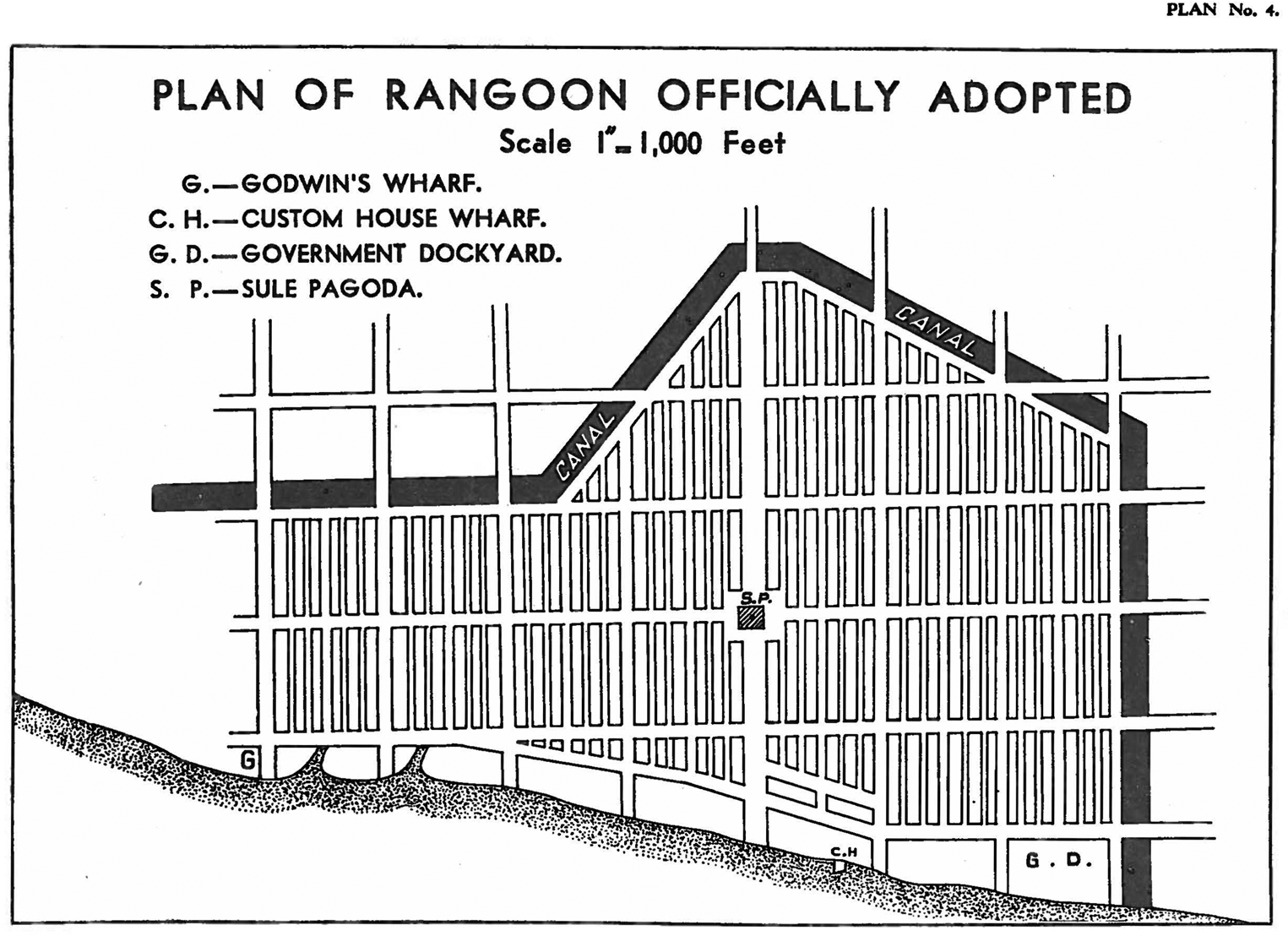
As one of the first tasks of the new civilian government, Phayre set out to construct a new city on the site of the older town by the river — one that was meant to represent the modern colonial order the British sought to impose and teach its inhabitants to live by its ways of ordering the world.Footnote 29 This was to be a modern colonial port, built upon an ordered grid. With the exception of the Sule Pagoda, for which colonial blindness relented enough that the later revision of the plan recognised it as the centre of the grid, the new city bore no traces of Burmese habitation and culture.Footnote 30 In their place was a highly regimented network of streets and buildings meant to act out a physical pedagogy in the proper order and discipline of colonial society. Starting from a wide Strand Road that bordered the river front, streets were all at right angles, with thoroughfares leading away from the river divided by long east–west cross streets into upper, middle and lower blocks. It was to be a place of clean and clear order, and its colonial hierarchies were made plain. Sule Pagoda, now finally seen, was deemed the centre and given a road 200 feet wide leading north from the Strand. Moving out from the centre:
in the western part of the town there were aligned four 100 foot roads running north-south, and in the eastern part three such roads, all parallel to the Sule Pagoda Road. … the blocks thus formed were [divided] by one central 50 foot road and four minor 30 foot roads, all running north-south. The east-west roads were four in number, each being 100 feet wide, and placed at 800 foot intervals.Footnote 31
The north–south streets were set in a strict hierarchy, with the central street the widest and most dominant, and alternating wider and smaller streets reflecting a hierarchy of buildings and institutions. Pearn's drawing of the plan in fig. 5 gives a good sense of the hierarchies of space and the starkness of the design. Wider streets were reserved for commerce, and narrower streets for residences, divided into clear ethnic quarters. As Sarah Maxim explains, the ideals of colonial urban planning at the time held that wide, ordered streets not only promoted efficiency and trade, but prevented the spread of both disease and crime. The built environment was to make the population and its culture both prosperous and governable.Footnote 32
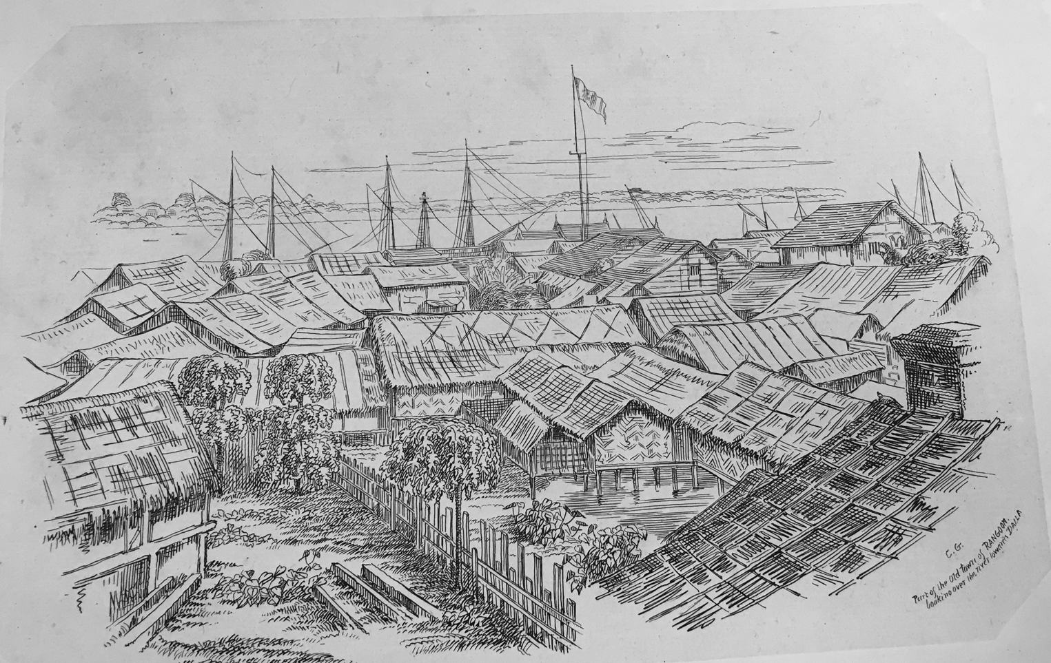
At Phayre's instruction, no recognition was given to previous land titles. Those residing on plots of land in the new city would have the first right to purchase it, but no other claim. The land was sold for development fairly freely, but came with strict requirements for construction. Chaos and delay were the enemies of the new ordered city and would meet with penalties. Landowners had to build upon their new lots in the first year, or risk forfeiting the property to the government. And the simple wooden thatched buildings of the pre-colonial town (seen in Grant's drawings in fig. 4) would no longer suffice for the colonial city. Buildings had to be constructed of the right materials. Porous materials that might allow for the flow of not just air and light, but sounds, people, ideas and interactions were outlawed in favour of brick and cement with ‘pucca’ roofs, meaning that only the richest could afford to build.Footnote 33 Moreover, the modern city was to be free of any creature that might not respect its order: ‘buffaloes, oxen, cows or pigs’ were not allowed, and even the dead were barred from a place in the city.Footnote 34
‘View of old Rangoon — looking over the river towards Dalla’, C. Grant, Rough pencilings of a rough trip to Rangoon in 1846 (Calcutta: Thacker, Spink & Co., 1853).

‘Plan of Rangoon officially adopted’, B.R. Pearn, A history of Rangoon (Rangoon: American Baptist Press, 1939), p. 196.

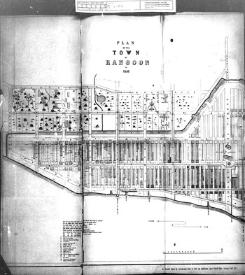
Plots on the largest streets and those closest to the river were to be reserved for the most important businesses in the colonial determination, offering a physical pedagogy in colonial capitalist values. Moreover, the hierarchies of space were racialised. There were separate quarters laid out for Europeans, Indians and Chinese. Like their cultural institutions, no quarter was given to Burmese or other local ethnic groups in the new colonial city. They were left to construct their own habitations in the new suburbs. (Fig. 6 shows the planned areas of the town in 1856.)
Town Plan of Rangoon in 1856, Administration Report of India 1856, British Library India Office Records Collection. By permission of the British Library. Thayettaw Kyaung Taik is the blank spot in the middle upper left.

While administrators laying out the new colonial city rejected petitions based on previous tenancy, they made a number of free land grants in 1854: an American Baptist church; an Armenian church; a Hindu temple; the Mogul Shia mosque; the Surti Sunni mosque; a synagogue; a Buddhist ordination hall; a Cantonese Chinese temple; a Hokkien Chinese temple and a Catholic convent.Footnote 35 Within a couple of decades they would add sites for a Presbyterian church, a Kali temple and a Sikh temple as well as a Catholic cathedral.Footnote 36 These institutions represented groups already present in the area — many of which had buildings before the war. However, this veritable world religions textbook list also represented a census of the types of institutions that counted as ‘religion’ in the colonial imaginaire — one that sought finite boundaries and clear doctrinal differences.Footnote 37
With these rules, the colonial administration felt it had succeeded in creating its colonial utopia. In his conclusion to his report on the transformation of Rangoon, Keighly wrote:
The triumph of civilization over barbarism is complete. Everywhere progress meeting the eye; everywhere are signs unmistakable that the public works of Rangoon, vast and expensive as they have of necessity been, have not been recklessly or extravagantly planned; but that they have, with a wise forethought, been devised upon a scale commensurate with the importance and dignity to which Rangoon is destined to rise among the great Commercial Emporia of our Indian Empire.Footnote 38
In the past few years, scholars have offered some insightful studies into the creation of this new urban landscape, the lessons it sought to impose on a cosmopolitan colonial population and its implications for understandings of race and culture in Burma. Jayde Roberts’ study of the Chinese community here is particularly useful in the ways it ties the built environment of the city to the history of ethnic constructions of identity.Footnote 39 Anthony Wade has argued that the specific exclusion of Buddhist institutions from the colonial grid set the origins of Burmese Buddhist nationalism and religious antipathy.Footnote 40 I want to look at this urban history from a slightly different angle, however, working with Talal Asad's argument that it is the creation of a universal secular epistemology that constructs the idea of religion. Asad charts the genealogy of this concept, pointing out that the idea of a shared, universal disenchanted space, was a specific European intervention.
What we now retrospectively call the social, that all-inclusive secular space that we distinguish conceptionally from variables like ‘religion,’ ‘state,’ ‘national economy,’ and so forth and on which the latter can be constructed, reformed and plotted, didn't exist prior to the nineteenth century. Yet it was precisely the emergence of society as an organizable secular space that made it possible for the state to oversee and facilitate an original task by redefining religion's competence.Footnote 41
That is to say, the work of secularism and the construction of religion begins by offering new ways of knowing and seeing the world — ones that define common shared spaces as ‘secular’, disenchanted and neutral, while constructing and confining ‘religion’ to particular aspects of social life. Secularism in this way offers a new conceptual grammar to organise knowledge and daily life.
The new urban grid stood as a pedagogy of the secular — one that sought to teach a colonial population to view the world in a new way. The grid itself was to be the neutral universal: the shared space of disenchanted assumptions and colonial discipline. Religions could be located (in fact literally constructed) in clear, bounded, particularised locales — the Hindu temple here, the Armenian church there. The lots and land grants meant that the messy worldviews, rituals and discourses that people brought with them to the colonial city, would not spill out willy-nilly into public interaction, but could be contained within the conceptual space of religion, as well as literally contained in space on the map. While there was little that could be done about the two most important symbols of the pre-colonial past: the Sule Pagoda in the city centre and the Shwedagon on the hill, both were quite clearly contained — the Sule surrounded by the brick buildings of colonial capitalism and commerce, the Shwedagon literally cordoned off with military presence and the vast cantonment areas surrounding the pagoda grounds.
The new city of Rangoon was organised such that the new universal ground on which people met was restructured: the space and mechanism for interaction were distinct from the pre-colonial towns. The new city assumed that interaction happened in a disenchanted ordered mode in which aspects of life could be clearly differentiated: religion, commerce, public, private, etc. Religious identities were equally discrete — Hindus distinguished from Muslims, Sunnis from Shia, Hokkien from Cantonese, Armenians from Jews, Baptists from Anglicans and Catholics. In contrast to Symes’ account of processions interacting on the streets and bells tinkling across space, religions here were to be both discreet and discrete: quiet and internalised as well as finite and limited spaces separated on the grid.Footnote 42 Moreover, in contrast to the Buddhist landscape of the past, where places gained meaning in relation to acts of merit and monastic hierarchies, Buddhism would no longer play a role in the grammar of collective life. The secular city was to teach its population how to internalise the divisions that secularism constructed by physically embedding them into the fabric of daily life.
Rangoon's colonial grid taught people to view themselves and their relationships through a conceptual grammar where markers like religious and secular, public and private, male and female, commerce and culture, were differentiated at a fundamental level.Footnote 43 The secular project of this new built environment did not simply put religion in its place (that is, prevented it from interfering with public life), it constructed religion and religions through the definitional power of boundaries. At the same time as it was reduced to the intellectual/moral/theological, religion's scope expanded to be essential in defining identity. Religion became the immutable signal of difference, meant to hold the essence of each community and create unbreachable divides. The built environment of the city reflected the same colonial ordering logic of the census — the people became legible and governable to the state only when they were identifiable by religious and ethnic categories — Christian, Muslim, Hindu, Buddhist; Indian, Chinese, Burmese, English.Footnote 44 And as with the census, the colonial project was not just emplacement and recording, but teaching the colonised population to know themselves in these terms — for example, as someone who lived in the Chinese part of town and belonged to the Hokkien Chinese temple religion. Colonial secularism was the instruction in this grammar — one that was productive in the sense that it constructed a particular role for religion and endowed it with the power to define identity.
But if this is what the grid taught in its secular pedagogy of bricks and pucca roofs, the inhabitants of Rangoon were not always good pupils. There is a very glaring omission in the original plan, one that gave way to a space for a different ordering. The 1854 grid had assigned virtually no place for Buddhism as a religion and no place for Burmese or any local ethnic nationalities. Burmese and Buddhist spaces were left, literally, to the margins, considered perhaps too unsophisticated and unimportant to belong to the modern organised secular space or perhaps too large and too chaotic to be effectively regulated by it. But the previous Buddhist landscape, so easily ignored by the planners, would not be so easily wiped away.
The messiness of the mango grove
This is where the story gets interesting. This is where we leave the colonial grid and the perhaps too familiar story of colonial secular governance and governmentality. When the British officials wiped out all of the Burmese institutions to create their utopic colonial order, they were forced to relocate all of the Buddhist monasteries.
In the 1830s, in the reign of King Thayawaddy, the mayor of Rangoon and another lay donor sought to make merit by founding a monastery in a nice grove of mango trees, at what seemed an ascetic site — outside of the town in a pleasant space, appropriate for quiet reflection. Even when the British established their structured city in the 1850s, Godwin Street was the westernmost of the ordered streets, and the mango grove, Thayettaw monastery, was to the west of Godwin — just outside of the city. In creating the ‘clean slate’ for the new colonial city, old monasteries had to be moved. Thayettaw thus became a home to relocate the 50 displaced monasteries from around the city — a means for the British to consolidate Burmese monasticism and move it out of their ordered, modern port. Thus, Thayettaw became a kyaung taik — a monastery complex. In 1854 the British government made it official and granted the land between Godwin and Phongyi streets, north of the canal and south of Commissioner Road, as religious land.Footnote 45 By the late nineteenth century Thayettaw monastic complex had come to house dozens of different Buddhist monasteries, each with a different identity and approach.
If the city surrounding it was a clear and ordered grid, Thayettaw Kyaung Taik can only be described as a warren, with monastery buildings jumbled up on top of each other, separated by skinny winding disjointed paths. It is quite easy to get lost in there, something that I have enjoyed doing over the past few years. The leafy shade of the space inside stands in stark contrast to the open and observed space of the surrounding streets. Colonial witnesses tended to describe Thayettaw in terms of chaos and disorder. Writing in 1905, one observer offered this description:
Its grounds were surrounded by a crumbling wall and a shallow, weed-choked ditch that could not be styled moat for lack of water. Three badly-warped planks, nailed together into a draw-bridge that would not draw, led through a breach in the western wall, the main entrance, evidently, for many a year. Inside was a teeming village of light, two-story buildings, with deep verandas above and below, scattered pell-mell about the enclosure as if they had been constructed in some gigantic carpenter-shop, shipped to their destination, and left where the expressman had thrown them off. The irregular plots and courts between them were trodden bare and hard or were ankle-deep in loose sand. Here and there swayed a tall, untrimmed tree, but within the area was neither grass nor flower nor garden patch.Footnote 46
Thayettaw was a place that eschewed order as an organising principle for its vegetation and its buildings as well as for its communal life. Spaces inside the monastery complex were in turns contested and shared; building materials and styles promoted a sense of boundaries being fluid and porous. It was a place out of place in colonial secular modernity as others would know it. Thayettaw monastic complex earned a reputation over the next 160 years as a place that both resisted the imposition of order, whether by colonial officials, doctors,Footnote 47 Buddhist reformers or military governments, and as a place where, in many periods, different groups of people could mix and interact. Thayettaw was such a vacuum of colonial regulation, it appears as a complete blank on the map of 1856 in fig. 6. Monks and lay people from Thayettaw and their anti-authoritarianism have been involved in some of the most liberative and pluralist aspects of Burmese history, from bridging ethnic cultures in the nineteenth and early twentieth centuries to playing a central role in the democracy protests of 1988,Footnote 48 but they have also resisted authority in darker and more xenophobic ways at other times. Thayettaw was deeply involved in the 1930 riots at the nearby Rangoon Jail, mainly targeting Indian staff, and monks from Thayettaw promoted anti-Muslim hatred leading up to the 1938 riots.Footnote 49
Defying boundaries and difference
A brief survey of the surviving colonial names of the more than 60 monasteries inside Thayettaw Kyaung Taik reads like a gazetteer of small Burmese towns. The Rangoon monasteries swept up by the British and deposited in this space represented many of the smaller places throughout the province. The monasteries began as outposts of the sangha from these smaller places, but eventually became hosts to those visiting or migrating to the city from the towns across Lower Burma.
From its early days, Thayettaw monastery complex established itself as a place that welcomed all comers. Not only was it a home to monks from various towns, the monasteries there commonly offered shelter to lay people from their hometowns. They provided a place of refuge in the urban metropolis for a mobile and migrant population who came for commerce, education and advancement. And in doing so, they offered an important place of interaction for groups of people from around the colonial province. This aspect of hospitality did not extend only to Burmese or to Buddhists — in fact, the description of Thayettaw above came from an American beachcomber who was told that he could find a free place to stay in Thayettaw — a recommendation that came to him from an Irish Buddhist monk.Footnote 50 Moreover, he describes poor sailors of European and African descent finding shelter inside its grounds.Footnote 51
According to conservative Burmese monks and many twentieth-century Buddhist reformers, such co-mingling of monks and laity is unacceptable, a violation of the Vinaya, the monastic code of conduct. However, the practice is fairly common in monasteries in smaller towns and villages around the country — where the monastery rest house serves as a place of refuge. To opponents, aside from a lay servant or two, or a group overnight en route to a festival or pilgrimage, it is not acceptable to have lay people living with monks. In fact, in the immediate post-colonial period, one of the tasks of the new independent government was to instruct monasteries in correct ‘modern’ Buddhist discipline, and inform them that it was inappropriate for people and monks to reside together in monasteries. The first target of this national effort in the late 1950s was Thayettaw monastic complex.Footnote 52 Michael Mendelson reports that during his research there in the late 1950s as many as 2,000 lay families were living in the various monasteries of Thayettaw alongside the monks.Footnote 53 If my informal surveys of laundry hung out to dry in Thayettaw are any indication, it seems that Thayettaw remains a place of refuge and residence for lay people as well as monks.
In the late nineteenth and early twentieth centuries, it also represented a place of ethnic interaction. Thayettaw is located at the edge of the original colonial grid, and although the grid soon spread beyond it, Godwin Street, which the formed the eastern edge of Thayettaw, led up from the most active of the jetties in which boats arrived from towns all over Burma. Godwin Street brought in the flow of local travellers, but the pre- and post-colonial name of this road will indicate to anyone familiar with Rangoon a much broader cosmopolitan context for Thayettaw. Godwin Street is Lanmawdaw, synonymous with Chinatown in Rangoon — and it was one of the most bustling and interactive commercial centres in colonial Southeast Asia.Footnote 54
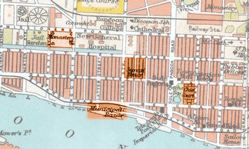
1924 Map of Rangoon showing Thayettaw Kyaung Taik (labelled ‘Monastery’, upper left) and its proximity to institutions on the colonial grid © A Handbook for travellers in India, Burma and Ceylon (London: John Murray Co., 1924).

Thayettaw Kyaung Taik was well embedded in the ethnic context of urban Rangoon, both in relation to the Chinese community and with the larger Hindu and Muslim Indian communities nearby. The records of events at Thayettaw are replete with mentions of Indian and Chinese participation and sponsorship in ritual events.Footnote 55 Such interactions were not always welcomed by the Burmese Buddhist elite. Taw Sein Ko, a middle-class Sino-Burmese government translator describes Thayettaw during the Thadingyut festival of lights in the 1880s:
We went into the sacred enclosure by a little bridge on the eastern side; and after much pushing and charging, in our efforts to thread our way through the crowd, we at last, reached the Kyaung where one of our friends was awaiting us. The sacred building was very much overcrowded, and the remark of the Burman, ‘Lu-ma-shi-bu-he kala hnin Tayok kyi be,’ ‘Heigh! there are no men (i.e, Burmans) but Kallas and Chinamen’ — was perfectly justified. We soon learnt that the great stream of people pouring into this Kyaung was owing to a theatrical performance that was going on near the sacrificial tables.Footnote 56
Our exclaiming Burman is complaining that there aren't enough of the ‘right people’; that there are not enough Burmese Buddhists, but instead that the place is full of Indians and Chinese — the neighbours of Thayettaw monastery as an urban monastery in the colonial grid. The elite Burman Buddhist uses the words ‘kala’ and ‘tayok’ and Taw Sein Ko quotes him directly, repeating the term ‘kala’ in the translation. ‘Tayok’ is a Burmese term for Chinese that has mostly a neutral meaning. ‘Kala’ on the other hand is frequently used as a derogatory term, originally referring to any outsider from the west, in the colonial era it could mean anyone of Indian descent, but then, as now, often was used to single out Muslims.Footnote 57
Thayettaw and its porous boundaries
In 1913, a court dispute over ownership of the monasteries and the creation of a religious trust resulted in the Chief Court and the Thudhamma Council of monks creating a new scheme for the management of the Thayettaw monastic complex and its monasteries. It was a practice in democracy, with two trustees and a council of administrators elected by all of the resident monks in Thayettaw. It also resulted in a series of official rules for the behaviour of those living in Thayettaw. The rules make it clear that the governance of the colonial world was attempting to impose order on Thayettaw.Footnote 58
Many of the rules proclaimed at the founding of Rangoon appear in the list — such as not allowing livestock and requiring ‘pucca’ roofs.Footnote 59 However, it might be more profitable to read the rules as an ethnography of behaviours that occurred in Thayettaw regularly enough to warrant their being outlawed — and thus a description of life at Thayettaw at the time. Just as in the Vinaya, where the Buddha offers a rule for monastic behaviour only after telling the story of the one monk who conducted such behaviour with disastrous consequences, it is likely Thayettaw's rules appeared only to curtail what was already in practice.Footnote 60 There are multiple rules addressing the problems of lay visitors and residents as well as rules for hosting pwe performances and festivals: both issues feature prominently in complaints about the place. There are also rules against keeping and preparing dead bodies, offering medical treatment and accepting a candidate for ordination who has a past drug addiction or criminal offence. Thus, it seems that Thayettaw offered a range of indigenous medicine and funeral services as well as offering a home to those found unacceptable by the rules of colonial society.
The 1915 rules declare that: ‘A wall must be built around the whole of the Thayettaw Kyaungdike.’Footnote 61 It is not clear whether this was to keep the city out of the monastery or the monastery out of the city. Perhaps those in authority felt the chaos and boundary-crossing inside Thayettaw had to be kept from spilling into the outside colonial world. But even this attempt at order failed. In the 1921 revisions of the rules, one-third of the new rules are dedicated to respecting and preserving this wall — against ‘timber or bamboos’ or tree branches that might allow one to climb it or buildings, and rubbish or water that might undermine or breach it.Footnote 62 Clearly life at Thayettaw had a hard time being boxed in and respecting the boundaries of the colonial world.
Defying and defining categories
It was not just the ethnic mixing and the mixing of lay people and monks that late-nineteenth-century observers complained about with regard to Thayettaw. It seemed to mingle incompatible kinds of behaviour as well. Some of the monks of Thayettaw were renowned for their scholarship (pariyatti), and in fact one of the first recipients of the highest prize and recognition for Pali scholarship in the colonial government's competition came from Thayettaw. But it also became known as a place for theatrical performances. Most of the monasteries contained zayats, or rest houses, for lay people to use during rituals and celebrations. Some of the monasteries in Thayettaw became famous for hosting pwes — theatrical and dance performances which often accompanied festivals, and it is clear that frequent performances drew diverse crowds and offered an opportunity for more cosmopolitan interaction. The archive of references to Thayettaw often contain memories of performances, and of theatre troupes keeping their equipment in Thayettaw.Footnote 63 The associations with theatre and performance are so strong that there are claims that the first circus performance in Burma happened in Thayettaw as did the first film screening.Footnote 64
Colonial observer James Scott describes one festival at the end of the monastic rains retreat in the 1870s, reflecting the shocked sensibilities of conservative Burmese at the mixing of worlds:
Instead of having the offerings displayed in their houses and giving them to the [monks], the new fashion with the inhabitants of Rangoon is to carry all the alms to the monastery overnight, set them up in goodly array, there and then hold receptions, sing songs, dance, play musical instruments, and generally turn the quiet monastery into the semblance of an uproarious penny gaff.Footnote 65
He complains that ‘Thayet-daw kyoung in Godwin's Road, […] is the chief sinner in this respect’, and goes on to recount the celebration he attended there:
The master of ceremonies here is our friend Moung Poh See, Patama Byan, certificated theologian and long resident in Mandalay, qualified, therefore, to be yahan [monk] himself, and from his previous experiences, one would think, not at all likely to countenance such open contempt of the provisions of the Weenee [Vinaya]. … But [he] is very emphatically in the world of [kama], and his place is the most startlingly secular of them all. …[N]ot only has he given up the front part of his kyoung, all but the elevated dais on the eastern side, where the images stand and visitors are received, but there is actually a play going on, trumpets braying, drums beating, and the bamboo clappers sounding high over all. It is zaht, [one of the Buddha's previous] birth-story certainly, but that does not make it any less sin for the pohn-gyee [monk] to be so near, and with all those thirty pretty girls looking on too. The monk is behind the curtain which shuts off the undesecrated part of the building [but it does little to shield him]. … In some of the kyoungs, indeed, the younger yahans [monks] take very little trouble to conceal the fact that they are looking through the chinks of the slight hangings which cut off their sleeping places from the noisy throng on the other side.Footnote 66
Life in Thayettaw clearly did not respect or enforce boundaries — as the young monks peeking through the cracks proved. It did not conform to the type of religion — austere, inwardly focused, ‘theological’ — that colonial and elite observers idealised. Secular and religious, austere and celebratory, male and female, Indian and Chinese, scholarly and musical mixed freely there.
Most of the complaints made by ‘respectable’ and elite Burmese Buddhists about Thayettaw imply a concern that the practice of Buddhism there intermingled two aspects of Buddhist life that should be distinct: lokiya (the worldly life of lay people, which also includes festivals, donations and interactions with spirits) and lokuttara (the other worldly, or better put, the beyond-the-worldly life of monastics and reflection.) These two are important ordering categories for much of Buddhist thought, and they had been debated more intensely in the mid-nineteenth century in reference to reforming the practices of monks. The monastic groups who argued for a greater division between lokiya and lokuttara were in the ascendancy and elite lay observers certainly would have sided with them. However, this was not the only position, and it is clear from the rhetoric around the need for greater separation on the part of monastic reformers that Thayettaw, probably like many monasteries, engaged both sides of the divide in daily life in the nineteenth century.
However, given the particular colonial sensibilities of those who complained, it seems more likely that the problem was that Thayettaw was violating the divisions that colonial secularism sought to instil — it mixed public and private, religious and mundane; and was unmoved by the divisions of religious identity and difference which the grid around it enforced. It was not that the people and practices of Thayettaw lacked any categories or boundaries, but that these categories were not a barrier to the Buddhist life of the place. The pragmatic colonial Buddhism practised at Thayettaw did not confine itself to the austere, the other-worldly, the moral or the philosophical — it could include offering temporary residence to a mobile population and entertainments to an urban community. Nor did this Buddhism require a single religious or ethnic identity; at least up to the 1920s, Indians and Chinese, Christians and Hindus could participate and commune for a time without much thought to what such participation meant for making themselves legible in the colonial state's religious categories.
Entanglements and conclusions
Much of the colonial archive's discussions of Thayettaw are focused on what seems to be the problematic fluidity of its boundaries — constant anxieties about whether its boundary markers and walls are insufficient, too dirty, too porous, too easily breached, that there is too easy a flow of people in and out. Thayettaw in the late nineteenth century seems to have been generally indifferent to colonial boundaries, both physical walls and categories of ethnicity and religious identity. Its response to colonial secularism is not the broad theoretical and conceptual landscape offered in the concept of sāsana that Ruth Streicher analyses in this issue, but was instead a pragmatic and daily material concern — of walls and laundry, performances and celebrations, and scholarship and examinations — one whose walls were continually breached by timbers and trees with too long branches.
The contrast between the colonial grid and the maze of Thayettaw monastery complex is not a contrast between the secular West and an indigenous Burmese Buddhist worldview, or between coloniser and colonised. Thayettaw of that era did not represent some surviving, pre-colonial institution and worldview set against a single Western colonial secularism. Thayettaw was the product of the colonial urban pedagogy of the secular. Just as it is secularism that constructs religion in Asad's terms, it was the grid that created Thayettaw. Its monasteries with monks from many different places were only jumbled together because the production of the modern, regulated, secular city required relocating religion in a secular grammar and a secular grid. Thayettaw was an entangled accident of the British secular experiment in Rangoon. Its modes of being were just as contingent and colonial a product as the secular disciplinary grid it foiled.
The contrast of the ordered and chaotic is nothing new in Southeast Asian Studies. The creation of Rangoon as an ordered and ordering grid is much the kind of project of legibility that James C. Scott analyses in Seeing like a state.Footnote 67 And the chaos of fluid boundaries in Thayettaw have strong resonances with upland peoples moving just outside the control of lowland empires.Footnote 68 From Edmund Leach onwards, some of the most innovative work in Southeast Asia has come from trying to understand the production of ethnicity and identity in relation to these dynamics.Footnote 69 We have come to see and expect fluidity and movement in ethnic identity in Burma, and yet somehow the construction of religion and Buddhism have remained more substantial. Talal Asad's analysis of the conceptual grammar of the secular allows us to see how larger conceptual architectures that we as scholars continue to inhabit were invented and imposed in material ways.
J.S. Furnivall's famous image of colonial Burma as a plural society asserted that divergent groups only ever met in the marketplace.Footnote 70 It is true that the logic of the colonial grid and the grammar of colonial secularism only offered up a disenchanted capitalist space for interaction. However, the archive of Thayettaw's role in the nineteenth-century city contests that this was the only space of connection. Its history proves that there were other ways of being and interacting possible. But this possibility was not always embraced. Thayettaw's indifference to boundaries and authority at times put it on the side of pluralism and at other times instead turned to violent attacks on others — against Indian jailors in the 1920s and Indian Muslims in 1938.
This is not meant as a paean of praise for the chaotic or for porous boundaries, although there are many reasons, as Bruce Lincoln reminds us, to be wary of those in authority who condemn the chaotic.Footnote 71 Instead it is to explore the limits of the colonial secular project and its unexpected contingencies, to see those places where its logic of religious identity and difference were infelicitous, insufficient and sometimes just ignored; places where colonial lived Buddhism exceeded — peeked through the cracks of — the secular construction of religion.