INTRODUCTION
As with many cultures, water possessed a symbolic value for the Classic Maya. Palenque's natural topography mimics the Maya image of the place of creation, described in the sixteenth-century Quiche’ epic, the Popol Vuh, as the land where waters flow out of the mountains: “The channels of water were separated; their branches wound their ways among the mountains” (Tedlock Reference Tedlock1985:74). The natural landscape of Palenque must have been emblematic to its ancient settlers, and architectural constructions evidence considerable forethought in managing the abundance of flowing water through the ancient city.
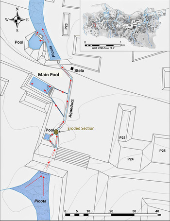
In the summer of 2014, we began investigating water management features in the Picota Group (Figure 1), one kilometer west of the central precinct, by clearing and consolidating the main pool of this civic-ceremonial plaza group. Pre-Hispanic construction of the 10 × 4-m rectangular main pool required the Maya to excavate through bedrock to a depth of 1.5 m below the water table. The pool is directly connected to the Picota aqueduct by an entrance conduit and exit drain, and is accessible from its west side by a monumental staircase entering this perennial source of fresh water.
Map of the Picota Plaza (adapted by French and Claire Ebert from Barnhart Reference Barnhart2001).

The main pool of the Picota Group was barely visible—largely obscured by vegetation—prior to our field work. After excavation and consolidation, both the form of the feature and construction sequence are now apparent. We report this archaeological work here, first detailing liberation of the main pool from the encroaching jungle and then continuing with a review of labor estimates for construction of the Main Pool of the Picota Group. This is followed with an ethnographic component, comparing similar pool configurations investigated in the highland Tzotzil community of Chamula in 2015. We end with a discussion concerning the importance of social organizations dedicated to regulating access to water—especially important during the dry season in the region—with reference to neighborhood waterhole groups in Tzotzil communities in the nearby highlands of Chiapas.
CONTEXT AND CULTURE HISTORY
Palenque, one of the best-known Classic Maya centers, has what is arguably the most unique and intricate system of water management known anywhere in the Maya lowlands (Stuart and Stuart Reference Stuart and Stuart2008). Years of archaeological research, including intensive mapping between 1997 and 2000 by Barnhart (Reference Barnhart2001), reveal the extent of this major center and regional capital (Marcus Reference Marcus1973, Reference Marcus, Sabloff and Henderson1993). Situated on a limestone shelf in the foothills of the Sierra Madres de Chiapas in southern Mexico, a modest settlement began developing as early as 100 b.c. During the seventh and eighth centuries a.d., under a series of powerful rulers, Palenque had mushroomed into a dense community of approximately 1,500 structures—residences, palaces, and temples—with an estimated population of 6,000 (Barnhart Reference Barnhart2001).
Palenque's environmental setting is very different from those found in most subregions of the Maya lowlands, where the development of major centers was generally unconstrained by topographic limits (with the exception of broad, flat, depressions—called bajos—which flood and hold water during the rainy season). Maya builders typically took advantage of extensive areas of well-drained low relief, and as a result the central precincts of cities such as Tikal and Calakmul grew in a haphazard or rambling pattern over the centuries, while dispersed agrarian households filled in the surrounding upslope areas. This common Classic Maya settlement pattern stands in contrast to the perpendicular streets and apartment compounds of a planned center, such as Teotihuacan (Millon Reference Millon1973). At Palenque, the inhabitants adapted their burgeoning settlement to a small geomorphological space (ca. 2.2 km2), resulting in a chaotic and crowded layout, dissimilar to most other Maya centers.
Contributing to the construction challenges imposed by Palenque's spatially confined plateau were the spring-fed streams that naturally divided the landscape. Andrews (Reference Andrews1975) recognized that this irregular natural terrain presented many challenges for the city's builders, who were forced to reshape the existing topography in order to maintain a semblance of visual order within the site center. With approximately 3,300 millimeters of annual average rainfall seasonally swelling natural waterways (French et al. Reference French, Duffy and Bhatt2012), the site required inhabitants to simultaneously control flooding, reduce erosion, and bridge the divided areas to expand civic space. The Palenque Maya accomplished this engineering feat by covering portions of the existing streams and constructing elaborate subterranean vaulted aqueducts to direct the waterways beneath the plaza floors. This unique hydraulic restructuring expanded the size of their plazas by an impressive 23 percent (French Reference French and Marken2007).
Perennial flowing streams were an important resource in a region where water is scarce during the summer dry season. To accommodate their growing population, Palencanos greatly modified their immediate landscape, engineering the settlement's architectural infrastructure to harvest hydrological resources. While the Maya of most urban centers were concerned with storing water seasonally, the Palencanos were devising ways to manage an abundance of it (French Reference French and Marken2007). With 56 springs and nine perennial waterways and associated aqueducts, ceremonial pools, dams, bridges, and even a water pressure system (French and Duffy Reference French and Duffy2010), the city truly lived up to its ancient name, Lakamha’ or “Big Water” (French et al. Reference French, Stuart, Morales, Fash and Lucero2006; Houston Reference Houston1996:133; Stuart and Houston Reference Stuart and Houston1994:30–31).
The Picota Group
The foundation of Palenque as a city or a community, and the social and political forces that led to its initial settlement, remains virtually unknown. This dilemma is a result of archaeologists focusing their attention almost exclusively on the central portion of greater Palenque (Stuart and Stuart Reference Stuart and Stuart2008)—driven by the lust of discovering royal tombs and carved monuments. Early Classic edifices have not been identified at Palenque, and most or all of the latest phase buildings in the central civic-ceremonial core were constructed between a.d. 640 and 740 (Straight Reference Straight and Marken2007:177). Though earlier substructures exist beneath some central temples and the Palace complex, these constructions postdate the Picota phase (a.d. 200–400).
Luckily, excavations were twice performed in the Picota Group, in 1962 by Rands and more recently by López Bravo (Reference López Bravo2013; López Bravo and Venagas Durán Reference López Bravo and Venagas Durán2012) in the early 2000s. Picota ceramics were “most fully represented in house-mound refuse” just west of the Picota Stream, while another excavation in the area “yielded sparse Preclassic remains, directly overlain by Picota refuse” (Rands Reference Rands and Hammond1974:54, 57). Although ceramics of the Picota complex (ca. a.d. 200–400) have been documented in the fill of the plaza below the Temple of the Conde and a few other areas of the central precinct, these represent tumblers or orphaned sherds in mixed deposits. It was the Picota Group that produced secondary deposits sufficient to reconstruct the range of Picota vessel forms and define the ceramic complex.
Some Maya scholars consider the Picota Group the original ceremonial center of Palenque. The area does have an abundance of Picota complex pottery—when such material is uncommon in the central district—as well as a rare stela (an upright stone monument closely associated with rituals of divine kingship [Stuart Reference Stuart1996]). This 3.5-m tall stela, although not sculpted, is where the Picota Group gets its name, since “picota” is Spanish for “pillar.” The wide main Picota plaza, with broad monumental staircases running the length of three sides, also suggests a civic-ceremonial center.
The Picota Group is also home to some of Palenque's most elaborate water management features. As the waters from three springs merge together, they enter the Picota's main aqueduct (P-A1; Figure 1), which runs under a structure and beneath the plaza floor for 60 m before exiting to the south. Three of Palenque's six pools are in the Picota Group, each connected by water conduits to the main aqueduct. Unfortunately, portions of this aqueduct are collapsing and in dire need of repair. Luckily, we were able to document the current state of these features before erosion deforms them further.
THE PALENQUE POOL PROJECT
In May of 2014, the Palenque Pool Project began investigating the largest of the three pools in the Picota Group, one kilometer west of the site's monumental center. Major goals were to: (1) excavate and consolidate this pool with the intention of better understanding its function and purpose, (2) establish a more detailed chronology of the area, and (3) evaluate and estimate the cost of consolidating the Picota's failing subterranean aqueduct running 60 m beneath the plaza floor. Here, we report our findings and interpretations.
Excavations
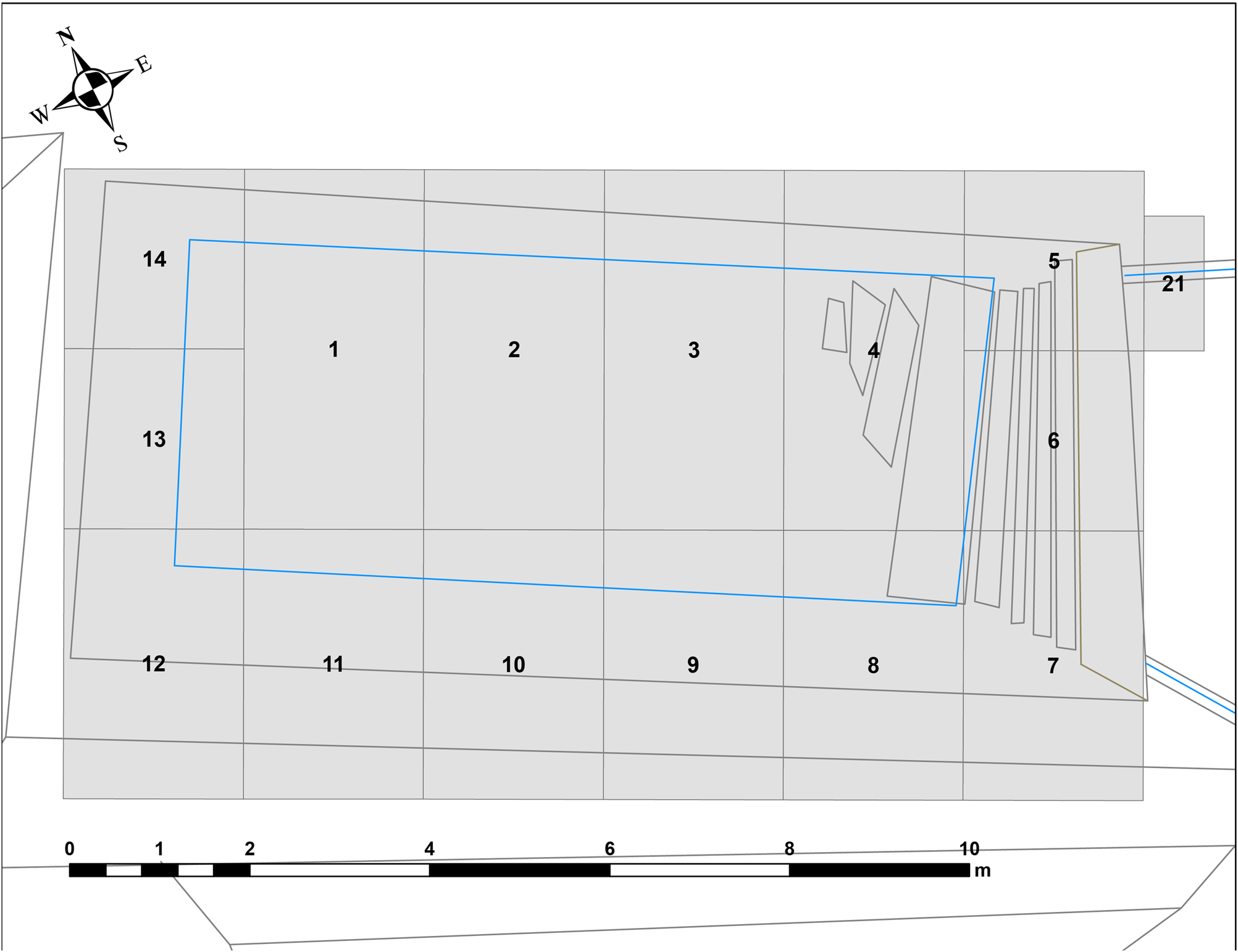
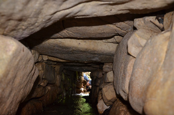
Prior to excavation, the Main Picota Pool was gridded into a series of 2 × 2-m and 2 × 4-m units (Figure 2). From the water's edge, the pool measures approximately 10 × 4 m, with an average depth of 1.25 m, containing roughly 48 m3 (48,000 L) of water (in July). The Maya formed the pool by excavating roughly 1.5 meters into bedrock directly into the water table. Although the pool is within the water table (i.e., a fresh water source), it is also fed by two external sources: (1) a subterranean conduit issuing from the Picota aqueduct in the southeast corner (Figure 1) and (2) a spring (or possible conduit) in the southwest corner. There is also a constant source of water that bubbles up (outgassing of CO2) from the pool's floor. For the excess water, the pool maintains an overflow drain (Figure 3) in the northeast corner that exits into the main aqueduct.
Excavation units of the Main Picota Pool. Map by Claire Ebert.

Interior of the Main Picota Pool's overflow (exit) drain, looking west from the interior of the aqueduct. Photograph by French.

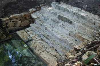
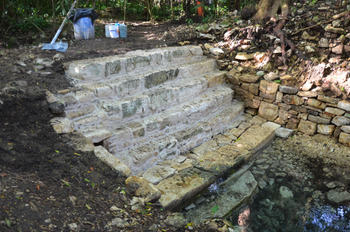
The feature's east side is marked by a monumental staircase (Figure 4) comprised of nine steps—five above water, one at the water's surface, and three underwater—directing the participant to the pool's floor. After descending approximately two meters down the first five monumental steps, the sixth step, formed with three large, well-faced construction blocks, forms a wider landing just above the level of standing water. From this landing, three increasingly shorter steps continue below the water line.
The Main Pool's monumental staircase. Photograph by French.

Although well-dressed stones were originally employed in the architecture bracketing the Picota pool, it is now in a state of considerable decay. The south face was evidently constructed into a double terraced configuration, with a single layer of blocks laid directly over bedrock. Remnants of stone foundations for small perishable structures sit overlooking the pool at the top of this 3.5-m high retaining wall. With sparse or no fill behind the walls and terrace, there was little chance of recovering a sealed deposit from which to date initial construction of the pool. The shorter built-up west and north sides of the pool appear to have been constructed as a single terrace or wall, which had largely collapsed into the pool.
The floor of the pool is comprised of a 10- to 15-cm layer of sand atop bedrock. The sand's origin was perplexing, as Palenque is devoid of the material. Initially we thought the sand must have been imported from elsewhere, perhaps from a coastal area or marine environment a great distance away. An examination of the material using X-ray diffraction (XRD), however, indicates a likely local origin for the sand covering the base of the pool.
Sand Analysis
XRD is a characterization technique in which X-rays are diffracted from the various crystallographic planes in a material. The advantage of XRD, compared to other compositional analyses, is that it demonstrates the presence of a substance in the sample rather than just the constituent elements (Cullity and Stock Reference Cullity and Stock2001). This data can then be translated into the different minerals present in the sample, to infer the origin of the material itself. Sand from the Picota pool's floor was subjected to this technique and various substances were identified in the sample.
The overwhelmingly high levels of dolomite (CaMg[CO3]2) in the sample suggests the sand was native to Palenque. Palenque is located on a plateau at the foothills of the Sierras, perched above a limestone escarpment overlooking the plains to the north. Heavy annual rainfall and perennial waterways have leached calcium from the bedrock leaving a calcium-deprived, though magnesium-rich, dolomitic bedrock across the site. This leaching process was accelerated within the circulating water of the pool. The minute presence of quartz (SiO2) is a recurrent theme, ubiquitous in essentially any mineral deposit on Earth. The sodium aluminum silicate (NaAlSi2O6) is more difficult to explain, and likely the result of a contaminant in the sample, possibly a substance in the debris that lies above the sand layer.
Through the process of CO2 outgassing, the limestone has been gradually broken down over the last ~1,700 years, leaving behind a thin layer of granular dolomite at the bottom of the pool. The concentrations of carbon dioxide are products of both the upper mantle and dissolved carbonate rocks (Yoshimura et al. Reference Yoshimura, Liu, Cao, Yuan, Inokura and Noto2004). Carbon dioxide outgassing is the natural release of carbon dioxide from the Earth when ground water is exposed to the atmosphere (Pearson et al. Reference Pearson, Fisher and Plummer1978), and the levels of CO2 resulting from this outgassing process become increasingly variable at the water table (Macpherson Reference Macpherson2009). Since the Picota pool is dug into the bedrock, the ground water has been exposed to the atmosphere at the surface, thus releasing built-up carbon dioxide. This release slowly disintegrated the dolomite already present in the substratum below Palenque.
Artifacts
A small collection of ground stone, chipped stone, and ceramic artifacts was recovered during exploration and excavation of the Picota pool. Several manos and metates (corn-grinding apparatuses) were discovered in situ on the stairs below the water line. Given their location, we are uncertain if these represent “squatter” activity, postdating the collapse of Palenque, or possibly cleaning or provisionally storing (discarding/hiding) in the pool. The obsidian recovered comprised a handful of random bladelets or implement fragments, nothing indicative of specific activities performed routinely at the location.
Ceramic Analysis
During the 2014 season, a total of 3,056 ceramic sherds were recovered from excavation of approximately 50 m2 of surface area surrounding the Main Pool. Very few sherds came from below the water line and these are assumed to be recent introductions from the four inclined sides surrounding the pool. Presumably ceramics would not survive long within the percolating water. From this collection, 304 sherds are rims—about 10 percent—and another 110 are diagnostic pieces for which form and/or ceramic complex can be assessed.
This assemblage has a predominantly utilitarian character, with basins and large utility bowls outnumbering other functional classes. By rim sherd counts, the assemblage is 85 percent utilitarian pottery and 15 percent serving wares. Aside from a single figurine, no ritual ceramics (e.g., censers, cache vessels, or miniatures) were recovered. Temporally the pottery ranges from Otolum [a.d. 600–690] through Murcielagos [a.d. 690–770] and Balunte [a.d. 750–820] ceramic complexes (Rands Reference Rands and Hammond1974, Reference Rands, Sharer and Rice1987).
Large tripod serving dishes, a hallmark of elite activity at the Palace and elsewhere in the central precinct, are noticeably sparse at the pool. Some large-capacity cylinders almost identical to examples from the Palace and elite residential compounds were present, however. The abundance of basins and large utility bowls combined with a distinct minority of small pieces from well-made and elaborately decorated serving wares is frustratingly difficult to contextualize. Perhaps the pool was the locale of different kinds of activities at different episodes during the year. For the moment, we are left with a small collection of fragmented pots that tell an equally fragmented story of the history of activity at the Picota pool.
Consolidation
Staircase
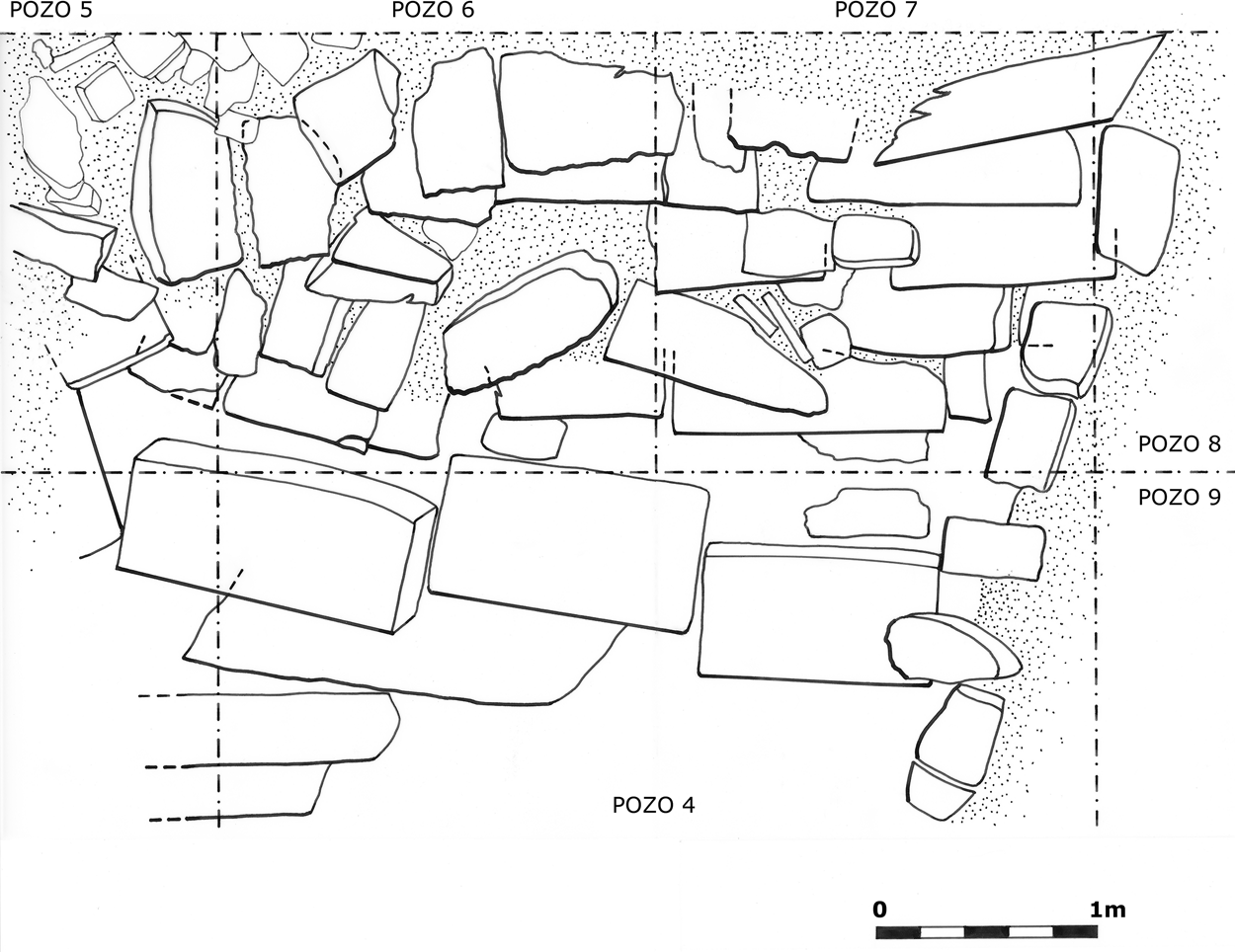
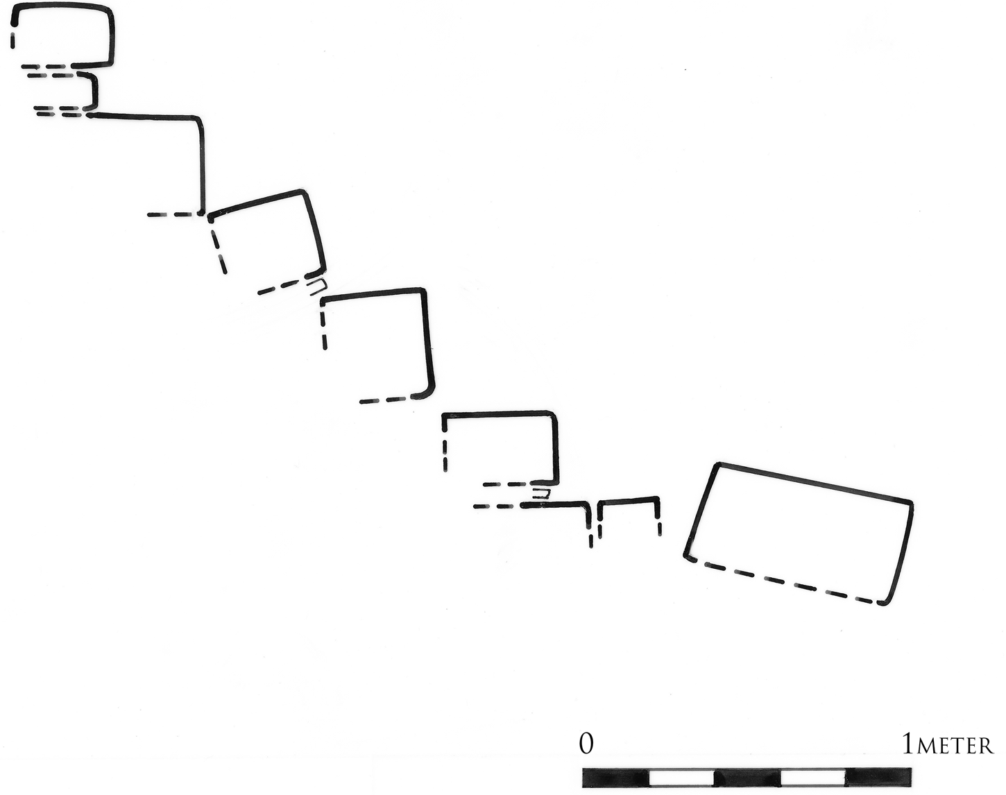
Prior to consolidating the monumental staircase on the pool's east side, the stones were numbered, photographed, and drawn (Figures 5 and 6). Once excavations beneath the staircase were completed, the stones were returned and aligned with the sections of the staircase in situ, at approximately 20° north. The team also relied on the few undisturbed steps to reconstruct the original slope of 33 cm vertical rise by 33 cm horizontal tread. All of the cut stones used in consolidation of the staircase were from the east side of the pool and associated with the feature.
Plan view of the monumental staircase. Drawing by Straight.

Profile of the monumental staircase. Drawing by Straight.

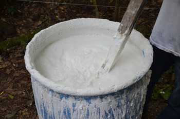
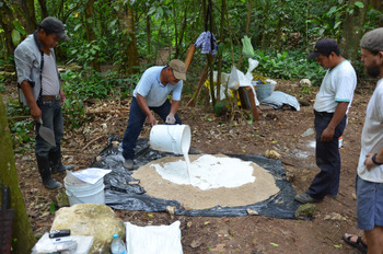
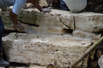
With the assistance and knowledge provided by the project albañil (stonemason), the staircase was carefully secured with a binder. The recipe for the binding mixture required for consolidation was provided archaeologists by González Cruz and Abendamar Balcells González, both from the Instituto Nacional de Antropología e Historia. Preparation of the mixture began with making cal or hydrated lime, a combination of calcium oxide (Ca[OH]2) and water, by a ratio of 1.5 kg of quicklime to 2 L of water (Figure 7). This mixture is stirred vigorously for 30 minutes, four times daily, for one week. Next the cal is combined with sand, gravel, and cement (Figure 8 and Table 1). The mortar was then applied to the staircase to ensure its preservation (Figure 9). Consolidation of the staircase required eight days (Figure 10).
Stirring the cal. Photograph by French.

Mixing the cal with gravel, sand, and cement. Photograph by Reed Goodman.

Stonemason, or albañil, applying the mixture to the staircase. Photograph by Reed Goodman.

Post-consolidation of the monumental staircase. Photograph by French.

Palenque Pool Project, Palenque, Chiapas (2014) ceramic sherd inventory. B/b = basin/bowl; Rsb = round sided bowl.

South Wall
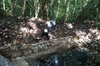
The lower terrace of the pool's south side was also consolidated (Figure 11). After locating portions of the wall near the southeast and southwest corners, we reassembled the wall's midsection. Without stabilizing the retaining wall, it seemed highly likely the feature's south side would not endure the coming rainy season. More excavation is required to fully understand the architecture of the pool's south terraces. It is for this reason we chose not to use mortar on the wall, relying instead on a dry stack method, allowing for future alteration.
Retaining wall (lower terrace) of the pool's south side. Photograph by French.

A CIVIC-CEREMONIAL CENTER?
The interconnected architectural features that collectively form the Main Picota Plaza Group must have first been envisioned by an individual or, more likely, a group of people with the skill and authority to organize a sufficient labor force. The complex as a whole was planned before excavating the pools into bedrock, quarrying and transporting construction blocks, and moving plaza fill. Multiple lateral conduits to move water in and out of the connected pool were set when the course of the aqueduct channel was first established. Constructing the 2-m high aqueduct itself entailed moving quantity of construction block and the engineering skills to build up the walls and place the capstones over the corbeled vault.
The steps forming the east side of the Main Pool and those running the 8-m combined length of the east and south sides of the Main Plaza are megalithic. Other very large construction blocks were also employed: the aqueduct capstones, the lintel that caps the south entrance to the aqueduct, and even the Picota stela were all unwieldy to move and place. The overall impression, even after ~1,700 years, is of a community center or civic-ceremonial plaza group. Seeing this project through from conception to completion was no mean feat, and those responsible were certainly concerned with projecting an air of authority and sense of permanence.
ESTIMATING LABOR COSTS OF THE MAIN POOL
The sections of the pool are as follows: nine stairs on the east side (1–6 at 0.33 × 4 × .33 m, 7 at 0.33 × 1.5 × 0.33 m, 8 at 0.33 × 1 × 0.33 m, 9 at 0.33 × 0.5 × 0.33 m), the north sidewall (10 × 0.25 × 1 m), the west sidewall (4 × 0.25 × 1 m), and the south side terraced wall (lower section at 10 × 0.25 × 1 m, terrace section at 10 × 0.25 × 1 m, and upper terrace at 10 × 0.25 × 1.5 m). Determined through volumetric calculations, a total of approximately 15.6 m3 (42,361.8 kg) of limestone was used to construct the entire Main Picota Pool. This figure will now be applied to each of the constituent components (i.e., quarry, transport, manufacture, assembly, and finishing) of the architectural energetics analysis.
Quarrying
The total volume quarried was 28.4 m3 (77,021.5 kg), determined by dividing the total used limestone by 0.55 to account for waste. The quarrying rate of 750 kg per person-day (p-d) is an average of observed results from a replicative experiment as well as ethnographic responses (Abrams Reference Abrams1994:45). This yields a rate of 103 p-d necessary to quarry the limestone for the construction of the Main Picota Pool. This raw and uncut building material was then transported to the site of construction so that the debris from manufacture could perhaps be used either for construction fill or to create quicklime plaster.
Since the structure of interest is a pool that was excavated into bedrock, however, this quarrying must also be measured. The negative space (10 × 4 × 1.25 m) where the pool's water is located equates to 50 m3 (135,550 kg). Employing the same quarrying rate of 750 kg per p-d, 181 p-d of work would have been required to create the cavity itself. These two figures will be combined henceforth to represent the work rate of 284 p-d of total quarrying.
Transport
Through petrographic analysis (microscope) of samples from the two quarries in close proximity to the site of construction, it was determined that Quarry 1 was the likely limestone source. For transport to the Main Picota Pool, the output statistic used is 0.257 m3 or 586 kg per five-hour p-d. This is applied to the total amount of limestone manufactured after quarrying in order to determine the amount of p-d necessary to move the materials used to construct the pool. Mathematically, the transport of the limestone for the Main Picota Pool would have taken approximately 131 p-d.
Manufacture
After quarrying and transportation to the site, the limestone is then fashioned in order to make use of the debris in construction fill or the creation of quicklime plaster. Using the manufacturing rate of 0.086 m3 per p-d, it would have taken approximately 181 p-d to dress the stones used at the Main Picota Pool (Abrams Reference Abrams1994:48).
Assembly
Though wall thickness varied slightly among cut stones around the pool, the constant of 0.25 m was used for the purpose of this analysis. In a single day a person could theoretically construct 0.8 m3 (1,896.8 kg) per p-d of cut construction stones (Abrams Reference Abrams1994:51). At the Main Picota Pool, 20 p-d would have been necessary to build the structure itself. This does not conclude calculation of the energetics of assembly, however; the placement of construction fill to support the structural integrity of the final pool construction remains a component.
In order for the cut stones to be securely assembled, a foundation of fill comprised of a combination of earth, limestone cobble, and other byproducts is needed. Since the surrounding plaza area of the Picota Group consists entirely of fill, a practical boundary of two m beyond the edge of the structure was considered for this analysis. In the region between this limit and the walls of the pool, there is space for 148.1 m3 of fill. There are two sources of fill, however, already procured during the construction process that could have been recycled. These are the 12.8 m3 of waste generated during the quarry process and the 50 m3 of bedrock limestone excavated to form the actual pool cavity, leaving a remainder of approximately 85.3 m3 of fill still needed. Using the average fill placement rate of 4.8 m3 per p-d, approximately 30 p-d of work would be needed, bringing the total assembly rate to 50 p-d.
Finishing
The finishing process of producing and applying quicklime (Ca[OH]2) plaster is an exhausting practice that requires many considerations. Limestone is first exposed to fire for an extended period of time, consuming a great deal of wood fuel. This means much of the labor focus of this portion of the construction process would turn away from the structure itself and toward the procurement of trees; not just any wood with do for lime production.
Schreiner (Reference Schreiner2002) proposed an all-encompassing rate (tree procurement, transport, and slaking—adding water to the quicklime) of 100 kg of quicklime per 12-hour p-d utilizing steel tools in the southern Maya lowlands, where there is wide availability of 10–25-cm straight-trunk trees. In an area with an abundance of small-diameter wood, such as the Yucatan, it would cost more than double (32 person-hours) to produce the same 100 kg of quicklime. Adjusting to the five-hour p-d (Coles Reference Coles1979:41) used throughout this analysis, this rate would convert to about 42 kg per p-d. However, this rate is still based, however, on the use of steel tools, unavailable to the engineers and builders of the Main Picota Pool. In order to account for this discrepancy, it is vital to acknowledge that Maya stone tools are roughly one-third as efficient as steel tools (Erasmus Reference Erasmus1965; Saraydar and Shimada Reference Saraydar and Shimada1971) Therefore, after dividing the rates by three, a quicklime production rate of 14 kg per p-d is applied.
Of the 2,000 kg of total mass in one cubic meter of plaster, 325 kg is converted quicklime (Schreiner Reference Schreiner2002:86). One cubic meter of plaster can cover approximately 12 m2 of surface. This figure was adapted from the 2,200 m3 of plaster estimated to cover the exterior wall surface area of El Tigre (which totaled approximately 26,848 m2), the enormous pyramid at the Late Preclassic site of El Mirador in modern day Guatemala (Schreiner Reference Schreiner2002:87).
The total surface area of the Main Picota Pool that warranted application of plaster is 75.84 m2 (60 m2 for the three walls and the south side terrace and 15.84 m2 for the monumental staircase on the east side). This surface area would require 6.32 m3 (12,640 kg) of plaster, which would entail about 146 p-d to manufacture the 2,054 kg of quicklime necessary to produce that amount of plaster. The labor involved in the process of adding water to the quicklime (slacking) to create the plaster would have been negligible given proximity to the perennial flowing Picota Arroyo, which physically connects to the Main Picota Pool, and would have provided all of the necessary water without further transport costs.
Using the plaster application rate of 50 m2 per five-hour p-d (Mahoney Reference Mahoney1981), it can be surmised that only 1.5 p-d would have been required to apply the plaster to the pool structure. This means the total labor-rate for the entire finishing process would be approximately 148 p-d. Evidently, the plaster production process of procuring trees, transporting the timber, and finally slaking was far more labor intensive than its actual application.
Combining all of the individual components of the energetic study (i.e., quarrying, transport, manufacture, assembly, and finishing), a total of about 794 p-d of labor were necessary to construct the Main Picota Pool. This figure can now be applied to various hypothetical labor forces to hypothesize the duration of construction. For example, this means that it would have taken a group of 100 laborers just over one week (7.94 days) to construct the pool. To extend the exercise, it would take 50 laborers just over two weeks (15.88 days), 40 laborers slightly less than three weeks (19.85 days), 30 laborers just shy of one month (26.47 days), 20 laborers more than one month (39.7 days), and 10 laborers approximately two and a half months (79.4 days).
AQUEUCT PRESERVATION COST ANALYSIS
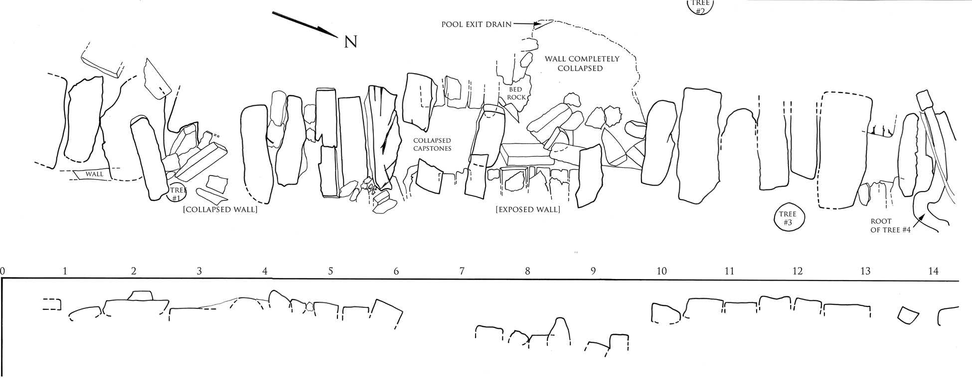
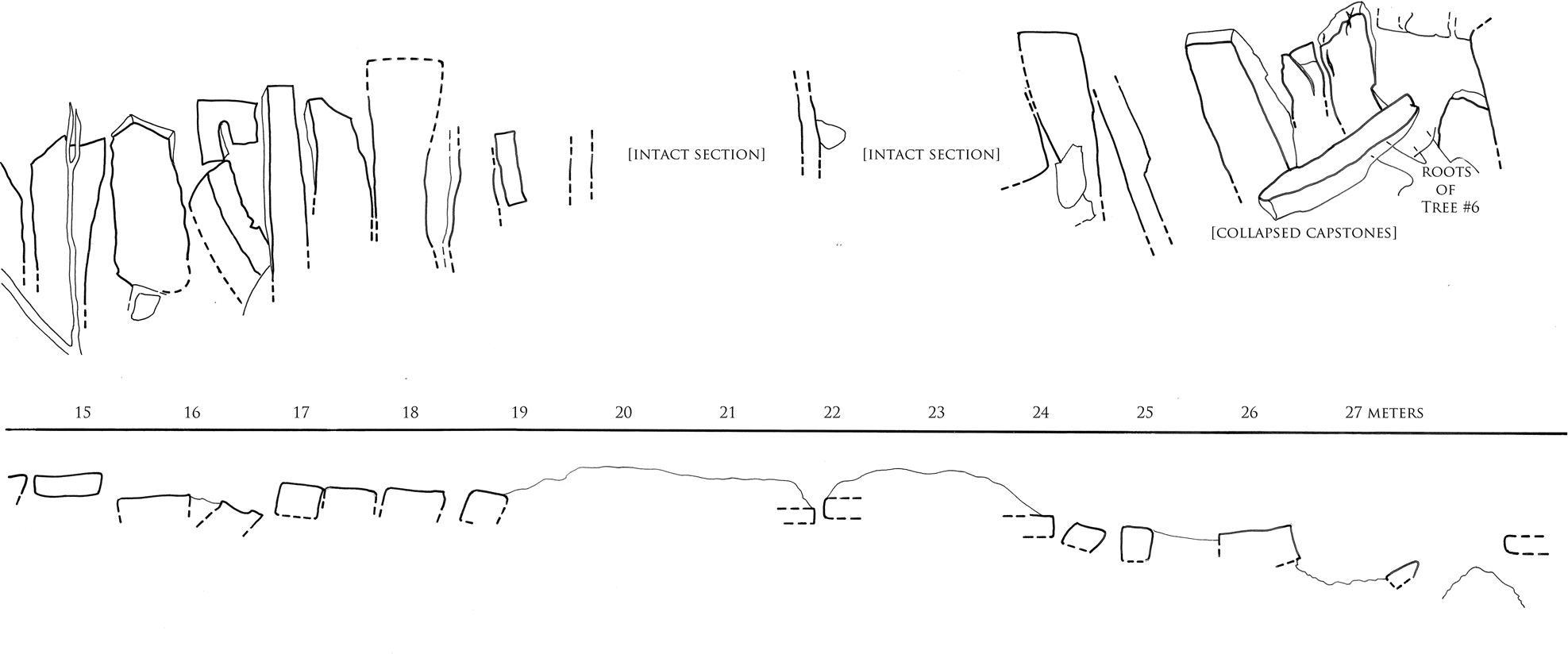
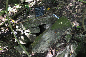
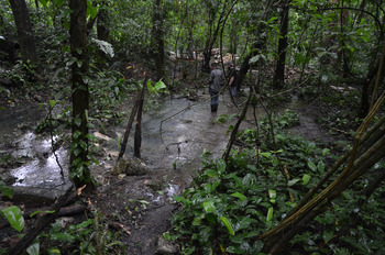
The main aqueduct that runs beneath the Picota Plaza is in dire need of consolidation (Figures 12–14). Many of the large capstones have fractured and fallen into the channel, virtually blocking the flow of water. When the Picota Stream is flowing at normal levels, this is not a serious issue. During heavy rains, however, forest debris (i.e., branches and leaf litter) becomes entangled with the collapsed sections, preventing water from flowing efficiently and thus causing the plaza to flood. This type of overflow event happened once in late-May, after just one night of heavy rainfall (Figure 15). Luckily crew members were there in the morning to clear the debris from the aqueduct and restore normal flow. Each time this happens, however, the additional erosion is astounding. In less than two years, over a cubic meter of wall has collapsed and eroded at just one juncture of the aqueduct.
Plan view of the aqueduct's capstones (southern section). Drawing by Straight.

Plan view of the aqueduct's capstones (northern section). Drawing by Straight.

Example of the aqueduct's poor condition. Photograph by Reed Goodman.

The Picota Plaza flooded after one night of heavy rains. Photograph by Reed Goodman.

The aqueducts of Palenque are a unique water management feature in the Maya world. They literally define Palenque's ancient name, Lakamha’, meaning Big Water (French et al., Reference French, Stuart, Morales, Fash and Lucero2006), and the Picota Water Complex (pools, drains, and aqueducts) are all still operational—after at least 1,500 years without maintenance—but their decline is accelerating. Excavation and consolidation of the entire system will be costly (approximately US $250,000–300,000), but is essential for the preservation of this unique feature. Excavations in the Picota Plaza will no doubt yield quantities of data on the early chronology of this ancient city—a subject we know little about.
ETHNOGRAPHIC COMPARISONS
Chamula
In June of 2015, an ethnographic component was added to the project after the discovery of similar pools currently being used and maintained in the Tzotzil village of Chamula, just 120 km south of Palenque. These pools were mapped and interviews conducted with members of the waterhole committee. The contemporary use of these pools in a modern Maya community suggests a possible usage pattern for the Picota pools in antiquity.
While acknowledging that, “ancient sociocultural contexts, material culture, and cultural transformations differ from the post-conquest era” (Palka Reference Palka2009:302), we also believe that meaningful analogies are appropriate given similar ecological contexts and production technologies. The modern Tzotzil of highland Chiapas are descended from, and still living in much the same manner as, the Classic lowland Maya. The social organizations and rituals associated with pools and waterholes in modern Tzotzil communities provide grist for discussing similar archaeological features at Palenque.
An historical-comparative linguistic approach assigns Tzotzil to the Greater Tzeltalan branch descended from proto-Mayan (Kaufman Reference Kaufman1976). Glottochronology places the break between the Tzeltalan and Ch'olan branches of Greater Tzeltalan around a.d. 200 (Campbell and Kaufman Reference Campbell and Kaufman1985). The glyphic script of the Classic period (a.d. 250–900) represents Classic Ch'olti'an, a prestige language of the elite which is directly ancestral to Eastern Ch'olan languages: historical Ch'olti’ and modern Ch'orti’ (Houston et al. Reference Houston, Robertson and Stuart2000). Both Tzeltal and Ch'ol are still spoken in the lowlands of Chiapas today.
After the early departure of Huastecan, the diversification and expansion brought Mayan speakers down the Usumacinta River into the Peten region around 1,000 BC, where Yucatecan and Greater Cholan are found. Later (about AD 200) the Tzeltalan branch went from this area up to the Chiapas highlands, formerly occupied by MZ [Mixe-Zokean] speakers (Campbell and Kaufman Reference Campbell and Kaufman1985:192).
This linguistic evidence implies that Mayan speakers of highland Chiapas today are descendants of Classic-period populations. “These Tzotzil-Tzeltal peoples are almost certainly descended from a proto-Tzeltalan population which has become differentiated into various contemporary groups within the past 1,000 years” (Vogt Reference Vogt and Vogt1969:24–25, Reference Vogt1973:99). Several modern towns of Tzotzil speakers can be traced back to the contact period, including Chamula (Gossen Reference Gossen1970, Reference Gossen1984; Pozas Reference Pozas1959; Wasserstrom Reference Wasserstrom1978).
Based on his reading of colonial documents, Collier (Reference Collier1975:115)concluded that “the Chamula population is found today where it was at the time of the conquest [a.d. 1524].” Alternately, Calnek (Reference Calnek, McQuown and Pitt-River1970:122) suggested that the center was relocated at contact from “north of the valley of San Cristobal and to the east of the present town.” It is further uncertain whether Chamula's three barrio structure reflects formerly independent groups that the Spaniards corralled for ease of control, or if later Dominican monks coerced several Tzotzil communities to coalesce during the reducciones program ca. A.D 1550 (Gossen Reference Gossen1970:60; Wasserstrom Reference Wasserstrom1978:131).
As with all New World population centers, Chamula faced high mortality rates in the years after subjugation to the Spaniards, and subsequent heavy tribute demands through multiple epidemics, leaving a mere 270 inhabitants alive by a.d. 1590 (Wasserstrom Reference Wasserstrom1978:131). Gossen (Reference Gossen1971:146) estimated the Chamula population at 40,000 by 1970 and updated this figure to over 100,000 within the 364-km2 municipio two decades later (Gossen Reference Gossen1993:445). Compared with Collier's (Reference Collier1975:Table 23) more precise population figures, Gossen's figures seem a bit inflated.
At an average elevation of 2,300 m above sea level, most households in Chamula practice swidden agriculture focused on the Mesoamerican triumvirate of maize, beans, and squash, with the minor addition of cabbage and potatoes. Secondary production of charcoal, pottery, woolen fabric, sandals, pine furniture, musical instruments, and cane liquor (pox) is common (Collier Reference Collier1975:70). Social organization generally follows patrilineal descent and patrilocal residence patterns.
Over 100 dispersed hamlets form the three barrios of the municipio (Gossen Reference Gossen1971). Civic organization is characterized by patrilineage segment heads serving on a rotating basis in the 62-position cargo system (Cancian Reference Cancian1965). A strong belief in naugalism (Pozas Reference Pozas1969) and emphasis on a powerful solar deity (Gossen Reference Gossen1984) are reminiscent of Classic Maya cosmology (Gossen Reference Gossen1971).
In general, Chamulas have always resisted Spanish and Mexican political control, emphatically punctuated by numerous rebellions since the contact period (Vogt Reference Vogt1973:103–105). Graeber (Reference Graeber2004:84, 86) has described such dominator-culture resistant modern Tzeltal and Tzotzil communities as “autonomous municipalities” and “popular assemblies;” what were commonly called “closed corporate communities” in the literature of a slightly older vintage (e.g., Wolf Reference Wolf1957). Chamula residents remain suspect of outside influence and cherish tradition (costumbre).
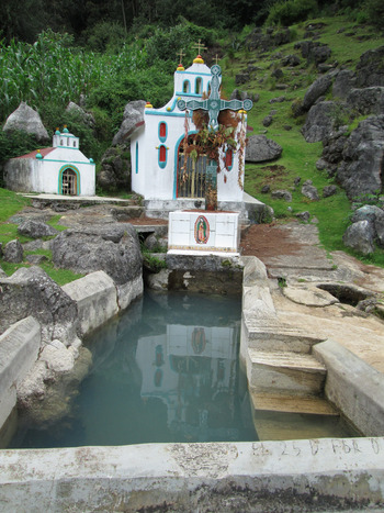
The interview with the head of the waterhole committee in Chamula was the most enlightening in regards to the pools in Palenque. The Spring of San Juan in Chamula (Figure 16) feeds a constructed pool, much as the Picota pool was fashioned. In this highland Tzotzil community, use of the pool is sanctioned only once per year, on the third of May, for the Fiesta de Santa Cruz. Early in the morning of the third, after ceremonial usage of the spring, a procession of the cross and important saints weaves through the village and terminates at the church. The restricted use of the spring-fed pool, and the awareness of the role this feature plays in community processions, have spurred contemplation of the periodicity of usage for the Picota pools and possible connections to social linkages features, such as cross stations, churches, or broader geographic features, difficult to detect in the archaeological record.
The Spring of San Juan in Chamula. Photograph by French.

When shown maps and photographs of the Palenque pools, the mayordomo of Chamula said that there was nothing unique or surprising about the similarities: these features exist throughout the area. In the highlands, this is true, limestone sinks with springs are a common geological feature. But in Palenque, this is not the case, there are no sinks or depressions with springs. All are completely constructed features, excavated into the water table through bedrock. This implies that the pools in Palenque were designed to mimic the natural landscape of the highlands. This suggests that some Palencanos were familiar with these natural features, common at higher elevations, perhaps through pilgrimages, trade, or other forms of intermittent or sustained contact. This Early Classic correlation between the highlands of Chiapas and Palenque is one that warrants more investigation.
Zinacantan
In Zinacanteco domestic groups or “households” (Bender Reference Bender1967; Yanagisako Reference Yanagisako1979) develop from patrilocal residence and patrilineal inheritance patterns (Vogt Reference Vogt1970:32–34). These households form larger social divisions within the largely endogamous societal structure: localized lineages (snas) and waterhole groups. Snas have no formal designation and are simply referred to by the predominant (or only) patrilineage name (Vogt Reference Vogt1970:42–44). Waterhole groups are similarly referred to by the dominant sna nominal (i.e., “the ‘house’ of…”). The sna basically fits Nutini's (Reference Nutini1996) definition of a barrio, a widespread Mesoamerican indigenous social unit based on kinship and territory. Snas and waterhole groups are the major “customary subdivisions” of these communities (sensu Mulhare Reference Mulhare1996).
In the highlands of Chiapas, rainfall is bimodal and waterholes take on a sacred character, each with a well-known origin myth (Vogt Reference Vogt1970:45). Access to these points are regulated by waterhole groups that vary in size from 2–13 snas, though membership is elastic, as water becomes scares during the summer months as smaller waterholes dry up. Collier (Reference Collier1975:115, 155) suggested a causal relation between farming practices and waterholes drying up seasonally or permanently, leading to transhumance or total relocation of some hamlets.
With such uncertainty in seasonal rainfall, both of these groups reaffirm their rights to land and water biannually in May and October. After an elaborate ritual feast is presided over by the outgoing senior mayordomo, the shamans from each sna conduct K'in Krus ceremonies at the cross shrines maintained by their group, followed by a perambulation route to reaffirm territorial boundaries. Similar cross shrines are maintained by waterhole groups, one at the side of the waterhole and one at a higher vantage point on a hill or mountainside overlooking the group's territory, called a kalvario (Vogt Reference Vogt1970:42–44).
Observances by the waterhole group are similar to those for the snas. Prior to the ritual meal, however, group members (men) clean the waterhole and repair its fence and cross shrine. Again, a ceremonial circuit ensues with rituals performed at the houses of the mayordomos, the waterhole, and the kalvario associated with the waterhole group. These acts reaffirm the social collective's rights and obligations to the water source (Vogt Reference Vogt1970:44–47).
The site of Palenque is situated on a plateau that was initially broken up by waterways. By channeling and capping perennial streams with aqueducts, a contiguous central district was created. Land and water were certainly the most important resources in this environment. Although water is available year-round, seasonal variability likely encouraged restricted control—either by the centralized authority (i.e., the royal court) or through collective agreements by “neighborhoods,” patrilineages, or other customary divisions.
Ethnographic work in Zinacantan has illuminated social institutions more extensive than the basic domestic group, yet smaller than the entire hamlet. The extended households of a patrilineage form a sna, often with minor lineages living in close proximity and intermarrying with the dominant lineage; a division based on both kinship and propinquity. Snas then group together to form a waterhole group, an even more inclusive division based in propinquity and access to water, the most fundamental resource of the community. Rights to water are balanced with the obligation to repair shrines and fences, clean and maintain physical access, and to provide appropriate ritual support.
While many lowland Maya centers do not have geographic barriers delimiting tracts of land, Classic-period Palenque was a unique situation where “neighborhoods” were physically separated by streams. Although agricultural tracts were probably maintained outside the densely settled community, access to potable water could have encouraged local control. In this regard, it is instructive to reiterate that waterhole group membership in Zinacatan is fluid as the dry season continues and waterhole dependence shifts as smaller sources dry up. These waterhole groups also have judiciary authority over members, with punishment meted out by local authorities for infractions of rules or failure to respect obligations.
CONCLUSIONS
The pool's true function and purpose will likely remain a mystery; however, our investigations did provide some insight. The location of the pool, in a large plaza just 8 m from Palenque's only standing stela, does suggest that it was ceremonial in nature—perhaps a community feature in Early Classic times. Unfortunately, secure dating for the construction of the Picota Group features—the raised plaza, subterranean aqueducts, pools, and structures—is lacking. Our own program can only confirm Late Classic ceramics associated with the pool excavation. We reiterate that an Early Classic construction date for the Picota Group remains an unsubstantiated hypothesis based on circumstantial evidence. The results of an extensive test-pitting program (López Bravo and Venagas Durán Reference López Bravo and Venagas Durán2012) suggest alternate locales for early settlement at Palenque; the quite large acropolis complex just south of the Picota Group, El Escondido (Barnhart Reference Barnhart2001), remains unexplored. Still, the Picota Group has a number of unique features that make it stand out, in particular. Finally, the early portion of the ceramic chronology of Palenque is neither precisely formulated nor well-dated. Even the definition and separation of the Picota and Motiepa ceramic complexes has become more complex with recent recoveries (Balcells González and Armendáriz Ballesteros Reference Balcells González, Armendáriz Ballesteros, Parrilla Albuerne, Sheseña Hernández and López Bravo2015). While an Early Classic foundation for the Picota Group can be inferred, we lack direct evidence from dateable materials or other definitive means.
Interestingly, the Main Picota Pool is quite similar in construction to the Spring of San Juan in Chamula (Figure 16), just outside of San Cristobal de las Casas, Chiapas. There, the Tzotzil community uses the pool only once a year, on May 3, for the Fiesta de Santa Cruz. A perambulation circuit initiates at the spring-fed pool early in the morning on the saint's day and terminates at the town church later the same. This situation leaves us considering restricted access to the Picota pool by gender, rank, occupation, and any number of shifting kinship or community divisions.
Ethnographic work at traditional villages in the Tzeltal and Tzotzil area of highland Chiapas and neighboring Guatemalan departments has repeatedly documented social arrangements instituted by community members to regulate water and other natural resources. Although methods to detect or infer such institutions have not been proposed, considering social distinctions that relate to the physical divisions—geographic and constructed—that are still visible on the ground at Palenque seems a promising avenue. The occupied land tracks separated by waterways that form the settlement of Palenque proffer a uniquely favorable context to test such hypotheses.
The nine stairs leading into the pool also suggest an element of ritual; they could be emblematic of the nine Lords of the Night (G1–G9) from Classic Maya mythology. Let it not be forgotten that the pool is below the water table—underground. The Palencanos might have viewed the pool as a symbolic (or actual) opening into the watery underworld—similar to the reverence held for the sacred cenotes of northern Yucatan (Munro and Zurita Reference Munro and de Lourdes Melo Zurita2011). Restricted use of the spring-fed pool in Chamula suggests that the Picota pool was not a purely utilitarian feature and might have been governed by a number of social arrangements, each with taboos, obligations, and/or rights. The important point, from an anthropological archaeological perspective, is that springs and waterholes are always the focus of some kind of social regulation in traditional communities.
Lastly, all three pools in the Picota Group have conduits that bring water in and out of the aqueduct/stream (Figure 1). Without a doubt, there is a symbolic reason for combining the flowing water from the stream with the still water of the pools. With the aid of time-lapse video, however, a functional reason for bringing water in and out of the pool was realized—cleaning. Introducing water from the Picota Stream creates circulation, allowing for debris to easily exit via the overflow drain. The design is very similar to that used in modern swimming pools.
The preliminary excavation of the Main Picota Pool yielded much information about the further complexity of Palenque's water management system. Although likely a ceremonial feature, the pool's exact purpose remains unknown. Preservation of the pool was also a high priority, and the successful consolidation of the monumental staircase was a great first-step in protecting this unique feature. Although consolidation of the Picota Aqueduct will be costly, it is imperative.
Conventional wisdom holds that the Picota Group was constructed earlier and represents an older epicenter that was superseded by the current “downtown” district known to scholars and tourists alike as the heart of Palenque occupied by the ruling elite in Late Classic times. The low labor costs presented above (50 workers for two weeks) do support a construction date early in Palenque's history—a period of low population (i.e., a smaller labor force). Although the evidence for an Early Classic construction date of the Main Picota Plaza Group is indirect, we believe this theory has merit and deserves further testing. Excavating into the Main Plaza while consolidating the aqueduct would most likely provide chronologically sensitive ceramics or carbon samples to date construction.
RESUMEN
En todo el mundo, en el pasado y en el presente, las organizaciones sociales se desarrollan para hacer frente a las fuentes de agua restringidas. Basándose en la arqueología tradicional, las estimaciones laborales y los datos etnográficos, el Proyecto de la Piscina de Palenque se propuso comprender mejor una serie de rasgos hidráulicos interconectadas ubicadas en el sector occidental de este sitio maya clásico. Aquí detallamos la temporada de trabajo de campo 2014–2015. Primero, se considera que el Grupo Picota fue un centro cívico-ceremonial establecido por primera vez en el período clásico temprano (250 a 500 d.C.), un kilómetro al oeste del núcleo del centro de la ciudad. A continuación, se presenta una revisión de las estimaciones laborales para la construcción de características arquitectónicas del Grupo Picota. Luego exploramos el componente etnográfico, comparando configuraciones de grupos similares investigadas en la comunidad de Chamula, ubicado en las tierras altas, en 2015. El artículo concluye con una discusión teórica de cómo y por qué las organizaciones sociales evolucionan para administrar los recursos hídricos en la región, con referencia a la información etnográfica de comunidades de tzotziles de las altas tierras de Chiapas.
ACKNOWLEDGMENTS
First and foremost, French would like to thank team members Kirk Straight, Reed Goodman, Claire Ebert, Emily Zavodny, Elijah Hermitt, and Laurel Pearson for the energy they put forth. And a round for Walter “Chip” Morris for his constant encouragement and assistance with the ethnographic component. A big thank you to Alfonso Morales and Julia Miller for great advice and allowing French access to the wonderful project house. Hector Cuevas and Toño Rodriguez of the Instituto Nacional de Antropología e Historia rescued French on several occasions—thank you, friends! French would also like to recognize Marcelo Hernández from the Comisión Nacional de Áreas Naturales Protegidas for his willingness to work with him on environmental issues concerning the pool. For their strength, ingenuity, and laughter we would like to thank the workers from Naranjo—Eduardo, Andreas, Jesus, Nicolas, and Alfonso. We would also like to express thanks to the National Geographic Society/Waitt Foundation and The Pennsylvania State University for providing financial support. Fabio Amador (NGS) and Dominique Rissolo (Waitt) for providing invaluable and encouraging advice before, during, and after the project. Lastly, and most importantly, we would like to thank Arnoldo González Cruz and Joshua Abendamar Balcells González…without their generosity and support this project would not have happened.