Depending upon one's point of view, it is fortunate or unfortunate that I did not realize the implications of what I was undertaking, for I surely would never have taken it on. . . . If this map proves to have value for future investigators, as I believe it will, it is just as well that the costs, human and financial, of preparing it were not foreseen. (Millon Reference Millon1973)
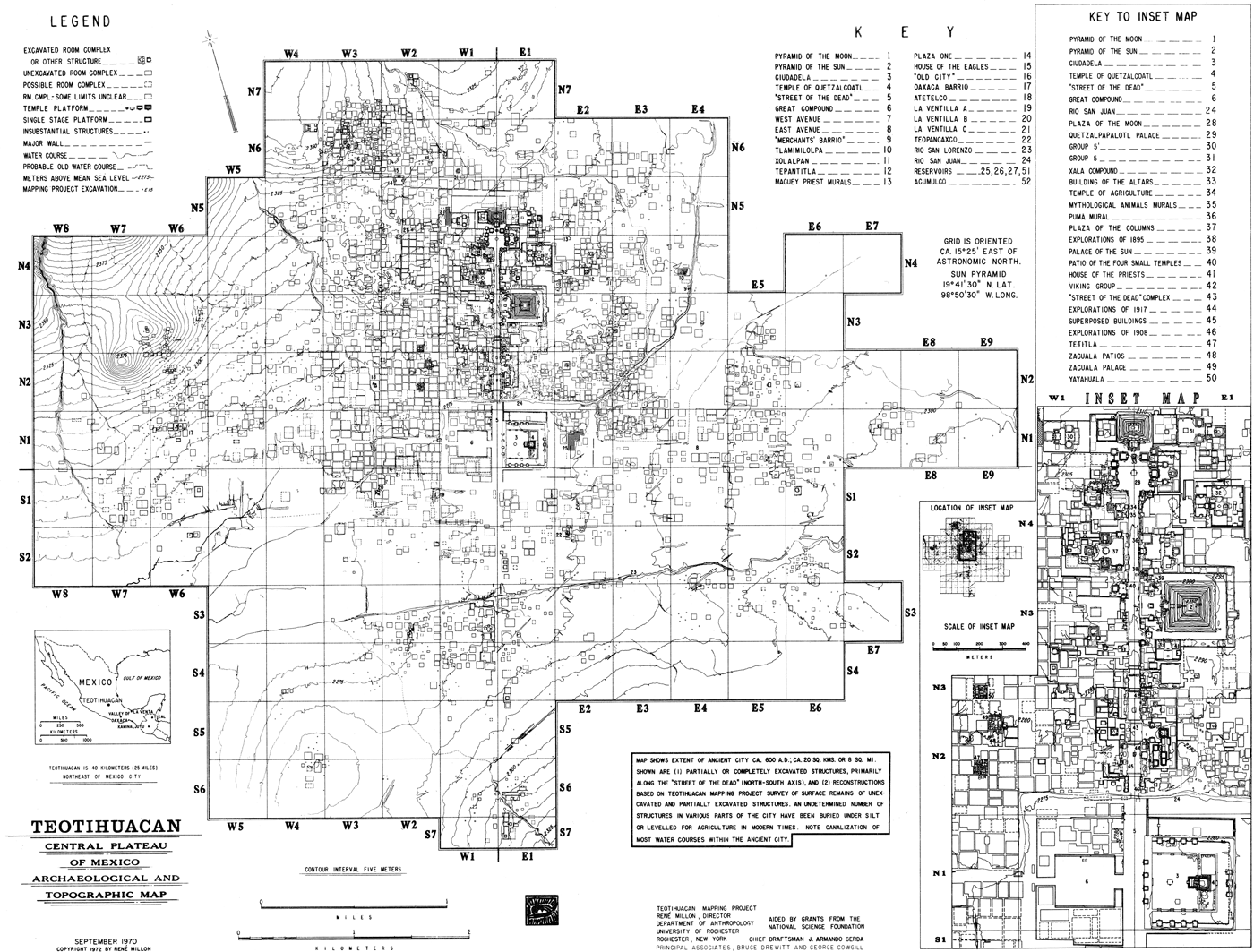
The Teotihuacan map is an accomplishment of singular importance in the history of archaeology (Figure 1). No other ancient city has been mapped in such detail. Scholars from diverse disciplines—archaeology, anthropology, ethnohistory, urban studies, and city planning—continue to use the map not simply to study issues pertinent to Mesoamerican archaeology, but to investigate the history of urbanism and the inner workings of cities in general.
The Teotihuacan Map (Millon Reference Millon1973).

Given the importance of the Teotihuacan map, one might assume that other archaeologists would have created similar maps of other ancient cities. Certainly, other mapping projects have followed, several of which specifically mention the Teotihuacan Mapping Project (TMP) as part of their inspiration and model (see, for example, Blanton Reference Blanton1978). Yet, no other project has resulted in a map of an ancient city comparable in detail and scope. Why? To answer this question, we explore how and why the map was created. In so doing, we identify a series of attributes that all big, complex archaeological investigations must have to be successful.
We begin with a personal account by the senior author of the origins of the TMP—what spurred Millon's interest in Teotihuacan and what led him to believe that a map of the city was essential (Millon Reference Millon2008).Footnote 1 Next, we present a brief history of the TMP. In the third section of the paper, we critically evaluate the results of the TMP, examining what went right and what went wrong. Our emphasis is less on defending or justifying specific actions as it is on providing a signpost of potential pitfalls that befall this type of project. We then speak more generally about the characteristics required to design and complete a project of the scope of the TMP. The final section places the TMP in historical context.
COMING TO TEOTIHUACAN
This is an account of what stimulated my interest in urbanism generally and in Teotihuacan in particular. While I was an undergraduate at Columbia University, thanks to Franklin Roosevelt and the GI Bill of Rights, I was a history major with interests in the origin of the state and in how the first cities arose in the Near East and elsewhere in the world. This interest developed from reading a book, published in Reference Childe1936 by V. Gordon Childe, Man Makes Himself. Childe's later works were marked by a growing interest in Marx's view of history. My own experience with peasant guerillas in the Philippines and the theft of the presidential election there after MacArthur's forces retook the Philippines in 1944 and 1945 (Millon Reference Millon1946a, Reference Millon1946b) predisposed me to look favorably on Childe's views and interpretations of the processes involved in the origin of the state and the rise of the earliest cities and civilizations in the Near East.
After graduating from Columbia in 1948, I was undecided whether I should do graduate work in history and if so in what field—Egyptology, Assyriology, Sinology? Then I took a great course in summer school from the famously iconoclastic Michigan anthropologist, Leslie White, who was in New York teaching at Columbia for the summer session. I had never taken an anthropology course before and knew next to nothing about the field except that anthropological articles in the National Geographic usually had naked women in them. But, the more I learned about it from fellow students, especially Bob Stevenson [Robert Findlay Stevenson] and Harry Raulet, and from Leslie White's idiosyncratic view of Marx in historical anthropology, the more I was attracted to it. At the time, anthropology was decidedly not a well-defined field. Wide open, the wooly west of academic disciplines, anthropology was especially attractive to me for that very reason. My interest was in the comparative study of the origin of the state and in how the earliest cities and civilizations came into being in various parts of the world. If I were to take on graduate work in history I would have to become a specialist in a particular area, to the virtual exclusion of comparative studies of other areas. But from what I could gather about anthropology, if I were to major in it, no one could say that the wide range of my interests from China to the New World wasn't anthropology because what anthropology was and what it wasn't was not yet clearly defined.
In any case, I enrolled as a graduate student in anthropology in the fall of 1948. After enrollment I quickly became intrigued by Julian Steward's interest in regularities in the comparative study of early civilizations (Steward Reference Steward1949) and in his comparative observation on societies in South America. Steward was the editor of the Handbook of South American Indians. From him I first learned about the multidisciplinary Viru Valley Project on the north coast of Peru that had just been completed. Concurrently with Steward's course I was taking a course in New World Archaeology from the self-described dirt archaeologist William Duncan Strong, one of the archaeologists who had been working in the Viru Valley.
Gordon Willey (personal communication) credited Strong as one who had influenced him in the development of his pioneering study of settlement patterns in Peru's Viru Valley (Willey Reference Willey1953). Strong had just returned from field work in Viru, where among other things, he had excavated what the National Geographic had titled “Finding the Tomb of a Warrior-God” (Strong Reference Strong1947). His accounts of work on the north coast of Peru, of its unique weather, of its fascinating archaeological history from coastal shell gatherers to city builders, made me want to go there to work. It was also then that Bob Stevenson aroused my interest in Karl Wittfogel's 1938 article about irrigation and the origin of the state—his Theory of Oriental Society, which Wittfogel (Reference Wittfogel and Fried1963) developed from Marx's Asiatic Mode of Production.
However, by the spring of 1949, in Duncan Strong's class, we had moved on to Mexican archaeology. Strong spoke in glowing, rapturous terms of Teotihuacan. He drew on the blackboard a sketch plan of the Street of the Dead, the pyramids, and the Ciudadela. Strong said that no other site had ever so overwhelmed him. I decided I had to go there. Shortly afterward in the same year—1949—the Congress of the Americanists met in New York. I was then writing my Master's thesis on irrigation and the origin of the state in the Viru Valley. I learned that Gordon Willey, who had just completed his settlement pattern study of the Viru Valley, would be attending the Americanist conference. With the single-minded arrogance of youth, I wanted to ask him if he could give me access to data he had on the Viru Valley irrigation system and its history. With the extraordinary graciousness characteristic of Gordon Willey, he readily agreed to send me what I needed. He also told me that, in view of my interests in the political implications of irrigation, I might want to talk to the Mesoamerican archaeologist Pedro Armillas, who was also attending the conference.
I went to hear Armillas’ paper at the Congress and afterwards talked to him, quickly coming under his charismatic spell. He told me that, while working at Teotihuacan, he thought that the irrigation system in the Teotihuacan Valley had played a critical role in the rise of the prehispanic city. He invited me to come to Mexico so he could show Teotihuacan to me. The following year, 1950, after I finished my graduate classes in anthropology, and after the Korean War started, fellow students and I drove to Mexico City partly for the trip and partly to avoid the possibility of being inducted into the service again.
Soon after my arrival, Armillas took me to Teotihuacan, showing me the majestic Street of the Dead with its pyramids and other monumental constructions, his excavations on the Street of the Dead in the Viking Group, and, beyond the Street of the Dead, his excavations in Tepantitla as well as at Tetitla. The Tlalocan murals were both delightful and awesome. Other murals as well at Tetitla and Atetelco were intriguing and challenging. That was it. I was hooked. I had to learn more about Teotihuacan. I had to work there.
Armillas also told me about his classes at the Escuela Nacional de Antropología, which I later attended and from which I benefited enormously. After classes he invited me and fellow students from Columbia to have coffee with him in a nearby shop. Over a period of months I learned a great deal about post-Porfirio Díaz Mexican history from 1911 on. Armillas taught me many things between 1950 and 1956. One of the most important was his insistence that I get and read a copy of Sir Mortimer Wheeler's (Reference Wheeler1954) Archaeology from the Earth and that I recognize the fundamental importance of excavating by layers rather than by arbitrary levels as was the custom in the United States. I took this to heart and have always excavated by layers in my subsequent excavations and instructed those excavating with me to do the same.
My interest in Teotihuacan was further stimulated by V. Gordon Childe's (Reference Childe1950) article titled “The Urban Revolution.” For students of early urbanism it quickly became a classic and an integral part of the theoretical basis for the study of urbanism. Fellow students and I also had long, productive sessions in Paul Kosok's apartment in Manhattan. The topic was early cities and irrigation on the north coast of Peru where he had worked and about which he had written. Kosok also introduced me to Dick Schaedel with whom I had many provocative conversations on problems in the origin of the state and early urbanism from which I learned a great deal. These conversations continued over the years.
Eric Wolf was several years ahead of me at Columbia and was still there when I was a student. He had a profound influence on my intellectual development because of the breadth of his knowledge and his brilliantly analytical way of attacking problems relating to urbanism, economic relations, class structure, domination, and irrigation. His Sons of the Shaking Earth (Wolf Reference Wolf1959) became a standard text in courses that included Mesoamerican archaeology. We became friends and he later introduced me to Ángel Palerm who, along with Armillas, was a refugee from the Spanish Civil War. Ángel often viewed what I said critically, told me what I should have said, and what I had best left unsaid. He and Eric had similar interests. I accompanied Eric and Ángel in 1955 in one of their searches for prehispanic irrigation systems in the general area of Cuicuilco in the southwestern Basin of Mexico. They also told me that they had just discovered what appeared to be a small-scale, abandoned, prehispanic irrigation system in the Valley of Teotihuacan, several miles to the west of the ancient city. This led to my excavations in the Maravilla part of the valley, north of the abandoned Hacienda Cadena, that confirmed the prehispanic origin of the irrigation system (Millon Reference Millon1957). It was my first excavation in the Teotihuacan Valley.
As we all do, I also learned from those younger than myself. One such joven was Bill Sanders, about whose work Armillas had told me. His paper on the “Anthropogeography of Veracruz” (Sanders Reference Sanders, Bernal and Hurtado1953) was exciting because of the way he examined social and environmental problems and ordered them convincingly and persuasively. We later participated in several Valley of Mexico sessions organized by Eric and Ángel between 1955 and 1957.
In 1960, a Valley of Mexico conference was hosted by Robert McCormick Adams at the University of Chicago. Among those present were Ignacio Bernal and Román Piña Chan as well as Eric, Ángel, and Bill. By that time I had decided to focus all my energies on Teotihuacan. I had taken a field school to Teotihuacan in 1959 for a surface survey of the Oztoyahualco region in the northwestern part of the ancient city and carried out a small excavation there in a locality known as Plaza One. We had tried to record the sites we found in our survey on aerial photos as best we could. I had decided by the 1960 Chicago conference that before anything else, what was needed was a detailed map of the entire city. Because my dad had been an aerial photographer for over 20 years, I was aware of the power and indispensability of photogrammetric maps for any detailed study of ground surfaces. In talking about our joint interests in Teotihuacan and the Valley of Teotihuacan, Bill and I decided that I would work in the city itself, and that he would work in the Valley of Teotihuacan.
A BRIEF HISTORY OF THE TMP
Millon knew he had to map Teotihuacan, he just did not know exactly how. He decided to follow in the footsteps of mapping projects at the lowland Maya centers of Mayapan and Tikal. Mayapan, a relatively small (4 km2) Late Postclassic center (a.d. 1000–1460), was a good model because as a walled city, it had clearly defined limits (Jones Reference Jones1952). Tikal, in contrast, was much larger than Mayapan, although still much smaller than Teotihuacan. Even though the resulting map of Tikal (Carr and Hazard Reference Carr and Hazard1961) shows no definable limits, Millon chose it as a guide for developing methods and procedures for mapping Teotihuacan.
The initial plan was relatively simple: (1) create a photogrammetric base map using low-altitude aerial survey, (2) take manageable sections of the photogrammetric base map into the field and make detailed observations, including surface collections of ceramics and other ancient materials, and (3) transform the raw aerial photographs into a finished map, which contains all possible structural information as well as information on areas lacking architectural remains (Millon Reference Millon1973:x, 3).Footnote 2 Originally, the map was to be prepared at a scale of 1:2,000 with 1 m contours (similar to the Tikal map) and to be published in 1 km2 sheets as well as on one sheet at a scale of 1:5,000. Millon estimated that the total area of the city would be no more than 20 km2.
While planning for fieldwork, Millon had to overcome two significant hurdles. The first was to gain permission from Mexican officials to map the city. At the time, the Mexican government was sponsoring a program of major excavations in the ceremonial heart of the city. The inclusion of the excavation results into the map complemented the objectives of both programs and permission was granted. The second hurdle was funding. In 1962, Millon was awarded a three-year grant from the National Science Foundation (NSF) to map Teotihuacan, the first of many such grants he would secure over the life of the project.
It would be 11 years before Volume 1 of the map was published. In that time, Millon would lead a team of young, relatively unknown archaeologists, a cadre of graduate students, and a loyal crew of local residents of the Teotihuacan Valley on a venture whose intensity and complexity none had imagined (Figure 2). The field survey began with nine months of fieldwork in 1962 and then more than three continuous years of fieldwork from June 1963 until October 1966, at which point about 90% of the city had been mapped. Field checking and test excavations (Figure 3) required extensive field seasons to continue until the end of the summer of 1970.
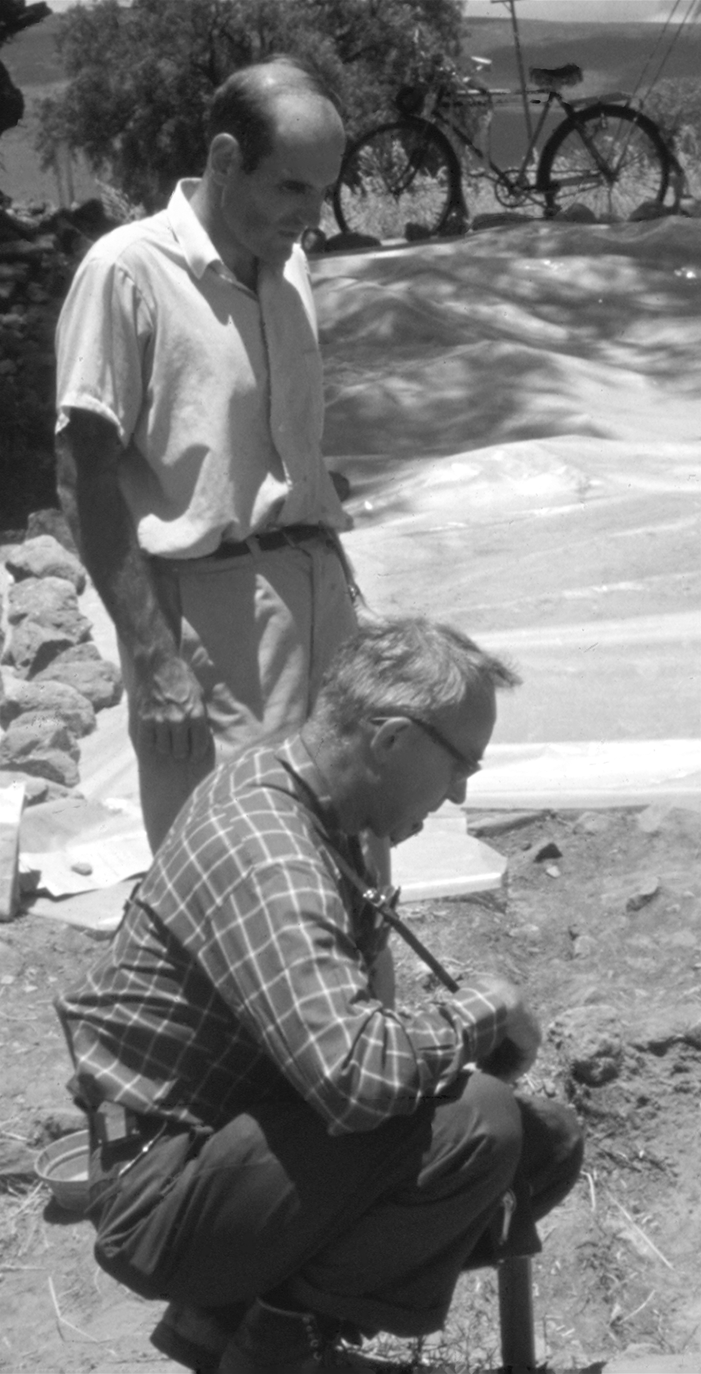
René Millon with Matthew Wallrath at Test Excavation (TE) 17, The Great Compound, 1968. Photograph by George Cowgill.

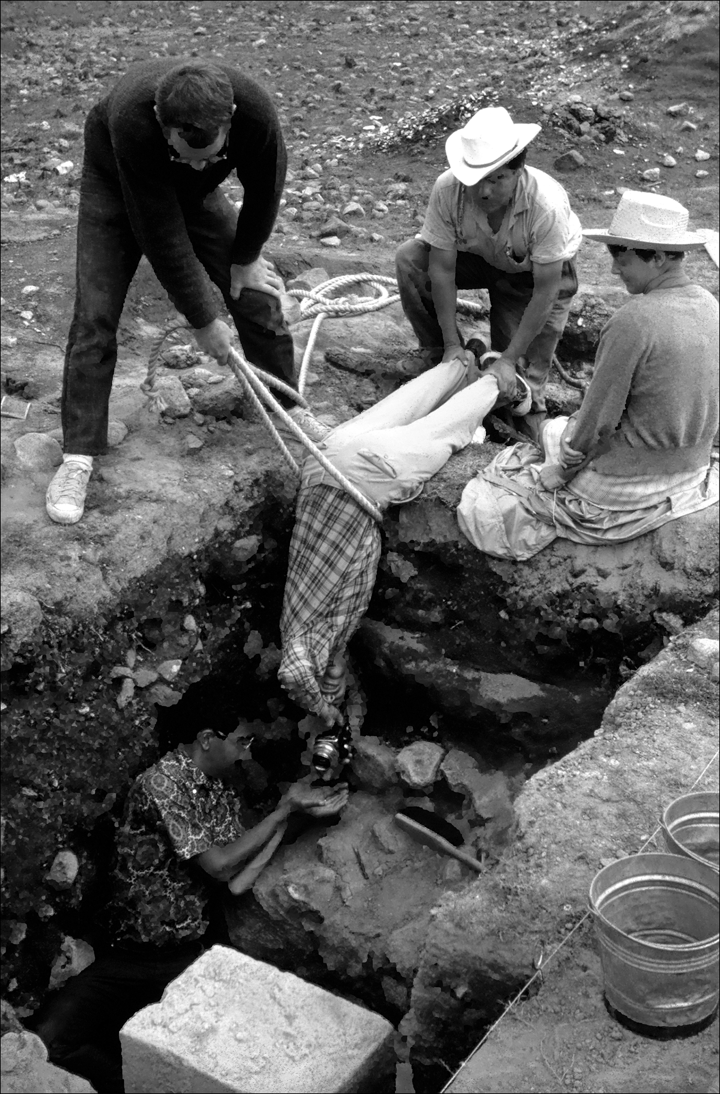
Test Excavations at 7:N1W6, 1967, showing methods used to photograph in situ stone door jamb of a Oaxaca-style tomb with Zapotec-style glyphs. The photographer is Juan Vidarte (field director) whose legs are being held by Reyes Avila, with Eric Ekholm holding the rope. Warren Barbour is protecting the camera in case it is dropped; Toni Barbour is watching. Photograph by George Cowgill.

Laboratory analysis began in 1963, concentrating first on material collected from the surface and then on material recovered from test excavations. Managing the copious amount of information led to computerization of the data, which began in 1965, shortly after George Cowgill joined the project in 1964. The first computerized data file of a portion of the surface material (DF1) was completed by 1966. Cowgill began statistical analyses of the computerized data shortly thereafter. From the outset, Cowgill's statistical analyses had a number of aims, including testing survey reliability, preparing multivariate statistical analyses, and conducting city-wide distributional studies (Cowgill Reference Cowgill1967), using an early graphics program called SYMAP. A few lines of FORTRAN code written by Michael Ester (Reference Ester1976) made it extremely easy and quick for FORTRAN users to access variables or Boolean combinations of variables.
The early 1970s were largely devoted to preparation of the final ink drawings of the archaeological interpretations and writing the text accompanying the map. Many parts of the map were drawn, checked, and redrawn. Particularly troublesome was the Street of the Dead complex, with its myriad temples, palaces, platforms, and other buildings made even more complicated by various attempts spanning more than 100 years to reconstruct buildings based on faulty archaeological interpretations (Drewitt Reference Drewitt1967, Reference Drewitt, de Tapia and Rattray1987). In 1973, the long-awaited publication of the map of ancient Teotihuacan finally took place. Like so much of the project, the publication itself was unique. Volume 1 of the map was published in two parts: Millon prepared the text accompanying the map (Millon Reference Millon1973:1:Part 1); and Millon, together with Bruce Drewitt and George Cowgill, co-authored the map (Millon et al. Reference Millon, Drewitt and Cowgill1973:1:Part 2). Instead of publishing the map of the entire city on 1 km2 sheets as originally planned, Millon and his colleagues decided to publish each 500-m square separately. Each of the 147 squares was shown on two sheets: a base photogrammetric topographic model and a clear plastic sheet that showed the archaeological interpretations in red ink that could be overlaid on the topographic sheet. Because of the shape of the city, 35 km2 were needed to encompass all features of the 20 km2 ancient city. The increased area led to a decision to publish a map of the entire city at a scale of 1:10,000, with only the ceremonial center published at the original 1:5,000 scale. The result was an odd-size, square, 11.25 × 11.25 in book, with a cloth pouch on the outside for the larger, foldout maps; a book review in Scientific American aptly described the publication as “marsupial.”
Archaeologists whose only exposure to Teotihuacan might have been in a class or in general reading might assume that the publication of the Teotihuacan map represents the intended end of the TMP. This is most definitely not the case. Indeed, the publication of the map was supposed to mark a turning point in the project in which emphasis shifted from the map itself to the analysis and presentation of data collected by the TMP. In the 1973 publication, Millon wrote confidently about subsequent volumes; there was to be a volume dedicated to the descriptions of the more than 5,000 sitesFootnote 3 identified on the pages of the map as well as other unique volumes focusing on the results of the test excavations, computer-aided statistical studies, ceramics and chronology, bioarchaeology and mortuary studies, subsistence studies, and perhaps other volumes not yet conceived of in 1973.
At first, research in the decade after 1973 moved assuredly in this direction. The TMP was transformed from essentially a field-mapping project to an analytical one focused on defining the culture sequence and cultural processes involved with urbanization at Teotihuacan. The TMP undertook only two more test excavations, both in the summer of 1978 (Figure 4). Neither project was directed at mapping problems but instead set out to answer specific research questions (Millon Reference Millon, Bricker and Sabloff1981). In 1980, the TMP wrapped up fieldwork with intensive surface collections at two apartment compounds (Altschul Reference Altschul1981). The final field project Millon directed at Teotihuacan took place in 1984 at Techinantitla, which focused on finding the source of a corpus of looted paintings known as the Wagner murals and was not considered part of the TMP (Millon Reference Millon and Berrin1988b).
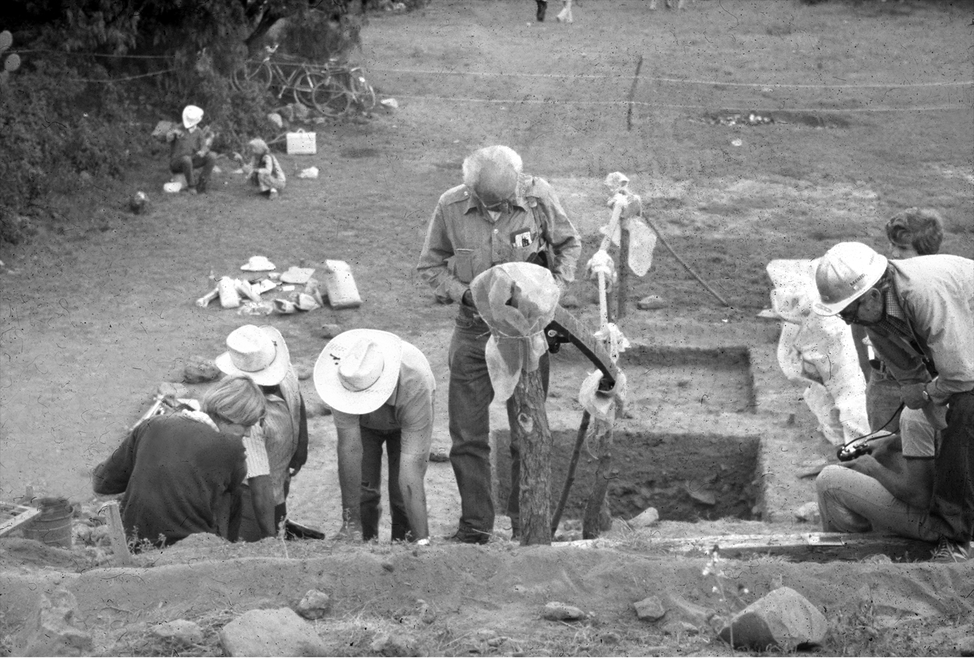
Test Excavation (TE) 27, Temple of the Puma Mural, 1978: (left to right) Martha Sempowski, Pedro Baños, John Sempowski, René Millon, Bruce Drewitt (wearing hard hat); in background, Darlena Blucher (wearing hat) and Clara Millon. Photograph by Jeffrey Altschul.

The analysis phase of the TMP took much longer and proved more difficult than anticipated. Unlike fieldwork, during which people and activities were centralized at Teotihuacan, analytical efforts were distributed among many scholars and different institutions, primarily in Mexico, Canada, and the United States. Analyses moved at different paces, dictated by the energy of the principals in charge and by their ability to attract funding and students.
By the mid-1980s, analytical efforts began to wind down even though the promised volumes had not materialized. Studies of the TMP collections continued, but sporadically and with a relatively low level of effort. Periodically, conferences and symposia were convened to present the results of the TMP along with its contemporary Valley of Mexico survey project and other more recent work in the region (see, for example, McClung de Tapia and Rattray Reference McClung de Tapia and Rattray1987).
In 1994, Martha Sempowski, Michael Spence, and Rebecca Storey published Volume 3 of the TMP series on skeletal remains and mortuary items (Sempowski et al. Reference Sempowski, Spence and Storey1994). To date, it is the only other volume besides the 1973 map to be published in the original series. Seven years later, Evelyn Rattray (Reference Rattray2001) published a monograph on Teotihuacan ceramics, much of it based on TMP data, albeit outside the TMP series. Two other monographs are currently in preparation. Rebecca Sload and Altschul are compiling a report of the 1978 excavations in the human-made cave underneath the Pyramid of the Sun (the twenty-eighth and last TMP test excavation). Simultaneously, Cowgill, along with Ian Robertson and Sload, are preparing a volume in the TMP series that describes the principal electronic files developed as part of the TMP and presents the major results from the computer-aided studies of the surface collections (Cowgill et al. Reference Cowgill, Robertson and Sload2003).
Whereas descriptive volumes have been slow to be produced, analytical studies of TMP data have resulted in numerous publications. As of 2003, Cowgill and his colleagues (Reference Cowgill, Robertson and Sload2003) cited 92 journal articles, book chapters, Master's theses, and doctoral dissertations that have been based entirely or significantly on TMP data. This list does not include all the popular articles, many of the professional meeting papers and presentations, or unpublished manuscripts.
Since the mid-1980s, attention has increasingly turned to the future of the TMP data. In 1986, Cowgill and Susan Evans received an NSF grant to develop the Arizona State University–managed Teotihuacan Archaeological Research Center, a facility located in San Juan Teotihuacan that houses the TMP and other collections. Interest continues to focus on extensive further studies of the materials curated at the Center and, more recently, on the computerized database. Between 1999 and 2002, Cowgill and Robertson, along with Peter McCartney, received an NSF grant to improve key parts of the TMP data files and to explore methods of Internet-based dissemination. Robertson continues to pursue the long-term goal of making TMP data available in electronic form and to create a TMP archive, which will include all published and unpublished documents, databases, site forms, photographs, and other project-related materials.
ASSESSING THE TMP: SUCCESSES AND SHORTCOMINGS
By any measure, the mapping of Teotihuacan was an audacious project. Even though Millon did not know all that was to be involved, he was convinced that it was a critical undertaking and that he could do it. As he (Millon Reference Millon1973:xi) stated:
An accurate, detailed map was an indispensable precondition for any intensive study of urbanization at Teotihuacan. The extent of the urban zone, the density of construction, and the way buildings were disposed within it and related to each other had to be determined if any serious progress was to be made in understanding the society whose members had built and lived in this great city.
Not only did the TMP create a map of the ancient city of Teotihuacan, it created a map of an archaeological site that is unequaled in the history of archaeology in terms of its size, scope, and detail. Although subsequent mapping projects have cited the TMP as their model, none has resulted in a map of equal standing. As Altschul (Reference Altschul, Whittlesey, Ciolek-Torrello and Altschul1997:645) observed:
Through Millon and his colleagues’ efforts, we know the location, size, and probable function of nearly every structure for the Xolalpan-Metepec city—Teotihuacan at its height. Similar data exist for no other historic city: not ancient Rome, medieval Paris, nor Shakespeare's London. For the last 35 years, discussions of the origin of the city have included Teotihuacan; they do so today, and will do so 100 years from now. The inability to ignore Teotihuacan is the result of the Teotihuacan Mapping Project, and is perhaps the best measure of its success.
We believe there were three key ingredients to the TMP's success. First, the problem was important. As one of the first urban centers in the Americas, the seat of an empire, and the center of a civilization, knowledge about Teotihuacan is critical not simply to specialists interested in Mesoamerica but also for all scholars interested in the origins of the city, state, and civilization. Second, the TMP assembled a team equal to the task. Third, of all the decisions required to successfully complete the map, the TMP got most of the key ones right. Yet, even with all these successes, the TMP also has come up short in one of its basic responsibilities: the publication of its descriptive data. We explore each ingredient below.
Vision and Commitment: Identifying an Important Research Problem and Maintaining Interest
Once the TMP began, Millon devoted his entire professional career to this project. His single-mindedness of purpose and importance was contagious; many TMP team members spent all or most of the first decade, working extremely hard, to complete the map. A surprising number continued with the project during the subsequent decades working on the analyses.
Millon's drive and enthusiasm was legendary among TMP team members, but it was not limitless. As Altschul (Reference Altschul, Whittlesey, Ciolek-Torrello and Altschul1997:645) noted:
By the time he published Volume 1 (the map) of the intended series Urbanization at Teotihuacan, Millon (personal communication 1997) was physically and emotionally exhausted. His ability or interest in directing others was limited. The momentum for publishing the site descriptions and computer analyses diminished.
Although it took several years, Millon recovered in large part by being stimulated by the work of others. Earlier in this paper, Millon described the events and people that initially led him to focus on Teotihuacan. Below, he writes about other scholars that influenced his thinking about Teotihuacan after 1960.
Because of prior conversations and discussions, Robert McCormick Adams was a significant influence even before he presented his views in lectures and seminars at the University of Rochester in 1965, views that were published as The Evolution of Urban Society: Early Mesopotamia and Pre-hispanic Mexico (Adams Reference Adams1966). His provocative comparisons of ancient central Mexico and early Mesopotamia influenced my subsequent interpretation of economic, social, and political relations at Teotihuacan. Thirty years after Adams’ book was published, Van De Mieroop's (Reference Van de Mieroop1997) The Ancient Mesopotamian City favorably cites Adams’ interpretation of how cities first arose in southern Mesopotamia. Discussions with Adams in the 1970s and 1980s continued my exposure to his brilliantly analytic mind, to his unending ability to cite data relevant to any problem I posed, and to his citation of important data on urbanism from the Near East of which, otherwise, I'd not have known.
For example, at the 1960 Valley of Mexico conference in Chicago, Bill Sanders had outlined what he expected to find in his survey of the Teotihuacan Valley's towns and villages on both sides of the valley. He didn't plan to survey the central alluvial plain which was under cultivation by irrigation. Bob Adams asked Bill at that point, “How do you know you'll find any settlements?” Adams had just completed his survey of the countryside around the ancient city of Uruk in modern Iraq and found that settlements in the region prior to Uruk's urban revolution were afterwards concentrated in the city. Whether voluntarily or under duress, people in surrounding settlements moved into what was becoming the city of Uruk. Sanders later found rural Teotihuacan period (150 b.c.–a.d. 650) settlements sparse and small in the Teotihuacan Valley. This was the first demonstration of how the Teotihuacan Valley and the Uruk countryside resembled each other both before and after the development of urbanism in each.
Another youngster from whom I have learned an enormous amount about urbanism is my long-time friend and colleague, Edward Calnek, whose special area of study is Tenochtitlan, the Aztec capital. His thorough familiarity with Aztec codices has helped me repeatedly in interpreting aspects of Teotihuacan murals.
My next major influence was Jorge Hardoy, the Argentinean urban specialist, whose Reference Hardoy1971 book titled Pre-Columbian Cities, as well as earlier and subsequent articles, established him as a major figure in the study of urbanism. I met him in Mar del Plata, Argentina, at the 1966 Congress of the Americanists and later participated in symposia he organized in Lima in 1970 and Rome in 1972. Over the years, Hardoy, Dick Schaedel, and I engaged in fierce discussions, including battles over ritual and ideology and their role in the growth of cities, states, and civilizations.
I met Paul Wheatley when he was an outside member of a doctoral committee I chaired at the University of California, Berkeley, in 1960 or 1961, but I didn't know then anything about his views on urbanism. Later I read articles of his, culminating in his magisterial The Pivot of the Four Quarters (Wheatley Reference Wheatley1971). I learned a great deal from his analyses of ancient Chinese cities and of early cities throughout the world. Particularly relevant for me was his discussion of the ideological concept of the “pivot of the four quarters” because it appeared to have such direct applicability to Teotihuacan, with its four quarters and the Ciudadela as its pivot.
Aidan Southall, whom I met at a meeting in 1998 or 1999, was another influence on my thinking. His 1956 social anthropological study of an east African group titled Alur Society, the subtitle of which explains my interest: A Study in Types and Processes of Domination (Southall Reference Southall1956). His subsequent article, “The Segmentary State in Africa and Asia,” represented for me a new look at state formation (Southall Reference Southall1988). Southall's (Reference Southall1998) more recent The City in Time and Space spans the whole period of urbanism from the earliest cities—the pristine cities—to the cities of today, and is a delight to read.
I was familiar with Maurice Godelier's (Reference Godelier1978, Reference Godelier1979) earlier work when his articles on infrastructure, society, and history appeared in Current Anthropology. His discussion there of domination in non-industrialized, stratified societies as based on a combination of “violence and consent” was so relevant to Teotihuacan that I subsequently cited it (Millon Reference Millon and Berlo1992). In his later 1988 book, The Mental and the Material: Thought, Economy, and Society, Godelier presents his understanding of the circumstances surrounding enduring, long-term domination of the many by the few, and I quote:
No domination, even when born of violence, can last if it does not assume the form of an exchange of services … It is this that establishes … active or passive consent of those who are dominated [Godelier Reference Godelier and Thom1988:160–161].
The exchange of services that Godelier argues for is the ideological for the material. The rulers provide the ideological contribution when they contact “the invisible forces controlling the universe” on behalf of the society as a whole. In exchange, the dominated provide labor and service. Should the reader think that the foregoing applies only to times long ago and far away, I refer the reader to Manufacturing Consent: Noam Chomsky and the Media (Achbar Reference Achbar1996). In it, Chomsky describes the same process—the process of exchange between forces dominating the political system in the United States and the dominated rest of us who behave and pay our taxes. What Godelier describes applies not only to past urban societies such as Teotihuacan, but to modern states as well.
Godelier's observation concerning the exchange of services seemed to me to make immediate sense and to provide at least a partial explanation for the long-term survival of the city, state, and civilization of Teotihuacan. It remains to be seen how it will stand up to future work at Teotihuacan and to works in progress there now.
The TMP Team: Staffing a Long-Term Multidisciplinary Project
At their core, archaeological projects are about people. To study the behavior of people of the past, people of the present—possessing divergent skills, talents, and personalities—are assembled; the more complex the project, the larger the number of people and the more diverse the expertise that is required. But a group of scholars, no matter how individually talented, does not necessarily make a team. Teams require commitment to a common vision, often requiring the sublimation of individual goals to those of the group as articulated by a leader.
Like many academic projects, the TMP consisted of a few dedicated principals who were or became tenured professors at various universities in the United States and Canada. Although there were changes, all the principals remained with the project for significant periods of time. James Bennyhoff (Figure 5) served as assistant director from 1962 until he was replaced by Bruce Drewitt in 1966. Drewitt, who had also started with the project in 1962, remained active into the late 1970s after co-authoring the map (Millon Reference Millon1973:1:Part 2). George Cowgill joined the project in 1964 and, along with Millon, has remained on it ever since. Cowgill has gone beyond the TMP and codirected a major excavation project at the Feathered Serpent Pyramid in Teotihuacan in 1988–1989.
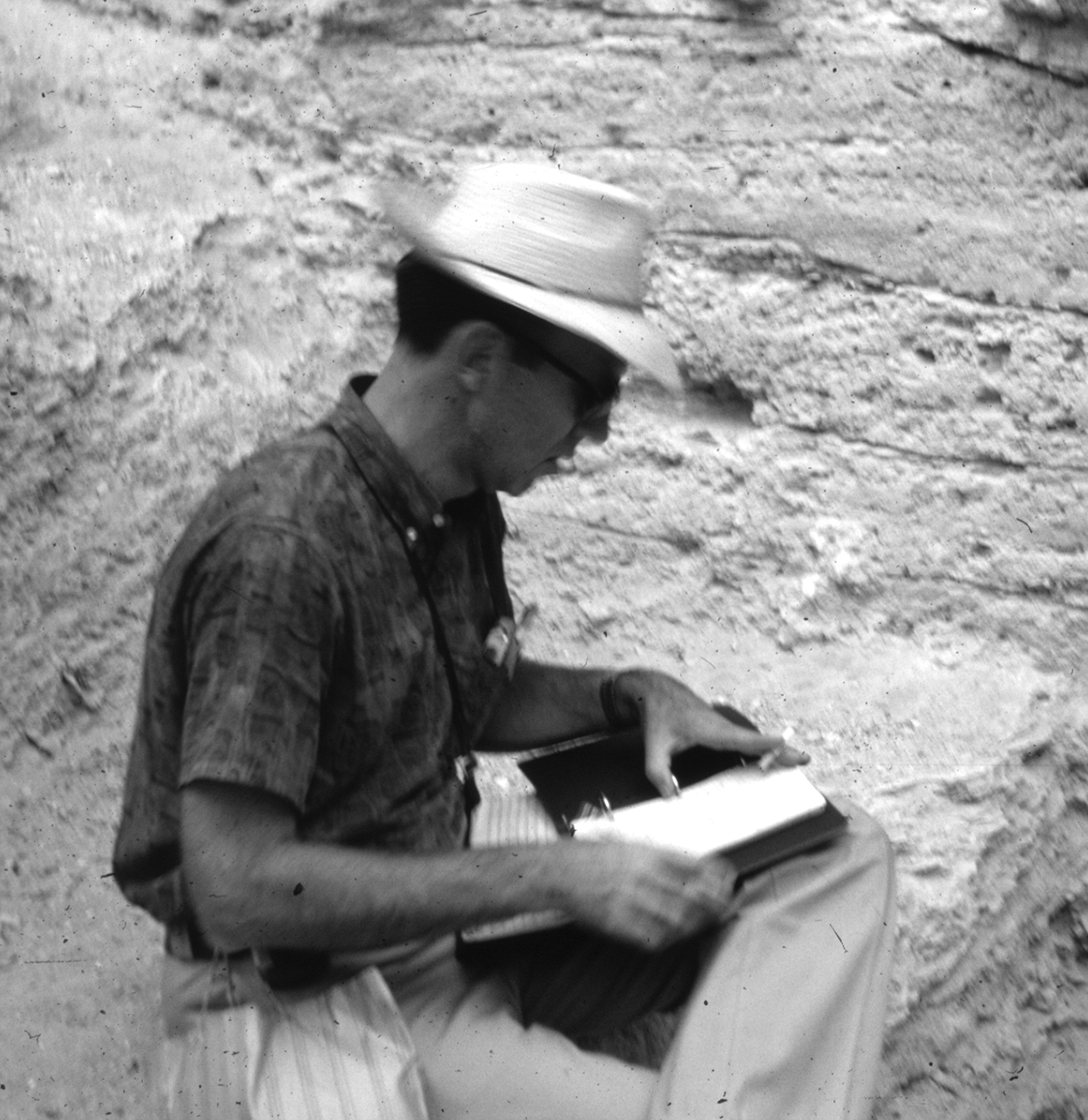
James Bennyhoff at Purron Cave, Tehuacan Valley, 1964. Photograph by George Cowgill.

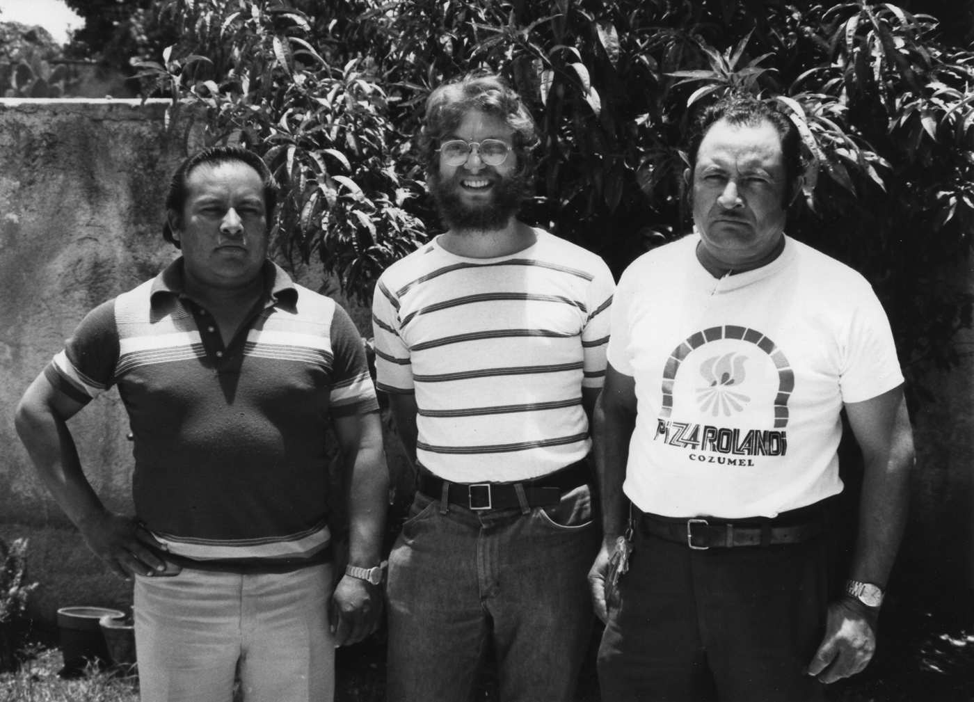
The other anchor in the TMP has been Pedro Baños, a resident of the Teotihuacan Valley. Baños originally began working with Millon in 1959. He joined the TMP in July 1962 and worked on the project until his retirement in 2005. After being trained in archaeological field and laboratory methods, Baños was given the responsibility of supervising field crews, writing site descriptions, and analyzing artifacts. Throughout the history of the TMP, Baños, aided chiefly by another resident of the Teotihuacan Valley, Zeferino Ortega, supervised local residents hired by the TMP. Baños and Ortega also assisted, and in most cases helped train, several generations of graduate students (Figure 6).
(left to right) Zeferino Ortega, Jeffrey Altschul, and Pedro Baños, San Juan Teotihuacan, 1980. Photographer unknown; photograph in possession of Jeffrey Altschul.

Between the enduring principals and local support team was a constant flow of graduate students. Students helped complete field and analytical tasks in support of general TMP objectives and then performed specialized studies as part of their graduate degrees. Most students only stayed with the TMP while completing their degree. Some, however, remained with the project for all or much of their careers and, in some cases, sponsored their own students. These include Michael Spence, Darlena Blucher, Warren Barbour, Emily McClung de Tapia, and Evelyn Rattray. Other professionals also played significant roles, including Matthew Wallrath and, most notably, Paula and G. Raymond Krotser.
The flow of personnel required vigilance on the part of the principals to ensure that the work between field crews and between field seasons were comparable. Drewitt drew the bulk of this responsibility, although Millon and Cowgill also checked field results and mapping data. As discussed below, the lack of continuity in the field and the lab required the principals to take a nearly fanatical approach to the issue of data quality.
The changing nature of the TMP team also required that the project's objectives, goals, and importance be imparted again and again. The junior author remembers being a student in the TMP as akin to entering a serious adult conversation in the middle and then leaving before it was over. For students, it was clear that they were part of something big and important. Millon, in particular, was good at conveying the significance of the work and the nobility of the effort. He spoke of Teotihuacan and little else. His energy, drive, and enthusiasm in the field were legendary and highly contagious.
Although Millon was clearly the leader, he recognized the importance of those around him. Again, in his own words:
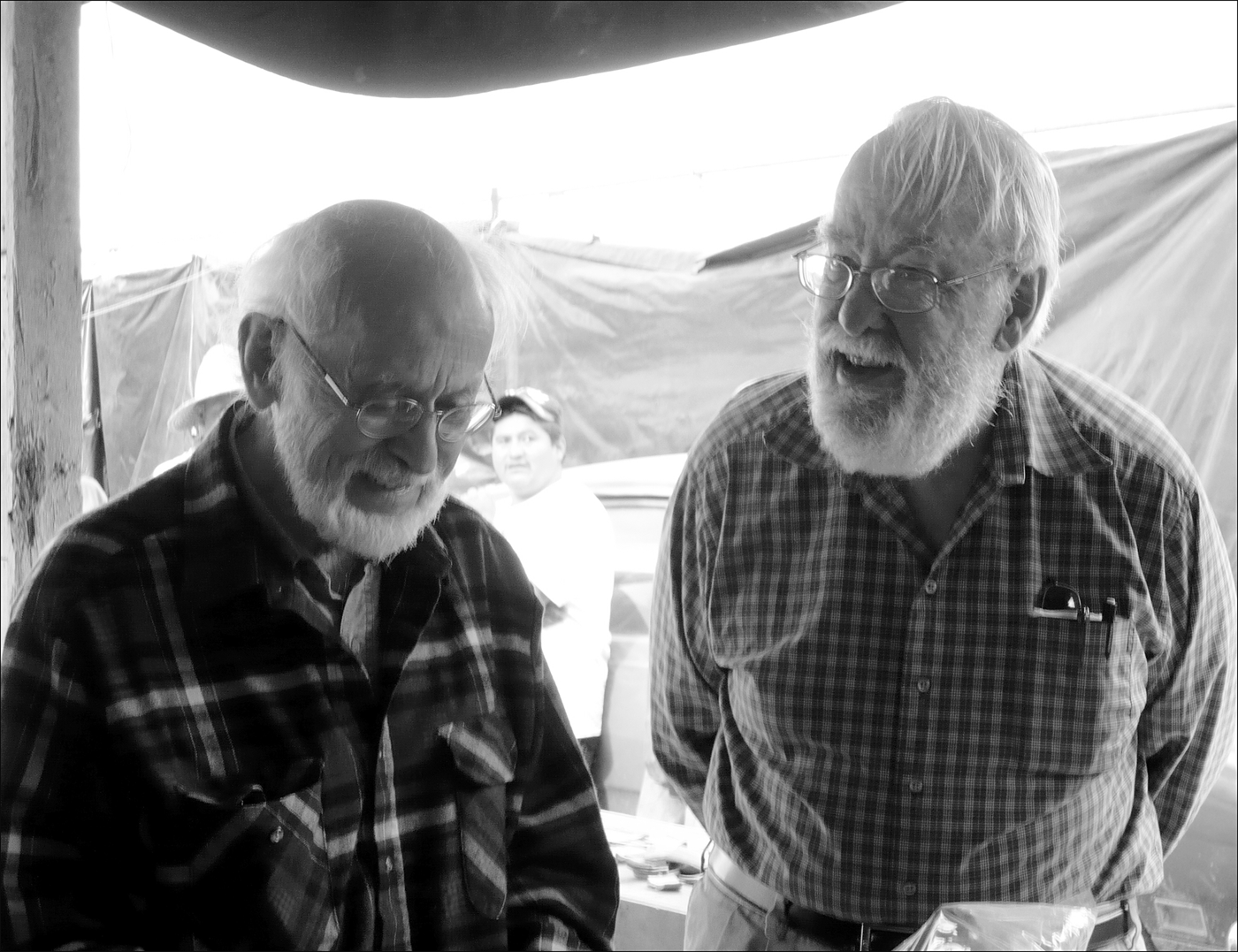
I owe intellectual and other debts to my good friends Bruce Drewitt and George Cowgill before, during, and after the making of the Teotihuacan map on problems we faced together—Bruce, for his commonsense views of our problems and, most importantly, for making the detailed drawings of the structures of the Street of the Dead, without which the map couldn't have been completed; George for his incisive mind, his ability to sort through difficult problems in plain English and propose solutions, and for his indispensable computerizing of our data (Figure 7).
Lastly I must state how much I owe intellectually to my late wife, Clara Millon. Her intellectual range was far beyond my own as is evident in her writings. I benefited enormously from the many conversations we had concerning my work plans and writings in progress. Her comments and criticisms contributed substantially to my writings. Just as importantly, they effectively prevented me from making egregious errors in texts I was submitting for publication or for presentation at conferences. My writings since Clara's death have been few, but I wish to thank Gretchen Markov for her assistance as a good friend, a sounding board, and a diligent proofreader of the most recent writings in my life.
René Millon and George Cowgill, Tecamac I, salt-making site north of Ecatepec, Basin of Mexico, 2007. Photograph by Ian Robertson.

Key Decisions: Adapting Methods to the Research Problem
In many respects, the published Teotihuacan map can be viewed as the result of a decision tree stretching back to the start of fieldwork in April of 1962. Some decisions may have seemed at the time to be trivial or of little consequence: the numbering system of the grid squares, the size of the field map, and the size and composition of the field crew. Others probably seemed more momentous or important: the selection of a zero point and center line, the spatial extent of the photogrammetric base map, the definition of a site, the creation of a field form, and the nature and size of surface collections. Like all archaeological projects, large and small, leaders of the TMP made hundreds, if not thousands, of decisions, some fully vetted by the project team and others made without much thought.
It is possible to change, or correct, many decisions, but the cost associated with such changes, even those that seem minor, tend to increase dramatically with time. For example, during the initial survey to delimit the boundaries of the city in 1962, 715 sites were described and mapped onto the aerial photographs. At the time, the site descriptions raised little concern. As field methods became more standardized, however, these early descriptions became increasingly inadequate as more and more descriptive information was found lacking in them. Eventually, a tipping point was reached, and Millon reluctantly decided to have most of these early sites re-recorded. Although the cost in terms of time and money was not prohibitive, it was substantial and certainly greater than if they had been done correctly in the first place.
In some cases, the cost of correcting a mistake is simply too great, and the project lives with the result. Further, and perhaps more importantly, early decisions impact later ones. If you only collect a small grab-bag collection of artifacts from a site, you are not in a position later to conduct detailed intrasite analyses (see Altschul Reference Altschul1981; Cowgill et al. Reference Cowgill, Altschul, Sload and Hietala1984). Decisions made early in the life of the project snowball, and they obtain a power and influence that is magnified well beyond anyone's foresight and, more importantly, beyond their control. In the main, the TMP got many key decisions right. These include:
• The Use of Low-Altitude Aerial Photography and Photogrammetric Mapping
Although aerial photography and photogrammetric mapping had been used previously in archaeology, no one had tried to use these methods on the scale proposed for Teotihuacan. The use of aerial survey allowed the entire city to be mapped, even after Millon determined that the size of the city was much larger than anticipated. It is not simply the size of the area mapped that is impressive, but the level of accuracy that was achieved. Horizontal accuracy of 90% of all well-defined planimetric features was set at 1.25 mm, with no such features being off on the ground by more than 2.5 m. Similarly, vertical accuracy was to be .5 m for 90% of all contours on unobstructed ground, with no elevation off by more than 1 m. With the possible exception of a small section in the extreme southwest section of the city, field checks have shown the map to be accurate within these specifications (Millon Reference Millon1973:10).
• Site Definition
For the purpose of comparing ancient cities, Teotihuacan as a whole might be considered a “site.” Such a definition, however, was of no use to the TMP. To map the city, Millon needed to divide Teotihuacan into manageable units that could be recognized in the field. Unlike most maps of ancient cities, which focus on architectural units such as temples, palaces, and other structures, the site concept at Teotihuacan was broadened to include areas that had no evidence of a standing structure, but that contained evidence of past use (Millon Reference Millon1973:4). This decision significantly increased the number of sites at Teotihuacan, but in so doing, the map captures other kinds of space important to urban life, such as plazas, markets, ceramic firing areas, and so forth. The process of interpreting the size and function of a site was never formal and changed over time in different parts of the city (see Millon Reference Millon1973:26–33). The linchpin in this process was Millon, who either made the interpretations or had the final word. Millon understood better than anyone the hypothetical nature of his interpretations, as he (Millon Reference Millon1973:30–31) noted when writing about apartment compounds: “The evidence for the existence of the apartment compounds I have drawn varies from certainty or near certainty to the problematic. I would insist only that the vast majority of the compounds I have drawn do in fact exist at or close to where I have drawn them, and that the dimensions I have drawn, for the most part, reasonably represent what their actual sizes would be.” Thirty years later, Cowgill et al. (Reference Cowgill, Robertson and Sload2003; see also Cabrera Castro Reference Cabrera Castro1986) noted, “[s]uffice it to say here that the interpretations published in Millon et al. (Reference Millon, Drewitt and Cowgill1973) have mostly proven accurate, the major exceptions being a few cases where surface survey revealed nothing much, but abundant materials were found upon excavation.”
• Surface Collection
To achieve its stated objective—“[the] investigation of the urban settlement pattern and population distribution in ancient Teotihuacan during the period of its florescence in the early centuries of the Christian era” (Millon Reference Millon1973:3)—the TMP relied on the analysis of surface artifacts from each site. Cowgill (Cowgill et al. Reference Cowgill, Altschul, Sload and Hietala1984:158) estimated that there were as many as 100,000,000 artifacts on the surface of Teotihuacan, so some form of sampling strategy had to be developed. Millon realized that even a small sample of artifacts from each site would result in a huge collection that would present a long-term curation problem. Early on, Millon experimented with a no- or very-limited-collection strategy that relied on in-field artifact analysis. Through his own field checks, however, he determined in a matter of one or two days that this strategy would prove disastrous. Additional experimentation led to a consistent approach that was applied throughout the city. In the field, the crew (which normally consisted of a crew chief, a student assistant, and a local workman) first determined the site boundaries, after which the workman generally made a surface collection of the entire site. Although never formal, the general policy was to collect ceramic rims, bases, and other identifiable parts of vessels as well as body sherds of decorated and Thin Orange wares. Additionally, unusual sherds or ceramic objects of any type (for example, figurines, candeleros, incense burners) were collected. Nonceramic items collected included artifacts of obsidian and stone. All or most relatively rare items, including fragments of carved stone and lapidary work, shell, bone, and mural paintings, also were collected. Most collections consisted of at least 100 sherds, but there was wide variation. In total, the TMP collected about 900,000 sherds and a few hundred thousand lithic and other objects, all of which are curated in the Teotihuacan Archaeological Research Center.
• Test Excavations
As originally conceived, the map was to use surface observations together with sample collections to present a plan of Teotihuacan at its height. As fieldwork progressed, it became clear that excavation data were needed to support or reject architectural interpretations based on surface evidence and to improve the ceramic chronology. As part of the TMP, 28 test excavations were conducted. Based on experience, Millon knew that excavations at Teotihuacan would produce a prodigious amount of cultural material, much of which would not be relevant to the particular question at hand. He decided, therefore, that TMP test excavations would be limited surgical strikes in locations that he believed were most likely to provide clear answers to one or more specific questions. When necessary, however, deviations to this plan occurred, and several test excavations consisted of much larger pits, more than 4 m deep, or sizable trenches. As with the surface material, these collections, with the exception of artifacts removed for further analysis, are curated at the Teotihuacan Archaeological Research Center.
• Computerization and Statistical Analyses
Prior to the TMP, few if any major archaeological projects in Mesoamerica had managed their data on computers. Given the size and scope of the TMP, it was critical to devise methods for assessing sampling strategies, survey reliability, and mapping errors. To do so, under Cowgill's direction the TMP invested significant time and resources in coding data and entering it into electronic files. The original Site Survey Records (SSRs) were printed forms carried into the field by crews, slightly modified from the form in early versions of Robert Heizer's Field Methods in Archaeology. (Curiously, by 1975 the sixth version of this manual, edited by Hester, Heizer, and Graham [Hester et al. Reference Hester, Heizer and Graham1975], shows one version of the TMP SSR, which changed slightly over time, on page 25.) In consultation with Bennyhoff, Cowgill devised a coding form intended to capture much of the data in the SSRs. These coding forms were filled out using information from the SSRs, usually by workers who had not been in the field. Information on the coding forms, in turn, was placed onto punch cards at Brandeis University. This multi-step procedure was time consuming and one source of errors in the data files; today, data can be entered directly to electronic files by the field crew. The master database has evolved over time as computer technology changed, and most errors in the data have been corrected. At certain junctures in this process, Cowgill renamed the version of the data file. Beginning in 1965 with DF1 (for data file 1), an incomplete file used primarily to obtain preliminary results and explore statistical and mapping techniques, there have been nine versions of the data file. Versions 1 to 5 (or perhaps 6) were created on punch cards (eventually 27 boxes), each transferring a larger amount of cases to magnetic tape. Subsequent versions were electronic modifications of the last punch-card version. The complexity of Teotihuacan, with more than 5,000 sites distributed unevenly over 20 km2, presented a challenge for spatial representations that was without archaeological parallel at the time. By 1971, the solution of summing the counts or averaging the ratios of particular artifact types for sites within relatively small grids (squares measuring 250 m on a side, each covering 6.25 ha) was adopted, leading to a digital printout form devised by Cowgill, from which isopleth maps were created by hand that foreshadowed the density maps common today (for example, Cowgill Reference Cowgill and Hammond1974). For most other purposes, the original collection tracts have continued to be used (for example, Cowgill Reference Cowgill, Hantman and Most2006).
• Interpretation and Publication
The decision to present the archaeological interpretations of ancient Teotihuacan on a separate, clear plastic sheet that could be overlaid on the existing topography was both unorthodox and unprecedented. It led to the 1973 publication of the map in an odd and oversized format that was costly to print and to purchase. Yet, it was the right decision. Prior to the publication of the Teotihuacan map, archaeologists generally had to choose between presenting their interpretations on top of the natural topography or publishing the archaeological interpretation without reference to the existing land surface. With the advent of geographic information system (GIS) technology, the separation of topography and archaeological interpretation is feasible and increasingly archaeologists are choosing to do so. This trend supports our belief that assessing archaeological interpretations requires the ability to distinguish what exists from what we posit to have existed.
It is important to point out that a lot of time and energy went into getting these decisions right. What today is called quality assurance or quality control was a mainstay of the TMP from the beginning. It is hard to convey the amount of care that went into each measurement and the number of times each such measurement was checked. This attention is certainly exhibited in the quality of work that has been published; however, as will be discussed below, it also has had a cost.
The Publication of the Descriptive Data and Analytical Results
Like so many projects, the TMP worked well in the field and struggled with publication of primary data and analyses. Why is this so? It is not as though the challenges of the field are simpler than those faced during the analysis phase. The TMP continually had to come up with answers to problems that no one had previously encountered in mapping and recording an archaeological phenomenon. So much of the map moved forward by trial and error. As Millon (Reference Millon1973:18) noted:
When the archaeological survey was in its early stages and many relationships among structures and groups of structures that we now take for granted were not known, we spent many hours in the map room with the base map, examining new sites as they were surveyed, in relationship to the totality of the survey. Some of the most exciting moments of the survey came to light through examining the totality of what had been surveyed up to that point. Street patterns or clustering of buildings into larger complexes were often hypothesized through examinations of the wall map, and field crews would then return to the field to confirm or refute their existence.
In a similar fashion, the analysis of the TMP data presented new and unusual problems as well as unforeseen opportunities. The amount of data was immense, and these data existed in multiple forms and were of varying quality. The cautious nature of the principals demanded that errors not be ignored or lived with; they were to be corrected. As the data were checked, errors detected required checking data that had already been checked. Moreover, the analyses led to new understandings of the cultural sequence which required reanalyses of the same data sets. This was particularly true of the ceramic data. By 1973, it was clear that the ceramic collection needed to be completely reanalyzed, entered into the computer database, and new maps and statistics calculated.
Although it may seem counterintuitive, it may have been harder to publish descriptive data from the TMP than to publish interpretations. The TMP principals’ attention to detail, low tolerance for error, and the use of results to improve the research process continually made it very difficult to reach a suitable point to stop and publish the data. The publication of the map also brought notoriety and opportunities to the principals. As the importance of the map and the associated collection became clear to other archaeologists, Millon and Cowgill, in particular, were sought after to publish their ideas about what it all meant. The list of these interpretive publications is impressive and by no means a small or unimportant accomplishment (Cowgill Reference Cowgill, Binford and Binford1968, Reference Cowgill and Hammond1974, Reference Cowgill1977, Reference Cowgill, Hammond and Willey1979, Reference Cowgill, Leventhal and Kolata1983, Reference Cowgill, Chase and Chase1992a, Reference Cowgill, Demarest and Conrad1992b, Reference Cowgill, Berrin and Pasztory1993, Reference Cowgill1997, Reference Cowgill2000, Reference Cowgill and Smith2003a, Reference Cowgill, Sanders, Mastache and Cobean2003b, Reference Cowgill and Braswell2003c, Reference Cowgill2004, Reference Cowgill, Gallut and Peralta2005, Reference Cowgill, Hantman and Most2006, Reference Cowgill and Stone2007, Reference Cowgill2008a, Reference Cowgill, Mastache, Cobean, Cook and Hirth2008b, Reference Cowgill2009a, Reference Cowgill2009b; Reference Cowgill2015; Cowgill et al. Reference Cowgill, Altschul, Sload and Hietala1984; Cowgill et al. Reference Cowgill, Robertson and Sload2003; Millon Reference Millon1960, Reference Millon1964, Reference Millon1967a, Reference Millon1967b, Reference Millon1967c, Reference Millon1967d, Reference Millon1967e, Reference Millon1968a, Reference Millon1968b, Reference Millon1970a, Reference Millon1970b, Reference Millon and Hammond1974, Reference Millon and Wolf1976, Reference Millon, Bricker and Sabloff1981, Reference Millon, Yoffee and Cowgill1988a, Reference Millon and Berrin1988b, Reference Millon, Castro, García and García1991, Reference Millon and Berlo1992, Reference Millon, Berrin and Pasztory1993; Millon and Sugiyama Reference Millon, Sugiyama, Castro, García and García1991).
With the exception of one, the descriptive volumes which were to be part of the TMP series have not materialized. Yet, it is important to point out that much of the TMP materials have been analyzed with the results presented in 20 doctoral dissertations as well as articles, conference presentations, Master's theses, and monographs. The ceramic sequence for Teotihuacan, for example, had largely been worked out by Bennyhoff (Reference Bennyhoff1967), and a somewhat revised version was presented in part in Rattray's (Reference Rattray1973) dissertation and more fully in her book titled Teotihuacan: Ceramics, Chronology and Cultural Trends (Rattray Reference Rattray2001). Spence (Reference Spence1971) completed his dissertation on skeletal morphology and then took on the task of analyzing the obsidian industry (Spence Reference Spence1967a, Reference Spence1967b; see also Spence Reference Spence1981, Reference Spence and Hirth1984, Reference Spence and Isaac1986, Reference Spence, de Tapia and Rattray1987; Spence et al. Reference Spence, Kimberlin, Harbottle, Ericson and Purdy1984). Darlena Blucher (Reference Blucher1971) reported in her dissertation on excavations of Patlachique phase (150–1 b.c.) occupation, and David Drucker's (Reference Drucker1974) dissertation reports on the TMP work at the Ciudadela. David Starbuck (Reference Starbuck1975) conducted faunal analyses of the TMP test excavations from which he analyzed animal utilization, and Warren Barbour (Reference Barbour1976) completed his analysis of ceramic figurines (see also Goldsmith Reference Goldsmith2000). Emily McClung de Tapia (Reference McClung de Tapia1979) completed her dissertation on subsistence practices based in part on paleobotanical analyses of TMP samples. Somewhat later, two of Millon's students at the University of Rochester finished dissertations based on TMP data: Martha Sempowski (Reference Sempowski1983) on mortuary practices at Teotihuacan, and Margaret Turner (Reference Turner1987) on the lapidary industry.
At the same time that analyses were being conducted, all 5,040 sites on the map had been interpreted in broad categories, with narrative descriptions prepared by Millon, Drewitt, and others, and the artifact collections from each site entered in a standardized computer database. These data allowed for more in-depth, city-wide studies. Dissertations based on computer-aided analyses were completed by three of Cowgill's students—Michael Ester (Reference Ester1976), Jeffrey Altschul (Reference Altschul1981), and Rebecca Sload (Reference Sload1982).
Dissertations based on TMP data have continued to be produced since 1990, albeit at a much slower pace. Mary Hopkins (Reference Hopkins1995) investigated the production and vessel variability of ceramic cooking pots. Martin Biskowski (Reference Biskowski1986, Reference Biskowski1997) studied manos and metates in his Master's thesis and his dissertation. Bradford Andrews (Reference Andrews, Hirth and Andrews2002; see also Reference Andrews1999) examined the production of obsidian blades. Ian Robertson (Reference Robertson2001; see also Reference Robertson1999) greatly expanded on the initial computer-aided studies to bring to bear the entire TMP database on questions of the internal social structure of the city. Christopher Garraty (Reference Garraty1998, Reference Garraty2006) used TMP surface collections to analyze Aztec ceramics from Teotihuacan in his Master's thesis before going on to a regional scale analysis of Aztec ceramics that is based on TMP and other collections in his dissertation. Sarah Clayton (Reference Clayton2003, Reference Clayton2009) placed the Maya ceramics collected by the TMP into a larger Mesoamerican context for her Master's thesis before moving on to the study of mortuary behavior at Teotihuacan in her dissertation. Oralia Cabrera Cortés (Reference Cortés and Oralia2011) excavated a ceramic workshop identified by the TMP in the southeast periphery of Teotihuacan, although it was later determined to be just outside the urban boundary. Other Masters theses include Castañada Saldaña (Reference Castañeda Saldaña1976), Crider (Reference Crider2002), Gómez Chávez (Reference Gómez Chávez2000), and Sullivan (Reference Sullivan2005).
LESSONS LEARNED
The TMP is a large, audacious project. More than 50 years after its start, analyses of the data continue to provide insight to the structure and history of ancient Teotihuacan. Analyzing the history of the project, we find five characteristics that were essential to its success but that also contributed to its deficiencies. We discuss them in hopes that others planning future projects will find the examination useful.
Think Big: Conceptualizing an Important but Attainable Research Project
Archaeology, like all scientific research, is cumulative; we build on previous results by correctly assessing the current state of research on a particular topic and devising projects that will take the next logical step. We sometimes are able to take small steps, such as strategically selecting one or a series of small sites to fill in gaps in the cultural sequence of a region. Sometimes, however, the next step is actually a leap. Teotihuacan was one such leap.
Prior to the TMP, maps of Teotihuacan existed but were of limited value because they did not show the true extent or architectural diversity of the ancient city. There were no means to study the size of the population at different times, the cultural affiliation of the city's inhabitants, or how the city evolved over time. Millon was convinced that to achieve any breakthrough in understanding Teotihuacan, we needed data on all these topics. He was equally convinced that you could not acquire these data piecemeal by employing a strategy common to many archaeological projects: mapping part of the city, analyzing the results, publishing results on that section of the city, and then moving on to another part of the city. A piecemeal approach might have allowed field results to be published in a more timely manner, but it certainly would have exacerbated the already complicated issues of field consistency and data comparability. Millon and Cowgill remain passionately convinced that mapping the city in its entirety as a single field project was the right decision. Millon, in particular, believes that it was not until the entire city had been surveyed that he could begin to see how parts fit together. Publication prior to the completion of the survey would have been rife with errors of interpretation.
But publication after such an enormous field effort is not without consequences. By working for more than a decade in the field, the TMP had quite a backlog: more than 5,000 sites to describe, 28 excavations to write up, and more than one million artifacts and samples to analyze. One wonders if the mountain of data was simply too high to climb. There may be no correct answer to the issue of when to stop fieldwork and publish. Archaeologists need to understand and weigh the implications of fieldwork against future project tasks carefully and plan accordingly.
Regardless of how the project proceeded, Millon's perception that the next step in Teotihuacan studies was a complete map and surface collection of the city resulted in a multi-decade research project of a scale that has rarely been seen in the history of archaeology. That both Millon and Sanders chose to make leaps instead of small steps has allowed meaningful study of the origins of the city, the state, and civilization in central Mexico.
Persistence: Funding and Staffing Long-Term Research Projects
Identifying a big problem is one thing, carrying out the project is another. Mapping Teotihuacan would take more than a decade and the analysis of the surface collections and excavations would take even longer. Maintaining a project of the size and longevity of the TMP requires a doggedness among the principals to ensure that the lifeblood of any archaeological project—money and people––is secure.
No project can succeed without financial support. Millon benefited greatly from a decision in 1959 by the NSF to sponsor multiyear, multidisciplinary archaeological projects. Even though Millon's original grant in 1962 for $75,700 (the equivalent of approximately $593,000 in 2015) was quite large, it was not sufficient for the task. Between 1962 and 1978, Millon would apply for numerous grants. He was never turned down by NSF, although the amount awarded was generally less than that requested. Cowgill and others on the project also were successful in gaining financial support from NSF and other funding agencies. Money, of course, is only one problem that must be overcome. Another is maintaining focus. In no small way, the TMP depended on graduate students; most joined the project for a relatively short period of time—typically, from 4 to 5 years—and then left. On an archaeological project that lasts a decade or less, this service is long enough so that major field and analytical components can be completed. Given the relatively short time frame, it is not that difficult to ensure that project personnel understand the project's goals and objectives and how and where their work fits in. On projects like the TMP, which last several decades or more, ensuring project continuity is much more difficult. Students arrived at Teotihuacan with varying field and analytical skills; none were familiar with the TMP's methods and procedures. Yet, it was important that field observations be consistent with earlier crews and that analytical studies build on previous ones.
The structure of the TMP evolved to meet this challenge. Millon hired and trained Pedro Baños and a loyal group of Teotihuacan Valley residents and was able to sustain them financially for decades. The locals, in turn, trained many of the graduate students in TMP field and lab techniques. Dissertation topics were in line with the analytical needs of the projects as defined by Millon or Cowgill. The junior author well remembers asking Cowgill if he could do a dissertation on Teotihuacan, at which point Cowgill wrote three topics on a sheet of paper and said, “Choose one.” With students’ time on the TMP at a premium, it was not worth having them flounder around for a year or so and hopefully pick a topic that might be beneficial to the project. Instead, the principals took a very strong hand in making sure each dissertation was appropriately sized to meet the student's needs and at the same time would advance the project's goals. For many students this approach worked very well; others resisted.
Finding the Balance between Publishing Data and Interpretation
Promotion in academia is in no small measure linked to publication. But it is not only important to publish, you must publish the right things. Peer-reviewed articles and book chapters count more than descriptive reports; theory-laden articles are better than presentations of data and results. In responding to a question about the plans for the TMP archive, Ian Robertson (personal communication 2009) summed up the academic archaeologist's predicament well: “I have learned that there is little or no reward for untenured faculty doing labor-intensive work on data.”
Even after tenure, there is little pressure to finish descriptive reports. Granting agencies generally do not require publication of results prior to considering additional funding requests. Panels convened to evaluate proposals are not told what previous panels or the granting institution requested or expected of the investigators in the way of documentation or publication of project results.
The publication history of the TMP is consistent with the academic reward system. There are lots of theoretical and methodological article-length publications, few descriptive reports, and even fewer descriptive monographs. Although we have no statistics, our impression is that the TMP's publication record is similar to many large academic projects. To address this situation, NSF now requires all grant proposals to include a section on how data from the project will be made accessible. It is interesting that NSF and other funding agencies are not necessarily requiring publication of results in traditional printed books; Internet-based presentations of data in digital archives are recognized as suitable venues for data dissemination.
Changes in technology will make the dissemination of archaeological descriptive data much easier. Such changes certainly have the potential to make the TMP data more accessible and better known. Unless we are careful, however, easier dissemination could undermine the very strengths of a project like the TMP. Without the benefit of serving something of an apprenticeship with core TMP personnel, it would be hard for someone to appreciate the nuances in the data and, more specifically, the types of logical inferences that were made between the field forms, analytical results, and the final site interpretations on the map.
Data Quality: The Price of Getting it Right
Millon was exceedingly careful to check and re-check field notes and site descriptions. The archaeological interpretations presented in the 1973 map are a combination of field notes and Millon's own observations combined with his extraordinary knowledge of the site's surroundings and similar sites throughout the city. For example, on the field data sheet of the 500 m grid square S1E5, there is a number “3” placed inside a roughly circular black polygon. On the corresponding clear plastic sheet, there is a red square that covers most of the polygon, indicating that 3:S1E5 has been interpreted to be an apartment compound. The evidence supporting this interpretation, however, which was to be published in Volume 2, is not available.
What are available, at least to serious researchers, are the original SSRs. These records were all checked by Millon and Drewitt, and many by Cowgill. In addition, they have been scrutinized and sometimes annotated by various analysts over the years. Yet, the forms are not the same as a written site description in which all evidence—SSR, photographs, field maps, collections, information from the surrounding sites, etc.—is synthesized into an argument in support of a particular interpretation. At this point in the TMP's history, scanning these records and entering them into a trusted digital repository that will maintain them and provide accessibility would make the map much more valuable.
A similar solution can be found for the surface collection data. Returning to 3:S1E5, the field record indicates that a surface collection was made. The record might also state the types of ceramics and other material classes collected as identified by the field survey crew. These notes might provide some indication of the intensity of occupation during each of Teotihuacan's phases, but the exact numbers are probably wrong. The correct numbers were obtained in a ceramic reanalysis phase supervised by Rattray and mainly carried out by local technicians, starting about 1971. These were entered onto coding sheets and then placed in an electronic database called REANS (see Robertson Reference Robertson2015).
Access to the SSRs and REANS will allow future generations of archaeologists to continue to mine the TMP data. But this solution is far from ideal. Archaeologists who do not take the time to become familiar with field conditions at Teotihuacan are likely to make mistakes in interpretation by relying solely on the electronic data. No matter how tempting it is simply to dump field and analytical data into an electronic archive, we believe that archaeological projects are better served by writing traditional site descriptions and analytical reports that accompany descriptive data. Use of the Internet to disseminate these types of materials may make good sense, but should not be used to dumb down descriptive results.
The Nature of Academic Research: The Organizational Challenge of Long-Term Research Projects
There are many advantages to performing archaeological research within an academic setting: freedom to choose one or more research topics to study, freedom to choose the sites or region to investigate, and the freedom to spend the time necessary to examine a problem. But there are also distinct disadvantages. Although there is no doubt that Millon was viewed as the head of the TMP, he had no real authority over anyone on the project save the local residents employed at Teotihuacan. Unlike in the world of contract archaeology, he could not fire analysts for failing to complete a task or easily reassign it to someone else. Most of those working on TMP data were graduate students who worked on the project for a few years. Upon leaving the project, they had to establish their own careers, which generally meant they had little time to complete or continue to work on descriptive tasks.
Big projects require more than big ideas and dogged principals; they require organizational and managerial skills. Large field efforts involve multiple crews of students and local labor that need variously to be housed, fed, paid, and moved around the project area. Field labs need to be established and supervised, supplies procured, permits obtained, and records on everything maintained.
Like so many other aspects of the TMP, logistical and managerial tasks in the field fell heavily on Millon, whereas these tasks were shared more equitably by Millon and Cowgill during the analysis phase. For most of the TMP, Millon and Cowgill were at universities with relatively small archaeological research programs. Although the institutional support provided was commensurate with that of other projects in their departments, the relatively weak support required Millon and Cowgill to devote considerable effort to managerial and administrative tasks. Being located at different universities meant that the principals generally worked at a distance. Working in small departments also meant that each had relatively few graduate students. Cowgill (personal communication 2009), who joined the faculty at Arizona State University in 1990, believes that had he and/or Millon been at universities with strong archaeological research programs capable of providing more infrastructure and more graduate students, the TMP would have completed work more rapidly.
Being housed within a strong archaeological research department would have provided additional support, but would not have been sufficient to guarantee the success of the TMP. In many respects, big archaeological projects share more in common with small entrepreneurial businesses than the academic research institution where they are housed. These projects are the brainchild of one or more investigators who come up with and sell the idea. As has been the history of many academic projects and many contract archaeological firms, success or failure has little to do with the archaeological competence of the principals and everything to do with how well these individuals acquire and use skills in project management, personnel, logistics, and so forth. These are skills that are rarely taught in graduate school. Yet, as Millon noted in the opening quote of this paper, the failure to acquire them can only be made up in a project the size of the TMP at great personal cost.
LEGACY?
The legacy of the TMP is perhaps best written by others. There are plenty of measures that may be used in the future to render a final judgment; creating the largest and most detailed map of an ancient city, characterizing the history of one of the first urban centers of the Americas, affecting the course of studies of urbanism and Mesoamerican archaeology. It also should not be lost that the analysis of the surface-collected material from the TMP still serves as the best source of data from which to study the internal structure of an ancient city.
The TMP is a testament to a bygone era in American archaeology, a time when individuals could plan truly audacious projects and, with luck and a lot of hard work, could pull them off. The map was a critical step toward understanding ancient Teotihuacan; the making of the map is an important part of the history of our discipline.
Although there may be no more ancient cities to map in Mesoamerica of Teotihuacan's size and scope, modern-day Mesomericanists certainly confront issues of comparable complexity and importance. The lessons of the TMP, if anything, apply equally today as they did during the project. Archaeologists fail to heed them at their peril. These lessons include:
• Identifying a research problem and the means to solve it
Millon came to Teotihuacan in 1950, but it was not until 1960 that he felt he had enough experience to develop a research project to map the city. Having a great idea is essential, but so is knowing how to tackle it.
• Maintaining focus
In a professional career there are many ups and downs. It is easy to get distracted by professional obligations and to fall under the spell of another site or research topic. The successful undertaking of a project like the TMP requires concentrated effort, which is hard to maintain. It is important to remember that you are in this for the long haul and not to exhaust oneself intellectually, physically, or emotionally.
• Teams and Organization
Archaeological projects composed of individuals are common, but team projects in which individual interests are sublimated to an overall vision and project objectives are rare. Project principals must recognize that large, long-lived projects require skills outside of archaeology and either obtain them or find others with those skills.
• Funding
Archaeologists going into academia often feel as though they have skirted the rough and tumble of private enterprise. On the contrary, selling yourself and your ideas are crucial to the success of any long-term archaeological endeavor.
• Publication and curation
Before you go to the field you need to know how the results will be published and how the collections will be stored and maintained. The failure to do so has plagued the TMP and will plague your project unless it is carefully planned.
In 1997, the junior author asked Millon if he thought the TMP would have made more progress if it had been guided more by theory and conducted less as a simple field project. Much to Altschul's surprise, Millon responded that he thought the project has been hindered by theory, by his desire to enter into debates about Wittfogel and Childe, which could never be satisfactorily decided because the problem—the origin of the city—was immense and that the only way to begin to have an intelligent discussion about it was to marshal immense amounts of data. Theory had to take a back seat, at least for a while, to method and data collection. That the time needed to gather and analyze these data ended being measured in decades and not years was not apparent at the outset. It may turn out that not even a lifetime will be long enough to finish this one project. But there can be no denying that much has been accomplished. Men and women will long debate how and why cities arose, and when they do, Teotihuacan will be brought up again and again because at a time when the city could still be mapped, a group of archaeologists had the foresight and fortitude to do so.
RESUMEN
El trazado del mapa arquitectónico de la antigua ciudad de Teotihuacan fue un proyecto arqueológico de singular importancia en la historia de la arqueología. En este trabajo se discute el origen y la historia del Proyecto del Trazado de Mapas de Teotihuacan (TMP en inglés) a través de una serie de viñetas o comentarios personales escritas por el líder del proyecto René Millon y que son puestas en un contexto más amplio por Jeff Altschul, uno de los muchos estudiantes que participaron en el proyecto. Se examinan las características que condujeron a los éxitos del TMP y sus deficiencias, al tiempo que se discuten las lecciones aprendidas que pueden ser relevantes durante la planificación de futuros proyectos arqueológicos de gran envergadura. Nosotros sostenemos que sobre todo un gran proyecto necesita un gran problema a resolver. En el caso del TMP, el problema era la forma en la ciudad se originó. Millon y sus colegas constituyeron un equipo de diversos talentos que fueron capaces de tomar muchas decisiones claves para superar con éxito los problemas que no habían sido, hasta ese momento, enfrentados por los arqueólogos. Estas decisiones incluyen el uso de fotografía aérea a baja altitud, la inclusión en la definición de sitios arqueológicos los espacios urbanos no habitados, el muestreo de artefactos recolectados en la superficie, la excavación de unidades estratégicas, manejo de base de datos computarizada y sofisticados análisis estadísticos, así como una original manera de publicar los resultados. Menos exitoso fue el registro de publicación de los datos descriptivos. El éxito del proyecto radicó en su capacidad para enfrentar un problema importante y llevarlo a cabo, a pesar de que algunos cometidos requirieran de décadas para concluirse y otros aun están pendientes de ser completados.
ACKNOWLEDGMENTS
In preparing this paper, we received help from many people. We want to thank Ian Robertson and Larry Gorenflo for the invitation to prepare the paper and their careful editing of the manuscript. The manuscript also was greatly improved by comments from George Cowgill, Rebecca Sload, Michael Spence, and Ian Robertson. Cowgill, in particular, read multiple versions of the paper, provided unique information and insight on the TMP, corrected errors of fact and logic, and provided many of the references and photographs. He also was a source of great encouragement, particularly to the junior author. We also would like to thank Richard Diehl and Arthur Demarest, who served as peer reviewers, for their thoughtful comments; the manuscript benefited greatly from their suggestions. Christopher Garraty provided references to recent work involving TMP data. John Yellen provided insight on past and present data archiving requirements of the National Science Foundation. Additional photographs of the TMP, not all of which were used, were provided by Ian Robertson, Rebecca Sload, and Emily McClung de Tapia. Robertson also provided the scanned image of the Teotihuacan map used in Figure 1. Peg Robbins, Jackie Dominguez, and Andrew Saiz of Statistical Research, Inc. (SRI), created the gray-scale images of the photographs used in the text. Maria Molina of SRI edited the paper. Sandra L. Lopez Varela provided the Spanish translation of the abstract. Finally, René Millon would like to thank Kroum Markov for editing his portion of the manuscript. Errors are the responsibility solely of the authors.