

INTRODUCTION
The goal of this article is the presentation and evaluation of settlement patterns that evolved in the region between the palatial centres of Knossos and Malia, mainly on the north coast of Heraklion (Fig. 1), during the second millennium BCE, a subject that has not yet attracted systematic scholarly interest.Footnote 1 Although the urban and rural territories of both Knossos and Malia have been investigated through extensive archaeological surveys (Cutler and Whitelaw Reference Cutler and Whitelaw2018; Legarra Herrero Reference Legarra Herrero2018; Shapland Reference Shapland2018; Whitelaw, Bredaki and Vasilakis Reference Whitelaw, Bredaki and Vasilakis2019; Whitelaw Reference Whitelaw, Relaki and Papadatos2018; Reference Whitelaw, Garcia, Orgeolet, Pomadère and Zurbach2019; Müller-Celka Reference Müller-Celka2007; Müller-Celka, Puglisi and Bendali Reference Müller-Celka, Puglisi, Bendali, Touchais, Laffineur and Rougemont2014), the region between them and particularly the constantly changing territories of power and control, as attested by the habitation patterns and cultural identities of the settlements in the area under examination, have not been studied thoroughly. It is telling, for example, that the west borders of the hinterland of the polity of Malia or of the more extensive version of what has become known as the ‘Malia-Lasithi State’ during the Protopalatial period are not discussed as extensively as the south, east and south-east borders (Cadogan Reference Cadogan1995; Knappett Reference Knappett1999; Schoep Reference Schoep2002, 104, 121–2; Poursat and Knappett Reference Poursat and Knappett2005, 195–6; Betancourt Reference Betancourt, Betancourt, Nelson and Williams2007; Whitelaw Reference Whitelaw, Relaki and Papadatos2018, 227, 232–3, 237–41).
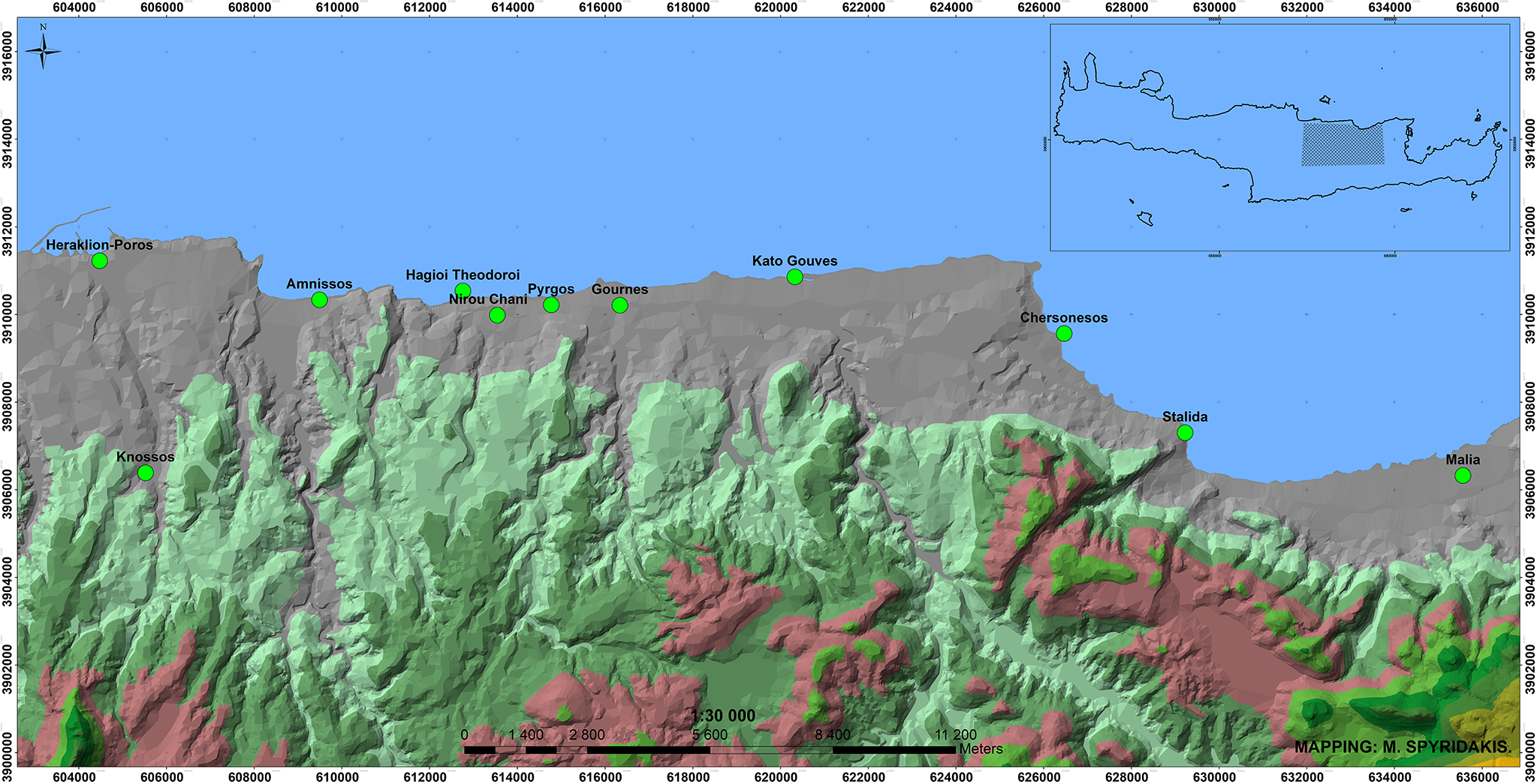
Minoan sites in the coastal region from Knossos to Malia.

My approach to the subject is primarily based on the results of recent excavations, which constitute the main part of the present study. These results are examined together with the existing data on the archaeological landscape from Knossos to Malia, in order to provide a complete picture of the dynamic development of cultural relations between the two powerful palatial centres of Knossos and Malia and their hinterland during the second millennium BCE.
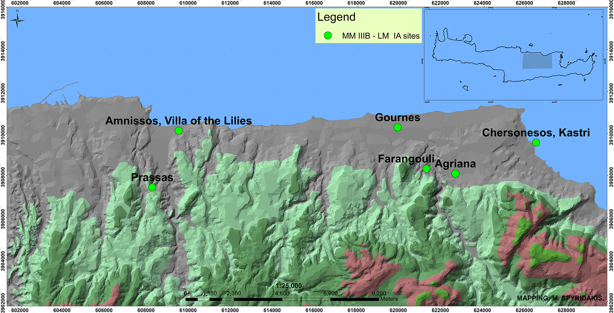
In particular, existing archaeological information, chiefly from the sites of Amnissos, Nirou Chani, Gournes, Gouves and Stalida (Fig. 1), will be taken into consideration along with the new data. Excavations on the slopes of the hill of Paliochora at Amnissos and in the areas to the east and the west of the hill have revealed the extensive occupation of the site from the Protopalatial to the Postpalatial period (Marinatos Reference Marinatos1933; Reference Marinatos1934; Reference Marinatos1935; Reference Marinatos1939; Alexiou Reference Alexiou1964; Schäfer Reference Schäfer1992), while Prepalatial tombs have been discovered north of Paliochora and south-east of the cave of Eileithyia (Marinatos Reference Marinatos1932, 98–9; Reference Marinatos1933, 93). Two Late Minoan (LM) IIIA–B chamber tombs with important finds are known from the area of Karteros south-west of Amnissos (Marinatos Reference Marinatos1927–8; Mandalaki Reference Mandalaki, Vlazaki and Papadopoulou2011), as well as a partly excavated settlement in the area of Prassas dated to the Protopalatial period and in LM IA (Platon Reference Platon1951). The site of Nirou Chani includes the well-known LM IB villa (Xanthoudides Reference Xanthoudides1922; Sakellaraki Reference Sakellaraki, Vavouranakis and Voskos2022), a settlement to the north (Xanthoudides Reference Xanthoudides1922–4, 126–7), the Neopalatial coastal settlement at Hagioi Theodoroi west of the villa (Xanthoudides Reference Xanthoudides1922–4, 128–9; Marinatos Reference Marinatos1929; Reference Marinatos1931, 94–5) and LM IIIA–B chamber tombs (Xanthoudides Reference Xanthoudides1922–4, 127–8; Kanta Reference Kanta1980, 43–5; Galanaki Reference Galanaki2021, 199). Early Minoan (EM) cemeteries have come to light at Pyrgos (Xanthoudides Reference Xanthoudides1921) and Gournes, inside the former American Military Base, along with an isolated Protopalatial and early Neopalatial building (Galanaki Reference Galanaki2021), while Early Minoan to Middle Minoan (MM) and LM IIIA–B tombs have been excavated south of the village of Gournes, at the ‘Kefali’ site (Hatzidakis Reference Hatzidakis1915; Reference Hatzidakis1918). A LM IIIB settlement (the ‘Potters’ Quarter’) has been unearthed in the coastal area of Kato Gouves (Vallianou Reference Vallianou, Laffineur and Betancourt1997), while a large number of LM III chamber tombs along with a small number of MM III–LM I tombs have been discovered in the region of Anopolis, Ano Gouves and Episkopi (Kanta Reference Kanta1980, 45–7, 53–70; Galanaki Reference Galanaki2021, 199). Indications for the existence of a MM IB–II settlement surrounded by a defensive wall, the latter excavated along most of its length, have been traced inside the Nana Beach Hotel in Stalida (Rethemiotakis Reference Rethemiotakis1999). All these sites constitute the widely known archaeological landscape of the north coast from Knossos to Malia, which will be reconsidered in the light of new evidence.
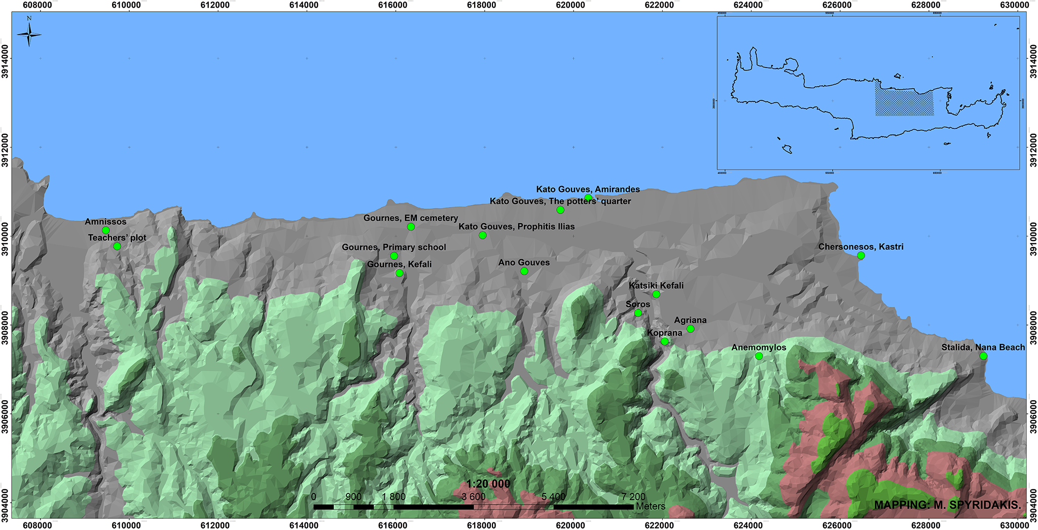
The archaeological evidence which follows comes from rescue excavations and digging activities of third parties supervised by the Ephorate of Antiquities of Heraklion, in the context of public or private construction projects at the sites of Amnissos, Gournes, Gouves, Agriana, Chersonesos and Stalida (Fig. 2), mainly in the coastal area. Although preliminary accounts for some of the excavated sites have already been published elsewhere (Mandalaki Reference Mandalaki, Adrianakis, Varthalitou and Tzahili2012; Reference Mandalaki, Karanastasi, Tzigounaki and Tsigonaki2015; Reference Mandalaki, Papadopoulou-Chrysikopoulou, Chrysikopoulos and Christakopoulou2016; Reference Mandalaki2024; Mandalaki and Velegraki Reference Mandalaki, Velegraki, Karanastasi, Tzigounaki and Tsigonaki2015; Mandalaki et al. Reference Mandalaki, Velegraki, Koukouraki, Nikolopoulou, Merkoulidi, Karanastasi, Tzigounaki and Tsigonaki2020), the discovery of new finds in the area of Amnissos and the preliminary publication of the Protopalatial pottery from the settlement of Agriana (Christakis, Apostolaki and Galanaki Reference Christakis, Apostolaki and Galanaki2024) necessitated a reconsideration of the data for a deeper understanding of the cultural and social networks in the region.
Minoan sites discussed in this paper.

Firstly, the material will be presented in chronological sequence, from the earliest, dated to EM III–MM IA, to the latest, dated to LM IIIB. If a site has more than one occupation phase, the classification follows a flexible chronological context based on its main habitation phase, while earlier or later archaeological evidence from the same site is also mentioned. A general consideration of the available data will follow, including the well-known sites located in the area under examination. Given that the current approach is based on rescue work, potential conclusions cannot be equivalent to the results of an extensive archaeological survey.
ARCHAEOLOGICAL EVIDENCE FROM THE PREPALATIAL TO THE FINAL PALATIAL PERIOD
Prepalatial period
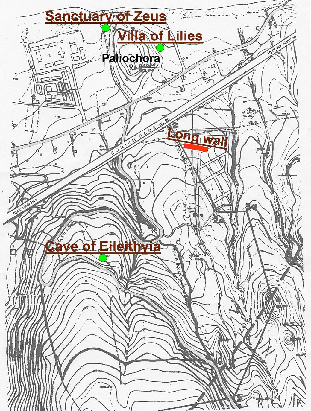
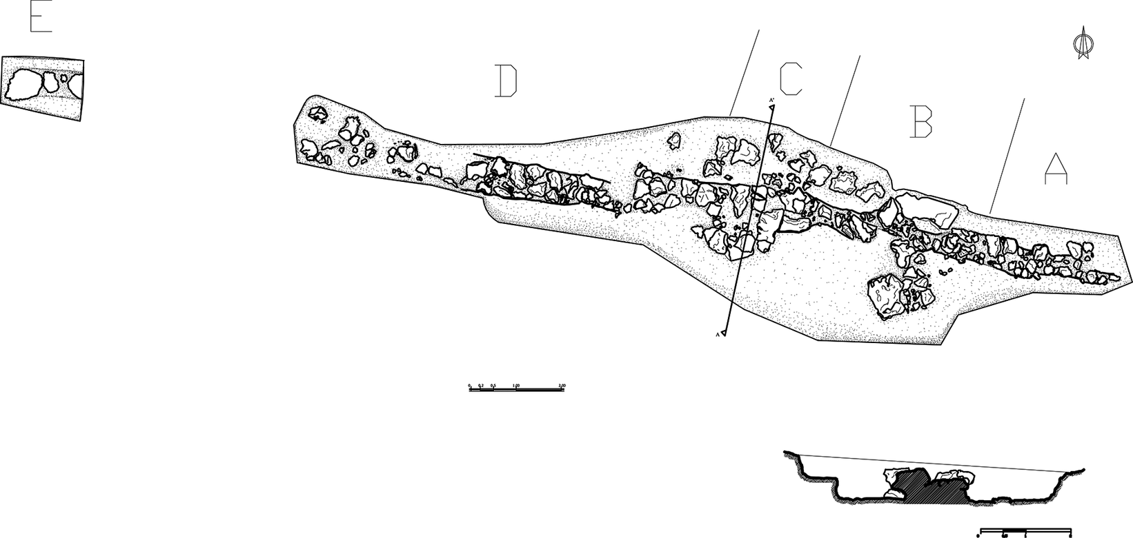
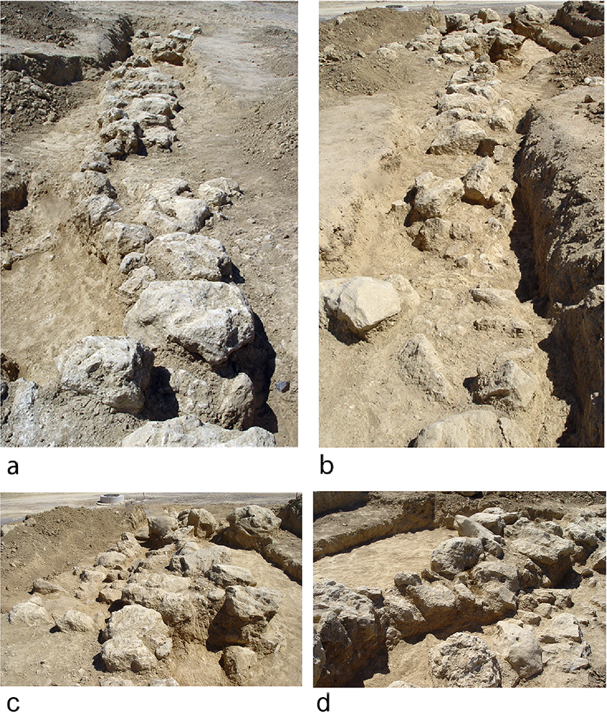
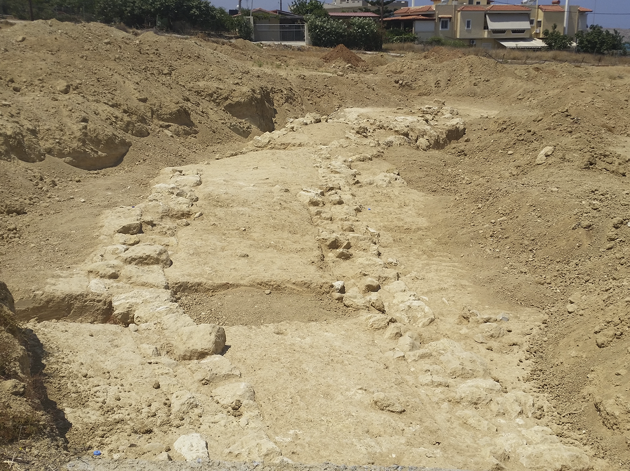
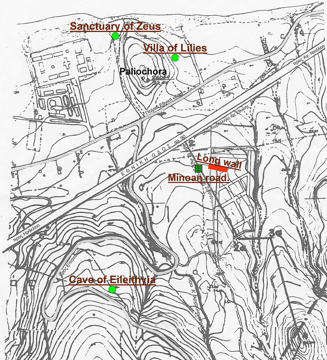
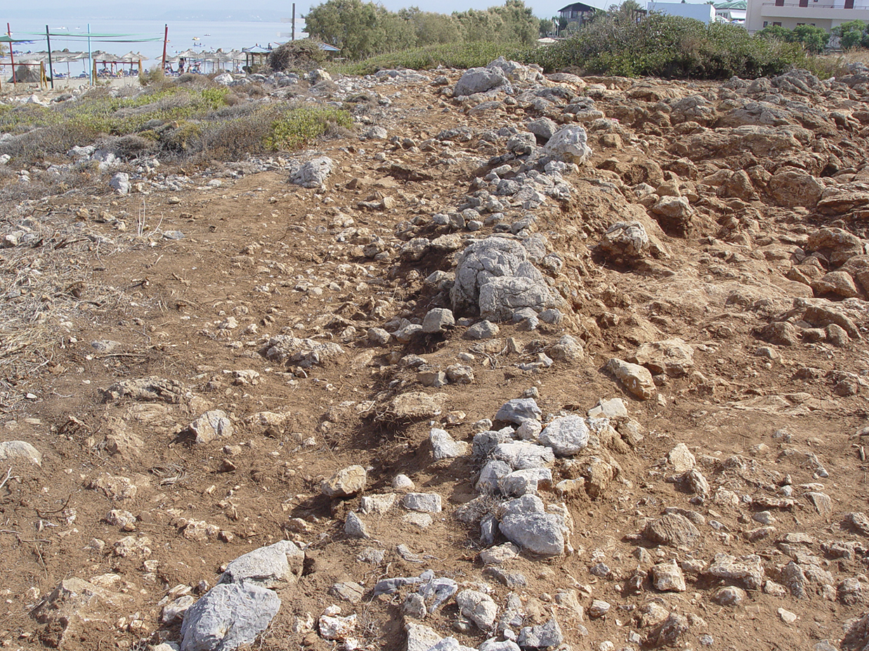
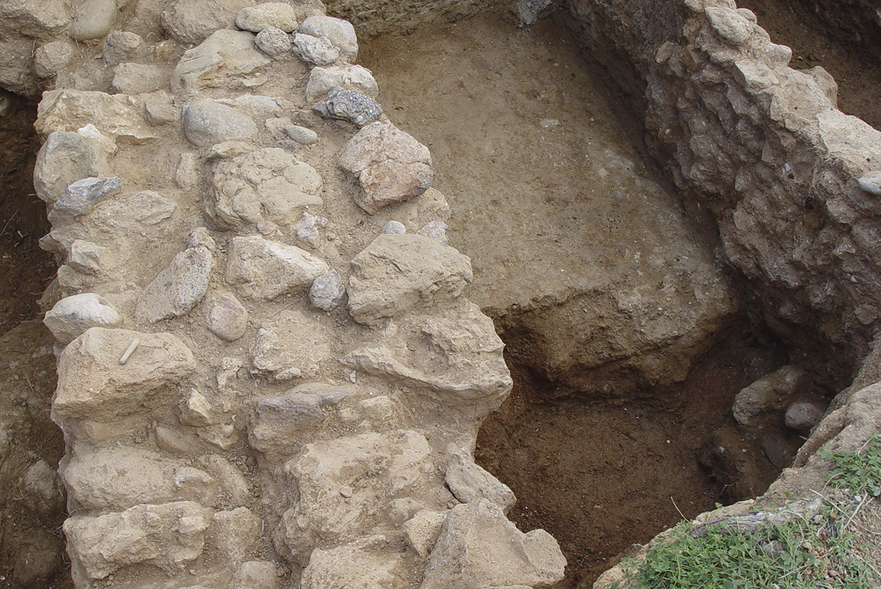
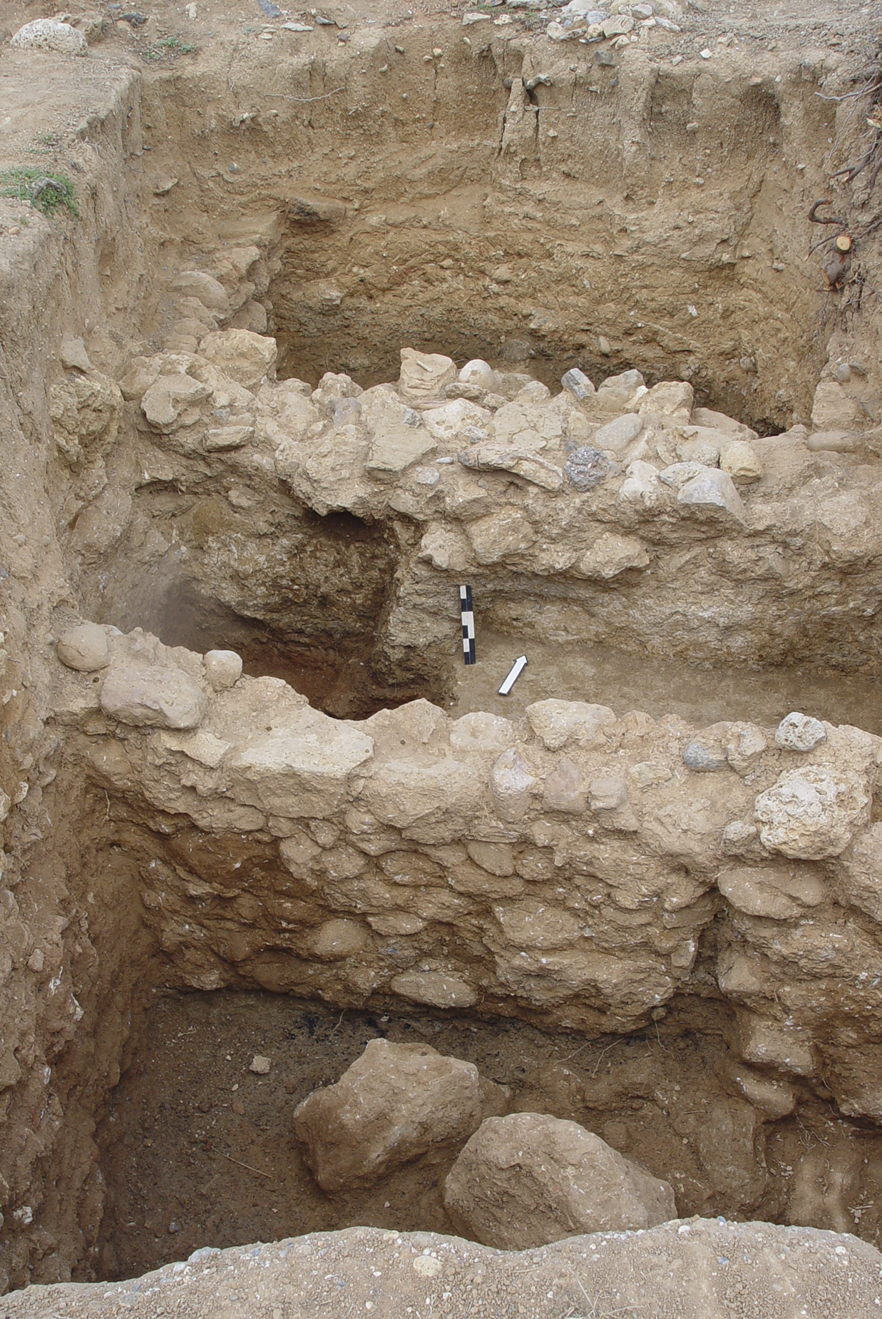
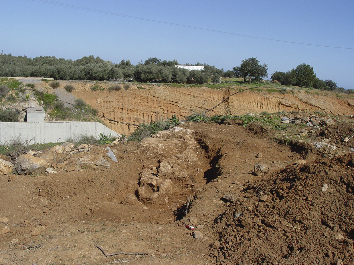
The Prepalatial period in the region is represented by an elongated wall which was discovered on the plot of the Teachers’ Construction Association in Amnissos in 2006, during landscaping work (Mandalaki Reference Mandalaki, Adrianakis, Varthalitou and Tzahili2012; Reference Mandalaki, Papadopoulou-Chrysikopoulou, Chrysikopoulos and Christakopoulou2016). It is located around 250 m south-east of the hill of Paliochora (Fig. 3) where the important LM IA ‘Villa of the Lilies’ is situated along with other architectural remains of different Bronze Age periods (MM I to LM IIIC). The wall was revealed to a length of 25 m, running east to west (Fig. 4). It is worth noting that no other architectural structures were found associated with the wall or across the whole surface of the plot, which measures five hectares. The structure, which has suffered extensive damage due to ploughing, is made of rough stones of different sizes and preserved to the height of one or two courses. The width ranges from 0.55 to 1.50 m (Fig. 5). The wall was founded on the bedrock, over a levelling layer of small pebbles, and does not present any projections to the north or south. Indications of an earlier construction phase were revealed at a certain point in the north face of the wall, while a heap of fallen rocks, small pebbles and pottery was removed from an area immediately south of the east part of the wall (south of section B, Fig. 4). The pottery, which is mostly fragmentary and worn, comprises discarded small sherds, with no complete vessels. The ceramic material is dated to MM IA, based on form and decoration, while a very small number of sherds can be assigned to MM IB (Mandalaki Reference Mandalaki, Papadopoulou-Chrysikopoulou, Chrysikopoulos and Christakopoulou2016).
Amnissos. The location of the Prepalatial long wall.

Amnissos. Plan of the excavated part of the Prepalatial long wall.

Amnissos. Views of the excavated long wall: a) from east to west; b) from west to east; c) detail of Sections B and C, from west to east; d) detail of Section C, from south-west to north-east.

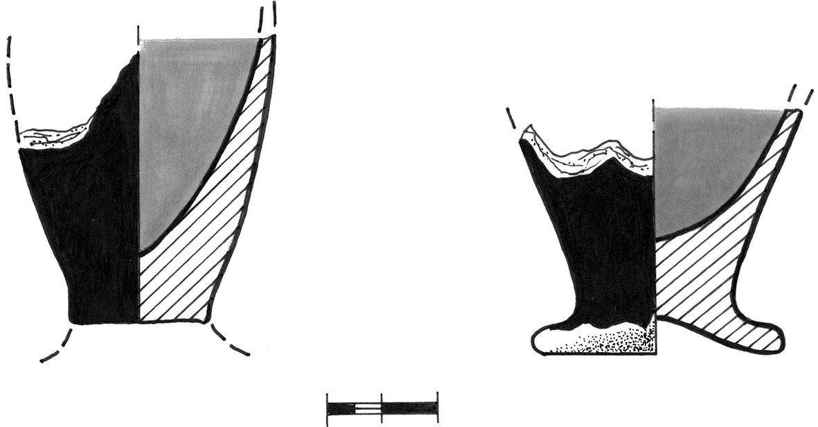
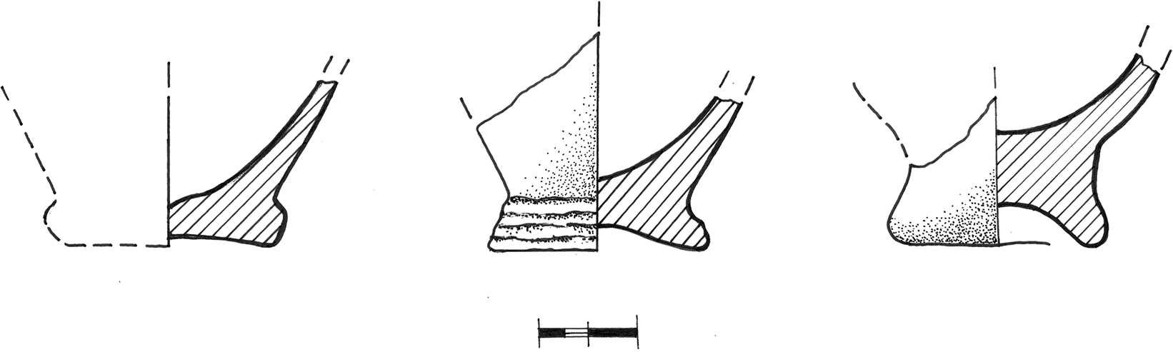
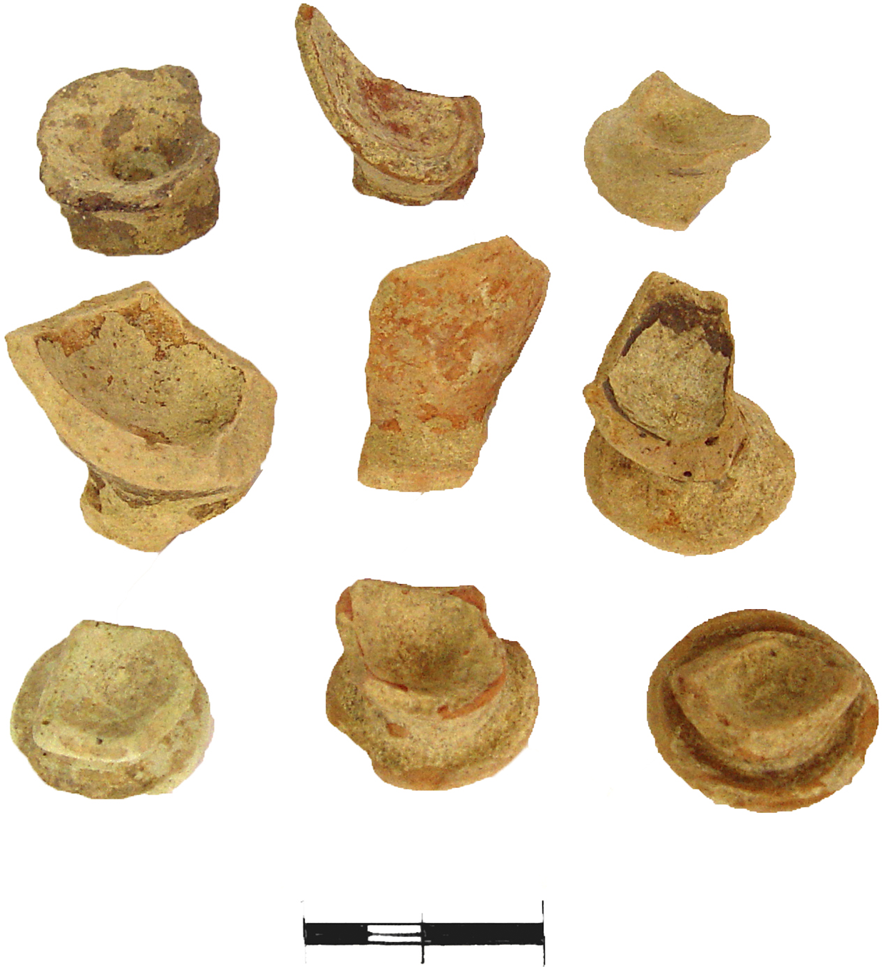
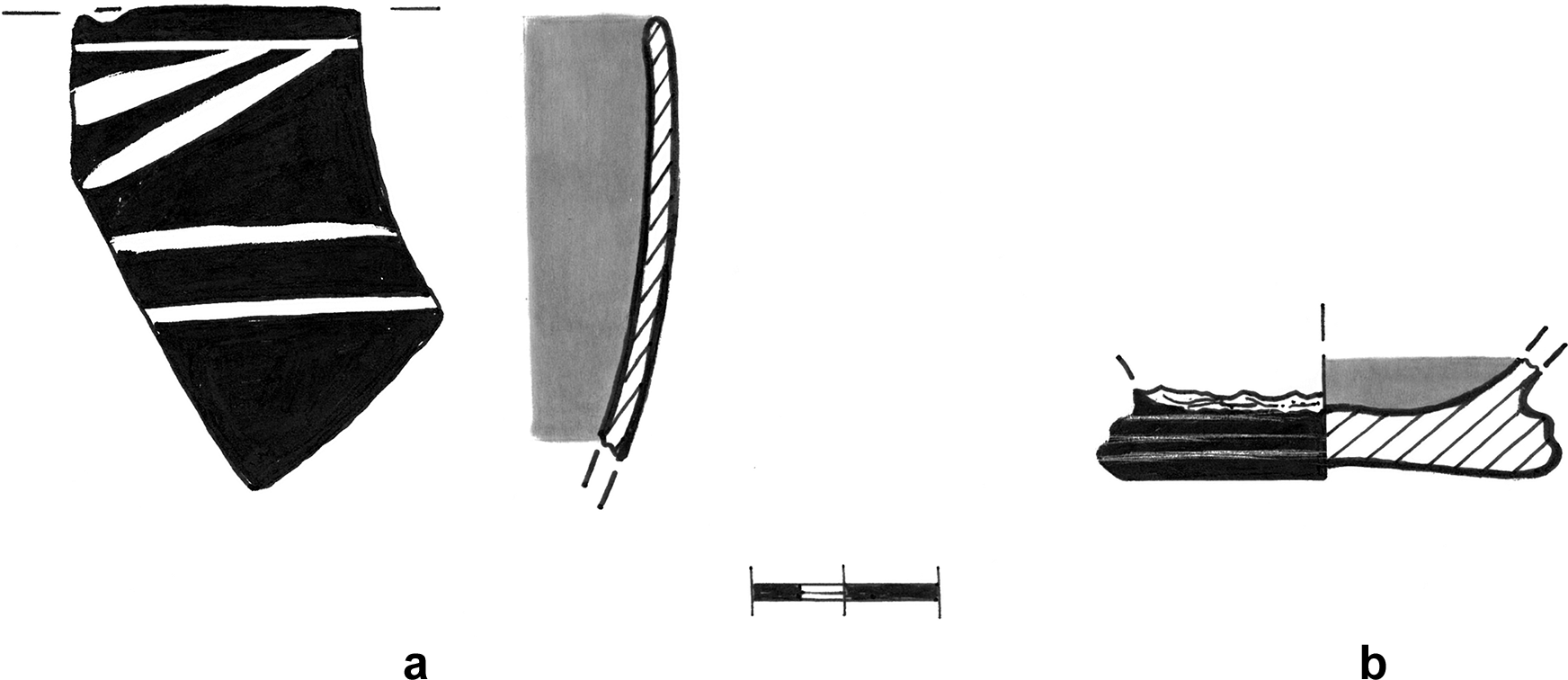
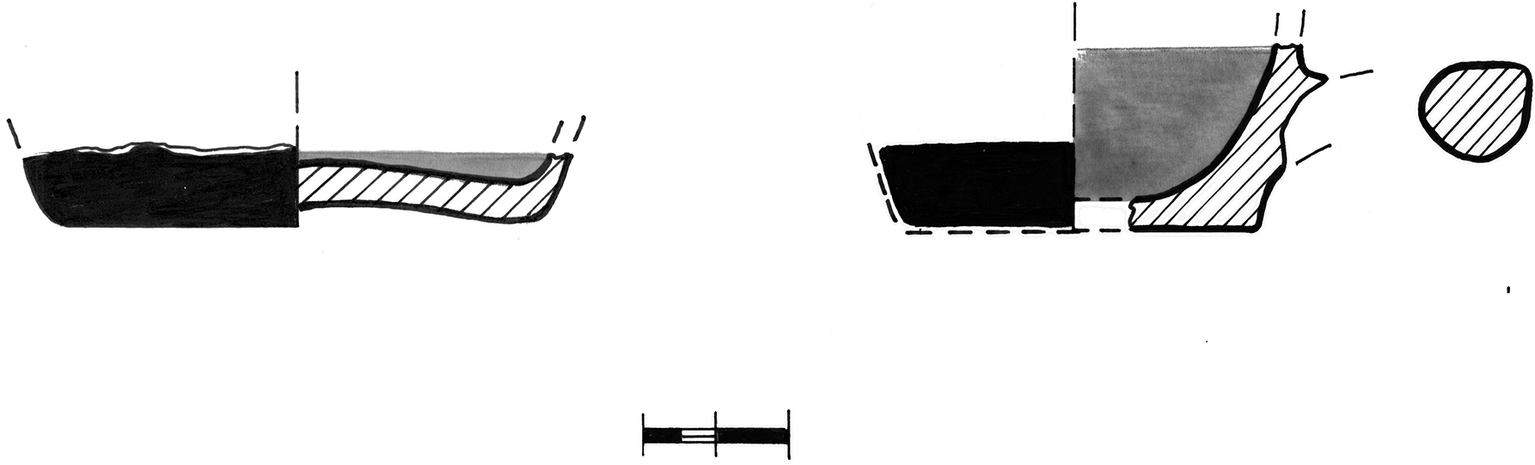
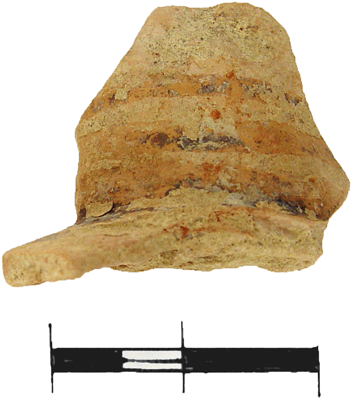
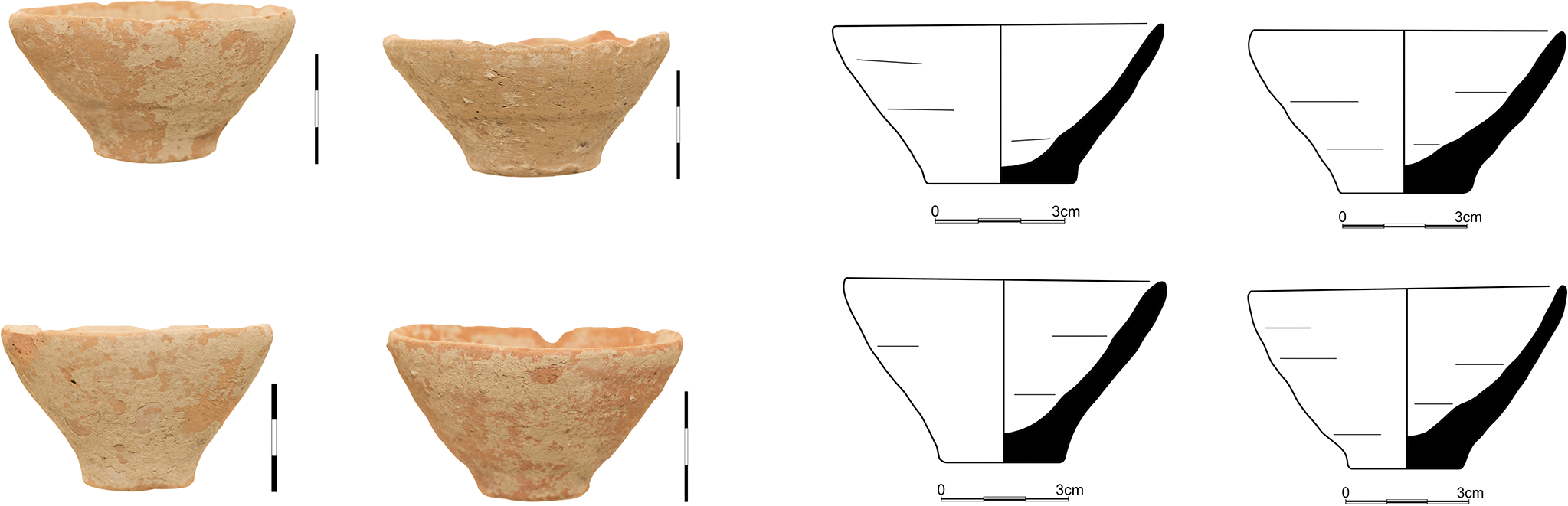
The most frequent shape is the footed goblet in different variations (Figs 6–9, 10b), as is the case in MM IA deposits from Knossos and north central Crete in general (Momigliano Reference Momigliano1991, 201, 245; Reference Momigliano and Momigliano2007, 84; Sakellarakis and Sakellaraki Reference Sakellarakis and Sakellaraki1997, 2.397–8). The most popular goblets are those with level or slightly raised edges to the conical foot. Specimens with a ring-shaped footed base are also present. Most of the sherds are all black- or red-washed on both sides and bear no decoration. Just one body sherd with white linear decoration on a black background could be identified (Fig. 10a). The fragments of footed goblets are dated to EM III–MM IA, based on parallels from Knossos and Archanes (Momigliano Reference Momigliano1990, 480, fig. 2:1–3, 482, fig. 3:1,3,4,6, 483; Reference Momigliano1991, 189, fig. 9:29; Reference Momigliano and Momigliano2007, 87, fig. 3.5:1, 88, fig. 3.6:1, 98, fig. 3.13:1,2; Sakellarakis and Sakellaraki Reference Sakellarakis and Sakellaraki1997, 2.396, figs 347 and 348, 398).
Amnissos. Footed goblets with low disc-shaped conical foot.

Amnissos. Footed goblets with ring-shaped bases.

Amnissos. Footed goblets with low disc-shaped conical foot.

Amnissos. Footed goblets of different types.

Amnissos. a) Body sherd of a footed goblet with white linear decoration. b) Footed goblet with ring-shaped flat base.

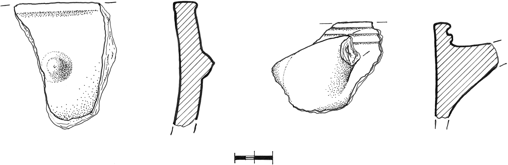
Apart from the footed goblets, the ceramic assemblage also includes a large number of coarse tumblers, as well as fine one-handled rounded cups and one-handled straight-sided cups (Fig. 11). Cooking pots, mostly tripod vessels and cooking trays, make up the majority of the coarse ware. The particular shape and decoration of the tripod cooking pots with protruding knobs and shallow ridges under the lip (Fig. 12), as well as the form of the cooking trays, resemble similar EM III–MM IA specimens from Knossos (Momigliano Reference Momigliano and Momigliano2007, 92, fig. 3.10:1,3, 102, fig. 3.16:1–3). It is worth noting that many fragments of cooking pots bear traces of fire, confirming that they have been used for cooking.
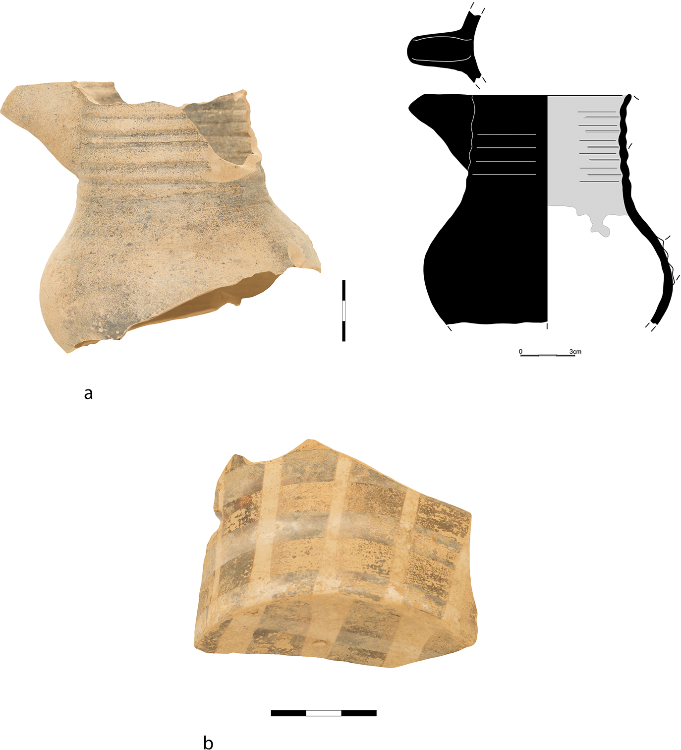
Other distinctive pottery specimens are a) fragments of a few handled bridge-spouted jars with rounded lips strongly inclining to the inside, decorated with parallel or oblique black bands or trickle patterns (for parallels see Momigliano Reference Momigliano1991, 259, fig. 36, type 1, pls 43:12,15, 50:58, 51:65, 53:79,80; Reference Momigliano2000, 72, fig. 5:31, 77, fig. 7:3,4, 79, fig. 8:30, 87, fig. 14:56,57; Sakellarakis and Sakellaraki Reference Sakellarakis and Sakellaraki1997, 2.401, fig. 357), b) cylindrical necks of beak-mouthed jugs (Fig. 13), sometimes decorated with red or black thin, parallel bands (Momigliano Reference Momigliano and Momigliano2007, 86, fig. 3.4:6 [EM III late], 98, fig. 3.13:8 [MM IA]), c) fragments of small jars decorated with rope or chain motifs (Momigliano Reference Momigliano and Momigliano2007, 92, fig. 3.10:6,7, 103, fig. 3.17), usually much worn, d) a sherd from a small fine ware vessel with small knobs on the surface (Momigliano Reference Momigliano and Momigliano2007, 91, fig. 3.9:5), and e) fragments of small clay bars and a clay discoid weight. Apart from the pottery, many obsidian blades were also found.
Amnissos. Sherds of one-handled straight-sided cups.

Amnissos. Sherds of cooking pots.

Amnissos. Cylindrical neck of a beak-mouthed jug decorated with red bands.

The majority of the pottery is handmade, with only a small quantity of ceramic material showing traces of the potter’s wheel, such as rilling marks on the walls. The assemblage, although mostly fragmentary, can be safely dated to the end of EM III or the beginning of MM IA. It should be stressed that the pottery shows close affinities to similar MM IA assemblages from Knossos,Footnote 2 thus indicating that during MM IA and just before the emergence of the palaces, Knossos had already established its cultural influence over the coastal site of Amnissos, which was to develop into one of the most important coastal settlements of the Knossian polity some centuries later (Warren Reference Warren, Cadogan, Hatzaki and Vasilakis2004, 164). A few sherds of footed goblets with ring-shaped flattened base (cf. Momigliano Reference Momigliano1991, 246, fig. 30, type 4 [MM IA]; Reference Momigliano and Momigliano2007, 97, fig. 3.12:2, 100, fig. 3.14:3 [ΜΜ ΙΑ], 110, fig. 4.2:1 [MM IB]; Fig. 10b), or small ledge-rim bowls and carinated cups with stronger angular profile, may be assigned to the MM IB chronological horizon. The dating of the pottery and consequently of the construction of the long wall to MM IA, with possible use until MM IB, coincides with the first indications of habitation on the hill of Paliochora, according to the evidence from stratigraphical trenches excavated by Spyridon Marinatos under the Sanctuary of Zeus Thenatas (Marinatos Reference Marinatos1934, 95–7; Reference Marinatos1939, 136; Kanta Reference Kanta1980, 38).
The purpose of this isolated long wall, located 250 m from the closest contemporary MM I settlement on the hill of Paliochora, is not easy to ascertain. The concentration of the pottery in a limited area by the south face of the wall, the heap of fallen rocks and stones at the same spot, the fragments of cooking pots with traces of fire, as well as the discovery of many cups, plates and everyday domestic utensils point to habitation in rough structures. Moreover, the reinforced width of the wall at some spots along its structure, the mild slope of the terrain which does not justify the necessity of building a retaining wall for practising agricultural activities, along with the location of the long wall across a small valley which could be used as a natural passage through the low hills surrounding the area, may indicate that this architectural structure is related to the management of movement from the sea and the coastal settlement of Amnissos to the hinterland.
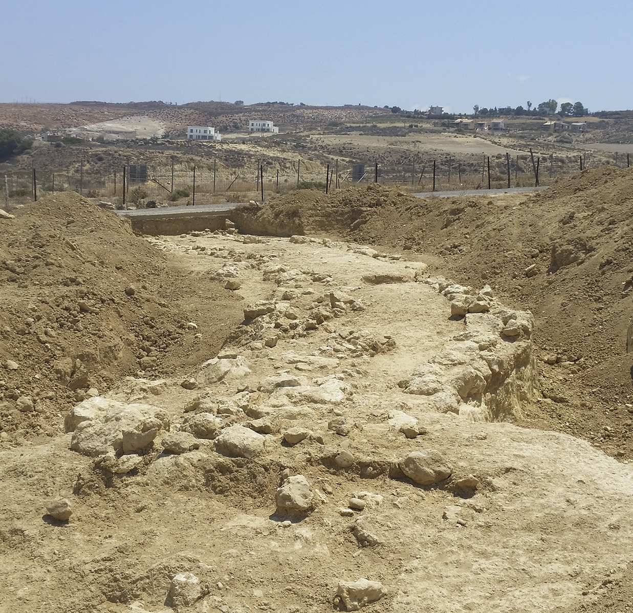
This initial suggestion was confirmed by the later discovery of a road (Figs 14, 15) during a rescue excavation in a neighbouring field to the west, which was undertaken by the Ephorate of Antiquities in 2016 and supervised by Calliope Galanaki.Footnote 3 The road consists of two parallel walls of rough construction, preserved in one course and 0.60 m wide. They are built on the bedrock and demarcate the actual surface of the road, which is levelled with kouskouras and small pebbles and is 1.60 m wide. The road is oriented west to east, just like the long wall in the plot of the Teachers’ Construction Association. It is preserved to a length of 22 m and located a little further to the south than the projected axis of the aforementioned long wall (Fig. 16). The pottery from the excavation of the road dates its construction to MM IA, the same chronological horizon as the isolated long wall. Based on the archaeological evidence, it seems clear that the remaining structures form part of the same architectural plan, intended to manage circulation from the coastal area of Amnissos to the hinterland.Footnote 4
Amnissos. The road from east to west.

Amnissos. The road from west to east.

Amnissos. Location of the road in relation to the long wall.

A similar but much stronger wall has been excavated in the open space of the Nana Beach Hotel in Stalida by Giorgos Rethemiotakis (Reference Rethemiotakis1999). It runs east to west and demarcates a Bronze Age coastal site to the south. The solid construction of large stones for the faces and much smaller rough stones in the inner filling, as well as the tower-like projections, led the excavator to identify the structure as a defensive wall. According to him, the defensive wall is dated to MM IB–II; it is consequently later than the wall in the Teachers’ Construction Association plot in Amnissos.
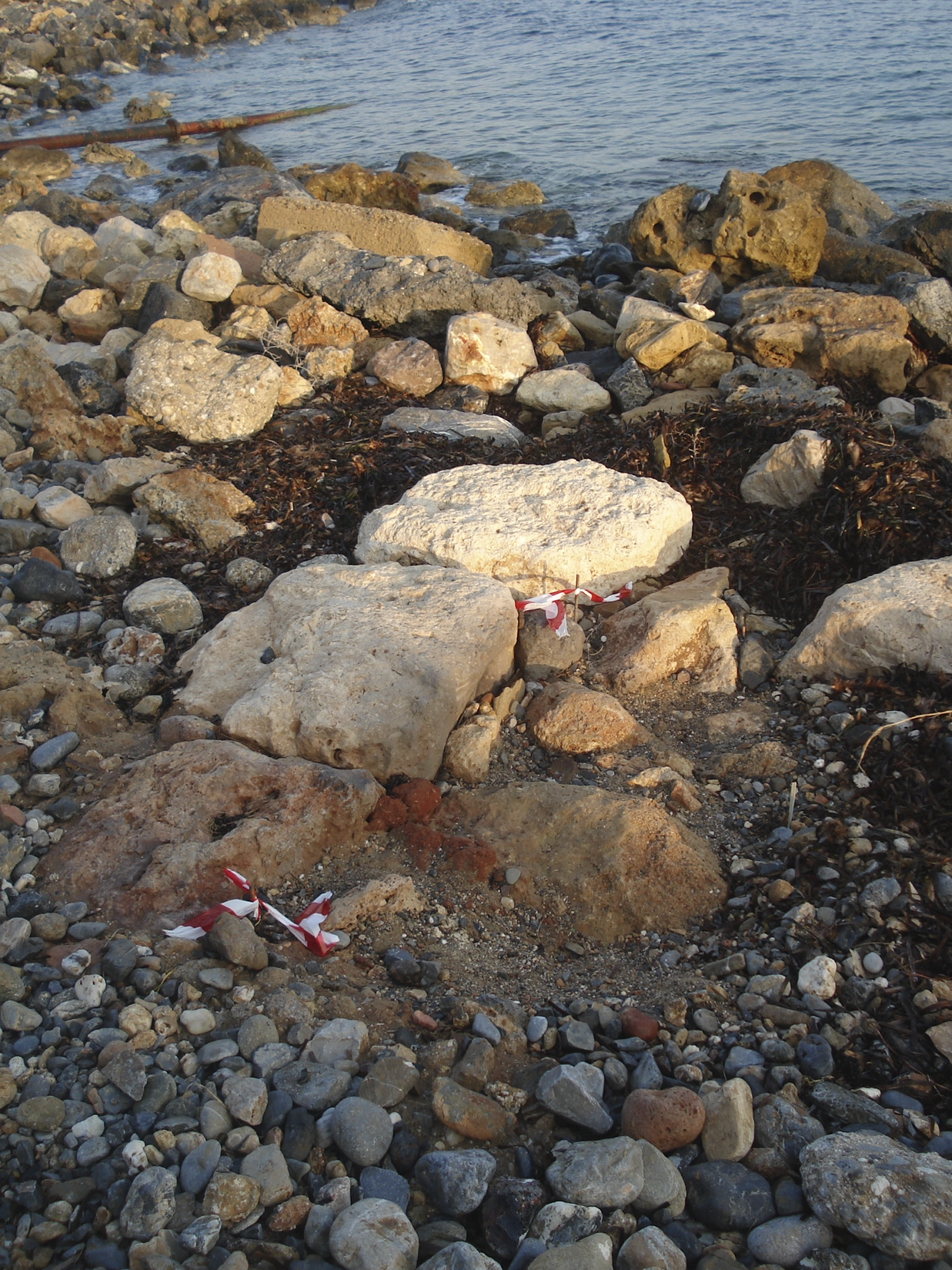
At the same site, west of the Nana Beach Hotel, another rural settlement dating to the Prepalatial period was investigated in the context of new building work by the hotel company (Mandalaki et al. Reference Mandalaki, Velegraki, Koukouraki, Nikolopoulou, Merkoulidi, Karanastasi, Tzigounaki and Tsigonaki2020, 103–5). It is dated to EM III–MM IA, the same chronological horizon as the long wall in Amnissos. Although potential structures were extensively disturbed by modern cultivation, the remains of what could be a long wall running approximately 20 m east to west were discovered (Fig. 17). It is built of small- and medium-sized rough stones together with parts of the bedrock remaining in situ, without bonding clay. Concentrations of rough stones were also unearthed in the cavities of the bedrock in the south-east part of the excavated area; they probably come from small destroyed structures. All over the excavated site, a large quantity of much-worn and fragmentary coarse pottery dating to EM III–MM IA was found. The ceramic material mainly consists of sherds of jugs, one-handled straight-sided cups, open vessels with vertical walls, plates, jars and tripod cooking pots. Two fragments of footed goblets, a fragment of a tumbler, a small discoid clay weight pierced at the end (probably belonging to a fishing net) and fragments of a beehive (Fig. 18) and obsidian blades were also discovered. Given the lack of extensive building material, the site was probably of an outdoor nature, an isolated structure in the countryside.
Stalida, west of Nana Beach Hotel. Destroyed wall.

Stalida, west of Nana Beach Hotel. Fragments of a beehive.

Protopalatial period
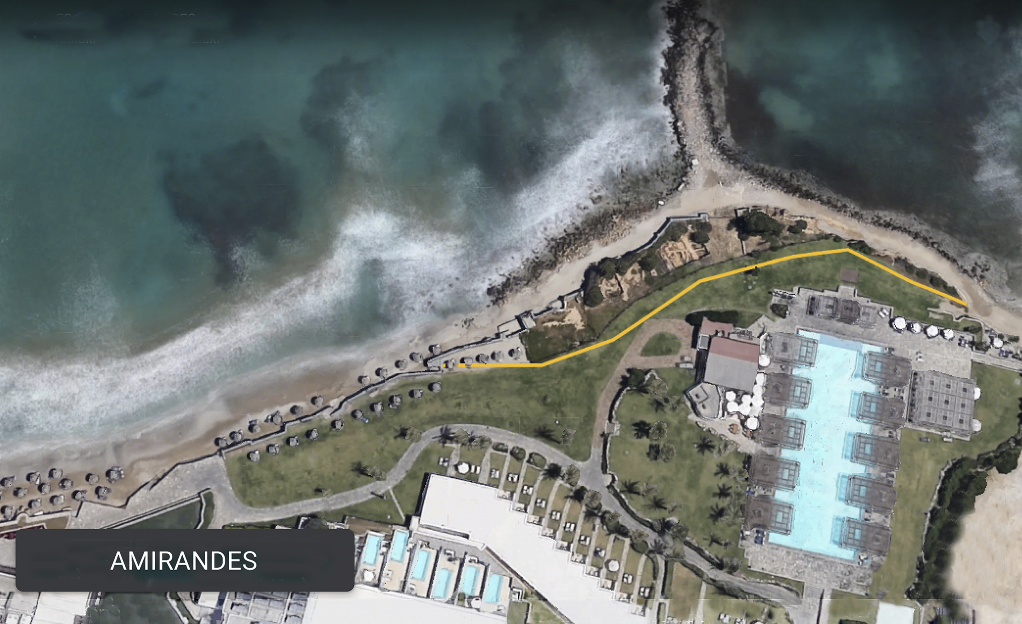
The Protopalatial period is mainly represented by an important, extensive settlement, revealed in the north open space of the Amirandes Hotel and the beach to the north in Kato Gouves (Mandalaki and Velegraki Reference Mandalaki, Velegraki, Karanastasi, Tzigounaki and Tsigonaki2015; Mandalaki Reference Mandalaki2024). The site is located 400 m east of the LM IIIB Potters’ Quarter, excavated and partly published by Despoina Vallianou (Reference Vallianou, Laffineur and Betancourt1997; Chatzi-Vallianou Reference Chatzi-Vallianou and Langohr2017). The investigation was initially implemented in 2007, as a rescue excavation, and continued in 2010. However, it was never finished, as the hotel company had no further interest in completing the renovation project in the north open area of their premises. Moreover, the site was subject to illegal landscaping works which caused the destruction of the installation. In spite of the contemporary destructive activities and the incomplete excavation, the extent of the settlement was traced through a large number of trial trenches which covered the whole area (Fig. 19). The results show that the Minoan settlement occupied an area 90 m long from east to west, covering approximately 700 m2. The main habitation phase is MM II, while some of the spaces may have been built by the end of MM IB. It is also possible that an older building dated to MM IA existed here before the construction of the extensive settlement, but this was poorly identified in the excavation process.
Kato Gouves, Amirandes Hotel. The yellow line indicates the excavated area of the preserved Minoan settlement.

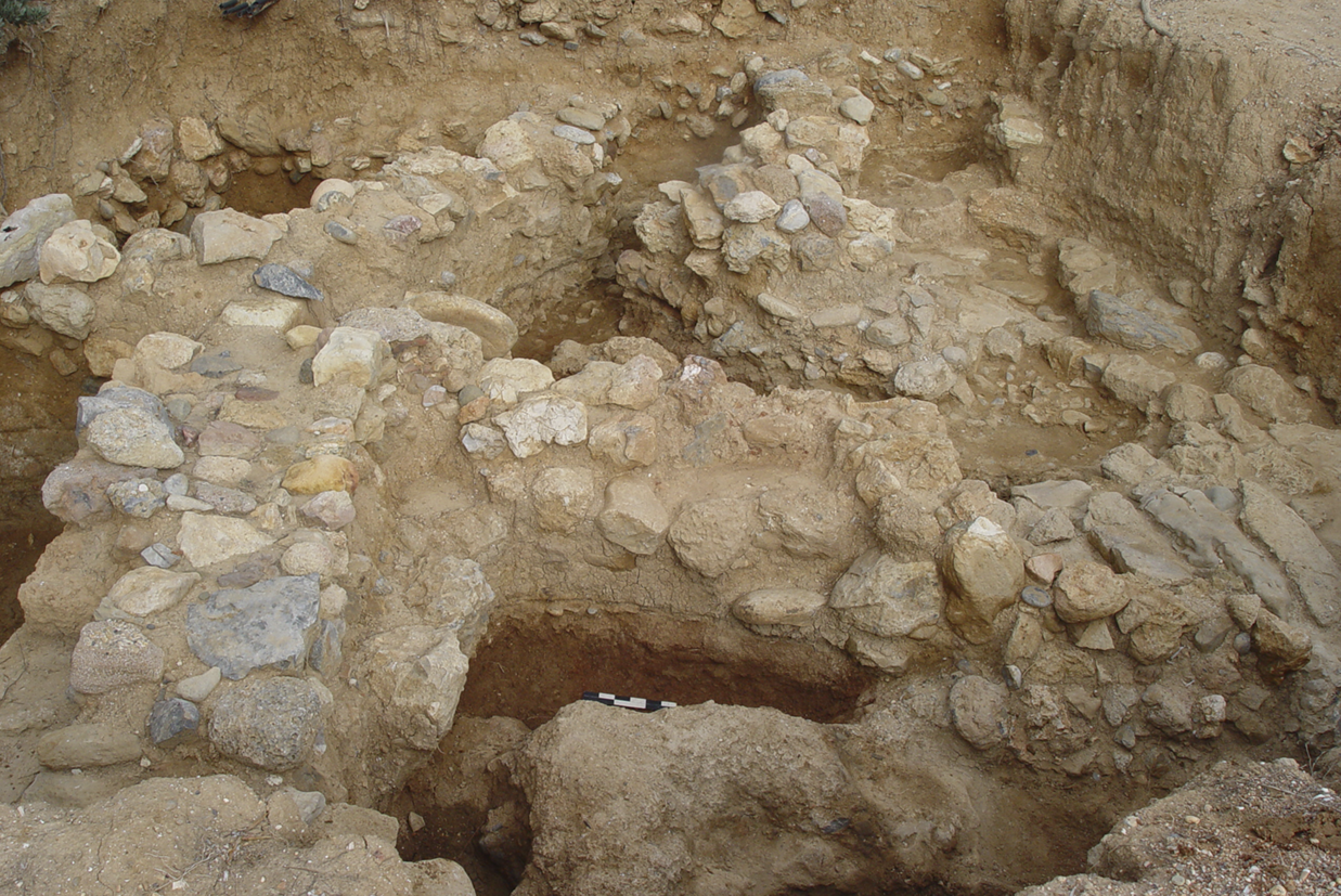
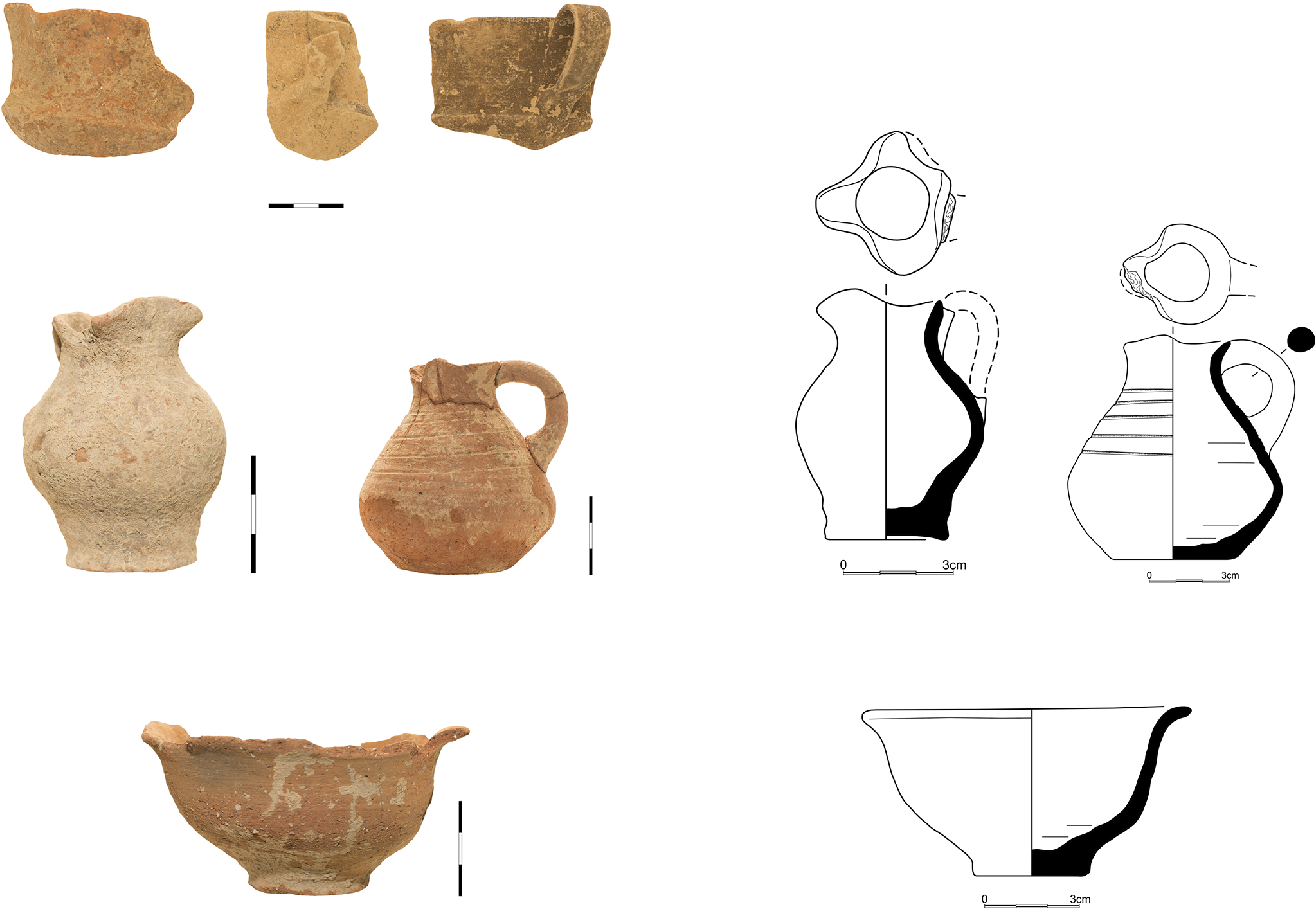
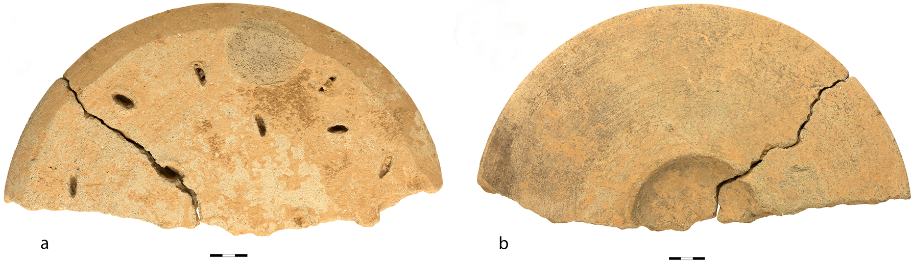
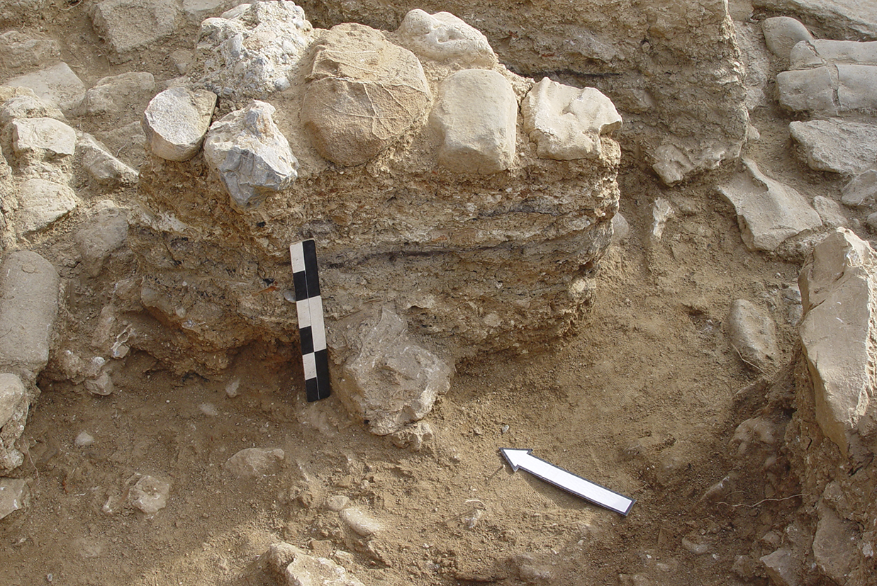
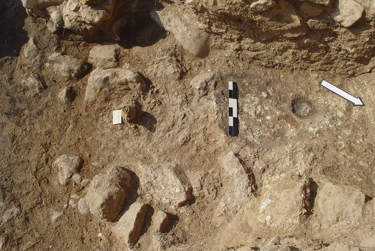
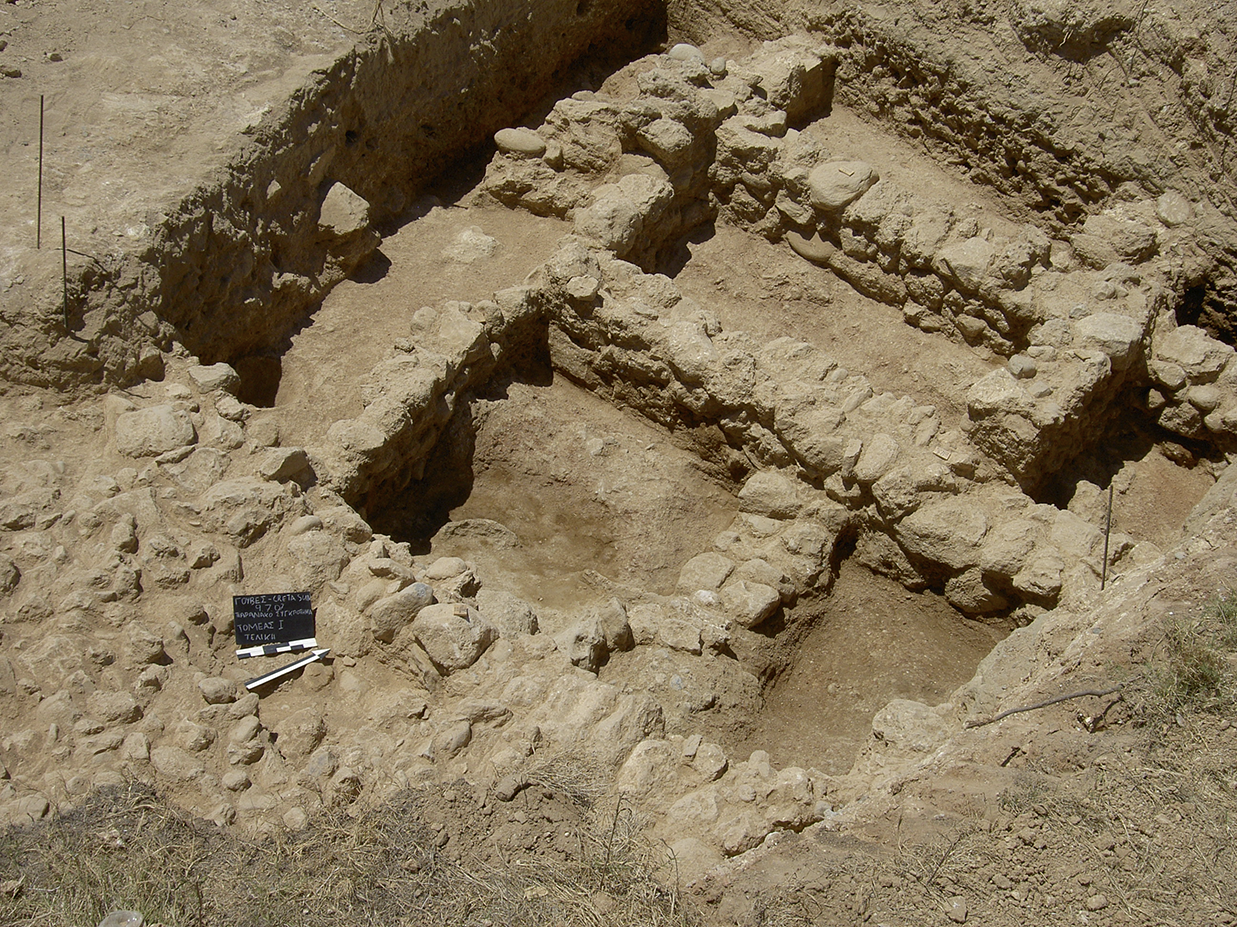
The earliest indications of habitation were revealed in the North-West Sector of the excavated site (Trench A, Fig. 20) and comprise a small number of EM and MM IA sherds found in the fill of the bedrock cavities, as well as two parts of walls constructed of large, worked stones on the bedrock, thus differing from most of the other walls which are built of rough small- or medium-sized stones. In the same area, small parts of rough walls were revealed, a few of which can be assigned to the same room layout. Just one room was distinguished among the other architectural remains. Its west wall is double, 0.85 m wide, and was probably used to support an upper floor. Similar double walls were found all over the excavated site (Fig. 21). Their existence denotes that they constitute a characteristic structural solution (see for example Zois Reference Zois1976, 80, 97, 112, 114; Rethemiotakis Reference Rethemiotakis, Mantzourani and Betancourt2012, 173). A destruction layer including sherds of small vessels (mostly cups and juglets) fallen from the upper floor was unearthed inside the room (Fig. 22). Among them, a trefoil jug with a low-bellied grooved body is a typical shape of the Maliote workshops, found in large quantities in Quartier Mu (Poursat and Knappett Reference Poursat and Knappett2005, pl. 23:559), and thus can safely be dated to MM IIB. Apart from the pottery, a clay wheelhead from a potter’s wheel (Fig. 23), also from the first floor, was discovered outside the room and west of it. North and east of the room, under many successive layers of the fill of the upper floor containing stones, sea pebbles, burnt soil, white plaster and kouskouras (Fig. 24), an open paved space was discovered, consisting of three different layers: the filling of the cavities of the bedrock with sea pebbles, and two paved surfaces separated by a thin layer of soil. Αn ovoid hearth of white plaster with a small cavity on the surface and a small juglet close to it was found on the pavement (Fig. 25). Among the pottery collected from the excavation of the pavement, mostly coarse ware, some discoid bases from footed goblets were distinguished, indicating that the construction of the pavement may be assigned to MM IB or early MM IIA, based on the similarity of the material from Gouves to well-stratified assemblages from Knossos (Macdonald Reference Macdonald and Krzyszkowska2010, 204, figs 20.1, 20.2).
Kato Gouves, Amirandes Hotel. Trench A, from south to north.

Kato Gouves, Amirandes Hotel. Trench M8/N8. Double wall, from west to east.

Kato Gouves, Amirandes Hotel. Pottery from Trench A.

Kato Gouves, Amirandes Hotel. Trench A. The wheelhead found west of the room.

Kato Gouves, Amirandes Hotel. Trench A. Stratigraphy above the open space.

Kato Gouves, Amirandes Hotel. Trench A. Ovoid plaster hearth with a small cavity on the surface and a juglet close to it, from east to west.

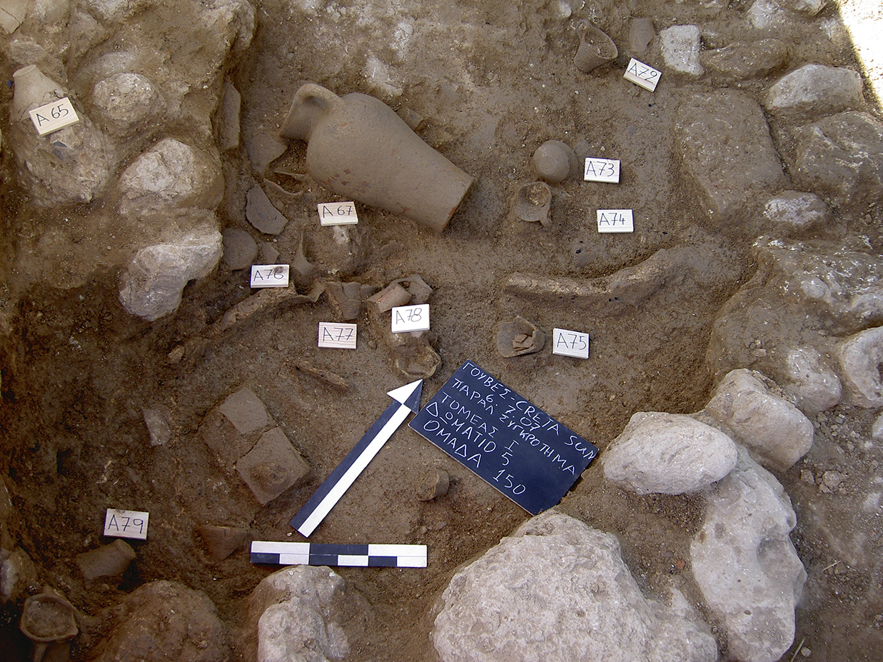
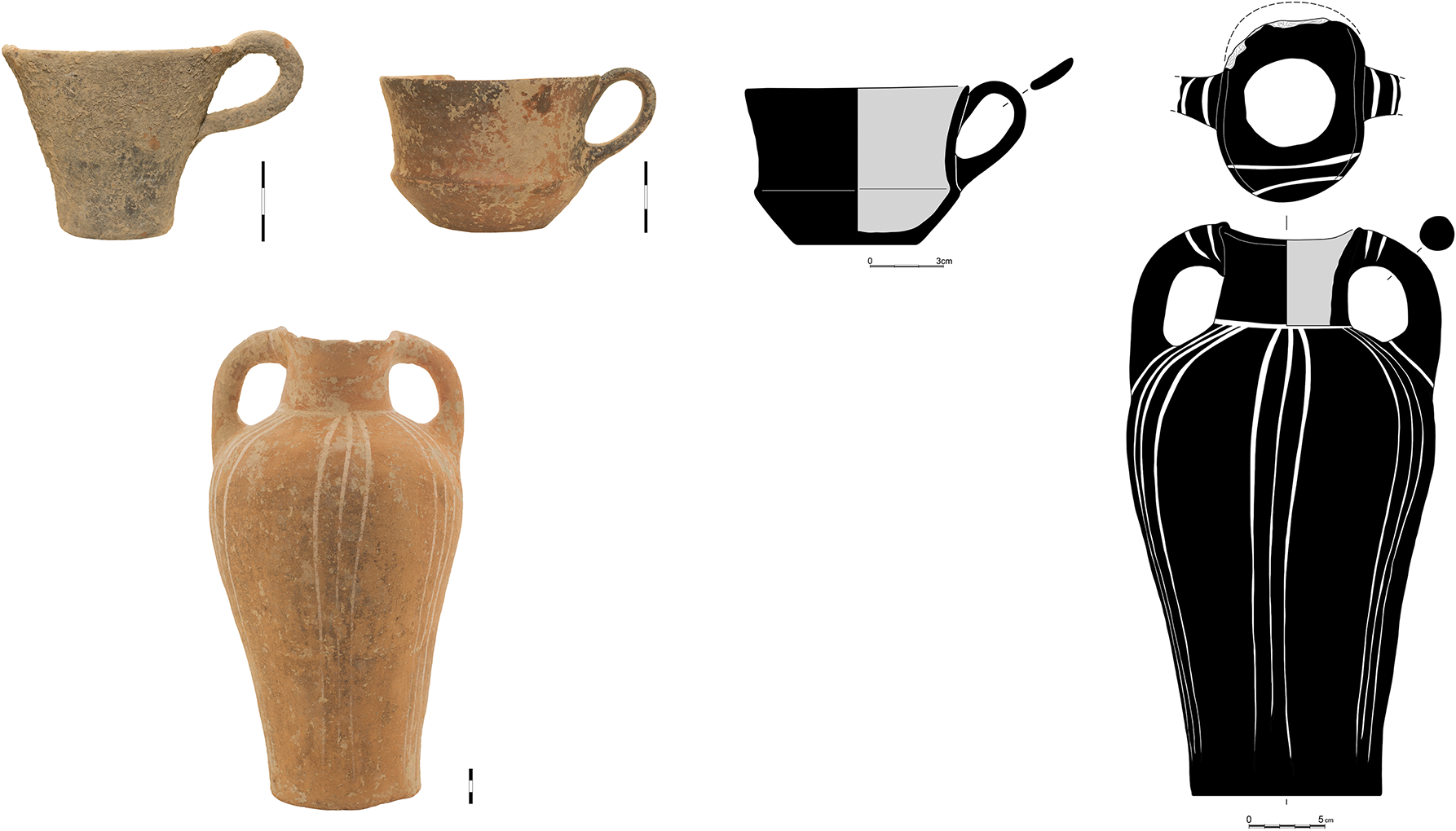
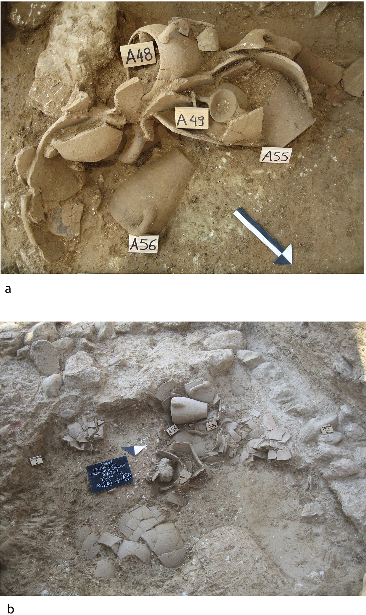
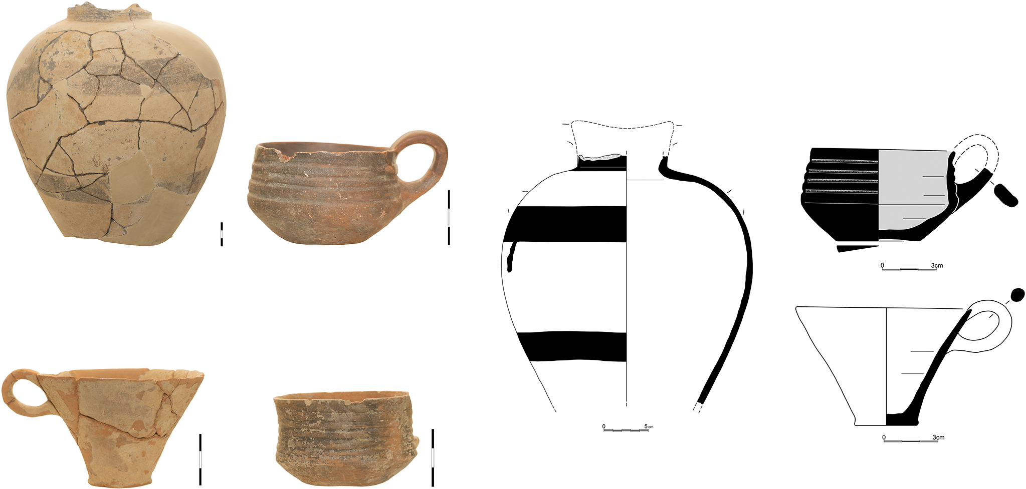
Especially interesting are the finds from the south trial trench in the open space of the hotel, Trench I, where a group of five storerooms was unearthed (Fig. 26). In one of these, Room 5, a deposit with complete vessels was found in situ (Fig. 27). The deposit occupies the west part of the room and is demarcated by a semicircular wall preserved to the height of one course of very rough stones. Inside the deposit, around 20 vessels, mostly carinated and one-handled conical cups (Fig. 28), were discovered in two layers with no chronological distinction between them. Apart from the cups, a complete two-handled amphora with elongated piriform body and ovoid mouth, decorated with groups of vertical lines in white paint on a black background, and fragments of two large jars were also found. The shape and decoration of the complete two-handled amphora are comparable to those of a similar specimen from Quartier Mu (Poursat and Knappett Reference Poursat and Knappett2005, pl. 4:61). Moreover, a huge quantity of coarse pottery was collected from the upper-storey layers inside the rooms, including fragments of amphoras, jars, pithoi and cooking pots, the last with obvious traces of fire. These assemblages from the upper floor also included a large number of conical cups (Fig. 29), which are dated to MM IIA, compared to similar specimens from Knossos and Phaistos.Footnote 5
Kato Gouves, Amirandes Hotel. Trench I, from south-east to north-west.

Kato Gouves, Amirandes Hotel. Trench I, Room 5. Pottery deposit.

Kato Gouves, Amirandes Hotel. Trench I, Room 5. Characteristic pottery from the deposit.

Kato Gouves, Amirandes Hotel. Trench I. Conical cups from the upper floor.

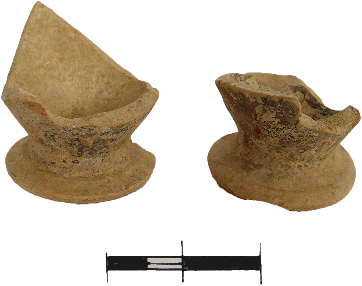
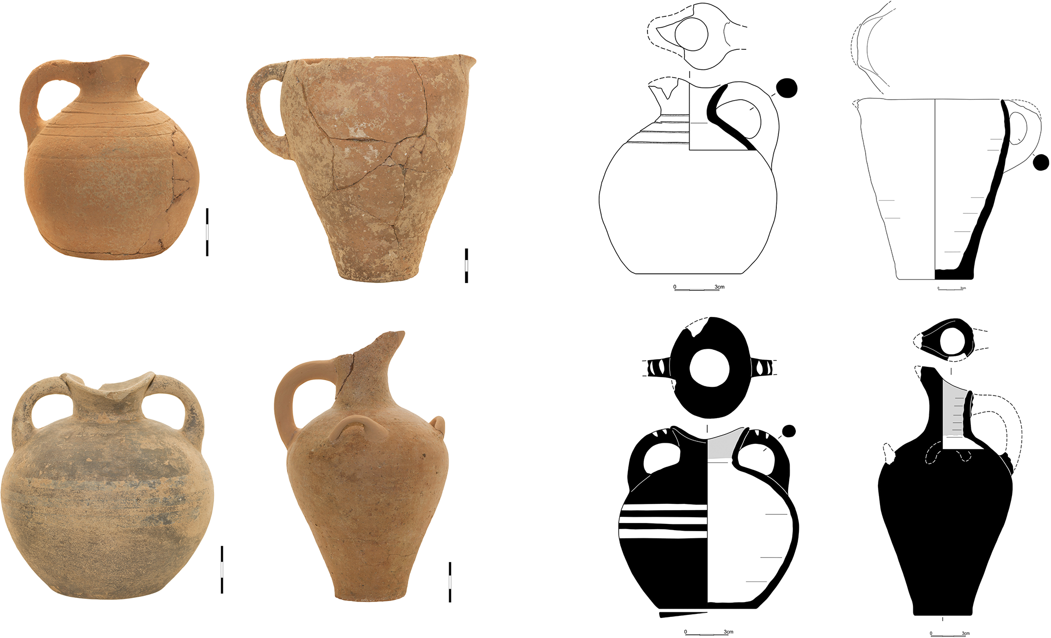
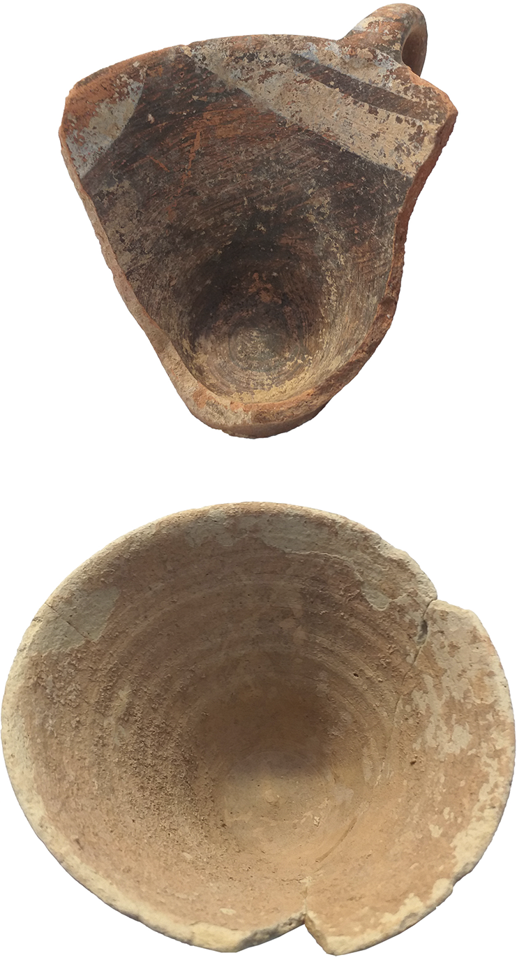
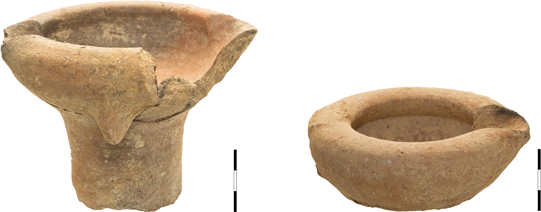
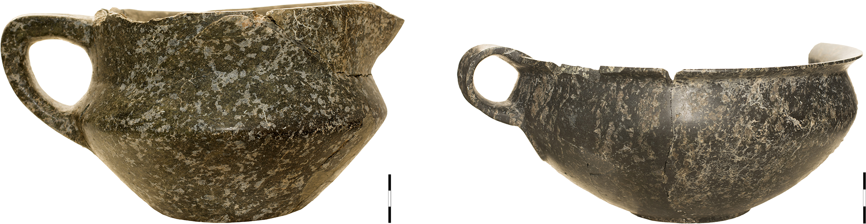
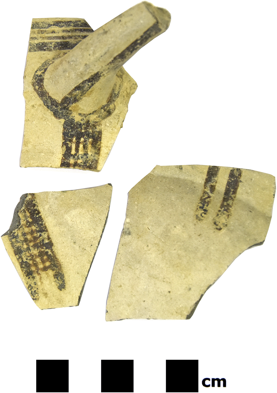
East of the pavement, parts of at least six rooms of the Protopalatial settlement were revealed (Fig. 30), with a similar archaeological stratigraphy. The rooms were filled with a destruction layer of remarkable thickness fallen from the upper floor, which included a large number of complete and broken vessels (Fig. 31), stones and bricks from the walls, kouskouras, sea pebbles and white plaster mainly in relation to walls and floors. Some characteristic finds include (Figs 32–4): a) an almost complete jar with piriform body decorated with horizontal dark bands and fragments of two similar vessels restored from the pottery during the conservation of the material, b) open-mouthed jugs (pitchers) which represent a very common ceramic form, c) a two-handled oval-mouthed amphora with globular profile, decorated with thin white bands on a black background, d) a beak-spouted red-washed jug with piriform body and three horizontal handles, e) trefoil-mouthed jugs with globular body and grooves on the neck, f) one-handled conical cups, g) carinated cups, often grooved on the upper half, h) clay lamps, one with tall cylindrical foot (Fig. 35), and i) a one-handled conical cup of fine ware decorated with red and brown bands. Some particular forms, like the pitchers, the two-handled oval-mouthed amphoras with globular profile, the beak-spouted jugs with piriform body and the trefoil jugs with globular body and grooved neck, are typical of the Protopalatial pottery of Malia, known from Quartier Mu (Poursat and Knappett Reference Poursat and Knappett2005, pls 15:273–316, 5:72–81, 19:400–24, 23:530–625; Caloi and Doudalis Reference Caloi and Doudalis2024b, 100 [for the pitcher]). Apart from the pottery, spherical and discoid loomweights were also collected, as well as a large number of fragments of stone vessels, while two of them (Fig. 36), probably of serpentine, were found almost complete.Footnote 6
Kato Gouves, Amirandes Hotel. Rooms revealed in Section M8/N8.

Kato Gouves, Amirandes Hotel. Destruction layer east of Trench A.

Kato Gouves, Amirandes Hotel. Pottery from Section M8/N8.

Kato Gouves, Amirandes Hotel. Pottery from Section M8/N8.

Kato Gouves, Amirandes Hotel. Pottery from Section M8/N8.

Kato Gouves, Amirandes Hotel. Clay lamps.

Kato Gouves, Amirandes Hotel. Stone vessels.

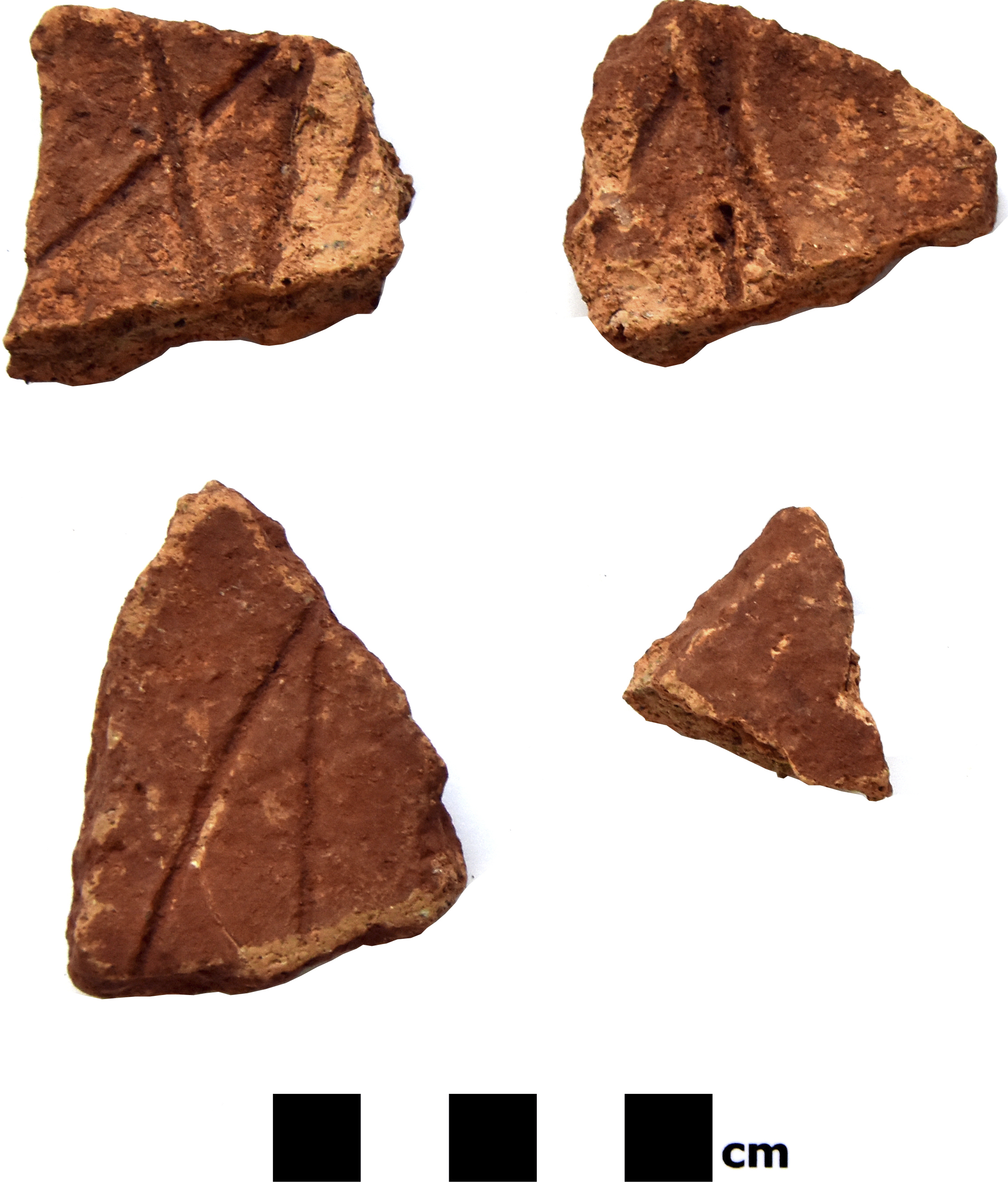
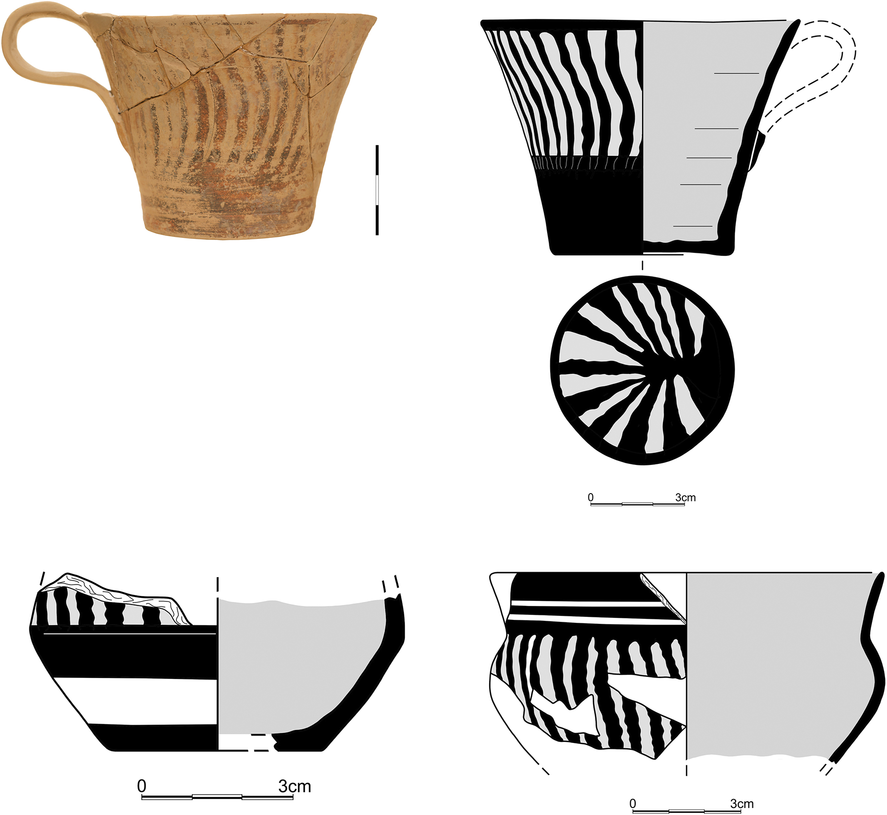
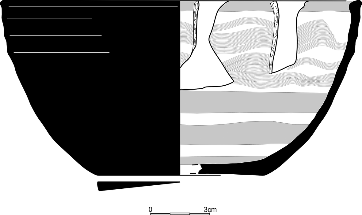
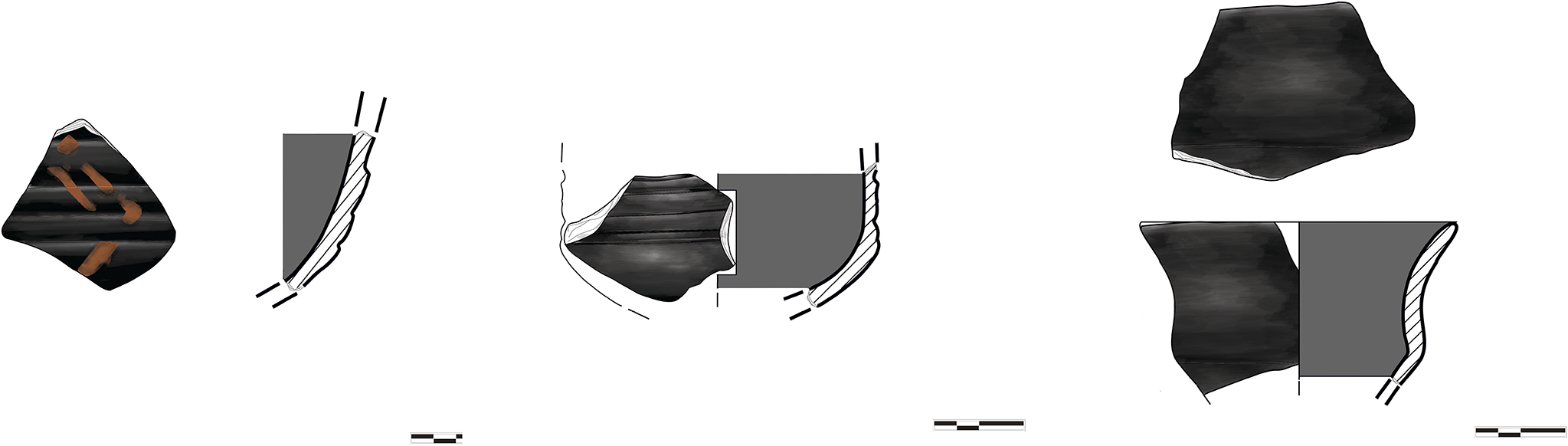
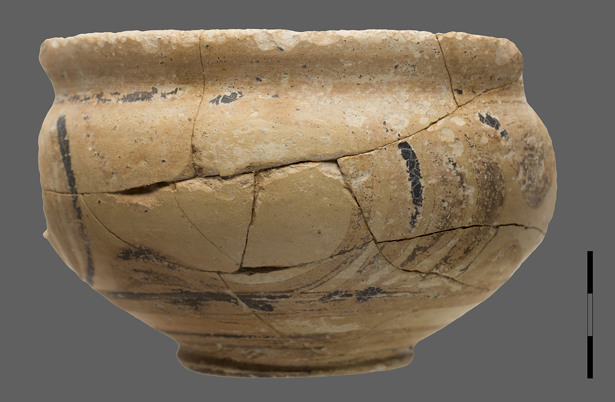
This unified picture is disrupted in the upper floor destruction layer inside one of the rooms (Room 3), where a later ceramic assemblage dated to MM IIIB was discovered. It included a one-handled straight-sided cup decorated with early ripple style (Fig. 37),Footnote 7 fragments of a straight-sided cup with faded ripple decoration, sherds from two different cups decorated with ripple and bands (Hatzaki Reference Hatzaki and Momigliano2007, 164, fig. 5.4:4), almost half an in-and-out bowl (Fig. 38) decorated inside with concentric circles of red colour at the base and wavy bands of the same colour on the upper body,Footnote 8 and fragments of a straight-sided cup with trickle pattern in dark-on-light style. Considering this late ceramic material, along with the fact that the ground floor of Room 3 was found full of debris, which means that the ground floor had been abolished during the final habitation on the upper floor, it is reasonable to assume that the upper floor was reoccupied, possibly in MM IIIB, after the extensive destruction of the settlement. This assumption is also supported by the finding of a few sherds with ripple decoration in the debris on the ground floor of Room 3, as well as the discovery of at least two deposits of discarded building material from destroyed walls in the north-west part of the excavated area.
Kato Gouves, Amirandes Hotel. Pottery from Trench M8/N8 decorated with ripple.

Kato Gouves, Amirandes Hotel. Pottery from Trench M8/N8. In-and-out bowl.

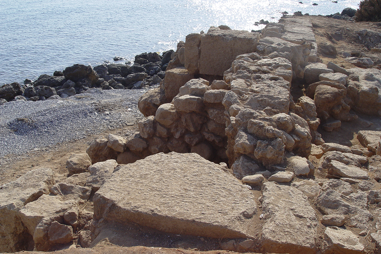
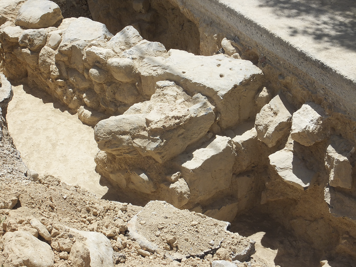
The excavation in the North-East Sector of the settlement revealed three long, strong walls, oriented north to south (Figs 39, 40). They measure 70 cm to 1 m wide, and are preserved to a length of 4–5 m and a height of around 2 m. These constructions of large stones at the north end of the settlement ensure the stability of the masonry, functioning as buttresses against the sea waves. Among them, an older one was revealed with the same orientation, preserved to a length of 1.60 m, while another strong wall running from west to east also came to light. The two western walls run further to the north, almost to the sea, as indicated by the discovery of a row of large stones at the foundation level (Fig. 41). East of this complex of massive masonry, parts of many walls were revealed which form at least five rooms from west to east. Inside these rooms, the typical layers of the upper storey were excavated, including mostly coarse ware for everyday use, bricks, burnt soil, white plaster and kouskouras. The fine ware included half a bridge-spouted jug with ridges on the neck (Fig. 42a), a trefoil juglet and a fragment of a one-handled straight-sided cup with tartan decoration (Fig. 42b). The spouted jug with ridges on the neck and the straight-sided cup with tartan decoration are typical products of Maliote ceramic workshops and are found in Quartier Mu (Poursat and Knappett Reference Poursat and Knappett2005, pls 22:493, 28:814,819) and other sites within the cultural domain of Protopalatial Malia, such as Myrtos-Pyrgos (Knappett Reference Knappett1999, 629, figs 11, 14, 630, fig. 17; Doudalis Reference Doudalis2024b, 289).
Kato Gouves, Amirandes Hotel. North-East Sector, from north to south.

Kato Gouves, Amirandes Hotel. North-East Sector. Strong walls on the beach, from west to east.

Kato Gouves, Amirandes Hotel. North-East Sector. Walls on the beach, from south-east to north-west.

Kato Gouves, Amirandes Hotel. North-East Sector. Characteristic pottery.

In total, parts of at least 19 rooms were excavated, while the original number of rooms in the settlement seems to be larger according to the archaeological data. Most of the ground-floor rooms were found empty, while a huge number of broken and complete vessels were stored on the first floor, including large quantities of pottery with fragments of pithos, domestic utensils and cooking pots. Special attention has been paid to the effective support of the upper floor with the construction of double walls and strong masonry. This is more evident on the north side of the settlement, where the long, massive walls more than 1 m wide resisted the waves, protecting the raised habitation areas of the upper floor. Although the ancient coastline was further north than it is today,Footnote 9 the site seems to have been threatened by strong winds and waves.Footnote 10 The abundant fragments of bricks in the archaeological layers and some remains of preserved upper-storey walls indicate that the walls of the first floor were built of stones at the foundation level and bricks in the upper courses. The walls and the earth floors were coated with thick white plaster.
The majority of the pottery, coarse and fine ware, shows close affinities to the ceramic material from Quartier Mu in Malia. As already mentioned, particular forms and decoration, like the trefoil jug with globular body and grooved neck, the open-mouthed jug (pitcher), the beak-spouted jug with piriform body, the two-handled oval-mouthed amphora with globular body, the two-handled amphora with elongated piriform body and ovoid mouth, decorated with groups of vertical lines in white paint, the spouted jug with ridges on the neck and the straight-sided cup with tartan decoration are characteristic products of the Maliote Protopalatial ceramic workshops. Additionally, the huge number of fine one-handled conical cups, decorated with white bands and festoons on a red or a brown background (Fig. 34), represents a major link with the ceramic tradition of Malia, given that this form of drinking cup is considered a typical creation of that palatial centre during the Protopalatial period, just as the footed goblet is associated with Knossos and the conical cup with Phaistos (Caloi Reference Caloi2023; Doudalis Reference Doudalis2024a, 197–8). Moreover, stone vases similar to the specimens found at the settlement in Kato Gouves are also known from Malia (Poursat Reference Poursat1996, pl. 36a).
However, there are some differences. The small ledge-rim bowl and the juglet (Fig. 22) are typical crude ware known from Knossos and dated to MM IIA (MacGillivray Reference MacGillivray and Momigliano2007, 131, fig. 4.20:2, 132, fig. 4.21:3), but they are also found in Quartier Mu (Poursat and Knappett Reference Poursat and Knappett2005, pls 30:1072, 36:1214). The footed goblet, which is represented by many sherds in Kato Gouves, is a popular product of Knossian ceramic workshops from EM IIA to MM IIA (Macdonald Reference Macdonald and Krzyszkowska2010), while the form is totally absent from Malia. Similarly, the handleless conical cups found in the upper floor layers of the room with the deposit in Trench I can be compared to similar specimens from Knossos and Phaistos dated to MM IIA (Macdonald and Knappett Reference Macdonald and Knappett2007, 86, fig. 3.17; Caloi Reference Caloi2009, 432–3, fig. 17l–z; Reference Caloi2024, 313, fig. 19.10e [MM IIA], 317, fig. 19.13gh [MM IIB]), but they are not found at Malia, despite the huge variety of drinking vessels discovered in Quartier Mu. The use of the carinated cup also seems to be much more common at the ‘Amirandes’ site than at Malia (Poursat and Knappett Reference Poursat and Knappett2005, 190; Caloi and Doudalis Reference Caloi and Doudalis2024b, 100–2). All these differentiations in ceramic preferences indicate that the inhabitants of the Protopalatial settlement in Kato Gouves followed both north-central and Maliote ceramic traditions, although with an obvious preference for the Maliote repertoire.
Apart from the pottery, architectural structures such as the oval hearth on the pavement in the North-West Sector of the excavated site, along with the extensive use of white plaster on the floors and the walls, evoke similar architectural characteristics of Protopalatial Malia (McEnroe Reference McEnroe2010, 41, 53), thus denoting a general tendency to the adoption of typical Maliote features by the occupants of the settlement in Kato Gouves.
The multiple similarities of the table and storage pottery from ‘Amirandes’ to the corresponding ceramic material from Quartier Mu, which is dated to MM IIB, confirm the chronological horizon of the main occupation phase and final destruction of the Protopalatial settlement at ‘Amirandes’ on the one hand, while indicating the close relationship of the settlement with the palatial centre of Malia on the other. Based on the data, it is quite possible that the cluster of rooms excavated at ‘Amirandes’ belongs to a single extensive building. Although it seems likely that it, too, was erected in MM IIB, some areas may have been constructed at the end of MM IB or the beginning of MM IIA. A distinct MM IB phase of habitation was not identified.Footnote 11 The building was destroyed by fire at the end of MM IIB. An intermediate destruction that differentiates MM IIA from MM IIB was not confirmed by the excavation, an observation that also applies to the palatial centre of Malia, where the limited MM IIA ceramic assemblages found in the palace and the town do not constitute a destruction horizon (Poursat and Knappett Reference Poursat and Knappett2005, 194; Caloi and Doudalis Reference Caloi and Doudalis2024b, 94, 104–5). Even the two homogenous MM IIA deposits excavated in Space 25 of Sector Pi are secondary fills rather than primary destruction deposits (Knappett et al. Reference Knappett, Pomadère, Gardeisen, Gomrée, Theodoropoulou and Westlake2017).The destruction at the end of MM IIB obviously coincides with the extensive destruction of the palatial centres at the end of the Protopalatial period (Knappett and Cunningham Reference Knappett and Cunningham2013, 183; Alberti, Müller-Celka and Pomadère Reference Alberti, Müller-Celka, Pomadère, Garcia, Orgeolet, Pomadère and Zurbach2019, 54; Driessen Reference Driessen2024, 3, 13). After the destruction and during MM IIIB, a partial reoccupation is attested, especially on the upper floors of the North-East Sector. This was accompanied by the abolition of indoor areas and the discarding of the building material in debris deposits.
The evidence of the pottery and the architecture demonstrates that the cultural evolution of the Minoan settlement in Kato Gouves did not follow a linear course through time. During the Prepalatial period, the site was under the influence of Knossos, as is indicated by the presence of particular ceramic forms like the footed goblet. Contacts with Malia become stronger during the Protopalatial period, although Knossian features are not totally absent. The social network of interconnections with Knossos seems to be reconstituted in MM IIIB, when the site was partly reoccupied.
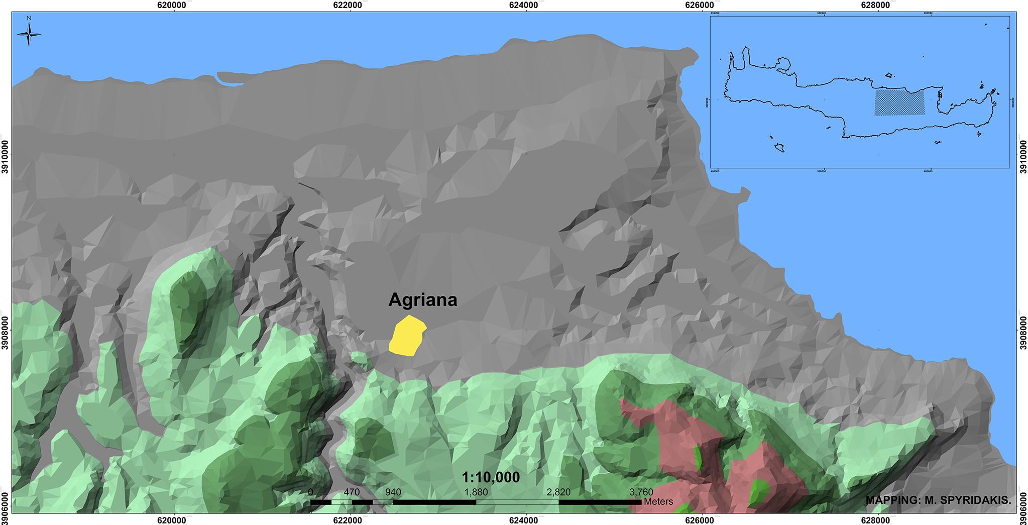
Apart from Kato Gouves, another extensive Protopalatial settlement was discovered east and south of the village of Agriana (Mandalaki et al. Reference Mandalaki, Velegraki, Koukouraki, Nikolopoulou, Merkoulidi, Karanastasi, Tzigounaki and Tsigonaki2020, 106–10; Fig. 43), which continued to be occupied during the early Neopalatial period. A small part, actually the north edge of the settlement, was investigated by the author east of the modern village in the context of a rescue excavation. Unfortunately, the field was used for intensive cultivation, resulting in the large-scale destruction of the architectural remains. Building material and pottery were scattered all over the surface of the field under investigation and the neighbouring fields.
The settlement of Agriana.

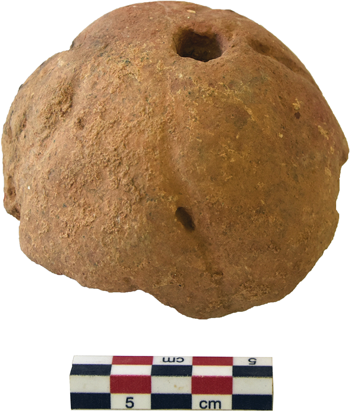
The excavation brought to light a small number of rough walls and worn, fragmentary pottery, mainly for everyday use, including jars, tripod cooking pots, plates and carinated cups (Fig. 44). Among the characteristic finds are a fragment from a pithos or an amphora decorated with red trickle, a handle with a plastic knob, a few sherds of conical cups, half a spherical loomweight (Fig. 45), a small stone grinder and fragments of a beehive. In addition to the finds from the excavated plot, a well-preserved wall belonging to the same settlement was discovered on the surface of a nearby village road during digging for the placement of water pipes carrying water from the Aposelemis Dam to Heraklion.
Agriana. Characteristic pottery from the North Sector of the Protopalatial settlement.

Agriana. North Sector of the Protopalatial settlement. Half of a loomweight.

The settlement extends further to the south (Fig. 46), beyond the Heraklion to Chersonesos national road which cuts across the site from east to west, causing serious damage to a unified archaeological picture of the Minoan settlement. In spite of the loss of archaeological evidence, however, the remaining indications support the existence of an extensive installation.
Agriana. The Protopalatial settlement cut by the North National Road, from south to north.

Trial trenches undertaken by the author during digging activities for the expansion of the North National Road revealed architectural remains and pottery from two different habitation phases, assigned to the Protopalatial and early Neopalatial periods respectively. The systematic excavation which followed by colleagues from the Ephorate of Antiquities (Galanaki et al. Reference Galanaki, Apostolaki, Volikou, Karagianni, Kasaris, Papoutsakis, Argiti and Vaggeliforthcoming b; Christakis, Galanaki and Apostolaki Reference Christakis, Galanaki and Apostolakiforthcoming; Christakis, Apostolaki and Galanaki Reference Christakis, Apostolaki and Galanaki2024) confirms the general chronological horizon of the two occupation phases. It has also brought to light important architectural remains of the Protopalatial settlement located in the east part of the excavated area and dated to MM IIA, as well as remains of the MM IIIA–LM IA Neopalatial phase of habitation located in the elevated west section of the excavated area. According to the excavators, the site was founded in the EM III–MM IA period, identifiable only through pottery which was not associated with architectural structures. A separate MM IB phase was also distinguished. During the Prepalatial period, cultural contacts with Knossos are indicated by the extensive use of footed goblets, locally made, as is the case at ‘Amirandes’ in Kato Gouves, while during MM IB the footed goblet falls out of use and the pottery shows similarities to that of the Pediada. In MM IIA, ceramic imports from Pediada continue, while strong contacts are established with Malia, as the relevant pottery assemblage is similar to MM IIA deposits from Sector Pi (Christakis, Apostolaki and Galanaki Reference Christakis, Apostolaki and Galanaki2024, 75–6), although there are some differences. According to the excavators, the absence of one-handled conical cups, a type considered a typical Maliote product, and straight-sided cups is explained by the specialised use of the Protopalatial installation. The early Neopalatial pottery is characterised by the appearance of the plain conical cup.Footnote 12 Regarding the Minoan settlement of Agriana, two factors should be taken into consideration: the absence of an MM IIB phase, contrary to the case of ‘Amirandes’, and the occupation of the site until LM IA and no later.
Archaeological indications for the existence of a Protopalatial settlement were also traced on the hill of Anemomylos at the Kastelli junction, south of Chersonesos (Mandalaki et al. Reference Mandalaki, Velegraki, Koukouraki, Nikolopoulou, Merkoulidi, Karanastasi, Tzigounaki and Tsigonaki2020, 110). An extensive scattering of Minoan pottery, Protopalatial and possibly LM III, is visible on the north, north-west and west slopes, while walls of Minoan and Roman times can be seen on the hilltop. Finally, an assemblage of MM IA and Protopalatial pottery was found in an area along the road from Kato Gouves to Ano Gouves (Mandalaki et al. Reference Mandalaki, Velegraki, Koukouraki, Nikolopoulou, Merkoulidi, Karanastasi, Tzigounaki and Tsigonaki2020, 110). The assemblage was discovered in a thick layer 0.90–1.70 m in depth, together with river cobbles, and was not associated with architectural structures. Because of its context, it seems probable that it was transported from elsewhere by a nearby stream.
Neopalatial period
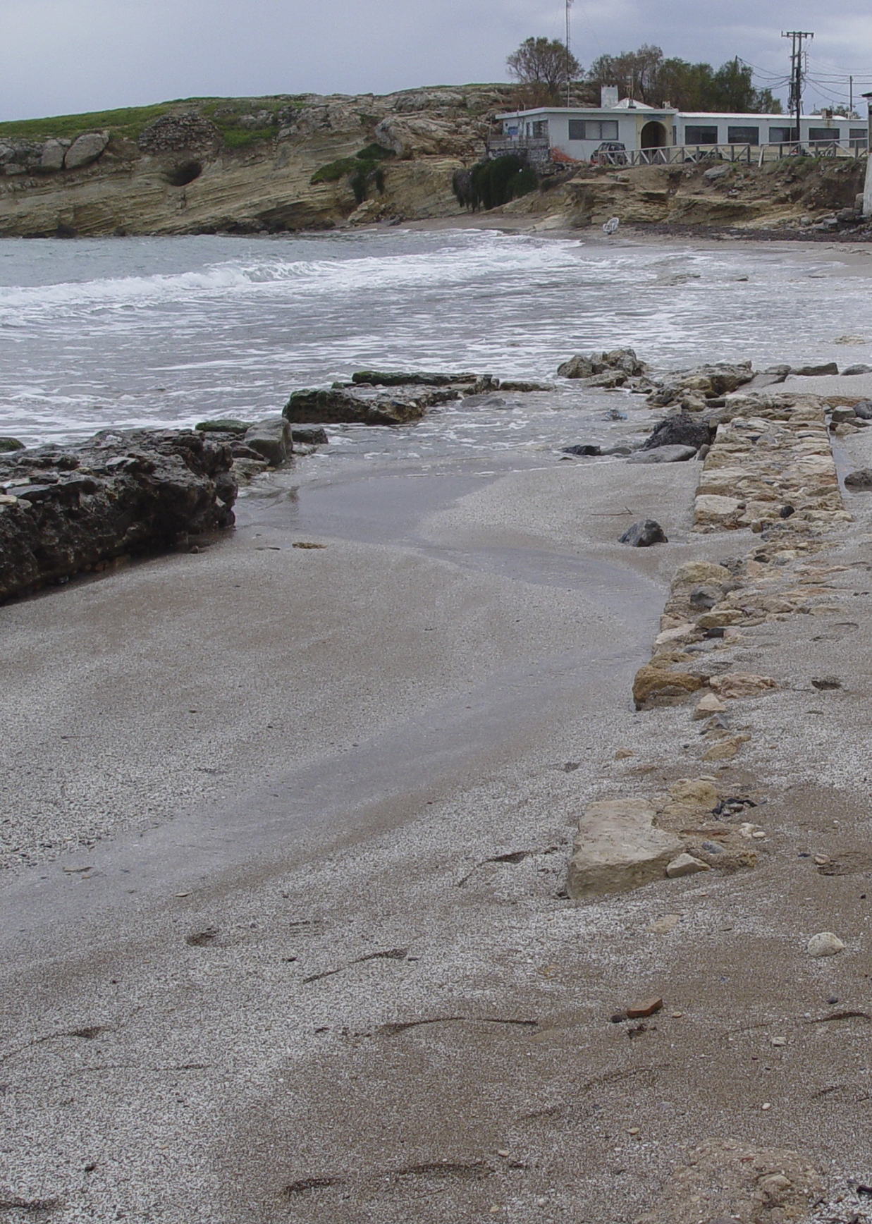
Apart from the Neopalatial phase of Agriana, the early Neopalatial period in the region is also represented by an installation on the hill of Kastri in the Port of Chersonesos (Mandalaki Reference Mandalaki, Karanastasi, Tzigounaki and Tsigonaki2015; Fig. 47), which was revealed during landscaping work undertaken by the Ephorate of Antiquities at the entrance of the archaeological site of the Early Christian basilica. Parts of walls from three rooms and a corridor, preserved to the foundation level, were uncovered beneath Geometric and Hellenistic layers on the west plateau of the hill, north of the Port Authority building. The rooms are seriously damaged by old and contemporary development activities. The northern room, situated on the edge of the natural rock, is poorly preserved, as most of it has collapsed into the sea. The southern room was found in better condition. A cut in the floor 30 cm wide runs around the walls, probably indicating the existence of a bench made of perishable materials, now lost. The floor consists of sea pebbles and plaster and has two construction phases. Inside the rooms, a number of vessels were revealed in situ on the floors. West of the complex of rooms and the corridor, an open space with a hearth on the bedrock was uncovered.
Port of Chersonesos. The rocky hill of Kastri by the sea, from west to east.

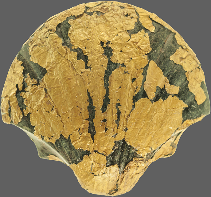
The settlement also occupied the overlying rock at different levels, as indicated by the cuts for floors in the slopes. Many of the broken and complete vessels discovered in the fill of the rooms on the lower level probably came from the occupation area on the hilltop. Apart from the pottery, no remaining structures of the Minoan settlement were found on the upper levels of the rocky site, due to extensive building activities in the Hellenistic and Early Christian periods, as well as in the modern era. However, the discovery of Minoan pottery in the disturbed layers among the graves of the Early Christian cemetery on the south slope of the hill confirms the extent of the Minoan settlement. Among the Minoan pottery from the disturbed layers on the south slope was a unique stone model of a clam covered in gold leaf (Fig. 48).Footnote 13 This unexpected find testifies to the performance of ritual activities in this area. The remarkable length of the object, almost 4 cm, and its weight indicate that it is unlikely to have been used as a pendant, in spite of a small hole at the edge which is probably related to the safe mounting of the object. The discovery of a natural triton shell and many small shells in the same area bear out this assumption. The whole assemblage is reminiscent of the well-known material in faience from the Temple Repositories of the Palace of Knossos (Panagiotaki Reference Panagiotaki1999, 78–81, fig. 16, pls 10, 11, 17). Similar models of sea creatures in clay are also known from Quartier Mu and elsewhere,Footnote 14 while an almost identical model of a clam in stone was found at Zominthos during the 2017 excavation, associated with a shrine (Sapouna-Sakellaraki Reference Sapouna-Sakellaraki2017, 317–18, fig. 8).
Port of Chersonesos, Kastri. Stone model of a clam covered in gold leaf.

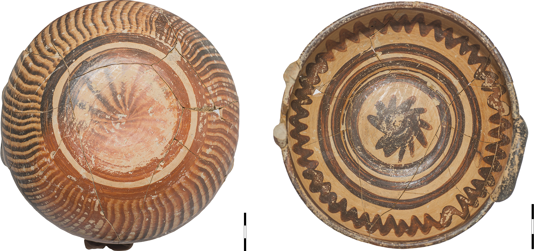
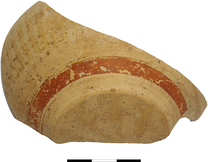
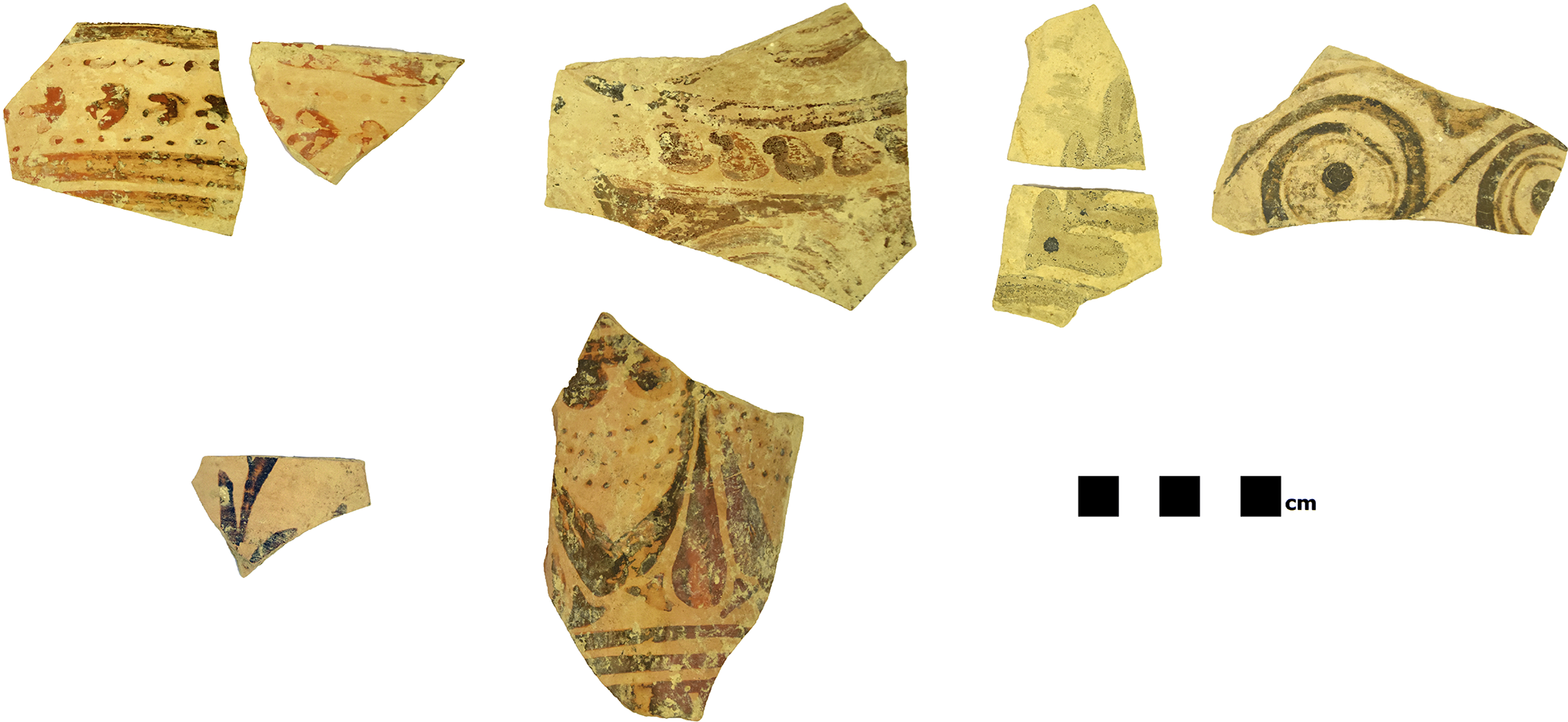
The pottery from Kastri dates the main habitation phase and the heyday of the Minoan settlement to MM III and especially MM IIIB. The most characteristic find is an in-and-out bowl of lustrous ware (Fig. 49), decorated with ripple on the outer side and a continuous zigzag line on the inner side. The form of the vessel, the decorative motifs and the intensely polished surfaces are typical features of MM IIIB (Hatzaki Reference Hatzaki, Macdonald, Hatzaki and Andreou2015), with similar examples from Knossos and Palaikastro (Hatzaki Reference Hatzaki and Momigliano2007, 165, fig. 5.4:7,8; Knappett and Cunningham Reference Knappett and Cunningham2012, 161, fig. 5.21:383). The bowl was discovered on the floor of the north room together with half of a lid decorated with brown painted circular motifs, a beaked jug and a trefoil-mouthed jug. Fragments of polished pottery of excellent quality, decorated with ripple or red bands (Fig. 50), were found in a high percentage in all the excavated areas of the site. Some of them, decorated with red wavy bands imitating marble veins, mark the MM IIIB chronological horizon (Knappett and Cunningham Reference Knappett and Cunningham2012, 159, fig. 5.20:360, 161, fig. 5.21:383; Macdonald Reference Macdonald2013, 27, fig. 2.6:2004; Rethemiotakis and Christakis Reference Rethemiotakis and Christakis2013, 101, fig. 8.12; Girella Reference Girella2013, 126, fig. 10.3ad). A large quantity of MM III pottery with dark-on-light decoration, mainly rounded cups with trickle, linear motifs or crescents (Fig. 51), was also collected. The dating of the settlement to MM IIIB is further supported by the absence of carinated cups from the destruction layers inside the rooms, while one-handled conical cups were quite few. The most popular forms are the straight-sided and rounded cups.
Port of Chersonesos, Kastri. In-and-out bowl decorated with ripple and zigzag line.

Port of Chersonesos, Kastri. Part of a cup decorated with ripple and red bands.

Port of Chersonesos, Kastri. Handleless rounded cup decorated with crescents.

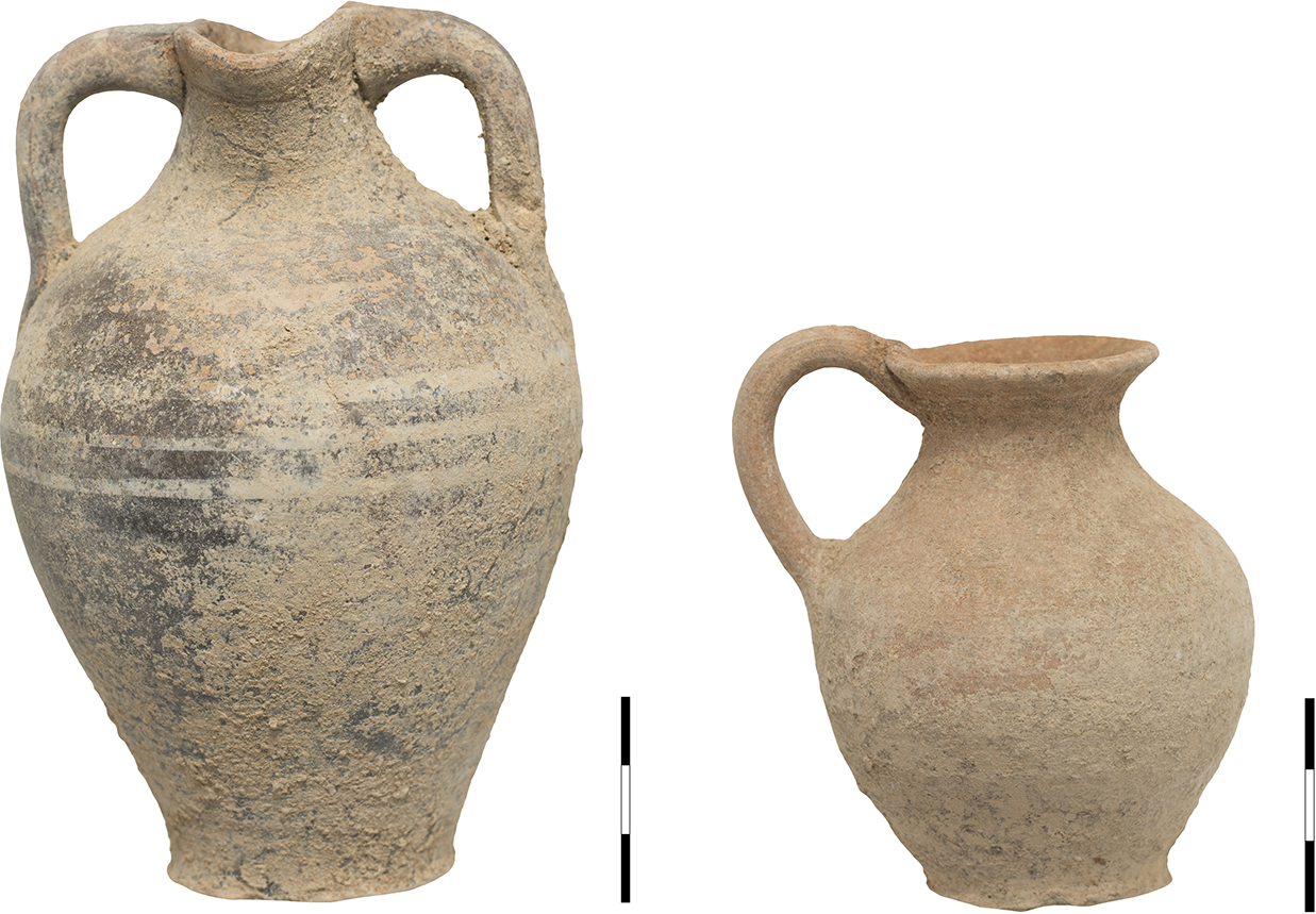
Although the ceramic material, mainly from the destruction layers, attests to the heyday of the Minoan settlement in MM IIIB, an earlier habitation phase is indicated by the discovery of a foundation deposit beneath the floor of the north room. The deposit included a two-handled amphora decorated with white bands on a black background and a jug (Fig. 52), both dated to the Protopalatial period or the beginning of MM IIIA (MacGillivray Reference MacGillivray and Momigliano2007, 132, fig. 4.21:3; Karetsou Reference Karetsou2013, 80, fig. 7.16). Consequently, these vessels from the deposit are not associated with the final use of the room, given that the vessels found on the floor of the room are dated to MM IIIB, as mentioned above. However, apart from the foundation deposit, an earlier Protopalatial habitation on the hill of Kastri is indicated by the discovery of Protopalatial pottery in the fill of the rooms and in the layers levelling the cavities in the bedrock.Footnote 15
Port of Chersonesos, Kastri. Two-handled amphora and jug from the Protopalatial foundation deposit.

Final Palatial and Postpalatial period
The following archaeological sites are assigned to the LM IIIA–B chronological horizon. They were identified during the supervision of digging activities in the context of public construction projects. At the same time, already known archaeological sites were further investigated, such as the Potters’ Quarter in Kato Gouves, whose southern borders were identified through the scattering of pottery and building material.
An assemblage of abundant LM IIIA2 pottery together with a small quantity of Hellenistic ceramic material was discovered at the site of Profitis Ilias in the west part of the modern village of Kato Gouves (Mandalaki et al. Reference Mandalaki, Velegraki, Koukouraki, Nikolopoulou, Merkoulidi, Karanastasi, Tzigounaki and Tsigonaki2020, 111). The assemblage was not associated with architectural structures. However, building material from destroyed Minoan walls has been identified across the neighbouring plots during the supervision of private construction works by the Ephorate of Antiquities. The Profitis Ilias site is located approximately 2 km west of the Potters’ Quarter excavated by Despoina Vallianou and dated to LMIIIB (Vallianou Reference Vallianou, Laffineur and Betancourt1997; Chatzi-Vallianou Reference Chatzi-Vallianou and Langohr2017).
Another assemblage of LM IIIB date was found at Ano Gouves (Mandalaki et al. Reference Mandalaki, Velegraki, Koukouraki, Nikolopoulou, Merkoulidi, Karanastasi, Tzigounaki and Tsigonaki2020, 111), disturbed by modern human intervention. It probably came from another area together with layers of soil, due to modern landscaping works. The absence of human bones indicates the domestic character of the site from which it originated. The dating of the pottery to LM IIIB is supported by the tall stemmed goblets included in the ceramic material. Apart from fine ware, a huge quantity of coarse ware was collected, comprising large jars and cooking pots.
An important settlement of the LM III period with indications of earlier habitation was discovered in the old village of Gournes (Mandalaki et al. Reference Mandalaki, Velegraki, Koukouraki, Nikolopoulou, Merkoulidi, Karanastasi, Tzigounaki and Tsigonaki2020, 111–12) while digging activities on the road next to the Primary School were in progress. The trial trenches excavated by the Ephorate of Antiquities are approximately 450 m north of the ΕΜ–MM burial complex and the LM III chamber tombs investigated by Iosif Hatzidakis at the Kefali site in 1915 (Hatzidakis Reference Hatzidakis1915; Reference Hatzidakis1918). The small-scale excavation that followed the discovery of the archaeological site brought to light a strong wall 0.80 m in height (Fig. 53), oriented north to south. It is constructed of large, roughly worked stones and small pebbles filling the gaps. A potential entrance was identified in the north section of the revealed masonry, while at least two different construction phases including a later addition eastwards were distinguished. Inside the spaces demarcated by the strong wall a huge quantity of fine and coarse pottery of excellent quality was collected, dated from LM IB to LM IIIB and possibly LM IIIC. Unfortunately, due to modern digging activities for the improvement of the water supply network, the stratigraphy was totally disturbed, mixing the pottery assemblages. Consequently, the presentation of the pottery is based exclusively on stylistic grounds. The ceramic material with typical LM IB features (Fig. 54) includes fragments of one-handled rounded cups decorated with iris motifs, sherds decorated with spirals, reeds and other floral patterns (see for example Mountjoy Reference Mountjoy2003, 91, fig. 4.18:240,243, 96, fig. 4.20:279,280, 98, fig. 4.21), and a fragmentary conical rhyton with superimposed horseshoe motifs and triple dotted festoons, this last being almost identical to a similar specimen from Palaikastro (Dawkins Reference Dawkins1902–3, 311, fig. 9). Representative LM IIIA–B fine ware forms include ‘champagne’ cups, high stemmed goblets, fragments of a large false-necked jar and rounded cups. Some characteristic motifs are (Fig. 55) festoons with arcs (Mountjoy Reference Mountjoy2003, 134, fig. 4.37:637), bivalve (Mountjoy Reference Mountjoy2003, 140, fig. 4.39:716,717), parts of two birds (Mountjoy Reference Mountjoy2003, 140, fig. 4.39:698), quirk bands (Mountjoy Reference Mountjoy2003, 131, fig. 4.35:611) and spiral motifs (Mountjoy Reference Mountjoy2003, 143, fig. 4.40:736). The large quantity of coarse ware comprises fragments of jars of different sizes, tripod cooking pots and cooking utensils. Special reference is made to the discovery of Cypriote pottery of the White Slip II style (see, for example, Kanta Reference Kanta, Stampolidis and Karetsou1998, cat. nos 13, 14, 15; Fig. 56), demonstrating the range of contacts of the Minoan settlement, which seems to be one of the most important sites in north Crete for a long period of time. Moreover, if we take into consideration that all the known archaeological sites in the area of Gournes, such as the Prepalatial cemetery in the former American Military Base excavated by Calliope Galanaki, or the EM–MM and LM III cemeteries on the hill of Kephala excavated by Iosif Hatzidakis, have a mortuary character, the discovery of the LM IB and LM III settlement in the old village of Gournes has a special value, given that it is the first installation of clear residential nature in the area. The excellent quality and the decoration of the pottery, as well as the dating of the earlier ceramic material to LM IB, allow us to place the establishment of the settlement during LM IB under Knossian influence.
Gournes, Primary School. Walls of the Minoan settlement, from north-east to south-west.

Gournes, Primary School. Characteristic LM IB pottery.

Gournes, Primary School. Characteristic LM III pottery.

Gournes, Primary School. Cypriote pottery of the White Slip II style.

An extensive site discovered on two terraces on the slopes of the ‘Stou Katsiki to Kefali’ hill, on the east bank of the River Aposelemis and north-east of the existing bridge, can also be dated in LM III (Mandalaki et al. Reference Mandalaki, Velegraki, Koukouraki, Nikolopoulou, Merkoulidi, Karanastasi, Tzigounaki and Tsigonaki2020, 112). The site was identified during a field survey in the context of excavation works for the improvement of the North National Road.
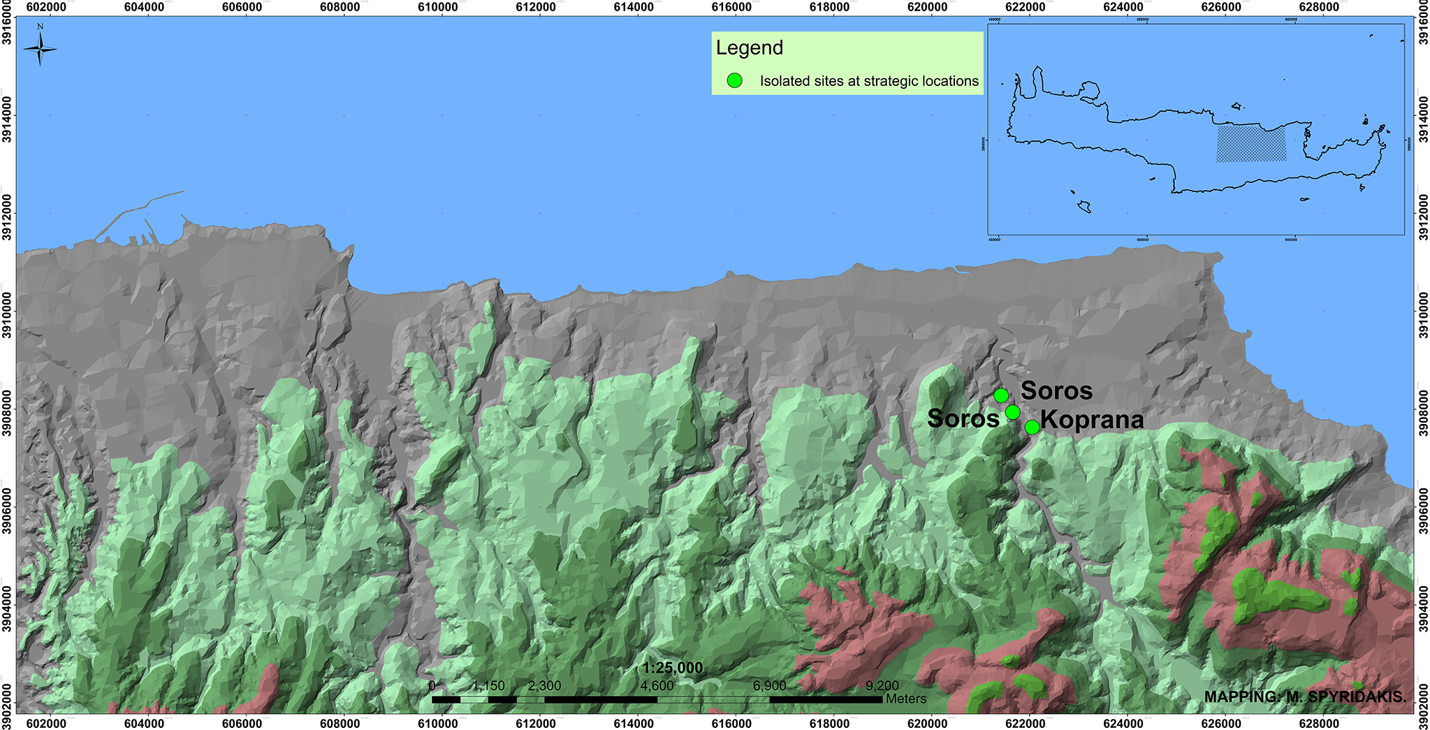
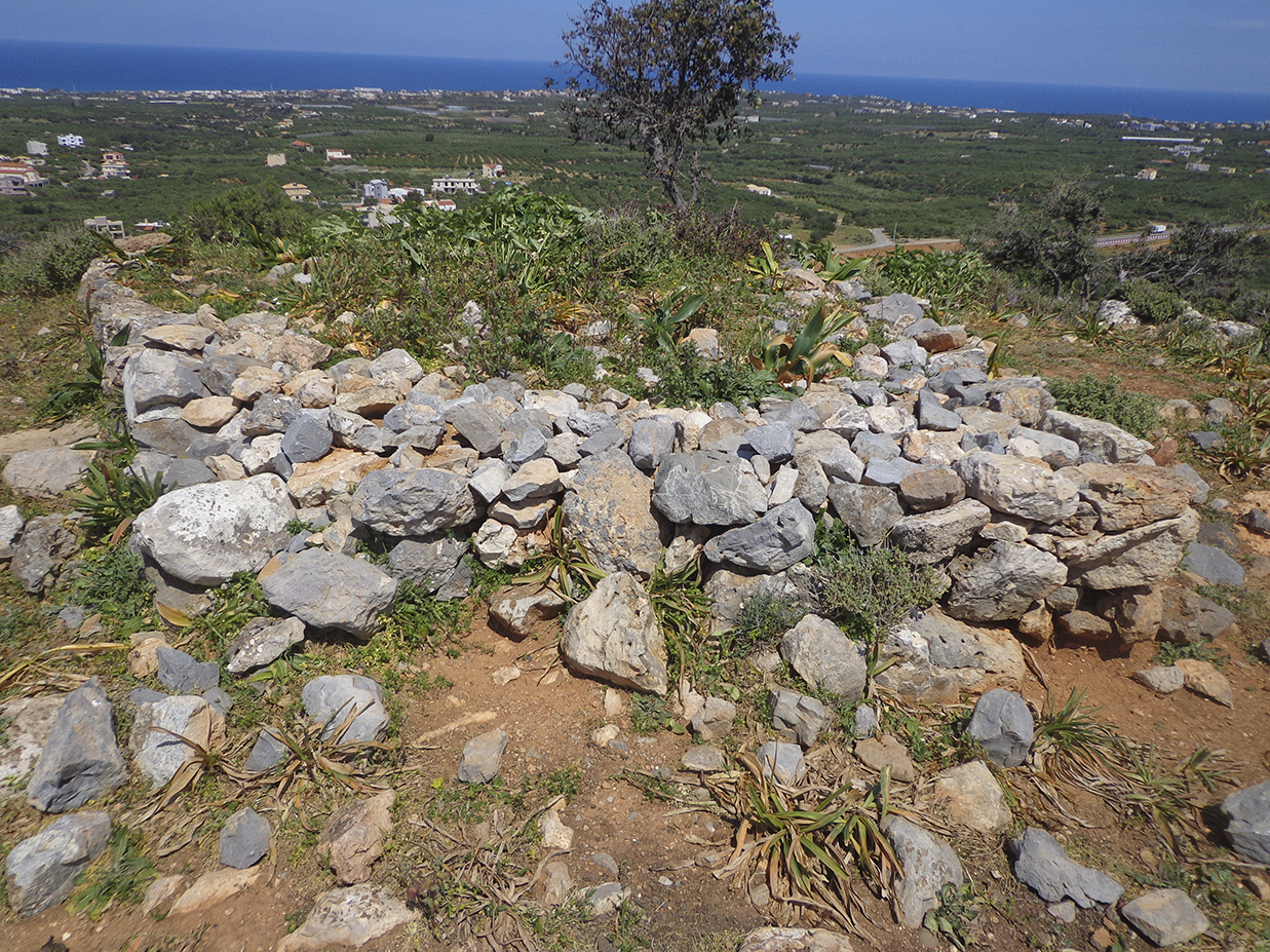
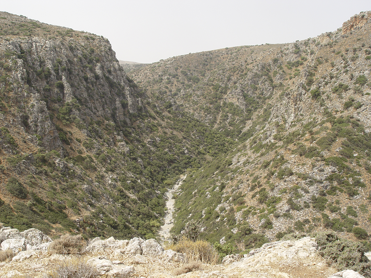
Three more isolated sites at strategic locations, probably ‘soroi’,Footnote 16 complete the archaeological puzzle (Mandalaki et al. Reference Mandalaki, Velegraki, Koukouraki, Nikolopoulou, Merkoulidi, Karanastasi, Tzigounaki and Tsigonaki2020, 115–16; Fig. 57). One was identified on the top of the Koprana hill, south of the modern village of Agriana. Indications of ancient building material were found beneath the upper courses of a modern structure (Fig. 58). The structure was associated with a grinder found in situ and a scattering of Minoan pottery. The hill dominates the Aposelemis Gorge, allowing us to suggest that the installation on the hilltop probably served to control the north coast and the hinterland, as the hill is inaccessible from the south slope facing the gorge and accessible from the north-east side (Fig. 59). The two other isolated sites are located on two neighbouring hills south of the North National Road and east of the small Faragouli stream. They probably belong to the same network of access control as the installation on the Koprana hill.
Isolated sites at strategic locations.

Agriana. Minoan installation on the Koprana hill south of the village.

Agriana. View of the Aposelemis Gorge from the installation on the Koprana hill.

SETTLEMENT PATTERNS AND REGIONAL DYNAMICS
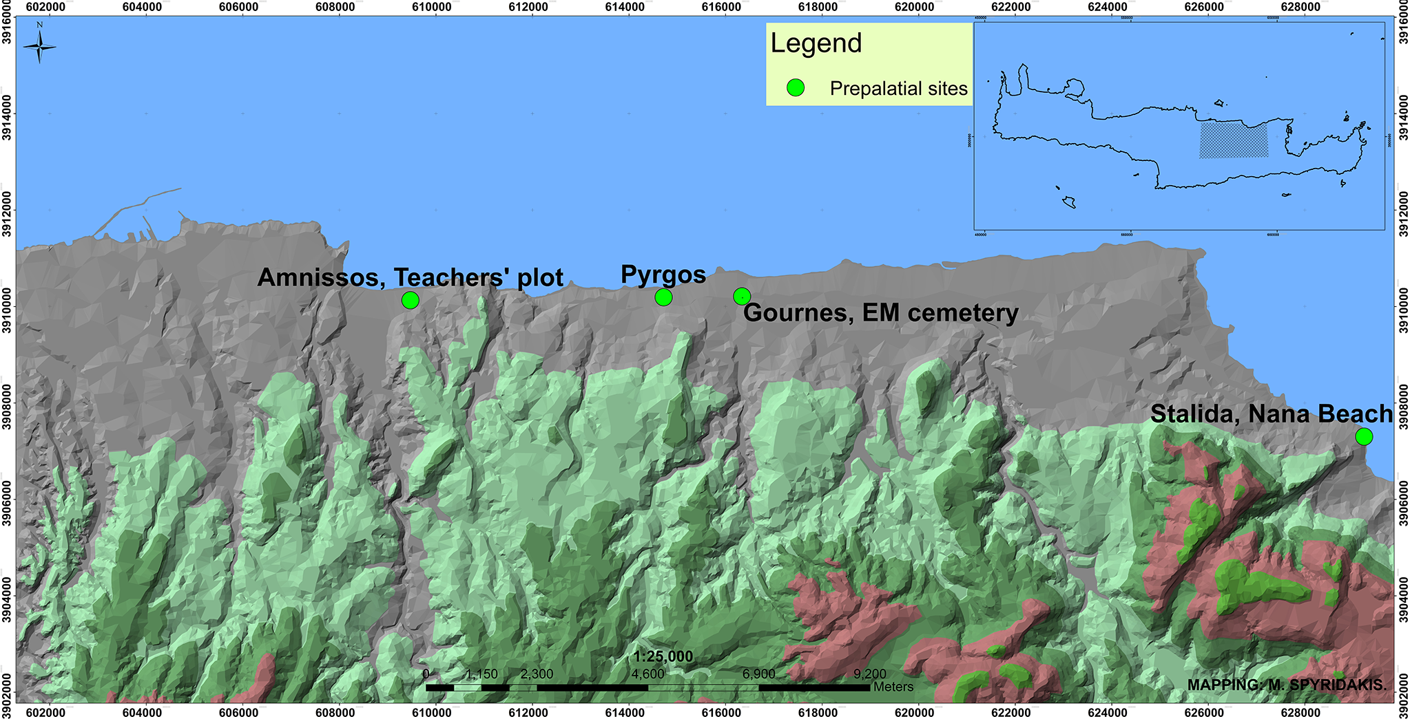
The above presents important new evidence on the Bronze Age settlement patterns of the north region of Heraklion from Knossos to Malia. It is really interesting that both of the late Prepalatial installations at Amnissos and in the area west of the Nana Beach Hotel in Stalida (Fig. 60) are of a rural character and that Knossos had already developed contacts with Amnissos before the end of the Prepalatial period, based on the similarity of the ceramic assemblages found in the excavation of the long wall at Amnissos to corresponding material from Knossos.
Prepalatial sites.

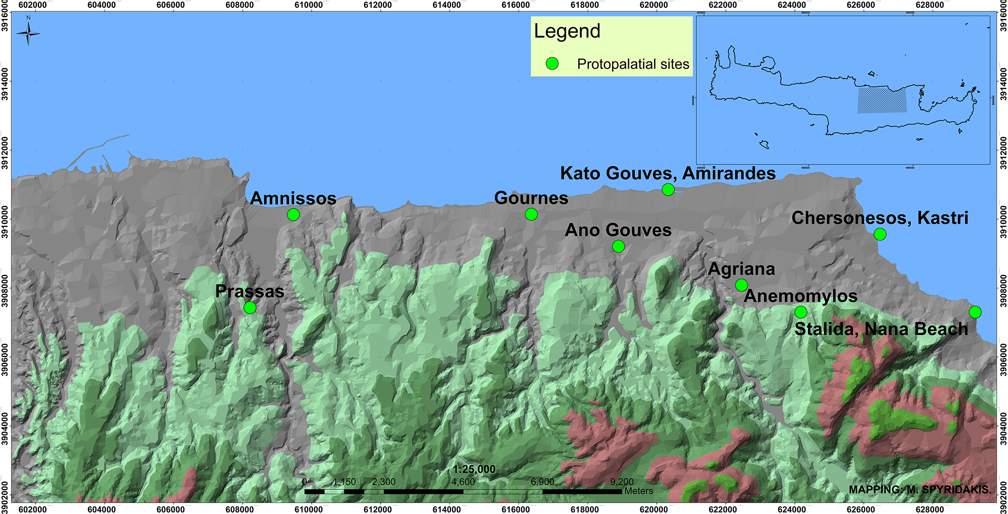
The density and large size of the Protopalatial settlements or sites (Fig. 61) discovered at the Amirandes Hotel in Kato Gouves, in Agriana, on the Anemomylos hill south of Chersonesos, on the rocky hill of Kastri in Chersonesos (the earlier occupation of which was identifiable through pottery deposits) and in Ano Gouves point to an extended habitation pattern, which is further supported by the already known sites at Prassas, Amnissos and Gournes (the isolated building inside the former American Military Base), and inside the Nana Beach Hotel in Stalida. This pattern is also attested in other regions during the Protopalatial period (Driessen Reference Driessen and Branigan2001; Whitelaw Reference Whitelaw, Garcia, Orgeolet, Pomadère and Zurbach2019, 96, 99), such as the neighbouring region of Malia, where an extensive survey brought to light 80 Protopalatial sites, in contrast to the dramatically fewer Neopalatial sites (Schoep Reference Schoep2002, 122; Müller-Celka Reference Müller-Celka2007; Müller-Celka, Puglisi and Bendali Reference Müller-Celka, Puglisi, Bendali, Touchais, Laffineur and Rougemont2014; Whitelaw Reference Whitelaw, Garcia, Orgeolet, Pomadère and Zurbach2019, 99; Alberti, Müller-Celka and Pomadère Reference Alberti, Müller-Celka, Pomadère, Garcia, Orgeolet, Pomadère and Zurbach2019).
Protopalatial sites.

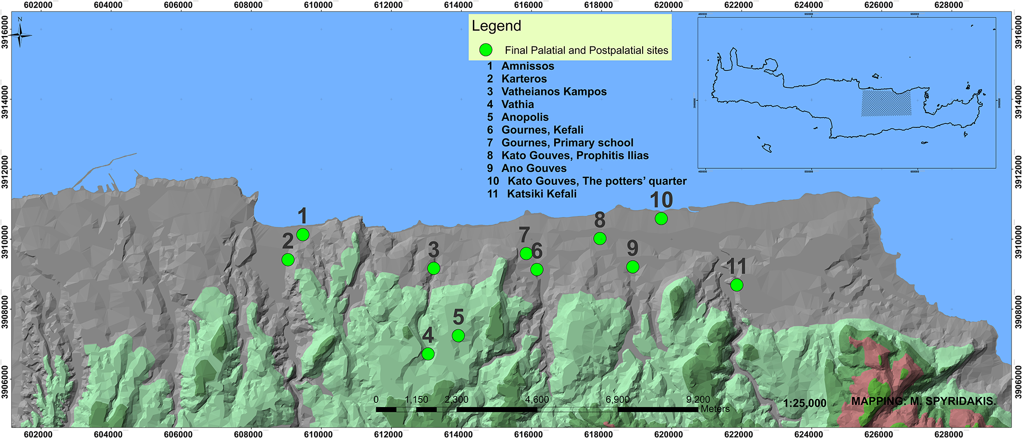
A similar density of sites is also evidenced during LM IIIA–B (Fig. 62), as archaeological testimonies from Amnissos, Gournes (settlement and cemetery), Gouves (Potters’ Quarter, pottery assemblages at Kato Gouves-Prophitis Ilias and Ano Gouves), and Aposelemis-Katsiki Kephali indicate. This conclusion is further supported by the existence of already known LM IIIA–B chamber tombs at a number of sites such as Karteros, Episkopi, Anopolis, Vathia, Vatheianos Kampos, Stamnioi and Gouves (Marinatos Reference Marinatos1927–8; Kanta Reference Kanta1980, 43–7, 53–70; Mandalaki Reference Mandalaki, Vlazaki and Papadopoulou2011), which presumably suggests the initial existence of an equal number of settlements.
Final Palatial and Postpalatial sites.

Habitation in the area under discussion during MM IIIB–LM IA is more limited compared to the Protopalatial period (Fig. 63), as the only confirmed sites on the coast and the nearby hinterland from Amnissos to Stalida are the ‘Villa of the Lilies’ and the surrounding settlement, Prassas, partly the settlement at Agriana, the isolated building inside the former American Military Base in Gournes, Chersonesos-Kastri and a small settlement at the Farangouli site west of a tributary of the Aposelemis, close to the north mouth of the gorge (Galanaki et al. Reference Galanaki, Apostolaki, Papoutsakis and Kasarisforthcoming a).
MM IIIB–LM IA sites.

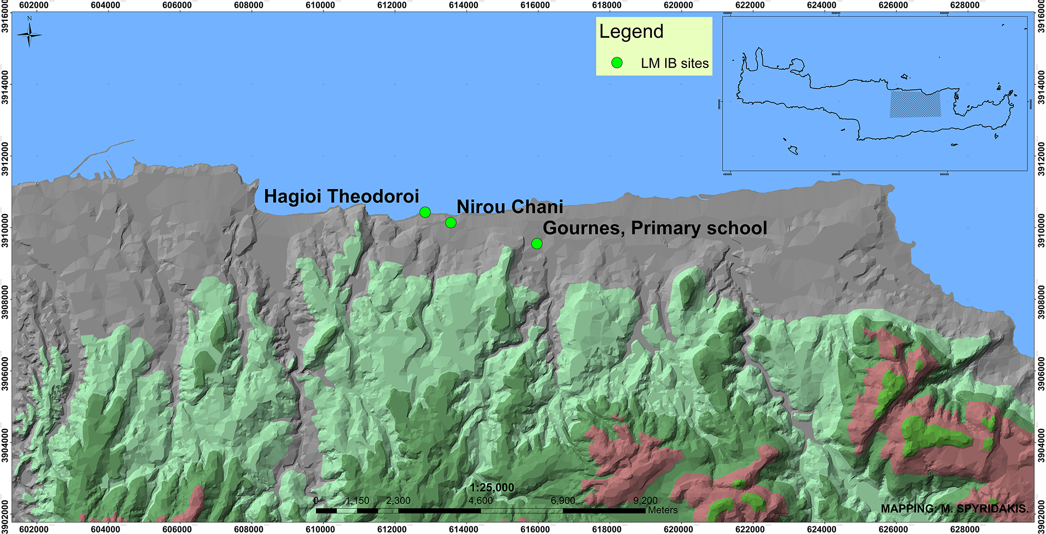
On the contrary, the absence of LM IB sites is striking (Fig. 64). Just one settlement was identified at Gournes with continuous habitation from LM IB to LM IIIB or even IIIC, while the villa at Nirou Chani with the surrounding settlement and the coastal site at Hagioi Theodoroi are also placed in the same chronological horizon (Sakellaraki Reference Sakellaraki, Vavouranakis and Voskos2022, 256). This decrease or scarcity of Neopalatial sites corresponds to the general habitation pattern attested elsewhere (Driessen Reference Driessen and Branigan2001; Whitelaw Reference Whitelaw, Garcia, Orgeolet, Pomadère and Zurbach2019, 96, 99–100; Müller-Celka Reference Müller-Celka2007; Müller-Celka, Puglisi and Bendali Reference Müller-Celka, Puglisi, Bendali, Touchais, Laffineur and Rougemont2014; Puglisi Reference Puglisi2007; Alberti, Müller-Celka and Pomadère Reference Alberti, Müller-Celka, Pomadère, Garcia, Orgeolet, Pomadère and Zurbach2019), and probably reflects the centralisation of the administration during the late Neopalatial period due to the expansion of Knossian control to regions of central and east Crete, as has already been argued (Warren Reference Warren, Cadogan, Hatzaki and Vasilakis2004; Wiener Reference Wiener, Betancourt, Nelson and Williams2007; Christakis, Mavraki-Balanou and Kastanakis Reference Christakis, Mavraki-Balanou, Kastanakis, Karanastasi, Tzigounaki and Tsigonaki2015, 301–4; Whitelaw Reference Whitelaw, Relaki and Papadatos2018, 212, 237; Reference Whitelaw, Garcia, Orgeolet, Pomadère and Zurbach2019, 101).
LM IB sites.

On the other hand, the density of Protopalatial sites, together with the contacts between the settlements at ‘Amirandes’ in Kato Gouves and Agriana with the palatial centre of Malia, indicates the inclusion of this particular region in the general cultural, ideological, social or economic ‘territory’ of the Malia polityFootnote 17 during the Protopalatial period. Moreover, given the location of the Protopalatial settlement at ‘Amirandes’ on the west bank of the Aposelemis, and the location of the Protopalatial settlement at Agriana approximately 1 km east of it (Christakis, Apostolaki and Galanaki Reference Christakis, Apostolaki and Galanaki2024, 66), as well as the location of the three aforementioned isolated installations east and west of the river, the geopolitical importance of the Aposelemis Gorge in the movement of people and goods from the coast to the hinterland and vice versa is extremely clear.Footnote 18 The density, size and importance of the settlements revealed in the area of the Aposelemis Dam during the rescue excavations undertaken by the Ephorate of Antiquities point in the same direction (Mavraki-Balanou Reference Mavraki-Balanou, Andrianakis, Varthalitou and Tzahili2012; Mavraki-Balanou et al. Reference Mavraki-Balanou, Kastanakis, Triantafyllidi and Papadaki2018; Christakis, Mavraki-Balanou and Kastanakis Reference Christakis, Mavraki-Balanou, Kastanakis, Karanastasi, Tzigounaki and Tsigonaki2015). The potential use of the Aposelemis Gorge as a route linking the coastal and inland Minoan settlements could also reflect the function of the natural formation as the western limit of the ‘Malia zone of control’ during the Protopalatial period.Footnote 19 Although the area of Gournes further to the west has already been suggested as a possible western limit of the ‘Malia region’ (Cadogan Reference Cadogan1995, 97) based on the partial similarity of ceramic assemblages from the ΕΜ–MM burial complex excavated by Iosif Hatzidakis to particular ceramic forms from Malia, this assumption needs to be reconsidered, as the majority of the pottery from Gournes presents Knossian features. However, these similarities of the ceramic assemblages from Gournes to Maliote ceramic forms may reflect a gradation of cultural contacts of the palatial centre of Malia with the surrounding regions, including different ‘contact zones’ depending on geographical/topographical constraints and particularities of the local communities involved.Footnote 20
Going one step further, the large size of the Protopalatial settlement at ‘Amirandes’, along with the fact that it probably represented a seat of a local authority which flourished and declined at the same time as Malia, as well as the considerable extent of the Protopalatial settlement at Agriana, challenges the discussion on the nature of the contacts of these sites with the palatial centre of Malia. The available evidence, however, is not enough to put forward definite suggestions regarding the relations of Malia – as confirmed by the archaeological data – with the region to the west,Footnote 21 and particularly whether these contacts refer to the cultural, social, political, economic, ideological or even religious domain.Footnote 22 The discovery of a potter’s wheel in the fill of the first floor in the settlement at ‘Amirandes’ indicates the existence of a ceramic workshop in the area, which would provide, to some degree, most of the domestic utensils for everyday use. Regarding the fine pottery with close similarities to the ceramic assemblages from Quartier Mu, we cannot be certain, for the time being, if it was imported from Malia or produced locally following Maliote prototypes, given that petrographic analyses of the material have not yet been carried out. Similarly, although local pottery production is attested at the Protopalatial settlement of Agriana, imports from Malia cannot be excluded, because of the similarities of the fabrics to related material from Malia (Christakis, Apostolaki and Galanaki Reference Christakis, Apostolaki and Galanaki2024, 75). On the contrary, the absence of administrative documents such as seals, sealings or inscribed documents from ‘Amirandes’ does not allow any suggestions for potential relations of administrative nature between Malia and the settlement at ‘Amirandes’.Footnote 23 Documents of this type (a seal, a sealing and a signet ring), however, which are generally considered solid evidence for reconstituting the sociopolitical relations of a regional site with an urban centre (Müller-Celka Reference Müller-Celka2007, 855), have been discovered at Agriana (Galanaki et al. Reference Galanaki, Apostolaki, Volikou, Karagianni, Kasaris, Papoutsakis, Argiti and Vaggeliforthcoming b; Christakis, Apostolaki and Galanaki Reference Christakis, Apostolaki and Galanaki2024, 66). Similarly, the intrusion of Knossian features recognised in the use of the footed goblet during MM I and the conical cup during MM II reflects the receptiveness of the ‘Amirandes’ inhabitants to different ceramic traditions coming from the west, probably due to a ‘loose’ exercise of control from the east.
Speaking in political terms, during the Prepalatial and the early Protopalatial periods until MM IB, it is possible that Knossos extended its network of contacts to the area of Gouves, as indicated by the use of typical Knossian products, such as the footed goblet, by the inhabitants of the site. This suggestion is further supported by the similar archaeological evidence from the area of Amnissos and particularly the excavation of the Teachers’ Construction Association plot mentioned above. Based on the ceramic forms of the pottery assemblages, the influence of Knossos in the Amnissos area had already been established by the Prepalatial period. The use of the footed goblet at Agriana until MM IA, but not during MM IB (Christakis, Apostolaki and Galanaki Reference Christakis, Apostolaki and Galanaki2024, 75) points in the same direction. However, during MM II, the influence of Knossos in the Gouves area was replaced by the new emerging power of the palatial centre of Malia, although it did not totally disappear, as the preference for specific Knossian ceramic forms testifies. In any case, even if the influence of Malia to the west were of a political/administrative nature, this control of the area does not necessarily imply a centralised administrative model during the late Protopalatial period. The large number and size of the Protopalatial settlements located in the area between Knossos and Malia, as well as local peculiarities and preferences, point rather to the opposite: a decentralised model of control in the regional environment of the palatial centre of Malia (Knappett Reference Knappett1999; Schoep Reference Schoep2002). On the contrary, for Whitelaw (Reference Whitelaw, Relaki and Papadatos2018, 232–3), the Malia-Lasithi State was highly centralised in the region corresponding approximately to the boundary of the catchment, which was necessary to support the estimated population of the urban centre, given that a two- or possibly three-level settlement hierarchy is indicated by the field survey. However, the same scholar admits (p. 241) that ‘to incorporate these more distant areas (Lasithi basin and the Mirabello coastal lowlands) would probably have required the development of a more decentralised form of administration, probably also resulting in a weaker control’. New developments followed the destruction of the settlements at the end of the Protopalatial period, as Knossos seems to re-establish its power over the region in the early Neopalatial period. The MM IIIB partial reoccupation of the destroyed Protopalatial settlement at ‘Amirandes’ indicated by the pottery assemblages with ripple decoration which is very popular, as at Knossos, during MM IIIB (Hatzaki Reference Hatzaki2013), and the early Neopalatial phase of Agriana, this last being identified by the use of the plain conical cup (Mandalaki et al. Reference Mandalaki, Velegraki, Koukouraki, Nikolopoulou, Merkoulidi, Karanastasi, Tzigounaki and Tsigonaki2020, 110; Christakis, Apostolaki and Galanaki Reference Christakis, Apostolaki and Galanaki2024, 73), reflect the new dynamics of ‘control zones’ developed in the area under discussion which led to the reinforcement of the Knossian state (Whitelaw Reference Whitelaw, Relaki and Papadatos2018, 233–8).
On the other hand, the fact that the early Neopalatial small-scale reoccupation at the coastal site of ‘Amirandes’ was a short episode in the long history of the area, which was finally abandoned after MM IIIB, cannot be sufficiently explained in the light of current evidence from other regions, such as the periphery of the Minoan town of Malia. Although the Protopalatial sites on the north slopes of Selena were abandoned during the early Neopalatial period, the coastal and lowland Protopalatial sites continued to exist and grew larger (Whitelaw Reference Whitelaw, Relaki and Papadatos2018, 237; Puglisi Reference Puglisi2007; Müller-Celka, Puglisi and Bendali Reference Müller-Celka, Puglisi, Bendali, Touchais, Laffineur and Rougemont2014, 432, 433, 438; Alberti, Müller-Celka and Pomadère Reference Alberti, Müller-Celka, Pomadère, Garcia, Orgeolet, Pomadère and Zurbach2019). This change of habitation pattern is usually explained by environmental reasons (Müller-Celka, Puglisi and Bendali Reference Müller-Celka, Puglisi, Bendali, Touchais, Laffineur and Rougemont2014), particularly new needs for intensive irrigation of the cultivated land with water from rivers and springs, probably due to limited rainfall which caused the abandonment of the mountains and the more extensive exploitation of the plains. The same development, also including dams and artificial terraces in order to increase the cultivated land, is noted elsewhere in east Crete (Betancourt Reference Betancourt, Laffineur and Niemeier1995; Müller-Celka, Puglisi and Bendali Reference Müller-Celka, Puglisi, Bendali, Touchais, Laffineur and Rougemont2014, 438–9), although a different pattern of movement from the plain to the mountain is also attested (Papadatos and Kalantzopoulou Reference Papadatos, Kalantzopoulou, Driessen and van Wijngaarden2022). Moreover, the location of the settlement at ‘Amirandes’ on the west bank of the River Aposelemis would provide the necessary resources for irrigating crops, thus ensuring the subsistence of the population. Apart from the advantages in the domain of agriculture, the location of the site on the north coast of Crete, just a few metres from the coastline, would probably have been a crucial factor for the potential inclusion of the area in the maritime trade or communication networks established during the late Neopalatial period. Similarly, the fact that the site is in the immediate vicinity of the Aposelemis Gorge, which connects the coast to the hinterland, could favour the extensive occupation of the area. The geopolitical importance of the site is further supported by the later small-scale occupation during the Geometric and Roman periods in the north-east part of the ruined Minoan settlement, as well as by the inclusion of the area in the defensive network of the Greeks and Allies against the Germans during the Second World War, as the discovery of a machine gun near the monumental Minoan masonry by the seaside indicates. On the contrary, the site was left ruined during MM IIIA, after the extensive destruction of MM IIB, and reconfiguration work restarted in MM IIIB with the dumping of the building material and broken pottery in large deposits of debris, without actually proceeding to the large-scale restoration of the settlement. It seems as if the whole project remained incomplete.
Based on the preceding analysis of the data and the archaeological evidence, the abandonment of the settlement at ‘Amirandes’ cannot be justified and consequently remains an open question.Footnote 24 A possible explanation could be conflicts for political control over the area.Footnote 25 Being almost equidistant from Knossos and Malia (around 17 km and 16 km respectively), it is probably no coincidence that the site is included in the overlapping part of the intersecting circles of agricultural catchment sequences of Knossos and Malia depicted by Whitelaw in his systematic studies on Minoan polities and Minoan urbanisation (Whitelaw Reference Whitelaw, Relaki and Papadatos2018, 220, fig. 11.6; Reference Whitelaw, Garcia, Orgeolet, Pomadère and Zurbach2019, 98, fig. 4). Despite the decline of Malia after MM IIB, the ruling elites of Knossos who probably gained political control of the area, according to the archaeological evidence, did not accomplish an integrated rebuilding project, thus leaving a kind of ‘neutral zone’ between the two territories. Environmental factors threatening the safety of the site might also have affected this choice. One of these potential dangers has already been identified in the need to reinforce the north façade of the settlement with strong masonry, probably due to an imminent threat by the sea, as mentioned above. This danger would require constant vigilance in order to prevent extensive destruction of the exterior walls facing the seaside, as well as flooding in the residential quarters to the north. Recovery from such disasters would cost a great deal in human labour, a factor that may have counted against the reoccupation of the area.
Another intra-regional factor which probably defined the habitation pattern through time is the potential relationship of the settlement at Kato Gouves with that at Agriana. It is worth noting that both Kato Gouves and Agriana were established in the late Prepalatial period under the influence of Knossos, as the extensive use of the footed goblet (until MM IB at Kato Gouves and MM IA at Agriana) indicates. The main habitation phase of Protopalatial Agriana is MM IIA, while for Kato Gouves the main habitation phase is MM IIB, after which the settlement is left in ruins. On the contrary, occupation at Agriana is re-established in MM IIIA and continues into LM IA, although much more limited compared to the Protopalatial settlement. Based on the evidence, it could be argued that the two settlements, which are only 3.5 km apart, reached their peak in different periods, a fact that could reflect complementary functions through time. From this point of view, the absence of a clear, stratified MM IIA phase at Kato Gouves may be due to the growth of Agriana in this period, while the absence of a MM IIB phase at Agriana may be due to the flourishing of the Protopalatial settlement at Kato Gouves. Similarly, Agriana was occupied once more from MM IIIA, while at the same time the settlement at Kato Gouves was left in ruins. Based on the available evidence, the two sites only coexisted during EM III–MM IB and in MM IIIB. After LM IA both sites were abandoned despite their privileged location on or close to the banks of the Aposelemis. It is interesting that, apart from Kato Gouves, attempts to arrange building material from destroyed walls of previous architectural phases along with broken pottery were also traced at Agriana, in the middle of the excavated area south of the North National Road, between the remains of the Protopalatial and Neopalatial installations (Christakis, Apostolaki and Galanaki Reference Christakis, Apostolaki and Galanaki2024, 66). Could these deposits be evidence of a rebuilding project which was abandoned, just like that at Kato Gouves during MM IIIB?
Given that the large settlements at Kato Gouves and Agriana only overlapped in the late Prepalatial period, it is not possible to identify relations of hierarchy, although the settlement at Kato Gouves seems to be a single extensive building, as mentioned above. Moreover, the section of the Protopalatial settlement of Agriana situated south of the North National Road may have not been used exclusively as a residential, domestic area but may have served some specialised function.
As for the particular cultural identities of the two sites during the Protopalatial period, beyond the general remark on developing contacts with Malia, they seem to be quite different. The Protopalatial ceramic assemblages from Kato Gouves show close affinities with Malia and a preference for specific Knossian forms, while those from Agriana show affinities with Malia and the Pediada with a parallel use of pithoi of the north-central tradition (Christakis, Apostolaki and Galanaki Reference Christakis, Apostolaki and Galanaki2024). A possible explanation for this more multicultural identity of the Protopalatial settlement at Agriana could be the location of the site on the borders of the Knossos, Malia and Pediada ‘control zones’ (Christakis, Apostolaki and Galanaki Reference Christakis, Apostolaki and Galanaki2024, 77).
Whatever the reasons for the abandonment of the two major installations of the Protopalatial period at Kato Gouves and Agriana and for the decrease in the number of sites during the Neopalatial period, especially during the late Neopalatial phase, it is clear that a new balance between the central authorities exercising control over the area from Knossos to Malia must have been established, resulting in the formation of a new settlement pattern which was adopted by the palatial elites in the Neopalatial period.
ACKNOWLEDGEMENTS
First and foremost I would like to thank Marina Velegraki, Anthi Koukouraki, Konstantina Nikolopoulou and Kallia Merkoulidi for the detailed documentation of rescue excavations and careful supervision of digging works in the area under discussion. I am greatly indebted to Michalis Spyridakis for providing all the maps in the paper and to Calliope Galanaki for giving me her permission to publish the road excavated under her supervision at Amnissos. I am also grateful to INSTAP for providing me with a research grant for the conservation of pottery from ‘Amirandes’ and to Tom Brogan, Director of INSTAP Study Center for East Crete, for supporting the study of the material from the same site. Many thanks are also due to the Ephorate of Antiquities of Heraklion and particularly to Stavros Amanakis, as well as to Don Evely, for facilitating the study of the pottery in the Ephorate storerooms and in the Stratigraphical Museum respectively. The pottery from ‘Amirandes’ was mended partly by the Ephorate staff and partly by Yiannis Rogdakis and Irene Sinadinaki. The plan of the long wall at Amnissos was produced by Aris Vlachakis, the drawings of the pottery from Amnissos by Kaiti Astrinaki, the pottery from ‘Amirandes’ by Gabriella Lazoura and the pottery from Agriana by Pepi Stefanaki. The photographs of the pottery from ‘Amirandes’ and Chersonesos, Kastri were taken by Yiannis Papadakis-Ploumidis, while all the others are by the author. Rosemary Tzanaki improved the English text, and Nikos Kritsotakis undertook the graphic processing of the images.
Last but not least, I would like to express my sincere gratitude to the two anonymous reviewers for their invaluable comments and suggestions and to Peter Liddel for his immediate feedback on my drafts and his helpful advice.