Introduction
In times of political instability threats to the survival of heritage sites, such as expanding agriculture, unregulated urban growth, or even deliberate destruction and looting, tend to be exacerbated (Rayne et al. Reference Rayne, Bradbury, Mattingly and Philip2017a). At the same time the ability of heritage management institutions to put in place mitigation strategies can be severely disrupted. Vast areas also exist in which many, or even the majority, of archaeological sites are yet to be identified or documented, making their protection for future research purposes impossible. The Endangered Archaeology of the Middle East and North Africa Project (EAMENA), a collaboration between the universities of Oxford, Leicester and Durham, gained a grant from the Arcadia fund in 2015 in the context of the aftermath of the Arab Spring (Bewley et al. Reference Bewley, Wilson, Kennedy, Mattingly, Campana, Scopigno, Carpentiero and Cirillo2016). The project aims to work with 20 countries across the MENA region from Mauretania to Iran. With the rate of destruction increasing the scale of the task of heritage management and protection in this region is huge.
One of the greatest needs is a wider distribution of skills in new digital technologies which allow a greater efficiency of heritage management (Therond and Tragona Reference Therond and Tragona2009). High resolution satellite imagery, for example, can be used to identify sites in certain regions which have yet to receive traditional archaeological field survey. Satellites launched by the European Space Agency in the last five years now provide freely available medium resolution imagery, allowing new evidence of damage, or even emerging threats to preservation, to be analysed on a week-by-week basis from the comfort of a desktop computer. Accessing such information remotely can enable heritage managers to allocate their limited time and resources where most needed and to remain informed about the state of preservation of sites in regions which have become too dangerous to visit.
In order to provide training in such new methodologies the EAMENA project was augmented with a £1.6 million grant from the Cultural Protection Fund (CPF) in 2017. The grant originally related to six countries: Iraq, Lebanon, Jordan, Palestine, Libya and Tunisia. Subsequent top-up grants have allowed Egypt and Yemen to also be included in the training programme, making eight countries in total. Four training managers were employed to plan and carry out the workshops, at the universities of Durham and Leicester these were also supported by a research assistant. At the time of writing, 17 of 22 planned training workshops in the EAMENA methodology have taken place. The final five workshops are scheduled to take place in the autumn and winter of 2019, bringing the total number of heritage professionals in receipt of EAMENA training to over 150. The results of the six training workshops undertaken by the University of Leicester in partnership with the Department of Antiquities (DoA) in Libya and with the Institut National du Patrimoine (INP) in Tunisia will be the primary focus of this paper.
The Aims of EAMENA's CPF training
A primary aim of the training workshops was to propagate as widely as possible the application and use of new digital technologies within the field of heritage management. The focus has been on the potential of satellite image interpretation to provide knowledge about the location and condition of many thousands of archaeological sites, supported by the use of spatial databases and Geographical Information Systems (GIS). A secondary aim was to develop and cement partnerships, facilitating the creation of a heritage management community across the MENA region, which would communicate regularly and work together in the endeavour of protecting cultural heritage affected by the Arab Spring (Joffé Reference Joffé, Hussey and Rose2014).
The training workshops functioned in tandem with the Protecting the Past conference series. Taking place on an annual basis since 2015, this conference has helped to focus the efforts of the heritage community across this vast region on certain key methods and goals which are held in common. Previous conferences have taken place in Amman, Jordan (2015), Sulaimani, Iraq (2016), Tunis, Tunisia (2017), Sharjah, UAE (2018) and a forthcoming event is planned for Agadir, Morocco in late 2019. The conference in Tunis in December 2017 followed directly on from our November training workshops, allowing all of the workshop participants to attend. A session of the conference was dedicated to the presentation of their training experience and the initial results of their recording and monitoring work. In 2018 an open competition for paper abstracts was held, with the best CPF participants gaining funding to support their travel to Sharjah to present at the conference. Similar plans are in place to support another session involving CPF participants at the conference to be held in Agadir.
The Libyan and Tunisian workshops
The training workshops for Libyan and Tunisian participants were organised by a Training Manager and Research Assistant employed through the University of Leicester and overseen by Professor David Mattingly. The six two-week workshops took place in three pairs, each of which took place in the same hotel in Tunis: Libya/Tunisia Basic Training 1 in November 2017, Basic Training 2 in April 2018 and Advanced Training in March 2019. At each basic training we intended to take 10 participants, training 40 people in total. For the advanced training a selection of 20 individuals (10 from each country) was to be made from this group of 40. In addition to flat-screen monitors used in the training room, each partner institution received 20 laptops and 20 handheld GPSs, the use of which was given to the participants for the duration of their time working with the EAMENA project.
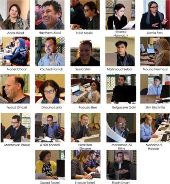
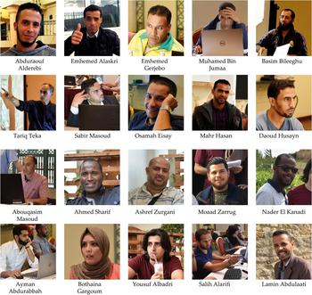
Participants were selected by our partner institutions from within their body of employees following a number of guideline criteria. It was stipulated that as far as possible all regions of the countries involved should be represented, with efforts made to achieve an equal gender balance where possible. It was requested that those attending the workshops should have general computer skills and have heritage management as their primary job role. In Tunisia the majority had the job title of conservator, although with varying degrees of seniority (Figure 1). They have general responsibilities regarding development control within the area administered by their regional offices. Architects responsible for standing buildings and monuments formed another significant group, with a smaller number of museum curators and researchers. A handful had completed doctoral research in the field of archaeology, and most were undertaking some form of doctoral or postgraduate study. In Libya, the majority were development control archaeologists or civil engineers with responsibilities for projects affecting heritage sites (Figure 2). A number possessed degrees and postgraduate degrees in archaeology. One gentleman, the controller of the south of the country, has completed doctoral research in the subject area of prehistory.
The Tunisian Participants.

The Libyan Participants.

In any given week the training team consisted of a minimum of five tutors: three project employees, supported by two Libyan nationals who also translated lesson content. All tutors possessed PhDs in archaeology, the majority related to North Africa. We were very fortunate to have four dedicated individuals performing the role of tutor/translator, all of whom gained PhDs from the University of Leicester's School of Archaeology and Ancient History, and went on to work in Higher Education within Libya. A total of 12 EAMENA staff visited Tunisia to be involved in the training workshops as tutors for varying lengths of time. The Training Manager was present for the entirety of each programme, with long stints also completed by Dr Nichole Sheldrick, Dr Julia Nikolaus and Dr Louise Rayne. The remote-sensing expertise provided by Dr Rayne in particular was crucial to the success of the advanced workshops. Finally, the EAMENA directors and members of the British Council also made a number of visits to observe the training and interact with the trainees.
Methods and new technologies
The EAMENA project's work in both Libya and Tunisia has been able to expand on previous capacity building projects on the one hand, and to take advantage of recent technological developments and open access initiatives on the other. Euromed Heritage I-IV along with UNESCO and World Bank initiatives, for example, have invested millions in Tunisia's heritage sphere. Digital recording systems based on international standards developed by the Gestion du patrimoine (Julien Reference Julien2003; Lavecchia Reference Lavecchia2003) and IPAMED projects (ARS and GHK 2004, 21–27) can be seen as direct predecessors of the modified Arches system employed by the EAMENA project (Zerbini Reference Zerbini2018). Libya, by contrast, has been involved in fewer capacity building projects, but there is a line of continuity linking the Cultural Protection Fund grants to the EAMENA and Training in Action projects with the curtailed training work conducted by the University of Leicester in 2011, and the work of the American Mission in Libya between 2005 and 2016 (Kane et al. Reference Kane, Raynolds and Carrier2017).
A number of fortunate and timely developments in information technology and remote sensing have allowed us to use almost exclusively open-source software and open-access data. This has ensured affordability for heritage management institutions with limited budgets, and at the same time has opened up the skills set we wish to teach to a far greater number of potential students. Perhaps the most important development in this direction has been the launch of the series of Sentinel satellites by the European Space Agency. Previously, free satellite imagery available through platforms such as Google Earth Pro, although higher in resolution, had been usable only to detect historic damage to sites. Imagery captured by the Sentinel 2a satellite, launched on 23 June 23 2015, and the Sentinel 2b satellite, launched on 7 March 2017, offers global coverage at 10 m resolution on a weekly basis. This has created a revolutionary opportunity to detect degradation to archaeological sites caused by urban growth, agricultural expansion, or infrastructural development projects as it occurs (Tapete and Cigna Reference Tapete and Cigna2018).
In order for this new imagery to be used successfully, however, it is also necessary to acquire a set of complementary skills. First of all, knowledge about the location and nature of archaeological sites needs to be collected in a spatial database, requiring at least basic database entry and querying skills from the heritage manager or researcher. To be able to view this information and overlay the most recently available satellite imagery requires an acquaintance with Geographic Information Systems (GIS). The EAMENA project has been able to rely on the open-source database software PostgreSQL for its spatial databases, communicating with the open-source QGIS via PostGIS in order to conduct analysis. This has solved the once severe problem of expensive software licenses, which previously inhibited the spread of skills in this area.
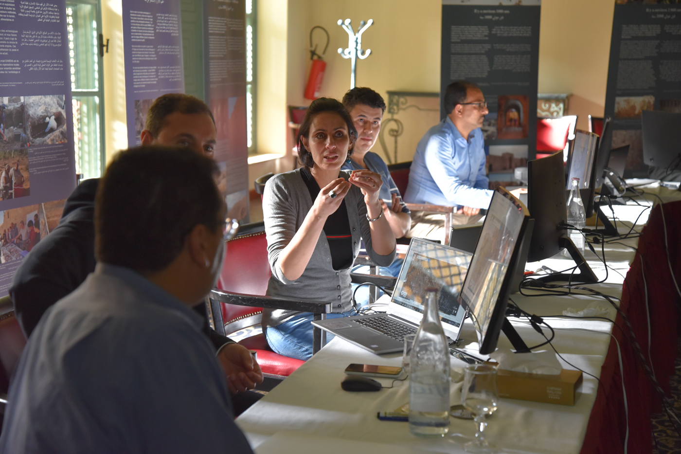
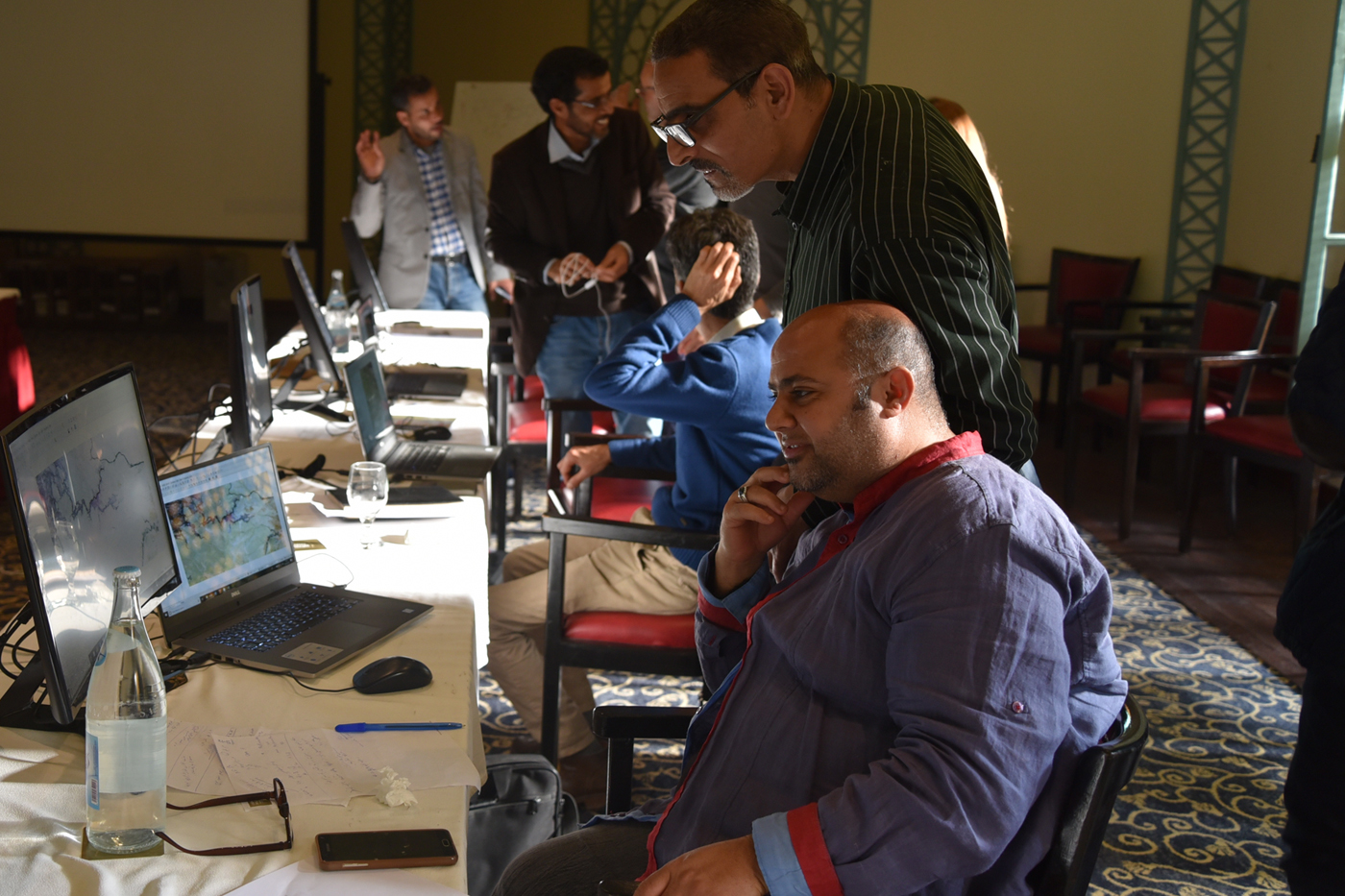
A third development of fundamental importance has been the establishment of Google Earth Engine (GEE) from late 2010 onwards, reaching widespread use in academia from about 2016 (Gorelick et al. Reference Gorelick, Hancher, Dixon and Ilyushchenko2017; Kumar and Mutanga Reference Kumar and Mutanga2018). With a user-friendly interface, the processing power of supercomputers can now be leveraged from the most basic personal computer. GEE can be used for many analytical functions. During the training workshops we used GEE and Sentinel 2 imagery to observe the current state of expanding quarries, housing estates, and agricultural farms in Libya and Tunisia, and their relationship to archaeological sites (Figure 5). We were also able to compare the more recent Sentinel imagery with historic imagery taken during the 1980s by the Landsat 5 satellite, for example, to observe the scale of change over time. For this purpose we also used the GEE Timelapse website as a platform for generating discussion about the major threats in various regions (Figure 3). More advanced uses of GEE have also been developed by Dr Louise Rayne at the University of Leicester in which Sentinel 2 imagery can be used to automatically detect significant pixel change in the vicinity of archaeological sites, using points and polygons of site locations entered into the spatial database by our participants. Such pixel change may well be indicative of damage or significant threat to archaeological preservation, and in the coming months we hope to trial such automatic detection with fieldwork conducted by our participants. This fieldwork will ground-truth the significance of automated alerts and validate the remote sensing workflow.
Tunisian Heritage professionals discuss threats to archaeological preservation.

Considerable effort was expended in producing the majority of training materials in both English and Arabic so that they can be followed by most people in the MENA region in possession of a laptop and with access to the internet. A combined result of the project's positive ethos towards the sharing of skills and of the current academic environment, which has encouraged the development of open-source software and remote-sensing data, each of our participants is now able to share the skills they have acquired with friends and colleagues. Thousands of interested individuals from beyond our partner institutions have been accessing our training content in online videos. Portable exhibitions introducing the archaeology of each country, and the threats it faces, were also produced as part of the CPF grant, in English and Arabic for Libya and in French and Arabic for Tunisia. Physical copies of the exhibition were deployed in-country in early 2019 and an online version will follow very soon.
Workshop content
From the above it will already be clear that the content of the workshops was highly technical, with a number of different software programmes being introduced. We structured the two-week basic training workshops to move from basic principles to more complex analysis. In the beginning we worked with clear examples of archaeological sites visible on satellite imagery, followed by the introduction of Google Earth Pro. We quickly moved from the use of well-known or clear archaeological examples to encouraging the participants to examine satellite imagery of sites from within their own regions of responsibility and expertise, familiarising them with a standardised glossary of terms (Rayne et al. Reference Rayne, Bradbury, Mattingly and Philip2017a, Section 2.2).
By the end of the first week each participant had chosen a study region of about 650 km2 defined by a grid based on WGS 1984, which they would then work with over the following months (Figure 4). Study within their chosen region involved the recording of previously known sites from surveys and archives, as well as the discovery of unrecorded sites through the inspection of high-resolution satellite imagery. We moved through the various elements of spatial database functionality, from data entry to querying and analysis. An afternoon of GPS training at an archaeological site was included which involved loading data into the GPS and downloading data from it. Participants were encouraged to use GPS in the course of their everyday work, to locate sites they had seen on satellite imagery, or to record the location of sites that they knew the location of on the ground. At the end of the two-week initial course participants were able to analyse and categorise data from their chosen regions in various ways, including satellite image analysis, and to make maps and figures of the resulting patterns using QGIS. Presentations given on the final day of the workshop included figures made by the participants with data from their chosen study regions, including condition assessment and damage causes.
The location of the chosen study regions in Tunisia and Libya.

Between basic training and advanced training participants were given the task of continuing data collection and analysis within their chosen EAMENA grid square. The participants were allowed to continue working with a laptop and GPS donated by the EAMENA project to their partner institution. A total of over 3,000 sites was recorded by the two groups of participants at this stage. Reports on the distribution of archaeology within each study region and the major patterns of damage and threat formed the basis of the selection process for the advanced training workshops.
Advanced training involved continuing the momentum of data collection in each personal study region and collecting feedback about the challenges the participants faced during data collection. Severe examples of threat and damage to archaeological sites were discussed and remote-sensing and GIS skills revised. We also focussed more closely on skills with GEE and introduced a version of Open Foris’ Collect Earth programme, adapted by Louise Rayne to allow data entry to the training databases directly from Google Earth Pro's user interface.
Results and the future
Despite the best efforts of the INP and DoA damage to archaeological sites within Libya and Tunisia was recorded in each of the zones investigated. In Tunisia the archaeological sites have been affected by considerable urban and agricultural expansion (Gutron Reference Gutron2010; Nardella and Cidre Reference Nardella, Cidre, Labadi and Logan2016). The well-known ‘Save Carthage’ excavations funded by UNESCO in the 1970s provide one example of mitigation against the threat of urban expansion (Ennabli Reference Ennabli1992). A contrasting story is told by the current state of the important site of Sabra El Mansouria on the outskirts of Kairouan, now largely built over. In the last decades, large infrastructural projects, such as the construction of dams for reservoirs at Tabarka and Siliana have had a large impact, as has the construction of Enfida airport, with little archaeological mitigation work. The scale of destruction and pollution of prehistoric sites in the phosphate producing regions of the central south is massive. Plans to begin phosphate extraction at the Sraa Ouertane mine, should they go ahead, would destroy large parts of a prehistoric funerary landscape around the Numidian and Roman town of Althiburos (Ben Baaziz Reference Ben Baaziz1986, Reference Ben Baaziz2000; Kallala et al. Reference Kallala, Sanmarti and Carme Belarte2017). Smaller scale stone quarrying is, however, also a constant threat to numerous sites. The worst example is probably the stone quarry at the Roman and Byzantine town site of Thelepte.
The recording of many thousands of ancient sites in the late nineteenth and early twentieth centuries in the archaeological Atlases provides an opportunity to quantify the number of sites now overbuilt, or being degraded considerably by agricultural ploughing (Babelon et al. 1892–Reference Babelon, Cagnat, Reinach and Merlin1913; Cagnat and Merlin 1914–Reference Cagnat and Merlin1932). In addition to the old archaeological atlases, which contain a bias towards classical sites, the INP has been conducting archaeological survey on a large scale during the last two decades and updating a central database of site locations inherited from the above mentioned IPAMED project (Institute National du Patrimoine and Euromed Heritage 2004). The locations of tens of thousands of archaeological sites are known, but access to the information is currently not being shared as efficiently as it could be with the development control officers. Developer-funded archaeological investigation is not practised in either Libya or Tunisia, although the INP will experiment with this model during the planned construction a new road between Tunis and Kairouan in the near future.
In Libya no national centralised database of archaeological sites yet exists and collating all of the available information concerning the location of archaeological sites, from old military maps, surveys conducted by the Department of Antiquities, foreign research teams and oil companies is a task of extreme urgency. The recorded distribution is heavily biased towards the north of the country. Insufficient archaeological survey work has been undertaken in the southern regions, which are being affected by oil extraction and expanding agriculture, to allow detailed mitigation strategies to be developed (Mattingly Reference Mattingly2006). Heritage managers in Libya are working in a very difficult context in which it is extremely difficult to enforce the law and to prevent damage even to some of the most important world heritage sites. In 2016 all five of Libya's World Heritage sites were put on UNESCO's endangered list. Deterioration of state infrastructure from 2011 onwards, combined with a building boom in a number of regions following the revolution, has resulted in severe threats to archaeological sites from urban growth (Rayne et al. Reference Rayne, Sheldrick and Nikolaus2017b).
An associated effect of this is the huge surface area being disturbed by the practice of quarrying to produce cement. In the hinterland of Lepcis Magna there has been huge expansion of quarrying relating to cement factories destroying and threatening the preservation of numerous ancient farm sites. Quarrying activity on the coast just east of Sabratha, near the amphitheatre, needs urgent mitigation and recording work. A region known as the line of quarries is also having a large impact on the landscape east of Benghazi. As noted recently in this journal and elsewhere, the archaeological landscape around Cyrene is suffering greatly due to the unregulated urban expansion of Shahat and surrounding settlements and this can be witnessed in satellite data (Bennett and Abdulkariem Reference Bennett and Abdulkariem2014; Rayne et al. Reference Rayne, Sheldrick and Nikolaus2017b; Tapete and Cigna Reference Tapete and Cigna2018). A large area in the vicinity of Villa Silin containing important archaeological sites (Munzi et al. Reference Munzi, Felici, Cifani and Cirelli2004) has been bulldozed in recent years. In more remote areas where the threat of urban development and agricultural expansion is less, significant levels of looting have been identified. Little to no archaeological mitigation work was carried out in association with the construction of the Great Man-made River during the 1980s and 90s, which has since had a negative impact on archaeological sites through the expansion of irrigated agriculture. Indeed, in a number of desert environments there has been a massive increase in the area exploited for agriculture, resulting from drill holes exploiting palaeowater reservoirs (e.g. in a vast region south of Sebha). This is having a negative impact on surface scatters of prehistoric artefacts of international scientific interest and importance.
The Libyan participants examining Sentinel 2 imagery using Google Earth Engine.

The EAMENA project and in particular the training has been crucial for developing a discourse about the past, present and future of heritage management strategies in these two countries, the impact of which should be felt for years to come. During the initial evaluation process we learned that the training events were very well received by the participants and by our partner institutions, with both advanced groups expressing their interest in forming dedicated research teams on the subject of digital technologies and heritage management. Indeed, many of the participants now use the skills and equipment introduced by EAMENA in their everyday work and will continue to develop their regional case studies. One extremely positive result has come from a recent grant scheme offered to EAMENA training participants by Global Heritage Fund and through the generous sponsorship of the J.M. Kaplan Fund. A Tunisian/Libyan team headed by Héla Mekki won the largest of three available grants for the purpose of conducting survey in a poorly studied region spanning southern Tunisia and northwest Libya known for its troglodyte houses. The end result of the project will be a detailed evaluation and mitigation plan for some of the most important and most threatened archaeological sites of this region.
Acknowledgements
I would like to thank the project directors Bob Bewley, Andrew Wilson, David Mattingly and Graham Philip for the trust they put in me in the role of CPF Training Manager for Libya and Tunisia. As a team we are very grateful to the Arcadia Fund for enabling core EAMENA staff members to come out to Tunis at various times to support the training. Heartfelt thanks are extended to the Cultural Protection Fund Grant Managers for the very existence of the Training in Endangered Archaeology Methodology project and for the encouragement they gave when visiting Tunis for the Protecting the Past conference in 2017. We received a great deal of help from multiple individuals within the British Council, the British Embassy and the Foreign and Commonwealth Office. In particular I would like to thank former Libya Country director at the British Council Tony Calderbank for his help on two occasions with transporting the expensive computer and GPS equipment from the UK to Tunisia. Tony showed us great hospitality on our first visit to Tunis. His interest in visiting the training workshops and talking with the participants was mirrored by Robert Ness, Ben Lawton, Faisal Alnajah, Angus McKee and Justin Spence. We are extremely grateful to Her Excellency Louise de Sousa, British Ambassador to Tunisia, for generously hosting our closing certificate award ceremony on two occasions in 2018 and 2019.
Organisation of the training work would not have been possible without the friendly cooperation of Faouzi Mahfoudh and Taoufik Redissi at the INP in Tunisia and Mohamed Shakshuki, Ahmed Abdulkariem, Mustafa Turjman and Saleh Alhasi at the DoA in Libya. These gentlemen gave us help and support in selecting our participants and allowing them time to attend the workshops. I thank Muftah AlHddad, Ahmad Emrage, Ahmed Buzaian and Mohamed Abdrbba for their hard work, enthusiasm for protecting cultural heritage, and companionship during the workshops. To Moez Achour, who very kindly put on the EAMENA Tunisia exhibition at the Carthage National Museum in March 2019, we extend heartfelt thanks.
Finally I thank the participants themselves, who really applied themselves to the tasks we set and who taught us so much in return about the realities of current heritage management in Tunisia and Libya. Many of the participants provided images and content for the EAMENA exhibitions which are now on tour for local communities to see. Faouzi Ghozzi helped enormously with day-to-day communications. The Tunisian team very generously hosted us in a joint visit to the Bardo museum and for GPS training exercises at sites in Carthage and for site visits to Oudhna.