INTRODUCTION
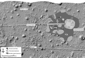
Near the center of Mexico's Yucatan Peninsula, a few kilometers east of the ancient Maya city of Yaxuna and in the collective agricultural landholding of the community of Yaxunah, there is a small archaeological site called Tzacauil. If you were to view Tzacauil from above, your eye might be drawn to three lines crossing east to west (Figure 1). Each line brought (or brings) people on foot through the forest closer to Tzacauil. Together, these lines inscribe in the landscape a history of walking and, with that history, a sense of how embodied understanding of Tzacauil as “rural” changed and continues to change.
Map of the Tzacauil site and surroundings, showing site architecture and terrain mosaic superimposed over LiDAR imagery. The modern access road is visible to the north, the Tzacauil Sacbe crosses the center to reach the Tzacauil Acropolis, and Sacbe 1 crosses to the south, connecting Yaxuna to the west and Coba to the east. Tzacauil house groups mentioned in the text are labeled. Adapted from Fisher (Reference Fisher2019:270). Malerized architecture for some structures has been redrawn from a map previously published by Hutson and colleagues (Reference Hutson, Magnoni and Stanton2012).

The first line built of the three dates to the Late Formative (ca. 300 b.c.–a.d. 1) to the Terminal Formative (ca. a.d. 1–250) and is known as the Tzacauil Sacbe. It blazes through the forest straight to the base of a large triadic group complex, the Tzacauil Acropolis, passing a scatter of some half-dozen low-lying stone platforms before reaching its destination.
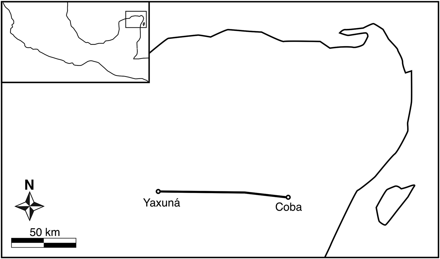
The second line, built centuries later, slashes through the forest in a clear and confident stroke. Sacbe 1, the longest known causeway in the Classic Maya world, streaks south of Tzacauil (Figure 2). It pays seemingly little regard to the small cluster of house foundations built and occupied around the same time period, the Late Classic (ca. a.d. 550–700) to Terminal Classic (ca. a.d. 700–1100).
Map of the northern Yucatán Peninsula, indicating the locations of Yaxuna and Coba, and the trajectory of Sacbe 1 connecting them. Redrawn from Stanton et al. (Reference Stanton, Freidel, Suhler, Ardren, Ambrosino, Shaw and Bennett2010:31).

The third line passes to the north. It winds and undulates as it bends to avoid bedrock bumps and dips. This line is a road and its builders improvised, as best they could, smooth passage for pedestrians, bicyclists, and the occasional truck traveling through the forest. For the past few decades, this road has connected Yaxunah community members to the eastern lands of their agricultural landholding. Outsiders, among them archaeologists like me, also use the road.
These lines express through their materials and trajectories three different ways of engaging Tzacauil on foot; the many other ways Tzacauil has been walked in the past two millennia are quieter in the landscape. Tzacauil is fairly small and only a short distance away from the much larger site of Yaxuna—for these reasons alone, can we consider Tzacauil to be rural? In this article, I push back against this kind of categorization, which tends to cast small outlying settlements as ahistorical. I focus on an anthropological framework of walking to explore how embodied understandings of small Maya settlements, like Tzacauil, as “rural” were social constructs sensitive to local historical change.
WALKING URBAN, WALKING RURAL
Walking intimately connects people and place through the production and reproduction of embodied, localized knowledge (Ingold and Vergunst Reference Ingold and Vergunst2008; Snead et al. Reference Snead, Erickson and Darling2009). “As people, in the course of their everyday lives, make their way by foot around a familiar terrain,” writes anthropologist Ingold (Reference Ingold2004:333), “so its paths, textures, and contours, variable through the seasons, are incorporated into their own embodied capacities of movement, awareness, and response.” Walking is a lived, embodied understanding of place (Carolan Reference Carolan2008), one that threads together landscapes and lives in a continuously unfolding historical process (Tilley Reference Tilley1994:29–30). As posed by human geographer Edensor (Reference Edensor2000:82), walking is “geographically and historically located practical knowledge…walking articulates a relationship between pedestrian and place, a relationship which is a complex imbrication of the material organization and shape of the landscape, its symbolic meaning, and the ongoing sensual perception and experience of moving through space.” Walking, then, is one way that people—now and in the past—experience and make embodied sense of urban and rural places.
Walking in cities produces and reproduces its own sort of “ambulatory knowing” (Ingold Reference Ingold2010:S129). In the words of urban theorist Lefebvre (Reference Lefebvre, Kofman and Lebas1996:102): “The city writes and assigns…it signifies, orders, stipulates.” For those of us accustomed to the urban landscapes of the twenty-first century, we might think of the gridded streets, sidewalks, traffic cones, police tape, orange plastic construction site fences, stop lights, lighting, curbs, gutters, street grates, and actual landscaping—flowerbeds, arbors, and trees—that constrain walking in cities today. City walking may often be sanitized and regulated; to describe this, Ingold (Reference Ingold2004) has written of the “groundlessness” of much urban walking, where walkers walking only on paved surfaces leave behind no footprints. Groundless walking divorces walkers from a fully grounded, embodied experience of the environment, sensitive to terrain, vegetation, and weather. Yet the way cities are experienced on foot is not at all universal, or predictable. Edensor (Reference Edensor, Ingold and Vergunst2008:127) says of walking through industrial ruins: “In contrast to the deliberate channeling of movement in the regulated city, the physical structure of ruins invites and constrains walking in a distinctive fashion,” one that is improvisational, alert, playful, disruptive, and expressive.
Similar to Edensor's ambling in industrial ruins, the phenomenon of desire lines shows too the historical contingencies shaping urban walking. Human-environment geographers Foster and Newell (Reference Foster and Newell2019), working with aerial images of the city of Detroit, Michigan, documented 5,680 unofficial footpaths (called desire lines), together measuring 157 linear miles, sinuating across the city's sprawling urban landscape. Desire lines form, grow, and fade as people's walking patterns respond to changes in Detroit's landscape, most notably to its rapid population declines. These ephemeral footpaths through vacant city lots are ad hoc solutions for the people who continue to make a home in this evolving landscape. That evolution can occur in bursts: within a single six-year period, Detroit lost 758 footpaths and gained 99 new ones. Walking is changing alongside changes in land ownership, changes in the development and abandonment of spaces within the urban landscape. Desire lines, in the framing of feminist writer Ahmed (Reference Ahmed2006), queer walkers’ on-the-ground experience of cities by moving them away from predictable pathways prescribed by streets and sidewalks. When these pathways start to show up, they suggest a return to grounded walking, that certain regimented ways of walking have already been rejected—that the neglected sidewalk perhaps once made sense but now no longer does.
Rural walking, too, creates and recreates its own ambulatory, embodied knowing (Woods Reference Woods2010). I have described how urban walking holds tension between ordered movements and transgression of that order; rural walking, similarly, has its own contradictions. Rural walking is more improvisational, more grounded (Ingold Reference Ingold2004) to the land and its contours: dirt roads, trails cleaving to hilly undulations, and cross-stream stepping stones. Grounded walking is conversation between walker and environment. Yet, while the substrate of rural walking is closely incorporated with the land itself and the paths more ephemeral than city sidewalks, when rural walking is habitual it, too, shapes the landscape. “The countryside is partly produced by the regular routes which walkers follow,” writes Edensor (Reference Edensor2000:82). Footpaths may be used for generations, as permanent in practice as the slabs of concrete prescribing pathways in cities. Because rural walking's footpaths and trails tend more towards “groundedness” (Ingold Reference Ingold2004), accumulations of footprints on the earth become archives of pedestrian history. A walker “leaves footprints in the ground as clues to (their) whereabouts and intentions, and for others to follow…One cannot, then, read individual movements from a path, but only those commonly or collectively made” (Ingold Reference Ingold2010:S129). This recalls the urban desire lines described earlier, which defy—or simply ignore—the groundless prescriptive paths of sidewalks and paved walkways.
The coexistence of and potential tension between grounded walking and groundless walking becomes especially important when considering the biases inherent in archaeological research. Ingold's (Reference Ingold2004) conception of groundless walking—that is, walking on pavement and artificial surfaces more generally—is more closely associated with cities and construction. Groundless walking is more detectible in the archaeological record. Archaeological explorations of past Maya walking have focused, unsurprisingly, on the kinds of ordered walking associated with the so-called built environment of urban landscapes. The boundary walls and constructed walkways documented at Classic period Maya cities offer clear avenues into discussion of pedestrian movements (Benavides Castillo Reference Benavides Castillo1981; Benavides Castillo and Manzanilla Reference Benavides Castillo, Manzanilla and Manzanilla1987; Goñi Motilla Reference Goñi Motilla1993; Kurjack Reference Kurjack1974; Magnoni et al. Reference Magnoni, Hutson and Dahlin2012; Shaw Reference Shaw2008; Vargas et al. Reference Vargas, Santillan and Vilalta1985).
Along with boundary walls, roads have structured archaeologists’ studies of walking in the Maya world—particularly in Maya cities. In Classic and earlier Formative Maya centers, raised limestone causeways—called “sacbes” by archaeologists after the Yucatec Mayan term for “white road”—connected and channeled walking within and between nodes of settlement. Extensive sacbe networks have been documented at large urban centers throughout the Maya area, including Caracol (Chase and Chase Reference Chase and Chase2014), Calakmul (Folan et al. Reference Folan, Hau, Marcus, Miller and Heredia2001), El Mirador (Sharer Reference Sharer, Danien and Sharer1992), and Tikal (Haviland Reference Haviland1970), as well as in village settings as at Ceren (Sheets et al. Reference Sheets, Dixon, Lentz, Egan, Halmbacher, Slotten, Herrera and Lamb2015). In the northern Maya lowlands of the Yucatan Peninsula, where Tzacauil is located, Maya people built sacbes of varying length—ranging from less than one kilometer to 100 km (Shaw Reference Shaw2008)—across their landscapes, spanning within and between urban and urbanizing settlements (Anderson Reference Anderson2011; Hutson and Welch Reference Hutson and Welch2014; Hutson et al. Reference Hutson, Magnoni and Stanton2012; Stanton and Freidel Reference Stanton and Freidel2005). Archaeologists have been wondering how past northern Maya people actually used all these roads for nearly a century (Villa Rojas Reference Villa Rojas1934), and through the decades have generated convincing cases for the roads’ roles in pilgrimage, economic exchange, administration, and political integration (Chase and Chase Reference Chase and Chase2001; Folan Reference Folan and Trombold1991; Hutson Reference Hutson2010; Keller Reference Keller, Snead, Erickson and Darling2010; Rohrer and Stanton Reference Rohrer, Stanton, Pennanen and Goosney2019; Shaw Reference Shaw2008, Reference Shaw, Alcock, Bodel and Talbert2012; Stanton et al. Reference Stanton, Ardren, Barth, Fernandez-Diaz, Rohrer, Meyer, Miller, Magnoni and Pérez2020). Sacbes helped form the landscape and lived experience of Maya cities; they made groundless walking possible.
Sacbes’ particular kind of groundless walking may diverge from the sterile pavement-pounding envisioned by Ingold (Reference Ingold2004), but I reckon still that walking a sacbe would have produced an embodied experience of landscape fundamentally different from (but not the opposite of) traversing grounded trails. While Ingold's groundlessness conjures a kind of walking that is totally neutral, Hutson and colleagues (Reference Hutson, Kilgore, Conley, Welch, Stanton and Ardren2020) have pointed out that sacbe walking would have been extraordinarily sensuous (see also Kurnick and Rogoff [Reference Kurnick and Rogoff2020] for recent discussion of sensuous walking in Maya landscapes). Sacbes’ plaster surfaces were capable of manipulating temperature, light, smell, and sight—all of which would have affected the bodies of walkers, as would have the time of day, night, season, or year in which they were walked. When I say that sacbe walking tends towards groundless, then, it is not to suggest that sacbe pedestrians were automatons or that sacbe walking lacked the sensuous richness of trail walking—it was just a different sort of sensuousness. And one of the major ways it was different was that sacbes, unlike footpaths or trails, imposed onto the landscape the possibility for more ordered, regimented forms of walking by placing physical barriers between the walker's feet and the grounded terrain.
Yet it is important to remember that while these groundless ways of walking in Maya cities would have created the possibility for regimented walking, their construction also called into being a range of possibilities for walkers to flout, transgress, and ignore that regimen. “Whereas occupants march along roads, inhabitants more usually step across them,” write Ingold and Vergunst (Reference Ingold and Vergunst2008:6). Maya archaeologists still lack a clear sense of precisely how sacbes were used—and who got to walk on them—but the sprawling, low-density layout of many Classic Maya cities (Fisher Reference Fisher2014; Isendahl Reference Isendahl2012; Lucero et al. Reference Lucero, Fletcher and Coningham2015) suggests that for most walkers on most days, urban walking was grounded to footpaths and trails.
Subtle are archaeological traces of grounded walking, the sort of walking that shaped most Maya people's everyday embodied understanding of land whether they lived in cities or in rural hamlets. At the rural Classic farming community of Chan Noohol, Robin (Reference Robin2002, Reference Robin2012) found that the areas immediately surrounding houses and the areas connecting houses to patios had packed surfaces. She interpreted this as a sign of frequent, habitual walking—returning to and leaving home. As walkers moved further away from their houses and patios, their paths scattered out depending on the day's plan; the remnants of their footsteps fan out and fade away. Likely Chan's walkers had other paths, but given the nature of archaeological preservation, only the areas where walking was most habitual and most condensed remain detectable.
The paths of grounded walking may be ephemeral in the archaeological record, but ethnographic and Colonial-era documentary accounts suggest that some rural Maya communities maintained webs of trails for generations. Among twentieth-century Tzotzil Maya people living in the highlands of Chiapas, during certain holidays every year leaders and ritual participants would walk a circuit visiting and performing ceremonies at important places in the community landholding (Vogt Reference Vogt1961, Reference Vogt, Vogt and Leventhal1983). These walkers would visit in an ordered sequence the wells, caves, and other key locales in the landscape as a way of reaffirming the community's boundaries and its multigenerational connections to sacred places. Walking as a practice for affirming relationships between people and land is suggested also in Colonial Yucatec Maya documents, which refer to places through the listing of landmarks that give boundaries to a community lands (Marcus Reference Marcus, Sabloff and Henderson1993; Roys Reference Roys1957; Tozzer Reference Tozzer1941). These sources glimpse the social memory that could keep footpaths and trails alive for generations in landscapes. Through collective remembering and repeated walking, grounded pathways could be maintained for centuries—but once forgotten, could melt back into the forest in a single generation, year, or even season.
There are a few key points to distill from this before I move to focus on Tzacauil more specifically: the first is that, probably through most of Maya history before the Colonial era, most walkers in most places and on most days walked not the groundless routes of paved sacbes, but rather a grounded network of relatively ephemeral footpaths and trails that could be maintained, adjusted, and abandoned as individual and collective walking changed. The second key point is that when sacbes and other paved surface walkways were constructed—most prevalently, in urban centers—they created an added possibility for more regimented, visible kinds of walking. The relationship between regimented walking and improvisational walking, this coexistence and potential tension between groundless and grounded ways of walking, then, formed part of walkers’ embodied understanding of urban spaces in the Maya area, prior to Colonialism. Walking in places where this contrast was unmarked or unpronounced reproduced a different sort of understanding of space, one that I propose is useful for considering how Maya settlements could have been experienced as rural. The third key point is that these embodied understandings of rural and urban spaces were historically contingent and subject to change. Documenting histories of walking can help archaeologists reckon our definitions of “rural” by moving beyond ahistorical markers, like site size, and by attending to the dynamic ways in which places were understood in embodied, experiential ways.
TZACAUIL AND YAXUNA
Maya archaeologists have tended to label small sites outlying larger sites as “rural” by virtue of their being small and outlying; such treatment tacitly casts these smaller sites as ahistorical and static, their inhabitants passive onlookers to the actions and agency of city-dwellers. A focus on walking shifts attention to how past Maya people experienced these so-called rural places on the ground. How did walking, as a form of embodied knowledge of place, inform how these small, outlying settlements were understood on the ground? And how can attention to walking enhance and historicize anthropological frameworks of so-called rural life over long periods of time?
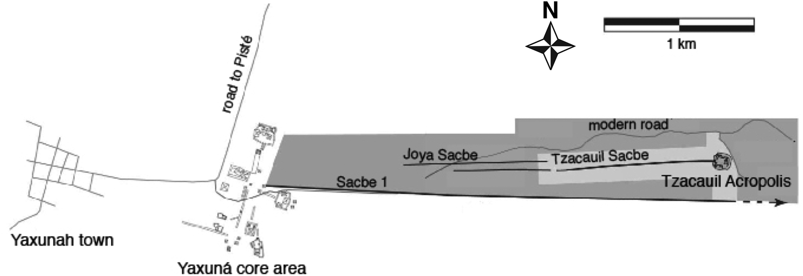
I approach these questions through my ongoing research in the ejido (collective agricultural landholding) of Yaxunah. The Yaxunah ejido is located in the northern Maya lowlands, in the central part of the Mexican state of Yucatán. Yaxunah itself is a town of about 600 people, many of whom are Yucatec Mayan speakers (Alcocer Puerto Reference Alcocer Puerto, Bascopé and Cano2010; Hernández Álvarez Reference Hernández Álvarez2014). Yaxunah's ejido lands include several pre-hispanic and Colonial-era archaeological sites, the most well-documented of which is Yaxuna (Figure 3), which was the political center of the central Yucatan region from the Middle Formative through much of the Classic period (Stanton et al. Reference Stanton, Freidel, Suhler, Ardren, Ambrosino, Shaw and Bennett2010; Tiesler et al. Reference Tiesler, Cucina, Stanton, Freidel and Ardren2017). Archaeological research at Yaxuna has been ongoing for decades, most recently under the regional project Proyecto de Interacción Política del Centro de Yucatán (codirectors from 2007 to 2017 have included Stanton, Hutson, Magnoni, and Ardren).
Map showing Tzacauil in relation to the archaeological site of Yaxuna and the modern town of Yaxunah. Modern and ancient roads are indicated, including the Tzacauil Sacbe, the Joya Sacbe (not described here, but see Hutson et al. [Reference Hutson, Magnoni and Stanton2012]), Sacbe 1, and the modern access road for the eastern part of the Yaxunah ejido. Map adapted from Hutson and colleagues (Reference Hutson, Magnoni and Stanton2012:298).

Tzacauil is an archaeological site located near the eastern edge of Yaxunah's ejido lands and just under an hour's walk from Yaxuna's central core; Tzacauil is a small settlement outlying a much larger settlement and thus checks the boxes by which many Maya settlements have been labeled as “rural.” Mapping conducted by Hutson and colleagues (Reference Hutson, Magnoni and Stanton2012) recorded information about the dimensions and spatial organization of the site's architecture. I later carried out a three-season program of survey, excavation, and intrasettlement investigation to understand household and community dynamics during Tzacauil's two major occupations, first in the Late to Terminal Formative (ca. 300 b.c.–a.d. 250) and later in the Late to Terminal Classic (ca. a.d. 550–1100; described in Fisher [Reference Fisher2019]).
The site centers around a pyramid, the Tzacauil Acropolis. The acropolis’ basal platform measures 80 × 70 m at its top, 110 × 105 m at its base, and is 8 m tall. On top of the basal platform are eight superstructures, the tallest of which reaches an additional 6.5 m above the basal platform surface. West of the acropolis is scattered a settlement of two-dozen structures that, based on my excavations, I have organized into nine house groups. The settlement is cut in half by a raised limestone causeway, the Tzacauil Sacbe, which emerges from the base of the acropolis and runs west before ending about halfway between Tzacauil and Yaxuna (Hutson et al. Reference Hutson, Magnoni and Stanton2012). The Tzacauil Sacbe appears to have been built in the Late Formative and abandoned to disrepair when the rest of the Tzacauil settlement was initially abandoned at the end of the Terminal Formative period.
Yaxuna is less than an hour's walk away (3.2 km) from Tzacauil and is much larger (Figure 3). Yaxuna emerged as a major center in the Late Formative period. Much of its monumental architecture and boulder-lined residential platforms were built at that time, though there is plenty of evidence to suggest that Yaxuna's role as a gathering place began much earlier (Collins Reference Collins2018; Stanton and Ardren Reference Stanton and Ardren2005; Stanton and Collins Reference Stanton and Collins2017; Stanton et al. Reference Stanton, Freidel, Suhler, Ardren, Ambrosino, Shaw and Bennett2010). As at Tzacauil, the construction of paved walkways—sacbes—articulated and ordered Late Formative Yaxuna's landscape. Around the same time that Tzacauil was abandoned, Yaxuna experienced a brief lull in activity, but the center's population recovered and reached record highs in the Terminal Classic period. Classic Yaxuna was heavily involved in regional politics, as evidenced by the construction of Sacbe 1, a raised limestone causeway that spans 100 km to connect Yaxuna with the center of Coba (Cobos Reference Cobos, Ciudad, Ponce de León and Carmen Martínez2001; Shaw Reference Shaw2008; Stanton et al. Reference Stanton, Ardren, Barth, Fernandez-Diaz, Rohrer, Meyer, Miller, Magnoni and Pérez2020; Villa Rojas Reference Villa Rojas1934), passing south of Tzacauil as it shoots east across the peninsula.
INTEGRATING METHODOLOGIES
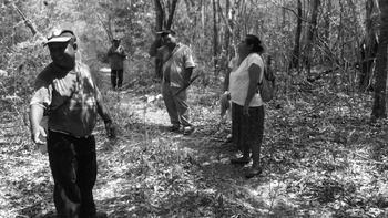
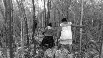
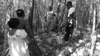
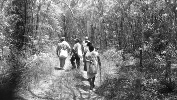
My approach to walking at Tzacauil is informed by the archaeological research I conducted at the site and in the surrounding ejido lands. Much of this work involved close engagement with Yaxunah community members, many of whom have several seasons’ worth of experience working on archaeological projects. Members of the Yaxunah community have their own walking understanding of ejido lands—they are the land's living inheritors and, for many, their livelihood is tied to the land. As part of my work documenting environmental and agricultural history at Tzacauil, I spent time walking Tzacauil with six Yaxunah farmers and gardeners (Fisher and Ardren Reference Fisher and Ardren2020). The informal name given this walking by the community members was xíimbal k’áax, a Yucatec Mayan term that describes the practice of walking the forest to select a parcel for milpa cultivation (Figures 4–7).
Yaxunah community members on the xíimbal k’áax survey of Tzacauil. Photograph by the author.

Yaxunah community members on the xíimbal k’áax survey of Tzacauil. Photograph by the author.

Yaxunah community members on the xíimbal k’áax survey of Tzacauil. Photograph by the author.

Yaxunah community members on the xíimbal k’áax survey of Tzacauil. In this image, they are walking the modern road used to access the eastern part of the ejido. Photograph by the author.

We covered the archaeological site on foot, focusing on the areas around house groups to evaluate whether and how these areas might have been used as houselots, the outdoor activity areas surrounding dwellings typical of past and present houses in Yucatan. Community members shared observations and oral histories about soil, terrain, and plant and animal life in the site. I documented this information spatially using an iPad equipped with LiDAR data, the geological fieldwork app FieldMove, a GPS, and a video camera (Fisher Reference Fisher2019:130–138).
As we walked Tzacauil together, the Yaxunah community members repeatedly pointed out two kinds of terrain that form a patchwork across the site: kancabales and tzekeles (Figure 1). Kancabales are flat, low-lying expanses of reddish-brown soil (kancab). Tzekeles are areas of exposed bedrock (tzekel), which forms either (1) flat expanses pockmarked with depressions and cavities that can be used seasonally to collect and store rainwater, or (2) large outcrops that jut out from the ground and crumble at the edges into boulders. Each terrain—the soil-rich kancabales and the bedrock tzekeles—is associated with particular plant communities and each, I was told, offers different advantages and drawbacks for living on it. Kancabales have fairly deep soils and are good places to plant, but during the rainy season they inundate and become so muddy that they are difficult to walk on. Tzekeles cannot be cultivated as easily (though see Fedick et al. [Reference Fedick, De Lourdes Flores-Delgadillo, Sedov, Solleiro-Rebolledo and Palacios-Mayorga2008]) but they provide firm footing above the soil flats, drain well, provide building materials, and offer seasonal water storage. This patchwork of bedrock and soil played an important role in the ways people walked the site in the past, and certainly played that role during our fieldwork.
Following xíimbal k’áax survey with Yaxunah community members, I directed horizontal excavations of Tzacauil's house groups and several of the open areas between and around house groups (Fisher Reference Fisher2019:164–301). I use data collected from those excavations to interpret how walking in Tzacauil changed from its first major occupation in the Late to Terminal Formative to its second (and last) major occupation in the Late to Terminal Classic. In the sections below, I bring excavation data into conversation with what I learned from walking Tzacauil alongside Yaxunah community members.
WALKING TZACAUIL IN THE FORMATIVE PERIOD
Tzacauil's monumental architecture—the Tzacauil Acropolis and Tzacauil Sacbe—and at least five of its house groups were built in the Late Formative and Terminal Formative (dating these contexts more specifically within these periods was challenging, and here I will at times collapse the terms together and use “Formative”; Fisher Reference Fisher2019:149). The Tzacauil Acropolis visually dominates the landscape, yet it is the sacbe that orders the surrounding settlement. The sacbe originates from and arrives at the base of the Tzacauil Acropolis, where it measures 9 m across. As it moves west towards Yaxuna, the Tzacauil Sacbe's width fluctuates between six to 10 meters and its height gently undulates between 30 and 50 centimeters above the ground surface for most of its trajectory. The Tzacauil Sacbe appears to be headed towards Yaxuna's central E-Group Plaza, but does not reach that presumed destination for reasons explored elsewhere (Fisher Reference Fisher2019:175–176; Hutson et al. Reference Hutson, Magnoni and Stanton2012). When it was built in the Late Formative, the Tzacauil Sacbe was not the only sacbe in central Yucatan, as some of the earliest urbanizing construction projects in Yaxuna included sacbes, but it would have been among the longest such causeways in the Maya area at the time (Hutson et al. Reference Hutson, Magnoni and Stanton2012; Stanton et al. Reference Stanton, Freidel, Suhler, Ardren, Ambrosino, Shaw and Bennett2010).
The Tzacauil Sacbe materializes the possibility of ordered, regimented walking in the Formative settlement. The community leaders who organized the sacbe's construction and the laborers who built it altered what it meant to walk in Tzacauil. The causeway is flanked by the Formative houses and leads straight to the stairs of the Tzacauil Acropolis, creating the possibility for new kinds of ambulatory understanding of this place and the community living there. At select times and for certain walkers, the sacbe could have enabled an embodied experience of landscape that was potentially more formal, constrained, and public. Special processions may have occurred regularly on the sacbe, and individual and collective memories of those highly charged ways of walking may have imbued the sacbe with particular meaning for community members in between processions. At the same time, we can infer that for Formative community members—who likely walked along the sacbe's length and crossed over it often in the course of their daily lives—the sacbe was part of an everyday embodied understanding of landscape. The presence of this regimented pedestrian artery and its constructed surface created the possibility for regimented, groundless walking, and, with this possibility, created also a contrast with the ephemeral pathways and winding trails of grounded walking.
Intrasettlement areas—spaces surrounding Tzacauil's house groups—hold hints of the grounded walking happening around the sacbe. Between and around houses, walking involved an ordering of the land's terrains into pathways and corridors. There are five documented Formative house groups at Tzacauil, and all were built on bedrock outcrops surrounded by flat expanses of low-lying soil, or kancabales (Fisher Reference Fisher2019:266). When deciding where to settle, Formative householders spaced themselves out across the area surrounding the Tzacauil Acropolis and Sacbe; they sought to “plant” their homes in parcels of land with relatively high agricultural potential. These founding households gathered up the stuff of the local environment—limestone boulders, rubble, and earth—and reordered it into houses. Houses, “planted” in this way, materialized multigenerational relationships between households and soil-rich places.
But householders’ choices to “plant” their houses on bedrock outcrops surrounded by soil came at a cost in walkability: the soil flats become mud traps during the months of the rainy season. This hitch was emphasized to me repeatedly by the Yaxunah community members who walked Tzacauil with me when we ran the xíimbal k’áax survey; their observation about the mud problem came from their own close intimacy with the land and I doubt I would have recognized it on my own. Kancabales would be a slippery mess to walk on for several months every year. Yet Formative households at Tzacauil seem to have been willing—and prepared—to overcome the seasonal drawbacks of living surrounded by soil.
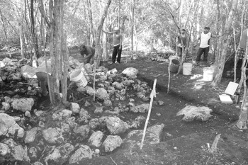
My crew and I documented one solution to this kancabal walkability issue at two Late Formative house groups, the P'aak Group and the Jach Group. Our excavations uncovered stones around the perimeter of the basal platforms of these two house groups (Figure 8). These stones appeared to have been placed deliberately, but not particularly carefully; they formed a sort of rudimentary pavement along the sides of the basal platforms. Seeing these crude pavements during excavations reminded some Yaxunah community members in the field crew of how their grandparents had dealt with rainy season mud in their own houselots, back in the mid-twentieth century. Since cement was harder to get back then, people in Yaxunah arranged stones into ad hoc pavements outside their houses and in frequently visited areas of their houselots so they could walk more easily, avoiding mud and puddles. When these stone pavements would get beat up and need to be replaced, they looked, some Yaxunah community members told me, just like the ones we found around the P'aak and Jach Groups.
Ad hoc pavement around the perimeter of the P'aak Group at Tzacauil. Photograph by the author.

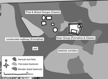
Another way Late Formative householders made kancabales more walkable was by combining natural and artificial topography to create networks of walkable corridors (Figure 9). These corridors connected house groups to each other and to intrasettlement areas used for cultivation, water collection, and other household activities. One Late Formative house group, the Kaan Group, was built on a strategic site that would have facilitated householders’ access to low-lying soil flats and to natural bedrock walkways. The Kaan Group incorporates a long, fairly narrow outcrop of bedrock into the eastern side of its main platform. This bedrock provides not only a natural ramp by which the platform could be accessed, but it also creates a sort of bridge extending back to an area of exposed bedrock. There, south of the Kaan Group, the exposed bedrock terrain is riddled with natural pits and cavities. During the rainy season months, these cavities served as seasonal water storage. Since this area was connected to the Kaan Group's basal platform via a stable, elevated bedrock corridor, householders could walk there easily (and without stepping in mud) to collect rainwater.
Detail of southwestern area of Tzacauil, showing Formative and Classic house groups, the Formative period walkway, and natural bedrock corridors. Adapted from Fisher (Reference Fisher2019:270). Malerized architecture for some structures have been redrawn from a map previously published by Hutson and colleagues (Reference Hutson, Magnoni and Stanton2012).

The area around the Kaan Group, in the southwestern part of the Late Formative Tzacauil settlement, was made even more accessible to year-round walking by the construction of a prepared surface running along the juncture between a large bedrock outcrop and an area of soil flats (Figure 9). Builders stabilized a wide band of kancab at the base of the bedrock outcrop by adding gravel and small stones to the soil. They reinforced this fill with a rough boulder alignment running parallel to the bedrock outcrop. On one side of the boulder alignment the kancab is loose and fairly stone-free, on the other side the kancab is compact and packed with stones. Testing in this constructed surface suggest a Late Formative construction date. As with the ad hoc pavements, the constructed corridor was pointed out to me through conversations with Yaxunah community members while working on the xíimbal k’áax survey. Several expressed admiration for the logic of the constructed corridor. It stabilized the kancab, they said, and would have let Kaan Group householders walk easily to the seasonal reservoirs on the other side of the soil flat.
The walkways of Formative Tzacauil suggest walkers’ embodied experience of the landscape was linked closely to multigenerational relationships between individual households and particular soil-rich patches of land, as well as long-term affiliations between community, forests, water, bedrock, soil, and the local environment more broadly. These relationships and their reproduction in Tzacauil's landscape were part of a wider Late Formative Maya lowlands emphasis on long-term rooting to arable lands and suggest the importance of intensive agriculture in houselot areas. Individual households embedded themselves in soil flats, choosing isolated bedrock outcrops surrounded by kancab as their preferred building locations (see also Pantoja et al. 2021). When choosing where to build their houses, householders spaced themselves so that each house was surrounded by ample soil-rich areas for cultivation. Households transformed the spaces around their houses to make these locations walkable year-round; the draws of living directly on farmable land outweighed the nuisance of rainy season mud. Households collaborated as a community to build the Tzacauil Sacbe, and then co-participated in maintaining the causeway's significance by orienting their houses, especially in later renovations, towards the sacbe (Fisher Reference Fisher2019:188). Through the end of the Formative occupation, there was community validation of the sacbe as an important pedestrian artery, one that created in contrast the possibility for markedly different ways of walking and that signaled Tzacauil's standing as a destination within the regional landscape.
Tzacauil's sacbe, acropolis, and scatter of houses together suggest that, at least for those who lived there, this was a place at which a walker could arrive—a destination. But, a short walk west, the urbanizing center of Yaxuna had long secured its role as the focal social destination for the central peninsula with its elaborate monumental complexes, royal institutions, and sprawling settlement. Here I want to propose that even despite the difference in scale, the experience of walking in Late to Terminal Formative Yaxuna and Late to Terminal Formative Tzacauil share critical similarities. Rigorous comparisons between the two settlements in the Formative have not been possible, as Yaxuna's long occupation history makes it difficult to recover “pure” Formative domestic contexts. Even so, there is evidence to suggest that walking at both Yaxuna and Tzacauil consisted of coexisting grounded and groundless experiences held together in the tension of their contrasts.
Late to Terminal Formative settlement at both Yaxuna and Tzacauil suggests a shared sense of spatial order. At Yaxuna, the Late to Terminal Formative settlement consists of loose clusters of houses (boulder-lined platforms supporting foundations for perishable structures) aggregated around focal points (typically a pyramid or other monumental architecture) with open intrasettlement areas preserved between and around house platforms, likely for intensive cultivation and other houselot uses (Stanton et al. Reference Stanton, Freidel, Suhler, Ardren, Ambrosino, Shaw and Bennett2010). This basic unit or node is replicated across the Yaxuna core settlement area, surrounding the site's Middle to Late Formative E-Group and Late Formative triadic group acropolises. Yaxuna settlement nodes are sometimes connected by short sacbes that link different parts of the Late Formative site together (Stanton and Freidel Reference Stanton and Freidel2005). With this basic settlement template replicated across a sprawling area, with a core of civic-ceremonial buildings and infrastructure, Formative Yaxuna fits many of the expectations for an urbanizing center (Stanton Reference Stanton, Freidel, Chase, Dowd and Murdock2017).
If we reconsider Tzacauil from the context of Yaxuna's urbanizing Late to Terminal Formative settlement, it is striking that Tzacauil appears as just another of Yaxuna's settlement nodes: it is a loose cluster of houses scattered around a monumental focal point, integrated into a larger settlement landscape via a sacbe. The only immediate difference is that instead of being one of several such nodes gravitating around the Yaxuna civic-ceremonial core, the Tzacauil node is instead far-flung just under an hour's walk to the east. These similarities are important to conceptualizing rurality as an embodied and historically contingent experience at Tzacauil. First, though, is the question of how walking changed at Tzacauil from the Formative occupation to the Classic occupation.
WALKING TZACAUIL IN THE CLASSIC PERIOD
Tzacauil was abandoned at the end of the Terminal Formative period (ca. a.d. 250), as were many other settlements throughout the region (Glover and Stanton Reference Glover and Stanton2010). The Tzacauil Acropolis, the Tzacauil Sacbe, and the house groups of the surrounding Tzacauil settlement were left and fell into ruin. Centuries later, around the transition from the Late Classic to the Terminal Classic, a small number of people came to live at Tzacauil. But while Tzacauil was once again occupied, archaeological evidence suggests that walking, and with it, people's embodied understanding of this place, had changed significantly since the Formative period.
To start to explain why, we can look west to Yaxuna. Unlike Tzacauil, Yaxuna had not been left—people continued to live there past the Terminal Formative abandonment of sites like Tzacauil and into the beginning of the Classic period. Population levels dropped at Yaxuna, and people changed their relationship to earlier Formative monumental complexes, but the center was never deserted. Urban settlement at Yaxuna had revived by the Late Classic, perhaps because of the center's involvement in interregional politics. It was around this time that Sacbe 1, the longest (pre-Colonial) causeway documented in the Maya area, was built to connect Yaxuna with the urban center of Coba, some 100 kilometers east in the modern Mexican state of Quintana Roo. Archaeologists have interpreted Sacbe 1 as a sign that Coba had incorporated Yaxuna into a hegemonic relationship (Guenter Reference Guenter and Stanton2014; Shaw Reference Shaw2008; Stanton et al. Reference Stanton, Ardren, Barth, Fernandez-Diaz, Rohrer, Meyer, Miller, Magnoni and Pérez2020). The causeway's construction corresponds with an increase in population at Yaxuna, and population continued to grow until it peaked in the Terminal Classic.
Sacbe 1 leaves Tzacauil—its Formative ruins and its Classic householders—by the wayside. The road passes south of the Tzacauil Acropolis and Tzacauil Sacbe as it shoots through the forest west to arrive in Yaxuna's settlement core. Whatever processions of pedestrians—whether political, priestly, militaristic, or some combination or other kind entirely—walked Sacbe 1, their paved pathway shows no signs of acknowledging the folks living at Tzacauil. Tzacauil had once been the destination of the most ambitious causeway-building project of its time. By the Late Classic, the pedestrians for whom Sacbe 1 was built seem to have simply walked on by. Like the Formative Tzacauil Sacbe, Classic Sacbe 1 created the possibility of groundless walking—walking on built, prescribed pathways—which stood in contrast to everyday grounded walking on the natural terrain. Yet the Tzacauil Sacbe arrived at Tzacauil and included the surrounding community in making meaning of this contrast between ways of walking. Sacbe 1, conversely, snubs Tzacauil. Processions and those walkers following the regimented trajectory of Classic Sacbe 1 would not have engaged Tzacauil in the same way those using the Formative sacbe would have engaged this place.
Still, for farmers, hunters, and all people living at Tzacauil and in the less-settled areas east of Yaxuna, Sacbe 1 offered opportunities for casual, clandestine, and improvised passage through forests and fields. As ambitious as it was as political infrastructure, in quieter quotidian moments this causeway was likely part of people's everyday embodied understanding of the forests and fields east of Yaxuna. Like the twenty-first century walkers whose feet create the queer desire lines of Detroit (Ahmed Reference Ahmed2006; Foster and Newell Reference Foster and Newell2019) or whose steps seek improved passage through industrial ruins (Edensor Reference Edensor, Ingold and Vergunst2008), Classic period walkers cocreated new ways of understanding Tzacauil's landscape through the centuries-old Formative sacbe. The constructed but now crumbling Tzacauil Sacbe created for Classic-era pedestrians a liminal crossing between grounded and groundless ways of walking.
Differences in how homesites were selected also tell us about how walking had changed at Classic period Tzacauil. The people who resettled Tzacauil in the Classic chose to build their houses in the southwestern part of the site, at the Pool, Mukul, and Kaan Groups (Figure 9). These house groups cluster in an area that is mostly exposed bedrock (tzekeles). Classic householders in Tzacauil preferred to live on elevated bedrock promontories and flat bedrock expanses riddled with water storage cavities. The low-lying soil flats so preferred by Formative settlers were no longer desired as homesites.
At Yaxuna, all investigated Late to Terminal Formative house groups show signs that they were renovated and reoccupied by Terminal Classic inhabitants (Fisher Reference Fisher2019:383; Stanton et al. Reference Stanton, Freidel, Suhler, Ardren, Ambrosino, Shaw and Bennett2010). But at Tzacauil, only one Formative house group (out of five) had clear evidence of significant Classic reoccupation. The single group reoccupied at Tzacauil is the Kaan Group, the group that integrated natural and artificial corridors to create a network of walkways between soil-rich and bedrock terrain. The founders of Tzacauil's first and most elaborate Formative house group, the Jach Group, embedded their home in an exceptionally soil-rich area flanking the point where the Tzacauil Sacbe meets the Tzacauil Acropolis. Yet there is no evidence that this area held any particular attraction to the founders of the Classic settlement at Tzacauil, at least not as a place to build their homes.
Tzacauil's Classic houses cluster on the bedrock of the southwestern part of the site, but a few lone Terminal Classic structures sit amid the soil flats north of the Tzacauil Sacbe. Horizontal excavations of these two structures, the Jaltun and T'uup Groups, found them to be nearly clean of artifacts and likely too small to have been used as houses (Fisher Reference Fisher2019:290–301). Instead I believe that they were ancillary structures used seasonally for farming, perhaps as corn cribs or temporary field huts (see Farriss [Reference Farriss1984] and Restall [Reference Restall1997] for Colonial-era analogs). Ceramic data suggests that the Classic houses at the southwestern part of Tzacauil may have already been abandoned by the time these two ancillary structures were built. These structures were likely maintained by people living elsewhere, who came to Tzacauil not to live full-time but to farm and walk the forests (i.e., for hunting, wood gathering, and beekeeping) periodically.
For the Late and Terminal Classic people who walked Tzacauil, it was not necessary to physically embed their houses in the soil-rich kancabales in order to be able to farm them, or perhaps even to walk them. Homesites preferred by the founders of the Formative Tzacauil community—bedrock outcrops surrounded by kancabales—were not where the Classic householders chose to live. They favored instead the natural drainage and stable living and walking surfaces provided by bedrock. Classic people who resettled the Kaan Group adapted a pre-existing Formative platform that had cleverly incorporated bedrock terrain into its construction. The platform came furnished with a network of natural and already-constructed walkways.
Bedrock provided stable walking surfaces above the soil flats. Considering that these soil flats turn to mud several months out of the year, this presented an advantage particularly valued among many Yaxunah community members with whom I discussed walking at the site. Aside from keeping people's feet clean, these networks of bedrock promontories served to connect Classic house groups with wide expanses of flat bedrock riddled with natural reservoirs. The Formative settlement had incorporated these bedrock areas, too, but Formative householders’ priority seems to have been to invest in homesites surrounded by soil, even if it meant having to invest labor in solutions for year-round walkability. Because walking in the Classic seems to have been grounded in synch with natural terrain and seasonal rhythms, it was less constrained, more dispersed, and generally harder to distinguish archaeologically a thousand years later.
I had scarcely considered the logistics of rainy season walking before conducting xíimbal k’áax survey with Yaxunah community members—even after having spent four rainy seasons living and working in the Yaxunah ejido myself. Questions of walkability were raised repeatedly during survey and excavations with Yaxunah community members, especially when we discussed why Tzacauil houses were built where they were. Kancabales are good for planting, but kancab turns to gluey mud in the rainy season. Figuring out ways to avoid having to walk in mud is a basic consideration for people living in Yaxunah today, the kind so basic that it feels funny to even point it out. And still, engaging these logistics of living on bedrock and living on soil are important to historicizing walking and rurality at small sites like Tzacauil.
DISCUSSION: WALKING RURAL AS HISTORICALLY CONTINGENT EMBODIED PRACTICE
Tzacauil is a small site outlying a larger site—but to use that distinction alone to categorize Tzacauil as “rural” is to treat the people who lived in small settlements like Tzacauil as ahistorical. On their own, size and location as definers of rurality cannot account for the dynamics of community life outside of and in relation to urban centers. My aim in this article has been to shift anthropological frameworks of past rural life from the static view of settlement hierarchies to an exploration of how these places were experienced at the ground level. Walking is one way that people produce and reproduce embodied understandings of place. There are others; eating, building houses, and burying the dead come to mind as examples.
Sacbes open a conversation into Ingold's (Reference Ingold2004) conception of “groundless” walking: prescribed movements along the sterile and artificial surfaces of constructed walkways, imposing order, following regimented expectations. Groundless walking is often associated with the so-called built environment of cityscapes. In Maya settlements, constructing sacbes creates the possibility for a more groundless sort of walking—we might imagine the public processions and marches these causeways periodically facilitated—but just as soon as they created the possibility for such formalities, sacbes created opportunities for ignoring and transgressing prescriptions. Sacbes created, too, a sense of contrast between sensuous experiences particular to sacbe walking and those particular to trail walking. Everyday “grounded” walking was more embedded in the land, on footpaths and trails that adhered closely to the terrain, and its subtle changes.
In thinking about sacbes and walking in Tzacauil, I talked about the Late to Terminal Formative Tzacauil Sacbe, which arrived at and originated from Tzacauil's acropolis (even while its other end was never fully defined). The sacbe enabled Tzacauil to be experienced as a destination. House groups are scattered around the sacbe, each “planted” on a bedrock outcrop surrounded by open areas of soil. The Formative householders who chose these homesites seem to have felt compelled to prioritize living in arable patches of land where they could practice intensive agriculture in their houselots. Living surrounded by soil flats, though, posed a walkability problem: for several months of the year, these areas would have been muddy and messy to walk on. Some Formative householders, in echoes of the sacbe's decisive trajectory across the terrain, handled this issue by reordering the materials of the land into ad hoc stepping stones and at least one gravel-packed terrace around their homesites. Not all house groups show signs of these accommodations. These built surfaces, along with the Tzacauil Sacbe, suggest a coexistence and potential tension between grounded and groundless ways of walking Tzacauil in the Formative.
I proposed here that for most walkers and on most days, Tzacauil and Yaxuna were probably experienced in similar key ways on the ground in the Late to Terminal Formative period. Yaxuna boasted a civic-ceremonial core that set it apart in central Yucatan, and its settlement was sprawling; for these and other reasons, Formative Yaxuna can be considered urbanizing if not outright urban. Looking more closely at Yaxuna's Formative sprawl suggests that it consists of community or neighborhood nodes replicated several times across the landscape. These nodes follow a template: several house groups, loosely clustered around a monumental focal point with open spaces preserved around the house groups, and with sacbes articulating monumental focal points with each other. Tzacauil follows the template of urbanizing Yaxuna's settlement nodes. The main difference is simply that while the other nodes are within a few minutes’ walk to Yaxuna's central core, the walk to Tzacauil takes almost an hour. Tzacauil was certainly smaller. Fewer people lived there, and it lacked Yaxuna's sheer number of plazas and pyramids and the political institutions associated with those complexes. But as experienced on the ground level, the everyday differences of walking in these two places may have felt muted.
For many walkers, much of the time, Late to Terminal Formative Yaxuna and Tzacauil may not have been experienced in categorically separate ways. In both places, sacbes created the possibility for regimented walking, which in turn created contrasts with everyday grounded walking on trails and footpaths. Sacbes offered similar possibilities for transgressing and ignoring their own prescribed formalities. In both places, householders molded a certain expectation of how they wanted to live onto the land. They took steps to “unground” even casual walking in houselot areas to make their home-siting decisions viable in all seasons.
If on-the-ground differences between Tzacauil and Yaxuna may have been muted in the Formative, they became pronounced in the Late to Terminal Classic period. Householders who resettled Tzacauil centuries after its Terminal Formative abandonment were living among the ruins of the sacbe—a way of walking decidedly rejected, yet rich with potential for reimagination. To the south passed Sacbe 1, the most ambitious causeway-building project of pre-Colonial Maya history, all but snubbing the handful of people living at Tzacauil. As in the Formative period, there is the contrast of groundless (sacbe) and grounded (path and trail) walking, but the dynamic had changed; Tzacauil's small community were now no longer active participants in the contrast, as their settlement was no longer the destination at the end of the causeway. Classic householders adjusted their home-siting decisions to make their walking even more grounded. They chose to resettle areas that offered the greatest access to networks of natural bedrock and abandoned-constructed walkways. This embrace of grounded walking suggests a freedom and flexibility to improvise, to synchronize settlement and movement not only with terrain but with the seasons. Yaxuna, meanwhile, had reached an even higher population peak, was experiencing denser levels of settlement than ever before, and was politically tied up in conflicts and alliance building spanning the peninsula. Walking in Tzacauil and walking in Yaxuna during this time, it seems, would have yielded fundamentally different embodied understandings of place.
It is there, in the Classic period community at Tzacauil, that I would reopen the discussion of what “rural” meant on the ground in central Yucatan. Walking rural and walking urban is not a simple distinction. A binary of rural walking as freeform and gamboling and urban walking as orderly and calculated would be forced and fail to attend to historical changes. What strikes me as more productive is considering a spectrum of grounded and groundless walking, and working to notice how and when Maya settlements show signs of shifting support for different kinds of walking through time. Classic period Tzacauil shows a move away from groundless walking (i.e., sacbes, artificial surfaces) towards grounded walking (i.e., natural bedrock corridors). Classic Tzacauil householders also incorporated pre-existing, decaying architecture into the natural passages and walkways they picked as places for homesites. We can observe these subtle shifts, and glimpse the unknowable, ephemeral ways that walking was grounded in conversational relationship with land: footpaths that followed the shade of trees, trails that jogged to avoid the stings of a wild chaya plant, or bedrock passages that reflected enough moonlight for night walking. These ways of walking existed in urban centers, but they existed alongside ways of walking that worked to impose order on the terrain through straight lines, stairs, and paved surfaces. This coexistence and potential for tension changed the way such places were understood; perhaps in the absence of that tension, places were understood as rural.
The boundary between rural and urban may not be where we presumed, and walking as a form of embodied understanding of place provides an opening for interrogating how rurality was experienced. By investigating how places were walked through time, we can better attend to the historical dynamics of small settlements and track how they slipped into and out of being experienced as rural. Archaeological documentation of walking in the Maya lowlands poses difficulties, not least of which is (to bring up our own imposed boundaries again) due to how we define the built environment against the natural environment. In Yucatan, Maya householders have for millennia learned to integrate terrain—especially bedrock in all its forms—into construction in ways that defy the built-natural binary. If we are to approach an understanding of rurality and landscape, we would do well to recognize this as a form of traditional ecological knowledge and continue to engage with the communities who walk these landscapes today.
RESUMEN
¿Cómo fueron percibidos los asentamientos pequeños—y supuestamente rurales—por los mayas del pasado? En este artículo, discuto una arqueología de caminata en el pequeño sitio de Tzacauil, Yucatán (en las afueras del antiguo centro urbano de Yaxuná), para explorar cómo las experiencias de ruralidad fueron historicamente y socialmente contingentes. La práctica de caminar es capaz de producir y reproducir comprensiones encarnadas del lugar y, como tal, produce una conceptualización más dinámica de la ruralidad. Evalúo cómo los patrones de caminar en Tzacauil cambiaron de ca. 300 a. C. a 1100 d. C. a través de: (1) un recorrido con agricultores y jardineros de la comunidad actual de Yaxunah, quienes manejan Tzacauil y sus alrededores como parte de su ejido; y (2) datos de excavación de viviendas y solares en Tzacauil y Yaxuná.
Mi equipo y yo documentamos evidencia arqueológica de caminatas pasadas en Tzacauil. Junto con un sacbe construido durante el período formativo (ca. 300 a.C. a 250 d.C.), también identificamos superficies caminables construidas alrededor de algunas casas del formativo. Por el contrario, encontramos que el reasentamiento del período clásico de Tzacauil (550–1100 d.C.) no se asoció con ninguna superficie construida para caminar.
Trabajando con miembros de la comunidad de Yaxunah, pude determinar que los primeros pobladores formativos priorizaron construir sus casas en áreas con mucha tierra. Durante los meses de la temporada de lluvias, caminar habría sido difícil en estas áreas lodosas. Por eso, las viviendas formativas utilizaron senderos naturales y artificiales para acceder a sus tierras circundantes. Aunque Tzacauil estuvo relativamente lejos del centro de urbanización de Yaxuná, las huellas físicas del caminar sugieren que ambos sitios se experimentaron el paisaje de manera similar.
Tzacauil fue abandonado al final del formativo, y luego unas pocas familias lo volvieron a ocupar en el período clásico. El asentamiento clásico indica que las viviendas clásicas priorizaron construir sus casas sobre afloramientos de laja (roca madre), en lugar de las áreas terrenosas favorecidas por los habitantes anteriores. Al contrario del asentamiento formativo, la investigación arqueológica sugiere que caminar en el asentamiento clásico era relativamente libre y sin restricciones. El Sacbe de Tzacauil ya había sido abandonado en esta época. Un camino posterior, aún más largo, Sacbe 1, conectó Yaxuná con Cobá, y pasó Tzacauil hacia el sur sin detenerse. Tzacauil ya no era un destino. Discuto cómo estas formas muy diferentes de caminar sugieren que Tzacauil no fue caminado ni percibido como un lugar rural, como un lugar categóricamente diferente de Yaxuná, hasta la segunda fase de su asentamiento.
Los ritmos dinámicos de caminar, y los cambios estacionales y centenarios que dieron forma a los senderos de los caminantes, demuestran que la ruralidad en el área maya fue (y sigue siendo) históricamente contingente. Las comunidades agrícolas no eran ahistóricas. No podemos asumir que los sitios pequeños y periféricos como Tzacauil eran automáticamente rurales simplemente porque son pequeños y periféricos.
ACKNOWLEDGMENTS
I thank the community members of Yaxunah for permitting me to work in their ejido, and for generously sharing how they walk the forested landscape. Archaeological investigations at Tzacauil were made possible through the permission of the Instituto Nacional de Antropología e Historia and through funding from the National Science Foundation, the Wenner-Gren Foundation, the U.S. Department of Education Fulbright-Hays Program, the University of Michigan Department of Anthropology, and the University of Michigan Museum of Anthropological Archaeology. I thankfully acknowledge the support of the Proyecto de Interacción Política del Centro de Yucatán (PIPCY), Travis Stanton, Traci Ardren, Aline Magnoni, 2013–2017 PIPCY project members, Joyce Marcus, and the Washington and Lee University Environmental Studies Program. I thank Scott Hutson and two anonymous reviewers for their thought-provoking comments on an earlier version of this article. Finally, my sincere thanks to Céline Lamb for her efforts coordinating this discussion of Maya rurality.