NORTHUMBERLAND
(1) Heddon-on-the-Wall, guardianship area of Hadrian's Wall (NZ 136 669): an intensive magnetometer survey traced a series of anomalies on the berm between the curtain and the Wall ditch. The clearest anomalies occurred over a length of c. 115 m, displaying diagonal patterns typical of the quincunx arrangement of pits which elsewhere on Tyneside accommodated obstacles in front of the Wall. The anomalies were not confined to the strip usually occupied by three rows of pits. Those to the south might have resulted from disturbance when the Wall was consolidated, though at one point it seemed possible that a fourth row of pits had been inserted next to the Wall. Some of the anomalies on the north side might have been associated with the remains of a small bank known elsewhere on the southern lip of the Wall ditch.Footnote 24
(2) Vindolanda, outside the third-century fort (NY 769 663): 2018 was the first year of a new five-year research excavation at Vindolanda focusing on the Severan fortlet and roundhouse complex. Work started on the part of the site covered by the third-century extramural settlement, outside the north-west corner of the last stone fort (fig. 5). The objective was to locate and explore the Severan fortlet’s north ditch, separating the base from the line of the Roman Stanegate road and the associated, unique roundhouse settlement. Work on the corresponding southern ditches in 2016 and 2017Footnote 25 had produced a large volume of material, including over 600 shoes, and it was hoped that the northern ditch, facing the road, would give equal if not more information about the lives of the garrison community at Vindolanda during this turbulent time.
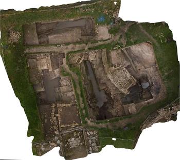
A general aerial view of the 2018 excavation area. (Photograph by Adam Stanford)

The remains of a seventeenth-century farmhouse, Smith’s Chesters, were revealed to the north of the third-century baths. The cobbled yard of the farmhouse had effectively covered all the standing remains of earlier Roman activity and many of the stones used were Roman, including the focus of an altar re-used in the farmyard drain. Removal of the farmyard exposed typical large sandstone block foundations of workshops and houses associated with the third-century extramural settlement. Although largely preserved in situ, most with hard-packed clay floors, the buildings had been extensively damaged by later farming activity.
One building consisted of a large stone platform, used as a temporary causeway to cross the northern ditch of the third- and fourth-century stone fort. The causeway was built over the corner of the ditch by filling in the space between two drystone walls with a mixed rubble core packed with a clay topping. The resulting structure was around 4 m in width, easily large enough for wheeled traffic. Eventually other streets in the extramural settlement allowed for easier access to the fort and the ditches were filled in, removing the reason for the causeway’s existence, and subsequently a large blocking wall was constructed east–west across the causeway, on the side closest to the fort. The third-century fort ditch itself, when in use, was only 3 m wide and 1.6 m deep; it would have functioned more as an oversized drain than a serious obstacle to crossing.
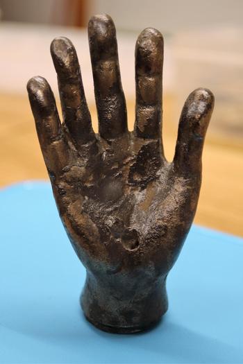
A pond located on the western side of the causeway preserved a significant artefact in its silted base: a copper-alloy hand of the god Jupiter Dolichenus (fig. 6). The discovery, in a watery context and less than 20 m from the north wall of the nearby temple to the same god, may suggest that the artefact was deposited as part of the dedication ceremony for the temple.
The hand of Jupiter Dolichenus.

Below the pond were the remains of the clay-filled base of a Severan rampart (c. a.d. 208–212) and the northern fortlet ditch. The north ditch was partly covered by the modern line of the Stanegate road making it unavailable for archaeological investigation. However, the section that was explored provided more evidence for the garrison of this period and included shoes and boots, and a very fine silver openwork brooch of trompetenmuster style. The top of a human skull bearing evidence of violence was also recovered; the remains await further forensic analysis.
The Severan rampart and ditches respectively filled in or cut out three very large north/south-running Antonine defensive ditches. The ditches were filled with organic matter associated with the occupation of the first stone fort at Vindolanda, c. a.d. 160–200. Artefacts of note were concentrated in the innermost ditch, which was closest to the fort wall. These included: a partial military diploma, provisionally dated to around a.d. 158/9; three pewter dishes, of which one is complete with an inscription and maker’s mark; ten fragmentary stylus tablets and a single ink writing-tablet fragment.
In the last fill of the first ditch, perhaps associated with the demolition or abandonment of the Antonine fort in preparation for the construction of the new Severan fortlet, a partial Roman tile with seven individuals’ names carved in cursive writing was recovered. The final artefacts of note were a complete set of four iron hipposandals in pristine condition. They were grouped into two pairs, separated by less than 20 cm, and had clearly been deposited in a single act into the thick mud of the ditch fill.
Excavations will continue in this area of the site in 2019 to explore more of the Severan defences, with the aim of targeting the area where the Severan and later third-century bath-house drains exited into the Severan northern ditch.Footnote 26
CUMBRIA
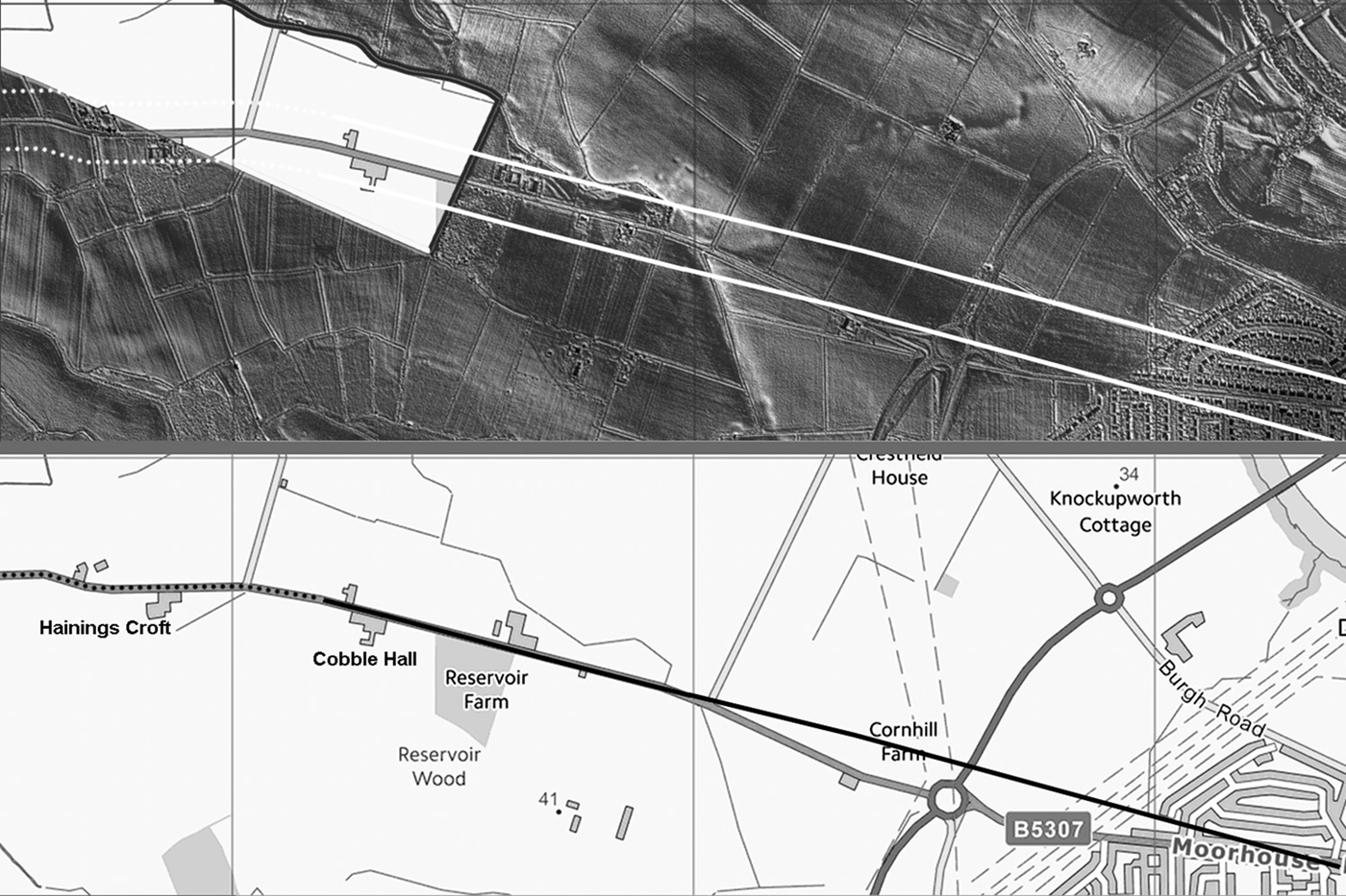
(1) Carlisle, possible Roman road from Carlisle to Burgh-by-Sands (NY 365 563): assessment of LiDAR has revealed a stretch of road cut by the A698 west of Carlisle. The road may be putatively identified as Roman, and it would fit with a route of the hypothesised ‘Stanegate extension’ stretching west of Carlisle to the forts of Burgh-by-Sands 1 and Kirkbride. It is notable that further lengths of the road align with the modern road system (fig. 7).Footnote 27
Lidar image and map of a possible Roman road heading west from Carlisle.