The project: aims, issues and methodologies (O. Menozzi)
In this difficult period for Libyan archaeology, certainly the most critical matter is to defend, document and transmit to future generations the country's rich cultural heritage, which is so monumental and pervasive as to be extremely difficult to control and defend. Urbanisation, building works, the inappropriate exploitation of resources, looting, vandalism and war are just some of the very urgent problems for archaeological remains in this splendid country.
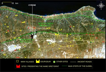
The project of mapping the territory of Cyrene, for the team of Chieti University, started between 1999 and 2001 as a layer of a ‘macro-GIS’ of the region to the east of Cyrene: relating to the transect between Al-Bayda – as the western limit – and El-Gubba/Qubbah – as the eastern limit – (Figure 1). The vastness, density and monumentality of this context made necessary a systematic project of GIS mapping, remote monitoring and documenting of this huge, but often neglected, patrimony at risk at the moment from damage, destruction and even definitive loss. Coexistence between cultural heritage and urban contexts causes continuous problems, prompting a need for landscape monitoring to help local institutions achieve sustainable urban development and exploitation of the territory. Urban planning and territorial projects need specific protocols finalised for the conservation and valorisation of monuments and sites directly integrated within urban contexts. Moreover, the area is extremely rich in environmental features, such as wild widian (canyons cutting the three plateaux of Jebel Akhdar) rich in floral and faunal species and sinkholes and karst features, which need to be protected from the unplanned and inappropriate urbanisation which is now literally ‘eating up’ the environmental context. Not only is this ‘immobile’ heritage at great risk at the moment, but also the mobile and intangible heritage, as the numerous Cyrenaican statues now on the black market can clearly attest. Local traditions and the perishable remains and finds of the rich local anthropological culture may all be lost due to the current state of confusion that has brought about a cultural decay and a widespread loss of interest in historical and anthropological roots.
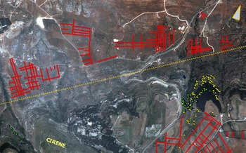
View of the main sites mentioned in the paper: 1. Labraq; 2. Jubbra/Jebbra; 3. Mgernes/Mqayrnis; 4. Siret Om Sellem/Umm Sellem; 5. Tert/Zawiyat al-Tart; 6. Gabu Yunes/Gabel Younis; 7. Lamluda/Lamlucah; 8. El-Mtaugat/Mtawqat; 9. Berteleis/Bertelles; 10. Gasr Khuraibah/Gasser Khrbìah; 11. Siret el-Bab; 12. Zawia/Zawiet Maragig; 13. Umm Heneia el-Garbia/Kenafes; 14. the two sites of Siret el-Mliatc and Siret er-Rheim are located to the south of Al-Bayda and in the territory of the village of Omar el-Mukhtar (GIS shot, Archive of the Archaeological Mission of Chieti University). (Colour online.)

Only a joint effort among different local and international institutions could help to safeguard this huge cultural heritage, but only by trying to overcome separatist and competitive attitudes among institutions and missions and starting to publish and share the data will it be possible to really help the local institutions, which are always willing to collaborate. Therefore, the aim of this paper is to publish data about quite a remote area of the territory of Cyrene in order to start sharing this data and possibly create a common archive documenting the numerous sites. It is just a preliminary presentation, aiming to then complete it with more surveys and geoprospecting and in the hope of collaborating with other missions and institutions for the conservation and management of the cultural heritage, with a wider sense of the heritage including not only sites and monuments but also natural resources and anthropological and ethnographic patrimony.
Since its beginning, the team's project in this territory has been to map and document this patrimony, in as wide a perspective as possible, and to look particularly at the ‘minor sites’ in the region, which are particularly numerous and almost unknown. They have been, from the Late Classical to the Islamic periods, vital settlements for the management of the local economy, for the export of local products, in both regional and Mediterranean circuits, as well as crucial points for the main road network and for the management of the ancient limes (the boundary of the Roman Empire). A myriad of villages, rural settlements, gsur, fortified basilicas, mansions and farms (Fossataro Reference Fossataro and Hakan2009; Goodchild Reference Goodchild1966a-Reference Goodchildb; Reference Goodchild, Reynolds and Elek1976; Menozzi and Fossataro Reference Menozzi and Fossataro2010; Ward-Perkins and Goodchild Reference Ward-Perkins, Goodchild and Reynolds2003), generally very monumental in appearance, have played an important economic and political role for the territory, creating a hierarchic system depending on Cyrene and, looking at their distribution and relationship, playing the role of intermediary between the main centres (Cyrene and Darnis), and always in close relationship with the main ports.
This territorial study is mainly based on a multidisciplinary scientific approach, involving archaeological specialists in different periods, geoarchaeologists, geomorphologists and paleobotanists, topographers and archaeometrists, in order to create a more complete view of the area both diachronically and synchronically (Menozzi and Fossataro Reference Menozzi and Fossataro2010, 157–71). This multidisciplinary work employed both traditional and instrumental surveys of the area in order to produce archaeological maps and a GIS (Figure 1) including the main geomorphological units, the hydrogeological system, the ancient road network and the distribution of sites and settlements on the basis of their typologies. The multilayer approach of a GIS certainly facilitates research involving more teams and specialists working in different fields. Moreover, it also allows the possibility to exchange data, views and methods among teams working on common bases, as well as with the Department of Antiquity (DoA), which can directly control, season by season, both the territory and the results.
For the systematisation and digitisation of the documentation of the surveys in the territory of Cyrenaica, since the beginning we have used ArcView 2 and 3.2 versions as a GIS platform, which have then been migrated into ArcMap and ArcGis versions. Because the information in the site forms or monument forms is often redundant for a GIS project, we planned a more complete set of forms for an Access database, which is still in use and is our source for regularly migrating the forms into the Cyrenaica GIS project (CyrGis), generally filtering specific fields (with geospatial data, information about the typology of the site or monument, dating of the remains, versions of the place name for toponomastic statistics and studies and brief notes). Recently, we have also been using the QGIS system for projects in collaboration with Libyan colleagues because it represents an open-source program and is user friendly, producing shp-files suitable to also then be opened by ArcGis. Specifically for this purpose, we have trained a student from ShahatFootnote 1 in using both QGIS and ArcGis programs; moreover, colleagues from Durham University and the American Mission have also organised training in this sense, and now the Omar Al-Mukhtar University at Al-Bayda also has specialists training the students locally on these programs and therefore, in future, the management of a common geodatabase will certainly be easier. At the moment, getting a local team of GIS technicians is still a far-off prospect, but this certainly represents a start for a future ‘DoA 2.0’. In the meantime, our CyrGis data are regularly given to the Mapping Centre of Cyrene, directed by Fawzi Al Raeid, in .kml and .kmz versions, which are suitable for opening in Google Earth, together with an Excel file including a list of the sites, in order to give a copy of the project to local institutions, updating the files regularly. In this way, our colleagues can more closely control their territory and in an ideal future these bases could be extremely useful for managing the urban expansion and the exploitation of the territory, safeguarding more closely this huge and splendid (archaeological, architectonic, environmental and anthropological) heritage.
In this sense, the GIS project in general is certainly a great help to the local authorities, representing also a field for close collaboration with them and at the same time offering institutions important tools for monitoring and controlling the developments and urbanisation in archaeological areas.
The cartographic base of the project has been built by merging different topographic maps (old Italian IGM, American and Russian regional maps), high-definition satellite images, geological maps, altimetry and topographic data from the differential GPS and radar data. In this way, all the information from digital and paper cartography can be used to draw as much information as possible, which is then organised in several layers of the GIS of the area and updated regularly with the data coming from the field survey, the excavations, the geophysical surveys, the geomorphologic analysis, the remote sensing and the old information from previous excavations and surveys. Thus, the GIS can be used for very different purposes, such as the location of archaeological finds and remains as well as for a geological or environmental study of the area or for the reconstruction of the ancient landscape in different periods. Obviously a homogeneous methodology, both in the field survey and in the registration of the data, is extremely important for a complete view and exhaustive study of the territory.
The remote sensing within the project is based on different methodologies and employs several images on the basis of the different specific aims and scales of the analysis. A first level of analysis has been finalised to the mapping of the main geomorphological units at a regional scale. This large-scale photo-interpretation and wider analysis is done on regional satellite shots coming from Landsat-Zulu datasets (mainly belonging to Landsat 7 imagery, taken with a polar orbit, therefore sun-synchronous, max. res. 15 m per pixel, using three bands or false colour). This step has also been important for a general reconstruction of the main axes of the ancient road network, especially the east–west axis, and some of the north–south paths linking the sites of the upper plateau of the Jebel with the main ports (Figure 1). In order to contextualise this ‘regional’ mapping more properly, radar data have also been used for reconstructing some elevation features and topographical aspects.
A second level of remote analysis is aiming at a more detailed mapping of the ancient landscape asset, looking at possible new monuments, sites, ancient quarries, local road networks and paths, and the ancient organisation of agricultural plots. For this specific step, very different images are used, often in combination, such as the old black-and-white aerial photos coming from archives (such as the Hunting collection), which have been important for a preliminary photo-interpretation prior to the strong urbanisation of the last 20 years. Moreover, for more detailed analyses, different typologies of high-resolution satellite imagery are used, such as Ikonos (panchromatic at 1 m res. and multispectral at 3.2 of res., swat about 10 km, radiometric res. 11 bit/2048 vol.) and Quick Bird (pan and multispectral, 4 bands, res. 0.61 cm the former and 2.44 m the latter, 11 bit) sets. It has been important to overlay different images for this step both for mapping the main anomalies coming from soil marks and crop marks, but also for shaping the progress of the consumption of the territory, which is now a huge problem for this area.
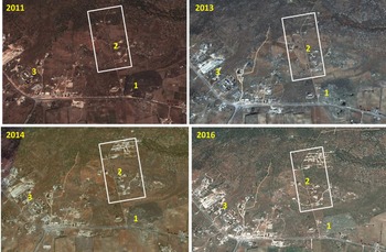
A third level of use of remote sensing analysis is aimed at the monitoring of specific archaeological sites and areas at risk or under threat of urbanisation, bulldozing and vandalism. For this specific purpose, the satellite bases already used for the previous steps have then been compared with more recent satellite shots coming from different sources (Google Earth, open-source archives, exchanges with other colleagues and missions working in the area and so on) and new HD panchromatic satellite sets (at res. 1 m/1.8) in order to identify the typologies and degrees of risk to the sites and then send field surveyors to investigate how to limit the damage. Moreover, a classification of the main risk typologies has been done in order to understand more properly the main meaning of the threats. Basically, there are two main typologies, which then include subcategories:
-
1. the first typology is represented by natural risks, such as erosion (including wind, weathering and coastal erosion), landslides, floods, biological elements (plants, biodeteriogen organisms) and also, in very remote cases, earthquakes;
-
2. a second typology is characterised by anthropogenic risks, such as building works, urbanisation, vandalism, looting, extremism, bulldozing and even quarrying the ancient sites in order to re-employ the building material.
Obviously, not all of them can be monitored and detected through remote sensing and photo-interpretation, and therefore it is always necessary to programme a team of surveyors for a direct checking of the mapped risks in the monitored areas.
In a paper, it is inconceivable to present a complete view of the study of this wide transect; therefore, on this occasion, we have chosen to present the sites and the main issues relating to the sites dating to Late Antiquity, while other papers (such as the paper on the Cyrene necropolis in this journal) and monographic studies, in future, will present other sites and aspects. Moreover, the GIS approach has been integrated here with data from both remote sensing and more traditional research approaches, such as planimetric and typological analysis of the buildings, study of the sources and detailed mapping of the building techniques. For instance, in the case of Lamluda, a complete photogrammetric documentation of the two sides of the cardo maximus has been realised (producing prospects) in order to systematically identify the different typologies of building techniques, as well as the several phases which have characterised the long life of this settlement. This step in the documentation for this site has been particularly fruitful because it has identified some blocks with anathyrosis, dating to the Hellenistic period, suggesting an earlier ‘monumental’ phase or fortification (a pyrgos or a larger fortified building?) which has then been totally obliterated by the later buildings, even re-employing part of the original blocks.
Byzantine fortifications: Cyrene and its territory (M. C. Somma)
Cyrenaica, as with all regions of the Roman Empire, was characterised in Late Antiquity by a number of political and administrative reorganisations, which in turn caused further transformations and changes in the layout and function of its sites, as well as of its defensive systems.
Most of the studies in this area, in general mainly looking at the Classical period, have shown only marginal interest for the later fortifications, contrary to what happened in Tripolitania (Di Vita Reference Di Vita1964, 65–98; Leone Reference Leone2007, 187–98; Munzi Reference Munzi, Tantillo and Bigi2010, 57–62; Sjöström Reference Sjöström1993, in particular 81–85; Welsby Reference Welsby1992); however, some useful suggestions, still valid today, have been advanced by Stucchi (Reference Stucchi1975), by Goodchild (Reference Goodchild1966a) and, more recently, by Mattingly, Sterry and Leitch (Mattingly et al. Reference Mattingly, Sterry and Leitch2013), and Catani (Catani Reference Catani and Luni2010; Bennet et al. Reference Bennet, Buzaian, Abdulkareem, Khalifa and al-Touati2008; Benthaer and Buzaian Reference Benthaer, Buzaian and Luni2010; Buzaian Reference Buzaian2009). This paper, therefore, intends to integrate a review of published works with data coming from the survey project of the Archaeological Mission of Chieti University (under the direction of Prof. Oliva Menozzi).Footnote 2 The basis for the research on these defensive structures was already drawn up by our late friend Domenico Fossataro, who in 2008 suggested an early classification of the fortified ruins identified during the surveys of Chieti University (Fossataro Reference Fossataro and Hakan2009).
The main literary and historical sources concerning the local defensive structures are based on documentary sources, which, although not always clearly defining specific sites and rarely matching with archaeological sites, allow us to identify the main chronological range for this phenomenon, between the fourth and sixth centuries. Some data on a few specific sites, or, mostly, on the systematic intervention of fortification, can be found in the work of Synesius of Cyrene, the well-known bishop of Ptolemais, which gives most of the information about the conditions in Cyrenaica in Late Antiquity. He indirectly testifies to the existence of city walls in some of the main towns and also to the presence of troops quartered in the region (for Synesius and his role in Cyrenaica in the fifth century: Goodchild Reference Goodchild, Reynolds and Elek1976, 239–54; Jones Reference Jones and Gadallah1970, 292; Roques Reference Roques1987).
The relevance and the role of these territories for the imperial defences are clearly attested by a decree of Anastasius I in the early fifth century; three epigraphic versions of this decree come from Ptolemais, Apollonia and Taucheria, and probably were located, at least in Apollonia, in the palace of the dux ruling the province (Capizzi Reference Capizzi1969, 142–43; Haarer Reference Haarer2006, 213–16; Jones Reference Jones and Gadallah1970, 293; Oliverio Reference Oliverio1936, 135–63; SEG IX, 356; for the military organisation in the region, see also Ward-Perkins and Goodchild Reference Ward-Perkins, Goodchild and Reynolds2003, 4). The decree points out the military structure and organisation of the region based on arithmoi, imperial regular units quartered within the city, and kastresinoi stationed in their own castra, assigned to the control of limes. In that period, the dux was based in Apollonia, renamed Sozousa probably during the Constantinian age, when he moved from Ptolemais at the middle of the fifth century.Footnote 3
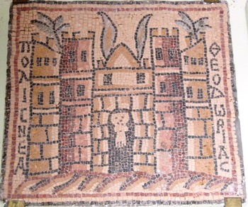
Information becomes in part more detailed for the age of Justinian, thanks to the thirteenth edict on Libyan limes dating to AD 539 (Reference Schoell CIC , XIII, 17–22, 789–92), which is attesting that at least for Libya Inferior, but probably also for Libya Superior, the dux was ruling the province, as civil governor as well, and that he depended directly on Constantinople, demonstrating that Justinian's reform was aiming to reinforce the connections between Libya and the capital. According to some scholars (e.g. Roques, Jones), this progressive militarisation of the region was due to the major defensive problems of these territories, that is the pressures exerted by Berber tribes coming from the southern desert areas and perpetrating their raids not only on the cities but also on the productive centres in the territory (Roques Reference Roques1987, 226–27). More precise information concerning the effects of Justinian's dispositions is provided by Procopius’ De Aedificiis, although for an appropriate interpretation of the information, it is necessary not to underestimate the political and encomiastic character of his work (Procopius, De Aed., VI, 1–2, 171–74). From Procopius we know that Justinian built two fortifications in Libya Inferior, Antipyrgus (modern Tobruk) and Paraetonium (modern Marsa Matrouh), and five in Libya Superior; the latter were represented by the city walls of Boreum, Berenice and Taucheira, and by two fortified monasteries (not yet identified): Άγριολώδη and Δινάρθισον, which were located on the southern border of Pentapolis and hosted a garrison. In this region, the emperor also built a bath system (in Berenice), two churches (in Boreum and Augila) and restored an aqueduct (in Ptolemais) (Reynolds Reference Reynolds2000; Roques Reference Roques1994). In fact, clear iconographic evidence of Justinian's construction and fortification activities is preserved in one of the mosaic emblemata which have been found in the eastern church at Gaser Libya (Goodchild Reference Goodchild1966b, 222–23): Polis Theodora, the settlement renamed after Empress Theodora, which appears strongly surrounded by huge defensive city walls (Figure 2). The centre occupies a highly strategic place, not far away from the northern coast, near the main natural passage of Wadi Kuf, connected to Cyrene and Apollonia, and controlling the plain of Al-Marj (old Barce), the largest and most fertile zone in the entire region.
Gasr el-Libia: one view of the mosaic methopes with the representation of the city of Theodorias (photo by M.C. Somma). (Colour online.)

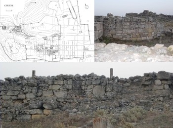
Fortifications and fortified buildings can be found both within urban centres and in rural areas, where they still constitute a strong characterising element in the landscape. These structures attracted the interest of early travellers and researchers who visited the region from the nineteenth century, often leaving behind interesting pictures, who witnessed a better state of conservation compared with today (Menozzi and Mancini Reference Menozzi, Mancini and Trinchese2015; Pacho Reference Pacho1827). Their presence is also emphasised by the local toponyms: recent studies have pointed out the large diffusion of the term qasr/gasr (almost a hundred). They are concentrated mostly on the middle and upper terraces of Jebel Akhdar. Moreover, by crossing this information with data from remote sensing, it is possible, in many cases, to establish a correlation with the remains of fortified structures (Lorenzo Jiménez, fReference Lorenzo Jiménezorthcoming). In this sense, Cyrene and its hinterland constitute an ideal vantage to understand the transformations of these settlements between the end of Antiquity and the Islamic conquest, with the defensive function representing one of the most characterising elements. Synesius mentioned a difficult period for Cyrene, between AD 405 and 412, when barbarians surrounded the town and the population took refuge within the city walls (Synesius, Epistolae CXXX, 27–29, 265). Today some sections of the city walls show structural characteristics that could date back to the post-Classical period, but further studies of Cyrene's city walls could be necessary, and in particular of the acropolis (Ermeti Reference Ermeti, Catani and Marengo1998, 254; Kenrick Reference Kenrick2013, 189–90; White Reference White, Catani and Marengo1998) (Figure 3). Stucchi suggested that some sections of the walls, still identifiable on the south-western side of the town linked to the acropolis, belonged to a narrow walled enclosure dating back to the post-Classical age (Stucchi Reference Stucchi1967, 18–19). Goodchild traced these walls back to the third century AD, coinciding with Claudius’ ‘refounding’ of the city, which was renamed Claudiopolis (Goodchild Reference Goodchild1966a, 236).
Cyrene: the late fortifications of the acropolis (photo by M.C. Somma; plan of Cyrene from Stucchi Reference Stucchi1975). (Colour online.)

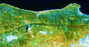
Going back to the analysis of rural areas, it is immediately evident that the large number of place names mentioning gasr (pl. gsur) concerning fortified structures are using the Arabic version of the Latin term castrum (Lorenzo Jiménez, Reference Lorenzo Jiménezforthcoming; Munzi Reference Munzi, Tantillo and Bigi2010, 57, n. 61). Within the context of the area which has been surveyed to date, there are about 56 sites whose names include this term and most of them present evident remains of fortifications. These structures, as can be seen from maps, are located along the main road system, or controlling rural areas, as well as the main widian (canyons/deep valleys, which played the role of natural paths and were also important for the water supply system) (Figure 4).
Satellite view of the territory between Cyrene and El-Gubba filtered in false colours in order to emphasise the topographic features, such as the steps of the Jebel and the courses of the widian (GIS shot, Archive of the Archaeological Mission of Chieti University). (Colour online.)

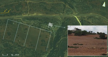
As is clear from the GIS data, about 41 per cent of the fortifications are located on the upper plateau of Jebel Akhdar, with a lower percentage, about 20 per cent, on the second natural terrace and only 5 per cent on the lower level, at sea level. Most of the fortifications on the upper terrace are located along the main west–east axis of the road network and mainly within large settlements with a pseudo-urban organisation, as suggested by their extent, the presence of large public buildings and an inner road system, as in the cases of Lamluda, Om Sellem and Mgernes. Interesting also is the position along the widian, and therefore along the north–south natural paths exploiting the natural passages of the widian connecting the different steps of Jebel Akhdar. In these cases, however, the fortifications are smaller and also strongly conditioned by the topography of the area. Moreover, in more regular and plain areas with a strong rural vocation, the fortifications are smaller but closely related to the agricultural exploitation of the land, as in the case of Gasr Khuraibah, which seems to present the features of a fortified farm with a regular organisation of the agricultural plots, as suggested by remote sensing analysis (Figure 26).
One of the most spectacular examples of these canyons, from both an environmental and an archaeological point of view, is Wadi Kuf, the wadi that historically marks the western boundary of the chora of Cyrene, where we can find one of the gsur that was most renowned and documented by travellers in the nineteenth and twentieth centuries: Gasr Beni Djem (Goodchild Reference Goodchild1966a, 239–40; Goodchild Reference Goodchild, Reynolds and Elek1976, 201; Kenrick Reference Kenrick2013, 136–37). For these structures, even more than for the urban centres, the chronological aspect remains a major problem (Ward-Perkins and Goodchild Reference Ward-Perkins, Goodchild and Reynolds2003, 169–70). The lack of systematic excavations, the absence in most cases of structural materials identifying historical periods (such as inscriptions and decorative elements), and the continuity of use of building materials make a precise dating quite difficult. Further excavations and studies could help in this sense, especially to draw relative chronologies on the basis of the stratigraphic analysis of the masonries.
According to the classification suggested by Fossataro, and from the data of the GIS of Chieti University, the fortifications in the territory of Cyrene can be organised into three main categories on the basis of their relationship with the topographic context:
-
1. towers and forts with a function of control and intervisibility seem to be the oldest ones, mostly dating to the Roman period, although it is impossible to give an accurate chronology. They seem to be the most attested typology: almost 50 per cent;
-
2. fortified farmhouses and production sites, which are about 25 per cent;
-
3. fortifications within rural villages, which are attested at about 25 per cent, regularly distributed in wider settlements and secondary villages.
Alternatively, from an architectural point of view, three main categories can be identified both for the plan and for the building techniques. The most widespread type is characterised by a square plan with at least two storeys and a regular masonry made of large local limestone blocks laid down in regular rows (Goodchild Reference Goodchild, Reynolds and Elek1976, 150, 206; White and Wright Reference White and Wright1998). They can be isolated, usually in relation to strategic points of the road system or topographic features, but much more frequently they are included into rural villages, where they either represent the only fortified element or may be complemented by other structures, as in the case of the Gasr Khuraibah (Fossataro Reference Fossataro and Hakan2009, 153) (Figure 5). This model is similar to that adopted in the Late Roman period for the military border settlements, as known already for the area of Tripolitania (for a recent review on the foundation and characteristics of these structures, especially in reference to the territory of Leptis Magna, see Munzi Reference Munzi, Tantillo and Bigi2010, 57–62, with previous bibliography; for a synthesis of the technical and building characteristics of these settlements, see Sjöström Reference Sjöström1993, 81–85). In the Cyrenaican examples, the identification of a possible Roman phase is often difficult, as in most cases later restorations of the Byzantine period have obliterated earlier phases (Goodchild Reference Goodchild1951).
View of the main fortified section of Gasr Khuraibah/Gasser Khrbìah (Archive of the Archaeological Mission of Chieti University). (Colour online.)

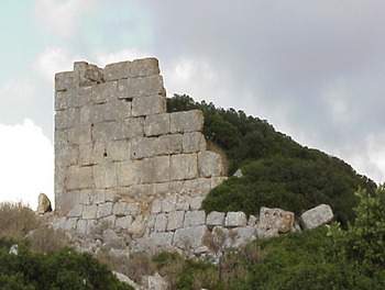
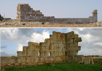
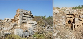
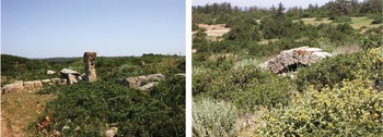
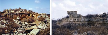
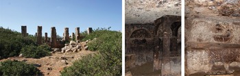
Another category of fortified buildings still shows their impressive grandeur over the ruins of several villages. They were probably fortified eminent residences within the settlements and were related to some ‘public authority’ or rich landowners, or used as fortified warehouses for these settlements. Two monumental examples can be found at Mgernes, where two of these structures are well preserved, and Jubbra (Fossataro Reference Fabbricotti, Menozzi, Di Marzio and Fossataro2009, 154; Kenrick Reference Kenrick2013, 303–304, 315–16; Ward-Perkins and Goodchild Reference Ward-Perkins, Goodchild and Reynolds2003, 311) (Figure 6). The structure in Jubbra is at the centre of an area were several remains of presses and other buildings emerged, suggesting the presence of a rather large agricultural settlement. The rectangular-shaped structure allows for an analysis of the masonry: large square stone blocks are laid down in regular rows, with small loopholes opening in the walls, whereas internally the base of the walls show some offsets that might have been used to support the floating floors, which characterise the ancient warehouses, both during the Roman era and widely documented also during the Late Antique and Byzantine periods (Somma Reference Somma2016).
Jubbra/Jebbra: external and inner views of the fortified building (Archive of the Archaeological Mission of Chieti University). (Colour online.)

Finally, among the defensive structures in Cyrenaica, ‘fortified’ churches should also be mentioned. Much has been written on these structures and their defensive functions in the past, and the different proposals advanced in the 1950s and 1960s are still valid today (Bonacasa Carra Reference Bonacasa Carra, Catani and Marengo1998, 68–72; Mattingly et al. Reference Mattingly, Sterry and Leitch2013, 177). Stucchi in his study on Cyrenaican architecture proposed that the fortifying structures for these buildings were probably mostly restoration and consolidation works, following the seismic damage or structural collapse suffered by these buildings (Stucchi Reference Stucchi1975, 430–32). In contrast, Goodchild and Ward-Perkins believe that these works were as a result of the need to strengthen the defensive structures of the places of worship (Fossataro Reference Fossataro and Hakan2009, 154–55; Ward-Perkins and Goodchild Reference Ward-Perkins, Goodchild and Reynolds2003, 16–17).
Carefully surveying these sites, it appears clear that not all works are identical in nature or of the same standards of construction. In some cases, scarp walls clearly line the entire structure, shrinking and significantly containing the entrances; similarly, the presence of ditches cannot be explained exclusively by the need to provide a reserve of water, as suggested by Stucchi. It should also be borne in mind that, in view of the average size of rural settlements, which in most cases were related to these places of worship, the churches were the largest architectural structures that with few changes could in fact become forts. In a context such as Cyrenaica, where since the Roman age the main assailants were the Berber tribes and populations living in the desert zone, this system could certainly offer the population a safe defence in case of danger (Goodchild Reference Goodchild, Reynolds and Elek1976, 151; Mattingly et al. Reference Mattingly, Sterry and Leitch2013, 177). One example that could certainly offer a major contribution to understanding this specific aspect is the basilica of Berteleis (Figure 7), located along the road that leads from Cyrene to Apollonia on the second terrace of the plateau in an area mostly dedicated to farming and in close proximity to rock-cut tombs dating to the Hellenistic age. The basilica has remained essentially ‘imploded’, its apse and some arches between the naves are still recognisable, as well as the powerful scarp wall surrounding it on each side and the ditch carved into the rock (Ward-Perkins and Goodchild Reference Ward-Perkins, Goodchild and Reynolds2003, 227–30, with previous bibliography; for the relative context, see Gambini and Catani Reference Gambini and Catani1976). In this case, the scarp masonry is realised with square lithic blocks placed in regular rows, constantly alternated with rows consisting of smaller and shorter lithic blocks, almost like an opus listatum. Another example is Umm el-Garbia: here the church has three naves and an apse in addition to a surrounding ditch and shows a remarkable hypogeum (Ward-Perkins and Goodchild Reference Ward-Perkins, Goodchild and Reynolds2003, 368–72). In all these examples, as well as at Lamluda, the defensive reinforcements to these places of worship were never concurrent with their construction, as indicated by the building methods adopted and the clear changes made to the entrances.
Berteleis/Bertelles: the fortification of the basilica (Archive of the Archaeological Mission of Chieti University). (Colour online.)

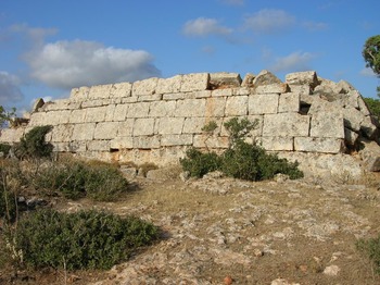
The location of these fortifications seems to suggest a close relationship with the ancient land exploitation. On the basis of the GIS data and remote sensing analysis, it is possible to suggest that there is a strong connection among fortified buildings, storerooms and productive buildings with presses and grinders, while the topographic relationship with other public buildings or even private structures seems to be secondary. The traditional products from these areas were olives, whose cultivation is attested by the large number of presses that still characterise these settlements, as well as wine, honey and almonds. Farming was accompanied by animal breeding and the exploitation of the resources largely present in the same territory, such as mineral salts and building limestone (Menozzi Reference Menozzi and Luni2010). The exploitation of these latter resources is attested by two settlements which have been at the centre of recent research: one is Siret el-Mliatc (Figure 8), 15 km from the village of Omar el-Mukhtar, certainly related to the exploitation of mineral salt, which is also mentioned by Synesius (Epistolae, CXLVII, 15–27, 293; Roques Reference Roques1987, 420–21). Near the village, the outcrops of mineral ore are still visible and, in the area of the ancient settlement, it is possible to recognise some rock-cut hypogeum chambers, which might have been used as warehouses for preserving the salt. In this case, a rectangular-shaped fortified building was placed at the centre of the settlement, whereas another large building constructed in the same way might have been a place of worship (Fossataro Reference Fossataro and Hakan2009, 153; Menozzi Reference Menozzi and Luni2010, 57–58). The Siret el-Bab site, instead, explored and mapped by Catani, is characterised by the presence of a gasr at the borders of the inhabited area, two buildings and a city wall quite monumental in appearance and possibly earlier in date (Catani Reference Catani and Luni2010). In this case, the inhabited area had to be connected not just to local agricultural activities, but also to the quarrying of limestone as building material, and several quarries have been identified nearby.
Siret el-Mliatc: view of the fortified building located at the centre of the small settlement (Archive of the Archaeological Mission of Chieti University). (Colour online.)

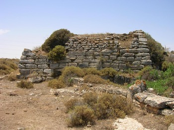
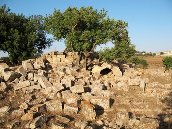
The remains of these fortifications are certainly very monumental throughout the region; however, as mentioned before, the main issue that remains is precise dating. In fact, the pioneering work on the Byzantine farm of Siret el-Giamel was not followed by systematic archaeological research on these contexts (Catani Reference Catani, Catani and Marengo1998). At the moment, the lack of excavations prevents us from going beyond a generic dating to the fifth to sixth centuries, although in many cases it is possible to see the existence of previous phases just as there may be elements suggesting a continuity of use well beyond this date with consequent implications for the relations with the phase following Islamisation, which in these territories dates to two successive campaigns in 642 and 644–45 (Goodchild Reference Goodchild, Reynolds and Elek1976, 255–67). A first data sample comes from Lamluda, which has been chosen as a sample site in order to rebuild the diachronic developments of this typology of settlement. Today, Lamluda is a small village 28 km east of Cyrene, which still shows the impressive ruins of the ancient centre, identified by the researcher as the town of Lamnia (Limnias) in the Itinerarium Antonini along the route linking Cyrenaica to Tripolitania (Leptis Magna) westwards and to Egypt (Alexandria) eastwards. Another important road axis connected the town to the coast near Ras el-Hilal (Ward-Perkins and Goodchild Reference Ward-Perkins, Goodchild and Reynolds2003, 295–302; for a more comprehensive examination of this context, see Antonelli and Menozzi Reference Antonelli, Menozzi, Nodarou and Kilikoglou2014; Menozzi and Antonelli Reference Menozzi and Antonelli2014; Menozzi et al. Reference Menozzi and Luni2010).Footnote 4 The urban planning is based on a north–south road axis (cardo), which has been partly obliterated and deviated by the presence of a square fortification, which is not accessible because of a huge collapse (Figure 9). This is lined by a fortifying scarp built in squared limestone blocks of different sizes in a regular masonry, in the lower part, with very poor pinkish beige mortar. The upper part, instead, mostly preserved along the north side, consists of irregular stones placed in irregular rows and joined with low-quality mortar. The original brickwork, visible only on the top of the structure, is formed by a double-facing wall made of squared limestone blocks joined with mortar and inner concrete. A Latin cross is engraved on one of the blocks in the lining on the north side, flanked by the letter A. There are no doubts about the defensive function of this structure, but it is more difficult to assess its time of construction and its connection to other structures in the settlement. Moreover, the excavations of the rooms just to the north side of the fort and the analysis of the structures suggest fundamental data for reconstructing the development of the building complex. It has been established, for instance, that all the rooms actually visible are posterior both to the first phase of the fortification as well as to the later structures for strengthening the previous building (a sort of counterfort). The later rooms belong to a housing complex, probably coming after another establishment whose signs are so scarce that it is impossible to trace back its shape or function, which in a first stage was characterised by the presence of small wells for preserving commodities and a water adduction plant connected to a dolium placed underground in one of the rooms. Later this phase was obliterated by new surface layers and by a different distribution of space. After an initial examination of the pottery found during the excavation, fragments relative to the latest phase date back to the second half of the sixth century, so the first phase of use of the area should date back, at least, to the first half of the same century, later followed by the construction of the rooms and their later transformations (Menozzi and Antonelli Reference Menozzi and Antonelli2014). The last phase, on the basis of the pottery finds and building techniques, might not date to before the second half of the sixth century or even later. This chronology certainly now represents a terminus ante quem both for the building of the fortification and for its strengthening. In this context, it is quite a clear connection between the fortification and the church which is located to the west of the fort, along the main decumanus of the settlement (Antonelli and Menozzi Reference Antonelli, Menozzi, Nodarou and Kilikoglou2014; Ward-Perkins and Goodchild Reference Ward-Perkins, Goodchild and Reynolds2003, 295–99). The church was later lined by a powerful scarp wall, which was built with large square blocks at the corners and smaller blocks and stones for the remaining sections (Figure 10). These works must have strongly reduced the width of the original access, which is located eastwards, facing the fortification on the cardo. The building technique adopted for these works was very similar to the one used for the fortification, so much so that they may have been the result of a common building action.
Lamluda/Lamlucah: view of the late fortification located to the south of the cardo and determining a reduction of the street (Archive of the Archaeological Mission of Chieti University). (Colour online.)

Lamluda/Lamlucah: the fortifications of the central basilica (Archive of the Archaeological Mission of Chieti University). (Colour online.)

In conclusion, based on the data available, a very complex picture emerges for the defensive structures of this area, which presented, between the fifth and sixth centuries, a high number of widespread and efficient defensive structures in both urban and rural areas. On the basis of historical sources, at least since the period of Anastasius I (but several elements seem to suggest even from the age of Diocletian), it seems to be plausible to hypothesise a planned organisation of the defensive structures, which were promoted by imperial authorities and certainly Justinian was the most representative. The differentiation of the contexts and the rural examples, however, suggests that an important role in this territorial fortification, aiming to defend the local resources, must have been played by the rich landowners and the local communities. This is the only way to explain the wide variety of systems and solutions which have been adopted in the area. A role, certainly not secondary, was also played by the ecclesiastical authorities considering the fortification of churches, of buildings related to Christian structures, the relationship between religious buildings and city walls and, as attested by the sources, the foundation of two fortified monasteries under Justinian.
However, it is important to mention again the need for stratigraphic archaeological research aiming at a more precise chronological contextualisation of these buildings than a generic ‘Late Ancient’ or ‘Byzantine’ attribution. A contribution may also come from a systematic study of building techniques, defining an evolution of the stratigraphy of the structure and comparing the different building techniques and materials to monuments excavated in urban contexts, and therefore be more properly dated.
Christian buildings in the Cyrenaican chora (S. Antonelli)
The Christian buildings in Cyrenaica, because of their monumental nature and widespread presence throughout the territory, have been studied extensively to establish their architectural and planimetric features (Duval Reference Duval and Duval1989; Goodchild Reference Goodchild, Reynolds and Elek1976; Ward-Perkins and Goodchild Reference Ward-Perkins, Goodchild and Reynolds2003).
According to the written sources, in particular the letters of Dionysius of Alexandria and Synesius (Feltoe Reference Feltoe1904; Garzya and Roques Reference Garzya and Roques2000), and the monumental and archaeological remains, mostly related to urban areas, Christianity appears to have spread and taken root early in the region (Bonacasa Carra Reference Bonacasa Carra and Harreither2006; Bonacasa Carra Reference Bonacasa Carra and Campanati2009; Bonacasa Carra and Scirè Reference Bonacasa Carra, Scirè and Brandt2013; Del Moro Reference Del Moro and Brandt2013; Michel Reference Michel and Couvenhes2012b). On the other hand, according to the tradition, the evangelisation of the region was promoted by St Mark (Acta Sanctorum III, col. 350). This assumption, founded on the written sources of the late periods, seems to be confirmed by the close relationship between the Jewish communities of Cyrene and Jerusalem (Acts of the Apostles 1:13; 2:10; 6:9; 11:20; Mark 15:21; see Avigad Reference Avigad1962 and, more recently, Michel Reference Michel and Guedon2012a, 187–88).
However, the monumentality of the remains and the lack of excavations often limit the possibility of clarifying whether the various building renovations of Justinian obliterated any traces of earlier phases or if the presence of the Christian monuments in this territory had its greatest spread specifically in that period.
The project carried out by the Italian Mission of Chieti University has made it possible to investigate more closely a number of minor settlements and rural sites of the Cyrenaican chora, which are particularly rich in Christian buildings, often marking important changes for urban contexts. Recent studies, in fact, emphasise that there is a close relationship among specific features of the Christian buildings and the development and the function of these settlements. Because of the limited space available in this paper, the topographic information related to the settlements will not be specified in this section – mainly in the conclusions – however, the location and distribution of the churches and the sites mentioned here can be seen on the general map in Figure 1.
The statistical data from the GIS analysis are quite interesting and suggest important implications. About 59 per cent of the churches are located on the upper terrace of Jebel Akhdar, in areas closely related to productive zones and to crossroads of the local road network, where the west–east main axes cross the south–north paths coming from the pre-desert area. Twenty-nine per cent of the Christian buildings are located on the lower terrace of the Jebel, at sea level, probably closely related to the main port settlements. Only a very low percentage, about 4 per cent, are located on the middle terrace and they seem to be quite limited and scattered sites, which were closely related with productive areas with a strong agricultural vocation, as in the case of the site of Berteleis.
Excluding the Christian buildings within proper towns (such as Cyrene and Apollonia), most of the churches were located in ‘pseudo-urban settlements’, which were ‘minor settlements’, but very important in the hierarchic organisation of the territory, and also formed and monumentalised in a more ‘official’ way, including public buildings, organised quarters and also an inner road system, as in the example of Lamluda. These settlements, then, also present a large suburb with monumental funerary contexts, where it is also possible to find the remaining approximate 13 per cent of Christian buildings, probably attracted from the funerary areas. The percentage of the churches located in secondary minor settlements seems to be quite low, about 25 per cent, and even lower is the percentage of churches in smaller scattered villages (about 12 per cent).
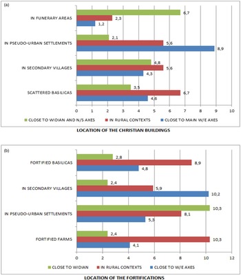
The strong relationship of the Christian buildings with the main infrastructures, such as the road network, seems to be confirmed by the topographic analysis, especially concerning the east–west road linking Cyrene with the east villages and sites, and with Egypt, obviously with a series of settlements acting as a nodal point and as junctions of the road network as well as of the settlement pattern. Looking across the statistical data (Figure 11) coming from the GIS analysis, the frequent association between Christian buildings and productive areas/structures, both in pseudo-urban settlements and in secondary villages, suggests a close relationship between them and even an interdependence which could probably be interpreted, although with caution, as a direct participation of the ecclesiastic authorities in the economic management of natural sources and productions (as in the case of Lamluda, which is analysed below). In this context, it has been chosen to analyse some typological and structural aspects, which could be useful for a chronological and functional definition of some of these buildings, also aiming at an interpretation of the spatial distribution of the main architectonic elements.
Statistical data from the GIS illustrating the location of (a) the Christian buildings and (b) the fortifications, in combination with the main typologies of sites in the area. (Colour online.)

In addition, the recent surveys have been useful for monitoring the state of conservation of the ruins of the basilicas, which can be compared with the review of these monuments edited by Joyce Reynolds (Ward-Perkins and Goodchild Reference Ward-Perkins, Goodchild and Reynolds2003). In some cases, these surveys have increased knowledge about the monuments, such as for the settlement of Siret el-Bab, where only some decorative elements (a window arch and capitals) dating to the sixth century were known about and then, on the basis of some epigraphic studies, a Christian building could only be hypothesised (Ward-Perkins and Goodchild Reference Ward-Perkins, Goodchild and Reynolds2003, 410), but recently the church has been identified by Enzo Catani (Figure 12). The building seems to be characterised by three aisles with a ‘west-facing’ apse and a pastoforium, and it shows clear traces of restructuring, by reducing its size compared with the original plan, through the addition of two monolithic columns which create a sort of endonarthex and through the transformation of the initial part of the south aisle into an apse (Catani Reference Catani and Luni2010, 67–68). Nearby, there is also a square-plan structure, which has been identified by Catani as a cenobium. However, at the moment other hypotheses cannot be excluded, even though there is evidence of a close relationship with the Christian building, since the two buildings seem to share the open space between them. Without any excavation, it is not possible at the moment to determine the exact function of this second structure and the dating of the renovation work, although Catani's hypothesis of dating them to the time of Justinian seems plausible. The settlement of Siret el-Bab, as well as Lamluda (see below), are included in a system of agricultural ‘villages’ which characterises Jebel Akhdar (Menozzi Reference Menozzi and Luni2010; Menozzi and Fossataro Reference Menozzi and Fossataro2010). They are not simply ‘villages’, since they often are wide and well-structured settlements with elaborate buildings, fortifications, a large necropolis and especially large common spaces for the processing of agricultural products (with presses for oil or wine).
Siret el-Bab: the eastern apse of the basilica (Archive of the Archaeological Mission of Chieti University). (Colour online.)

Gabu Yunes could be another example of this kind of settlement. Here, the presence of a possible large basilica is still a debated question, because one of the buildings, which seems to show specific features for a basilica, has also been identified as a bath complex of the Byzantine or Islamic period (Ward-Perkins and Goodchild Reference Ward-Perkins, Goodchild and Reynolds2003, 391). However, some elements, such as its large size and the ditch surrounding the building, seem to support the interpretation, also advanced by Stucchi, that it could be a Christian basilica. Certainly, when the Italian archaeologist visited the site, the remains of the building were more visible and he suggests that it could present a plan with five aisles and apses facing to the west (Stucchi Reference Stucchi1975, 396).
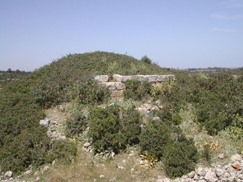
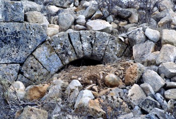
For the village of Siret el-Mliatc, it is difficult to definitively identify as a basilica the large building with a rectangular plan located near a fortified building and closely related to the main access to the site (Fossataro Reference Fossataro and Hakan2009, 153; Menozzi Reference Menozzi and Luni2010, 57–58): the thick vegetation does not allow for an accurate study of this building. However, it seems to be built in ashlar masonry and a large arch (Figure 13) seems to support some monumental vaulting. This settlement also presents storerooms (Menozzi, Reference Menozzi and Luni2010, 58), related probably to the production of salt, as mentioned by Synesius (Epistolae CXLVII, 15–27, 293). For the settlement of Jubbra, it is still impossible to recognise and identify the basilica, and only a cross inscribed in a circle with the letters alpha and omega has been documented (Oliverio, Reference Oliverio1933, pl. 88, by Ward-Perkins and Goodchild Reference Ward-Perkins, Goodchild and Reynolds2003, 391), probably indicating a religious building.
Siret el-Mliatc: the presses and the possible basilica (Archive of the Archaeological Mission of Chieti University). (Colour online.)

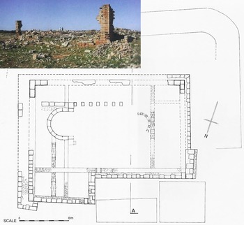
A wider readability and a better state of conservation characterise the churches of other sites such as El-Mtaugat, Berteleis, Siret er-Rheim, Siret Om Sellem, Mgernes and Lamluda. The basilica at El-Mtaugat has three naves separated by pillars, with an external(?) apse facing east and a narthex (Figure 14). The perimeter walls, built in regular ashlar masonry, show evidence of a phase of renovation for this building, which has especially affected the north side, as can be seen from the different building technique of the walls and from the addition of a room on the same side. Such activities, as with most building renovation activities, are usually related to the consequences of seismic events (Ward-Perkins and Goodchild Reference Ward-Perkins, Goodchild and Reynolds2003, 321). However, there is no evidence to support this. In the eastern side of the nave, there is a circular structure made by reused columns, which, according to Stucchi, belonged to the first phase of basilica construction (Stucchi Reference Stucchi1975, 376). During the restoration works of the second phase, rows of external orthostats were used as well as an internal facing made up of smaller and irregular blocks which alternate with long binding blocks. During the later phase, some restoration works were done, such as the addition of a scarp wall and a ditch on three sides (east, south and west) of the original structure, which evidently had to be reinforced, while the north side has been completely rebuilt.
El-Mtaugat: plan and view of the basilica (from Kenrick Reference Kenrick2013; Ward-Perkins and Goodchild Reference Ward-Perkins, Goodchild and Reynolds2003). (Colour online.)

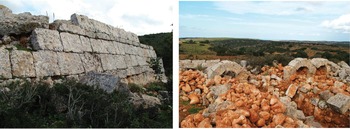
In Berteleis and Siret er-Rheim, the presence of the ditch and of the scarp wall also seems to be the result of renovation. The village of Berteleis is located on the second terrace of Jebel Akhdar, in an area with a strong productive vocation. The basilica has a smaller size compared with those of the other settlements (16 × 12.6 m). It has three naves and an apse facing west, with five pillars that support the arches of the nave (Figure 15). There is probably the presence of two pastoforia. The architectural features seem to be typical of the sixth century in Cyrenaica (Ward-Perkins and Goodchild Reference Ward-Perkins, Goodchild and Reynolds2003, 227).
Berteleis/Bertelles: external and inner views of the basilica (Archive of the Archaeological Mission of Chieti University). (Colour online.)

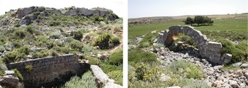
As for Siret er-Rheim (Ward-Perkins and Goodchild Reference Ward-Perkins, Goodchild and Reynolds2003, 356, and Stucchi Reference Stucchi1975, 404–406), a settlement situated at about 15 km south of Al-Bayda, the presence of the rain overflow basins connected to the ditch that surrounds the church on the north, east and south sides shows the functional nature of this accommodation, before it had a defensive purpose. The eastern part of the northern nave became a vaulted cistern for the harvesting of the rainwater. The basilica has three naves (Figure 16), oriented to the west, with a central nave divided by arches from the lateral naves, two rooms flanking the apse (pastoforia) and matronei (women's galleries), identified by the architects, on the first floor. Stucchi writes about a quadrangular structure, located at the north-west corner of the basilica with an opening to the east, that was perhaps once a baptistery.
Siret er-Rheim: the monumental remains of the basilica (Archive of the Archaeological Mission of Chieti University). (Colour online.)

The presence of two churches and of a triconchos (for the latter, the relationship to Christianity remains uncertain) characterises the village of Siret Om Sellem, located on the road that links Cyrene with Derna. The settlement is very wide and is also characterised by the presence of a huge number of presses, which were probably oil presses (Menozzi and Antonelli Reference Menozzi and Antonelli2014, 66). The western church has three aisles including an apse oriented to the west, and a probable presence of pastoforia; moreover, a wall indicates a caesura between the naves and the narthex. The impressive scarp wall (Figure 17) on all sides of the building is very interesting. The building seems to have been enlarged on the southern side. Some further renovation works have been identified, on the northern side too, which were probably not related to a Christian function (Ward-Perkins and Goodchild Reference Ward-Perkins, Goodchild and Reynolds2003, 366).
Siret Om Sellem/Umm Sellem: views of the western basilica (Archive of the Archaeological Mission of Chieti University). (Colour online.)

The eastern church also has three aisles, but it is not possible to verify the presence of the back wall and establish if the apse, facing east, was included or not (Figure 18). Two spaces are found to the sides of the apse. For the eastern church it is also possible to hypothesise that it developed in two phases: in fact, the south wall was made using ashlar masonry, while the north wall was built using rough limestone material and the structure appears slightly offset. Next to the east basilica, a triconchos building with a north-east entrance is preserved. It has been identified as a Christian building only because of its close spatial relationship to the church (Ward-Perkins and Goodchild Reference Ward-Perkins, Goodchild and Reynolds2003, 367). However, since no excavation has been done, it is still quite difficult to confirm this hypothesis.
Siret Om Sellem/Umm Sellem: the inner view of the eastern basilica (Archive of the Archaeological Mission of Chieti University). (Colour online.)

In addition, in the village of Mgernes, well known for its monumental appearance and which has recently been considered an important centre of agricultural production (Menozzi and Antonelli Reference Menozzi and Antonelli2014), the scholars have mentioned two churches, conventionally known as east and west basilicas, according to their reciprocal position. The eastern church, which is in the south-east area of the settlement, is quite well preserved, even though the vegetation does not permit a detailed study of its plan and features. However, it seems oriented to the west and it has six arches on pillars on the north side related to the arches of the nave (Figure 19). Stucchi also underlines the presence of an atrium (Stucchi Reference Stucchi1975, 404), but today it is no longer visible. For Mgernes, as mentioned above, the presence of a second church (the western basilica: Stucchi Reference Stucchi1975, 415–16) has been suggested, which has then been reinterpreted as a fortified private building and named as a ‘palace’ (in this paper, see the contribution of M. C. Somma) or ‘citadel’ (Kenrick Reference Kenrick2013, 302, fig. 198, and 403, n. 3 in the plan). Moreover, the orientation of the building, almost north–south, does not find parallels with other basilicas in Cyrenaica, which are generally oriented along the east–west axis.
Mgernes/Mqayrnis: the church (Archive of the Archaeological Mission of Chieti University). (Colour online.)

Two churches are certainly known at the Lamluda settlement, but in different contexts. The site has been excavated by the Mission of Chieti University (Menozzi and Antonelli Reference Menozzi and Antonelli2014; Menozzi et al. Reference Menozzi, Fossataro and Somma2010; Menozzi, Reference Menozziforthcoming) and therefore this can be considered a sample case for studying the rural villages of this territory. Unfortunately, because of the current unstable political conditions in this context, it has not been possible to continue the archaeological excavations, but in future it could be extremely important to start excavating at least the urban basilicas. The settlement is generally identified with Limnias, as mentioned in the Itinerarium Antonini, and it is located at the intersection of two important routes: the east–west road that connected Cyrenaica to Tripolitania (to the west) and to Egypt (to the east) and the north–south road connecting with the coast and the villages and tribes of the desert and pre-desert areas.
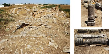
The urban basilica is located approximately 40 metres from the Late Antique fortification, which causes a reduction of the cardo maximus. The church has three naves and includes an apse facing west. It is certainly very large (32 × 16 m) and the most monumental building of the settlement. Its entrance faces east and it has an endonarthex divided by aisles, by two columns, and probably it also presented a second floor (Stucchi Reference Stucchi1975, 387–88). Massive reinforcing walls (again counterforts and/or fortifications) on all sides also reduce the original entrance. Some interesting architectural elements are also preserved, although in quite an erratic way, such as the monolithic columns in local limestone with moulded bases and the rich capitals with an acanthus leaf motif (Figure 20).
Lamluda/Lamlucah: view of the urban basilica and the architectural decoration (Archive of the Archaeological Mission of Chieti University). (Colour online.)

The west basilica is located in an extra-urban area, at about 500 metres to the north-west of the settlement. The building has three aisles with an apse oriented to the west (Duval Reference Duval and Duval1989, 2777–78, 2785; Stucchi Reference Stucchi1975, 395–96; Ward-Perkins and Goodchild Reference Ward-Perkins, Goodchild and Reynolds2003, 299–302), built using large blocks, with an exonarthex with stone columns perhaps similar to those mentioned above as being erratically preserved near the basilica, which were certainly produced locally. In the apse there is a very simple moulded frame, again realised in local stone, which could be dated to the sixth century and finds parallels with examples from Constantinople (Duval Reference Duval and Duval1989, 2785).
The funerary function of the basilica is based not only on its extra-urban location, but also because it has been built in a necropolis area, above and in close relationship with a large collective tomb in Alexandrine style (Menozzi in Menozzi and Antonelli Reference Menozzi and Antonelli2014, 70), whose entrance is from the south side. However, there are no elements to support the hypothesis of the presence of a Christian funerary cult, although reuse of the burial chambers in the Christian period is possible, drawing the location of the basilica over the hypogeum.
In order to integrate this analysis of the Christian buildings within the agricultural settlements of the chora of Cyrene, it is necessary to add the following considerations: the widespread presence of the buildings that were sometimes very big (such as, for example, the two basilicas at Lamluda, respectively 32 × 16 m and 32 × 14.5 m in size) is, on the one hand, an indirect sign of the population of these villages while, on the other, the monumentality of the buildings (sometimes more than one) seems to underline a precise intention for self-representation of the local church that obviously played a much more important role than simply the care of souls.
It seems to be plausible that the church in this context played a primary role in the production of olive oil and wine, as well as in the trade of these goods (both also widely used for liturgical purposes) in the Late Antique period and until the early Middle Ages (Ermini Pani and Stasolla Reference Ermini Pani and Stasolla2007), such as for Palestinian wine. Therefore, the discovery at Lamluda of an amphora fragment with a Christian graffito inscription is very important (Menozzi and Antonelli Reference Menozzi and Antonelli2014). The inscription, dating to the sixth to seventh centuries, preserves its invocation of protection βωηθε (coming from the verb βοηθέω/ βωηθέω) generally associated with ΚYΡΙΕ / ΧΙΡΙΕ / ΧΡΙΣΤΕ (and then using the third person βωηθει or the imperative βωηθε: Cinalli in Menozzi and Antonelli Reference Menozzi and Antonelli2014). The inscription seems to be related to the ecclesiastical hierarchies and entities directly involved in the management of the local agricultural production (Bernal-Casasola Reference Bernal-Casasola, Menchelli, Santoro, Pasquinucci and Guiducci2010, 19–31).
Concerning the cultural aspects, or the possible presence of the veneration for martyrs, there are many doubts about the extra-urban basilica of Lamluda; however, the presence of a funerary hypogeum can find parallels in Cyrenaica with the churches of Messa and of Umm Heneia el-Garbia/Kenafes. In these cases, the basilicas present apses, three aisles and a plan built directly onto hypogea, which may be seen as symptomatic of specific cults.
The issue of the so-called churches with opposing apses, typical of North Africa and of Egypt (Duval Reference Duval and Sapin2002), is long-standing. However, it is accepted that in most cases they are subsequent renovations aimed at changing the original orientation of the building, which still preserves the original apse, in order to create a second liturgical complex or to house the relics of a martyr.
In the two cases mentioned above, as well as for the extra-urban church at Lamluda, it is conceivable that the presence of the hypogeum and of a possible martyrial element might have led to the preservation of the first apse during the orientation change, resulting in an original earlier apse oriented to the east and the addition of a second apse to the west.
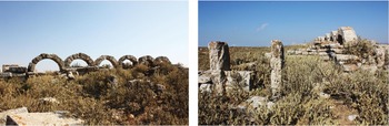
The basilica of Umm Heneia el-Garbia, situated about 10 km to the south of Cyrene, is characterised by quite large structures, probably defensive in purpose as well as to reinforce the original structure. The building is then completed by a ditch surrounding it, as with many of the buildings described above (Ward-Perkins and Goodchild Reference Ward-Perkins, Goodchild and Reynolds2003, 368–72). The pillars of the nave arches are still partly preserved, standing in situ, and they are squared monolithic blocks of local limestone, subsequently closed in a later phase. This is related to the need to reinforce the structure or to transform the spaces, which could also be related to a change in use of the building during the period of Islamisation of the countryside (Figure 21).
Umm Heneia el-Garbia/Kanafes: the pillars of the basilica and views of the hypogeum (Archive of the Archaeological Mission of Chieti University). (Colour online.)

The hypogeum can be reached from the southern side of the upper basilica and presents an inner space divided into three sections by pillars, and in the inner chamber a rock-cut mono-block ciborium is located, with columns and capitals but without any other decorative elements. On the floor of the ciborium there was a possible burial, which was probably considered privileged and perhaps venerated. Inside the hypogeum, in the north-east side some decorative elements with early Christian symbols are also preserved, such as the elements of the burial, and are decorated with a circular element with six petals and the stylised letters X and P, with two Greek crosses inscribed on the sides of the circle.
Stucchi proposed that these chambers could be identified as funerary spaces (Stucchi Reference Stucchi1975, 439–40) and that, in this case, the architectural arrangement of the hypogeum with its division into ‘aisles’ should belong to a later period subsequent to its funerary function, maybe even beyond the Christian period. The analysis of the building technique attests that the east-facing apse can be related to the basilica's first phase of construction. It is, in fact, built with regular isodomic blocks, while the realisation of the apse facing west has been made through a technique that involved some rows with orthostats alternated with blocks arranged on a flat surface. This technique can find a parallel in the building of the second phase of the basilica construction in El-Mtaugat.
The basilica of Messa, between Al-Bayda and Wadi Kuf, probably had an external apse, since there is no evidence of a back wall. It was also originally oriented to the east (Duval Reference Duval and Duval1989, 2755, fig. 11). Later, perhaps because of the problems related to stability (earthquake?), the building is characterised by a one-nave structure with an apse oriented to the west, but still keeping the original apse (Figure 22). In relation to Umm Heneia el-Garbia, even in this case the building was built on a hypogeum, whose access was from the north nave, which has a very well-defined plan with pillars dividing the inner spaces into three aisles, a kind of exonarthex and a small room, which is almost a terminal apse, while on the sides of the apse there are two small rooms. It has also been assumed that it had a funerary function, but there is no evidence for this (Stucchi Reference Stucchi1975, 439–40).
Messa/Massa: the basilica (Archive of the Archaeological Mission of Chieti University). (Colour online.)

Starting with the examples mentioned above and also looking at a wider context, including examples throughout the region, on the basis of the survey by Ward-Perkins and Goodchild (Reference Ward-Perkins, Goodchild and Reynolds2003) it is possible to make some suggestions on the orientation of the apses in the Cyrenaican churches. In fact, out of 43 churches in Cyrenaica where it is possible to analyse the plans, about 23 present a west-facing apse, while three of them clearly show a change in orientation from east to west and the rest present east-facing apses. Within the territory surveyed and analysed through the CyrGis of Chieti University, the trend seems to be clearer and more defined: out of 16 churches, about 11 present apses facing west, while three are east facing and two have a changed orientation from east to west, such as in the cases of Messa and Umm Heneia el-Garbia (mentioned above).
Therefore, the hypothesis about the orientation change from east to west in the churches of Cyrenaica, already suggested by Stucchi (as described above and in relation to Messa), would seem to be confirmed. Furthermore, the orientation to the west of most of the above-mentioned churches, above all concerning the monumental churches, can reveal that they are buildings dating back to the late sixth century when most of the above-mentioned farming villages developed as a result of the trade policies in the age of Justinian. This hypothesis could be confirmed by the chronology of the change in orientation of the east church at Cyrene, which has been dated exactly to the age of Justinian (Bonacasa Carra and Scirè Reference Bonacasa Carra, Scirè and Brandt2013, 978). This hypothesis can also be supported by chronological data coming from some of the churches built with the apse facing west, such as in the cases of Lamluda, Ras el-Hilal, Siret el-Bab, and in urban contexts and also the western basilica of Apollonia, which dates homogeneously to the first half of the sixth century.
Using, then, the orientation to the west as a chronological marker for individuating the churches planned and built within the first half of the sixth century, it seems to be clear that their wide presence and capillary distribution within the area analysed through the GIS analysis, and in relationship with productive settlements and sites, could be reinterpreted on the basis of the politics of Justinian in economic and territorial management.
It is important to also mention here another two sites which are certainly rich in Christian elements, though not presenting proper churches, and widely influenced by external cultural stimuli, such as Egyptian, although their function is still not clear.
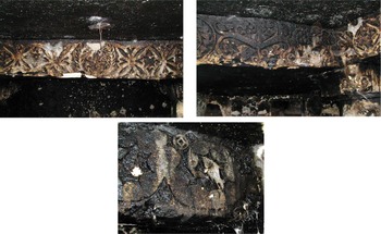
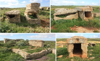
In the village of Zawia Maragig, already built in the Hellenistic era but with traces of settlement in a later period (Fabbricotti Reference Fabbricotti and Luni2010, 43–44), there is the so-called ‘Tomb with the Friezes’, which was visited and drawn by Pacho (Reference Pacho1827, 114, table XIII). It is a small room carved into the rock with an internal porch decorated with a fairly complex frieze carved directly into the rock, in a fair state of conservation. The drawing done by Pacho is particularly precise and detailed about the decoration, which includes on the front a series of four-petal flowers which create a rhombus inscribed in circles. This motif was widespread in the Late Antique period and it was used also on Byzantine mosaic floors (Marini Calvani and Maioli Reference Marini Calvani and Maioli1995). In the centre, there is a monogram of Christ enclosed within a wreath of leaves (olive leaves?). On the left lateral frieze, there is a classic motif of the vine raceme with bunches of grapes, belonging to the Early Christian period, and in its centre a framed monogram, the identification of which is still difficult. Also on the left lateral frieze, there are some spirals which enclose rather stylised floral motifs and, in one case, even a fish, directly relating to Christian symbolism (Figure 23). The monument is extraordinary and rich in decorative elements which are rarely found in the graves of later Cyrenaica. The suggestion made by Emanuela Fabbricotti not to consider this monument as a tomb for later periods, but as a place of worship connected to an adjacent tomb with three arcosolia, is therefore interesting (Fabbricotti Reference Fabbricotti and Luni2010, 43).
Zawia/Zawiet Maragig/Marazig: the frieze of the Christian hypogeum (Archive of the Archaeological Mission of Chieti University). (Colour online.)

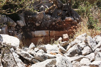
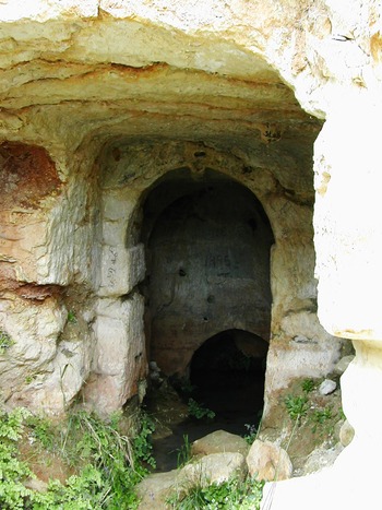
Even in the settlement of Wadi Morgus situated on the coast between Ras el-Hilal and Latrun (El-Atrun), in a room partly carved into the rock and partly built, traditionally interpreted as a monastery dedicated to St Mark, there is the presence of a cross carved into the rock and there is also part of an inscription (Ward-Perkins and Goodchild Reference Ward-Perkins, Goodchild and Reynolds2003, 419), and a stone on which a lion is sculpted in high relief (Halag Reference Halag1989, 139) (Figure 24). However, during a survey conducted with Joyce Reynolds in 2002, it was impossible to document the cross and the inscription because they had been erased. Certainly, with the location of the site along the coastal area and its place name related to the apostle, this site is very interesting for the study of the ‘Christianisation’ of the territory, that, from the first spread of Christianity, establishes direct relationships with the east. Moreover, these relationships intensified because of political and cultural reasons, in Byzantine times and, above all, during the period of Justinian.
Wadi Morgo: the hypogeum (Archive of the Archaeological Mission of Chieti University). (Colour online.)

Conclusions
The results of the surveys and the GIS data are slowly suggesting, for the territory of Cyrene during Late Antiquity, an extremely interesting picture with a kaleidoscopic distribution of settlements, villages and smaller sites. On the basis of the extent of the sites, the presence/absence of an urban asset and the typology of the buildings, it is possible to define three main categories of ‘minor sites’ for this territory,Footnote 5 apart from the proper towns such as Cyrene and Apollonia.
A first category is represented by the pseudo-urban settlements (Menozzi and Antonelli Reference Menozzi and Antonelli2014, 65), which can be seen as ‘minor settlements’ compared with the main towns, but show an organisation with a regular distribution of the main buildings, the presence of a large open space, which was probably used as a market-forum/caravanserai, the presence of quite monumental buildings, both public and private, and in some cases also regular planning with orthogonal axes. There are several examples of this first category, such as at Lamluda, Mgernes, Om Sellem, Gabu Yunes and Messa.
A second category can certainly be defined as secondary villages, which were smaller in extent with less emphasis on monumentality and were basically not urbanised, although public buildings were still present, such as in the cases of El-Mtaugat, Siret el-Mliatc, Mechili.
A third category is widely represented by small rural scattered sites, such as farms, small gsur and apparently isolated Christian buildings, as in the cases of Berteleis and Gasr Khuraibah, but which were certainly deeply connected to the fertile lands around them and had a strong rural vocation.
Most of these sites, especially for the pseudo-urban settlements, showed a long continuity of life, since the late Hellenistic period, as attested by the presence of monumental tombs dating to this period, sometimes even earlier, by the pottery finds, as in the cases of Lamluda and Mgernes, and even by epigraphic sources, such as attested for Lamluda by the numerous funerary anthropomorphic tombstones (Bacchielli Reference Bacchielli1987) and for Mgernes by a precious inscription (SEG IX, 1, n. 354): it mentions the settlement in the first century BC as a village (κώμα) with ediles magistrates (πολιανόμοι) and then refers to the construction of a granary for the village, thus attesting to a structured ‘pseudo-urban’ settlement with public magistrates and common buildings since that period.
Most of the pseudo-urban settlements, according to the GIS of the region, are located on the upper terrace of the Jebel, mainly on the main west–east axes linking Cyrene and Derna and at the junction with the south–north paths and roads, coming directly from the pre-desert and therefore used as caravan routes. Therefore, the presence in the pseudo-urban settlement of large open areas, used as market-fora or caravanserais, is certainly due to the close relationship with these roads. Moreover, generally these large open areas are located to the south of the settlements, such as in the case of Lamluda and probably Gabu Yunes, and often present large cisterns or water reservoirs, which were certainly used not only, and not much, for the water supply of the settlement, but mainly for the watering of merchants and cattle. The only pseudo-urban settlements which can be found outside the upper terrace of the Jebel are located on the lower terrace, at sea level, and are closely related to the harbours, as in the cases of Phykous, Ras el-Hilal and Latrun, which can be counted in this category.
Looking at the topographic distribution of the pseudo-urban settlements on the upper terrace, they seem to represent, from the hierarchic point of view, the main means for rural exploitation, with smaller satellite sites, mainly farms, rural structures and small fortified buildings. Considering the territory of Lamluda as a sample case (Menozzi and Antonelli Reference Menozzi and Antonelli2014), it seems plausible that this typology of settlements represented a leading centre of a stratified system with satellite sites, which was then connected to two ports, in the case of Lamluda to Latrun and Ras el-Hilal. In some way, this model of a hegemonic settlement as the centre of a territorial system, strictly connected with more than one harbour, reflects, on a minor scale, the model of Cyrene with the two ports of Apollonia and Phykous. It is, then, conceivable that Mgernes could also have had a similar territorial system and, as for Lamluda, that the main skeleton of this system was represented by the wadi, which cut the Jebel from north to south, allowing for easier natural passages and paths across the three steps of the Jebel in order to reach the two closer ports, that is Apollonia and Latrun. Therefore, the ports were numerous and homogeneously distributed along the coast, at quite a regular distance, in order to serve the coastal cabotage, but also for a possible differentiation of the goods.
Almost the totality of the pseudo-urban settlements, as with the secondary settlements, are associated with large storerooms, at times even fortified, such as in the cases of Mgernes, Jubbra and Siret el-Mliatc. This feature certainly confirms the strong productive vocation of these villages and the role of stocking and managing the local products, probably in some examples even in early phases, as attested by the inscription at Mgernes mentioned above (SEG IX, 1, n. 354) and attesting the construction of a public granary for the village.
Both pseudo-urban settlements and secondary villages present the presence of a basilica and, in some cases, even two, such as at Om Sellem and Latrun. However, the presence of a basilica in a funerary context is attested mainly for the pseudo-urban settlements, which also show a more organised suburb, such as in the examples of Lamluda and Messa, as was also typical of the larger towns, such as Cyrene with the suburban basilica at Gasr Grescendi (Stucchi Reference Stucchi1975, 404–405, 418; Ward-Perkins and Goodchild Reference Ward-Perkins, Goodchild and Reynolds2003, 174) in the southern necropolis and located to the south of the alek (the beginning of the canyon) of Wadi Belgadir. What is certainly interesting are the locations of these basilicas close to or above (as for Lamluda and Messa) monumental tombs, which probably attracted the construction of the basilica, playing the role of ‘pseudo-martyrial’ monuments, and then, after a while, the new Christian complexes started to attract, in turn, new burials, giving new impetus to the funerary use of the area.
The pseudo-urban settlements generally present more of a single fortification, and most of the public or important buildings present evident fortified structures, such as in the cases of the granaries/storerooms of Jubbra, Mgernes and probably Lamluda or the so-called ‘palace’ or ‘citadel’ of Mgernes, or the public buildings of Siret el-Mliatc. The fortification or ‘re-fortification’ around the sixth century of some of the basilicas, such as at Lamluda, El-Mtaugat, Om Sellem and Berteleis, can certainly be seen within this ‘programme’ of fortification of the limes and of the countryside, but it is also plausible that in some cases this was determined not exclusively by the need to fortify, but rather to support the structures. These fortifications/counterforts may have played an important structural role, especially after the seismic events largely mentioned for this area (Stucchi Reference Stucchi1975, 333, 334, 351, 357, 363, 418, 445, 448, 536) between the fourth and the sixth centuries. Moreover, the use of the fortification/counterforts also greatly contributed to emphasising the power of the religious institution.
However, there was not a proper walling system for these villages, probably because in Late Antiquity it was mostly the buildings with some specific function that were fortified and defended. Only Siret el-Bab seems to present a regular circuit of city walls, which seem to date to earlier periods according to the building technique.
Particularly interesting when looking for the fortifications of sites is the situation at Lamluda, which does not present any city walls for the period of its maximum expansion, in the Early Roman and Imperial periods. But, in Late Antiquity, the settlement shrank in size, concentrating the main efforts around the area of the cardo maximum, reinforcing and reconstructing the buildings along it, closing the street to the north to create a sort of posterula (small gate), and then shrinking also the cardo to the south, positioning in the middle of the road the tower/fort which limited and controlled the passage, leaving the market area outside (Menozzi and Antonelli Reference Menozzi and Antonelli2014, fig. 9).
Looking at the position of the second category of settlements, the secondary villages, they seem to have been located as satellites of the larger pseudo-urban settlements, or in the pre-desert areas, along the south–north paths/caravan routes, again with the function of small markets, but also as rest areas along the roads. Moreover, in some cases, they could have been used for the exploitation of specific products, such as mineral salt and for quarrying limestone, as in the cases of Siret el-Mliatc and probably El-Mtaugat, where evident salt deposits and ancient quarries are largely attested. Moreover, the large exploitation of mineral salt is also attested by late sources, such as Synesius (Epistolae 148, 15–27; for discussion, see also Garzya and Roques Reference Garzya and Roques2000, 293; Menozzi Reference Menozzi and Luni2010, 57–58; Struffolino Reference Struffolino2012 and Reference Struffolino2014, 370).
The third category, represented by the smaller and scattered sites (such as mansions, small gsur, fortified farms) is mostly attested on the second plateau of the Jebel, with the specific function to control the rural exploitation of the fertile lands of the ‘Green Mountains’. Moreover, their position also along the secondary paths of the road system and along the widian certainly suggests also a role of control of passages and resources. In this category, scattered basilicas are also attested, as in the case of Berteleis, which is apparently the only monumental building within an isolated context, but closely related to a simple (with rock-cut semi-hypogea storerooms and probably just wooden superstructures) but large farm with presses, millstones and storage areas.
The structures concerning the storing of local products are extremely interesting in this area, because different kinds of structures for storing are attested. For instance, in the pseudo-urban settlements, there is generally the large granary, even in a fortified version, such as at Jubbra, Mgernes and probably Lamluda. In the secondary villages and scattered rural sites it is generally possible to find rock-cut hypogea or semi-hypogea used for storing goods, such as in the cases of Siret el-Mliatc, Berteleis and Gasr Khuraibah. However, in the larger settlements, the villages and in the rural sites, the storage system for oil was based on regular series of dolia, such as in Lamluda in the so-called ‘press building’ along the cardo, in a farm which has been found close to Tert, as well as in the storerooms at Siret el-Jamel, El-Mtaugat and in a farm close to Messa.
The excavations at Lamluda, the surveys in several sites and the GIS data seem to attest, ever more clearly, that there was not a homogeneous phase in Late Antiquity: several reconstructions, changes in function of buildings and workshops, the use of very different building techniques, the contraction of some of the sites, and the increasing emphasis on the productive and storing vocation of the pseudo-urban sites suggest quite different phases of reorganisation of the local economy, especially during the period of Justinian. These phases are also attested by the stratigraphy of the structures along the cardo at Lamluda, showing at least three phases, after the Roman period and before the Islamic phases.
Moreover, another important series of changes seems to be attested for between the seventh and ninth centuries with the advent of Islamisation, which did not quickly change the local rural exploitation, initially reusing structures within the main pseudo-urban villages, such as at Lamluda and probably Mgernes, and slowly abandoning most of the secondary settlements (such as El-Mtaugat, Siret el-Mliatc, Jubbra), but restructuring or transforming a few of them into wider settlements when positioned along the main caravan routes, as in the case of Mechili. Moreover, the scattered rural sites continued to be used for agricultural purposes, though reducing in size and monumentality, such as in the case of Berteleis where the basilica was partially reused and the apse became a water reservoir. Moreover, the pseudo-urban settlements which saw continuity during the Early Islamic period present an important marker of Islamisation, that is the presence of ancient zawia/zawiet (or madrasa; important religious centre) closely related to the settlements, as in the cases of Lamluda, Tert and Zawia Maragig. The last of these is extremely interesting because not only does the name of the place attest to the existence of a zawia, but the name Maragig is closely related to religious structures for the reception of pilgrims, similar to the ancient hospitales attested in medieval Europe. This later phase relating to the Islamisation of Cyrenaica is almost unknown for most of the sites and it is certainly important in the future to collaborate with local Islamic-era archaeologists to understand more properly the evolution of these sites during this important phase.
Thanks to the remote sensing, it has also been possible to investigate how the scattered rural sites were closely related to the land organisation; in fact, especially from the second plateau of the Jebel, the organisation of the plots seems to have been quite intense and also underwent several redistributions, as is quite clear from the mapping of the plots in the Mansura area (Figure 25) on the middle terrace of the Jebel, just below (to the north of) Cyrene. Moreover, the fortified farm which has been found at Gasr Khuraibah (an evocative place name meaning ‘Fort of the Ruins’) is a great example of this typology of sites: it had an earlier phase, attested by an inscription (Roman in date), which was then defunctionalised and reused (upside down) in the fortification of the farm; it was then fortified and controlled the wadi (coming from Mgernes) as well as the surrounding fertile lands, which were in antiquity organised in plots (Figure 26), as is clear from the remote sensing. The site had a clear productive vocation, as the numerous presses and rock-cut semi-hypogea storerooms can attest. According to the mapping of the plots from remote sensing, they were organised in iugera (about one quarter of a hectare) or heredia (half a hectare), dating to the Roman Imperial period, but still based on a Ptolemaic metric system which was continuously used in Cyrenaica until the Byzantine period.
View of the area of Mansura, just to the north of Cyrene, on the middle terrace of the Jebel, with remains of the ancient layout of the plots (Archive of the Archaeological Mission of Chieti University). (Colour online.)

Gasr Khuraibah: the location of the fortified farm with the ancient land organisation, which has been mapped on the basis of remote sensing and survey. The dotted line in the top left shows the main remains of an ancient road, which is partially cut into the bedrock. In the small photo on the right: a view of the gasr and from the agricultural plots (Archive of the Archaeological Mission of Chieti University). (Colour online.)

For the territory of Cyrene and Lamluda, because of their richness in monumental remains and sites and, at the same time, because they are now so exposed to different risks, from 2011 a joint project between Chieti University and the DoA of Cyrenaica has been testing a protocol for monitoring the monuments and remains in the territory, using a combination of surveys and remote sensing analysis, which has continued even during these problematic periods, regularly analysing numerous satellite shots of the past four years. During the last two years, when it has been impossible for the Italian team to work at Cyrene, the Libyan members of the joint team have continued the fieldwork in close connection with their Italian colleagues. In fact, during the continuous monitoring by remote sensing and photo-interpretation, new areas with problems of urbanisation, vandalism and looting were found; the Libyan colleagues were soon informed and they visited the sites; they documented the development of the situation and in several cases even stopped the bulldozers in order to document the site.
The monitoring of the site of Lamluda, for instance, shows an increase in the bulldozing of the necropolis area (n. 2 in Figure 27), especially for the construction of several new farms and secondary roads, mostly built during 2014; however, the area of the ancient site (n. 1 in Figure 27) is still quite well preserved, especially because it is completely surrounded by fences and also strictly controlled by the owner of the land, who established a fructuous agreement with the DoA in 2007 for the control of the site.
The funerary area between El-Mtaugat/Mtawqat and Tert (Archive of the Archaeological Mission of Chieti University). (Colour online.)

A good example of collaboration between Libyan inspectors of the DoA (archaeologist S. Farag Abdel Hati and technician A. Abdalrahim Sheriff Saad) and Italian archaeologists is the case of the funerary area to the south of Tert and to the west of El-Mtaugat (see Appendix). Another similar intervention has been in the area of the eastern necropolis of Cyrene where, from satellite shots taken in different periods over the last 36 months, it has been possible to delimit the areas in worse situations and the Libyan colleagues Masen A. S. Abdalgader Mziene and Fawzi Al Raeid have been involved in documenting the main instances of destruction and vandalism (which are presented in a paper published in this journal).
Appendix: The funerary area between Tert and El-Mtaugat: a sample case of remote sensing and common protocols for monitoring the territory (V. Petraccia, A. Abdalrahim Sheriff Saad, S. Farag Abdel Hati)
A common issue for all of Cyrenaica is obviously the defence of a heritage so rich, monumental and vast that it is too often not easily controllable by the offices of the local DoA. Increasing urbanisation, construction or agricultural works all too often carried out using bulldozers, tomb looting and vandalism: these are daily issues for Cyrene, which also has to face problems related not only to the archaeological site itself, but also to the vast surrounding territory. Such a situation surely deserves a larger team of inspectors, maybe even dedicated to specific territories, working as territorial inspectors. The case of the funerary area between Tert and El-MtaugatFootnote 6 has been chosen here as a recent example of a Cyrenaica archaeological site which, over the past few years, has been damaged in often irreparable ways. Inspectors and technicians from the local DoA, in collaboration with the team from Chieti University, have been trying to document the extent of the damage, also by raising awareness among the local population. It is a battle against time in this site as well as over the rest of the territory: only a continuous monitoring of the territory could help in this situation, but it would be possible only with the involvement of local archaeologists in collaboration with local baladie (municipalities) and with the DoAs of Cyrenaica and Cyrene, local police forces and missions operating in the territory. It is desirable that in future the DoA of Cyrene could count on a larger number of archaeologists, technicians and restorers working in several teams in specific areas of the large territory in order to cover more regularly such a wide patrimony of sites.
Tert and El-Mtaugat represent particularly interesting rural sites, quite far from Cyrene and not directly visible from the modern main road network from Cyrene to Lamluda, in quite a remote position for direct monitoring. However, in antiquity they were strongholds along the ancient limes. Throughout all of the ancient Roman world, the limes did not always represent an impassable border or a totally immovable entity; on the contrary, they often constituted a strip of land crossed by main roads, sometimes even promoting interconnection. The Cyrenian limes, in the tract from Cyrene to Tobruk, stands on the upper plateau of Jebel Akhdar. It constitutes, today as in the past, the threshold as well as the connection between one of the most fertile zones of the region and the desert hinterland, spreading and hosting military garrisons, goods, markets, peoples and ideas. This allowed this strip of land to be populated and covered by farms and rural villages. At the same time, the limes in this context also gave birth to important markets, which worked as commercial poles between trade routes and sea lanes. In the transect between Cyrene and El-Gubba (Pacho Reference Pacho1827, 109, 117–18, X, XI 1, 2; Stucchi Reference Stucchi1975, 362; Ward-Perkins and Goodchild Reference Ward-Perkins, Goodchild and Reynolds2003, 391) many such examples can be found, some of them well known, such as Mgernes (Fossataro Reference Fossataro and Hakan2009, 154; Goodchild Reference Goodchild1966a-Reference Goodchildb, 220; Menozzi Reference Menozzi, Fabbricotti and Menozzi2006, 61–84; Pacho Reference Pacho1827, 159–61, table XXIII; Ward-Perkins and Goodchild Reference Ward-Perkins, Goodchild and Reynolds2003, 311; Menozzi Reference Menozzi and Luni2010, 53–55; Menozzi and Fossataro Reference Menozzi and Fossataro2010; Roques Reference Roques1987, 118, 149, 401, 475, 506; Stucchi Reference Stucchi1975, 80–81, 226, 396, 404, 415, 428, 433, 448, 475, 505–506, 543), Saf Saf (Stucchi Reference Stucchi1975, 359, 484–86, 543), Jebbra/Jubbra (Fossataro Reference Fossataro and Hakan2009, 154; Menozzi Reference Menozzi and Luni2010; Pacho Reference Pacho1827, 155, table XXII; Stucchi Reference Stucchi1975, 506), Tert (Bacchielli Reference Bacchielli1987, 489–21; Roques Reference Roques1987, 106, 263), Om Sellem/Um Sellem (Ward-Perkins and Goodchild Reference Ward-Perkins, Goodchild and Reynolds2003, 363–67; Stucchi Reference Stucchi1975, 362), and Gabu Yunes (Ward-Perkins and Goodchild Reference Ward-Perkins, Goodchild and Reynolds2003, 391; Roques Reference Roques, Barker, Lloyd and Reynolds1988, 125, 401, 405; Stucchi Reference Stucchi1975, 359, 395, 447, 474, 543).
Most of these villages developed during the Hellenistic period, with a strong vocation for the agricultural exploitation of the hinterland. The remains dating to this first phase mainly include funerary structures, and unfortunately no significant archaeological evidence of settlements is at the moment available. The example of Zawia Maragig (Fabbricotti Reference Fabbricotti and Luni2010, 43–47; Laronde Reference Laronde1987, 299; Pacho Reference Pacho1827, 111–15, table XII–XIII; Stucchi Reference Stucchi1975, 535; Ward-Perkins and Goodchild Reference Ward-Perkins, Goodchild and Reynolds2003, 420–22) stands out as particularly representative: it is characterised by a necropolis which had been used from the Hellenistic period up to the late Roman age and then the Islamic era, but very few remains of the settlements have been found. These villages often include one or more fortifications, so also named gasr or gsur; they often presented production areas, as is the case in Jubbra and in Mgernes. Their main characteristic is the specific connection to agricultural production, clearly attested by the very high percentage of presses, grinding mills, dolia, pits and warehouses, in many cases so well preserved that a direct reading of the production methods is possible. The number of presses scattered across all the villages within the limes suggests that the quantity of production was very high, certainly high enough to allow some surplus to be allocated for trade with other villages, the port cities or with the centres in the desert hinterland. It is no coincidence, then, that the villages stood exactly in close proximity to the crossings with the main routes which connected the coast to the desert: along all of the Jebel, every village is connected to one or more ports, replicating the model of Cyrene with double ports. These settlements stand on the point where the east–west route meets the southern desert area, in particular El-Mtaugat, thus connecting the goods and markets of the desert areas and the Jebel with the ports and the Mediterranean Sea.
The ancient site of El-Mtaugat (Pacho Reference Pacho1827, 156–57; Stucchi Reference Stucchi1975, 376–77, 396, 429, 431, 433; Ward-Perkins and Goodchild Reference Ward-Perkins, Goodchild and Reynolds2003, 316–25) was mentioned for the first time by Pacho, who confused its structure with that of a fort; Goodchild recognised instead the typical ‘fortified basilica’ of the limes. Finally, Ward-Perkins documented the site more properly and his pictures are now in the archives of the British School at Rome. Because the site is not directly visible from the main road going from Cyrene to Derna, it was almost impossible to see the damage to these sites by just passing through the area. However, the presence of nearby farms has always been problematic and therefore it is one of the sites chosen for regular remote monitoring.
As a result of the remote sensing of the area, it has been possible to highlight a particular section in the territory between El-Mtaugat and Tert, pointing out the zones in critical condition. An example is the funerary area between the two sites (Figure 28) and another area to the south-east (Figure 29). The remote sensing has shown how modern quarrying, the construction of new buildings relating to the local farms and the use of the bulldozers have all increased in the last few years, causing irreparable damage. As for other similar cases, after individuating the location of the areas under threat, the areas were surveyed in 2014 by colleagues at the DoA according to common protocols for documenting, locating and reporting on both the damages and the monuments.
Shots of the monitoring from remote sensing of the south-east part of the funerary area, showing the bulldozing of the area in the last three years (photo by A. Abdalrahim Sheriff Saad and S. Farag Abdel Hati). (Colour online.)

The results of the bulldozing in the area from 2011 to 2014.

It has been possible to understand from the field survey that the most problematic area was related to a funerary zone, but some of the tombs are located on private farms and within private fences. The necropolis comprises a large number of rock-cut sarcophagi (Figure 30); they are larger than the example from Cyrene, probably because of their date, attesting a late use of the necropolis (Catani Reference Catani and Luni2010; Thorn Reference Thorn2005, 515, 520).
The funerary area today after the works to build roads and farms (photo by A. Abdalrahim Sheriff Saad and S. Farag Abdel Hati). (Colour online.)

There are niches on the lids of some coffins, probably used to accommodate portrait busts. During the survey an ancient road was also found, completely carved into the bedrock, which still presents evident signs of the passage of carts.
In the northern area of the necropolis, a structure has been found, totally cut into the bedrock and rectangular in plan: it could be interpreted as a cistern, not completely visible because it is partially covered by soil and vegetation.
In the past, a big statue (probably a typical Cyrenaican ‘funerary goddess’) is said to have overlooked the zone, but now it does not seem to be preserved any longer. Not far from the ancient road, a large ancient quarry is easily visible, which seems to have mainly exploited the most superficial veins of the limestone and, therefore, has a wide extension, but is not very deep. The superficial method of quarrying seems to have been typical mainly of later periods.
The area of the necropolis today is heavily damaged by building works using bulldozers: several tombs have been partially or completely destroyed, or covered by a thick layer of soil. After the visit of the technicians and inspectors of the DoA, the bulldozers were stopped and the monuments of the necropolis documented and photographed. Moreover, the site of the village of El-Mtaugat with its monumental basilicas, storerooms and fortification, which is located not far from the funerary area, has been surveyed and the local farmers have agreed to avoid building and works within the monumental areas. Obviously, the site needs to be regularly controlled, not least to show locally that it has not just been an occasional control.
In this case, the lucky collaboration between an archaeological mission and two DoA collaborators, and the establishment of a common protocol for monitoring the territory, has avoided further damage to the site. This case, then, has been used as a ‘pilot case’ for developing more extensively this common protocol for monitoring, in an attempt to help the local institutions as much as possible.