The main problems in the monumental areas just around Cyrene (M. El Mziene and F. Al Raeid)
The considerable historical, artistic and cultural heritage coexisting in Cyrenaica with the local population deserves, as a responsibility, to be studied, properly conserved, protected and transmitted for the future generations. For this reason, it is important to create a local awareness of the value of this patrimony. Moreover, Cyrene has been a UNESCO site since 1982 and this should oblige local institutions to participate and collaborate with the Department of Antiquities, from the municipality to the local schools and from the tribes to the police, aiming for a common result: the safeguarding of our history, our culture and our past, in order to build a more conscious future. This paper looks at the problems of some areas within the territory of Cyrene, and aims to identify damages and risks to preserving and managing the territory.
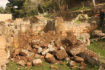
The site of Cyrene is certainly more enduring than the surrounding territory because the presence of a gefir (guard) and fences, if not stronger walls, helps to limit the vandalism and the more substantial damage. In the case of the monuments of the ancient town, most of the damage to the ancient buildings is due to the complete lack of maintenance, consolidation and conservation. In some cases, it could be enough to cut the roots of the main trees affecting the masonry of some of the buildings. Moreover, weathering is at the moment another big issue for the mosaics and pavements of Cyrene, and a programme to cover or protect the mosaics is certainly urgent (Figure 1). The situation is far worse for some of the other sites and monuments located around the ancient site of Cyrene, especially owing to problems directly linked to uncontrolled urbanisation. The Department of Antiquities is now trying through emergency excavation to document and save as much as possible, but with very depleted resources. The collaboration of the Italian missions in the excavation, documentation and restoration work has been of some practical support, continuing even after 2011, but in the last year the critical local political situation has forced the missions and their practical support to stop. The local Department of Antiquities is lacking in support, as well as technical equipment and materials for consolidation and restoration work, and the number of technicians and archaeologists is too few in relation to the needs of such a huge and significant site and necropolis. Moreover, there is a lack of specialists in specific fields within the Department of Antiquities, especially relating to the management of the site and to the more technical skills, and this can be solved only by introducing master's and PhD programmes in Libyan universities to better prepare the future generations of archaeologists, restorers, topographers, architects and geologists, who are necessary for the continuity of the site.
Damaged structures at Cyrene. (Colour online.)

The situation around the site is certainly tragic, especially for the large necropolis surrounding Cyrene, which is certainly one of the most urgent matters for the Department. Most of the tombs are very monumental, both rock-cut and built, but are located very close to modern Shahat. Obviously, these monuments are officially protected by law, but the legal obligation does not find practical application because of the difficulty in stopping modern building works and owing to the lack of the large number of inspectors and archaeologists needed to continuously survey such a vast territory; moreover, at the moment the situation is compounded by the confused political state of affairs, which means there is not a large nucleus of police to properly safeguard these monuments. Therefore, very often the monuments are destroyed or heavily damaged by abusive constructions, which also affect the natural landscape and scenery of this territory. The main cause of this crisis at the moment is the complete lack of infrastructures and institutions to control and organise urban planning and development; moreover, a local office specifically tasked with looking for suitable areas for sustainable urban expansion still does not exist today and, therefore, the construction of new buildings is mainly destructive.
Soon after the revolution, some Department of Antiquities inspectors, together with numerous citizen volunteers, started a programme of safeguarding monuments and museums in strict collaboration with employees of the local institutions. In this early stage, surveys were also organised with a view to controlling the abusive building works. However, this problem has now grown over the last three or four years with the evacuation of people from large quarters of Benghazi and Derna, as it was too risky for them to remain there under constant attack. This large mass of people started settling in the area of Cyrene, forcing the local housing market to look for new areas to build around Cyrene and Shahat. Obviously, the most sensible choice would have been to help the local citizens plan their construction works, but, again, at the moment there is not a proper office or authority supervising these activities or looking for new areas of expansion away from archaeological remains, or finding a way to build without destroying the monuments. The situation is getting worse and worse and the local offices of the Department of Antiquities are not equipped to control it.
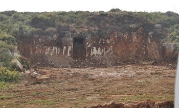
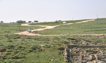
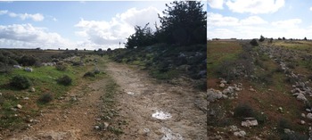
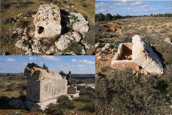
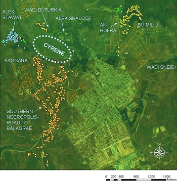
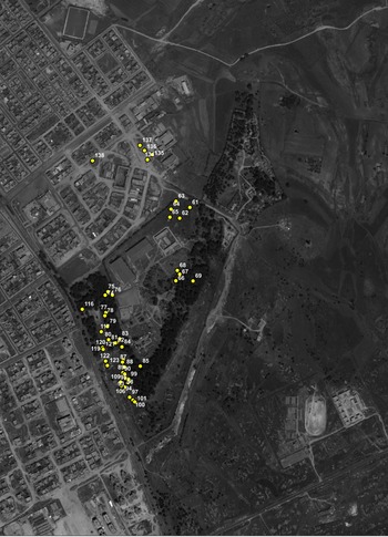
Here, then, we present a list of the areas at major risk, also showing the large-scale destruction, damaging and even demolition of ancient monuments, mainly relating to funerary areas. One of the first areas which must be mentioned here is the hill named Baggara, and particularly the zones of Wadi Bu Nabeh and the area of the southern necropolis along the ancient road from Cyrene (Shahat) to Balagrae (El Beida) (Figures 2 and 3). Here, large new farms have been built and in some cases, as in the southern necropolis, some of the existing ancient buildings have been destroyed, removed by bulldozing and even quarried, using the ancient blocks as sources for new building materials. In this area, acts of pure vandalism are also attested against both Graeco-Roman monuments and Islamic remains, such as the monument of Boubba Jouda, which has been totally removed.
Tombs of the southern necropolis along the ancient road from Cyrene (Shahat) to Balagrae (El Beida). (Colour online.)

Tombs of the southern necropolis along the ancient road from Cyrene (Shahat) to Balagrae (El Beida). (Colour online.)

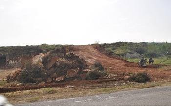
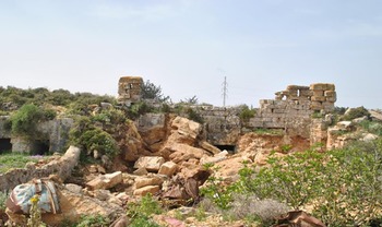
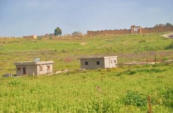
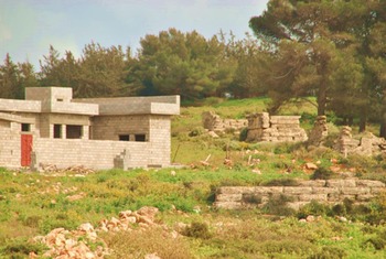
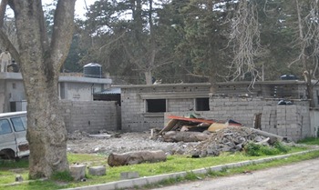
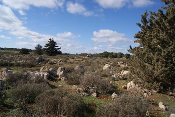
In the area of Wadi Bel Gadir, the looting of tombs and archaeological remains as well as the abusive construction of cottages (Figures 4 and 5) just in front of the monumental propylaeum and theatre of the Sanctuary of Demeter has damaged the landscape and also brought about uncontrolled destructive excavations in an archaeological area in order to build the foundations of the cottages. Several features of the fortifications of ancient Cyrene, especially in the southern sections located in the middle of modern quarters, have been damaged and even partially covered (Figure 6).
The abusive construction of cottages in the area of Wadi Bel Gadir. (Colour online.)

The abusive construction of cottages in the area of Wadi Bel Gadir. (Colour online.)

Several features of the fortification of Cyrene, damaged and even partially covered. (Colour online.)

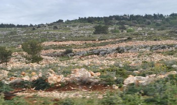
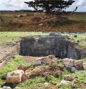
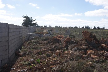
Serious damage has also been done in the eastern necropolis, especially in the area just to the east and to the south of the Katiba, along the road going to the ancient village of El Safsaf. For details, see the contribution in this paper by Clara Tamburrino. It must be mentioned here that in particular in the zones to the east of the Katiba and in the area of Wadi Sneidi (Figure 7), large monuments have been destroyed and even looted. Certainly in this area the coexistence of ancient remains and modern houses is becoming more and more problematic, with many issues especially in the area of the extramural Christian basilica and in the area to the east of the museum and storerooms (Figure 8), not far from the Temple of Zeus, and so much so that abusive constructions have been built even within the area of the Sanctuary of Zeus. Going to the north of the site, two areas showing a strong exploitation of buildings are Mansoura and Sambar (Figure 9). Here, the typology of works is due to the construction of large farms and is characterised by several buildings, meaning extensive excavations which are again uncontrolled and rarely documented.
Damage in the area of Wadi Sneidi. (Colour online.)

Modern houses in the area of the extramural Christian basilica. (Colour online.)

Damage in the areas of Mansoura and Sambar. (Colour online.)

It must be clearly mentioned here that, during our survey to document changes and damages, it has not always been possible to visit the farms or controlled areas within private fences, because often the people did not want to reveal their recent damage and looting, and it was even dangerous to approach some of the private plots. But, it must also be attested that there have been positive episodes of people opening their houses or even calling the Department to report their works or finds.
Thus, this difficult period is strongly characterised by a complete lack of control over this rich cultural heritage, which must be considered a foundation for our country and our culture, and therefore a patrimony which deserves to be protected by several institutions and authorities, not just by the Department of Antiquities, which cannot do enough without other support. The big issue of lack of control is also leading to clandestine excavations and the illegal export and sale on the black market of numerous illegal finds, mainly sculptures from the necropolis, and in this recent period from the eastern necropolis. The smuggling of funerary deities from the necropolis through the Egyptian borders and via the internet has reached unbelievable proportions.
Moreover, these problems over the safeguarding of sites are not confined to Cyrene; most of the sites in Libya preserve invaluable archaeological and historical patrimonies and therefore the effort must be a nationwide one and must seek international support. However, we must start by building a local awareness of this patrimony, starting with training programmes about the local cultural heritage in schools and clubs for children and scouts, trying to involve the younger generations as much as possible, as several colleagues are now trying to do, in order to create future citizens who are not only aware, but even proud to coexist with this archaeological patrimony and are directly involved in its protection.
General notes on the alteration and decay of limestone in the necropolis of Cyrene (E. Di Valerio)
The area of the monumental necropolis lies mainly on the upper steep slopes or steps of the Jebel Akhdar mountain plateau border, which is characterised mainly by a limestone substratum and karst formations. The altitudes range from 500 to 700 metres above sea level. The upper slope belongs to the Superior Miocene geological era, while the lower one belongs to the so-called ‘Thyrrenian’ (Middle Superior Pleistocene) (Salvini et al. Reference Salvini, Callegari, Ventura, Anselmi, Fabbricotti and Menozzi2006). The whole necropolis was built using two kinds of rock: the lower limestone rich in large nummulites and the upper marl algal limestone.
The very nature of these types of rock makes the tombs (both the rock-cut and built tombs) subject to various kinds of decay and alterationFootnote 1 by natural causes, due to sun and weather exposure, the quality of the stone and working processes. Another deteriorating factor is the karst nature of the territory, which hosts numerous palaeosprings and active springs, attesting hydrogeologic instability and cracking of the rocky bench at various levels.
Without considering isolated traumatic phenomena and damages due to anthropogenic factors, the principal actions that contribute to the decay can be divided into three groups:
-
1. physical mechanical actions of thermic or chemical natures or due to the water: problems linked with thermic expansion, direct water absorption, hygroscopic events and capillarity;
-
2. chemical actions: mainly linked to the solubility of calcium carbonate, which is higher where the stone is more porous;Footnote 2
-
3. microscopic and macroscopic biological actions: linked to the action of biological organisms and microorganisms, such as algae, bacterial flora, lichens, mosses and superficial plants, sometimes with very large roots.
The most visible phenomena damaging (quite often in combination) the tombs around Cyrene are:
-
1. colour alteration, superficial stains and deposits caused by biodeteriogens, surface differential absorption, deposit of external materials such as paints from vandalism and, quite often, surfaces blackened by numerous and continuous hearths lighted inside the rock-cut tombs;
-
2. concretions, sometimes quite thick and large, caused by long-lasting moisture;
-
3. crumbling caused by biodeteriogens, weather and roots;
-
4. detachment of superficial layers due to thermic stress and swelling of metal parts inserted into the rockFootnote 3 and roots;
-
5. efflorescence and sub-efflorescence caused by phenomena of water capillarity coming from above for meteoric water with rapid evaporation of the surface water;
-
6. weathering: erosion of elements in the facade, mainly due to the heavy rain, wind and cycles of cold and thaw;
-
7. cracking with movement of the detached parts, due to thermic stress, water, pressure by roots and tectonic instability;
-
8. vegetation growing due to moisture accumulation and attacks by autotrophic organisms;
-
9. encrustation caused by biodeteriogens;
-
10. lack, fall and loss of parts due to tectonic instability, pressure by roots and vandalism;
-
11. biological patina caused by autotrophic organisms flourishing in areas with high levels of moisture;
-
12. pulverisation and corrosion caused by microorganisms and disintegration of calcium carbonate by acidic water; the contact with soil rich in organic substances, and therefore carbon dioxide, supports the transformation of the calcite into calcium bicarbonate: CaCO3 + CO2 + H2O ↔ Ca(HCO3)2. The stone slowly takes a sugar-like and dusty consistency, disintegrating in a not reversible process. Porosity has also a role in this since the more a stone is porous the deeper the acid attack will go. Furthermore, the meteoric water slowly washes away stone blocking the cementation of calcite crystals and accelerating the corrosion process.
What can be done in such a context to aid processes of conservation and consolidation? The first step is to map the surfaces of the most damaged elements for a detailed diagnostic mapping that would then provide a basis for a conservation project. This should be done together with a mapping of the tooling on the rocks; the tombs of Cyrene show a variety of marks left by ancient tools and these are often difficult to distinguish from the later additions caused by vandalism and reuse. Such traces are very important from historical and archaeological points of view, especially for the tombs with various phases of occupation and reuse. Moreover, these tool marks can also be important to chart the evolution of the long-term quarrying of the limestone and can be of great help in planning conservational interventions. The study of the ancient tool marks, in fact, is fundamental for both the reconstruction of the rafting processes and the evaluation of the rocks’ state of decay (Bellini Reference Bellini1980; Lazzarini and Tabasso Reference Lazzarini and Tabasso1986). The first process to damage the rocks was the original quarrying itself. Mechanical forces and transport traumas could have caused latent internal cracks in the blocks. Later working by tools on the external surfaces provoked a web of superficial micro-traumas which augmented the porosity of the materials, favouring the incisiveness of the agents involved in the alteration and decay of the stone.
Photography, especially combined with filters and thermic and infrared cameras, is fundamental to the process of mapping the decay in the large number of damaged tombs. The photographic documentation can also constitute the historical testimony of the status of the tombs prior to any intervention of conservation, consolidation or restoration. Another great help for the restorers mapping the decay is the NorMal Lexicon (CNR-ICR 1990), which helps to standardise language and make personal observations more readable and comparable with others, facilitating the dialogue among the experts.
The second step to take is the microscopic analysis of samples to understand the chemical and physical characteristics of the limestones and of the damaging agents. Tests on a limited sample of surfaces define the best solutions case by case. In a few areas, it is necessary to perform actions of pre-consolidation in order to avoid the loss of some damaged materials during the next restoration phases. An important phase is the accurate cleaning of the surfaces with deionised water, removing elements partly adhering to the rock surfaces such as soil, dust, and so on. In the meantime, roots and vegetation must be cut and very carefully removed, otherwise an abrupt removal can cause detachments, even very serious ones.
In a few cases, a mechanical cleaning can be performed on the surfaces, especially against calcite encrustations caused by meteoric water. These encrustations should firstly be softened by a special compress and then later removed. Where needed, there should be an accurate cleaning to eliminate paints and blackening without damaging the original surface of the rock. Before this cleaning, a few tests on small sample surfaces should be done in order to identify the better procedures and techniques.
Another phase includes disinfection through the use of biocides. Those chosen should be totally uncoloured, as stable as possible, and resistant to light and air, and their aim is to eliminate the micro-vegetation. Lancets and brushes can be used to eliminate harder deposits, but there is always a need to be extremely careful.
The next main step, after cleaning and preparing the surfaces, is consolidation and it can be divided into two different operations:
-
1. the plastering and sealing of cracks and fissures;
-
2. the consolidation and restoration of detached parts.
This process aims to give the stone its original molecular cohesion and should not be planned on the basis of aesthetic needs. This can be done with the help of special mortars, resins and plasters mixed with calcareous dusts. It is very important to consider in this phase the hardness of stones and plasters. These should be softer than the surrounding materials in order to absorb the energy released by tectonic instability.
Probably, in a few terribly damaged cases, it could be necessary to use epossidic resins in conjunction with stainless steel pins, or another unassailable metal. These extraordinary cases are very invasive and they should be limited to scenarios where the stability of the stone fabric is compromised.
Lastly, since prevention is the best conservation method, the rock surfaces should be protected, especially in the most vulnerable spots, with special saturating paints, always choosing non-aggressive elements. Therefore, they should be uncoloured, stable, resistant to light and thermic instability and able to penetrate deeply into the rocks, returning them to their original molecular cohesion and preventing, as much as is possible, aggression by agents of decay and favouring transpiration and the right hygroscopic balance.
The main problems of the painted tombs: infrared mapping and reflectance data resulting from laser scanning for supporting the diagnostic analysis (O. Menozzi, M. G. Di Antonio and C. Tamburrino)
The painted tombs represent a rare and precious group of funerary monuments in the northern and southern necropolis at Cyrene. They are in a particularly delicate state owing to their easy accessibility, constant frequentation and recurrent aggression from natural agents, and the decay of the paintings is also due to vandalism causing the frescoes and plaster to deteriorate. In addition, although this has not caused substantial damage inside the town of ancient Cyrene, the recent problematic events over lack of control have caused more problems in its territory and necropolis.
Moreover, one of the main problems for these tombs is their total abandonment – the complete lack of monitoring, maintenance and safeguarding – and their too easy accessibility, without fences or limitative enclosures, exposing them to everyday vandalism and improper frequentation such as robbery and even gunfire inside, problems which became even more problematic during the recent war when these rocky funerary chambers were used as refuges. Therefore, a collaboration with architects has made a further stage in our project possible, that is a hypothetical plan for the safeguarding of these monuments, projecting possible solutions for the use of fences or enclosures to prevent future damage after the restoration work, with as little impact on the natural and archaeological environments as possible.
From the methodological point of view, the documentation of these tombs has been based on several steps aimed at a complete mapping and analysis of the damage, before planning interventions of conservation, restoration and future valorisation. First, the tombs were scanned with a laser scanner, scanning the external facade and each of the internal ones at a high definition, using an even higher definition for the painted and plastered areas. During this phase, the laser scanner, which has its own internal camera, took several photographs of the internal and external views, allowing us to use the images to give a natural appearance to the monument, thanks to the merging of the data in post-processing. In this way, the damage could be mapped onto both reconstructed 3D models of the tombs and life-size 3D reconstructions of the monuments as they appear today.
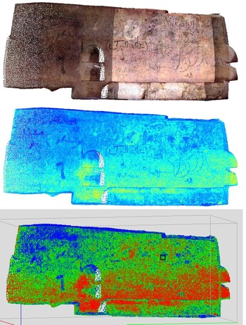
Moreover, during the scanning of the monument, the data and values coming from the laser reflectance have been isolated and used as a supporting layer in the diagnostic mapping. In fact, the values of the reflectance change completely in the case of problematic limestone or the dry plaster of the paintings, or in the presence of microorganisms, hygroscopic infiltration, damp layers in the plaster below the paintings, the detachment of the superficial levels, or in wet areas in the limestone.
The second step was photogrammetric documentation with a high-definition camera, which helped in the interpretation of the remains of the paintings, also documenting in more detail the smaller damages. Moreover, in post-processing it was possible to merge the high-definition photogrammetric shots with the data from the laser scanner.
The next step in the protocol was the analysis of the monuments with an infrared camera, which has been fundamental to individuating the main wet areas, the problems of humidity, the micro-infiltrations and their consequences (lichen, fungi, algae, cyanogen bacteria, and the detachment of the plaster and paintings). A further fundamental step has been the archaeometrical analysis of samples (including thin-section and SEM analysis) of the paintings and their plaster bases in order to understand the composition and the microstratigraphy of the paintings and to plan more carefully for possible future consolidation of the paintings.
A team of restorers has analysed our reports and documentation and verified the damages, suggesting possible solutions case by case, integrating our detailed mapping of the damages with the solutions then proposed to the local Department of Antiquities. A biologist has also surveyed the tombs in order to make a database and a mapping of the biological microorganisms causing the deterioration of the paintings and limestone. This has also been a very useful basis for planning a future conservation project.
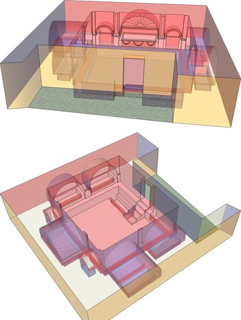
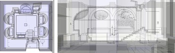
One of the main tombs presenting several problems in terms of painting conservation is the so-called Tomb of the Good Shepherd (N241, in the northern necropolis; see Bacchielli Reference Bacchielli1990–91). It consists of a rocky chamber tomb, with four inner monumental arcosolia on the lateral sides and a larger and central arcosolium on the main side, just in front of the entrance (Figure 10). The floor level of the tomb is lower than the external level and therefore a small staircase at the entrance gives access to the funerary chamber, emphasising the passage to the funerary room. The external facade is plain and not particularly elaborate; it does not present any architectonic decoration. As is usual in Cyrenaican rock-cut tombs, the area just outside the tomb is characterised by an external square courtyard, creating a sort of sacred area devoted to the tomb and delimited by the remains of the original rocky slopes, which were cut in antiquity and adapted and partially integrated by artificial sections of walls, to create a temenos of the funerary space.
Model of the Tomb of the Good Shepherd (N241). (Colour online.)

The tomb's paintings are located on the arcosolium at the north-eastern corner and on the facade of the sarcophagus just below it. The iconography of the arcosolium shows a peacock standing on a kantharos, surrounded and emphasised by garlands and fish, showing strong references to Christian symbolism. The front of the sarcophagus, just below this arcosolium, bears the representation of a shepherd with his sheep, carrying one of them on his shoulders, again showing strong Christian symbolism reminiscent of the well-known iconography of the ‘Good Shepherd’.
The monument shows several phases of use, with an earlier Hellenistic phase and later interventions. However, the last interventions, including the painting, have been dated to the end of the fourth or beginning of the fifth century AD.
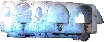
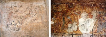
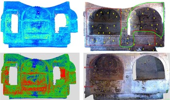
The laser scanning of the tomb has allowed a precise volumetric documentation, offering the possibility of thematic plans, sections, prospects and drawings of details. The photographs taken directly by the internal camera of the laser scanner (Figure 11) have allowed us to precisely locate the remainder of the paintings, as well as the most evident problems affecting the tomb, such as lichen, modern graffiti and other damage. The photogrammetric documentation, then, undertaken with a high-definition camera, after the post-processing, enabled a better reading of the even smaller details, representing a great basis for the mapping and analysis of the degradation. The infrared analysis (Figure 12) which has been widely employed for this tomb has revealed many problematic areas, especially the high concentration of humidity – for example along the western internal side, especially at the corners – as well as areas exposed to direct light, which has caused the proliferation of an invasive photophilic microorganism.
View from the laser scanning of N241. (Colour online.)

Thermography of the painted arcosolium (on the left) and reconstruction (on the right) of the paintings. (Colour online.)

Therefore, the problems mapped for this tomb come from different origins. Most of the problems affecting the front of the rock-cut sarcophagus come from humidity causing a proliferation of moss on the lower part of the painted area. There is also some damage due to modern graffiti, writing and drawings, mainly obliterating and in some cases damaging the inner plastered, sculpted and painted surfaces. A greasy patina covers the upper paintings and the inner sides of the rocky funerary chamber, mainly due to the dusty atmosphere in combination with occasional fires, because the tomb is easily accessible and particularly used for picnics. A homogeneous layer of white paint (scialbatura in base di calce), probably done in the 1940s during reuse of the tomb (which is quite frequent in Cyrene's necropolis), covers most of the inner surfaces, stopping the proliferation of moss and lichen, but covering other possible paintings. Accumulations of soil and litter within the lower sarcophagus just below the painted area contribute to the increase in condensation and humidity around the paintings and their plaster base is spreading the moisture and microorganisms.
A second important painted tomb in the northern necropolis is the so-called Tomb of the Games (N22, Tomb of the Ludi). Here the paintings are very badly preserved, but present very interesting subjects, thematically homogeneous and running around the four sides of a rectangular rock-cut funerary chamber, showing several typologies of ancient games: gladiatorial, hunting, musical and athletic competitions, carriage races and Graeco-Roman wrestling (Figure 13). The paintings date to the Roman imperial period (Bacchielli Reference Bacchielli, Rinaldi Tufi and Santucci2002a, 141–75; Bacchielli Reference Bacchielli2002b, 285–312). The first step in documenting the tomb has been the photogrammetric documentation, which has been done on both the dry and wet paintings. Then the documentation has been compared with the old photographs and drawings to understand how much the damage has increased. In this case, laser scanning has not been possible because of the problematic light. The problems presented by this tomb are mainly due to a lot of modern graffiti on the paintings, walls and ceiling (Figure 14). Moreover, a greasy patina on the paintings and the remains of gunfire and picnics are quite evident. There is also a technical problem with the paintings, due to the use in antiquity of very diluted colours and of a very thin base of preparation, making their preservation even more difficult and already some areas of the paintings have been partially lost. The concentration of moisture (Figure 15) in specific areas from micro-infiltrations, capillarity and rising humidity from below, generally due to the presence of soil and rubble accumulation, is causing proliferation of microorganisms in the lower sections of the walls and saline efflorescence in the upper part due to the typology of the local limestone, which is rich in mineral salts.
The Tomb of the Games (N22) and the reconstruction of the inner decorations.

Details of the paintings in N22, showing some of the problems affecting them. (Colour online.)

An infrared thermographic shot of N22: an example of a humid area. (Colour online.)

The Tomb of Demetria (N83), again in the northern necropolis, presents similar problems. It is similar in plan to the so-called Tomb of the Good Shepherd, consisting of a rocky chamber tomb (Figure 16) with a very simple facade, an external courtyard, and with arcosolia inside, covering sarcophagi cut directly into the rocky bed. Three of the arcosolia present shell decorations (the central and southern ones), while the north-eastern arcosolium has a plain surface and the north-western arcosolium is painted. A painted inscription is still preserved, although in very poor condition, at the left of the entrance; it mentions the owner of the tomb, Demetrìa, and her son, who both died during an earthquake, dating it, and the paintings, to the last decades of the fourth century AD (375) (Bacchielli Reference Bacchielli1992). The painted arcosolium (Figure 17) shows walls decorated with a polychrome grid pattern reminiscent of garden fences, while the ceiling presents a paradeisos scene with flowers, different kinds of birds, peacocks and fish below a male figure (Adam), again suggesting again a strong Christian iconography.
A 3D model of the Tomb of Demetria (N83). (Colour online.)

Laser scanning of the painted and decorated side of the Tomb of Demetria (N83). (Colour online.)

The first stage in documenting the monument has been a complete high-definition laser scanning of the tomb, which allowed a 3D mapping, which could then be used both as a basis for the diagnostic mapping, through the analysis of the reflectance values, and for a 3D model and reconstruction of the tomb. The second stage has been the photo-documentation directly taken, in this case, by the camera of the scanner; the photographs have been used to reconstruct the natural appearance for the interactive 3D models coming from the post-processing of the data. The third stage has been the infrared photo-documentation, which has shown in a more detailed way the degree of deterioration of the monument, also delimiting areas with high percentages of humidity.
Among the problems affecting this monument, apart from modern graffiti, are areas with a high quantity of mould and litter on the floor close to the lower parts of the walls, particularly of the east wall, causing high levels of humidity and microorganisms. The tomb has been also the site of recent fires and the sarcophagus at the centre of the back wall is marked by signs of tea waste thrown there. There are numerous writings in charcoal and spray paint. However, the recent survey and documentation of the painting have allowed us also to identify many new decorative details.
Another important painted funerary monument in the northern necropolis is the Tomb of Ammonius the Veteran (N173). It is a funerary chamber with loculi burials and presents paintings on the walls and on the ceilings of the chamber. The monument is very badly preserved, both inside and outside. Charcoal drawings and writings obscure most of the paintings. Some moisture is affecting the lower part of the funerary chamber, with higher concentrations in the corners. The moisture seems to be thicker near the old restorations, done in concrete and of poor quality. Encrustations of saline efflorescence, plaster detachment and rock calcification have all damaged the wall presenting a paradeisos scene (peacock, birds, vegetal and floral decoration) in the first panel. With proper consolidation and restoration, this tomb could become one of the most important in the whole of the necropolis, with its wall paintings, vivaciously decorated ceiling with polychrome geometric and floral patterns, and a painted Doric frieze with figurative metopes.
The tomb has been documented using an infrared thermo-camera, by photogrammetric survey and by the remote sensing of photographs and thermo-camera images. It has not been possible to use the laser scanner here, because of the inaccessibility of this monument with delicate equipment. The documentation and photogrammetric reconstruction of the polychrome ceiling has been particularly difficult, but the high-definition and infrared thermo-camera images have been very useful for a detailed diagnostic analysis.
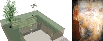
Tomb S64 is located in the southern necropolis. It is a monumental rock-cut tomb with an antechamber and a funerary loculus chamber (Figure 18), but the paintings were seen and identified only recently during the survey (Cherstich and Santucci Reference Cherstich and Santucci2010). The tomb is located along the modern road linking ancient Cyrene to Balagrae, along a still well-preserved track of the ancient Greek and Roman road. The front of the tomb still has part of its facade in ashlar masonry. The interior is organised into two sections. The first room is a rectangular antechamber with painted decorations, which acted as a vestibule of the tomb, while the second room with its two series of double loculi hosted the burials. The tomb is now used as a repository for agricultural tools. The tomb has been widely documented with graphic and photographic surveys, and a macroscopic analysis of moulds and lichen, infrared and photogrammetric surveys, drawings and graphic reconstruction of the walls. The infrared survey has been done at a constant distance of c. 1.3 m from the walls, because, along with the light exposure and temperature, the distance from the walls is one of the factors determining good results.
A 3D model of the tomb with an axonometric view of S64. (Colour online.)

The problems presented by this tomb are quite similar to the previous ones. The walls of the first room are heavily covered in smoke from frequent fires. The wall paintings are damaged by charcoal graffiti and incised writings. Moreover, the soil above the tomb (which now hosts a vegetable garden) is not very thick and the irrigation water freely penetrates from above, where the rock is collapsing. The wall paintings are concentrated along all sides of the antechamber and they were used to integrate the benches and the architecture of this room, with illusionistic painted architectural features showing balusters, Doric porticoes and friezes, with portraits and statues among the columns, with an illusionistic perspective and the use of light yellow and red for the architectonic decorations and blue for creating chiaroscuro effects. The cleaning and the consolidation of the paintings could probably help in reconstructing more elements of the elaborate decorative apparatus.
In spite of the detailed mapping of the damages and of the project of consolidation and restoration, at the moment the tombs are left in a very dangerous situation, without any fences or control. In a more stable amenable future, one of the main projects for the local Department of Antiquity should be to protect this patrimony, so perishable but so important.
The eastern necropolis: survey, remote sensing and the main issues of the current situation (C. Tamburrino)
The analysis of the territory of the eastern necropolis is methodologically organised according to specific protocols that take into account scientific and logistical parameters. The first step concerns the remote-sensing activity which was preliminarily conducted before arriving and continued during the survey. This operation allows an aerotopographic interpretation of the examined territory in its totality and knowledge of the specific topographic features and of the territorial organisation of each single zone. Remote sensing activities, photo-mapping, photo-interpretation and post-processing of old aerial photographs together with more recent satellite and photographic cartography,Footnote 4 contribute to the mapping of archaeological elements as well as to monitoring the development of the territory, if using recent shots.
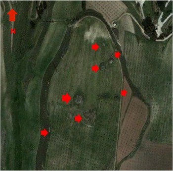
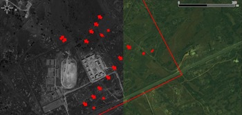
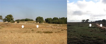
The archaeological remains in the area are often well preserved and consequently well readable and suitable for photo-mapping (Figure 19); but minor marks, which are less evident, could also be useful and explicative, as, for instance, were the anomalies of the vegetation and soil (Figure 20) in determining soil marks, crop marks and vegetation marks. Thus it is possible to choose in advance the areas to analyse on the ground, providing information which has to be verified, documented and used in the historical reconstruction. In this specific case, knowledge of the place is necessary in order to optimise the investigation with rational choices which considerably reduce the working time and allow carrying out comprehensive work in a shorter time frame. Clearly, during the survey, wider areas can be controlled, and in this case the photo-interpretation can be updated after the fieldwork phases. Graphic and descriptive elaboration data which has been obtained by the remote-sensing process is collected and managed by a multilayer geographic information system (GIS), which allows us to work easily on a considerable amount of information connecting it to specific geographic data.
Archaeological remains readable in the photo-mapping of the area of Wadi Ain Hofra. (Colour online.)

Archaeological remains readable in the photo-mapping of the Katiba. (Colour online.)

The second step concerns the fieldwork and consists of surveys to control marks and anomalies, which can then also be implemented by the use of non-invasive prospecting (using a geo-resistivimeter, georadar or magnetometer); obviously, stratigraphic soundings can be of great help in solving dubious interpretations. Obviously, both remote-sensing analysis and fieldwork activities must start from a geological analysis of the territory, mainly in order to avoid false interpretation due to the geological substratum.
The third step gathers together the information from the first and the second steps; in this phase, the data is collected in a geodatabase that can manage both the geographical information (location coordinates and geometrical definition of the inserted information) and the historical and archaeological information which summarises the features of the archaeological evidence. Data entry must be as precise as possible in order to preserve, first of all, the information that the archaeological evidence provides, but the data can easily be updated and improved by several teams working on the area, and for this reason especially a standardisation of protocols and parameters is also necessary.
The next step consists of incorporating the entirety of the descriptive and geographical data, as well as the graphic and photographic, into the territory's multilayer GIS, which can easily be utilised and can contribute to the historical reconstruction of the examined areas in a synchronic and diachronic perspective. The standardised management and the possibility of using several data easily make archaeological dynamics more detectable and clear, simplifying the integration with other data and allowing for the development of an investigation with results that are complete and from different points of view.
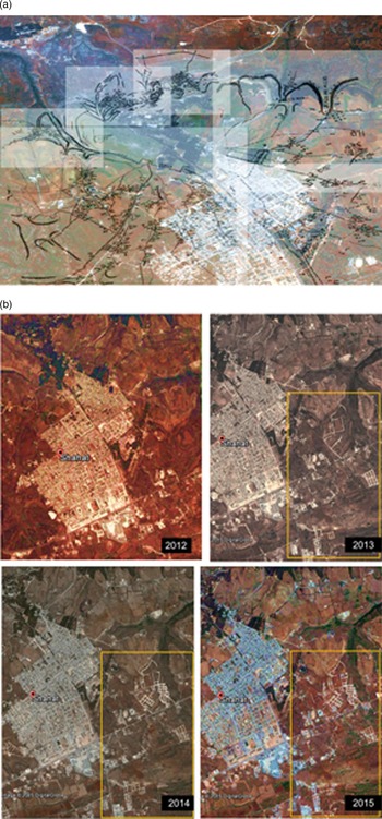
A further step in remote-sensing and photo-interpretation analysis has been organised over the last two years in order to map the damages of urbanisation and modern construction in the areas around the necropolis. In this case, there is no need for panchromatic images in high definition, but we mainly need images covering the development of the situation every 2–3 months, coming from Google Earth platform archives, in combination with further satellite images specifically bought for a more complete view of the last 2–3 years. This step has been fundamental to starting to draw a map of the risks caused by building work and urbanisation.
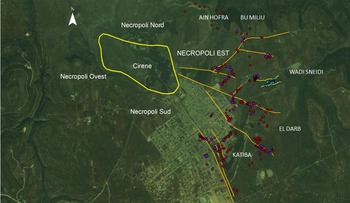
The transect analysed here is situated to the east and south-east area of the ancient city and delimited by the widian (wadis) of Ain Hofra and Bu Miliu to the north and Sneidi to the east, and the plain of El Darb to the south-east (Figure 21). A large amount of archaeological evidence of the funerary type is preserved in the area, so that many call it the ‘Eastern Necropolis’ because of its disconnection (Cassels Reference Cassels1955, 1). From a morphological point of view, the rock-cut tombs partially exploited the steep slopes of Wadi Sneidi and other widian, but also occupied, mainly with built tombs, the fertile plots among these widian, which represented one of the main areas suitable for the agriculture of the chora of Cyrene thanks to the presence of wide fertile fields and very few rocky areas. Even today, if walking in the area, it is still possible to observe the continuity and the intensity of the agricultural exploitation with intensively cultivated fields, fruit trees and numerous modern farms, which today fragment the area into many private properties.
A map of the eastern necropolis, showing archaeological remains and ancient roads. (Colour online.)

The ancient road network
The wide expanse of the territory controlled by the city also suggests the presence of a capillary road network made up of primary and secondary paths, articulately adapting to the local geomorphology. This component, in most cases, has forced modern routes to maintain the ancient paths. The examined eastern area contains, as in the case of the southern necropolis, some important ancient road axes which, for the most part, are still used today. In the general maps of the eastern necropolis (Cassels Reference Cassels1955, 39–40) there are, in fact, signs of some road layouts which reconnected to the main inland road network and ran towards the east and the south of the jebel. They led to the pre-desert and desert territories, reaching the most important caravan arteries, which became essential for trade relationships during the Hellenistic age (Luni Reference Luni1979, 58). Besides these major roads, there is also a series of secondary branches, which followed the topographic peculiarities of the area. All of these tracks, the main ones as well as the minor, can be recognised today owing to the continuity of their use, the presence of cuts and marks on the rock, the remains of road elements and, above all, the funerary evidence aligned along them. The study of the architectural and decorative features of these remains can provide important information on the factor that has influenced their location and dating and, therefore, on the use of the roads. This is possible because of their position, which usually reflects planning according to the road network and the exploitation of the territory. In this specific case, the land, basically flat and interrupted by some low hills and small widian, presents roads excavated in the outcropping limestone bed which often follow the edge of the rocky slopes of the small widian or run along the bottom, as in the case of Wadi Sneidi. When the roads are in the flat areas it is possible to preserve traces, lateral crepidoma and orthostatic rows, interspersed with fillings of stone which, in ancient times, delimited the sides of the roads.Footnote 5 One of these roads is also included in the Itinerarium Antonini, running from Cyrene toward Derna in an west–east direction: it passed through the eastern necropolis throughout Wadi Sneidi and the widian of Az Zahadi in the north, and of Al Ikhwan in the south, running along the edge of the jebel up to Mghernes, where the road is still in use. From here the road ran towards Limnias (Lamluda) and then Derna. Therefore, this track must have had more importance during the Hellenistic period and during the Roman imperial age, as attested from the dating of the tombs located in Wadi Sneidi. Some minor paths departed from this track, going north towards the widian of Ain Hofra and Bu Miliu, and from there descending to the mid plateau of Jebel Akhdar; other minor roads going to the south were then connected to the main road to Derna, departing from the south-east gate of Cyrene up to El Safsaf and Al Abraq. One of the stretches of road, in the area just to the east of Wadi Sneidi, still preserves the orthostats in situ. The minor road network, which is possible to observe in the area, was used as paths between plots, between the city and the chora, and also as connections among the main roads coming from southern and eastern routes. It is no coincidence that the caravanserai, the arrival point of the caravans, is situated just in-between the eastern and southern gates of Cyrene (Cassels Reference Cassels1955, 2, fig. 1; Luni Reference Luni1979, 56–58; Stucchi Reference Stucchi, Barker, Lloyd and Reynolds1985, 70–73).
The tombs
The tombs of the eastern part of the necropolis, as well as those of the southern (Cherstich Reference Cherstich, Fabbricotti and Menozzi2006, 391–408), occupy a large slice of territory that is strategic from the road network and agricultural exploitation points of view. In the areas geomorphologically suitable for cultivation, the funerary remains are scattered across the territory according to different logical and organisational typologies, which at the same time reflect a certain homogeneity. Tombs partly reflect the agrarian allotment of the fields, with tombs located in the marginal and less fertile areas of the same fields, and work as territorial markers; in other circumstances, they are located in homogeneous groups according to chronology, architecture and decorative features and may indicate that area's belonging to a specific family (Menozzi Reference Menozzi, Fabbricotti and Menozzi2006, 61–84; Menozzi Reference Menozzi and Luni2010, 47–58). These tombs indicate private properties and borders and, from an anthropological point of view, the social status of the families of their owners. In some areas of the necropolis, especially in the east and in the west, it is also possible to notice in the same place the coexistence of rock-cut and open-air sanctuaries, with different areas for worship and caves and funerary spaces usually surrounding the area of cult.Footnote 6
The funerary evidence already known about in the area, first developed by Cassel in 1955 and then by Thorn in 2005, signified the presence of 267 tombs (Cassels Reference Cassels1955, 38–43; Thorn Reference Thorn2005) in the eastern necropolis; each one of these is indicated by the capital letter of the cardinal point, namely ‘E’, and followed by an identification number. In many cases, a number may also indicate a group of more tombs. About 75 per cent of the recognised funerary evidence was built from local limestone and can be divided into two types: circular tombs and temple-like tombs (Stucchi Reference Stucchi1975; Thorn Reference Thorn2005). The remainder consists of rock-cut tombs that are obviously located on the slopes of the widian.
From 1999, the Archaeological Mission of Chieti University in Cyrene together with the Department of Antiquities of Cyrene has carried out a huge survey and mapping of the whole territory of the ancient city. With particular reference to the eastern section,Footnote 7 the Mission's activity has been focused on the north-east area of Wadi Ain Hofra and Bu Miliu, where the funerary space is strictly connected to the area of cultic ritual. The work has continued on the slopes of Wadi Sneidi, the alak of a small wadi situated just to the south-east, which probably were not visible or accessible in the 1950s and escaped the extensive mapping work done by Cassels. The research has revealed new rock-cut evidence, but, among other things, the survey could not investigate here beyond a certain limit because the area was no longer safe.
Continuing towards the south-east, the recently examined sector is in the El Darb area, that is the beginning of the flat area itself, where a large number of funerary remains can be found, previously seen by Cassels and Thorn. The area, in fact, had not been entirely recognised in the past because of the presence of a lot of private properties; in 2013, the survey activity was focused on the area to the south-east of the plain and, as a result of the presence of private properties, security issues had to be identified.Footnote 8 Lastly, it is important to remember the area of the Katiba, namely the barracks of Shahat's army. The tombs in the area, reported by Cassels in his maps, are located in an interpenetration area between the eastern and the southern parts of the necropolis; they have been hidden from archaeologists for decades, but this fact has not preserved them and, in fact, they are in need of restoration.Footnote 9
The integration of the data from the surveys of the Sneidi, Ain Hofra and Bu Miliu widian and from the El Darb plain increased the total number of funerary remains to about 390, largely made up of built tombs and, the remainder, of rock-cut tombs.Footnote 10
It is important to point out, then, that the analysis of the territory, methodologically organised according to the predefined steps mentioned at the beginning of this article, may be subject to change due to the unpredictable situations which may occur. The remote-sensing activity conducted preliminarily before the team's arrival in Libya, and continued during the fieldwork, permits an aerotopographic interpretation of the entire area of Cyrene and allows us to organise the work in a better way. In the specific case of Cyrenaica, knowledge of the place is necessary to optimise the investigation with rational choices which considerably reduce working time, which is usually very limited and influenced by situations that are complicated from a logistical point of view. In addition to this, it is important to consider that, since 2011, a year of political clashes, the logistical situation has become yet more complicated and has led to a need to arrive on the field of work with very specific ideas in order to be able to work safely.
The most recent surveys of this territory have often had complications. Sometimes evidence has been identified, but it has not then been possible to complete a full and articulate documentation because of time constraints, because of issues relating to the owners of the farms and plots, and also because of the contingent situations that might occur during the work itself. The teams try to gather the basic information in these circumstances, augmenting this when possible by repeating the survey during safer conditions. The use of this protocol led to the discovery of new important data regarding Wadi Sneidi and El Darb, which will be briefly commented upon. In the first area, remote-sensing activities could only locate the specific tombs which had already been reported in Cassels’ maps, cross-checking the satellite data with previous maps and performing a scan of the tombs which had already been classified, and whose continuity has been observed by the survey.
The two sides of Wadi Sneidi's alak are excluded from the maps. In the aerial photographs and satellite images, that area is obscured by the presence of dense vegetation that covers most of the built evidence, which are often semi-buried, and the rock-cut tombs are not visible, since they are cut onto rocky slopes and therefore do not show up in a vertical image. The survey has been essential to highlighting the presence of about 20 new funerary remains, some of them belonging to the built type. These tombs, for their decorative devices and manufacturing techniques, are connected to the Hellenistic temple tomb type in ashlar masonry of a single compartment and to the single sarcophagus type, which is not enclosed and unfortunately lacks a lid, which would be useful for a more precise dating. However, most of the evidence is related to the rock-cut type, a typology which is usually less prevalent in the area because, as explained above, it mostly consists of morphologically flat land. Among these rock-cut types, it is important to remember some tombs have only one burial chamber and lack a portico, whereas some tombs do have a portico and antechamber with one or more entrances, which have decorations on the external facade that are built and carved simulating ashlar masonry, and placed against it as semi-pillars and doors. The tombs of this type may be placed between the Classical and the Hellenistic periods, although it would be useful to examine them again and test the stratigraphy,Footnote 11 already disturbed, the pottery or other materials which may give more specific information about their dating.
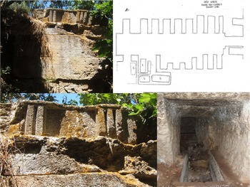
Some mixed chambers with loculi and sarcophagi are very interesting, especially one of them, which is very big: it is made up of a long gallery with nine loculi on the south side and six on the north side, and three of them are not completed; it presents two burial chambers with sarcophagi inside, which are partly located in the rocky block (Figure 22). Among the most interesting data is a series of three Hellenistic loculus tombs, whose interior is divided into various levels. Some of their loculi still preserve the false door stele. In Cyrene, this type of tomb, already seen in other parts of the necropolis, has an essential importance in the cultural relationship with the city of Alexandria, where they spread between the fourth and second centuries BC.
Wadi Sneidi: a chamber tomb with loculi and sarcophagi. (Colour online.)

Among the other evidence it is possible to recognise a well/cistern, about 7–8 m deep, which probably belonged to a previous funerary structure. Most of the evidence is often accompanied by a front courtyard with walls decorated with ashlar masonry, either actual or simulated by carvings; the facades in some cases have doors and semi-pillars; many preserve superstructures, often temple tombs, which had the dual role of burial and symbolism, to mark the graves just below; some tombs present on their facades niches for funeral divinities; the presence of inscribed bases for statues is also important.
In the area of El Darb, and also in the entire area that runs from the plain to the south-east of the border with the southern necropolis, the contribution of remote sensing was essential. It is possible to see the presence of funerary evidence, of some ancient side roads and quarrying lines in the outcropping rock; they are visible in satellite images because they are well preserved and not completely covered by plants. Other evidence is visible in the trace of the soil and in the vegetation, and they may subsequently be verified not only through the survey, but also with non-invasive prospecting and stratigraphic tests. Among these traces, there are some very important roads that seem to form a network of paths among the plots,Footnote 12 and there are traces in the soil and vegetation which usually have either a square or a rectangular shape; they are spared from the agricultural fields and include the typical metric forms of the tombs which are already known. In the colour photographs, these traces are covered with vegetation, small bushes and brambles, which take their specific form; in many cases the colour of the limestone is also detectable. So the area examined by remote sensing has been subject to survey and the evidence that was recognised by photo-interpretation has been examined for a complete documentation.
The flat area of El Darb begins just beyond Wadi Sneidi and goes in a south-easterly direction to another small alak towards Ain Daméra. The first archaeological evidence which stands out is an ancient road layout and some minor roads; it is no coincidence that the name of the area means ‘the road’. The road organisation identified by the survey, which was carried out on the south-east of the flat area, has highlighted the presence of a series of more or less important paths that divide the flat area into rectangular lots with a north-east/south-west orientation, which suggests a subdivision in kleroi/centuriae. The information will be confirmed when the survey is carried out also for the rest of the plain, up to the branches to the north-east of Wadi Sneidi. Here it is possible to notice other roads and, close to the south of the wadi slopes, also the presence of larger structures that might belong to a farm, which is usually related to agricultural land management of a later period.
The main road of the allotment is the aforementioned ancient track reported by Cassels in the map of the east necropolis. It runs in a north-west/south-east direction and is still used to reach the cultivated fields. The road is clearly visible in places, where it is also possible to notice the block of limestone used as a road surface. Further east, on the other hand, in some places it is possible to recognise the stone limits. The road is about 5.5–6 m wide and it is accessible for about two kilometres up to an area where the modern building activity has destroyed most of the remains. It seems, in fact, that it partly gets lost beneath a portion of the modern pebbly road which, as did the old one, connects to the main road that runs in an east–west direction towards the villages of Mghernes, Tert, Lamluda, and so on. A street of the same size runs in parallel to it in the south-east to the area at the south of the Katiba barracks. Other minor roads are placed in parallel to these two main routes and, therefore, with a north-east/south-west orientation. It is possible to recognise one of them, in the north-east area, which leads to the farm, and two in the south-east. They are about three metres wide (Figure 23).
El Darb: segments of the ancient roads. (Colour online.)

All along these branches of road, and in their vicinity, there is a series of rock-cut tombs, in most cases built tombs, which can be attributed once again to the Classical, Hellenistic and Roman periods. The presence of temple tombs, which very often show significant architectural features such as the Ionic kyma, Doric entablature, doors, and so on, is also very remarkable. It is possible to notice the existence of mastaba tombs; one of them, in particular, which has been recently excavated by grave robbers, contains very specific materials such as fragments of alabaster. Mastaba tombs are very numerous and often preserved in large evidence; usually, as is the case in other areas of the necropolis, they are typical of the Hellenistic period. This dating, in this specific area, converges with the growth in its importance after the trade with Egypt, where these models come from. The sarcophagi are widespread (Figure 24), with typologies ranging from the ossuary to the large sarcophagus. They are usually placed right on the road edge, creating several rows that precisely follow its course. In particular, they are located on the road situated near to the Katiba that runs in a north-west/south-east direction. In the area there is also an important example of an enclosure with sarcophagi inside. It is also possible to see the remains of built tombs, which are located along the whole of the track (Figure 25). Other sarcophagi and temple tombs seem to show traces of tumuli, not preserved anymore, or of circular fences in limestone blocks. For the tumuli and the stone circles, a more detailed study, placed in relation to other evidence of this kind, could give new information and provide a more precise dating of this section of the necropolis. Some semi-hypogeum funerary chambers are also very interesting, because, although built onto the plain, they have been heavily quarried and then the areas used as courtyards for rock-cut tombs (Figure 26). They seem to show a long series of phases and functions through the centuries: from quarries to tombs, cisterns, dwellings in recent times, and so on. In this area, too, tombs have been identified with only one chamber, or with an antechamber and a chamber, with single access, with a courtyard carved out of the wall and sometimes niches in the facade. More specific analysis and post-processing of the vast amounts of data collected for this specific area will partly clear up some of the distribution dynamics of the tombs in the territory as well as doubts regarding the specific types of tombs.
Sarcophagi on the roads in the area of El Darb. (Colour online.)

Tombs on the road in the area of El Darb. (Colour online.)

Tombs in the area of El Darb. (Colour online.)

The area of the Katiba in the eastern necropolis (M. G. Di Antonio and O. Menozzi)
The 2011 and 2012 seasons of Chieti University's team have been dedicated to the survey in the area of the Katiba at Shahat, that is in the area to which access was extremely forbidden before the revolution and which saw the very beginning of the war. The Katiba of Shahat was one of the main military barracks in the region, with a large depository of weapons and military vehicles, and it was therefore quite a sensible area for military reasons. However, the area has always been an important section of the eastern necropolis of Cyrene (for its location, see Figure 27), but very few people could see what tombs were inside and how well preserved they were during the long military use of the area. However, Dr S. Agab al Alhasi, Chairman of the Department of Antiquity in those years, sent a joint team from Chieti University together with members and collaborators of the Department of Antiquity in Shahat, including Ali Ibrahim Dhakhil il Hase, Abdulkerim Farag, M. El Mziene and a military escort in 2011, and Farag Abdel Hati and Abdalrahim Sheriff Saad in 2012. The team surveyed the area and it soon became very clear that, although the area was badly damaged around the military buildings, it contained the best-preserved built tombs of the eastern necropolis of Cyrene (see GIS map in Figure 28), constituting probably the only sample of this necropolis that is still preserved and not yet urbanised, but is at serious risk of urbanisation from now on.
The location of the Katiba. (Colour online.)

GIS mapping of the tombs and ruins in the Katiba area. (Colour online.)

The monuments mainly consist of temple tombs dating to the Hellenistic and Roman periods, some Roman mausoleums, a very monumental circular tomb on a high podium, two possible late Roman/Byzantine fortified farms, several monumental original limestone quarries, which were then transformed into rock-cut courtyard tombs and several smaller sarcophagi and other unidentifiable remains, together with sections of the ancient road system. The monumentality of the remains suggests the need for an even more detailed documentation and not just a mapping of the area, before any intervention by building or urbanisation, drawing monument by monument and also with the possibility of excavations to find some of the best-preserved contexts in the Cyrenean necropolis. Within the military camp, they had never before been visited or damaged, whereas now they are exposed to robbing, vandalism and looting.
The main issues of the current situation (C. Tamburrino)
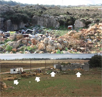
The eastern area of Cyrene, as with the territory to the south, occupies a very large portion of the agricultural land of the ancient city, which is still exploited, but is also home to the urban development of modern Shahat. It is for this reason that the road layouts and archaeological evidence (tombs, farms and so on) have in many cases been incorporated from other buildings, destroyed by construction digging or damaged by re-use (for dwellings, quarrying, and different uses); when they are spared by the houses, they are very often receptacles for garbage (Figure 29). The most peripheral remains are considerably damaged by agricultural activities, used as stables or garages or even homes, and during the past three years also as shelters for weapons and fighters. Some of the peripheral areas are also the objects of unauthorised modern building. Often the structures are used not only for finding building materials, but as foundations for buildings, or they become embedded into portions of them. The areas where the situation seems to have worsened are precisely the plain area just to the east of the small Wadi Sneidi and the plain of El Darb to which it is connected. Currently, the foot of the wadi and its walls have not undergone much damage thanks to the presence of tangled vegetation and mounds of earth. In 2006, the construction of an imposing water purifier at the south-east of the entrance of the wadi occupied land adjacent to some tombs. It is highly likely that its construction has erased archaeological traces forever.
Litter, diggings and damages in Wadi Sneidi. (Colour online.)

The easily detectable presence of the above-mentioned road layouts, which still maintain orthostats and portions of crepidoma, is also very remarkable. Some of these structures have been wiped out as a result of cultivation, but in a specific case they have been removed for the building of dwellings (Figure 30). The tombs which are adjacent to these orthostats have been retained, but structurally damaged; the construction materials have been used for new housing and the tombs have been illegally excavated and incorporated in part into the gardens of the new houses. The surveys carried out between 2011 and 2013 have revealed this disastrous situation, which can no longer be contained as had happened in the past. Pictures dating back several years testify to the difficulties in safeguarding these sites. In the plain of El Darb, in the farthest portion from the living quarters, some protection is offered by the presence of cultivated fields, which currently do not allow the construction of houses because they still are partially exploited. But, in the same place, in the south-east most portion near the road to Al Abraq, the plain is gradually being encroached upon by building works which involve the creation of a rich and impressive residential neighbourhood. Early in 2013, among these construction works were included, in particular, the building of a surrounding wall that has practically cut into several of the built tombs. The blocks that had been worked have been wiped out, moved and piled up next to the massive wall (Figure 31). These works have now practically invaded the area, as it is possible to see in the most recent satellite images (Figure 32). The ancient road, which runs in a north-west/south-east direction from Wadi Sneidi, is visible for about two kilometres, with a road surface derived from the limestone block and cart tracks, and is still used to get to the fields. In the new district, and in 2013 it was already detectable, the road has been obstructed and flattened by a large pebbly road, probably made for the passage of work vehicles. Probably all of this area's archaeological evidence, which has never been documented, has been completely destroyed. Many of the tombs spared from destruction, however, nevertheless suffered illegal excavation and damage, thereby from now on preserving only partial information. From the historical point of view, this area is as essential as the rest of the site of Cyrene, but, as seen in the previous sections, it is in the funerary study that it is of considerable importance as it retains tomb types which are either present or not in the other portions of the Cyrene necropolis.
Archaeological remains in the same area in Wadi Sneidi: 2006 and 2013. (Colour online.)

Funerary remains damaged in El Darb. (Colour online.)

(a) A GIS shot with a high-definition satellite view of Cyrene, using a false colour filter to emphasise the main features, and Cassel's map overlaid with transparency; (b) The area of the eastern necropolis: photo-reading of damages in 2012, 2013, 2014 and 2015. (Colour online.)

Conclusions
The gravity of the situation is, therefore, not only in the loss of the evidence, which is tragic in itself, but also in the loss of the information which could explain artistic, historical, social and anthropological dynamics. At the moment, the survey activity, realised with cooperation between foreign missions and the Department of Antiquities of Cyrene, seems to be the only way to verify the presence of the remains, document their existence and features, and organise a list of the monuments and sites under threat. The elaboration of maps of the risks, including typologies, distribution and degree of the risks, could become a useful working tool for the local institutions and foreign missions.
In this case, the protocol of remote monitoring and control in situ that has been organised as a collaboration between Italian and Libyan archaeologists is an example of successful cooperation to protect this historical and archaeological heritage of immense value.