Introduction
Preserving and managing the heritage of any country is a complex task which requires the availability of resources and skills, a good knowledge of the heritage itself, and a well-structured system to organize, carry out and review the work and its outcomes. Documentation and inventory – at different scales from objects to monuments and sites to landscapes – are an essential foundation for effective management and protection, especially in regions experiencing political instability or conflict, when heritage is especially vulnerable. Recording, however, should be allied with other activities, in particular the assessment of condition, risk and value, as part of a management plan that engages with the local community. An integrated understanding of the issues facing heritage at different levels aids the decision-making process, offering a way through complicated scenarios and leading to the best options being selected.
The Training in Action project (TinA) has been using and developing an integrated approach to capacity building that responds to these problems and the specific needs of Libyan and Tunisian heritage organizations. The issues and approach were investigated and identified together during previous collaborations.Footnote 1 Over the three years 2017–19, TinA has worked with 72 Libyan and Tunisian professionals on the documentation and management of archaeological sites, forming individuals and teams capable of deploying an integrated set of skills from the disciplines of archaeology, conservation and heritage studies. Impact can be demonstrated at a human level where employees have increased confidence and new competencies, while their relationship with local communities has been strengthened through awareness-raising campaigns. In addition, at an institutional level, new strategies have been implemented which have improved the protection of objects, monuments and sites.
Libya and Tunisia: A shared heritage requiring similar responses
Libya and Tunisia, although two nations in modern times, have a common past and shared cultural heritage. They are both the custodians of archaeology, the focus of this project, recognized as being of outstanding universal value including prehistoric, classical, medieval and Islamic sites and cities. The Department of Antiquities of Libya (DoA) is responsible for five World Heritage Sites (WHS) which cover this long time period, from the rock art of the Acacus, through the coastal Classical sites of Cyrene, Lepcis Magna and Sabratha, to the Old City of Ghadames, an historic Berber oasis town. Likewise, Tunisia has seven WHS. The Institut National du Patrimoine de Tunisie (INP) looks after the Classical and Punic sites of Carthage, Dougga and El Djem, the Islamic medinas of Kairouan, Sousse and Tunis, as well as the Ichkeul National Park and the Punic town of Kerkouane. Threats to the rich heritage of both countries come from environmental and human factors, with the dangers associated with urban expansion, agricultural development, natural resource extraction (especially mining and oil fields), extreme weather events and climate change, pollution, vandalism and looting being particularly prevalent. Many of these issues, common across the globe, have been exacerbated in North Africa following the revolutions of 2011.Footnote 2
Unlike Tunisia, post-revolution Libya is suffering from ongoing conflict and the associated political instability. This has seriously hampered efforts to manage and preserve cultural heritage, a fact that has been reported by scholars and in the media, if to a lesser extent than Syria or Iraq.Footnote 3 One indicator of international concern came in July 2016 when the World Heritage Committee placed all five of Libya's WHS on the List of World Heritage in Danger. Many of the threats and challenges were already present prior to the revolution,Footnote 4 but have increased significantly as a result of continued civil war, affecting the DoA's ability to enforce legal regulations controlling development and, therefore, protecting archaeological sites or preventing other illicit activities.Footnote 5
Unfortunately, there has been a substantial increase in uncontrolled development and the looting of museums and sites. Although affecting many sites and monuments of all sizes and periods, the damage to Cyrene and the cemeteries surrounding the WHS has been the most widely reported.Footnote 6 The site's boundaries have been encroached upon by new construction work, including roads and buildings, which threaten and have even destroyed significant archaeology.Footnote 7 Although many archaeological sites have not been within active conflict zones, the WHS of Sabratha was the location of armed clashes in September 2017. At that time, the monuments, in particular the theatre, was used as a shield by the militias, and the site was used as shelter for migrants. DoA colleagues have been doing excellent work with the limited resources available, focusing on the protection of sites and community outreach.Footnote 8 The same can be said of the INP, where access to resources and the ability to reach certain sites has affected their ability to prevent development and looting or enforce site protection in certain regions, especially the southern Sahara and the border region with Algeria.
These activities should be seen against the backdrop of longer-term inventory projects intended to create a complete register of objects, monuments and sites. Since 1995 Tunisia has been compiling a Carte Archéologique, which has now been integrated into a GIS database.Footnote 9 Libya, however, has no comprehensive dataset of archaeological sites at a national level, and materials in museum storerooms and on sites in both countries are often partially illustrated, and in many cases there are no pictures of the objects.Footnote 10 In this context, the rapid and appropriate recording of heritage can provide valuable data for making decisions that reduce the impact of environmental and human threats. New and reliable management systems are now a priority because without them and the documentation on which they are based, both countries’ heritage will continue to deteriorate at an alarming speed and be at threat from illegal activities.
In response to longstanding problems and the new challenges that have arisen since 2011, there have been a number of programmes focused on building capacity in heritage management in Libya and Tunisia through training in remote sensing,Footnote 11 mosaic conservation,Footnote 12 photogrammetry and ceramics. Skills are crucial to empower staff members, giving them the confidence to make the right decisions when faced with individual problems or large-scale issues. Projects run by international organisations (including the Blue Shield, British Council, ICCM, ICCROM, Getty Foundation, UNESCO and UNOSAT) have contributed to capacity building in the DoA and INP, but there remains significant need for further investment.
The limited number of personnel trained in heritage documentation and basic conservation skills can only be improved by responding to the realities of each country, especially in terms of human and financial resources. Increasing skills in up-to-date, fast, reliable technologies for heritage documentation can lead to high-quality, easily obtainable heritage records, a more complete dataset, and specialized units able to collect and manage the data. In order to achieve this within the limited resources available, it is important to use and train people in open-source software such as QGIS (industry standard mapping software). The result is digital data based on activities in the field, archive documentation and satellite images, which can be used to map threats at different scales.Footnote 13
The next challenge is how to embed these materials within a conservation and site management strategy. Documentation skills integrated with basic conservation practices, such as condition assessments and preventive conservation, are necessary for the DoA and INP to develop and implement effective management plans using limited resources. Such knowledge can also be used to assess the values and significance of the sites, and engage local communities and stakeholders in their safeguarding. Creating and renewing site management plans is a crucial component of this work. It is a complex process, however, requiring advanced skills to complete and a good understanding of the host's management system(s).Footnote 14
The production of a management plan is the result of a collective effort.Footnote 15 It requires high-quality documentation and an understanding of the site's significance from the perspectives of various stakeholders. The inclusion of stakeholders in decision making has become integral to the process – this is new to the field of archaeology in both Libya and Tunisia. A participatory approach to management is being promoted in the heritage sector, given the perception of heritage as the shared property of communities and a factor in ensuring sustainability.Footnote 16 The values people assign to places, however, are not static; they differ according to age and background, and might have changed during and as a result of the conflict in Libya and the political instability in Tunisia following the Arab Spring. This puts even more emphasis on the importance of involving the local community to share their experiences and opinions, and become part of the decision-making process.
There are further considerations in Libya. Outreach activities in post-conflict countries are essential, especially if cultural heritage is being used to foster reconciliation.Footnote 17 The Faro Convention states: ‘in the face of the present crisis relating to political representation, economic models and cultural identity, heritage provides answers by fostering citizen participation, promoting itself as a resource rooted in continuity and sustainability, and becoming a factor for dialogue as a source of respect and social cohesion.’Footnote 18 This was recognized at the International Expert Meeting on the Safeguarding of Libyan Cultural Heritage in Tunis in May 2016, where one of the main priorities of the action plan devised by the participants focused on the design and implementation of advocacy and outreach activities aimed specifically at engaging civil society institutions, schools and the media. The importance of a community-centred approach has been recognized by both the DoA and the INP as appropriate and valuable in the current socio-political environment, able to boost the local economy and bolster international tourism, once the situation improves.Footnote 19
An integrated approach to the documentation and protection of cultural heritage
TinA develops a values-based system for the recording and management of cultural heritage with high levels of significance (socio-cultural, historic, scientific and economic) at local, regional and international levels, which responds to the needs of the DoA and INP. The methodology results from the pre-existing research of the project team. It employs a new model piloted from 2014 during GIS training conducted by Durham University (Anna Leone) in collaboration with the Deutsches Archaeologisches Institute – Rome Department (Ralf Bockmann) and the DoA. The innovative system built knowledge in steps using data collected in the field by the trainees during a project carried out in the territory of the Jebel Nafusa in Libya. The results were then elaborated during focused training in Tunisia. This approach produced excellent results and has supported the successful development of a group of skilled archaeologists within the DoA.Footnote 20 Similarly, a project conducted by King's College London (Will Wootton) since 2012 has been working with the DoA on conserving and managing mosaics within the context of archaeological sites,Footnote 21 building capacity in the assessment of condition, significance and risk within the context of human use and environmental factors. It also developed new ways of delivering capacity building via practical activities on site combined with more traditional classroom teaching. Finally, the project draws upon workflows and strategies developed for the rapid documentation of complex buildings, sites and landscapes using UAV (drone) survey and photogrammetry in projects conducted in Tunisia and Tanzania between 2013–2017 by University College London (Corisande Fenwick and Gaygysyz Jorayev). These demonstrated the potential of training local colleagues to use these new, technologies to locate, map and monitor archaeological heritage in Africa.Footnote 22
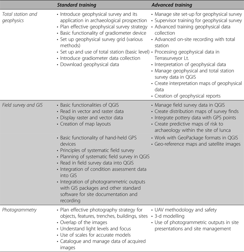
From these experiences, the project's integrated approach has emerged. TinA has taken a different approach to previous training by offering an integrated set of skills aimed at heritage protection, combining documentation, conservation and management, and community and stakeholder engagement. Content and delivery were innovative, combining traditional approaches with recent digital techniques, dividing the delivery into ‘basic’ and ‘advanced’ phases and incorporating the theoretical and practical to build knowledge and deeper understanding of the issues at stake, and giving the participants the opportunity to generate and analyse data by themselves at the training site and back in their own countries. Together these aspects were intended to encourage and enable decisions based on rapid assessment, flexibility and the ability to solve problems.
The project takes a pragmatic and responsive approach to the protection of Libya's and Tunisia's cultural heritage. The shared history between the countries and the value of common protocols underpins the collaborative approach and the project's longer-term aims for sustainability by building consensus across borders. The range of skills selected for the training cover the intellectual and practical processes required to meet the needs and result in the participants’ ability to:
1. Record sites, monuments and portable objects, using accurate and rapid techniques (field-survey, geophysics, photogrammetry, UAV survey, HeDAP app for object recording); produce graphic plans (sections and elevations) and digital 3-d models; and integrate these data into a geographic information system (GIS) to enrich their analysis and lead to a better understanding of the problems and building a long-term effective tool for the digital management of the heritage.
2. Assess the condition of monuments and produce priorities across a site based on risk (using GIS to identify and map them); identify the range of possible interventions and design action plans for the most critical problems; determine the different values of a site and create statements of significance which acknowledge and interact with stakeholders; integrate these evaluations into a management plan with effective outreach strategies which engage local communities to highlight the value of protecting cultural heritage.
Between 2017 and 2019, the project trained 72 individuals, 27 to an advanced level. Every attempt was made to enhance and promote the role of women and support better gender equality across the field of heritage in the MENA region. Each calendar year involved one or two ‘basic’ training session focused on core skills, followed by a series of ‘advanced’ ones, where participants developed their knowledge through more focused and integrated learning and practice. Advanced trainees were offered an English language course, tailored around heritage management, and were tasked with creating a ‘mini project’, either individually or collectively, which linked all the different aspects of the training.
Key challenges were to develop a sustainable approach, foster leadership skills, disseminate knowledge beyond the group of professionals attending the training sessions and, therefore, create new professional networks across the two countries. Building on previous projects and the educational literature,Footnote 23 the programme was designed around practical activities on site and in museums during which the trainees produced new data to embed skills and understand their full potential. Outside of the training workshops, participants then employed these skills during the mini projects, producing costings and schedules, workflows for different scenarios, and presentations to disseminate their results to different audiences. Mini projects were selected in partnership with the DoA and INP so that they were aligned with their current strategic objectives. They were mentored remotely by the project team, producing new research and data which formed part of subsequent training sessions. Participants applied their knowledge and skills on the heritage they knew best and would continue to be responsible for after the project ended.
These mini projects not only gave trainees confidence in their own abilities but also encouraged them to become leaders, by providing an opportunity to work with colleagues on a defined activity, which they carried through from start to finish and, in so doing, transferred the skills they had learnt and contributed more broadly to the direction of their institutions.Footnote 24 The structure of the training reinforced this. Advanced trainees from the first year of the project became facilitators in the second year. They supported the new trainees, developing and delivering some elements of the training themselves and contributing to the practical on-site exercises. The training was not just focused on learning but also on identifying and encouraging leaders who could form self-sustaining groups of their peers on defined projects, in the process transferring their expertise within their organization and beyond.
TinA is the first stand-alone training project in the two neighbouring countries that integrates heritage documentation, conservation and site management. The project was intended to serve as a model for the region and to be replicable in the target countries and other areas with similar problems. Accordingly, the training resources, manuals and videos have been made freely available online so that the participants and others in the region can continue to augment their skills and to train others.Footnote 25
Training in Action at Iunca (Tunisia)
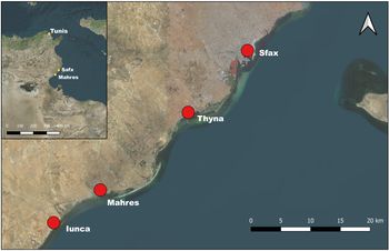
The site of Iunca,Footnote 26 located around 45 km south of Sfax on the southern coast of Tunisia, was the main location of the training (Fig. 1). The training was possible on site thanks to a research collaborative agreement between Durham University (Anna Leone) and the INP (Ammar Othman).
Overview of the location of the training site of Iunca within Tunisia and the region of Sfax. (Background image: Bing Aerial 2019)

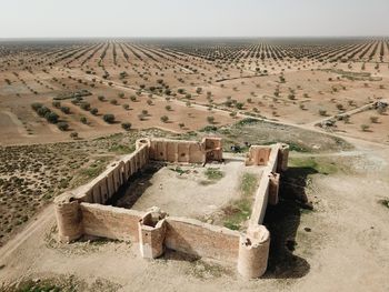
Although little known, it has been occupied for a considerable time – from pre-Roman to Medieval and modern – and is similar to much of the archaeology along the North African coastline. The site's most obvious and well-known monument is a large fort of debated date (Fig. 2).Footnote 27
UAV shot of the fort in Iunca (Gaygysyz Jorayev). The image was acquired with the permission of the local authorities during one of the training sessions in February 2018.

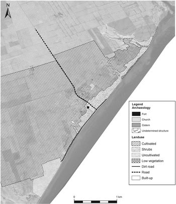
There are also important Christian churches, excavated during the French colonial period, and a marabout still in contemporary use for festivities and worship, all of which lies amid and above an unexposed Roman city.Footnote 28 The paucity of standing structures today is due, in part, to the encroachment of modern agricultural activities carried out by local landowners over one hundred years or more, as well as the limited excavations at the site during the twentieth century (Fig. 3).
Current land uses around the archaeological area of Iunca mapped from the satellite image. It is clear how modern agricultural practices such as olive tree cultivations are increasingly threatening the archaeology. (Background image: Pleiades 4-band bundle 0.50 m resolution acquired by the project – created by M. Nebbia)

A survey was conducted in 2016 and the major buildings recorded.Footnote 29 When the project began, however, the threats were significant because the perimeter had not been identified, there were no boundary markers, such as a fence, or signage, no assessments of condition, nor a management plan. As such Iunca provides a good example for the trainees because the site and its monuments have a familiar history, recognizable human and environmental threats.Footnote 30 Historically the site covers most of the periods that an archaeologist at the DoA or INP might have to deal with: pre-Roman, Roman, Vandal/Byzantine and Early Islamic.
Documentation of archaeological sites, monuments and objects
Documentation comprises all the materials relating to the archaeology that is to be protected. Collecting these together is the first phase in a programme of heritage management as it provides knowledge and understanding of its history, context and conservation through time. New records are needed to assess the current nature and condition of a site. Along with other types of assessment, these form the basis for a management plan, which demands regular monitoring and review. In the present situation within the MENA region, an important requirement of archaeological recording is rapidity, as the condition of and accessibility to heritage sites can change quickly. Technological advances in field methods meet this need, offering a multi-scalar approach which can gather complete and accurate information in a speedy manner.
The training focused on field survey with GPS, geophysical survey, remote sensing and aerial photographs integrated into GIS,Footnote 31 and photogrammetry. These are rapid, replicable techniques for the mapping of sites and monuments, which are easily learnt and applied. In order to keep the costs limited, the software used in the training focused on those available for free, as for instance QGIS. Targeted field survey can define a buffer zone, identify damage and predict potential dangers.Footnote 32 Although remote sensing has great potential, it also has limitations and should be combined with field survey to ensure accuracy and a thorough understanding of the results.Footnote 33 Together these techniques enable the recognition and recording of archaeological sites and features in the landscape as well as their monitoring.

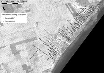
The initial priority was to understand the size and nature of the archaeological landscape at Iunca. To demonstrate this process to the participants and introduce them to the concept of intensive field walking, a systematic sampling strategy was established to map the extent of the site and its sub-surface archaeological remains.Footnote 34 A total area of approximately 250 ha was surveyed following a track-walking strategy.Footnote 35 It was decided that in order to understand the distribution of surface artefacts across the sites, a number of parallel transects should be walked by the participants and material collected at regular intervals (Fig. 4).
Overview of the regularly gridded samples wherefrom surface material has been collected during the two field seasons in 2017 and 2018. (Background image: Pleiades 4-band bundle 0.50 m resolution acquired by the project – elaborated by M. Nebbia)

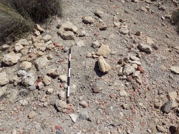
A first assessment of the quantity of surface material led to the decision to collect samples every 50 m and to include all finds found in each sample of 1 m radius (Fig. 5).
Example of surface scatter of potsherds within a sample. It is clear that the high density of surface material led us to decide on a 50 m sampling spacing and 1 m radius as pick-up area. Larger spacing or wider pick-up area would have resulted in too much material to process within the time frame available to the project.

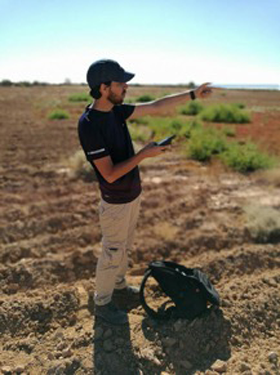
Location was recorded through the use of hand-held GPS devices (Fig. 6).
One of the participants, Fouad Elgumati, using the hand-handle GPS device to both record the location of the sample and to guide his team to the next pick-up area, during the first field season in 2017 at Iunca.

The project also developed in collaboration with the INP and the DoA a bespoke survey form in which information was recorded such as the visibility, topography and land use of each sample area (Fig. 7).
Survey form developed by the project on which to record information regarding the sample in which surface material is collected. This information will be used to calibrate the quantities of pottery and other material before comparison across the site. This is because the quantities of material collected on the surface are biased by the locational settings of the pick-up area. All this information will be then transferred into the GIS.

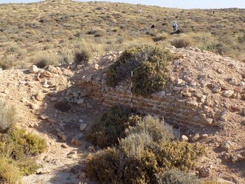
This data has been then used to calibrate the densities of surface material across the site. Along each transect up-standing features, whether in situ or collapsed, were recorded separately with a GPS point, photograph and brief description (Fig. 8).
Remains of a wall found along one of the sampling transects in Iunca. Alongside the surface collection participants have been recording upstanding features such as the one represented in the photo.

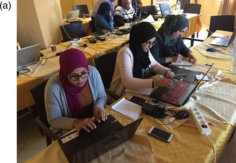
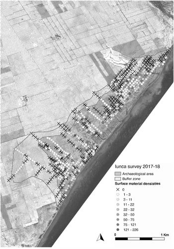
A total of 530 samples yielded over 1,000 artefacts. These were analysed, catalogued and integrated into the GIS platform as part of the project's training activities. As a result different pottery typologies and chronologies were plotted across the sites alongside the overall densities of artefacts (Figs. 9a and 9b).
Trainees elaborating GIS data

Overall distribution of surface material densities across the site of Iunca. Quantities of material are displayed with a gradient colour palette. Based on the distribution of surface material, the extent of the archaeological area (red) and the buffer zone (green) have been proposed by participants (elaborated by M. Nebbia).

A smaller team of specialists was trained in magnetometry for the exploration of the sub-surface structures, as a valuable source of further information for the documentation of large archaeological sites.
The GIS platform adopted by the project was Quantum GIS (QGIS). This is free, open-source, user-friendly and widely used in archaeological research. Its value and potential were demonstrated by integrating the data from the field survey to show how the areas of more intense human activity can be detected alongside areas of less ground visibility and fewer archaeological remains. The results contribute to the INP's understanding of the extent of the archaeological area, its development over time and the functional distribution of buildings. This information is essential for national heritage institutions as it is the basis upon which buffer zones are defined and upon which legislation relies to protect sites from encroachment and development.Footnote 36
Following the remote sensing and field-walking training, which focused on the investigation of the site at Iunca in a macro level, geophysical survey training was carried out to introduce the concept of investigation at a micro level. There are multiple geophysical survey techniques which can be employed to investigate archaeological sites. However, the project decided to provide gradiometer training. Gradiometer survey is often the first geophysical technique undertaken to detect the extent and nature of buried archaeology across a site. Gradiometer surveys are capable of detecting a wide range of archaeological features with rapid data collection. While geophysical instruments and processing software is relatively expensive, gradiometer equipment is one of the most cost-effective techniques that can be employed. Previous projects throughout North Africa have carried out successful detection of archaeological remains with gradiometer surveys. However, these surveys have always been carried out by a team of international experts and have provided relatively little training for local archaeologists. Furthermore, access to geophysical equipment in this region is also problematic. The purpose of the geophysical training was to provide equipment and training in geophysical survey that would be sustainable and replicable for future investigations of archaeological sites. Three Bartington Grad601-2 fluxgate gradiometers were donated to the DoA and INP to collect survey data and for future use for their site management plans and definition of the buffer zone.Footnote 37 Three Terrasurveyor Lt. licences were also provided in order to process the geophysical data.
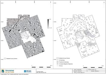
The results of the remote sensing and field walking surveys provided numerous locations that would benefit from further geophysical investigation with a complimentary dataset. Four areas at the site of Iunca were targeted with gradiometer survey as part of the standard training session in 2017 (Fig. 10.)
Iunca, Basilica 3: Detailed gradiometer results and interpretation (elaborated by P. Voke).

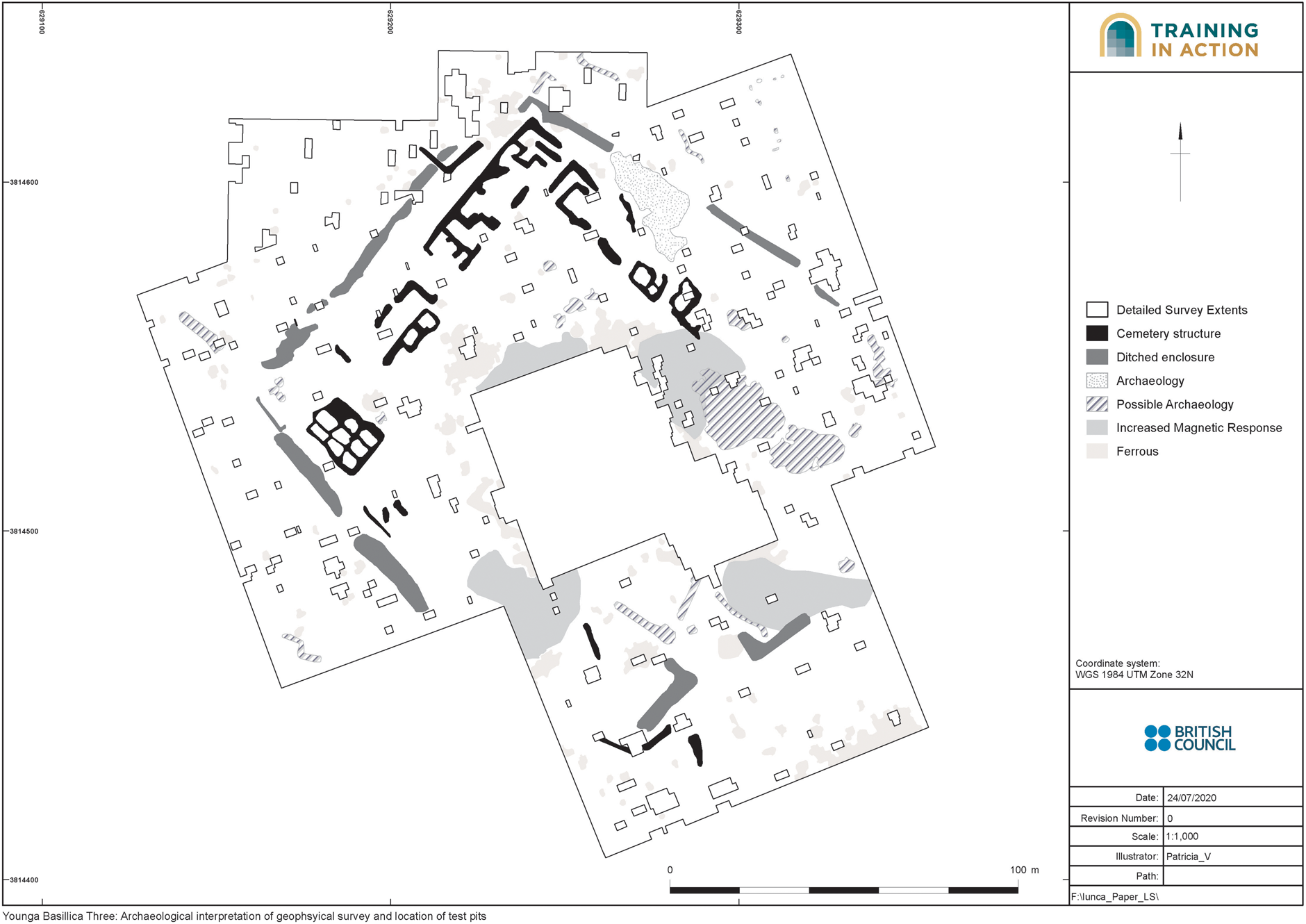
Following the successful detection of archaeological features directly north of the Basilica III during standard training in 2017, this area was used for advanced training. This was due to the presence of clear and identifiable anomalies useful for the purpose of training (Figs. 11 and 12). In addition, the results of the gradiometer survey could be used to delineate the extent of sub-surface archaeological remains surrounding Church 3.
Iunca Basilica 3: Archaeological interpretation of geophysical survey (elaborated by P. Voke).

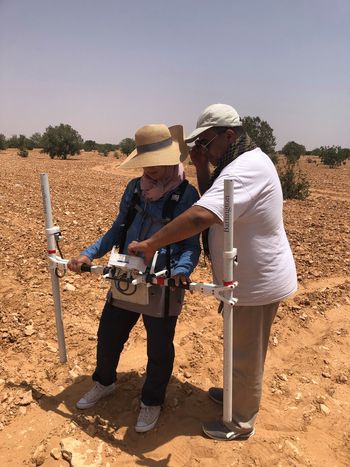
Geophysical survey training at the site of Iunca: Amina Ben Azouz and Nasser Elharari practising (September 2018).

Gradiometer survey training was conducted using a Bartington Grad601-2 fluxgate gradiometer instrument, with a vertical separation of 1 m between sensors. Data were collected at 0.25 m intervals along transects spaced at 1 m apart with an effective sensitivity of 0.03 nT, in accordance with guidelines used in UK geophysics.Footnote 38 Individual survey grid nodes were established at 20 m × 20 m intervals using tapes and bamboo canes. A total station was used to record the location of corner canes to geolocate accurately the survey data. This data was then integrated into existing GIS platform as part of the project's training activities. The trainees in geophysics collected over 3 ha of detailed gradiometer data and were taught to process the results using Terrasurveyor Lt.
The results of the gradiometer data were analysed and interpreted as part of the project's training activities. The gradiometer survey detected numerous, previously unknown, archaeological remains surrounding Basilica B. As a result of the geophysical training the trainees were able to carry out their own geophysical surveys across sites in Tunisia and Libya as part of their mini projects. The results of these surveys are now being integrated into existing research projects. Furthermore, the surveys have provided new information for buffer zones for the management and protection of archaeological sites. At the conclusion of the geophysical training the trainees have long-lasting skills in the collection, processing and interpretation of gradiometer data. They also will be able to replicate this training and induct new archaeologists in the method of geophysical data collection and survey.
Archaeological recording techniques are shifting towards digital-by-default systems with sites and features being scanned with differential GPS units and total stations. Even 3-d laser scanners are not uncommon in North Africa on international research projects. All require expensive equipment and software, skilled operators, significant amounts of computer power, and time commitment. Photogrammetric recording, or structure from motion technology (SfM), offers a way forward in this area by enabling almost any heritage specialist to record archaeological features and materials in the field three-dimensionally with limited resources.Footnote 39 The precision of the final outputs is high with sub-cm accuracy being replicated routinely in colour, even with inexpensive photographic equipment.
The use of photogrammetric techniques thus has the potential to transform the speed of documentation of heritage assets at different scales with limited financial outlay. TinA focused on using ordinary cameras – and, where possible, small unmanned aerial vehicles (UAVs) – in conjunction with widely available and inexpensive software packages. The emphasis on simplicity, affordability and scalability was key to creating a model which could be transferred to other staff members.Footnote 40 Participants gained the confidence and experience to:
1. Design and conduct photogrammetric surveys of objects, monuments and buildings using a variety of different tools (phones, cameras, GPS units, total station).
2. Process and analyse large, complex datasets of photogrammetric data using common software and following accepted data management standards.
3. Create 2-d and 3-d models, plans and elevations of objects, monuments and buildings in a variety of different formats.
4. Integrate the results with other forms of spatial and archaeological data in common software and mapping software (especially QGIS and Google Earth).
5. Develop workflows for how photogrammetry and other forms of rapid documentation can be used in condition assessment, monitoring and site management and interpretation.
Training is only successful if it can be put into practice and is replicable. With this in mind, the programme scaled up from small objects in the Musée archéologique de Sfax to the documentation of features, buildings and finally entire sites at Thaenae and Iunca (Figures 2, 13). To illustrate the flexibility of this methodology, the trainees were shown how different forms of equipment could be used depending on budget, from the cheapest, such as mobile phone cameras and ordinary rulers as scales, to more expensive DSLR cameras, UAVs and custom-built photogrammetric scales and targets Figure 14.
The trainees were also trained to use an open-source UAV data capture software called Pix4D Capture. This software gave them the skills to plan photogrammetry surveys of landscapes and collect accurate data in order to create 3-d models. This software gave them replicable skills in accurate and safe data capture with the UAV. Twenty-six copies of the industry-standard Agisoft PhotoScan were given to the trainees as the processing software because of its ease of use. Additional guidelines were provided for open-source packages of a similar nature. By the end of the training, each trainee was able to plan, document and produce 3-d models of objects and sites which could be employed in subsequent parts of the training, in particular condition assessment and monitoring, site presentation and public engagement.
HeDAP (Heritage Documentation and Protection) system: Towards the creation of a national museum databaseFootnote 41
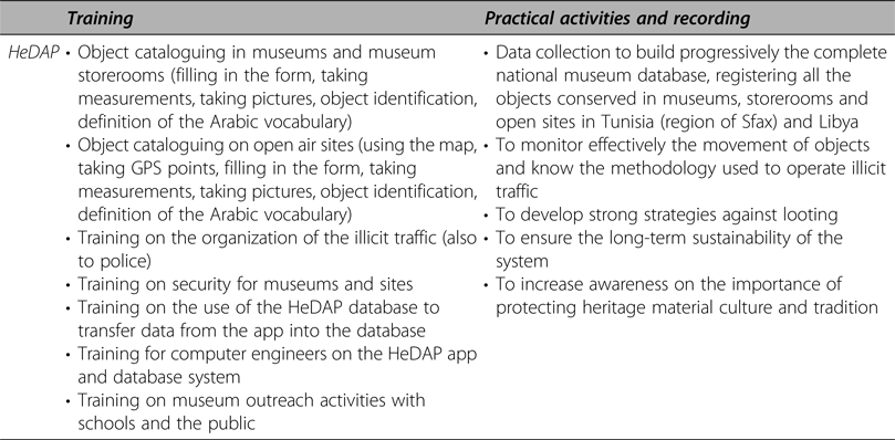
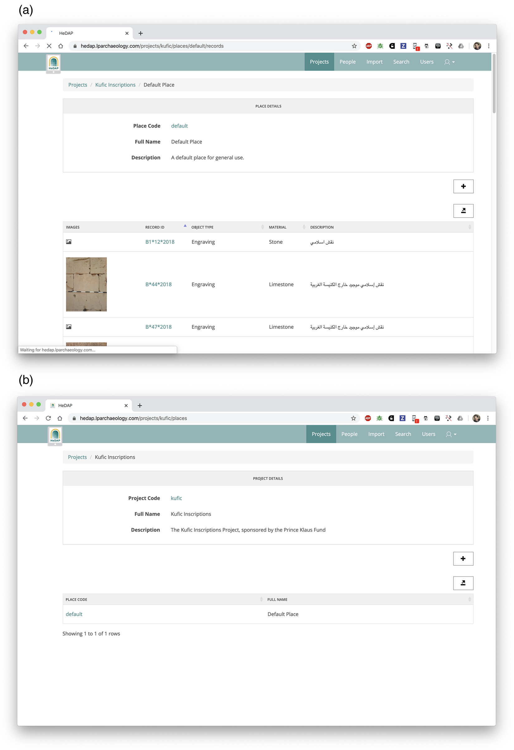
Although the International Council of Museums (ICOM) published a ‘red list’ of Libyan antiquities at risk to alert customs officials of potential illicit trafficking of looted artefacts,Footnote 42 not all object types are included in the document. The art market has many artefacts coming from archaeological sites, storerooms and museums, but very few have an established provenance.Footnote 43 The main issue that hinders the seizure and repatriation of archaeological objects is the lack of reliable documentation. The HeDAP recording system addresses this problem, offering the means to record objects using software installed on tablets. It connects photographs with a detailed form for object data collection, which includes fixed vocabularies (Arabic, English and French) and free text.Footnote 44 The resulting data, protected through encryption, is integrated with GIS and web-based databases, and managed centrally by the DoA and INP.Footnote 45 The HeDAP system developed in collaboration between Anna Leone and the DoA, to support the protection of the museum collections.

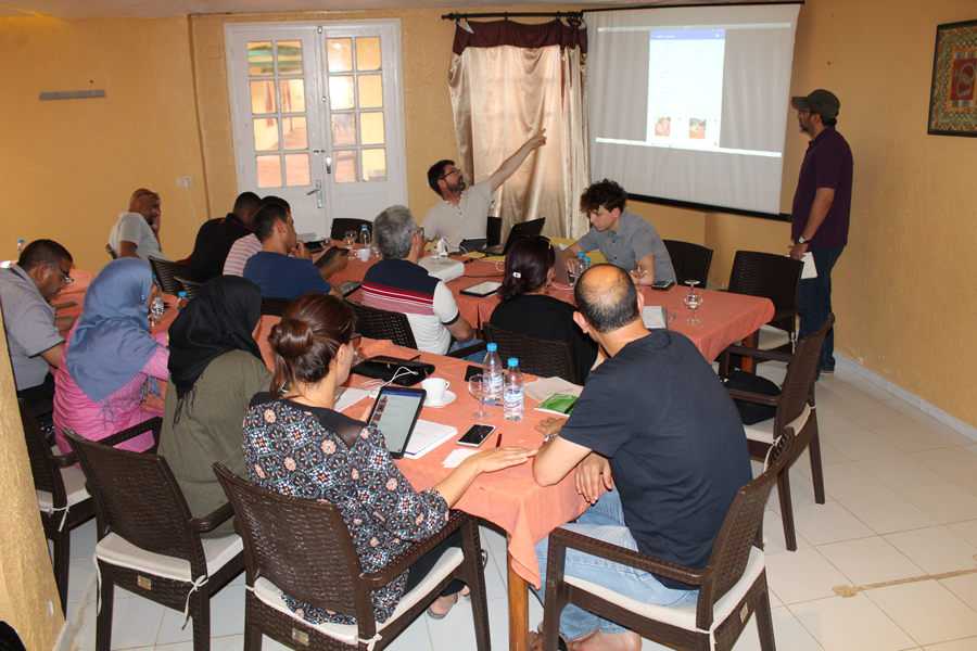
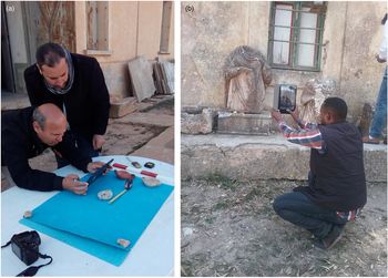
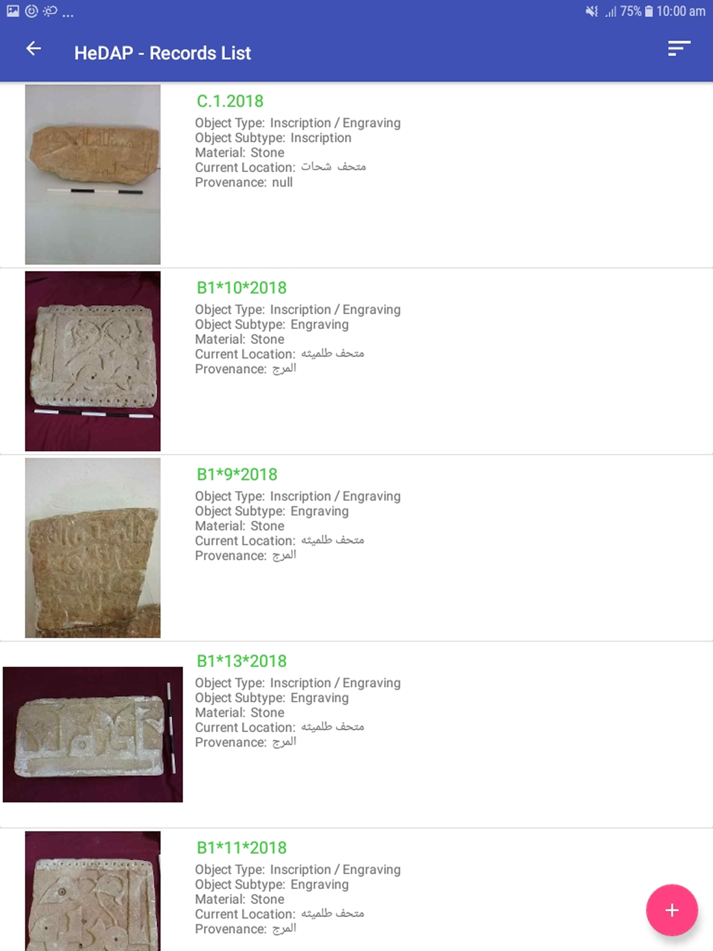
A dedicated team from both organizations has been trained to use the HeDAP system (Fig. 15). This has involved the negotiation of the technical terms to be used in the shared vocabularies. Between training sessions, the trainees tested the functionalities of the mobile application in the field, with issues and improvements fed back to the software developers for regular updates. They have taken photographs of objects and gathered data on sites and in museums across Libya and in southern Tunisia (Fig. 16a and 16b). A second, more specialized team, based at local museums, transfers the records into the database, checks them and adds bibliographic references. A third team collect the data centrally and manage the dataset (Figs. 17 and 18). They are also responsible for communicating with the international community and police, if required. The ‘bottom-up’ involvement of Libyan and Tunisian end users in the development process has resulted in increased engagement of the trainees during the workshops and a sustainable end product.
The training included the cataloguing of objects, taking measurements and photos. It was also extended to the issue of the organization of illicit traffic and security, conducted by Morgan Belzic. The training went beyond the archaeologists to members of the custom police. A meeting was held with Interpol and police from Libya and Tunisia as well as archaeologists from the DoA and the INP to improve contacts and develop an effective communication system.
Finally, in order to provide expertise within the DoA and INP, computer engineers were trained on the HeDAP and its database so that they can assure the long-term implementation of the database.
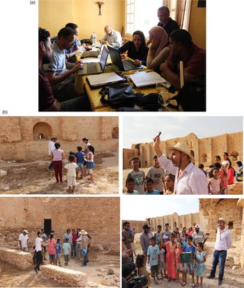
It has been widely recognized that an effective way to fight illicit traffic is to increase knowledge and understanding among the population of the importance of material culture and objects.Footnote 46 For this reason, specific training has been carried out on museum activities to involve schools of any grade. The activities were designed between the two countries, Libya and Tunisia, so that the two regions conducted the same series of outreach activities and involved schools. These included the creation of tablets in cardboard with the HeDAP form on it and asking the school children to record different types of objects so that they were introduced to the care that archaeological objects require, as well as their meaning and importance.Footnote 47 Over 6,000 objects have been recorded and three desktops with a backup system have now been given to the DoA and the INP-Sfax to implement the database.
From assessment of condition, risk and value of sites and monuments to site management
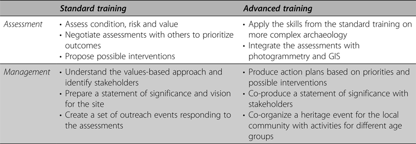
In the project's integrated approach, developed from the Planning Process Methodology created by the Demas Reference Demas, Teutonico and Palumbo2002 Conservation Institute,Footnote 48 rapid and appropriate recording is the precursor to assessments of condition and value which form the basis for making decisions about heritage protection and management in the immediate, mid- and long term. This approach was at the core of the training because it can be used effectively and consistently by heritage professionals, with various degrees of expertise and different specialities. The training was split into two distinct phases: assessment and analysis, followed by management and response.

Condition and value assessment are basic elements that help to identify the level of integrity of the heritage site.Footnote 49 The training followed a value-based approach, rather than an object-centred one, so that the condition of the site and its values are understood together before any interventions are made.Footnote 50 At Iunca, we used various approaches to evaluate the structures and to manage the associated data, including basic descriptive methods with forms and also computer-aided ones such as photogrammetry and GIS. To facilitate the training, we designed specific sheets to undertake the condition assessment, in both Arabic and English, based on the team's expertise in conducting architectural building survey, analysis and description. These sheets were then augmented in dialogue with the trainees to meet the requirements of the DoA and INP, and have subsequently been integrated into their systems of reporting.
The approach to condition assessment was systematic and replicable. It follows clear steps for the identification of materials, previous interventions, areas of deterioration, along with the underlying factors and likely rates, the associated risks and their impact (figs. 19, 20a). It identifies the possible interventions and then prioritizes them, based on the severity of the damage and risks to the structure and people. Focusing on the fort at Iunca, a report was produced and submitted to the INP in June 2018 which detailed the current risks to human life and to the architectural integrity.Footnote 51 All risks were characterized and a set of recommendations made to ensure human safety and the protection of the structure. During the advanced training photogrammetry was incorporated into the assessments, leading to the creation of 2-d plans and 3-d models to document and monitor condition over time. GIS was used to contain the data, interrogate it and produce priorities.
Rapid condition and damage assessments are essential in the context of emergency and conflict situations. Many studies have focused on this specific challenge to protecting cultural heritage, but few have done so in the context of capacity building using a more holistic programme which supports the complete heritage management cycle.Footnote 52 Need and response will depend on the scale of disruption and the security situation of the area. Risk assessment, therefore, should consider both the structure itself, based on condition, but as importantly the individual(s) conducting the assessment – a point we have emphasized in our report on the fort of Iunca. Risks, however, may need to be assessed in advance of the proposed activity, as is the case at Sabratha, where some of the participants were recording the condition of buildings following a recent armed conflict. This involved determining the risk to those conducting the exercise as well as devising an inventory of the necessary equipment to carry on that occasion.
Condition and risk were undertaken in combination with the assessment of values, which is widely considered as part of heritage protection planning, for example in the Nara Document on Authenticity (1994), the Declaration of Saint Antonio (1996), and the Burra Charter (1999). Values and the participation of stakeholders are viewed as essential elements in the planning and decision-making process.Footnote 53 The integration of condition and value assessment, therefore, is a crucial part of the management plan, which has the aim of improving site protection and strengthening the involvement of the local community.Footnote 54 We adapted a tool that could facilitate the proposal and assessment of these values, called a ‘Statement of Significance’.Footnote 55 This statement includes a summary of the most relevant values that give the site and/or the place its character, including the following categories: historical, social and cultural, architectural and aesthetic, research and education. All of these were applied by the participants to the case study site of Iunca and to the sites at which they work.
The values-based methodology connects the protection of cultural heritage with its wider socio-economic context, so that it can respond to local needs and interests, as well as forming part of the peace-building process. Shared objectives and values, however, should not be assumed especially in the post-conflict context of the MENA region. This is a fundamental issue that lies at the core of values-based heritage management models but has particular resonance in the field of post-conflict healing, where the ethical conduct of archaeological and heritage specialists should be reflected on and scrutinized.Footnote 56 The importance of shifting the balance of power between professionals and stakeholders has been much debated and is resulting in greater equity between these groups in all aspects of archaeological practice and management.Footnote 57 This involves developing inclusive, rather than exclusive, approaches to both decision making and participation.Footnote 58 During the training we highlighted the importance of values being identified from the bottom up rather than imposed from the top down, which is why stress was placed upon the engagement of stakeholders and members of the local community, and public outreach activities (figs. 20b, 21).
Local stakeholders, outreach and community engagement
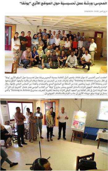
An important component of the integrated methodology is to emphasize the inclusion of people, stakeholders and members of the local community in the management and protection of archaeological sites. The effectiveness of managing cultural heritage in both countries requires the development of a vision that cares as much for those connected to the material remains as about the material remains themselves. Accordingly, we organized Charrette-style workshops, where representatives from the local community and stakeholders in Mahres and Sfax were invited to listen and respond to the participants’ visions and participate in the co-production of a statement of significance for the site of Iunca (Fig. 21).Footnote 59 This part of the training focused on their skills in understanding the planning process, moving from the identification of the site, its values and condition assessment, to a response which is predicated on an overall vision for the site and a set of guiding principles which involve the setting of objectives and the development of strategies. It also involved members of museum staff who were responsible for organizing outreach activities in the museums where the HeDAP was used for the catalogue of objects.
After the workshops with the stakeholders and local community, the focus of the training shifted to outreach activities (fig. 20b). With the visions, values and memories about the site in mind, the trainees designed outreach activities aimed at different age groups (6–11 years, 12–21 years, adults).
The focus was on the children and young adults, as they have the greatest opportunity to have a positive impact on sites over the medium to long term. These groups, however, have often had their sense of attachment, belonging and identity damaged due to security issues, accessibility problems, and the paucity of activities, information and education. Outreach activities, whether virtual or real, play a major role in providing knowledge and understanding, social events and psychological support to people of all ages, but especially children.
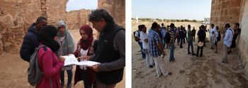
The application of skills related to engaging stakeholders and conducting outreach activities are quite specific. As part of the training, therefore, participants developed and delivered their own events, discussing them afterwards, to practically develop these skills.Footnote 60 Real-world experience was gained during a co-produced public event as part of ‘Tunisian Heritage Day’ in April 2018. This event was organized in collaboration with the INP and in parallel with the 27th session of Tunisian Heritage Month under the theme ‘Universal Values of Tunisian Cultural Heritage’. The main aims were to raise awareness about the tangible and intangible cultural heritage of the site of Iunca, to highlight the role of the local community in protecting and promoting its national cultural heritage, and to give an opportunity for the trainees to apply the skills learnt in class.
This collaborative activity took participants through the main steps for event planning, including understanding the history and benefit, identifying the audience (stakeholders/community), organizing the activities, implementing the activities, and collecting feedback. By evaluating these activities, the project and participants were better able to assess values from a range of different stakeholders and incorporate them into their visions for the site and overall management plans. It was also possible to demonstrate the significance of public engagement in bringing the community together around heritage issues in order to create and maintain support networks and, therefore, improve the sustainability and impact of conservation work. As part of their mini projects, participants have organized many activities back home, some of which built on those created during the training, and, in one case, even crossed national borders connecting communities in both countries.
The trainees in action: Mini projects in Tunisia and Libya
The trainees selected for the advanced training were responsible for running ‘mini projects’ in their own territories, collaborating with other participants and colleagues, and practising one, some, or all of the skills learnt during the training at Iunca. These mini projects were developed in phases, in parallel with the rationale of the training, which gave the trainees the opportunity to test the methodologies in practice and modify them to meet their local challenges and needs, and gather new data for the protection of various heritage sites. They were mentored remotely by the project team while doing the work and also received feedback during each training session.
During the three years of TinA, the advanced trainees conducted their projects, testing their skills by collecting new data, entering that dataset into GIS in order to monitor sites and buildings, map threats and develop priorities and interventions, thereby contributing to the running of their respective heritage organizations. In total, there were 33 mini projects completed over the course of the project.Footnote 61 Their results were presented during a public conference in January 2019 at the Institut National du Patrimoine INP in Tunis. The projects can be grouped under four themes that demonstrate the diverse training offered by TinA:
1. Archaeological survey for mapping and protecting sites.
2. Integrated documentation methodology (GIS, photogrammetry, condition assessment).
3. Awareness raising and outreach activities.
4. HeDAP and the national museum database.
There are six mini projects focused on archaeological survey, three in Libya and three in Tunisia. Four used geophysical survey to identify buffer zones, two in Libya (Tocra; Qaser Alakyar and Zwara) and two in Tunisia (Gabes; Thyna). Survey work and remote sensing were also undertaken at Carthage, Cyrene and the southern part of the Tarhuna region. All of these projects created new teams and trained colleagues, ten in total, who had not attended the training. They also produced new data, submitted to the DoA and INP, identifying threats from urban expansion and vandalism, and offering plans for mitigation and protection.
Nine mini projects used the integrated methodology, focusing their efforts on condition and value assessments of archaeological sites in tandem with photogrammetry and GIS. The documentation produced has been deposited with the DoA and INP, detailing current condition at sites in Libya (Bani Waleed; Sabratha; Tocra Baths; the buffer zone of Cyrene; the Hunting Baths of Lepcis Magna, etc.) and Tunisia (Ad Aquas Church; Bechima Roman Tower; Henchir Bourgou; Kasar Chouline, Maatmata; Saadeh Mosque, Sfax; ‘Sidi Moussa Jemni’ Madrassa; Thyna Baths; Carthage), as well as risk maps and priorities for intervention. In some, action plans for emergency interventions have been produced and in the cases of Sidi Moussa El Jemni and Ad Aquas work was undertaken. The projects have involved the training of at least 18 more members of staff across the DoA and INP. In addition, two projects were conducted at WHS in Libya (Sabratha and Lepcis Magna). The reports produced by the trainees were included in a DoA submission to UNESCO in February 2019.Footnote 62
The third group of projects focused on outreach activities and awareness-raising campaigns as part of the effective management of cultural heritage. There were four projects in Libya (Acacus; Fezzan; Lepcis Magna; Cyrenaica) and two in Tunisia (Acholla; Djerba). Through these projects, new collaborations were established with local schools, NGOs, the Red Crescent and other local heritage bodies.Footnote 63
As part of the widening impact of these campaigns, the trainees have taken part in three documentaries about Libyan heritage, three interviews on national television and one on a local radio station. Local sites have also received new interpretation panels: three in Libya and one in Tunisia. Installed in multiple languages for the first time, including Arabic and local indigenous dialects, they are aimed at engaging local populations and promoting understanding of shared heritage.
The fourth group of projects has focused on object recording using the HeDAP. In total, nine projects have documented around 5,808 objects in both countries, including six museums in Tunisia and seven in Libya, as well as two sites in Tunisia and four in Libya. A national team in Tunisia has been created with individuals trained by TinA participants. They have also developed museum outreach activities, targeting local schools, focused on Kufic inscriptions in Libya and objects in Djerba Museum. The main aim has been to highlight the value of object recording, with events being put on for hundreds of school children.
The results of our colleagues' work are impressive and stand testament to their skills in documenting and protecting cultural heritage, their dynamic response to the practical problems at hand, and the overall impact of an integrated approach to heritage management. The data generated by these projects is being used by the DoA and INP to manage and protect the sites. The increase in activities and the new co-operations guarantee sustainability with work ongoing in the field. It suggests a bright future for the respective organizations at this difficult time, also demonstrated by recent successes by participants to win external funding for their own projects.Footnote 64
Conclusion: The need for an integrated approach to documentation and protection
The core aim of the project has been to build capacity within the DoA and INP. As evidenced through the mini projects, staff members who attended the training programme have a skill set that covers an integrated and holistic approach to heritage management and are now establishing the priorities for cultural heritage protection and engagement at different sites and regions across Libya and Tunisia. They are also transferring their skills to colleagues and students, and engaging stakeholders and local communities in the preservation of archaeological sites.Footnote 65 We encourage others to use and develop the methodology in the hope that it can continue to have wider impact as a model for capacity building.Footnote 66
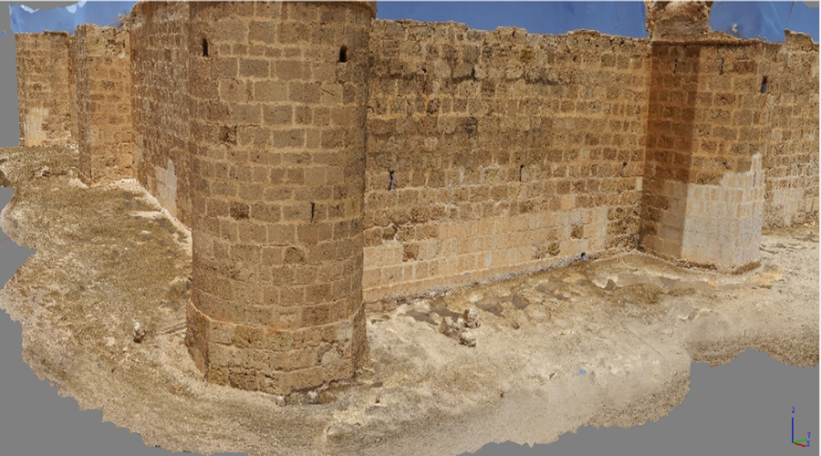
3-d model of the fort of Iunca elaborated by the trainees (July 2017).

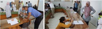
(a and b). Trainees practising photogrammetric method to document objects at the Museum of Sfax (June 2018).

Trainees working on the HeDAP (June 2019).

(a). Recording objects with the HeDAP at the site of Thyna by Rached Hamdi and Nabil Belmabrouk (2017). (b) Recording objects with the HeDAP at Cyrene by Momahed Bouleigha (2019).

Screenshot of records from the HeDAP (elaborated by John Layt).

(a and b) Screenshot of the HeDAP database (elaborated by John Layt).

Condition and risk assessment training at the Fort of Iunca (June 2019).

(a). Trainees analysing and digitizing the condition assessment recorded on the field (June 2018). (b) Outreach activities at the site of Iunca (July 2017).

Engaging with the public, workshop with key stakeholders at Iunca and Mahres (June 2019).

Acknowledgements
We are grateful to the Cultural Protection Fund (the British Council in partnership with the Department for Digital, Culture, Media & Sport) for funding the project and our grant managers Alexander Bishop and Catriona Jackson for looking after the project. TinA would not have been possible without the support of the Department of Antiquities of Libya and the Institut National du Patrimoine in Tunisia and their directors; thanks in particular to the INP who hosted the training at Iunca and the project's Tunisian co-director Ammar Othman. Thanks are also due to our Libyan colleagues who supported the training and helped us deliver it: Moftah Hddad, Ziad Siala, Ahmed Emrage, Mohamed Hesein Bianco. Gratitude is due to Vincent Michel, director of the French Mission of Libya, and Michel Bonifay, University of Aix-Marseille, for collaborating with the project. Michel Bonifay conducted pottery training for our trainees on the field.
A special thanks goes to all our 72 trainees and, in particular, our advanced trainees:
DoA (Libya): Mahmdoud Hadia, Ahmed Masoud, Nasser Alharari, Fouad Elgumati, Abdulsamad Alshiyin, Faraj Atelawi, Mohamed Bouleigha, Adullah Hamida, Hussein Eldali, Misbah Badr Abdulafith, Ali Khalfalla, Abubakr Adade, Hani Mohamed, Mohamed Mannaa.
INP – Tunisia: Nabil Belmabrouk, Nesrine Derbel, Hela Mekki, Yacine Lakhal, Amna Ben Azouz, Amina Ferjani, Kais Trabelsi, Abdallah Nayli, Nadia Tebai, Rym Jrad, Imen Askri, Nizar Ben Slimene, Sana Ben Ammar.
Finally, our gratitude is due to Mohamed Ali Othmen for his excellent logistic support throughout the project – we could have not done it without him.