

Around the eleventh to thirteenth century CE, Nguni-speakers living southeast of the Drakensberg Escarpment, between the Mfolozi and Mzimkulu Rivers, began investing in extensive cattle-herding.Footnote 1 Nguni-speakers and their Southern Bantu-speaking ancestors had kept cattle in some measure since the early first millennium, but, before the eleventh century, Nguni-speakers did not prioritize cattle as a source of food or a valuable commodity. As they made the transition to cattle-keeping between the eleventh to thirteenth century, they drew on their unique social history, using rites of passage and shared notions of gender propriety to channel young men into unequal labor relations. The history of cattle-keeping among Nguni-speakers thus intersected with the ongoing construction of the household and the relations and identities comprising small social units in the early centuries of the second millennium CE. This article draws attention to the ways in which social context can set necessary conditions for changes in food technology and political economy.
In what is now the KwaZulu-Natal foothills of the Drakensberg Escarpment, high elevations underwent an ecological shift after the mid-first millennium CE, a few centuries prior to the extension of Nguni speech communities in the region. Climate trended towards wetter conditions, seemingly restricting heathlands indicative of less fertile soils and expanding forest cover.Footnote 2 At the end of the first millennium, a notable and nearly absolute shift in settlement patterns from low-lying riverine areas to uplands environs may have coincided with more favorable farming conditions in the foothills and a potential increase in biting insects in the valleys.Footnote 3 While abundant grassland was well-established at high elevations, some evidence indicates that the seasonal carrying capacity of uplands settlements was low, limiting the availability of suitable farmland and open pasture beyond the extension of disease vector zones.Footnote 4 The environment in which cattle-keeping took hold thus rendered the choice to accumulate large herds of cattle a counterintuitive one. Among Nguni-speakers living in the Southeast at the start of the second millennium, the adoption of cattle economies required a deliberate strategy demanding remarkable social investments without which the maintenance of large herds of cattle would have been impossible.Footnote 5 To satisfy this need, they began to channel young men into unequal generational relationships and gendered identities conducive to the extraction of their labor. Households began to impose on young men who had passed through initiation the expectation that they would make their labor available as cattle herders, and that doing so satisfied the characteristics of sociable adult masculinity.
The counterintuitive history of cattle-keeping among Nguni-speakers shows how generations of communities southeast of the Drakensberg Escarpment wrought practices that fit, amplified, and refined relationships and ideas important to them. This approach highlights the ways in which the choices households and small collectives made about how to manage intergenerational relations of power accumulated into large-scale political economic transformations over long periods of time.Footnote 6 For Nguni-speakers, the innovation of new ways to manage labor and loyalties was a necessary condition of the expansion of cattle-keeping. At the same time, increased possibilities in herd management and resulting wealth encouraged the institutionalization of gendered and generational regulations of young men's bodies and identities.
As the history of Nguni cattle-keeping shows, households served as nexuses for transformations in foodways and mediated new opportunities through the intimate relationships necessary to supply labor and form alliances. Nguni-speakers long practiced male initiation through circumcision, and households that promoted the importance of initiation introduced cattle-keeping into the discourse surrounding the social conditions of adult masculinity between the eleventh to thirteenth century. These efforts gradually transformed the household as well, creating a new emphasis on the curation of masculine respectability and new expectations of potential sons-in-law. Through gendered and generational debates over the relationship between entrepreneurial pastoralism, sociable forms of masculinity, and young men's relationships, households conducted the work of shifting the food systems and political economies of Nguni-speaking communities in the Southeast. The choices households made as they initiated their young men, sought marriage partners for adult children, and pooled resources across households constructed and reinforced shared beliefs regarding the value and meaning of cattle as a social form of wealth. Institutions and ideologies related to the distribution and exchange of cattle thus emerged from the gradual transformation of social relations within the local and long-term history of Nguni-speakers.
A SLOW REVOLUTION: FOODWAYS AND SOCIAL CHANGE
In Southern Africa, cattle have received considerable attention, taking shape in historical writing as a ‘god with a wet nose’, at once intensely intertwined in the forging of social bonds through marriage and clientship and the formation of political economies in the region.Footnote 7 In the early twentieth century, the importance of cattle derived from their utility as sources of food, skins, milk, and dung; as ‘the principal medium of exchange, and the medium in which court fines [were] levied’; as a conduit for appeasing the ancestors through sacrifices; and as ‘the means of obtaining sexual satisfaction, since a legal marriage [could not] take place without the passage of cattle’.Footnote 8 The commissioning of a marriage through the payment of cattle, a practice known as lobola, gave the union legitimacy. It gave men sexual access to their wives and claim to the children she produced.Footnote 9 In essence, the payment of lobola transferred the rights a woman's natal household held over her productive and reproductive labor to her marital household.Footnote 10
While linguistic evidence suggests the concept of lobola has deep antiquity among Southern Bantu-speakers and derived from the revision of concepts of social transaction among their East Bantu-speaking ancestors, the institution should not be regarded as uniform even in the recent past.Footnote 11 Rather, early twentieth-century ethnography and interviews conducted by colonial administrator James Stuart from the 1890s to 1910s reveal lobola to be an expansive category within which households made claims and assurances in preparation for joining their interests through their adult children. Within these processes, cattle sometimes played a major role, but other times did not. The spirit of exchanges made before a wedding were more important than the medium of the transaction, and variability and flexibility were important features of lobola.Footnote 12
Stability has nonetheless tended to define analyses of cattle and their social role in early Southern Africa. Most notably, Thomas Huffman's archaeological model, the Central Cattle Pattern (CCP), seeks to describe the shared worldview of a population structuring their use of space as well as their foundational beliefs about the world around them.Footnote 13 The construction of the model begins with observations of correspondence between the use of space and a range of social features in the ethnographic present, including a preference for the use of cattle as bridewealth, which must be held as constant. Proponents of this method argue the established spatial patterns can then be identified in archaeological settlements, creating a link between the social features available through ethnography and the past societies represented in archaeology.Footnote 14 The model has faced consistent critique for its treatment of culture as stable over time and space, though it remains popular as a comprehensive account of the past from the sixth to nineteenth century.Footnote 15 A considerable shortcoming of the model is that it foregrounds large-scale population migration as an explanation for the imposition of new worldviews and thus changes in material culture.Footnote 16 Indeed, Huffman claims Nguni-speakers cultivated their worldview in East Africa before migrating to Southern Africa, and thus ‘the spread of a fully mature … way of life was but a by-product of … migration and needed no further explanation’.Footnote 17 One integral aspect of this way of life, according to the CCP, was long-term continuity in beliefs that structured preferences for cattle as a conduit of bridewealth and of ancestor veneration. Within the CCP, cattle thus became descriptive and constitutive of Southern Bantu culture and history from the earliest times through the present.
This article instead presents a history of cattle-keeping among Nguni-speakers in which gradual social transformations created conditions allowing for the labor-intensive work of transhumant herding and a growing awareness of the ways cattle could be used in the dispensation of social relations. Nguni-speakers had always kept cattle, a subsistence strategy inherited from their Southern Bantu-speaking ancestors; the reorganization of their political economies in the eleventh to thirteenth century thus shows the ways available food technologies become more feasible, popular, and meaningful through local engagement. In recent years, scholars of Southern Africa have emphasized the importance of local conditions over exotic imports, including the character of social relations and networks, in understanding circumscribed political economies.Footnote 18 For Nguni-speakers, local efforts to manage the challenges of new environmental and demographic circumstances likewise shaped their engagement with cattle-keeping and the ways in which they chose to order gendered and generational relations of power in an effort to better manage food production and acquire wealth.
This article draws on Jan Vansina's model of a ‘slow revolution’ in farming technology, in which farming spread throughout sub-Saharan Africa not as the result of a single wave but through incremental processes of contact, exchange, and local adoption. Several histories of the distant past in Bantu-speaking Africa have chronicled examples of smaller-scale adoption and incorporation of food technology in both farming and animal husbandry, supporting the idea that gradual, intergenerational strategizing over access to resources was crucial in shaping the ways communities understood those goods to work in the world.Footnote 19 Furthermore, as Kathryn de Luna has recently shown for Botwatwe-speakers of Central Africa, the availability of farming, herding, or a multiplicity of other food practices did not structure the responses of communities, but rather could result in multiple slow revolutions as people adjusted their subsistence strategies. Accordingly, responses to the introduction of food technology should be regarded in conjunction with broader circumstances, including changing ideas about who had access to and could generate wealth by pursuing those strategies.Footnote 20
For Nguni-speakers, the gradual rise of cattle economies resulted from the dual pursuit of greater control over young men's labor and loyalties and the exploitation of that control for the purposes of undertaking the difficult work of cattle-keeping. The increasing importance of cattle among Nguni-speakers was thus a slow social revolution, in which the recasting of gendered and generational social relations amplified cattle-keeping as a worthwhile pursuit, and in turn cattle and cattle-keeping became an institution through which Nguni-speakers reproduced social relations and practices. As with Botatwe-speakers, the availability of cattle did not ordain the construction of a cattle-keeping way of life, but rather meant that domestic herding was available to fit the social strategies of a community struggling to maximize the use of available resources, including labor, in a part of the world characterized by significant ecological challenges and impediments to participation in regional trade. The small-scale changes Nguni-speakers wrought within and between households allowed for the extension of intensive cattle-keeping to the area southeast of the Drakensberg Escarpment.
While the forging of local attitudes towards cattle unfolded according to new social conditions, Nguni-speakers also intensified cattle-keeping in the larger context of political economic transformation throughout much of Southern Africa. In the centuries leading up to and contemporaneous with Nguni-speakers’ eleventh- to thirteenth-century undertakings in pastoralism, major commercial hubs like Mapungubwe, Toutswemogala, and, later, Great Zimbabwe were undergoing processes of assigning new meaning to cattle as well. Transformations in local political economies thus unfolded in the context of regional changes in attitudes regarding the value of cattle, but were also unique to the conditions experienced and created by Nguni-speaking communities.
AGROPASTORALISM AND SETTLEMENT, NINTH TO ELEVENTH CENTURY
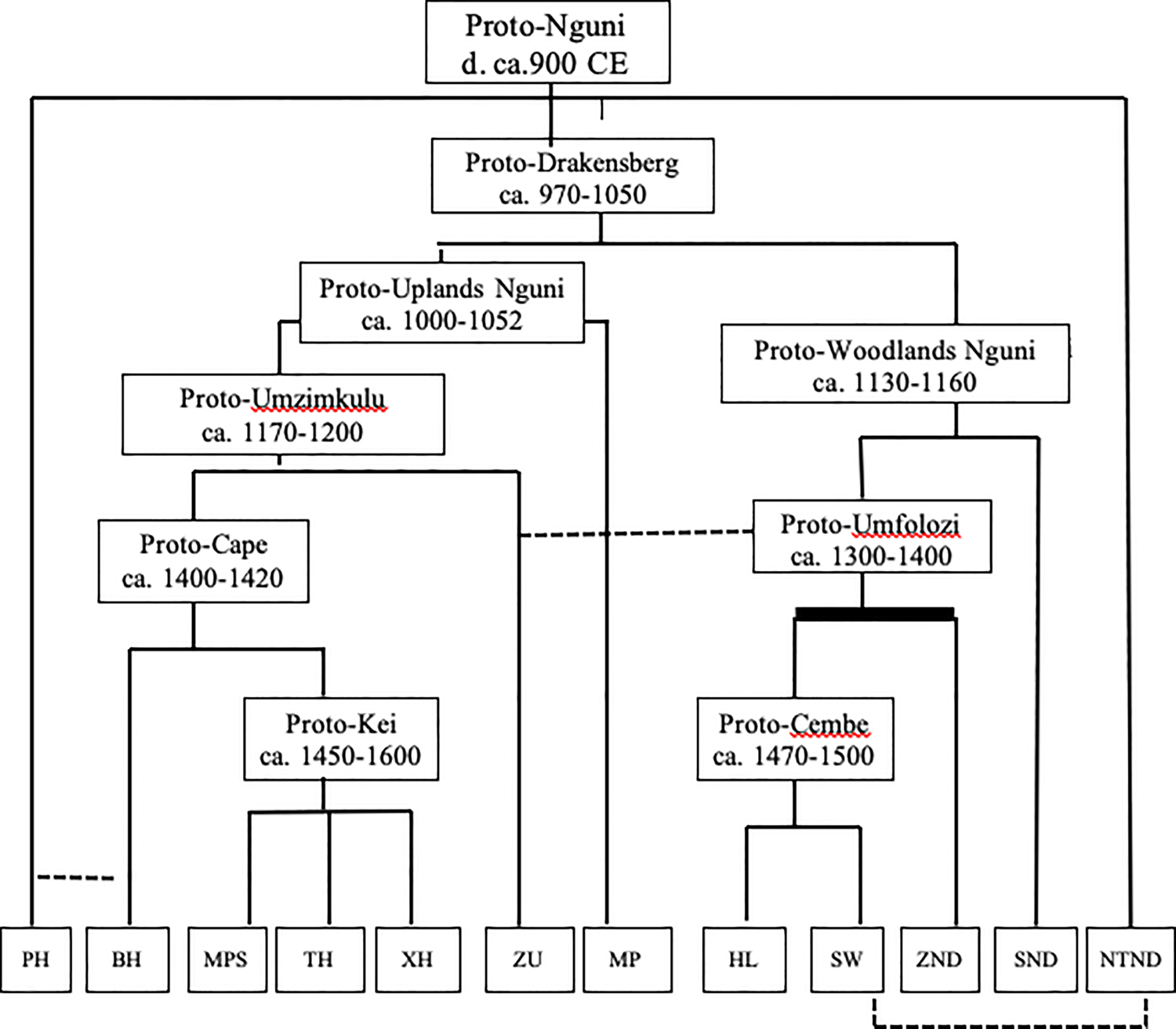
In the late first millennium CE, Proto-Nguni emerged from an intermediate subgroup of Southern Bantu, an ancestor shared with Sotho-Tswana, Shona, Tshwa-Ronga, and Venda. The speech community populated the riverine Lowveld to the east of the Upper Drakensberg, where it diverged in the late ninth century, yielding Proto-Drakensberg and ancestral forms of Northern Transvaal Ndebele and Phuthi.Footnote 21 From roughly the ninth century, Proto-Nguni and its descendant speech communities diverged rapidly through short-range movement, populating the landscape southeast of the Drakensberg Escarpment in dispersed settlements. These earliest Nguni speech communities inherited knowledge regarding cattle-keeping from their ancestors, which they not only carried with them into new environments, but also generated a range of knowledge as they learned to use their animals in different ways.
Classification of Nguni.

Proto-Nguni-speakers inherited a generic breeding taxonomy for domestic stock indicative of the knowledge necessary to grow and manage herds and flocks. They shared some of this lexicon with other descendant speech communities of Southern Bantu, and their linguistic ancestors seemingly inherited many of these words from even more distant ancestors who diverged in Eastern Central Africa or earlier in East Africa. For example, terms like *-kunzi, ‘male animal’; *-kábi, ‘steer, ox, bullock’; and *-tole, which refers to both a heifer and an unweaned calf seem to derive from an indeterminate ancestor shared with speech communities in what is now Malawi and Eastern Zambia.Footnote 22 Tellingly, these roots referred to all species of domestic stock — including fowl, goats, and sheep — as well as wild animals, and did not specifically indicate cattle.Footnote 23 Proto-Nguni-speakers also used the inherited root *-pákul-, ‘to castrate’, showing that their knowledge of livestock went beyond passing familiarity.Footnote 24 Herders controlled the number of intact males among their animals, which prevented damage from competing males, limited reproduction, and converted breeding animals into a separate category useful for draught power and meat.
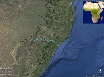
Approximate location of Proto-Nguni speech community. Source: Google Earth.*
*Adapted by author from Google Earth 7.3.3.7721, ‘Newcastle, ZA, eye alt. 544.78 mi.’, 27°42′48.43” S and 30°1′11.70″ E (13 Dec. 2015), viewed 17 June 2020.

While Southern Bantu-speakers seemingly preserved the vocabulary for a generic breeding taxonomy, the larger ancestral speech community also adopted a new term for ‘cow’, *-komo.Footnote 25 Christopher Ehret has argued Southern Bantu-speakers living in clusters around the Limpopo River acquired the term from Khoekhoe-speakers, but his interpretation has not been without critics.Footnote 26 Some contention also lingers as to how livestock entered Southern Africa. The delay in disseminating herding practices from Central Africa has been explained by the presence of a barrier of major animal diseases including trypanosomiasis.Footnote 27 In the absence of effective herd management practices, the threat of disease prevented the movement of livestock farther south. A shift in temperature and rainfall around the turn of the Common Era may have redistributed ecological biomes conducive to disease vectors in the area of Northern Botswana around the Okavango Delta, easing expansion of livestock.Footnote 28 It is uncertain if Khoi and San desert specialists were subsequently the first to adopt cattle and small stock, traversing the Kalahari with their animals and later transferring them to Bantu-speakers.Footnote 29
The availability of an inherited breeding taxonomy and animal husbandry technology suggests some continuity in stock-keeping in the Southern Bantu speech community, but the generic nature of the vocabulary cannot specify whether that continuity included cattle. The innovation of *-komo suggests a change occurred in Southern Bantu-speakers’ relationship with the animals. While the origins of cattle in Southern Africa remain up for debate, domestic livestock was certainly widely available towards the mid-first millennium CE as Southern Bantu speech communities diverged and populated the region.Footnote 30 As descendant speech communities differentiated, however, their use and knowledge of cattle produced dissimilar lexicons, indicating independent processes of innovating practices of subsistence and social uses of livestock.
During the earliest phases of their history, Proto-Nguni-speakers seemingly refined their use of cattle products, including milk. For example, they extended the term *-bísì, ‘milk’, from the Early Bantu root *-bÍcÌ, ‘unripe, uncooked, fresh’, while also innovating the terms *-senga, ‘to milk an animal’, and *-thûbi, ‘beestings’. This innovation suggests the increased importance of direct access to fresh milk.Footnote 31 While the emphasis placed on fresh milk may have arisen in the ninth century, Proto-Nguni-speakers already knew how to sour their milk, retaining the root *-mâsi, ‘sour milk, curds’.Footnote 32 Domestic stock were kept not only for milk, however, as the roots *-khumba, ‘animal hide’, and *-qwa, ‘dried meat’, show that Proto-Nguni-speakers had various uses for slaughtered animals.Footnote 33
Proto-Nguni-speakers also had occasion to innovate several terms related to herding activities and ownership of livestock. They innovated the root *-hlambi, ‘herd of animals’, and further articulated what it meant to engage in herding activities by innovating the root *-lus-, ‘to herd, herder’.Footnote 34 They began to speak differently of suitable grazing land as *-ndle, ‘pastureland, wild place’, the polysemy of which suggests pasture lay afield of areas regarded as settled parts of the village or needed to be cleared and domesticated before they became useful.Footnote 35 Stock-keepers had reason to differentiate their animals from those of other herders as they began to use the term *-phawu, ‘to notch ear’, a method of marking ownership.Footnote 36 Thorough understanding of herding activities thus accompanied Proto-Nguni-speakers as they diverged from their linguistic ancestor, but the speech community also found reason to continue developing their technological repertoire as regarded their animals.
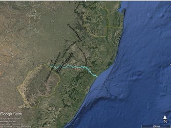
Stock-keeping was not the sole or primary motivation for early Nguni-speakers as they entered new environments, however. As Proto-Drakensberg-speakers moved into the region southeast of the escarpment, they formed polyglot communities also comprised of ancestral Khoi- and San-speakers. On the cusp of the eleventh century, multilingualism and the benefits of knowledge transmission pulled the Proto-Drakensberg speech community into two distinct and extended dialect chains: Proto-Uplands Nguni (circa 1000–52) and Proto-Woodlands Nguni (circa 1130–60).Footnote 37 The two branches embarked on remarkably different historical trajectories. As the names of each chain imply, Proto-Uplands Nguni-speakers moved west from the Proto-Drakensberg point of origin into high-elevation grasslands skirting the southern side of the escarpment, while Proto-Woodlands Nguni-speakers entered and continued to occupy mixed woodlands/savannah biomes in the lower-elevation river basins and interior plateaus closer to the southern coast. A series of lexical innovations and archaeological shifts support the locations of each and begin to describe living conditions and lifeways.
Approximate locations of descendent Nguni speech communities. Source: Google Earth.*
*Adapted by author from Google Earth, 7.3.3.7721, ‘Newcastle, ZA, eye alt. 544.78 mi.’, 27°42′48.43″ S and 30°1′11.70″ E (13 Dec. 2015), viewed 17 June 2020.

Around the eleventh century, as archaeological evidence attests marked transitions to dispersed grasslands agricultural settlements, Proto-Uplands-speakers innovated the roots *-konto, ‘to terrace (a field)’, and *-ceceshela, ‘to irrigate’, each indicating new technologies for managing farms on hills and cliffs removed from major waterways.Footnote 38 Communities settled near soils fertilized by the weathering runoff from dolerite dikes where the land would support year-round farming.Footnote 39 Ecological preferences, combined with the high initial and perpetual labor investments required to terrace and irrigate foothills, showed a significant commitment to farming.Footnote 40 On the other hand, the uplands had a low carrying capacity, and the limited availability of nutritious sweetveld made cattle-keeping more precarious.Footnote 41 A deliberate transition to new farming environs and the innovation of attendant technology makes it unlikely Proto-Uplands-speakers moved into higher elevations to better accommodate cattle.Footnote 42
Proto-Woodlands-speakers took a more southerly route into savannah environs, where they innovated words for *-lo, ‘wild animal’ — specifically *-duba, ‘zebra’ and *-bhejane, ‘rhinoceros’ — correlating to lower-lying areas where such animals were present. The two branches remained in contact, however.Footnote 43 Uplands and woodlands communities regularly traded raw and finished iron products as smelting proved impossible in the grassland environs of the high-elevation foothills.Footnote 44
The proposed settlement chronology of Proto-Woodlands corresponds with a notable discontinuity in ceramic typology, both dated to the early twelfth century. Huffman identifies the appearance of Blackburn pottery, mostly along Southern Africa's eastern seaboard from about 1100 CE.Footnote 45 Huffman argues the discontinuity between Blackburn and earlier pottery types is sufficiently remarkable to suggest the appearance of a new population, which he surmised to be ‘Nguni’ migrants from East Africa.Footnote 46 Setting aside a long-distance migration hypothesis, the question remains whether smaller-scale migrations of Proto-Woodlands-speakers towards the seaboard account for the appearance of Blackburn. This is unlikely, since it would require further explanation as to the impetus for Proto-Woodlands-speakers to develop remarkably different pottery from Proto-Drakensberg-speakers. A more likely scenario would be to consider the transition in light of the processes of generating polyglot communities among established populations. The same dynamics of interaction with Khoi- and San-speakers responsible for pulling the Nguni dialect chains apart best account for significant changes in material culture as well.Footnote 47
Though cattle may not have been the impetus for settling the environments Proto-Uplands-speakers and Proto-Woodlands-speakers chose, both speech communities kept cattle and retained related knowledge inherited from their ancestors. They continued to refine their knowledge of domestic stock as well. Proto-Uplands-speakers learned to *-thêna, ‘castrate by cutting’, as opposed to tying off the testes of the animal, showing a greater confidence in managing the risks of infection and blood loss associated with cutting.Footnote 48 They also replaced the Proto-Nguni term *-yùmbà, ‘barren animal’, with the innovation *-dlólo, ‘barren animal’, perhaps indicating increased awareness of the causes or consequences of infertile animals.Footnote 49
According to linguistic evidence, the period between the ninth to eleventh century was thus one of significant and continuous change in demographics, environment, food technology, and material culture. Over the succeeding several centuries, descendant Nguni speech communities would continue the trends of their ancestors, founding new settlements through short-range movement and developing new knowledge to expand their capacity for agropastoral production. The eleventh to thirteenth century would be marked not only by significant material changes, but also by dramatic reorderings of household social relations intended to better manage challenges and opportunities.
MASCULINITY, BIOSOCIAL REPRODUCTION, AND POLITICAL ECONOMIC TRANSFORMATION, ELEVENTH TO THIRTEENTH CENTURY
Confronted with challenges of mobility, dissolution of community, and labor-intensive opportunities, Nguni-speakers managed their changing circumstances through the gendered conditions of their young men. Newly refined rites of passage and demographic controls, including circumcision and age-based regimentation of men, recursively positioned sociable men within distinct factions that marked them as preferable husbands and granted them opportunities to receive assistance from the extended networks that came with advantageous marriages. The regimentation of men offered institutional support for the transition to cattle-keeping by making young men readily available as laborers and allies, and as cattle became the domain of initiated men, association with sociable masculinity made cattle meaningful to Proto-Uplands Nguni-speakers. The history of cattle-keeping among Nguni-speakers is thus inextricable from the history of biosocial reproduction and concepts of gendered and generational decorum. The significance of cattle and the value it acquired in the early second millennium flowed dually from the work animals performed in the lifecycles of young men and from the labor and resource inputs required to maintain them.
In the late first millennium, Proto-Nguni-speakers innovated new concepts and institutions related to initiation, including generational male regimentation, and new ideas about masculine propriety, especially in the context of marriage. The presence of male initiation rites among Sotho-Tswana speech communities suggests the practice predates the divergence of Proto-Nguni from its Southeast Bantu ancestor, but practices took on new form and meaning among Nguni-speakers.Footnote 50 Sometime before the late ninth century, Proto-Nguni-speakers extended the older root *-tángá, ‘vine plant’, to also describe ‘age regiments’, or networks of young men assembled and reproduced through initiation and circumcision.Footnote 51 The initial metaphor implied by the innovation of the root *-tángá describes initiation networks as a vine plant crawling along the ground, binding fruit across a distance.Footnote 52 In the context of an increasingly mobile population reflected in the settlement chronology, *-tángá ‘age regiments’ were the bonds that maintained contact and viable cooperation between distant communities, or at least the factions of them that participated in men's initiation.
Within the transformative spaces of rites of passage, some members of Nguni-speaking communities cultivated specific ideas about the content of socially acceptable masculine behavior and relations. The lexical innovations that emerged from such debates should be regarded as the products of extended discourse, and also as descriptive of aspirational ideals. Words that refer to concepts (as opposed to materials independently verifiable through archaeology) reflect not only the ideals perhaps constrained to empowered constituencies, but forms of those ideals that may infrequently work out in practice.Footnote 53 The term *-khwe, ‘in-law; mount, mate; help’, illuminates this dynamic, for it contains a broad semantic field around the ways in which households established sociable adult men within a range of expectations. The root *-khwe derives from an Early Bantu root *-kó, a term that referred to the giving of bridewealth.Footnote 54 By the eleventh century, Proto-Drakensberg-speakers extended the root to include the meanings ‘help’ and ‘mount and mate’, with the latter two glosses applicable to both humans and livestock. The potential drain on resources associated with mobile younger generations of men may have sparked an increased cognizance of the ways biological and social reproduction could be encouraged and controlled.
In the tenth to eleventh century, Proto-Drakensberg-speakers expanded the meaning of *-khwe to contain a wide array of social dynamics tangential to marriage, as the possibilities for constructing sociable masculinity extended to concerns over the decorum of a good husband. For example, words containing the root *-khwe could alternatively refer to the status of an ‘uninitiated male’ or young men around the time they became candidates for initiation, and as a label for both formal ‘suitors’ and the lovers or chosen mates of unmarried young women. The varied uses of the root demonstrate the conceptual links between male initiation, the choices young women made when selecting lovers, and the decorum expected of young suitors and of married men. Collective influence on masculine decorum would later become a useful way of imposing cattle-keeping responsibilities on initiated men.
Thirteenth century Proto-Umzimkulu-speakers stretched the semantic field of *-khwe even further to clarify what the relationships of sociable men looked like, especially for younger generations. The root *-khwe can refer variously to a man's in-laws, his relationships to his wife's people, as well as concepts and actions such as ‘climb, ascend, mount; cover (as an animal the female); mate; harass, pester, continually annoy; work persistently at’.Footnote 55 As to what such pestering might look like, one interviewee recorded in the James Stuart Archive remarked of a young man's relationship to his in-laws, ‘the phrase isigodo so mkwenyana was used because, in case of necessity, the father could go and break or peel off, the metaphor being an old log from which one could break or peel off wood or bark whenever he required it for fuel’.Footnote 56 The ideas associated with *-khwe cast young men living in the uplands communities of the eleventh to thirteenth century in a state of perpetual obligations to in-laws. Older generations established the parameters of masculine propriety, including male obligations, through the lessons taught to circumcision candidates and through subsequent access to sociable forms of marriage.
While Proto-Nguni-speakers may have originally fashioned the *-tángá ‘age regiments’ as vines to which communities might cling as they moved below the escarpment, male networks quickly became a source of reliable labor and support. John Wright and Carolyn Hamilton have suggested that, as early as the sixteenth to eighteenth century, male regiments participated in regional ivory procurement and trade — activities that may have extended to earlier periods as well.Footnote 57 But beginning in the eleventh century, the *-tángá took on responsibilities as cattle herders as a facet of the obligations associated with propriety. Proto-Uplands-speakers began to use the root *-sízí, ‘help; young man; feed, lead out to pasture’, to describe one way that in-laws and others in a young man's network may have ‘peeled off’ his labor. The eleventh-century root *-sízí derives from Early Bantu *-dÍicÍ, ‘to feed, lead out to pasture’, but, like *-khwe, took on the meaning ‘to help’ among Southern Bantu-speakers.Footnote 58 Proto-Nguni-speakers and their descendants retained the meaning ‘to help’, but Proto-Uplands-Nguni-speakers extended it to refer to ‘young men’.
Taken quite literally, the history of the word implies the use of the root *-sízí to describe the work of young men in giving help to or receiving it from cattle herders in need of labor supply. Because males became *-doda, ‘men’, solely through initiation, *-sízí could indicate herding as a requirement for, or as the domain of, initiated adult men. To the contrary, the innovation of a new word for ‘young man’ alongside the forms of *-khwe that glossed as ‘suitors’ and ‘lovers of unmarried young women’ may suggest cattle-keeping became its own avenue to adult masculinity. Either interpretation, however, supports a history in which pastoralists achieved sufficient success promoting cattle-keeping as a criterion of masculine propriety to materialize their efforts within the Proto-Uplands lexicon.
CATTLE-KEEPING IN THE DRAKENSBERG UPLANDS
The reorientation of masculine respectability and relationships towards the care of herds was likely a necessary precondition for a transition to cattle-keeping. The carrying capacity of uplands settlements was low, and the success of livestock herding was precarious. While high elevation grasses were of superior quality and palatability, they grew for only a brief interim following the first spring rain and were quickly exhausted.Footnote 59 To compensate, herders heavily grazed their animals in nearby lowland valleys, possibly keeping them at low elevation satellites for the duration of winter.Footnote 60
In addition to the difficulties of herding in the uplands, high elevation sites could sustain only a very low density of livestock on a perennial basis. The challenges of keeping cattle in these areas were severe. At site clusters around the Ntinini Basin, for example, maximum exploitation with a vertical transhumant herding pattern could support 375 head of cattle.Footnote 61 But even smaller herds placed the environment under stress. Moderate grazing potentially expanded grassland, but heavier grazing risked decreasing biodiversity while making way for invasive species.Footnote 62 The effects of drought could be devastating. In the Drakensberg foothills, where suitable pasture sprouted only after the first spring rains, a delay in the onset of the rainy season could have a marked effect. Spring pasturage overlapped with the expansion of tsetse fly zones in lowlands, creating a narrow window during which herders could move their cattle to higher elevation or risk the herd. Lower precipitation and constrictions in pasturage meant herders were likely forced to reduce herd numbers and strategize to expand pasture areas for each animal in nearby upland grasslands. Any increase in demand for cattle would have had the same effect.
Over time, successful management of grasslands likely improved conditions by expanding suitable pastureland, and modern South African Nguni cattle are well known for their relative resistance to trypanosomiasis and ticks compared to other breeds.Footnote 63 As early Proto-Drakensberg and Proto-Uplands speech communities engaged in rapid, small-scale population movement, however, each settlement likely faced the need to establish herding and farming strategies anew. Uplands environmental constraints created a few necessary conditions for herders. First, cattle specialists, facing challenges maintaining herd numbers, likely depended on the *-tángá ‘age regiments’ and *-sízí ‘young men’ who pastured cattle to manage transhumance between the foothill settlements and valley sweetveld. Second, Proto-Uplands-speakers traded with Highveld communities on the other side of the mountain range to replenish their herds.Footnote 64 Archaeological evidence documents the movement of cattle and items of daily life, including pottery, in both directions, and herders depended on transregional networks in difficult times.Footnote 65
The vast extension of regional trade, including global commerce from the Indian Ocean, raises additional questions about the ways in which the implications of cattle-keeping for neighboring political economies influenced the decisions of Nguni-speakers to invest in herding in inhospitable environs. The extent to which ideas about cattle generated in Eastern Kalahari and Zimbabwe Plateau trade hubs penetrated uplands communities or influenced Nguni-speakers is difficult to ascertain. However, Nguni-speakers made the unlikely transition to cattle-keeping in the context of rapidly growing regional circulation of materials, people, and ideas, raising the possibility that they did so in response to changes not far removed from them.
TRANSFORMATIONS IN THE EASTERN KALAHARI, HIGHVELD, AND ZIMBABWE PLATEAU
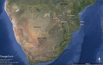
As early as the late seventh century, long-distance trade routes connecting Southern Africa to the Indian Ocean world carried goods inland and to the coast, linking small agricultural communities with expanding global commerce.Footnote 66 At the same time, Southern African communities expanded the reach of their commercial activities to include trans-Kalahari trade and drew goods and allegiance from the Highveld and other hinterlands.Footnote 67 Previously small-scale communities in the Eastern Kalahari and Shashe-Limpopo Confluence Area consolidated their wealth and influence, founding political economic hubs. From an early date, however, consolidation and centralization efforts also meant expanding the reach of exchange networks, both towards the coast and distant foreign markets, and more locally among communities who offered material and social support for aspiring elites.
Major commercial sites in Southern Africa. Source: Google Earth.*
*Adapted by author from Google Earth, 7.3.3.7721, ‘Botswana, eye alt. 1691.44 mi.’, 22°29′47.54″ S and 24°38′32.33″ E (13 Dec. 2015), viewed 17 June 2020.

The region of the Southeast, into which Nguni-speakers would enter in the ninth century, remained marginal to the flow of goods throughout much of the second millennium. Evidence of specialized ivory procurement and production and the limited presence of foreign prestige goods from as early as the seventh century suggests exchange networks did extend into the area; these may have influenced the division of territory according to the availability of resources, including elephant ivory.Footnote 68 Further evidence of the movement of pottery and cattle to and from the South African highveld and Nguni-speaking uplands indicates the circulation of more mundane items, and this may have helped Nguni cattle-keepers maintain their herds in times of hardship.Footnote 69 It is unlikely, however, that Nguni-speakers or other populations participated heavily in organized trade across the mountain range, especially at the height of their northern neighbors’ success.
The extensive trade networks crisscrossing Southern Africa nonetheless establish an unavoidable context in which transformations in Nguni cattle-keeping occurred. At nearly all the major Southern African commercial centers, cattle took on increased significance as markers of prestige and relations of power between elites and their subjects. For example, in the eleventh to thirteenth century and concomitant with the rise of trade wealth, some occupants at Mapungubwe began to consume more meat from cattle than other segments of the population, and examples of cattle figurines and ‘beast burials’ have been recovered in limited numbers.Footnote 70 Elites may have used feasting to differentiate their status, a practice with the potential to publicly mobilize resources, including relationships with allies.Footnote 71
Among the sites that make up the clustered grouping of major and minor settlements known as the Toutswe Complex of the Eastern Kalahari, the presence of cattle signaled the range of relationships necessary to maintain ties between hinterlands and major settlements.Footnote 72 From at least the early second millennium, cattle signified relationships far more valuable than the animals themselves. Cattle remains, pottery, and the transmission of other prestige goods indicate reciprocal relations in which favor and allegiance flowed in both directions alongside materials.Footnote 73 Political centralization furthermore depended on external relationships, which were themselves subject to local forms of authority, smaller-scale networks, and a variety of prestige goods marking those relations. As such, it was not possession of these materials (cattle, copper, gold, ivory) that gave elites power, but rather the capacity to control their circulation and to manipulate or exploit the social processes and relations through which they moved.Footnote 74
A similar dynamic appeared on the Zimbabwe Plateau in the thirteenth to sixteenth century. In 1978, Peter Garlake documented the distribution of minor zimbabwe (settlements built with stone walls), noting that they clustered at the edge of the plateau at an ideal location for vertical transhumant herding.Footnote 75 Herders could move cattle to lower elevation sites in the winter to graze animals on better pasturage, and onto the plateau in the summer to avoid tsetse and other disease vectors. Despite the higher numbers of cattle kept at peripheral sites — a strategy to avoid resource exhaustion around the capital — elites living in and around the Hill Complex at Great Zimbabwe showed an almost exclusive preference for consuming cattle, and especially young cattle that had not yet reached full size.Footnote 76 As Great Zimbabwe hosted greater influxes of trade, seemingly prestigious materials like gold and ivory could not supplant the ideological significance of cattle. Within a political economy characterized by the capillary circulation of foreign-sourced goods and locally-produced items at all levels of society, most wealth eventually transformed into wealth in cattle, which were crucial to the production of social capital through brokering patron-client relations, signaling political alliance, and honoring ancestors.Footnote 77
Nguni-speakers living in the Southeast remained marginal to scalar changes in trade, but goods had moved across the mountain range for millennia, meaning the Drakensberg presented no insurmountable boundary to regional interaction.Footnote 78 Communities populating the area had contributed ivory to trade routes supplying Chibuene port on the Indian Ocean coast, and, by the mid-second millennium, all of Southern Africa could be characterized by the flow of materials, ideas, language, and people.Footnote 79 The timing of Nguni-speakers’ transition to more intensive cattle-keeping is therefore indicative if not definitive of a shared awareness of cattle's growing importance at sites of considerable power. At the same time, however, the diversity of ways communities in the broader region deployed cattle in the creation and maintenance of relations of power speaks to the flexibility of cattle as a marker of cooperation, prestige, and indebtedness. As with other forms of prestige goods in the Eastern Kalahari and Zimbabwe Plateau, the ability to manipulate the care and value invested in cattle operated as part of the practice of power throughout Southern Africa. Commonalities in the exploitation of cattle are indicative of widespread ideas about the instilment and dispensation of prestige, but not necessarily of a shared system of symbols or ancestral cattle culture.
CONCLUSION
The counterintuitive choice among uplands Nguni-speaking communities to invest in cattle-keeping, and the value subsequently assigned to cattle as a conduit of social relations, thus seemingly unfolded at the intersection of regional political economic affluence and local household efforts to manage the lifecycle of young people through expectations of decorum and the appeal of opportunities created by cattle-keeping. Domestic stock-keeping was not new to Nguni-speakers, but the conditions necessary to exploit cattle required innovations to both the technology used to maintain herds and the social relations that supplied reliable labor to agropastoral efforts. The transition to cattle-keeping in the eleventh- to thirteenth-century uplands was therefore not determined by the availability of cattle or ancestral ideas about the role of cattle, but rather followed a slow revolution in local and regional social contexts that both allowed for and incentivized the use of animals in more intensive and socially meaningful ways.
During the early second millennium, the dual nature of cattle as a useful good and socially relevant conduit of important relations of power began to materialize among Nguni-speakers and some of their regional neighbors. The processes by which cattle became increasingly relevant to social exchanges likely informed each other, but nonetheless unfolded according to narrower historical circumstances. The availability of cattle did not structure or signal a conditioned response among Nguni-speakers, but rather provided a set of opportunities some Nguni-speakers chose to pursue. The ways they did so intensely intertwined the innovation of food technologies with significant changes in household politics and the biosocial lifecycles of young men.
APPENDIX: LINGUISTIC RECONSTRUCTIONS
1. *-lóbol ‘bridewealth’ (noun class 5/6)
Proto-Nguni innovation. From Proto-Bantu *-dób ‘to fish with a line’ with reversive suffix -ol. The root *-lóbol appears in Lakes Bantu with a variety of meanings around social payments and relations. The meaning ‘bridewealth’ likely first appeared in an undetermined subgroup of Southeast Bantu, as the reflex rovora ‘bridewealth’ appears in Shona.Footnote 80
2. *-kunzi ‘male animal’ (noun class 9/10)
Proto-Nguni retention. Distribution in Nyanja-Chewa and Tumbuka suggests the term was innovated in an earlier period and retained among Southern Bantu-speakers and Proto-Nguni-speakers.
3. *-kabi ‘castrated male animal’ (noun class 9/10)
Proto-Nguni retention. Distribution in East Central and East Africa, as well as relict distribution in Southern Bantu, suggests innovation by an intermediate ancestral speech community and retention in Southern Bantu and Proto-Nguni.
4. *-tole ‘heifer, calf’ (noun class 9/10)
Proto-Nguni retention. Like roots 2 and 3, the term was likely innovated in an ancestral speech community in East Central or East Africa and inherited by Southern Bantu and Proto-Nguni-speakers.
5. *-komo ‘head of cattle’ (noun class 9/10)
Proto-Nguni retention. Christopher Ehret argues Limpopo Khoekhoe herders transferred *-komo ‘head of cattle’ to Proto-Southern Bantu-speakers living in clusters around the Limpopo river.Footnote 81 Reflexes appear in most Southern Bantu languages, making a Southern Bantu innovation or transfer likely.
6. *-pákul ‘to castrate’ (v.t.)
Proto-Nguni retention. From Early Bantu root *-pákud ‘to castrate’. Appears with relict distribution in Southern Bantu and Nguni. Replaced by Proto-Uplands innovation *-thêna ‘to castrate by cutting’.
7. *-bísì ‘fresh milk’ (noun class 11)
Proto-Nguni innovation. From Early Bantu root *-bícì ‘unripe, uncooked, fresh’. The appearance of *-bícì as a modifier meaning ‘fresh’ in the Shona attestation mukaka mumbishi (‘fresh milk’) may indicate that the process of innovating *-bísì ‘fresh milk’ began earlier during the lifetime of a Southern Bantu subgroup. Reflexes of *bícì ‘fresh milk’ in Southwest Bantu likewise may suggest earlier innovation or transfer.Footnote 82
8. *-senga ‘to milk’ (v.t.)
Proto-Nguni innovation. Etymology unknown.
9. *-thûbi ‘beestings’ (noun class 9/10)
Proto-Nguni innovation. Etymology unknown.
10. *-mâsi ‘sour milk, curds’ (noun class 6)
Proto-Nguni retention. The root has wide distribution in East Africa and limited distribution in Southern Africa, suggesting Southern Bantu retention.
11. *-khumba ‘animal hide’ (noun class 7/8)
Proto-Nguni. Khwe -khòó ‘hide, fur’ and Nama -khob ‘skin’ suggest the term may be a transfer from Khoi-speakers.
12. *-qwa ‘dry meat’ (noun class 3)
Proto-Nguni innovation. Etymology unknown.
13. *-hlambi ‘herd of cattle’ (noun class 3/4)
Proto-Nguni innovation. The term likely derives from Proto-Nguni root *-hlàmb ‘to swim’, a reflex of Savannah Bantu *-càmb ‘to bathe, to swim’.Footnote 83
14. *-lus- ‘to herd’ (v.t.)
Proto-Nguni innovation. The root may derive from Early Bantu *-dùt or Eastern Bantu *-dùtI, both meaning ‘to pass; surpass’.Footnote 84
15. *-ndle ‘pastureland’ (noun class 9/10)
Proto-Nguni innovation. Etymology unknown.
16. *-phawu ‘to notch ear’ (v.t)
Proto-Nguni innovation. Etymology unknown.
17. *-konto ‘to terrace’ (v.t)
Proto-Uplands Nguni innovation. The root attests with relict distribution as Woodlands languages replaced it with isolated terms as their environmental context changed. Etymology unknown.
18. *-ceceshela ‘to irrigate’ (v.t.)
Proto-Uplands Nguni innovation. Etymology uncertain. The root *-ceceshela is likely a compound term combining Proto-Nguni *-shela or *-sela ‘to drink/to water’ with the unknown root *-cece. The term -cece no longer has an identifiable meaning among extant languages.
19. *-lo ‘wild animal’ (noun class 9/10)
Proto-Woodlands Nguni innovation with recent spread to Xhosa. Etymology unknown.
20. *-duba ‘zebra’ (noun class 9/10)
Proto-Woodlands Nguni with probably recent spread to Zulu. Etymology unknown.
21. *-bhejane ‘rhino’ (noun class 3/4)
Proto-Woodlands Nguni with spread to Bhaca, likely by Hlubi-speakers during population movement of the early nineteenth century. Etymology unknown.
22. *-thêna ‘to castrate by cutting’ (v.t)
Proto-Uplands Nguni innovation. From Proto-Bantu root *-téen ‘to cut’.Footnote 85
23. *-dlólo ‘barren animal’ (noun class 9/10)
Proto-Uplands Nguni innovation. Etymology unknown.
24. *-tàngà ‘age regiment’ (noun class 5/6)
Proto-Drakensberg innovation. The root derives from a metaphorical extension of the retained Savannah Bantu root *-tàngà ‘pumpkin, pumpkin pip’, with new meaning ‘age regiment’. Christopher Ehret argues for a more general definition of *-tàngà: ‘edible curcubit’. At least in the context of Nguni, the term -tanga refers to both the pumpkin fruit and the plant, suggesting an even more general meaning ‘vine plant’.Footnote 86
24a. *-khwe ‘in-law’ (noun class 1/2)
Proto-Nguni innovation. From the Proto-Bantu root *-kó ‘give bridewealth’. Proto-Nguni-speakers innovated the passive form of the root *-khwe with meaning ‘in-law’.Footnote 87 It is possible the form *-khwe derives from the Great Lakes Bantu root *-kwé ‘brideprice’, which similarly attests in terms for in-laws, especially in reference to the relationship with a wife's parents. Given the restricted distribution of *-khwe ‘in-law’ in Southeast Bantu, an independent process is more likely. The seemingly logical extension of active form *-kó ‘give bridewealth’ to passive *-kwe/*-khwe ‘receive bridewealth\’, or deverbative *-kwe/*-khwe ‘recipient of bridewealth/in-law’, further supports an independent innovation.
24b. *-khwe ‘circumcision candidate, uncircumcised male’ (noun class 1/2)
Proto-Uplands Nguni innovation. The form derives from root 24a *-khwe ‘in-law’, with a semantic extension to refer to young men preparing to undergo circumcision rites and to men of any age who did not undergo circumcision. The implications of the term tie male initiation to the qualities of an ‘in-law’ and the failure or refusal to participate in initiation to the qualities of childhood.
25. *-sízi ‘young man’ (noun class 9/10)
Proto-Drakensberg innovation. Likely derives from Early Bantu *-díici ‘feed, lead out to pasture’. An undetermined Southeast Bantu subgroup extended the root in the spirantized form *-sízi with innovated meaning ‘to help’. Proto-Drakensberg-speakers subsequently innovated the term to refer to ‘young man’ while retaining meaning ‘help’. Proto-Umzimkulu retained earlier meaning ‘feed, lead out to pasture’.Footnote 88