




No CrossRef data available.
Article contents
- Abstract
- CERAMIC SEQUENCES AT CHICHEN ITZA AND MAYAPAN
- MAYAPAN'S ARCHITECTURE
- CHRONOLOGICAL OVERLAP BETWEEN CHICHEN ITZA, UXMAL, AND MAYAPAN
- EXTERNAL CONNECTIONS IN MAYAPAN'S ARCHITECTURE AND ART
- POLITICAL INTERACTIONS AT MAYAPAN
- THE KATUN CYCLE IN THE HISTORY OF MAYAPAN
- RECONCILING THE KATUN CYCLE WITH MAYAPAN'S ARCHAEOLOGICAL RECORD
- MAYAPAN IN THE CONTEXT OF MAYA HISTORY
- RESUMEN
- ACKNOWLEDGMENTS
- References
REVISITING MAYAPAN: Mexico's last Maya capital
Published online by Cambridge University Press: 11 July 2003
Article contents
- Abstract
- CERAMIC SEQUENCES AT CHICHEN ITZA AND MAYAPAN
- MAYAPAN'S ARCHITECTURE
- CHRONOLOGICAL OVERLAP BETWEEN CHICHEN ITZA, UXMAL, AND MAYAPAN
- EXTERNAL CONNECTIONS IN MAYAPAN'S ARCHITECTURE AND ART
- POLITICAL INTERACTIONS AT MAYAPAN
- THE KATUN CYCLE IN THE HISTORY OF MAYAPAN
- RECONCILING THE KATUN CYCLE WITH MAYAPAN'S ARCHAEOLOGICAL RECORD
- MAYAPAN IN THE CONTEXT OF MAYA HISTORY
- RESUMEN
- ACKNOWLEDGMENTS
- References
Abstract
Archaeological excavations begun at Mayapan in 1996 require re-evaluation of this site, sometimes disparaged as representing “decadent” Postclassic Maya culture. New discoveries show that the site was an international center that incorporated specific symbols in its art from areas as far away as Central Mexico and Oaxaca. Indeed, there is evidence of trade with both areas. Another important Postclassic trade route connected Mayapan to Yucatan's eastern coast and Peten, Guatemala. These connections are reflected in similar ceramics and architecture in the three areas. Revival of Terminal Classic traditions at Mayapan inspired certain architectural constructions and a stela cult marking Katun endings. The Katun-cycle chronologies of the Colonial period provide intriguing evidence that political events at Mayapan may be linked with the site's architectural history. The “founding” of Mayapan may have occurred earlier than the conventionally accepted date of a.d. 1263 (end of Katun 13 Ahau). The Chilam Balam of Chumayel chronicles use of a 24-year Katun instead of a Katun of 20 Tuns, suggesting that the earliest founding event at Mayapan (Katun 8 Ahau) may date back to the eleventh century a.d. and overlap with the demise of Chichen Itza. Some of Mayapan's earliest architecture is contemporary with Chichen Itza's latest constructions. Several hundred years after Mayapan was founded, there was a renaissance of the Cocom heritage evident in specific architectural forms modeled on those from Chichen Itza.
Information
- Type
- Research Article
- Information
- Copyright
- © 2003 Cambridge University Press
Recent excavations at Mayapan, Yucatan, Mexico, reveal an eclectic mix of artistic styles that calls for a reappraisal of Mayapan's interactions with other Mesoamerican cities. Mexican archaeologists, working under the direction of Carlos Peraza Lope of the National Institute of Anthropology and History in Yucatan (Centro Instituto Nacional de Antropología e Historia [INAH], Yucatan), found sculptures and murals that resemble artworks from Central Mexico, almost one thousand miles away. They also discovered murals combining elements of the Mixteca-Puebla style with those seen in the Madrid Codex and in murals of the east coast at Tulum. In addition, beneath a “Maya-Toltec” pyramid like one from nearby Chichen Itza, they found another pyramid in a different style, bearing reliefs closely resembling images from the Dresden Codex. Our reappraisal of the archaeological chronology of Mayapan and a stylistic analysis of newly discovered murals and sculptures reveal Mayapan's role at the crossroads of cultural contact between the Central Mexican and Mayan areas of Postclassic Mesoamerica.
Friar Diego de Landa provided the first European record of Mayapan in 1566 and described it as a cosmopolitan center that housed Mexican warriors and representatives of provincial towns from all across Yucatan (Tozzer 1941:26, 32). The legend of Mayapan lived on in Landa's time, even though the city had been abandoned for more than a century. As the last Maya capital of Yucatan, Mayapan governed widespread territories until it was destroyed in a political revolt during the fifteenth century. Landa described a number of Mayapan's ceremonial structures fairly accurately, including residences, a pyramid modeled after one at Chichen Itza, and a round temple with four doors.
John L. Stephens's 1841 expedition provided the first detailed descriptions of major structures at Mayapan (Stephens 1963:65–78). Brasseur de Bourbourg (1870) and Augustus Le Plongeon (1881) further documented the site in the second half of the nineteenth century. Although some minor archaeological excavations took place in the first half of the twentieth century, intensive investigation began in the 1950s with an archaeological project organized by the Carnegie Institution of Washington (Pollock 1962:2). After several years of excavations (1951–1955), archaeologists concluded that Mayapan was a Late Postclassic city dating between a.d. 1200 and 1450, largely constructed after the fall of Chichen Itza. They found that an extensive wall enclosed about 4 km2 of dense settlement clustered around cenotes (sinkholes), the main water source in this region devoid of rivers and lakes (Pollock 1962:2). The Carnegie project mapped the area enclosed by this perimeter wall and produced excavation reports on many prominent structures in the Central Plaza area (Quadrant Q; Jones 1952; Pollock 1962).
The Carnegie group embarked on the Mayapan project in order to establish a link between archaeological data and the Colonial chronicles. These excavations confirmed Landa's descriptions of the typical Maya house plan and important ceremonial and civic buildings in the center of the city (Pollock 1962:15–17; Tozzer 1941:25–26, 85–87). There was also evidence that the city was looted and burned, confirming Landa's account of a catastrophic revolt. Landa described the wall enclosing Mayapan's central area as an eighth of a league long, but Carnegie archaeologists were unable to locate this wall (Proskouriakoff 1962a:133; Tozzer 1941:24–25). Ledyard Smith (1962:204) noted that stones could have been removed to construct Rancho San Joaquin, which has an extensive wall surrounding the central area of Mayapan. This wall, presumed to be modern, may follow the approximate location of the original wall because it forms a square enclosure, oriented approximately to the cardinal directions and centered precisely on an important round temple.
The Relación de Yucatán describes another larger wall that enclosed 60,000 dwellings at Mayapan (Tozzer 1941:24, n. 131). The Carnegie project located this 9-km-long wall and mapped the entries (Shook 1952). Seven large roofed gateways and five minor gates allowed access from all directions while serving as fortification against military attack (Proskouriakoff 1955:102; Sharer 1994:201; Smith 1962:204). The relatively low wall (from 1.5 to 2.5 m high) is up to 3 m wide and could have served as a base for a wooden stockade (Shook 1952). The Carnegie project surveyed about 4,000 structures within this wall and suggested a population of about 12,000 inhabitants just before Mayapan was abandoned (Pollock 1962:15). More recently, Diane Chase (1990:206) estimated a population as high as 21,000 within the walls of Mayapan. Current excavations beyond the wall indicate that the settlement area may be as much as three times larger than previous estimates, but this outlying area is less densely settled than the walled area (Marilyn Masson, personal communication 2002).
In 1996, while consolidating collapsing structures, archaeologists from INAH began exploring the chronological development of structures surrounding the Central Plaza, reconstructing buildings only partially investigated in the past (Figure 1). These excavations and recent revision of Yucatan's archaeological chronology prompted us to reassess Mayapan's role in the history of Postclassic Mesoamerica, focusing on several major questions: (1) How long was the city occupied? (2) What accounts for the eclectic mix of artistic and architectural styles? (3) Did Mayapan house Central Mexican warriors, as Landa claims? (4) Are events reported in the Maya Chilam Balam chronicles reflected in the archaeological record at Mayapan? (5) Did people from Chichen Itza found Mayapan?

Instituto Nacional de Antropología e Historia map of Mayapan's Central Plaza. Note the chronological development of Castillo (Q162, Q162a) and columns of Q161 covered over by bench that was built after lower terrace of Q162 (courtesy Instituto Nacional de Antropología e Historia).
Our study indicates that Mayapan's ceramic and architectural chronology extends further back in time than previously supposed and overlapped with the decline of Chichen Itza around a.d. 1050/1100. Thus, the chronicles may accurately describe interactions between the two cities, including accounts that people from Chichen Itza founded Mayapan. We also found that the Chilam Balam of Chumayel chronicles may employ a 24-year Katun (k'atun) cycle that extends Mayapan's chronology back to the eleventh century, in accord with the archaeological record. This allows us to tie events in the chronicles to the archaeological chronology (Table 1). We also provide a detailed architectural chronology for monumental artworks at Mayapan. Some murals and relief sculptures relate to Postclassic Maya codices. Others, completed near the end of Mayapan's occupation, reflect Mixteca-Puebla stylistic influences and more direct links with Central Mexico, a contact confirmed by evidence of Aztec importing of pigments from the Mayapan area.
Mayapan's history in relation to the Katun cycle

CERAMIC SEQUENCES AT CHICHEN ITZA AND MAYAPAN
Ceramics indicate that the Mayapan area was occupied long before the city was established (Pollock 1962:6; Smith 1971:I). Archaeological remains in the Mayapan area date back to the Preclassic period (400 b.c.–a.d. 250). Classic and Terminal Classic pottery typical of Puuc sites appears in small amounts in excavations of Mayapan itself (1.6% Cehpech in the Carnegie excavations; Smith 1971:164). The Carnegie project also found a small component of Chichen Itza's Sotuta complex at the site (.3%). Although Sotuta sherds were mixed in the earliest construction phases, it seems unlikely that there was any substantial population at Mayapan associated with the Sotuta complex (Pollock 1962:6).
The Carnegie ceramic analysis by Robert E. Smith (1971) defined the Hocaba phase (a.d. 1200–1300) and Tases phase (a.d. 1300–1450) as the two ceramic phases associated with construction of Mayapan. The INAH project continues to use Smith's type-variety designations for ceramics at the site. The materials resulting from their excavations, located primarily in the construction fill of buildings in the Central Plaza, are largely Tases deposits mixed with a small quantity of ceramics from earlier components: Early Classic Cochuah, Late Classic Cehpech, and Terminal Classic Sotuta and Hocaba (Peraza et al. 1997:206–207, 1999:103–139, 210–211).
The chronology of Cehpech, Sotuta, Hocaba, and Tases in Yucatan's ceramic sequence is still poorly understood (Ball 1994:394). In current appraisals of Yucatan's ceramic sequence, Sotuta and Cehpech ceramics fade out by a.d. 1050–1100 and are gradually replaced by Hocaba and Tases ceramics characteristic of Mayapan (Andrews et al. 2000). Sotuta materials first appear in central Yucatan between a.d. 700 and 800, at a time that the area severed its ties with the southern Maya Lowlands (Cobos 2002). William Ringle and colleagues (1998:189–192, Figure 5, Table 1) suggest that Chichen Itza's Sotuta phase dates to about a.d. 700–1000, noting that radiocarbon dates for pure Sotuta deposits have calibrated midpoints ranging from a.d. 663 to 891. Rafael Cobos (1998:322) dates Chichen Itza's Sotuta ceramics from a.d. 800–1050, revising the traditional dates of a.d. 1000–1200.
The Cehpech and Sotuta complexes, once thought to be sequential, are now believed to overlap during part of the Terminal Classic period (Andrews et al. 2000; Ball 1979:Figure 1; Ringle et al. 1998:189, Figure 5; Robles 1986:128). Certain technical features of ceramic manufacture link the two complexes, because Sotuta and Cehpech slateware both employ imported volcanic glass temper, but Sotuta wares lack the limestone carbonate temper typical of Cehpech wares (Chung 2000:4–5, 54–55, 151). The chronological span of Cehpech ceramics varies in different areas (Andrews et al. 2000; Andrews and Sabloff 1986:447; Cobos 2002; Suhler et al. 1998). Around a.d. 900, regional differentiation between eastern and western Cehpech begins when Sotuta ceramics, associated with Chichen Itza's political apogee as a regional capital, first appear at Uxmal, Dzibilchaltun, and Cozumel (Andrews and Sabloff 1986:450; Lincoln 1986:171–172; Robles and Andrews 1986:85). At sites outside Chichen Itza's sphere of influence, such as Coba and Ek Balam, Sotuta ceramic components are largely absent, and Cehpech ceramics continue until a.d. 1100/1200, when Tases phase ceramics are introduced (Bey et al. 1998:114; Peraza 1993:401, Table 5; Robles 1990:261).
Recent excavations at Chichen Itza indicate that more than 90% of the ceramics are Sotuta and fewer than 2% are Cehpech, leading Peter Schmidt (2000:40) to conclude that the Cehpech episode at the site was brief. Although Chichen Itza's Cehpech component is very small, Cobos (1997, 2001:186, 2002) notes that the presence of Cehpech distinguishes the early Sotuta phase (a.d. 750/800–900), associated with hieroglyphic texts not found in the subsequent phase. The early Sotuta component is characterized by Cehpech Thin Slateware (jars, bowls, and censers), “Mixtec” ladle censers, tripod censers of Chichen Unslipped ware, vessels of Chichen Red ware, and imported Fine Orange ware (Silho or X Fine Orange) from the Campeche coast (Smith 1958:153–156, 1971:I:21, 184). The late Sotuta phase (a.d. 900–1050), when Chichen Itza became a powerful regional capital, is associated with hourglass censers (Sisal Type) and other vessels of Chichen Unslipped, Chichen Redware, and Chichen Slate. Imported Silho Fine Orange continues from the previous phase, but the late Sotuta phase also sees the introduction of Tohil Plumbate ceramics, a ware with a distinctive metallic sheen from feldspar crystals in the clay (Cobos 2002; Smith 1971:I:26–27). Cobos notes that Tohil Plumbate was imported from Tajumulco in western Guatemala to sites such as Uxmal, Chichen Itza, and Isla Cerritos between a.d. 850/900 and 1100. Chichen Itza also imported obsidian blades from Central Mexico (Hidalgo and Puebla), and Ixtepeque, Guatemala, during the late Sotuta phase (Braswell 1997; Cobos 2001:186; Schmidt 2000:40). Both Sotuta facets include imported turquoise disks from the Chalchihuites region of Zacatecas and a large number of obsidian artifacts from Ucareo, Michoacan, probably brought to the capital along a trade network of sites in the Cupul region and the area west of Chikinchel (Andrews et al. 1989; Cobos 1997:794–795, 2001:186, 2002).
Between a.d. 1050/1100 and 1200/1300 Chichen Itza declined and monumental construction largely ceased. Cobos (2001:186) associates this period with Hocaba ceramics made by Postclassic squatters living in Terminal Classic buildings. This period is roughly contemporary with the Hocaba-Sotuta phase (a.d. 1000–1150/1200), a revised designation proposed by Ringle, Tomás Gallereta Negrón, and George Bey (1998). Their Hocaba-Sotuta phase, dated on the basis of radiocarbon dates from Balankanche cave and Isla Cerritos, seems to include material from two different phases defined by Cobos. The Hocaba-Sotuta cave offerings include spiked hourglass censers, like those in Cobos's late Sotuta period, as well as Peto Cream associated with the Hocaba component that postdates monumental construction (Ringle et al. 1998:189, 216, Figure 29a, Table 1). Peto Cream seems to be most common along the east coast, an area extending from Cabo Catoche south to the border between Mexico and Belize, but it also appears in Central Yucatan, and in the Cupul area and neighboring Chikinchel region (Kepecs 1998:128–129; Ringle et al. 1998:191). Virginia Ochoa-Winemiller (1999, 2000) suggests that Peto Cream may have appeared first at coastal sites and later spread throughout the peninsula via major sites, such as Mayapan, Dzibilchaltun, and Chichen Itza.
The ceramic chronology of Chichen Itza has been refined by study of the city's trading port on the north coast. Isla Cerritos has two major phases: the Late Classic Chacpel phase (a.d. 750/750–900) and the Jotuto-Sotuta phase (a.d. 900–1150/1200), representing the island's last permanent occupation (Andrews et al. 1988; Robles 1987:103–105). The Chacpel phase is characterized by Sotuta Phase ceramic types, such as Dzitas, Sisal, and Silho, found in association with Terminal Classic Cehpech ceramics. The subsequent Jotuto-Sotuta phase has negligible amounts of Cehpech wares and abundant Peto Cream ware, as well as Tohil Plumbate and Sotuta phase materials. In both phases, most obsidian came from sources controlled by Tula in Central Mexico, and only a small amount came from Guatemala. Tohil Plumbate, a marker for the late Sotuta component, also appears to be associated with the Jotuto-Sotuta phase at Isla Cerritos. This phase also has Hocaba ceramics, which suggests it groups material from two different phases defined by Cobos at Chichen Itza (late Sotuta and Hocaba). The Jotuto-Sotuta phase seems to compare best with the Hocaba-Sotuta phase in Ringle et al. (1998).
Chichen Itza's trade also involved east coast ports. At San Gervasio on Cozumel Island, Sotuta ceramics may be linked to Chichen Itza's invasion of Cozumel around a.d. 1000 (Peraza 1993:I:37–43). San Gervasio's deposits show a mixed component of Hocaba and Sotuta ceramics (Arrecife Sotuta-Hocaba complex, a.d. 1000–1200) that largely replaces slatewares (Ticul and Muna) of the eastern Cehpech complex. The Sotuta-Hocaba phase features Dzitas (Chichen Slate), Dzibiac (Chichen Red), Silho (X Fine Orange), Tohil Plumbate, and Peto Cream (Kukula) ware. The subsequent Tases phase (Costa Tases, a.d. 1200–1650), representing the cultural apogee of the island, has Chen Mul Modeled and Cehac-Hunacti Composite incense burners, Tulum Red, Navula, Mama Red (Mayapan Red), Matillas Fine Orange, and Peto Cream (Kukula) ware, the last in lower frequencies than in the previous phase (Peraza 1993:I:43–45). The Costa Tases phase includes materials from both Mayapan's Hocaba and Tases phases defined in Smith (1971).
At El Meco, also on the east coast, Sotuta ceramics were introduced around a.d. 1000, following a Late Classic period of abandonment (Robles 1986:127–129). The Sotuta wares are considered to be “intrusive” or foreign, whereas the Cehpech component is a local east coast complex (eastern Cehpech; Andrews and Robles 1986:131). Mixed deposits of Sotuta, Cehpech, and Hocaba wares, such as Peto Cream, define El Meco's Hocaba-Sotuta phase. This phase also has some Paxcaman and Agustin ceramics, which developed in the Peten around a.d. 1000 (Bullard 1973; Robles 1986:129). Peto Cream ware is found almost exclusively in the Hocaba-Sotuta phase and early facet of the Tases phase at El Meco, which seems to share features with Mayapan's middle lots (Andrews and Robles 1986:131; Robles 1986:129, Tables 1, 2, Figures 25, 27, 29, 32). Around a.d. 1200, Tases ceramics typical of Mayapan replace the earlier Hocaba-Sotuta component (Andrews and Robles 1986:131; Robles 1986:129–130). Robles (1986:Figure 21) distinguishes an early and late facet of the Tases phase. His diagrams of Trenches 2 and 4 show that the early facet of the Tases phase shares a number of wares with the Hocaba-Sotuta phase (Robles 1986:Figures 25, 29). These trenches have Hocaba ceramics, such as Peto Cream ware (Xcanchacan), in the same levels as Silho Fine Orange, a Sotuta marker at Chichen Itza. Xcanchacan ceramics also appear in the Hocaba-Sotuta phase levels and diminish in quantity in Tases Phase levels, paralleling the situation at Mayapan where this ware appears in the Hocaba phase and markedly diminishes in the Tases phase (Smith 1971:I:200–202, 234, 243). Chen Mul Modeled effigy censers, a ceramic type assigned to the Tases phase at Mayapan, generally date late in the Tases phase at El Meco (Trenches 1–3; Robles 1986:Figures 23, 25, 27). In Trench 3 at El Meco, defining the early and late facets of the Tases phase, Kukula and Xcanchacan ceramics (both Peto Cream wares) and Matillas Fine Orange are confined to the early Tases facet, whereas Chen Mul Modeled is restricted to the late facet (Robles 1986:Figure 27). This suggests that the early facet of El Meco's Tases phase is comparable to Smith's (1971:I:202–205) Hocaba phase at Mayapan. Recently, archaeologists have noted that there are few real distinctions between Hocaba and Tases at Mayapan (Kepecs 1998:129, n. 11; Ringle et al. 1998). Nevertheless, Robles defines an early and late facet of Tases at El Meco, and the early facet seems comparable to Smith's Hocaba phase. The predominance of Peto Cream ware in both Mayapan's Hocaba phase and El Meco's early Tases facet indicates some form of overlap that seems to be chronologically significant.
Some scholars maintain that chronology assigned to Peto Cream ware depends on the chronological framework used by different archaeologists (Ball 1979; Chase and Chase 1985; Ochoa-Winemiller 1999). Smith (1971:I:193–194, 253), who first classified Peto Cream ware in the type-variety system, suggested that Peto Cream appeared shortly before Chichen Itza was abandoned in about a.d. 1185–1204, a date derived from ethnohistorical sources. Smith (1971:I:26) maintained that Peto Cream was found without Mayapan Red at Tihoo (Merida) and nearby Dzibilchaltun, leading him to suggest that Peto Cream ware was a true time marker that developed earlier at these sites. E. Wyllys Andrews IV (1965:56) cautioned, however, that only two structures at Dzibilchaltun provide evidence to suggest that black-on-cream (Peto Cream) pottery replaced Sotuta ceramics, and none of these deposits is completely “pure,” nor were they sealed in construction floors. Peto Cream, recovered from the surface and the upper levels of stratigraphic excavations, is diagnostic of the Terminal Classic or Early Post classic.
Fernando Robles (1986:129), who has been instrumental in revising Yucatan's ceramic sequence, notes that Kukula (Peto Cream) ceramics are diagnostic markers for a “transitional horizon” that begins at the end of the Late Classic and ends in the middle of the Postclassic. Heajoo Chung (2000:69, 146–151) dates Peto Cream ware ca. a.d. 1100–1250, based on test pits and thermoluminescence studies of ceramics (mostly from Edzna). Based on a study of Peto Cream from more than 50 Maya sites, Ochoa-Winemiller (1999:77–78, 2000) notes that Peto Cream spans from a.d. 900/1050 to 1250/1300, indicating that the Cehpech, Sotuta, and Hocaba complexes are partially coeval. Radiocarbon dates from Balankanche cave and Isla Cerritos suggest that the earliest appearance of Peto Cream dates between a.d. 900–1000 (Ringle et al. 1998:189–192; Robles 1987:105–106). The calibrated midpoints for the Hocaba-Sotuta materials at Balankanche range from a.d. 968 to 1009. At Isla Cerritos, the Hocaba-Sotuta phase deposits have calibrated midpoints ranging from a.d. 1027–1209. Ringle and colleagues (1998:189–192, Table 1) link the cessation of monumental construction at Chichen Itza, dated to about a.d. 1000–1150/1200, to the introduction of Peto Cream, a diagnostic ware of their Hocaba-Sotuta phase, although there are no radiocarbon dates for this phase at the site.
Peto Cream (Kukula) ware, found with Sotuta wares in some areas of Chichen Itza (Lincoln 1990:323–328; Peraza 1993:I:42), is most characteristic of the Hocaba deposits sealing the last major construction phase at the site (Coarse Slateware of the Middle Mexican substage; Brainerd 1958:4; Smith 1971:II:173). Even though Peto Cream ware shares many of the painted design features and forms of Sotuta phase Chichen Slateware (Brainerd's Early Mexican Medium Slateware), the paste composition and surface finish differ (Smith 1971:I:253–254). According to George Brainerd (1958:45), Peto Cream was scarce at Chichen Itza and Mayapan. Although Smith (1971:I:112) noted that Peto Cream was “found in large quantities at Chichen Itza” his own stratigraphic trenches at Chichen Itza would seem to confirm Brainerd's assertion to the contrary. Smith and Edwin Shook excavated 19 trenches at Chichen Itza in 1954 and found only 80 Hocaba and Tases sherds, all from deposits near the surface (.003%; Smith 1971:I:170). Scholars originally concluded that there were no Hocaba pottery offerings in the Sacred Cenote (Ball and Ladd 1992:193; Brainerd 1958:44–45; Ringle et al. 1998:208). Nevertheless, reanalysis of the Cenote ceramics by Eduardo Perez de Heredia suggests that there are more than 1,800 sherds of Peto Cream (Virginia Ochoa-Winemiller, personal communication 2002). Some minor construction and maintenance continued at Chichen Itza in the epoch of Hocaba and Tases ceramics (see later), but the city functioned primarily as a pilgrimage center during the Tases phase. Abundant offerings of Tases phase ceramics in the Sacred Cenote and in ceremonial structures at Chichen Itza indicate that the site was still a religious center, even though the city was largely unoccupied (Ball and Ladd 1992:193; Schmidt 1998, 1999:36). Mayapan apparently controlled access to the Sacred Cenote at this time (Paxton 2001:133).
Ringle and colleagues (1998:189–190) argue that the Hocaba phase should be redefined because it is an incomplete complex, distinguished from the Tases ceramics at Mayapan principally by the higher frequency of Peto Cream and the absence of San Joaquin Buff. They maintain that Hocaba is not a true ceramic phase but, rather, a subcomplex overlapping with Sotuta at Chichen Itza and Tases at Mayapan. Ringle (personal communication 2002) distinguishes the Hocaba-Sotuta phase at Chichen Itza by the prevalence of Dzibiac Red (Chichen Red), in contrast to Mayapan's Hocaba-Tases phase where Mama Red (Mayapan Red) predominates. Ringle, Gallereta, and Bey (1998:190) imply that there is no association of Mayapan Red with Peto Cream at Chichen Itza, but according to Smith (1971:I:255), Peto Cream is almost always associated with Mayapan Red at Chichen Itza, as it is at Mayapan. Brainerd's (1958:34–45) study shows relatively high frequencies of Peto Cream and Mama Red in the Temple of the Wall panels and Southeast Colonnade. Charles Lincoln (1990:288, 326) found Peto Cream and Mayapan Red associated in the upper levels of his Test Pit 8 (an association not noted in his other trenches). Lincoln (1990:289–291) suggests that Mayapan Red had a more restricted distribution at Chichen Itza, because it was used primarily for ceremonial offerings in tombs, in contrast to the utilitarian function of Peto Cream ware. Thus, Mayapan Red was used in a more limited way at Chichen Itza, but it is nevertheless a temporal marker indicating that these deposits at Chichen Itza are contemporary with early deposits at Mayapan. The Hocaba complex, found primarily in the Central Plaza of Mayapan, is characterized by three principal local wares: Mayapan Red (Mama Red, 54.3%), Mayapan Unslipped ware (19.8%), and Peto Cream ware (10%; Smith 1971:I:202–203). In addition to the chronological overlap of Peto Cream and Mayapan Red at both sites, it is noteworthy that Mayapan Red and Peto Cream wares both lack volcanic temper, suggesting this imported material was no longer available (Heajoo Seu Chung, personal communication 2001).
Smith (1971:I:194, II:Table 24, Chart 3) identified three different ceramic components at Mayapan, referred to as early, middle, and late lots. The early lots represent the Hocaba ceramic complex and nothing later, the middle lots are a mixture of Hocaba and Tases, and the late lots are virtually all Tases material.
Peto Cream ware (Kukula and Xcanchacan) has its highest frequency in early lots at Mayapan (Smith 1971:I:232–234, II:Table 24). Smith (1971:I:112) suggested that Postclassic Mayapan was first settled in the Middle Hocaba period, when Peto Cream was on the wane, because Peto Cream represents only 8.5% of all early lots at Mayapan. He dated Mayapan's Hocaba phase around a.d. 1200/1250–1300, employing ethnohistorical dates and a fairly contrived analysis for the foundation of the site (Smith 1971:I:202–204, 254). Nevertheless, Joseph Ball (1979:33–34) proposes a “total chronological overlap” model in which Chichen Itza and its Sotuta sphere continued perhaps as late as the twelfth century, while Mayapan emerged sometime between a.d. 1050 and 1150, developing in part out of a tradition in the Puuc zone. Merideth Paxton (1986:609, 627–632, 1991:307) notes that, because Peto Cream ware is earlier than a.d. 1200 at a number of sites, the Hocaba phase may actually begin as early as a.d. 1100 at Mayapan. Based on a study of ceramics, Paxton (1986:169–171) suggests that Mayapan was founded around the time Chichen Itza was abandoned, well before a.d. 1200. Robles and Andrews (1986:90) propose that Mayapan was founded around a.d. 1100 or earlier (in Masson 2000:53). Clearly, construction at Mayapan began as early as a.d. 1050/1100, based on the presence of Peto Cream ware and a small amount of Cehpech and Sotuta wares in sealed deposits.
Sotuta wares were so scarce at Mayapan that it has been suggested that the site was abandoned during this period (Pollock 1962:6; Smith 1971:I:112). Sotuta ceramics represented 1.5% of the ceramics in early lots, compared with 72.1% Hocaba ceramics, while Tepeu 3 and Cehpech pottery represented 10.3% of the early lots (Smith 1971:II:Table 6). Many of these lots are from monumental construction fill, certainly not the best conditions for stratigraphic analysis. However, there are a few deeply stratified deposits at Mayapan that provide clear evidence of chronological change. Excavators found Hocaba material with no Tases ceramics in early lots of Mayapan's Q97 colonnade and the Q77 platform, and in a trench between Q77 and Q162 (the Castillo), and another between Q151 and Q152 (Smith 1971:II:Table 24, Lots C35c–d, C42, C43, C64, C104).
A stratigraphic trench running from the Castillo's north side to the Q77 platform included a deposit (Lot C64) with a large amount of Mama Red (2,206 sherds), along with 243 Cehpech sherds, 80 sherds of Peto Cream, and 26 Sotuta sherds, all sealed between Plaza Floor 3 and bedrock (Shook 1954b:99; Smith 1971:I:22–23, 203, 242, II:Table 3). An inverted tripod “grater” bowl of Papacal Incised (Mayapan Red) covering a Peto Cream ware bowl, both types typical of Smith's Hocaba, phase, was part of this lot (Shook 1954b:92, 103, Figures 2a7, 5k, l; Smith 1971:II:Table 24, Figure 46a). Lot C64 also included a Sotuta-phase Cumtun Composite-Type censer made of Chichen Unslipped ware, the ware used for tripod and hourglass censers at Chichen Itza (Smith 1971:I:171, 187, II:Figure 30u, Table 37). Cobos (2001) dates Chichen Itza's hourglass censers to the late Sotuta facet between a.d. 900–1050; however, they are also characteristic of Balankanche cave offerings associated with the epoch of Chichen Itza's decline between a.d. 1000 and 1150/1200 (Hocaba-Sotuta phase in Ringle et al. 1998:Figure 29a, Table 1). In the stratified deposits between Q77 and Q162, the early Lot C64 was below two middle lots (C63, C62) with mixed Tases and Hocaba materials, and a late lot with predominantly Tases materials (C61; Smith 1971:II:Table 3).
Another deeply stratified deposit in the area of the Central Plaza, excavated in a passage between Q151 and Q152, had six different levels. Shook and William Irving (1955:145–146, 151–152) noted that non-effigy censers, dominant in lower levels, were replaced by human effigy censers (80% of the sherds in the upper level). The lowest level (Level 6, early lots: C86, C87) was characterized by more than 20% Puuc period material, and 79.4% Mayapan period, which included 38.3% Mayapan Red, 31.9% unslipped vessels, 7.7% Peto Cream, and 1.2% non-effigy censers (Shook and Irving 1955:152). Levels 3–5 (middle lots: C88, C89, C90) had relative high percentages of non-effigy censers (Smith 1971:II:Figure 31b) and the first human effigy censers (1.8% in Lot C88), which increased in higher deposits (7.8% in C90). In the upper levels of the stratified deposits (late lots: C91, C92), non-effigy censers decreased dramatically (Lot C91 had only 1.4%), being largely replaced by Tases Phase effigy figure censers (80.3% in Lot C91; Shook and Irving 1955:152–153). These Chen Mul Modeled Type (Unslipped Panaba Group) effigy censers date to the Tases phase (a.d. 1300–1450) in the chronology established by Smith (1971:I:242). A similar pattern is evident in a trench on the northwest side of Q151. Shook and Irving (1955:153) noted that a deposit sealed between Plaza Floors 1 and 2 (Lot C104) had a small amount of Puuc material (5.3%) and 94.7% Mayapan period (40.5% unslipped vessels, 40.1% Mayapan Red, 12.9% Peto Cream, and only .4% non-effigy censers). Non-effigy censers became increasingly common in the middle lots (C105, C106) and were later completely replaced by effigy-type censers in the late Tases Phase lot (C107).
Non-effigy censers of the unslipped Navula group are typical of the Hocaba phase, largely defined by Mayapan's early and middle lots. Navula non-effigy censers include Cehac-Hunacti Composite and Hunacti Applique types (Figure 2; Smith 1971:I:23–24, 135, II:Figures 31a–c). Paxton (1991:304–305, Figures 1a–d) points out that Cehac-Hunacti Composite-Type censers are similar to vessels represented on Dresden Codex 25b–26b and those found in postconstruction deposits at Chichen Itza (Brainerd 1958). Cehac-Hunacti censers, characterized by appliqué designs, first appear before a.d. 1200 (Ball 1982:109). These censers are also related to those represented in murals dated to the Terminal Classic or Early Postclassic period at Tancah, a site that probably fell into disuse before the rise of Mayapan, sometime between a.d. 1050 and 1200 (Ball 1982:110; Miller 1982:64, Figure 96, Plate 6). The censers date to the Hocaba phase (a.d. 1200–1300) in Smith's (1971) chronology. Ringle and colleagues (1998:Figure 5) assign similar dates to their Hocaba-Tases component, and they date their “pure Tases” phase to a.d. 1300–1450, in accord with Smith's dates for the Tases phase.

Mayapan Cehac-Hunacti Composite Censer with appliqué fillets (photo courtesy Instituto Nacional de Antropología e Historia).
The characteristic effigy censers of the Tases phase are unslipped vessels of the Panaba group, most notably the types known as Thul Applique, Huli Impressed, and Chen Mul Modeled (Figure 3; Smith 1971:I:136). Mayapan's late lots include two new types of ceramics not seen in the early lots: San Joaquin Buff and an unslipped-exterior variety of the Mama Red Type (Smith 1971:I:112, II:Table 24). Only this unslipped variety of Mayapan Red ware is diagnostic of the Tases phase. Apparently, Mayapan Red is more typical of the earlier Hocaba component. Comparing the Hocaba and Tases ceramic complexes overall, Smith (1971:I:202, 242) noted a decline in Mayapan Red (from 54.3% to 27.6%), accompanied by a significant decrease in Peto Cream ware (dropping from 10% to .4%).

Chen Mul Modeled effigy censer depicting a Mayapan god with maize foliation on a flaring headdress (after Smith 1971:II:Figure 32n).
The introduction of human-effigy censers marks a major change in cult practices at Mayapan that occurred some time between a.d. 1200 and 1300, possibly inspired by Tohil Plumbate vessels, also predominantly effigy forms (Paxton 1986:612–618). Masson (2000:52–59, Table 3.3) identifies effigy censers as a chronological marker, but she also implies that it may not be possible to separate Hocaba and Tases material, noting continuity of certain Hocaba types. Some of this apparent continuity may be an artifact of Smith's analysis, which grouped materials together in a single type that probably should have been separated into distinct types, such as his Cehac-Hunacti Type ceramics (compare middle and late lots in Smith 1971:II:Figures 31a–c,e, 62a–e). Nevertheless, until there is a comprehensive reappraisal of Smith's ceramic types, we will employ his two-phase ceramic sequence, although we believe the Hocaba dates should be revised. The INAH project places Mayapan's Hocaba “horizon” in the Terminal Classic period (Peraza et al. 1999:139).
Unfortunately, chronological issues cannot be resolved by radiocarbon dates from Mayapan, for the only samples are three collected during the Carnegie excavations (Pollock 1962:8–9). Only two dates from Mayapan (a.d. 1295 and 1489) are associated with the Tases phase, both recalibrated from samples collected more than 50 years ago (Ringle et al. 1998:190, Table 1). Ringle and colleagues conclude that the earliest Mayapan sample helps date their Hocaba-Tases phase to the late thirteenth century. This early sample (Gro-452), from below plaza floors associated with Q162a, was originally dated to a.d. 1015 ± 95 years (Pollock 1962:8; Proskouriakoff 1962a:118). Ringle and colleagues (1998:Table 1) now report this as GrN-452, a recalibrated date with a midpoint of a.d. 1279 and a range of ±115 years. This recalibrated date has multiple intercepts, meaning there are multiple “solutions” for the calibrated date, making the results less reliable. They report the second specimen (GrN-1166), originally dated at a.d. 1315, has a recalibrated midpoint of a.d. 1295, and the third sample (GrN-450), originally dated to a.d. 1360, has a recalibrated midpoint of a.d. 1489. New samples are being processed in a variety of contexts to establish the site's antiquity (Marilyn Masson, personal communication 2002).
Despite the revised chronology presented by Ringle and colleagues (1998), we believe that the division between Hocaba and Tases at Mayapan proposed by Smith (1971) remains a useful construct. Composite non-effigy censers of the Navula group, most characteristic of the Hocaba phase, seem to be derived from forms first developed at Chichen Itza. In fact, a Sotuta-phase censer was found in an early lot at Mayapan. Apparently, there was some direct contact with Chichen Itza around the time Mayapan was founded, and subsequently Mayapan controlled access to Chichen Itza and even appropriated its architectural style in certain buildings.
MAYAPAN'S ARCHITECTURE
In this section, we discuss the chronological correlation between the site architecture and its ceramic record and propose dates for the artistic decoration associated with monumental architecture (Table 1). Such a chronology has never been previously attempted, although the seeds of such an analysis are in the original Carnegie reports (Proskouriakoff 1962a:132–139). The main types of decorative programs in the Central Plaza are painted murals (Q80, Q95, Q152, Q161) and modeled stucco (Q162, Q163; Peraza et al. 2001). Carved stone, representing only a minor theme in architecture at the site, is mostly reused Puuc-style stones from earlier dismantled structures (Peraza et al. 1997:7–8; Proskouriakoff 1962a:132).
A Late Classic Puuc city existed at the site of Mayapan, as indicated by the quantity of Puuc-type ceramics and Puuc carved stones reused in later construction (Shook 1954b:90). The well-carved Puuc stones are easily distinguished from relatively crude Mayapan stone work (Shook and Irving 1955:132). The Puuc stones often appear on the front of buildings, but the intricate carving was usually not visible because the stones were covered with heavy coats of lime plaster. For example, a fallen frieze on Q163 includes a guilloche design and a variety of other carved stones, but all were apparently covered by stucco, making their designs invisible (Peraza et al. 1999:ii).
Although we focus on civic and ceremonial structures, a discussion of Mayapan architecture would be incomplete without some reference to the numerous residential structures at the site. Smith (1962:171, 204) identifies more than 2,000 dwellings, suggesting complete urbanization. Boundary walls delimit the lots surrounding single houses or dwelling groups (solares), except near the ceremonial centers, where boundary walls are lacking (Smith 1962:208, Figure 1). Clusters of house lots in solares share boundary walls and are separated from other such groups by footpaths (Brown 1991:20, Figure 2). The typical residence has front and back rooms, closely paralleling Landa's description of houses occupied by commoners (Smith 1962:180, 217, 230–231; Tozzer 1941:85–87). Smith (1962:230) notes that Mayapan residences have a bench area in the open front room, a plan found only rarely in Chichen Itza and virtually absent at Puuc sites. Such “tandem-plan” houses are found outside the walls of Mayapan, some as far as 12 km away. Unlike elite residences, these ordinary thatched houses rarely have altars.
Elite dwellings are usually part of residential assemblages. They feature a colonnaded hall or residence; a smaller, one-room colonnaded oratory; and a group altar or shrine in the center of the plaza. About 50 are elaborate residences with stone columns, masonry walls, and beam-and-mortar roofs (Smith 1962:218–219). Utilitarian ware predominates in the 20 elaborate residences analyzed by Robert Smith (1971:II:Table 13). Burials are found in most, a pattern also seen in ordinary dwellings (Smith 1971:II:Table 12). Diane Chase (1992:128–131) plotted the structures Smith identified as elaborate residences and found them located throughout the site, contrary to Harry Pollock's assertion that distribution confirms Landa's account that the heads of various political units lived within the central area of the city (Pollock 1962:15–17; Tozzer 1941:26).
The Carnegie excavations reveal that some civic and ceremonial structures have two construction phases, with the first phase built over limestone bedrock. Archaeologists concluded that ceramics sealed between bedrock and the first construction phase date primarily to the Mayapan period (Smith 1955:112, 115). Only the foundations survive from the first phase of construction, so it is difficult to tell anything about the style of the earliest architecture. Most of the visible structures pertain to later construction phases. The latest architectural additions are benches and small shrines that enclose altars built earlier (Peraza et al. 1997:48–49, 58; Proskouriakoff 1962a:113).
Colonnaded halls on raised platforms are the most common type of structure surrounding the Central Plaza (Figure 1). Sometimes an earlier hall had been completely razed to make way for a new hall (Q97, Q151; Shook and Irving 1955:130, 143). At least 23 of the 130 architectural units clustered around the Castillo are colonnaded halls. Only three such halls are found elsewhere at the site, all grouped around the ceremonial center at Cenote Itzmal Ch'en (Shook and Irving 1955:127–128). Colonnaded halls are characterized by a flat beam-and-mortar roof or, in some cases, gabled thatch (Smith 1971, I:109). They have a bench along the rear wall and an altar in the center, often modified in later times by enclosing the altar in a shrine. The altars once contained buried caches, but some were removed before the city was abandoned (Shook and Irving 1955:128, 130–131).
The function of colonnaded halls has been a subject of great debate. They tend to cluster around the Main Group (22 of the 26 halls are in Quadrant Q; Smith 1971:I:109, II:Tables 13, 18) and contain high percentages of ceremonial pottery (predominantly effigy censers) and caches, but no burials (unlike colonnaded “palaces” that served as elite residences). Shook and Irving (1955:128, 134–135) concluded that the colonnaded halls may have been “men's houses,” like those described by Landa (Tozzer 1941:124). Tatiana Proskouriakoff (1962a:90–91) suggested the large halls housed pilgrims to the temple or served as secular or religious quarters for men rather than as public or administrative buildings. However, she also noted that, because there are about the same number of colonnaded halls as there were provinces known to be part of the confederacy under Mayapan's control, each hall may have served the nobility of a specific province, implying an administrative function. Chase (1992:128–131) interprets the colonnaded halls as administrative or ritual buildings for elite political groups. Robert Carmack (1981:385) identifies Mayapan's colonnaded halls as lineage houses (“big houses”) like those in highland Guatemala, where a link between gallery structures and lineages is fairly well established. Ringle and Bey (2001:276, 287) note that the high percentage of censers in these structures indicate that they were “council houses” (popolna) rather than residences, and they suggest the term “great house” because of problems with documenting lineage archaeologically (see also Gillespie 2000).
Proskouriakoff (1962a:91) identified the “basic ceremonial group” as a colonnaded hall, a shrine, and an oratory. With the addition of a temple, the group is defined as a “temple assemblage,” a configuration with a colonnaded hall at right angles to a temple, an oratory to the right of the temple and an altar facing the temple, and a shrine roughly centered on the hall. Smith (1971:I:109) noted four main types of temples: serpent column (Q143, Q159, Q162, Q218), round (Q126, Q152, Q214), pyramid (Q58, Q141), and platform (Q80, Q95). Landa's statement that there were twelve priests at Mayapan fits well with the number of temple assemblages known at the site (Ringle and Bey 2001:284; Tozzer 1941:40). Unlike the freestanding colonnades of Mayapan, most colonnades at Chichen Itza are attached to other structures (Proskouriakoff 1962a:133). These large halls form gallery–patio configurations associated with a temple and a range structure (Cobos 2002).
Mayapan's shrines are small, cell-like enclosures with an altar or a statue. Shrines for the worship of idols are found in temples, colonnades, and houses, as well as freestanding on small platforms (Proskouriakoff 1955:101). They conform to three main types: interior shrines enclosing altars of colonnaded halls, statue shrines on stairways or on low platforms in front of temples, and raised shrines that are sometimes elaborate, freestanding structures resembling temples (Proskouriakoff 1962a:90).
The oratory is generally a one-roomed structure with a doorway divided by two columns and an altar placed against the center of the back wall. Proskouriakoff (1962a:90–91) suggested that oratories in ceremonial groups had a function similar to the oratory in residential structures, which was used by family members as a retreat before important ceremonies. Landa noted that community temples had oratories; lords, priests, and leading men also had oratories and idols in their houses for private worship (Tozzer 1941:108).
One of the most important oratories, Structure Q153, is atypical because it is not associated with a residence hall (Smith 1971:I:107–108). Located alongside the Cenote Ch'en Mul in the Central Plaza, it served a cenote cult that had considerable antiquity at the site. Beneath Q153 archaeologists found the floor of an earlier structure that predates the first plaza floor (Smith 1955:112–115, Figure 1a). Between the lowest plaza floor and bedrock, the construction fill included a relatively high percentage (12%) of black-on-cream ware (Peto Cream), a marker for the Hocaba complex. These sherds all but disappeared in the sealed deposits of the later oratory, which was filled with Tases-phase human effigy censers, suggesting it is relatively late in the site chronology (Table 1).
The construction sequence of the colonnade on the north side of the Central Plaza (Q81) also reflects the site's ceramic chronology. An earlier structure was completely razed to build Q81, but column drums found in the fill may belong to the earlier structure (Winters 1955b:383, 388–390). The early structure is identified as the first floor of the structure (Floor 1). Ceramics between Floor 1 and Floor 2 (Lot C70) included early Mayapan ceramics such as Peto Cream and no sherds from human effigy censers, indicating that Q81 was begun prior to the Tases phase, according to Howard Winters. The first phase of Q81 was a colonnaded hall built on Floor 2 over fill covering the razed structure. Fill between Floors 2 and 3 contain a few effigy censers (Lot C71). Subsequent construction phases of Q81 are contemporary with Floors 3–5. A bench with a niche was added in Phase II, and the bench niche was closed to form a cist with an altar on top in Phase III. A turtle effigy was placed beneath the altar in Phase IV. A shrine associated with Tases phase effigy censers was added in Phase V (Winters 1955b:384–388, 390, Figures 3o, p). The shrine also contained a lidded jar with a diving god resembling images of Chaac in the codices.
Another hall (Q151) has a double row of columns and proportions (43.50 m long × 9.10 m wide) resembling other colonnaded halls at Mayapan, but the mosaic Chaac masks on pilasters are unique. The arrangement of masks in the Hall of Chaac Masks displays a reverence for Puuc forms, while the carved blocks with birds and scrolls on the bench seem to be randomly placed as though the original designs were no longer considered important (Figures 4 and 5; Peraza et al. 1999:54). As in the case of Q81, the hall was built over an earlier hall that had been razed. Carnegie archaeologists were not able to ascertain whether similar masks were in place on the early hall. Their excavations of Q151 produced sealed deposits between bedrock and the floor of the earliest building phase. Sherds in these deposits were classified as 17.5% Puuc period and 82.5% early Mayapan period (Hocaba phase), characterized by ceramics such as Peto Cream ware, non-effigy censers, and Fine Orange wares (Lots C84, 84a, 85; Shook and Irving 1955:151). Effigy censers came into use around the time the later colonnade was built (Tases phase), when the building was used for ceremonies involving burning copal, bloodletting, and animal sacrifice (Lots C86–92; Shook and Irving 1955:142–143, 148).

Reused Puuc stones on a bench in Mayapan's Q151 show stones placed without regard to the original designs (photograph courtesy Instituto Nacional de Antropología e Historia).

Hall of Chaac Masks (Q151) at Mayapan displays Chaac masks possibly brought from Kabah (photograph by Susan Milbrath).
The Hall of Chaac Masks faces south, away from the Central Plaza, toward the Cenote Ch'en Mul, forming part of the complex associated with the cenote cult. The cenote has water holes at some distance from the cave-like entry, and pottery fragments indicate that the cenote was used as early as the Classic period (Smith 1955:110). Although Phillip Smith originally proposed that the ceramics had washed into the cenote, it seems more likely that the ceramics represent ceremonial offerings (Paxton 2001:205, n. 27). A reverence for cenotes as a source of water survives today. Indeed, some cenotes in Mayapan are considered still “alive,” requiring special ceremonies for entry (Peraza et al. 1999:551). An intriguing cave passage from the cenote to the Round Temple (Q152) runs directly beneath the Hall of Chaac Masks (Pugh 2001:Figure 4; Smith 1954:Figure 2).
Many of the stones that form the masks on the Hall of Chaac Masks (Q151) had fallen off. The original Carnegie excavation photos show only the lower jaw of one mask in place between Columns 3 and 4, but enough elements were found nearby to complete restoration of the mask (Shook and Irving 1955:141, Figure 5a,b). Subsequently, two more masks were restored, and INAH excavators recently added another mask on the east side when they found the lower jaw and earplugs in situ (Peraza et al. 1999:53, Plate 134). The façade now displays four masks, but abundant mask elements moved to a storage area suggest that there were many more. As Proskouriakoff (1962a:95) noted, the masks are virtually identical to those from the Codz Poop at Kabah (except that Kabah's have larger snouts and lack headband elements; Pollock 1980:Figure 367). The dimensions of the Puuc mosaic masks are approximately the same at the two sites, with a width from earplug to earplug of about 178 cm and a height from the top of the brow to the lower edge of the jaw of about 92 cm. The crescent motifs forming the headband of the Mayapan masks are conjectural, for they were not found in situ, and similar motifs formed part of the band and apron moldings nearby (Shook and Irving 1955:141). Perhaps the mosaic masks were transported from Kabah, about 40 km away, because many masks were removed from the Codz Poop in pre-Columbian times. The Codz Poop was destroyed by people who introduced Sotuta ceramics such as those at Chichen Itza, according to Ramón Carrasco and Eduardo Perez (1996:305). They note that Kabah's later occupation is linked with Hocaba-phase ceramics. Two radiocarbon dates reported from this phase are around a.d. 1210 (Carrasco and Perez 1996; Ringle et al. 1998:Table 1). This indicates a chronological overlap between Kabah and Mayapan, because the Hocaba complex is relatively early at Mayapan. The Hocaba components at Kabah might indicate that people affiliated with Mayapan briefly reoccupied Kabah. Mayapan's Hall of Chaac Masks may have been built to commemorate the Puuc heritage, although the construction employed a flat ceiling instead of a Puuc-style vaulted interior.
Mayapan's Round Temple reflects a link with the Caracol at Chichen Itza, a structure that incorporates Puuc masks and moldings. Carnegie archaeologists referred to Mayapan's Q152 as the Caracol, based on its resemblance to Chichen Itza's Caracol (Figures 7 and 8). The Carnegie archaeologists never excavated Q152, but their map and reconstruction drawing represent this round building with only one door, in accordance with two nineteenth-century drawings made before a lightning strike caused the building to collapse in 1869 (Figure 6; Aveni 1980:269, Figure 94b). The fallen building looked like a mountain of stones when INAH archaeologists began work in 1997 (Figure 9). They were surprised to find that it has four doors, as originally reported by Landa (Tozzer 1941:25). They renamed Q152 the Round Temple (Templo Redondo) because it lacks the spiral staircase that gave the Caracol (“snail”) its name. The Round Temple has a vaulted interior and a reverse-batter cornice molding like the Caracol, but it is a more austere copy, lacking Puuc masks and the second-story windows. Catherwood's drawing shows two roof moldings (Figure 6), but INAH archaeologists reconstructed only one because insufficient evidence was available to indicate the location of the second molding, especially as there was a discrepancy of more than 30 cm in their estimations of the buildings height and Stephens's (1963:76) measurements. Both Stephens and Brasseur de Bourbourg describe paintings in a vaulted interior chamber, and they mention that the center was a solid core (Proskouriakoff 1962a:114). INAH excavators found four niches inside the temple, spaced evenly around the central core (Barrera and Peraza 2001:439–442; Peraza et al. 2001:286). Fragmentary murals in two of the niches had polychrome designs outlined in black paint, including step frets, feathers, and rosettes—all remains of costumed figures (Barrera and Peraza 2001:Plate 27).

Two cornice moldings are pictured in Catherwood's nineteenth-century drawing of Mayapan's Round Temple, made before a lightning strike in 1869 caused Q152 to collapse (after Stephens 1963).

Caracol at Chichen Itza, a round structure that served as an astronomical observatory between a.d. 800 and 1100/1200 (photograph by Susan Milbrath).

(a) View from the southwest of the Round Temple at Mayapan (Q152) with four doors similar to the Caracol at Chichen Itza. The ring stone in the pavement and squatting figures in the foreground were added relatively late in Mayapan's history. (b) View from the south with Q151 in foreground (photographs by Susan Milbrath).

The Round Temple resembled a mountain of stones when INAH began work on the building in 1997 (photograph courtesy Instituto Nacional de Antropología e Historia).
The western stairway of the Round Temple has virtually the same orientation as the midline of Window 1 of the Caracol, which functioned as an astronomical observatory between about a.d. 800 and 1100/1200 (Figure 1; Aveni 1980:258–269; Milbrath 1999:Figure 3.1b). The two structures replicate an alignment facing sunset in late April and mid-August, marking intervals of 105 and 260 days used for agricultural purposes (Aveni 1980:269; Aveni and Hartung 1978:139–140). Further, the two cities are located at almost exactly the same latitude (Mayapan is only 8 km south of Chichen Itza). The recent restoration of Mayapan's Round Temple has made it possible to compare other alignments. Preliminary evidence suggests a purposeful repetition of certain Caracol alignments, including an equinox orientation (Aveni et al. 2002). All four doors are oriented approximately to the cardinal directions.
The Round Temple, reviving a form seen much earlier at Chichen Itza, dates to relatively late in Mayapan's history, ca. a.d. 1300 or later (Table 1). Ceramics associated with Trench 82, excavated in the rectangular basal platform of Q152, include abundant Chen Mul Modeled human effigy censers characteristic of the Tases phase (Peraza et al. 1999:65). Carnegie excavations between Q151 and Q152 (Shook and Irving 1955) led Proskouriakoff (1962a:132) to describe a substructure beneath Q152 as “very early,” although she pointed out that this does not necessarily date the round structure. INAH archaeologists found that this substructure was actually part of a colonnaded hall on a north–south axis that was partly dismantled to build Q152 and its basal platform.
Another round temple (Q126) has two principal stages of construction, the later phase probably erected near the end of the major occupation of Mayapan (Shook 1955:269, Figure 1). Anthony Aveni and Horst Hartung's (1986:Table 1) measurements indicate Q126 has a south-facing orientation (192°47′), virtually identical to the Hall of Chaac Masks (Q151). Originally, Q126 had a vaulted roof, and there may have been a row of stelae across the terrace in front of the temple (Shook 1955:269–271, Figure 4i–m). Shook found fragments of at least seven plain and three sculptured stelae scattered in a fashion that suggests they had been thrown down from the temple during political upheaval.
A third round temple (Q214), with a sloping basal zone and a doorway that faces east, may have originally had a vaulted masonry roof and small tenoned heads on the façade (Shook 1954a:17–18, Figure 1). The structure had only one major construction phase, dating about midway through Mayapan's occupation (Table 1; Shook 1954a:16). According to Smith (1971:II:Table 24), Hocaba-phase sherds totaled 74% and Tases-phase sherds, 23% (Lots C73, C74). During the Tases phase, Q214 was used for rituals involving Chen Mul Modeled effigy censers (Shook 1954a:18–19). Sometime after the basal platform was completed, a small shrine was added to house a female figure seated with knees drawn up, a pose that Proskouriakoff (1962a:137, Figure 10f) compares to Central Mexican sculptures. According to Shook (1954a:17, 19), this as an image of Ixchel, a goddess important at Cozumel.
Proskouriakoff (1962a:106, 132–133) identified a round platform (Q84) in the center of the plaza as one of the earliest structures at Mayapan, noting that it probably served as a platform for stelae found lying on top (Figures 10 and 11). Now almost completely buried in the Central Plaza, Q84 was built on bedrock and remained relatively low, so that successive repaving of the plaza floors finally almost covered it (Adams 1953:158–161, Figure 8). The original platform, about 5 m in diameter, may have been built to enhance a natural protuberance in the bedrock. Next, a stairway was added, and then the circular platform was enlarged and a thick-walled cist was added. The sealed cist contained burned and unburned fragments of at least two human skeletons and pot sherds. The floors were not preserved sufficiently to separate the later surface accumulations, so the structural fill (Lot C49) was mixed. Consequently, Smith (1971:II:Figure 74m) classified the Q84 fill deposit as a middle lot. A pit excavated on the southeastern side of the structure, sunk almost 2 m through intact floors underlying the later enlargements, apparently included material from early construction phases (Adams 1953:159). The proportion of censers was low in earlier levels and black-on-cream (Peto Cream) was relatively abundant.

The earliest round structure in the ceremonial precinct of Mayapan, Q84, now almost completely buried in the Central Plaza. To the left is the Q77 Platform. On the north side of the plaza is the Temple of the Niches (Q80), and beyond the plaza to the right is the Temple of the Fisherman (Q95) with a modern roof covering the murals (photograph by Susan Milbrath).

Carnegie's plan of the round platform (Q84) shows a series of concentric circular walls (after Adams 1953:Figure 5).
A round temple near Cenote Itzmal Ch'en has a miniature round temple with four niches resembling small doors, oriented to the cardinal directions, similar to H18 and its platform base (Chowning 1956:Figures 1, 2f). In front of the western niche is an altar formed by a stone ball mounted on a circular pedestal. Given the cardinal orientation of the doors of H18 and its miniature temple, the round altar could symbolize the setting sun at the equinox, an orientation evident in the alignment of the western door of Q152. Tases-phase effigy censers were found beneath the altar, but all other ceramics from H18 are earlier (Puuc and Hocaba), indicating H18 may date to the early period of Mayapan (Table 1; Chowning 1956:450). Beneath H18 there was an early platform with four staircases oriented to the cardinal directions. It is not clear whether this square platform originally had a superstructure. An unusually high percentage of Puuc-period sherds suggests that this structure may be quite early (H18-sub; Table 1).
In a crypt added to the north side of the platform underlying H18, archaeologists found the skeletal remains of four sacrificial victims (two without heads), buried without grave goods (Chowning 1956:446–447, Figure 1). Ann Chowning noted that 11 other skeletons were added later, probably one or two at a time.
Several sacrificial altars found nearby Q84 suggest rituals involving human sacrifice by heart excision. These altars are tapering stones like those depicted in scenes of human sacrifice at Chichen Itza (Shook and Irving 1955:133). There is also evidence of decapitation at Mayapan. Excavations of a deep trench between Q151 and Q152 yielded two decapitated skulls and a number of other human remains, apparently dismembered before they were thrown into the passage and then covered with rubble and mortar to seal the putrefying remains (Shook and Irving 1955:146). A cult of skull veneration may be evident elsewhere, such as a deposit of nine skulls with associated ceramics (predominantly Tases phase) in a shrine on the east side of the plaza (Q88c; Peraza et al. 1999:197).
Proskouriakoff (1962a:133) noted that sacrificial victims were buried without grave goods, crammed into cists and shafts associated with different buildings at Mayapan, including temples such as Q58 and Q95 that had burial shafts filled with disarticulated bones. William Ringle (personal communication 2002) suggests that burials with grave goods are scarce at both Mayapan and Chichen Itza because bodies were redeposited in ossuaries. Recent excavations seem to confirm this pattern. For example, excavators found a deposit of 18 skulls with a concentration of disarticulated bones in a trench between Q152 and Q152c (Burial 29; Peraza et al. 1999:198–199). It may be difficult to distinguish reburied bones from those of sacrificial victims, except when there is evidence of decapitation. More formal burials do occur at Mayapan in buildings designated as oratories in residential units and ceremonial groups and in the residences of elites and commoners (Smith 1971:I:107–108, II:Tables 12–14). There were no elaborate tombs at Mayapan, and most skeletons were buried without offerings (Proskouriakoff 1955:101).
Numerous ring-shaped stones at Mayapan are positioned in a manner that suggests they were used in a cult of human sacrifice (Figure 8a). When found in residential structures, Ledyard Smith (1962:227) identified them as cord holders for curtains used to close doorways. In the ceremonial precinct, however, they are usually not associated with doorways. Proskouriakoff (1962a:138) noted that ring-shaped stones set at ground level in several locations at Mayapan may have been used to tie prisoners before sacrifice, but she cautioned that there is no “factual or documentary confirmation of the idea.” The location of ring stones around Mayapan, and the position of ring stones in the rear wall of a shrine associated with a serpent-column temple (Q143), led Winters (1955c:402) to propose that the ring stones could have been used to tie men or animals intended for sacrifice. Two such rings, embedded in a platform facing the Central Plaza in front of Q81, are positioned on each side of a stone altar in a manner that clearly suggests they were used to tie a victim to the altar. Aztec captives destined for sacrifice in gladiatorial combat were tied to large ring-shaped stones. Sacrificial victims may also have been tied to a small ring-shaped stone, about the size of Mayapan's rings, set relatively low on the façade of Huitzilopochtli's temple in the Templo Mayor pyramid (Phase II).
Mayapan's five serpent-column temples may have been associated with a cult of human sacrifice. The largest, the Castillo (Q162), has a square altar in front of the north stair with a tapered sacrificial block that was either originally positioned on the altar or was thrown down from the Castillo temple (Shook 1954b:98, Figure 1a, c). A tapering block in front of the staircase of the Q218 serpent temple may also have been used for human sacrifice (Winters 1955b:405, Figure 2a).
Three of the serpent-column temples (Q58, Q159, Q218) have pyramidal substructures with two or three battered (sloping) terraces, while the terrace walls of Q143 seem to rise vertically (Winters 1955c). Only Q218 has serpent heads at the foot of the balustrades. All the temples originally had a portico formed by serpent columns with sculpted or modeled heads flanking the entry to a single room. Traces of painted plaster indicate that the serpent columns were orange on the top of the body and green on the sides with a blue-green tail (Winters 1955c:400, Figures 4g–k, 5g–i). Some of the serpent columns have front paws, and all originally had rattle tails on top (Winters 1955c:Figures 3h–i, 4i–j, 6j–k). One of the temples (Q58) was built over an earlier pyramid-temple of a different design (Proskouriakoff 1962a:100), but beneath Q218 archaeologists found a pyramid with a similar serpent temple. The construction fill sealing this substructure (Lot C95) included Peto Cream ware and non-effigy censers, as well as 40 incensario sherds that may be intrusive, according to Winters (1955c:404, 407, 413, Figure 2a). Given the date of Q162 (discussed later), it may be that Lot 95 is like Smith's middle lots, with predominantly Hocaba mixed with some Tases ceramics. If so, the early temple (Q218 Phase I) would date to the transition between Hocaba and Tases (Table 1).
Describing Mayapan's plaza, Landa said, “[I]n the center of this enclosure they built their temples, naming the largest, which is like that of Chichen Itza, the name of Kukulcan” (Tozzer 1941:24–25). Pollock (1962:10–11) suggested that Kukulcan and his Itza followers might have chosen Mayapan because there was already a settlement of Itza there predating the traditional founding date in Katun 13 Ahau (a.d. 1263–1283). He proposed that construction at Mayapan began between a.d. 1185–1283, the epoch of Brainerd's Middle Mexican substage, when Hocaba Coarse Slateware (Peto Cream) was one of the main ceramic types (Pollock 1962:5–6). As we have seen, Hocaba wares are now dated earlier at Chichen, and the earliest manifestations of Mayapan's Hocaba ceramic component may be contemporary with this Hocaba-Sotuta component at Chichen Itza, dating a.d. 1050–1150. Mayapan's Castillo may be associated with the introduction of Tases-phase effigy censers, contemporary with Mayapan's middle lots (discussed later).
Mayapan's Castillo pyramid dedicated to Kukulcan (“feathered serpent”) had serpent heads at the base of the north stair, like Chichen Itza's, although Mayapan's were of modeled stucco rather than carved stone. Chichen Itza's Castillo is constructed of finely cut stone set in excellent lime mortar, whereas the Mayapan copy uses inferior coarse mortar (sascab) over rough block-and-slab masonry alternating with reused Puuc stones (Figures 12 and 13; Shook 1954b:94–95). Stephens's (1963:72) nineteenth-century account exaggerates the size of the Castillo pyramid, recording a height of 60 ft (18.28 m) when it actually measures 15 m to the uppermost platform. The Castillo is a smaller version of one at Chichen Itza, which measures 24 m high (32 m high with the temple).

Mayapan's Castillo, with a 5° east of north orientation, has a serpent balustrade that displays triangular shadows (serpent markings?) at sunset around the winter solstice (photograph by Susan Milbrath).

Chichen Itza's Castillo, a radial pyramid with a 21|SD east of north orientation (photograph by Susan Milbrath).
Both pyramids originally had a north-facing temple with twin columns in the form of feathered serpents. Chichen Itza's temple is larger and has stone columns supporting a masonry vault rather than the flat beam-and-mortar roof of Mayapan's temple. Shook (1954b:94) noted that the temple plan in both is the same, with a separate door on each side and a continuous passage around three sides. The north side is closed off by a large room with a portico entryway framed by serpent columns. Instead of the well-carved stone serpents seen at Chichen Itza, only bifurcated serpent tongues attached to blocks survive at Mayapan. The serpent heads originally were modeled over a rubble core and had many layers of painted plaster with different designs in polychrome colors of red, orange, yellow, green, blue, and black (Shook 1954b:94–95). Both temples have a sloping basal batter on the exterior walls, but the Mayapan version is constructed with reused Puuc stones that supported layers of stucco. Carnegie excavators found seventeen superimposed floors of stucco in the temple. Floor 4 had many fragments of human-effigy censers, indicating that the temple renovations took place largely during the latter part of Mayapan's occupation in the Tases phase (Shook 1954b:95). Scattered column drums and carved serpent tails at the base of Mayapan's pyramid suggest purposeful destruction of the temple (Shook 1954b:97). The altar at the rear of the temple was looted and refilled in pre-Columbian times, before the roof timbers collapsed, a pattern of destruction seen in many other Mayapan altars (Shook 1954b:96).
Both pyramids have nine terraces, evoking the levels of the underworld. The terraces are split by four radial staircases to form 18 levels per side, the number of months in a Maya year (Carlson 1999:136). According to John Carlson, the four sides combined to symbolize the sequence of months in the four-year cycle of year-bearers. He also identifies 52 niches on each side of Chichen Itza's pyramid as representative of the 52-year Calendar Round (Carlson 1981:180). Carlson notes that Chichen Itza's pyramid has 91 stairs per side, totaling 364 with the platform forming the 365th step, a number that evokes the solar calendar. Mayapan's Castillo originally may have had 65 steps per side (although some were covered over in later remodeling) for a total of 260, another significant number in the Mesoamerican calendar.
The Castillo at Chichen Itza has a precise astronomical orientation (21° east of north for the north stairs), with its west axis facing the direction of the solar zenith sunset (Milbrath 1999:Figure 3.1a). This orientation creates the markings of a rattlesnake formed by triangles of light and shadow on the serpent balustrade of the north stairs at sunset on the equinox, a phenomenon that has attracted great attention over the past thirty years (Aveni 2001:298–300). There is a similar effect on the north stairway of the Castillo at Mayapan, but with its 5° east of north orientation, the play of light and shadow occurs at sunset around the winter solstice (Figure 12; Arochi 1991; Aveni et al. 2002). Because the sun seems to move more slowly in its seasonal journey when viewed along the horizon around the solstices, the sunset pattern at Mayapan is visible for a month on either side of the winter solstice. In contrast, at Chichen Itza the sunset pattern lasts for only about a week on each side of the equinox, because the sun moves rapidly along the horizon at this time of year.
Both Castillos are built over an earlier substructure with the same astronomical orientation and the same configuration of nine terraces or levels. INAH archaeologists excavated nine terraces and a stairway on the east side of Q162a at Mayapan (Peraza et al. 1997:111, 1999:79). The Castillo-sub at Chichen Itza has a single stairway on the north side. This suggests that the play of light and shadow was also evident on the north stairs of the earlier pyramid (Piña Chan 1998:Figure 44a). This is not the case at Mayapan, where the earlier pyramid (Q162a) probably lacks a north stairway (Shook 1954b:91, 99, Figure 2a). Carnegie archaeologists were able to determine that Q162a was begun when the plaza was first paved (Plaza Floor 1). This suggests that it was the central feature in planning the main ceremonial group. Subsequently, the base of the early pyramid was sealed by Plaza Floor 3, and later the Castillo covered Q162a when Plaza Floor 6 was laid down, one of thirteen successive floors in the Central Plaza (Shook 1954b:90–91).
A stratigraphic trench on the north side of Mayapan's Castillo revealed that Structures Q162a, Q77, and Q77a, all connected by Plaza Floor 1, were among the oldest structures in the Central Plaza (Shook 1954b:91). Structure Q77, a square platform with balustraded stairways on all four sides, is reminiscent of the Venus platform at Chichen Itza, which is similarly positioned on the northwestern side of the pyramid (Adams 1953:156). Plaza Floor 3, laid down after the completion of Q162a, sealed the partially razed Q77a and a layer of fill above bedrock designated as Lot C64 (Table 1). This early lot included Mayapan Red, Peto Cream, Matillas Fine Orange and non-effigy censers, all typical Hocaba ceramics, as well as a cache containing a Sotuta-phase vessel (Shook 1954b:90, 99, Figure 2a1; Smith 1971:II:Figure 30u, Table 3). A middle lot (C63) in the stratigraphic trench, sealed between Plaza Floors 4 and 8 may be contemporary with construction of the new pyramid and Plaza Floor 6. This middle lot had predominantly Hocaba material. Chen Mul modeled censers diagnostic of the Tases phase first appear in the middle lot (C62) between Plaza Floors 8 and 9, and these censers dominated the latest lot (C61) contemporary with the last paving of the plaza (Plaza Floor 13).
INAH's stratigraphic Trench 4 on the eastern side of the Castillo had ten levels, some of which were sterile layers probably representing repairs to plaster surfaces on the stairs (Peraza et al. 1997:111, 119–124). The few ceramics were all Tases phase, except a single Hocaba sherd found in Level VI, above the Q162a stairs. On the southeastern side of Q162, INAH excavations of Trench 18 found the lowest level (Level IV) deposited before the construction of the early pyramid (Q162a). It yielded mixed deposits (31 Cehpech sherds, 18 Hocaba sherds, and 130 Tases sherds). These mixed deposits contrast with the trench excavated by Carnegie archaeologists on the north side of the Castillo, where the lowest levels (Lot C64) were sealed by early plaza floors (Shook 1954b; Smith 1971:I:Table 24).
INAH excavations of the Castillo also revealed stucco reliefs on two terraces of the southeastern corner of Q162a (Figures 14, 15, and 16; Peraza et al. 1999:82, Plates 236–243). Their high quality and originality indicates that the early pyramid differs markedly from the later Castillo. The themes are also quite different from the felines and interlaced serpents represented on Chichen Itza's Castillo-sub (Erosa 1939:Figure 1; Ringle et al. 1998:Figure 11a,b). A profile figure on the south side of the southeastern corner seems to represent a subordinate individual, possibly a slave (Peraza et al. 2001:288). In the terrace above, a frontal figure with skeletal ribs wears a tiered headdress, garters with bells, and a long necklace with a mask or trophy head (Figure 15). A niche replaces the figure's head, one of three such figures preserved in the relief program on the southeast corner of Q162a. Fragments of cranial bone found in one niche indicate that they displayed skulls (Peraza et al. 1999:82, Plate 240). This could suggest a cult involving decapitation such as that at Chichen Itza (Miller 1999:353–354), but the cranial fragments are preserved too poorly to tell whether the victims were decapitated. Alternatively, the skulls could be from venerated ancestors. The Cocoms at Mayapan made offerings of food to the skulls of ancestors displayed in household oratories with statues containing their funerary ashes (Tozzer 1941:131).

INAH excavations of the southeast corner of the Castillo's inner pyramid (Q162a) has stucco reliefs depicting birds and human figures, three with their heads replaced by a niche to hold a human skull (photograph courtesy Instituto Nacional de Antropología e Historia).

Detail of one skeletal figure on Mayapan's Q162a with niche to hold a human skull (photograph courtesy Instituto Nacional de Antropología e Historia).

(a) On the southeast corner of Q162a, the east side depicts a skeletal “bee god” and vulture figures resembling ones from Postclassic Maya codices. (b) Detail of vulture on Q162a pyramid (photographs by Susan Milbrath).
On the east side of the southeastern corner, two vultures flank a frontal figure with an exposed rib cage and wing-like forms that may represent bee wings like those on Madrid Codex 105–106 (Figure 16a). One vulture stands on the back of a jaguar; the animal beneath the other vulture is not preserved. The vultures resemble those in the Madrid Codex (18b, 42a), but their overall appearance and the proportions are actually quite close to those on pages 3a and 36b of the Dresden Codex (Figures 16b and 17). The relatively early date of Q162a helps confirm an early Postclassic date for the Dresden Codex. Archaeological evidence suggests that Q162a dates to early in the site's history, probably between a.d. 1200 and 1250 (Table 1). Based on study of the ceramic forms in the Dresden Codex and other evidence, Paxton (1991) suggests the Dresden Codex could be as early as a.d. 1150. Eric Thompson (1972:15) proposed a date between a.d. 1200 and 1250 for the Dresden Codex. A more recent study of the Venus tables also indicates a date of about a.d. 1225 (Milbrath 1999:163–176).

The Dresden Codex 36, believed to date from a.d. 1200–1250, depicts a vulture that compares with Mayapan reliefs (after Villacorta and Villacorta 1977).
Mayapan's Castillo has six later structures attached to the pyramid. Two are colonnades (Q161, Q163) that probably had a specialized function linked with the temple (Proskouriakoff 1962a:117). They both originally had stone columns with modeled stucco forming figures in the fashion of atlantids, but only traces of the feet remain (Figure 18a). The walls and roof of Q161 abut the second terrace of the pyramid's eastern side (Peraza et al. 1997:87). Benches were later added to the colonnade, covering one of the columns on the north side. Beneath two coats of plain stucco, INAH archaeologists discovered murals with colorful sun disks done in a style that clearly reflects contact with Central Mexico (Figure 29b; Peraza et al. 2001). A stratigraphic trench produced predominantly Tases-phase ceramics, confirming the late date of the structure. The colonnade on the west side of the Castillo (Q163) originally had 39 atlantid columns (Figure 18b). Carnegie archaeologists found only traces of stucco legs and feet still in place (Proskouriakoff 1962a:Figure 7p). In 1997, INAH excavations located more such feet and six stucco heads (Peraza et al. 2001:288). Among these is a head of Xipe Totec, a masterwork of stucco modeling (Figure 19; Peraza 1999). Excavations on the west side of the Castillo indicate that Q163 was constructed after Q162 and before Plaza Floor 11 (third from the top), making it relatively late in the site's history (Pollock 1954:277–278). Another late addition to the Castillo is the Sanctuary of the Jaguar (Q162d), a south-facing shrine with a stucco jaguar (Peraza et al. 1999:89; Proskouriakoff 1962a:118; Shook 1954b, Figure 3d,f).

(a) The colonnaded hall (Q163) on the west side of the Castillo with stucco feet of some atlantid figures still in situ (photograph by Susan Milbrath). (b) West side of Castillo showing colonnaded hall (Q163) and Q163a colonnade with bench and niche covered by a modern roof (photograph courtesy Instituto Nacional de Antropología e Historia).

Deity heads found in INAH excavations of Q163 include Xipe Totec, a god closely associated with human sacrifice among the Aztecs (photograph courtesy Instituto Nacional de Antropología e Historia).
A small colonnade (Q163a), built over the base of the Castillo's southwestern balustrade, is a later addition to the Q163 colonnade (Figure 18b; Peraza et al. 1999:94–97; Proskouriakoff 1962a:119). INAH archaeologists excavating the bench abutting the balustrade found a niche that marked the spot of repeated offerings made before Q163a was constructed. Excavating below the level of the niche, they found more than 10 stratigraphic levels. They were not able to reach bedrock before they had to close the trench or risk collapse (Trench 24; Peraza et al. 1999:117–121, Plate 277). Offerings in the niche included stone knives and obsidian blades, implements associated with blood sacrifice. The Castillo was built on the construction-fill level associated with Level 8 in the niche, indicating this level is equivalent to Plaza Floor 6. Ceramics found above this level were predominantly Postclassic, and the levels below lacked ceramics except for a single Cehpech sherd.
At the opposite site of the plaza, the Temple of the Niches (Q80) has its principal entry facing north, away from the Central Plaza. The temple has a vaulted ceiling with reused Puuc stones and supporting beams. Four construction phases were detected, but the excavators could not determine the temporal relationships with other structures in the plaza or why the temple is off-center in relation to its platform (Proskouriakoff 1962a:105; Winters 1955a:365–372). The earliest phase seems to predate the first phase of the adjacent Q81 colonnade on the north side of the Plaza (Winters 1955b:389). Room 1 has five large niches facing the plaza that were completed by construction Phase II. A second story was added to Q80 in Phase III. Elaborate murals surrounding the niches date to Phase IV, the final building phase (Figure 23; Winters 1955a:370–372). A mixed lot (C68) of debris in Room 1, including materials typical of both the Hocaba and Tases phases, does not help to pinpoint the date of the murals. The Mixteca-Puebla style of the murals seems to indicate a relatively late date (ca. a.d. 1350/1400; Smith 1987:33, 264). The murals were sealed by a thin layer of undecorated stucco that was blackened by smoke, but the murals themselves showed no evidence of smoke damage (Winters 1955a:369). Purposeful sealing of the murals is part of a pattern related to the site's demise, discussed in greater detail later.
Mayapan's architectural decoration is eclectic, including elements of Puuc mosaic stone work, “Toltec-Maya” serpent-column temples, and Central Mexican and Mixteca-Puebla–style murals. The mural designs relate to an influx of foreign traits that seem to be relatively late at the site, a subject explored in greater detail in the next section. The Puuc stonework seems to be reused from earlier structures in the vicinity, although it is possible that some masks were imported from as far away as Kabah. Because so many of the earliest structures were razed, it may be that they were originally constructed with Puuc-style elements that were later reused in architecture of a different style. The later architecture involves decorative programs using primarily modeled and painted stucco. Some of these forms evoke links with Chichen Itza, which is intriguing, because they suggest the revival of an architectural style dating centuries earlier at Chichen Itza.
CHRONOLOGICAL OVERLAP BETWEEN CHICHEN ITZA, UXMAL, AND MAYAPAN
Dates for the end of monumental construction at Chichen Itza are still debated. The eclectic nature of architecture at Chichen Itza originally led Alfred Tozzer (1957:28, Tables 1, 26) to propose a long building sequence that spanned more than five centuries, from a.d. 700 to 1263, the latter date derived from the chronicles. Recent evidence has undermined his chronology, and it is now apparent that major building activity ceased earlier. Linda Schele and Peter Mathews (1998:198) dated all major public architecture and subsequent renovations to the period of Chichen Itza's inscriptions, between a.d. 800 and 948. This period was extended to a.d. 998 by a revised date for the Osario inscription (García 2000:23; Graña-Behrens et al. 1999:Table 3). The end of monumental construction cannot be dated by the inscriptions alone, because hieroglyphs are largely absent during the later phases at Chichen Itza (Andrews 1990:280; Krochock 1998:234–235). Ringle and colleagues (1998:192, 225) suggest that the last monumental construction at Chichen Itza dates to about a.d. 950–1000, allowing only a short period of overlap with Tula when that city emulated Chichen Itza, rather than vice versa. Others propose that Chichen Itza's decline began in a.d. 1050, at the end of the Terminal Classic period (Andrews et al. 2000; Cobos 2001). The revised chronology of the Sotuta phase indicates that the apogee of architectural construction at Chichen Itza dates to the ninth through the tenth centuries, and possibly as late as a.d. 1050.
Andrews and colleagues (2000) see the eleventh century as a sort of interregnum, a period of collapse, chaos, and transition from a Terminal Classic culture defined by Cehpech/Sotuta/Hocaba ceramics and architecture, to a Postclassic culture characterized by Hocaba/Tases ceramics and Mayapan east-coast-style architecture. They suggest abolishing the Early Postclassic-period designation because it is based primarily on Chichen Itza, a site now realigned with the Terminal Classic. They also point out that there is a 100-year gap in the chronology of northern Yucatan, unless some unexplored part of Chichen Itza fills the time period, or Mayapan emerged earlier, about a.d. 1100. The ceramic evidence discussed earlier indicates a short period of overlap between Chichen Itza and Mayapan. One of Mayapan's early lots (Lot C64) has both Sotuta and Hocaba ceramics but lacks Tases vessels, suggesting contemporaneity with Chichen Itza's Hocaba deposits (Hocaba-Sotuta, ca. a.d. 1000–1150/1200 in Ringle et al. 1998).
Schmidt (2000:46) points out that there is considerable continuity from Sotuta to Hocaba at Chichen Itza, but some structures show evidence of sudden abandonment and reoccupation, meaning that a new group of people moved to the site (with Hocaba material). This last major occupation is characterized by Peto Cream found associated with Sotuta ceramics in layers sealed beneath collapsed vaults, as in the West Colonnade (Peraza 1993:I:400). Peto Cream ceramics, a marker for Brainerd's (1958:45) Middle Mexican substage (Hocaba), were found in above-floor refuse in the Mercado and adjacent Southeast Colonnade, the Temple of the Wall Panels, and the East building of the Monjas. Ringle and colleagues (1998:190, n. 7) point out that, although Peto Cream ware was relatively abundant in these structures, the sherds were not incorporated in construction, except for a single sherd in the Mercado dais. Chichen Itza had a small population during this post-monumental phase, but some minor construction seems to be inspired by Mayapan. A colonnaded hall on the northern edge of Chichen Itza's Great Platform, resembling ones from Mayapan, was probably constructed to serve pilgrims traveling on the sacbe to the Sacred Cenote (Schmidt, personal communication 2002). Certain groups at Chichen Itza characterized by a temple, altar, and a colonnaded hall, such as the 5D group and Southeast groups, are similar to Mayapan's temple assemblages (Ringle and Bey 1992:Figure 9).
Rafael Cobos and Terance Winemiller (2001:285–287) divide the period of monumental construction at Chichen Itza into two phases linked with the site's ceramic phases (Cobos 2002). The early Sotuta phase correlates with the High Priest's Grave (Osario) Group and Monjas complex, and the Southwest Group with the Temples of the Three and Four Lintels, all connected by an early sacbe system (a.d. 700–900) centered on the Monjas. The Casa Redonda, Initial Series Group, the Castillo-sub, and the Temple of the Chacmool, also seem to be early Sotuta in date, for they are associated with mixed Sotuta and Cehpech ceramics (Cobos 2002). The late Sotuta phase corresponds to a later sacbe system (a.d. 900–1050) that shifted the center of the city to the Great Terrace, where architects copied the earlier High Priest's Grave and its Venus Platform when they built the Castillo and Venus Platform. The Castillo itself is one of the latest major constructions at the site (Cobos 2001:186). The Mercado also seems to be late Sotuta phase because it lacks Cehpech ceramics, the diagnostic ceramics of the early Sotuta phase in the Cobos chronology (Brainerd 1958:37–38). Another late structure, the Temple of the Warriors, is very similar in style to Tula's Pyramid B, constructed during the major Toltec occupation of Tula in the Tollan Phase ca. a.d. 950–1150 (Cobean and Mastache 1989:Table 5.2). Brainerd (1958:4) noted that during the Middle Mexican substage there were “a few minor additions to the Toltec period buildings at Chichén Itzá [and] the beginnings of the main Mayapan occupation.”
Despite a period of chronological overlap, it is clear that the architectural constructions at Mayapan that most resemble those at Chichen Itza are not contemporary. The Castillo, dating to no later than a.d. 1050, served as a model for Mayapan's Castillo, constructed midway through the site's history, probably about a.d. 1300 (Table 1). At this time, architects introduced feathered-serpent imagery, radically modifying earlier themes, such as the vultures and skeletal imagery on the Q162a pyramid.
The earliest round temple at Mayapan probably dates to about a.d. 1280 (Q218, Table 1). The largest of such structures, the Round Temple (Q152), dating to about a.d. 1350, is inspired by Chichen Itza's Caracol (Figures 7 and 8a). According to Brainerd (1958:36–37), the Caracol's lower platform was constructed in the Florescent (early Puuc) period, while the upper platform and the tower was built in the Early Mexican substage (Sotuta). The Caracol tower has serpents inscribed with dates as late as a.d. 911 or 968 (Voss 2001:161, Table 2). A Plumbate vessel, found in the collapsed tower, dates the tower to the late Sotuta phase (ca. a.d. 900–1050; Brainerd 1958; Cobos 2001). During the subsequent period (Hocaba phase), the building was used sporadically, and the building continued in use during the Tases phase, when the interior was refloored in concert with late pilgrimages to the site (Brainerd 1958:37).
Mayapan parallels are evident in Chichen Itza's Casa Redonda, which has architectural details such as the battered basal wall on the superstructure, reuse of sculptured column blocks in stairway balustrades, and inferior masonry, all elements typical of Mayapan's architecture (Pollock 1936:108, Figures 35–37). Although the ceramics from the Casa Redonda had been lost, Brainerd (1958:41, 95) described the building with its mud-mortared masonry as one of the latest at the site, probably dating to shortly after the end of the Early Mexican (Sotuta) period. Analyzing the 107 diagnostic ceramic sherds described by the original excavators, Brainerd (1958:22, 41) identified the ceramic complex as late Early Mexican (Sotuta), even though he noted the presence of some Middle Mexican ceramics (Hocaba). The Casa Redonda is like Mayapan's Q126 and Q214, all three characterized by an interior chamber formed by a wall bisecting the circular plan, but the Mayapan structures seem to be centuries later than Chichen Itza's Casa Redonda (Table 1).
Round structures, such as serpent-column temples, are connected with the feathered serpent, Quetzalcoatl-Kukulcan (Ringle et al. 1998; Tozzer 1941:25, n. 134). Quetzalcoatl and his Maya counterpart, Kukulcan, are the mythical feathered-serpent culture hero linked with the pan-Mesoamerican Venus cult (Milbrath 1999:177–180). Ringle and colleagues (1998:221–222) associate the Sotuta ceramics at Uxmal to an intrusive “Mexican” cult linked with Quetzalcoatl, noting that the spread of Sotuta ceramics reflects an ideological influence rather than an actual conquest by Chichen Itza. Tohil Plumbate is one ceramic type associated with the cult. A round structure at Uxmal, contemporary with Chichen Itza's Caracol, has three offerings of Tohil Plumbate pottery in post-occupation contexts (Kowalski et al. 1996:286, 288–289, Figures 8–10). Sotuta ceramics, although rare at Mayapan, could indicate a link to a cult disseminated from Chichen Itza. As we have noted, one of the Sotuta vessels is a cache, indicating a specific association with ritual activity.
At Uxmal, a Silho Fine Orange plate was found in a sealed cache in the east wall of the ballcourt, and the associated structural fill included predominantly Cehpech wares mixed with some Hocaba and Sotuta wares (Kurjack et al. 1991:155–156). Uxmal's ballcourt, with its serpent rings and Fine Orange cache, reflects cult activity related to Quetzalcoatl (Ringle et al. 1998:221). Jeff Kowalski (1987:50–51, l994:93) dates the ballcourt and other late buildings (Nunnery) to the tenth century, in accordance with inscriptions dating between a.d. 895 and 907 on these structures. He notes that construction and maintenance ceased at Uxmal after a.d. 900, and the demise of Uxmal's Florescent period coincided with the time that Chichen Itza dominated the Puuc centers (ca. a.d. 925–975; Kowalski and Dunning 1999:290, 293). Alfredo Barrera Rubio and José Huchím Herrera (1990:11–13, 31–33) originally proposed a later date for Uxmal's Florescent style based on archaeological materials, dated between a.d. 1000 and 1050, associated with the Great Platform. They also noted that a different cultural group occupied the terrace east of the Governor's Palace, reusing Puuc stones in residences that were constructed with a sloping basal batter (Barrera and Huchím 1990:75–77). They dated this unvaulted residential construction to the Early Postclassic period, after a.d. 1100. More recently, such C-shaped structures have been associated with the introduction of Sotuta ceramics at the site, marking the Terminal Classic occupation between a.d. 900 and 1050/1100, although the ceramics remain predominantly Cehpech (Bey et al. 1997:248–249, Table 1; Huchím and García 2000; Kowalski and Dunning 1999:295–296, n. 6).
Rectangular “C-shaped” structures, a time-marker for the Terminal Classic to Postclassic transition at a number of sites in Yucatan, may have inspired similar structures at Mayapan (Bey et al. 1997:246; Proskouriakoff 1962a:90). Bey and colleagues note that the C-shaped residential structures, representing a substantial post-monumental occupation of various sites in northern Yucatan (including Chichen Itza and Uxmal), reflect a process of social transformation rather than the constructions built by squatters or pilgrims. They point out that these structures reflect the breakdown of the Classic-period culture, because they frequently were built with reused stone from earlier Florescent façades. According to Bey et al. (1997:251), there is no sharp break between the Terminal Classic and Postclassic because post-monumental Terminal Classic construction is associated with Cehpech ceramics at Labna, Sayil, Ek Balam, and Yaxuna.
Archaeological evidence suggests that the earliest construction in Mayapan's Central Plaza dates to about a.d. 1050/1100, contemporary with the Hocaba ceramics at Chichen Itza and Uxmal. This partial overlap is intriguing in light of the intertwined histories of these three cities in native chronicles. The Chilam Balam of Mani records that in Katun 2 Ahau, the Tutul Xiu founded Uxmal and for “200 years they governed along with the chief ruler of Chichen Itza and Mayapan” (Restall 1998:141). The native chronicles describe the “League of Mayapan” as a peace treaty among Mayapan, Chichen Itza, and Uxmal that lasted 200 years. Alfredo Barrera Vásquez and Sylvanus Morley (1949:34, n. 40) dated the treaty to a.d. 997–1194 (mid-Katun 2 Ahau to mid-Katun 8 Ahau). Munro Edmonson (1982:7, n. 66) placed the Katun dates one cycle (∼260 years) later, and he proposed that the treaty established Mayapan as the new seat for the Xiu Katun cycle or may. More recently, Ernesto Vargas (1997:207) has dated the end of the League of Mayapan to a.d. 1185–1204 (Katun 8 Ahau) and accordingly pushed the foundation of Mayapan back to the Katun 13 Ahau in a.d. 1007–1027. Because the dates for Uxmal and Chichen Itza have been moved back to the Terminal Classic period, archaeologists now conclude that the League of Mayapan must date to an epoch when Uxmal and Chichen Itza were virtually abandoned (Andrews 1993:53–55; Ringle et al. 1998:225, n. 31). Masson (1999) suggests that the triple alliance took place between a.d. 1000–1200 or a.d. 1100–1300. The League of Mayapan may refer to a period in which all three cities were occupied contemporaneously, when Uxmal and Chichen Itza were declining and Mayapan was ascending.
The innovations represented by serpent-column temples inspired by Chichen Itza correlate with the period in which the effigy censer complex was introduced in about a.d. 1300, a date that may correspond to the end of the League of Mayapan. Around this time, there was extensive remodeling of Mayapan. A number of structures were razed to build new constructions on existing platforms, leaving only the floors of the earlier structure intact (Table 1). The earlier architectural style is difficult to determine because so little remains.This earlier architectural phase may correspond to the initial period of the League of Mayapan, about a.d. 1100.
EXTERNAL CONNECTIONS IN MAYAPAN'S ARCHITECTURE AND ART
Like Chichen Itza, Mayapan was a major capital, in contact with a number of distant sites. Mayapan's architectural decoration reflects long-distance connections with Oaxaca and Central Mexico, indicating contact with the cults of the Mixteca-Puebla world. Links to the east and south are even more pronounced. Similarities are notable when comparing the architecture and ceramic complexes of Mayapan with those of Yucatan's east coast, coastal Belize, and Peten, Guatemala. The general conformity of common utilitarian red ware and unslipped forms reflects a circum-Yucatecan trade route that linked Mayapan to Peten, northern Belize, and east-coast sites in the Late Postclassic period (Masson 2000:112). After a.d. 1300, Mayapan became the center of a Late Postclassic religion that spread to Quintana Roo, Belize, and Peten, introducing the cult of effigy incense burners and rekindling the older religious cults of Chichen Itza by building similar structures (Andrews 1993; Masson 2000:249–264).
Zacpeten, on Lake Salpeten in Peten shares certain architectural patterns and ceramics with Mayapan. Zacpeten's effigy incense burners are almost identical to those at Mayapan. Groups A and C at Zacpeten resemble Mayapan's temple assemblages. Groups D and E have tandem plan dwellings grouped into residential assemblages like those of Mayapan (Pugh and Rice 1996:522–523). An extensive defensive wall was constructed in the Terminal Classic and maintained during the Postclassic period (Pugh and Rice 1996:521, 525). Zacpeten is tentatively linked with the Cuouhs (Kowohs or Kowojs) who migrated from Mayapan to Guatemala at the time of the Conquest, presumably between a.d. 1520 and 1543 (Jones 1998:16, 19, 430, n. 24; Pugh and Rice 1996:521, 521–525). Grant Jones notes that they were rivals of the Peten Itza under the leadership of Kan Ek' (Canek) in the seventeenth century.
The island site of Topoxte in Lake Yaxha, Peten, has effigy censers and temple groups with colonnaded halls similar to those at Mayapan, an architectural configuration also seen at Iximche and Utatlan in Guatemala, and Tipu in Belize (Bullard 1970:275, 300, Figures 18–19; Carmack 1981:391–392; Pugh 2001:253). Topoxte's tiny “dwarf” shrines also evoke Late Postclassic shrines at Mayapan and those on the east coast. Mayapan-style stone carvings at Topoxte include plain stelae with stucco surfaces (originally painted), turtle effigies, and a tenoned serpent head (Hermes 2000a:65, Figures 47, 63). Balustrades with a vertical upper zone seen at Topoxte and Mayapan (a feature shared also with Chichen Itza) are common on the east coast (Andrews and Andrews 1975:102; Carmack 1981:388–389, 391–392). Carmack originally suggested that Topoxte was an archaeological manifestation of the Peten Itza culture, representing a group that migrated from Yucatan to Peten some time between a.d. 1441 and 1461, around the time Mayapan was abandoned. Nevertheless, recent excavations at Topoxte indicate that Postclassic occupation began around a.d. 1150, and effigy incense burners and turtle effigies were introduced in concert with a surge in construction activity around a.d. 1350, quantum changes that may indicate a new government (Hermes 2000b:295–296; Hermes and Noriega 1997). The new government may have been closely linked with Mayapan, as Topoxte was abandoned around the same time as Mayapan, about a.d. 1450, according to radiocarbon dating.
Parallels between Mayapan and Utatlan in highland Guatemala during the Postclassic period include Mayapan-style temple assemblages with a colonnaded hall, shrine, and oratory (Carmack 1981:381, 385, 392). Both sites also share skull imagery and squatting figures, as well as some crude masonry, lavish use of stucco, and effigy figure censers, all elements typical of the east coast. Postclassic fortifications resembling Mayapan's extensive wall were also found in highland Guatemala and on the east coast of Quintana Roo (Sabloff et al. 1974:404; Vargas 1984:30, 36, 40–45). Vargas associates the Postclassic fortifications with the rise of militarism, urbanism, and large-scale commerce linked with political confederations. Defensive walls appear earlier at sites throughout the Maya area, but most of these sites were abandoned by the Late Postclassic period, with the apparent exception of Zacpeten.
Many of the traits shared by Mayapan and Guatemala are also found on the east coast of Yucatan. The Late Postclassic period shows the most extensive occupation of the east coast, and most of the standing architecture in the area dates to that period (Andrews and Andrews 1975:101). Tandem-plan elite residences like Mayapan's appear at Tulum (cf. Structures 27 and 29), Ichpaatun, and on Cozumel Island, a trading center closely connected to Mayapan (Freidel 1981:315–317, Figure12.1; Lothrop 1924:67; Plate 25; Sabloff et al. 1974: 403–408; Smith 1962:Figures 4, 5c). Mayapan's colonnaded halls most closely resemble those of Cozumel, El Rey, El Meco, and Tulum (Andrews and Robles 1986:131; Sabloff et al. 1974:406–409; Trejo Alvarado 1984:Figure 2; Vargas 1978:103).
El Meco has the only known serpent balustrade on the east coast, a form shared with only Mayapan and Chichen Itza (Andrews and Andrews 1975:102). Mayapan's architectural links with El Meco also find parallel in the ceramic record. Clifford Brown (personal communication 2000) suggests that Mayapan-style culture may have started as early as a.d. 1100 at east-coast sites such as El Meco. El Meco's Hocaba-Sotuta component begins some time between a.d. 1000 and 1100, and the Tases phase emerges after a.d. 1200, when building activity was greatest (Robles 1986:129). El Meco's occupation persisted after the fall of Mayapan.
Citing work by Joseph Ball and Jennifer Taschek (1989) and reappraisals of Mayapan's chronology (Robles and Andrews 1986), Masson (2000:53–56) suggests that the development of Postclassic redwares occurred first in the south and spread northward. These redwares first emerge in the Peten in the tenth century; they spread to Belize in the eleventh century and finally to Tulum and Mayapan in the twelfth century, although Masson also notes that redware may be as early as a.d. 1100 at Mayapan. Redware predominates in Mayapan's Hocaba phase, and Smith (1971:I:202, 242) noted a decline in Mayapan Red (dropping from 54.3% to 27.6%), accompanied by a decrease in Peto Cream ware. Tulum Red ware makes its first appearance in Mayapan's middle lots, and apparently links with Tulum are strongest at this time of transition, later dropping to only .01% of the Tases phase ceramics (Smith 1971:I:241–242, 244).
This time of transition, ca. 1250, is also the time that Mayapan's effigy censers first appeared. Effigy incense burners of Mayapan's Tases phase are quite similar to Tulum Buff paste censers from the east coast, first developed between a.d. 1300 and 1400 (Ball 1982:111; Sabloff et al. 1974:412). Human-figure censers similar to those at Mayapan (although not quite as detailed) are found all along the coast, extending as far south as Belize. Masson (2000:52–59) suggests that Chen Mul Modeled–type full-figure censers appear first at Mayapan and later spread south, signaling a north-to-south direction of influence after a.d. 1300.
Effigy censers also appear at San Gervasio, a site that shares marked architectural parallels with Mayapan, especially notable in four elite residential groups (Peraza 1993:I:44–45; Sabloff 2002; Sabloff et al. 1974:406, Figure 5). Between a.d. 1350 and 1550, at the time of Cozumel's architectural apogee, the island played a leading role as a commercial entity, and San Gervasio was the center of governance and a pilgrimage site for the cult of Ix Chel (Ramírez and Azcárate 2002). As Sabloff (2002) notes, Cozumel's growth was related to the expansion of the Chontal Maya (Putun), who extended their trading network at the end of the Classic and reached the pinnacle of their influence during the Late Postclassic period (a.d. 1200–1519). The east coast played a central role in exporting Yucatan's cotton, salt, and honey (Ramírez and Azcárate 2002). Mayapan imported cacao from Tabasco, Belize, and Honduras, as well as obsidian from El Chayal, Guatemala, the main source of obsidian at Mayapan (Andrews 1999; Escamilla 1999).
The Campeche coast of Yucatan also shows some close links with Mayapan, especially at Isla Cilvituk, which has a temple assemblage with colonnaded halls like Mayapan (Pugh 2001:253). Champoton, most probably the legendary Chakanputun, has hundreds of Postclassic incense fragments and a Postclassic structure with polychrome murals built atop the Great Platform, a massive construction built during the Preclassic and Classic periods (William Folan, personal communication 2001). Aguacatal, Campeche, an archaeological site linked with the historical Xicalango, shares Matillas Fine Orange with Mayapan (Ball 1978:91, 141; Matheny 1970:93–99, 119–121).
Matillas Orange appears at coastal sites in Campeche and Quintana Roo, as well as inland at Mayapan, Dzibilchaltun, and in small quantities at Coba (Ball 1978:91; Kepecs 1998:129; Robles 1990:235). Matillas Fine Orange is found at east-coast centers such as Cozumel and Tulum and at Mayapan in both the Hocaba and Tases phases (Ball 1978:91; Matheny 1970:93; Ringle et al. 1998:218; Smith 1971:I:243–244). Matillas Fine Orange signals trade contact with Tabasco, an area that may have been an intermediary in more distant contacts between Central Mexico and Mayapan. Brainerd (1958:77) noted that Matillas Fine Orange imported from Campeche (V Fine Orange) “shows cultural interrelations with Aztec III ceramics of the Valley of Mexico.” This ware was also imported from the Chontalpa, in what is now Tabasco and Chiapas (Peraza 1993:I:44). The Chontalpa is the homeland of the Putun, traders who plied the coasts of Yucatan from the Terminal Classic through the Postclassic. Ringle and colleagues (1998:216–218) suggest that Matillas Fine Orange, the only trade ware of any significance in the Postclassic Yucatan, was connected to the spread of Quetzalcoatl's cult, just as Silho Fine Orange and Plumbate were linked with this cult in earlier times. Other religious cults spread along these trade routes may have inspired Chen Mul Modeled effigy censers representing “foreign” deities derived from Central Mexican cults (Taube 1992:120–142, Figures 63a, 64a, 65a; Thompson 1957:621, 624). Proskouriakoff (1955:98, 101) suggested that the effigy censers are “idols” representing a new religion, most probably introduced by Quetzalcoatl-Kukulcan. Ringle and colleagues (1998:218) place the introduction of Quetzalcoatl's cult much earlier, contemporary with Sotuta ceramics at Chichen Itza, but they note that trade wares such as Matillas Fine Orange indicate that the cult had continuing importance at Mayapan.
Proskouriakoff (1962a:137, Figures 10e–f, 11b) recognized no definite influence from the rising Aztec (Mexica) empire in the architecture of Mayapan, but she noted that sculpture and murals give hints of Aztec contacts that probably came via Tabasco and coastal Veracruz. She suggested that Aztec forms inspired a low relief depicting a monkey with a Tecpatl day sign, represented by a knife bearing teeth (also seen in Borgia group codices). She also recognized Aztec forms in two figures in a squatting pose, a male wearing an animal headdress and a female wearing a huipil, the triangular blouse worn by Aztec women. The limestone medium of Mayapan sculptures indicates local manufacture, but inspiration from Aztec forms is certainly possible.
Studying the spread of the Aztec style beyond the Valley of Mexico, Emily Umberger and Cecelia Klein (1993:323) note that imperial Aztec sculptures are found in northern Veracruz at Castillo del Teayo, where immigrants from Central Mexico settled (Solís 1981). Sculptures resembling Aztec forms are known from southern Veracruz, but these scattered examples do not constitute a true regional style. They point out that Aztec-style sculptures at Tehuacan in Puebla represent an emulation of Aztec art among non–Aztecs. This would also seem to be the case in Mayapan.
Karl Taube (1992: 128, Figure 69a) notes a close resemblance between a Mayapan sculpture from a shrine (H18a) and the Aztec deity Tlaltecuhtli (Figure 20). The original altar, carved in high-quality limestone, represented a female figure in a splay-legged posture framed by twin rattlesnakes (Figure 20a; Chowning 1956:452–455). In a later remodeling of the altar, the serpents were completely covered by stucco, except for the eyeholes. The remodeled sculpture more closely resembles Aztec images of the earth monster, with skulls on the elbows and knees, a trait very typical of Aztec art (Figure 20b; Klein 1976; Pasztory 1983:Plate 98). Also, the limbs were lengthened to give a more elegant proportion, more like Aztec figures. A feathered headdress was added in relief to frame a head or skull, which was missing.

A stucco-covered limestone altar sculpture from Structure H18a (after Chowning 1956:Figure 1b). (a) Earlier altar shows feathered serpents and female goddess. (b) Later remodeling has serpents covered over and added traits of the Aztec earth monster.
A number of other Aztec parallels are seen in sculptures from recent excavations. A skeletal figure from Q95 (Temple of the Fisherman) has a kneeling pose and skeletal imagery similar to figures identified as the Aztec death goddess or the Cihuateteo (Figure 21b; Gendrop 1994:Figure 247; López Luján 2001:319; Pasztory 1983:Plates 186–187). A tenoned limestone head of Ehecatl-Quetzalcoatl, originally covered with a fine coat of stucco and paint, resembles Central Mexican forms (Figure 22; Pasztory 1983:223, Plates 160, 190, 191). Another tenoned head, depicting the Central Mexican rain god (Tlaloc) with six large teeth, is very similar to Aztec images of Tlaloc (Pasztory 1983:Plate 188; Peraza et al. 1999:204, Figure 78). Monkey figures found in the INAH excavations of a small shrine near the northeast corner of the Castillo (Q162b) also evoke Aztec forms (Pasztory 1983:Plate 225; Peraza et al. 1997:195–196, Figures 71, 72).

(a) Pregnant figure from Q163 colonnade, possibly representing a counterpart to the Aztec goddess of childbirth, Tlazolteotl (photograph courtesy Instituto Nacional de Antropología e Historia). (b) A small skeletal figure from Mayapan evokes comparisons with the Aztec Cihuateteo (photograph by Susan Milbrath).

Limestone head of Ehecatl from the INAH's excavation of Q163a suggests links with Central Mexico (photograph courtesy Instituto Nacional de Antropología e Historia).

One of five miniature temples represented in the murals of Room 1 in the Temple of the Niches (Q80). Polychrome color cells outlined in black closely resemble those in Mixteca-Puebla style codices (after Proskouriakoff 1962a:Figure 3d).
INAH archaeologists excavating Q163, the colonnaded hall on the west side of the Castillo, found seven heads dislodged from columns that originally were covered with life-sized stucco figures (Peraza et al. 1999:205–207). One of the heads clearly represents a deity with fangs (Peraza 1999:51). A column on the west side has monstrous clawed feet, but all the other columns with stucco feet still in place depict anthropomorphic figures (Figure 17). Among the stucco heads is one that may depict Xochipilli with a mouth mask, perhaps originally painted with his characteristic butterfly design (Peraza 1999:51). Another head depicts Xipe Totec, a god closely associated with human sacrifice, represented in a number of ceramic forms at Mayapan (Figure 19; Taube 1992, Figures 64a–c). The Xipe head has slit eyes and naturalistic features, resembling Xipe figures from the Gulf Coast and central highlands (Easby 1967:Plate 404; Gendrop 1994:Figures 180–184; López Austin 1996:12; Pasztory 1983:Figure 199). A naturalistic torso depicts a pregnant female, apparently originally joined with a youthful face (Figure 21a). Given the prevalence of deity figures, this female may represent a goddess of childbirth, like Tlazolteotl, known from Veracruz and Central Mexico, and effigy incense burners at Mayapan (Taube 1992:Figure 65a).
Polychrome murals from Mayapan indicate connections with the Postclassic Mixteca-Puebla style and its shared symbolic language. This International Style, characterized by a Postclassic iconographic system, understood across a wide area of Mesoamerica, apparently was not confined to a specific ethnic group (Nicholson 1982; Nicholson and Quiñones Keber 1994; Robertson 1970; Smith and Heath-Smith 1980). Mural paintings in the Temple of the Niches (Q80) depict Mixteca-Puebla reptiles and temples that reflect Mayapan's participation in the widespread economic interchange (Figure 23; Barrera and Peraza 2001: 443, Plates 5–11). Areas of blue, black, red, white, and yellow outlined in black form color cells that resemble those of Mural 10 on Structure 16, one of the few polychrome murals at Tulum (Miller 1982:Plate 33). The mask above Mural 10 has beaded fillets around the eyes, much like the reptiles in the Mayapan mural, a Postclassic convention also seen on Maya codices (Milbrath 1999:Figure 5.9a–f, 6.3a–f; Proskouriakoff 1962a:Figure 3d). Arthur Miller (1982:71–73, Plates 25–40, 1986) dates paintings in Structures 5 and 16 to after a.d. 1400, suggesting that they reflect an influx of foreign ideas from the Mixteca-Puebla International Style. As noted in the section on architecture, the Mayapan murals in Q80 date to Phase IV, the last construction phase.
Proskouriakoff's reconstruction of the Mayapan Q80 murals shows five identical temples painted around south-facing niches, each niche forming a false “doorway” (Winters 1955a:369, Figure 4). She compares the temples to those in the Mexican codices and the Templo de las Caritas at Cempoala (Proskouriakoff 1962a:137, Figure 3d). Each niche has a vertical column of dots varying in number from six to eight, painted either solid red or blue (Barrera and Peraza 2001:Plate 5). This intriguing detail may represent a calendar inscription, similar to a “Mexican” inscription on Chichen Itza's Venus Platform that has a string of eight dots (with no day glyph), representing the eight years of the Venus almanac (Milbrath 1999:186, Figure 5.5a). The upper part of the Mayapan mural is red and the lower part black, a division that evokes the colors associated with day and night (Barrera and Peraza 2001:429). Winters (1955a:369) identified four reptile heads positioned among the five temples as crocodilian earth monsters, but the tongue and dentition indicate that the figures are serpents (Barrera and Peraza 2001:430). They resemble serpents on Late Postclassic pottery from Cholula, dated a.d. 1350–1550 (McCafferty 1996:314, Figure 16f). Similar snakes also appear in Structure 2 of Coba's Grupo de las pinturas (Lombardo 1987:Figure 46). This area of the site has Postclassic features, including glyphic texts resembling the codices, abundant effigy censers, and a colonnade (Structure 3) similar to those seen on east coast and at Mayapan (Arellano 2002:348–349; Benavides 1981:96–97, Figures 44, 45).
Timothy Pugh (2001:255) suggests that the five temples represent the five serpent temples in the central area of Mayapan. The five temples in the murals are all slightly different in detail, but each apparently had a symbol resembling the Central Mexican chalchihuitl, the Aztec symbol for “precious stone” (Barrera and Peraza 2001:430, Plate 5). This symbol links Mayapan and Tulum to the Mixteca-Puebla world of Central Mexico and Oaxaca. It appears in the Codex Nuttall on the roof of a temple tentatively identified as Quetzalcoatl's Temple of Turquoise in Acatlan, Puebla (Figure 25; Caso 1979:I:56), more recently described as the round “wind temple” associated with the Place of the Red and White Bundle in the Mixteca Alta, Oaxaca (Byland and Pohl 1994:76–80, Figure 30). The precious-stone symbol also appears with the sun and moon on Codex Borgia 33 and on a skyband on Structure 16 at Tulum, both instances where it has an astronomical significance (Miller 1982:Plate 39). The link with serpent imagery suggests a connection with Quetzalcoatl's Venus cult. The five temples could be Venus temples, one for each synodic cycle (584 days) in the Venus almanac of eight solar years (5 × 584 days; Milbrath 1999:158–159). The niches were clearly intended for offerings, and such offerings were probably made in accordance with the five divisions of the Venus almanac, a cycle seen in both Maya and Mixteca-Puebla codices (Dresden Codex 46–50 in Thompson 1972; Codex Borgia 53–54 in Seler 1963).
A somewhat different stylistic flavor is evident in the murals INAH archaeologists discovered on the floor of a platform temple (Q95) at the northeast of the Central Plaza during the 1999–2000 field season (Peraza et al. 2001:286–287). These polychrome murals more closely parallel the east-coast variant of the Mixteca-Puebla style seen at Tulum, a site first occupied around a.d. 1000 (Velázquez 2002). The Temple of the Fisherman depicts an elaborately dressed male in a watery scene with two speared fish, a marine snake, and a speared crocodile bound with ropes (Figures 26 and 27; Barrera and Peraza 2001:Figure 31, Plate 32). The substructure of Tulum's Castillo (predating the Castillo) depicts a fish and a crocodile in water with undulating waves somewhat similar to the Q95 mural (Barrera and Peraza 2001:443, Figure 33). The dense polychrome cells outlined in black more closely resemble those of Mural 10 on Tulum's Structure 16, a later style tentatively dated to about a.d. 1400 (Miller 1982:71). The shell on the fisherman's torso seems to be an olive shell like the one being devoured by a fish in the lower mural of Tulum Structure 5, a mural program also dated late in the Tulum sequence (Figure 24). The fish in both murals also are similar.

Mixteca-Puebla painting in Structure 5 at Tulum, dating about a.d. 1400 (after Miller 1986:Figure 6.2).

Codex Nuttall 15 depicts temple variously identified as Quetzalcoatl's Temple of Turquoise possibly in Acatlan, Puebla, or the round “wind temple” associated with the Place of the Red and White Bundle in the Mixteca Alta of Oaxaca (after Codex Nuttall 1975).

The Temple of the Fisherman (Q95) depicts an elaborately dressed male “fisherman” with speared fish, a bound crocodile, and a marine snake (painting by Anne Deane; courtesy Marilyn Masson).

Mural in situ on the floor of Q95, known as the Temple of the Fisherman (photograph courtesy Instituto Nacional de Antropología e Historia).
The bound crocodile in Q95 evokes comparison with images in Paris Codex Katun pages (Figures 26 and 31). An even closer parallel is seen when comparing the fish snake to the Chicchan serpent on Madrid Codex 12–18, represented with similar beaded Chicchan serpent spots and parallel lines as body markings (Figure 28). The Madrid Codex is usually dated between a.d. 1200 and 1450, based on the types of artifacts represented in the codex (Graff 2000:28; Graff and Vail 2001:73; Paxton 1986:605). The murals of Q95 also show general stylistic links with those in Mayapan's Temple of the Niches (Q80), for both represent color units or cells outlined in black (Figure 23). Although the ceramic analysis of Q95 is not yet complete, a skeletal sculpture from the structure seems late in style (Figure 21b). The Q80 murals date to the last of four construction phases, indicating a relatively late date. We suggest that both sets of murals date around a.d. 1400 (Table 1). Close parallels with the Madrid Codex suggest the codex is contemporary. Gabrielle Vail (personal communication 2002) notes that the Madrid Codex could be from Mayapan, based on comparisons of the Q95 sea serpent and the Chicchan serpent and similarities between Mayapan's ceramics and those represented in the codex. She also notes that Mayapan was a multilingual city where both Yucatec and Chontal were spoken, paralleling the multilingual aspect of the codex, which records both Yucatec and Western Cholan words.

Madrid Codex 16 showing Chicchan Serpent (after Villacorta and Villacorta 1977).

(a) Mayapan's Hall of Frescos (Q161) displays one of a pair of standard-bearers framing a sun disk resembling Central Mexican imagery. (b) One of the eight sun disks and solar companions forming the mural program of Q161, possibly representing the eight-year Venus almanac (photographs by Susan Milbrath).
Mayapan's architectural chronology helps to date the murals from the Q161 colonnade, also known as the “Palace of the Solar Symbols.” This building was dedicated to a solar cult, like that of the Quauhcalli (“house of the eagles”) among the Aztecs (Barrera and Peraza 2001:439). The benches and their murals, painted in blue, green, red, and yellow, are clearly the latest additions to Q161 (Figures 1, 29). The murals depict warriors or standard-bearers facing each other across sun disks with solar rays. Originally there were eight sun disks, a number suggesting a link with the eight solar years in the Venus almanac (Barrera and Peraza 2001:Figures 23–24). Diving figures in the sun disks evoke Aztec images of deceased warriors serving as companions to the sun, but each figure here is different. Each may represent a different solar companion, symbolizing the eight years in the Venus almanac.
The sun disks on Q161 have a yellow corona and four red rays with curved ends at the base (Figure 29b). This type of solar ray appears in the Codex Borgia (Codex Borgia 43 in Seler 1963) and in Late Postclassic Mixteca-Puebla style murals at Mitla, Santa Rita, and Tulum Structure 5 (Miller 1982:Figures 109–110, Plate 28). The sun disks represented in Late Postclassic Aztec sculpture are also similar to the Mayapan examples, although they usually have a total of eight rays and a multitude of jade and feather symbols forming the corona (Pasztory 1983:Plates 36, 85, 90, 234, 243). A similar sun disk with four rays is represented on gilded copper disks from Chichen Itza's Sacred Cenote, dated to the Late Postclassic (Coggins and Shane 1984:120–121, Figures 137, 138). The standard-bearers also evoke Mixteca-Puebla style murals, especially those at Tulum, Santa Rita, Iximche, and Utatlan (Barrera and Peraza 2001:439, Figures 25–28). The murals of Iximche lack the lowland Maya traits seen in paintings at Tulum and Santa Rita, and Umberger and Klein (1993:314–315) note that the Iximche murals could be the result of Aztec contact.
Aztec contact may also be evident in the Q163 murals. The costuming, proportions, and pose of the figures closely parallel those seen in early Aztec art. The Mayapan murals depict pairs of figures facing each other across a central object (the sun disk), identical to compositions seen in early Aztec sculptures dating prior to a.d. 1427 (Umberger 1981:225–226). The standard-bearers are a great deal like those from Phase II of the Temple Mayor, about a.d. 1375–1427 (Figure 29a; Staines 1999:Plate 69; Solís 1999:Plate 145). Both the Aztec and Mayapan murals display designs formed by broad areas of color, lacking the detailed cell partitions of black lines typical of Mixteca-Puebla murals such as those in Mayapan's Temple of the Niches and the Temple of the Fisherman (Figures 23 and 27). Both seem to lack a black outline, but the Aztec murals actually have a very thin line that is less than 3 cm wide (Leonardo López Luján, personal communication 2001). Despite stylistic differences, the murals of Q80, Q95, and Q161 were probably done in a relatively short time, spanning the later period of Mayapan, from a.d. 1400 to 1450. The solar murals in Q161 are probably the latest, based on links with early Aztec art (Table 1). All the murals were purposely covered over with plain stucco before the site was abandoned, an act that may relate to Mayapan's destruction (Barrera and Peraza 2001:437, 439).
Trade goods at Mayapan provide hints about the routes of contact by which Mixteca-Puebla stylistic influences were transmitted, but they do not provide a clear picture. A very small amount of Pachuca obsidian came to Mayapan along Aztec exchange routes (Smith 1990:Table 3). Mayapan imported predominantly Guatemalan obsidian, with 95% from Ixtepeque (Escamilla 1999). The Guatemalan connection is reinforced by links with the architecture and modeled-censer complex, especially at Topoxte in Peten. Indeed, Topoxte apparently served as an intermediary in trading obsidian from Ixtepeque to the Caribbean coast (Braswell 2000:221). However, metalwork at Mayapan suggests a western trade route. William Root's (1962:397, Figure 48) study compares globular bells from Mayapan with examples from Michoacan, the Valley of Mexico, and Oaxaca, as well as Bell Cave in Honduras. Similar bells from Chichen Itza's Sacred Cenote are related to Oaxacan bells dating between a.d. 900 and 1520 (Coggins and Shane 1984:106, Plate 116; Root 1962:Figure 48z).
Contact with Oaxaca is evident in these trade goods, but there is no evidence of trade ceramics imported from Oaxaca or from the larger Mixteca-Puebla area extending across Central Mexico. Based on the ceramic evidence, it is unlikely that there was any large resident population from Oaxaca or Central Mexico. The absence of trade ceramics does not rule out contact. The Mixteca-Puebla murals in Q80 and Q95 could reflect indirect contact with the International Style via Tulum, but we still must account for the clear Central Mexican flavor of late monumental programs in the architecture of Mayapan (Q161, Q163). Landa notes that the “Mexicans” (Canuls) from Tabasco and Xicalango were invited to live in Mayapan because the Cocom rulers desired “riches,” apparently referring to a lucrative trading relationship that involved slaves (Tozzer 1941:32, 36). Landa notes that the traders of Yucatan exchanged salt, cloth, and slaves for cacao and “stone beads” (Tozzer 1941:94–95). Cacao beans were not preserved, but a number of stone beads were found in the Carnegie excavations, including beads made of jade (Proskouriakoff 1962b:352–353).
The foreigners at Mayapan were clearly Nahuatl-speakers from Xicalango, an Aztec trading colony on the western end of Laguna de Terminos, Campeche (Scholes and Roys 1968:28, 35–36). It is not certain whether Xicalango was a true garrison with Aztec warriors, or a trading center that housed armed Aztec traders (Hassig 1988:355, n. 84; Ochoa and Vargas 1987; Scholes and Roys 1968:34–35). The Aztec pochteca came to Tabasco to trade with Potonchan, a Chontal Maya town near the mouth of the Grijalva River, and Xicalango. Fray Bernardino de Sahagún (1959:IX:3, n. 1, 17, n. 2) mentions that the Aztec emperor Ahuitzotl (r. a.d. 1486–1502) sent heavily armed pochteca merchants to Gulf Coast lands known as Anauac Xicalanco to trade for tropical lowland goods. The land-based pochteca traders probably traveled inland from Laguna de Terminos to reach Mayapan. The earliest pochteca trade in the region of Xicalanco mentioned in Aztec sources dates to the reign of Ahuitzotl, but it is clear the Aztecs had already begun importing rare Maya blue pigments from the region of Mayapan almost a century earlier. López Luján (personal communication 2001) notes that as far back as Phase II (a.d. 1375–1427) the source of a principal component in Maya blue pigment used in the Templo Mayor murals was palygorskite sepiolite clay from the region around Mayapan. It is noteworthy that the latest mural program at Mayapan (Q161) shares many features with the murals of Phase II at the Templo Mayor, reflecting an epoch of heightened contact with Central Mexico.
The Maya used the term Culhua to refer to Central Mexicans when first they first encountered the Grijalva expedition in 1518, indicating they had had previous contact with people of Central Mexico (Restall 1998:206–207, n. 16). Miller (1982:74) suggests that Culhua-Mexica were planning a future invasion when they arrived on the east coast of Yucatan in about a.d. 1400 and introduced Mixteca-Puebla themes in the architecture and murals of Tulum. Pochteca traders may have informed the Aztecs that Yucatan was ripe for conquest, for documentary evidence indicates that they were planning to conquer Yucatan at the time the Spaniards invaded (Farris 1984:21; Scholes and Roys 1968:34–36). The Aztecs apparently coveted Yucatan as a source of blue pigment, honey, cotton, salt, and slaves. According to Landa, Mayapan controlled the northern salt beds of Yucatan, the single largest source of salt in Mesoamerica (Andrews 1983:22–23, 129; Tozzer 1941:189). The Aztecs especially prized unadulterated white salt such as that available on the northern coast of Yucatan (Kepecs et al. 1994:149).
There is clear evidence of a strong “Mexican” flavor in architectural programs added near the end of Mayapan's occupation, around a.d. 1440 (Q161, Q163; Table 1). The remodeling of the H18a altar probably took place at this time, about a.d. 1420–1440 (Figure 20b). Somewhat earlier murals dating to about a.d. 1400 reflect external contacts with the broader Mixteca-Puebla sphere (Q80, Q95; Table 1). Earlier (a.d. 1300), external connections were more localized, as seen in serpent-column temples inspired by the nearby site of Chichen Itza (Q58, Q143, Q159, Q162, Q218; Table 1). The feathered-serpent imagery of the H18a altar probably dates to this time (Figure 20a). This may be part of a wave of revitalization at Mayapan associated with the introduction of Chen Mul Modeled censers and the revival of the cult of Quetzalcoatl-Kukulcan apparently linked with the Cocoms (Masson 2000:261).
POLITICAL INTERACTIONS AT MAYAPAN
The Cocoms were the most powerful of the different groups residing at Mayapan. They bolstered their power with support from the “Mexican” (Canul) mercenaries. Except for the Cocoms, who later resided in Sotuta, the different groups mentioned in accounts of Mayapan had the same name as the provinces they lived in at the time Landa was writing (Ah Canul, Cupul, Ah Kin Chel, and Tutul Xiu, also known as Mani; Tozzer 1941:17–18). These represent only a small number of the 16 native provincias of Yucatan that Landa mentioned in his account. Anthony Andrews (1984:589, 1993:45–48) concludes that many of these may have existed before the founding of Mayapan.
Landa noted that the leaders of different “towns” lived in Mayapan attended by their retinues, and they called on their towns to supply them with goods and food (Tozzer 1941:26). Apparently, these leaders controlled larger territories (cuchcabalob or kuchcabaloob), later identified as the main provinces in Spanish accounts (Roys 1957; Okoshi 2000). For our ethnohistorical analysis, we identify the residents of these provinces as different entities, with the understanding that they were social or political groups rather than related members of extended families or lineages. Susan Gillespie (2000:477–478) argues that the term house generally should replace lineage when referring to the pre-Columbian Maya, because lineage implies that the Maya were organized into localized corporate groups on the basis of unilineal descent ties. She points out that the lineage model privileges descent over other factors and relationships and fails to account for the evidence relevant to Maya social and political organization.
Mayapan's provincial groups clearly saw themselves as distinct entities, for they all moved to separate territories after the revolt. Representatives of these territories were part of a confederacy under the control of Mayapan's rulers (Ringle and Bey 2001:273). According to Ralph Roys (1972:58), Mayapan's rulers wielded power by means of a joint government involving three prominent “families”: the Cocoms, the Canuls, and the Xius. Elsewhere Roys (1967:194) said that the Xius and Cocoms ruled Mayapan jointly, although he also noted that the Xius did not have equal power (Roys 1966:169). The notion that Mayapan was a confederacy with a “joint rule” is based on a literal interpretation of the term mul tepal (Ringle and Bey 2001:273–274). Ringle and Bey point out that the term mul tepal appears only in relatively late sources and may refer not to joint rule but, rather, to a type of court composed of powerful vassals. They conclude that Mayapan was a monarchy dominated by two families, the Cocoms and Xius, who may have ruled sequentially.
Political conflicts between the Cocoms and Xius led to the fall of Mayapan. Landa noted that “Governor Cocom began to covet riches and for this reason he arranged with the troops of the garrison, which the kings of Mexico kept in Tabasco and Xicalango, to hand over the city to them…. [A]nd the lords would have put him to death, but for fear they had of the Mexicans” (Tozzer 1941:32–35). Landa attributed the subsequent Xiu revolt to the tyranny of the Cocom ruler who invited more Mexicans into the city (Tozzer 1941:36). Landa describes the revolt at Mayapan as follows: “[T]he nobles joined with the party of Tutul Xiu … and they conspired to put Cocom to death. And this they did, killing … all his sons, except one who was absent” (Tozzer 1941:36–37). Landa's account may be biased, reflecting the opinions of the Xiu contingent, but his informants included representatives of both factions: Gaspar Chi of the Xius and Nachi Cocom (Tozzer 1941:vii).
In a late-sixteenth-century account, Ciudad Real wrote that the Cocom and Xiu lords were recognized as superiors by the other lords, but the Cocoms had greater status until the Xius led a revolt and killed the Cocom ruler (Roys 1962:49). The Relación de Mama records the Tutul Xiu ruler came from the west and was acclaimed king because of his valor, replacing the Cocom ruler, “the native lord of a great part of these lands” (Ringle and Bey 2001:274). In a 1582 Relación, Gaspar Xiu records that the Tutul Xiu lord was the supreme ruler of Mayapan until disagreements with his vassals led him to destroy the city in a.d. 1420, 260 years after its foundation (Tozzer 1941:230). The Xius may have stayed on as late as Katun 4 Ahau (a.d. 1480–1500), until a pestilence forced them to move away (Pollock 1962:15).
Kowalski (1987:56–58) suggests that during the Mayapan epoch the Xius came to Yucatan from Tabasco, where people from Nahuatl-speaking towns mingled in the Putun or Chontal Maya towns. The Cocoms said that the Xius were “foreigners,” while the Xius countered that they were an ancient princely family like the Cocoms (Tozzer 1941:40). Landa recorded that the Xius came from Chiapas, and they “subjected themselves to the laws of Mayapan and thus they intermarried” (Tozzer 1941:30–31). Chiapas was once part of the province of Tabasco, and the word Xiu itself is Nahuatl, indicating an origin beyond the Maya area. Edmonson (1982:9, n. 119) noted that the Xius living at Mayapan included seven lords with Nahuatl names who were responsible for the destruction of the city.
The Chilam Balam of Mani records that the Tutul Xius came from Zuiva (Zuyua) in the west, from the land of Tulapan, stopping in Peten, and arriving some five hundred years later at Uxmal in Katun 2 Ahau (Brinton 1969 [1882]:100–102; Craine and Reindorp 1979:138–139). Schele and Mathews (1998:259) place this 2 Ahau arrival at Uxmal in a.d. 751. Landa said that the Xius finally abandoned Mayapan after living there for more than 500 years, which would place their arrival at Mayapan shortly after a.d. 941, in Katun 8 Ahau (Tozzer 1941:37, n. 180). This raises the possibility that the Xius are linked with a Puuc city in the immediate area of Mayapan, predating the actual city of Mayapan, or that the earliest components of the city itself are Puuc but no trace remains except the razed foundations and reused Puuc stones. Certainly it is intriguing that Cehpech ceramics represent more than 10% of the early lots at Mayapan (Smith 1971:II:Table 6). In Herrera's account, the Tutul Xius first built the structures in the sierras (Puuc hills) 10 leagues from Mayapan and were then invited to construct buildings at Mayapan (Tozzer 1941:215). Either Herrera is referring to an early Puuc city at Mayapan, with buildings modeled after the Terminal Classic Puuc constructions, or he has mistakenly linked the Puuc cities to the Tutul Xius.
Among the twelve priests of Mayapan, there was a “very wise” priest (Ah Xupan) who was a member of Xiu lineage or house and the founder of Mani, the Xiu capital after the fall of Mayapan (Tozzer 1941:40, n. 194). Xiu priests at Mayapan may have been involved with calendric rituals related to Mayapan's stelae and turtle sculptures. A turtle sculpture from a shrine (Q244b) records the cycle of 13 Katuns in a shorthand fashion, much like Colonial-period Katun wheels depicting an Ahau face for each Katun (Proskouriakoff 1962b:Figure 1g; Tozzer 1941:167). Masson (2000:201) suggests that turtle sculptures were used in calendric rituals, perhaps even rotated around the city as Tun or Katun stones. Ball (1979:34) sees continuity between the Puuc tradition and Mayapan in the ceramics and shared features such as defensive walls and tortoise-related motifs, which he interprets as the totemic animal of the Xius at Uxmal. The sculptures may be linked with the cycle of Tuns and Katuns, but their association with the Xius remains debatable.
The Xius may be closely affiliated with the stela cult at Mayapan (Figure 30; Proskouriakoff 1962a:134–135). Proskouriakoff points out that, among the gates of Mayapan, only the western gate had two plain stelae, an interesting detail in light of the association of the “western division” of Yucatan with the Xius. Stelae are relatively common at Uxmal but extremely rare at Chichen Itza (Kowalski 1987:37–38; Morley 1970; Schmidt 1999:37). Because the stela cult disappeared at the end of the Terminal Classic period, a revival of the cult may be linked with a contingent claiming descent from the Xiu people from Uxmal, where the stelae were found grouped on a platform, as they were at Mayapan. Mayapan's stela platform (Q84) and the stelae themselves may date to an early epoch of Mayapan, about a.d. 1100–1250 (Table 1).

Mayapan Stela 1 dated to the Katun ending 10 Ahau (a.d. 1441; after Proskouriakoff 1962a:Figure 12a).

Paris Codex 6 depicts a Katun ceremony with God K head presented to a figure seated on a bound crocodile on a skyband throne (after Villacorta and Villacorta 1977).
Ringle and Bey (2001:286) suggest that Q151 and adjacent buildings in the Cenote Ch'en Mul group (Q153, Q153a) are affiliated with the Xius, and other Mayapan “basic ceremonial groups” with a similar plan (colonnaded hall, shrine, and oratory, but no temple) may pertain to other western cuchcabalob in Yucatan. Proskouriakoff (1962a:134) linked Mayapan's Hall of Chaac Masks (Q151) with the Puuc architectural style of western Yucatan. The Q151 colonnade seems to date relatively late in the site's history, about a.d. 1350 (Table 1); however, there is another hall beneath that may date to the early period of the site. It forms part of the Cenote Ch'en Mul group, alongside two other early structures (Q153 and Q153a, Table 1). Is it possible that the Xius constructed these early buildings?
Despite the archaeological evidence of an early Xiu or Puuc presence at Mayapan, Landa implies that the Cocoms held the power following the founding of the city. He notes that after Kukulcan founded Mayapan, the house of Cocom was selected to rule as “the most ancient or richest family,” or because it was headed by the man of “greatest worth” (Tozzer 1941:26). The founders of Mayapan were probably émigré Cocoms from Chichen Itza, according to Ringle and colleagues (1998:225). Feathered-serpent imagery at Mayapan, reflecting worship of Quetzalcoatl-Kukulcan, seems to be linked with the Cocoms. According to Torquemada, “The people of Yucatan venerated and reverenced this God, Quetzalcoatl, and called him Kukulcan, and said he arrived from the west…. They said of him that from him descended the Kings of Yucatan, whom they call Cocoms, which means Oidores” (Roys 1967:194).
In Colonial-period accounts, the Cocoms claimed to be from a ruling line from Chichen Itza (Farris 1984:245). The Cocoms may have constructed the Castillo and Osario at Chichen Itza. The Osario could be linked with the Casa Colorada, where the name Cocom appears in hieroglyphic texts (Ringle 1990:240; Ringle and Bey 1992; Stuart 1993:346). Ringle and Bey (2001:284–286, Figure 9.7) suggest that the Cocoms and the eastern cuchcabalob are linked with Mayapan's serpent temple groups, especially Q212, Q214, and Q218 (a colonnaded hall and round temple with a serpent temple). This would indicate that there was a Cocom presence at least as far back as the earliest serpent temple (Q218), which may date back to Plaza Floor 4 or 5 when Tases effigy censers first appear at Mayapan (Table 1). The Carnegie project tentatively linked the Tases-phase effigy censers to the Cocoms and their Canul allies (Pollock 1962:8). Cocom trading expeditions may have helped to spread this style of ceramics along the east coast and south to Belize, where local styles of effigy censers developed as a result of influence from Mayapan after about a.d. 1300 (Masson 2000).
According to Roys (1962:48), the Cocoms were descended from people who once called themselves Itzas. Schele and Mathews (1998:367) propose that the Itzas were an alliance of people from the southern and northern lowlands, only some of whom were Itza speakers from Peten. Jones (1998:16) notes that the Itza migrated from Yucatan to Peten prior to the Spanish conquest, but it is unclear whether they came from Chakanputun, from Chichen Itza, or from Mayapan. A seventeenth-century Itza ruler of the area of Lake Peten Itza, Kan Ek, claimed an unbroken line of descent from a lineage at Chichen Itza (Jones 1998:274, 308). Indeed, there is an individual named Kan Ek in Chichen Itza's Great Ballcourt (Schele and Mathews 1998:244–245, Figure 6.42).
The Itzas are strongly associated with the site of Chichen Itza, named literally “the well of the Ah Itzas” (Tozzer 1941:26). Alexander Voss (1999) concludes that the Itza of Chichen Itza were not descendents of those mentioned in the Classic-period inscriptions of Peten, and there were a number of different groups who called themselves Itza, a word that probably refers to a toponymn meaning “watery place.” He identifies the Itza as a group affiliated with the Cocoms from Chichen Itza and suggests that Itza refers to a lineage of local origin at Chichen Itza, one that held the office of orator or astronomer/priest. Cocom seems to be a patronym, and Itza is an ethnic or religious term (Ringle, personal communication 2002). It should be noted, however, that the native chroniclers writing the Books of Chilam Balam referred to their ancestors as Itzas, and there is hardly any mention of the Cocoms (Okoshi 1997:181).
Ringle and colleagues (1998:218–219, 226) point out that the Itzas may be not an ethnic group but a religious identity sometimes linked with a specific ethnic group. They propose that Itza mercenaries may have played a role in the spread of the Quetzalcoatl-Kukulcan cult in Mesoamerica. A number of different groups claimed affiliations with Kukulcan or his Central Mexican counterpart, Quetzalcoatl. Accounts describing how this culture hero “founded” Tula, Cholula, Tilantongo, Chichen Itza, and Mayapan may actually refer to the introduction of a new religious cult. They suggest that the cult originated in the Tlaxcala corridor of Central Mexico and spread along trade routes previously established by Teotihuacan. In their opinion, the Itzas brought the cult of Quetzalcoatl-Kukulcan as part of a warlike incursion, after first establishing contact with trade in luxury goods (Ringle et al. 1998:191, 225–226, n. 33, Figure 5).
Like the Cocoms, the Cupuls traced their roots back to Chichen Itza, where glyphic inscriptions record the Cocom and Cupul patronyms before a.d. 900 (Ringle 1990:239). Elite Cupul families at Cozumel were intimately linked with Chichen Itza (Ringle et al. 1998:191). Piedad Peniche (1987:945–946) identifies the Cupuls and Cocoms as Itza dynasties that came to Chichen Itza after conquering the coast of Quintana Roo. Their stay on the coast was relatively brief, for Roys (1957:114) did not find the Cupul patronym in records of Cozumel or the east-coast province of Ecab (with virtually the same boundaries as modern day Quintana Roo). The Cupuls were probably among the “provincial groups” living in Mayapan, but we know little about them at this time. After the fall of Mayapan, they resided in Cupul, the province or territory where Chichen Itza is located, and remained allies of the Cocoms for centuries after the conquest (Roys 1966:170).
Scholars have attempted to link the Cocoms and Itzas to Mayapan's ceramic complexes. Smith (1971:I:254) links Hocaba ceramics to Itza settlers who came to Mayapan. Peto Cream and other wares of the Hocaba complex are also described as diagnostic of Chichen Itza's commercial and military expansion in northeastern Yucatan and northern Quintana Roo (Peraza 1993:40, 400; Robles 1987:106). The Carnegie report links Coarse Slateware (Peto Cream or Kukula) of the Hocaba complex to the Itza founders of Mayapan and the subsequent Tases complex to the Cocoms (Pollock 1962:I:7–8). The founding events probably represent the arrival of a new ruling dynasty rather than a massive horde of people (Ringle, personal communication 2002). Thus, the ceramic changes reflecting these founding events may have been minimal at the outset. Ringle and colleagues (1998:190–191, 225) identify the first settlers of Mayapan as a Cocom faction from Chichen Itza that produced Peto Cream ware, ceramics associated with the decline of Chichen Itza. An alternate interpretation would be that the people who produced Peto Cream ware were actually invaders from the east coast, who contributed to the decline of Chichen Itza and were one of a sequence of “founding populations” who came to Mayapan. Roys (1966:165) suggested that the name “Maya Cuzamil Mayapan” in native chronicles commemorates the first Itza invasion of Yucatan by way of the port of Pole, located on the east coast opposite Cozumel Island.
Landa identified Mayapan's “princely houses” as the Cocoms, the Xius, and the Chels (Tozzer 1941:40). We know little about the Chels, except that they intermarried with the Xius and later were enemies of the Cocoms. Landa said: “[A]mong the twelve priests of Mayapan, there was one who was very wise, who had but one daughter, whom he married to a young nobleman named Ah Chel, who had sons who bore the name of their father according to the custom of the country” (Tozzer 1941:40, n. 194). After the fall of the city, the Chels moved to the north-coast province of Ah Kin Chel, where they prevented the Cocoms from acquiring fish and salt, and the Cocoms, now confined to the land-locked Sotuta province, countered by refusing to sell the Chels fruit and game.
The Canuls, allies of the Cocoms, were clearly the most “foreign” of the groups residing at Mayapan. After the Xiu revolt, the Canuls were sent to the west coast province of Canul and were prohibited from marrying Maya people (Tozzer 1941:39). The name Canul literally means “guardian,” an appropriate title for mercenaries brought in to protect the Cocom rulers. The Canuls may have been assigned a specific sector of the city, because the Chilam Balam of Chumayel says that Nahuat was the guardian (Ah Canul) of the southern gate of Mayapan, indicating a link with Landa's account of the Mexican guards at Mayapan (Roys 1967:69, n. 1). The other gates may also be linked with different ethnic groups, but their affiliation is not clear. The account positions Zulim Chan at the west gate, and Couoh at the east gate with Ah Ek, but it does not mention a guardian at the north gate.
Landa noted that, after the fall of Mayapan, the Canuls settled in the province of Canul because they chose “to remain in Yucatan rather than to return to the lagoons and mosquitoes of Tabasco” (Tozzer 1941:39). By the time of the Conquest, the Mexican connection had grown quite distant, because the Canuls spoke only Yucatec Maya, and they called themselves Maya (Roys 1967:194). Roys (1957:11–12) questioned their Mexican affiliation, pointing out that Mexican names were not common in the province of Canul, and the Codice de Calkini, a main source of information on the Canuls, records little evidence for their Mexican origins. The Calkini narrative says that the Canuls came from Peten Itza, but they ultimately were from West Zuyua (Barrera 1957:107; Restall 1998:101). Jones (1997:427–428, n. 8) discusses the possible location of Zuyua in Peten, based on its apparent proximity to Peten Itza. However, Matthew Restall (1998:211, n. 67) suggests that Peten Itza is a location closer to Mayapan, in the Canul region (also known as Calkini). In his opinion, Zuyua is not a real place but metaphorically alludes to any distant place (Restall 1998:21). Others link Zuyua with the legendary Chicomoztoc and the area of Central Mexico in origin legends naming Tula or the mythical Tollan (Barrera 1957:118–119; López Austin and López Luján 1999:142–143, 2000). Landa makes it clear that Canuls came from Tabasco and Xicalango (Tozzer 1941:32, 39). The “Mexican” garrison of Xicalango is mostly likely located on the Laguna de Terminos (Farris 1984:21; Hassig 1988:235; Scholes and Roys 1968:34–35). Alternatively, Xicalanco or Xicallanco may be located farther west in Veracruz or the “province of Tabasco” (including parts of Chiapas), according to Colonial sources from Central Mexico (Carmack 1970:65; Carrasco 1999: 376, 393).
The Aztecs or their Canul trading partners obtained the blue pigment used in the Templo Mayor murals from the area of Mayapan as early as a.d. 1375–1427 (Phase II). The presence of the Canuls is documented in the Chilam Balam of Chumayel, which records that the Canuls “afflicted” the people for seven years, eating their food and destroying their crops in the Katun 1 Ahau (dated a.d. 1382–1401 in Roys 1962:45–46). The Canuls may be connected to the wave of Central Mexican influence at Mayapan seen in sculpture and certain architectural programs shortly thereafter (H18, Q161, Q163). They may have commissioned “Mexican”–style murals and sculptures depicting Central Mexican deities (Figures 19, 20b, 21, and 29). It is possible that artists came from Central Mexico to paint murals in halls used by the Canuls, especially Q161, which has standard-bearers that closely resemble Phase II murals (ca. 1375–1427) from the Templo Mayor. These murals and the stucco earth monster (Figure 20b) evoke forms developed in the Aztec capital and rarely seen beyond the confines of Central Mexico.
The Mixteca-Puebla and Central Mexican elements at Mayapan are clearly a veneer—a later addition to an already eclectic style of architecture intended to reflect a populace drawn from different areas of Yucatan. The Xius and Cocoms constructed a number of Mayapan's structures. A third group that came from the east coast may have constructed the rest. Proskouriakoff (1962a:132) identifies three different architectural styles at Mayapan linked with three different geographical areas, possibly with different ethnic affiliations. Her Toltec-Chichen Itza style probably pertains to the Cocoms, who came from Chichen Itza to Mayapan. The style she identifies as pertaining to western Yucatan is certainly the Puuc tradition affiliated with the Xius. The third style is linked with the east coast, which she notes is an area of uncertain ethnic identity in the epoch of Mayapan. This east-coast style includes early colonnaded halls associated with the Hocaba complex and Peto Cream ware. Perhaps the people who originally developed Peto Cream ware migrated from the east coast of Yucatan and moved inland to found Mayapan and occupy Chichen Itza, initiating the decline of that city. Although we cannot yet identify this group ethnically, we can turn to the Katun histories to study events that shed light on the history of different ethnic groups at Mayapan.
THE KATUN CYCLE IN THE HISTORY OF MAYAPAN
The Books of Chilam Balam place historical events in both the European calendar and the may, a cycle of thirteen Katuns, a Maya calendar that repeats approximately every 256 years (Milbrath 1999:6). The surviving books, written by the Yucatec Maya to preserve their historical records hundreds of years after the conquest, are mostly copies of ones compiled in the late sixteenth and early seventeenth centuries (David Bolles, personal communication 2002). Even though the recorded chronology is confusing, these books are important documents because they preserve earlier oral histories (Roys 1967:139, n. 1). When comparing different versions of the Chilam Balam texts, problems arise in interpreting the chronology because conflicting dates are ascribed to specific events (Kelley 1983:164–166). The texts were transcribed mostly in the eighteenth century, when two different Katun systems were in use. One was the traditional Katun denoting a set of 20 Tuns of 360 days each (approximately 20 years), and the other a Colonial-period Katun of 24 years (Ahau Katun). Differences in Katun dates around the time of the Conquest are minimal but become more pronounced in earlier epochs (Table 1). Helga-Maria Miram (1994:378) concludes that, once the appropriate system is recognized, the inconsistencies for dated events are minimal. Even so, some dates are clearly inaccurate. For example, Spanish accounts record that Bishop Toral arrived in 1562, but the third chronicle of the Chilam Balam of Chumayel places this event in the sixth Tun of Katun 9 Ahau, equated with 1555 in the 20-Tun cycle (Roys 1967:143, n. 4). Transferring the date to the 24-year Katun system gives a date of 1542, which is even further from the correct date.
Roys (1949:94) noted that the 24-year Katun was fairly widely used in the eighteenth century. He suggested it could have considerable antiquity, pointing out that one mid-eighteenth century commentary traced the system back to the epoch of one of the founders of Merida. In his study of parallel passages in the Books of Chilam Balam, Bolles (1990) suggests that they record a sequence of Ahau Katuns spanning from a.d. 1392 to 1800. He translates one of the texts from the Codex Perez as follows: “In the year 1392 then 8 Ahau was seated (in the year) 7 Cauac” (Bolles, personal communication 2002). In the 24-year Katun system, the day Ahau following the day Cauac on which a new Ahau Katun begins gives its name to the next 24 years. The annual new year's day invariably falls on the Uinal day 1 Pop, and the Katun always begins on a year-bearer day named Cauac (24 years being divisible by four). Bolles notes that, unlike the Classic Maya system, the Ahau Katun system counts the Uinal from 1 to 20 (rather than from 0 to 19) and names the Katun after the first day Ahau (rather than the last). Studying factors such as the fixed date beginning the annual festival calendar recorded in a number of Colonial-period sources, Bolles (1990) concludes that the Ahau Katun system predates the Conquest. However, Edmonson (1988:137) maintained that the system was developed as late as 1752 in a calendar reform he describes as the Valladolid calendar. A third possibility is that it was introduced shortly after the Conquest, as suggested by the source that traces the calendar back to the founding of Merida.
Regardless of when the 24-year Ahau Katun system was invented, we maintain that it was used in the eighteenth-century chronicles to give the historical dates for events preserved in oral traditions. The Chilam Balam authors calculated back through time to position the dates in their calendar. The same sort of adjustment takes place today when historians discuss events that took place at a time when a different calendar was in operation. For example, scholars now using our Gregorian calendar (which is itself a revised calendar instituted in 1582) must adjust the dates of ancient events recorded in the Chinese imperial calendar. The Colonial-period Maya incorporated key dates known from the European calendar and calculated where they fit in the Ahau Katun cycle; they also figured out when events recorded in the oral tradition would fit in the Ahau Katun system. No doubt some errors were introduced in these calculations, such as the inaccurate dating of Bishop Toral's arrival.
All three chronicles of Chilam Balam of Chumayel are essentially lists of dates and events, a format quite different from other sections of the manuscript (Roys 1967:135–144). Miram's (1994:378, Table 6) analysis indicates that the third chronicle of the Chilam Balam of Chumayel employs a 24-year Ahau Katun. The text says: “It was the seventh tun of Katun 11 Ahau that Christianity then began; it was the year a.d. 1519” (Roys 1967:143). In the 24-year system, the year 1519 does fall in Katun 11 Ahau (a.d. 1512–1536; Table 1). The same principle suggests that the second chronicle also uses the 24-year Katun, because the text says that Katun 11 Ahau was when the Maya ceased to be called Maya and were called Christians (Roys 1967:140). This similarly places the transition in the first phase of the Conquest, although the conversion of Maya rulers certainly did not take place at such an early time (Roys 1949:97). Miram (1994:378) demonstrates that apparent contradictions found in the first chronicle of the Chumayel are also resolved by adjusting dates to the 24-year system. Miram (1994:378) points out that similar inconsistencies in the dates for the arrival of the Xius (Katun 10 Ahau in the Chilam Balam of Tizimin and 2 Ahau in the Chilam Balam of Mani) may be resolved if the two works used different Katun systems. The Mayapan dates in all three Chumayel chronicles may correspond to the 24-year Ahau Katun. Table 1 lists significant dated events recorded in these chronicles with corresponding dates in the Ahau Katun system.
The Books of Chilam Balam mention Itza founding events at Mayapan on Katuns 8 Ahau, 2 Ahau, and 13 Ahau. The earliest founding date appears in the third chronicle, which recounts that the Itza founded Zaclactun Mayapan in Katun 8 Ahau, some three Katuns after they were driven out of Chichen Itza in Katun 1 Ahau (Roys 1967:141). This 8 Ahau founding event coincides with the Katun running from a.d. 1185 to 1204 in the Classic-period Katun chronology but falls a century earlier in the 24-year Ahau Katun (a.d. 1080–1104; Table 1).
The latest Mayapan founding date appears in the second chronicle of the Chilam Balam of Chumayel, which says that “13 Ahau was the katun when they founded the town of Mayapan” (Roys 1967:140). An earlier part of the text clarifies that the founders of Mayapan were “Maya men” called Itza, who had ruled at Chichen Itza. Roys (1962:43, 77) links this founding date to Landa's account of Kukulcan founding Mayapan. He dates Mayapan's founding to the 13 Ahau Katun spanning from a.d. 1263 to 1283, in accordance with the traditional 20-Tun Katun (Table 1). In light of Miram's (1994) study, this founding date could correspond to the 13 Ahau in the 24-year Ahau Katun cycle (a.d. 1176–1200, Table 1). The Chilam Balam of Tizimin places the founding events one Katun earlier (Katun 2 Ahau) and identifies Mayapan's founders as refugees from Champoton (Chakanputun) rather than from Chichen Itza (Edmonson 1982:7–8, n. 66). This Katun 2 Ahau in the traditional system is the one ending a.d. 1263, but it falls almost a century earlier in the 24-year Ahau system (a.d. 1152–1176; Table 1).
The first chronicle of the Chilam Balam of Chumayel notes that the Itzas wandered for 40 years before establishing a new settlement at Mayapan in Katun 4 Ahau. This event sounds more like an invasion of refugees from Chichen Itza. The text says that “4 Ahau was when the land of Ich-paa Mayapan was seized by the Itza men who had been separated from their homes because of the people of Izamal and because of the treachery of Hunac Ceel” (Roys 1967:137). The earlier events in the text suggest that the Itza took over Mayapan as an act of revenge because Mayapan's ruler, Hunac Ceel, had attacked Chichen Itza in Katun 8 Ahau (Roys 1967:136, n. 3). The Chilam Balam of Mani provides more information, saying that in Katun 8 Ahau, Mayapan's Hunac Ceel ousted the ruler of Chichen Itza (Chac Xib Chac) with the aid of seven men from Mayapan (Roys 1962:74, 1967:177–179). The Hunac Ceel “episode” is difficult to date, because the order of events is inconsistent (Roys 1967:141, 177). Although there has been uncertainty about the dates, many scholars now place the Hunac Ceel's attack on Chichen Itza in the Katun 8 Ahau dated a.d. 1185–1204, early in Mayapan's history and contemporary with Chichen Itza's decline (Okoshi 1997:188–189; Quezada 1998:470; Schele and Mathews 1998:204). In his 1933 commentary, Roys (1967:177–181, 204) originally proposed a similar date, interpreting Mayapan's conquest of Chichen Itza as a struggle between two branches of the Itza nation. Later, in the Carnegie volume, Roys (1962:46–47, 74) dated the Hunac Ceel episode to the final Katun 8 Ahau in Mayapan's history (a.d. 1441–1461), largely because his previous dates for the episode (a.d. 1185–1204) seemed to predate Mayapan's 13 Ahau founding date.
Ringle and colleagues (1998:191–192, Table 2) propose that Chichen Itza's destruction in 8 Ahau took place in a.d. 948, basing this relatively early date on radiocarbon dates, epigraphic evidence, and the earliest dates for Peto Cream ware, the ceramics associated with the city's decline. The evidence presented in the section on Chichen Itza's chronological overlap with Mayapan does not support such an early date for Chichen Itza's fall. Further, applying the 24-year Ahau Katun, the best fit for the 8 Ahau date would be a.d. 1080–1104, dates more appropriate for events involving Chichen Itza's decline (Table 1).
Although the ceramics suggest that Chichen Itza was gradually depopulated, the architectural evidence indicates a more violent end (Sharer 1994:408). This abrupt end may be the result of an attack led by Hunac Ceel, purposely orchestrated to coincide with a transition point because Katun 8 Ahau was the end of the Xiu (western) Katun cycle or may. As Edmonson (1982:xvi) notes, the end of the may involved destruction of the power symbols associated with one city and the transfer of power to a new city. The Xius and Itzas disagreed on the timing of this transition, with the Xius insisting that it went from 6 Ahau to 8 Ahau, while the Itzas maintained it went from 11 Ahau to 13 Ahau. The last day of the may simultaneously marked the beginning of a new cycle, when the seat of power was supposed to shift to a new city. The 8 Ahau founding date for Mayapan in the Chumayel's third chronicle reflects the key transition point in the Xiu (western) cycle, whereas the later founding date in 13 Ahau reflects the transition point in the Itza (eastern) cycle. One possible scenario is that the first founders of Mayapan were followers of the Xiu cycle who believed that Katun 8 Ahau should mark the end of Chichen Itza's role as the seat of the Katun. About 40 years later (Katun 4 Ahau), people from Chichen Itza, proponents of the Itza or eastern Katun cycle, invaded Mayapan to maintain Chichen Itza's hegemony as the seat of the may. Two Katuns later, when the Itza Katun cycle came to a close, the Itza established the new seat of the may by “refounding” Mayapan at the end of Katun 13 Ahau.
Landa provides no Katun dates, which makes the events involving Mayapan's early history difficult to place in time. He noted that Kukulcan founded the city and ruled for “several years.” The next notable event in Landa's account is the Cocoms' ascent to power just after Kukulcan departed. Roys (1962:45–46) links Kukulcan's departure and the Cocoms' increased power to a revolt in Katun 1 Ahau, but this scenario is contradicted by Spanish chronicles that emphasize that Kukulcan departed peacefully (Tozzer 1941:26, 215). Roys interpreted the revolt as the consequence of a questionnaire administered at the end of Katun 3 Ahau, which he dated to a.d. 1382 (a.d. 1320 in the 24-year Katun cycle; Table 1). The Chilam Balam of Chumayel passage says that on the last day of Katun 3 Ahau, the head-chiefs of the towns were asked a series of questions in the language of Zuyua (Nahuatl in Roys 1967:88, n. 1), interpreted as an arcane language linked to Toltecs (Kepecs et al. 1994:151). The questions were intended to test whether “they are of the lineage of rulers”; if they could not answer they were removed from office, taken prisoner, and killed with considerable brutality (Roys 1967:88–92). Roys (1962:45, 1966:167) concluded that a faction of the Itza was forced to leave Mayapan as a result of the questionnaire. The questionnaire is clearly a key event, but it is not certain that it took place at Mayapan. The relevant section, the Interrogation of the Chiefs, does not mention Mayapan, but instead refers to Ichcanziho (Merida; Roys 1967:88). One of the questions involves a riddle referring to a horse and stirrups, an impossible detail if the interrogation took place in the epoch of Mayapan. The questionnaire apparently dates to the next Katun 3 Ahau, for David Bolles (personal communication 2002) dates the Zuyua questionnaire to the early seventeenth century.
There is a clear break with the past at Mayapan at the beginning of Katun 1 Ahau recorded in the third chronicle of Chilam Balam of Chumayel. The text says that “the first tun of Katun 1 Ahau … the head-chief Tutul [Xiu] departed with the chiefs of the town and the four divisions.” The text also says that “1 Ahau was when the district of Tancah Mayapan, as it was called, was depopulated” (Roys 1967:142, n. 3). Roys suggested that Tancah may refer to the portion of Mayapan lying outside the walls; however, Tancah actually means the area “in the middle of the town” (tan kah; Barrera 1980:769). Katun 1 Ahau is also when the Canul “afflicted” Mayapan (Roys 1967:155). This Katun 1 Ahau could be when the Cocoms ascended to sole power after Kukulcan (or his priests) departed. Some Tutul Xius remained for they led the revolt some 60 years later that destroyed the city (or the Cocom part of the city) in Katun 8 Ahau. Since the Xiu may ran from 6 Ahau through 8 Ahau, the Tutul Xius probably waited for the Katun 8 Ahau to destroy the Cocoms, ending Mayapan's role as the seat of the Katun.
Comparing dates from Spanish sources and those of the native chronicles does not totally resolve the date of Mayapan's fall. The Chilam Balam of Tizimin says that in the thirteenth Tun of the Katun 2 Ahau, the “foreigners” first saw the lands of Yucatan, and this was 80 years after the fall of Mayapan (Edmonson 1982:10–11). The traditional dates for Katun 2 Ahau (1500–1520) clearly apply here because the thirteenth Tun is 1513 (Table 1). This would place Mayapan's fall in a.d. 1433. The second Chumayel chronicle notes that “Maya men” abandoned Mayapan in Katun 8 Ahau, and the “sixth katun after they were dispersed then they ceased to be called Maya” (Roys 1967:140). In the traditional Katun chronology, Katun 8 Ahau ended in a.d. 1461. Six Katuns later would be Katun 11 Ahau (1539–1559), linking the Katun with Montejo's final conquest of Yucatan in 1546. The 24-year Ahau Katun places 11 Ahau in 1512–1536, the first phase of Yucatan's conquest, when Montejo's forces attempted to conquer Yucatan between 1529 and 1534. The Ahau Katun cycle shifts back Mayapan's demise to the Katun 8 Ahau ending in a.d. 1416. Writing in 1656, Cogolludo noted that the date of Mayapan's destruction in Katun 8 was a.d. 1420, a date probably drawn from Gaspar Chi (Tozzer 1941:37, n. 180, 230). In the seventeenth century, Landa said that about 120 years had passed since the abandonment of Mayapan, indicating a date around a.d. 1441 or 1446 (Tozzer 1941:37–38, n. 180).
RECONCILING THE KATUN CYCLE WITH MAYAPAN'S ARCHAEOLOGICAL RECORD
Despite some confusion in the chronicles, it is possible to correlate the Katun cycle with archaeological data and monumental art and architecture. The few surviving Katun dates on Mayapan's monuments may record the Ahau dates ending the Katun (20-Tun Katun), according to Proskouriakoff (1962b:135). We follow this assumption but note that some adjustment is necessary before linking the monumental inscriptions to accounts in the chronicles recorded in the Ahau Katun system. Table 1 shows the dates for each Katun in both systems.
Archaeologists have assumed that there was a time lapse between the abandonment of Chichen Itza and Mayapan's founding, based on differences in the ceramic complexes and a belief that Peto Cream ware was not well represented at Mayapan (Smith 1971). Nevertheless, as noted earlier, both sites are characterized by similarly low frequencies of Peto Cream ware. At Mayapan this ware is associated with Mayapan Red, a situation also noted at Chichen Itza in some contexts. Further, one of the earliest Mayapan lots (Lot C64) has a Sotuta censer similar to those of Chichen Itza. Lot C64 also has Peto Cream ware and no Tases ceramics, indicating links with Chichen Itza's post-monumental Hocaba phase (Hocaba-Sotuta in Ringle et al. 1998). We place the beginning of Mayapan's Hocaba phase in the eleventh century, overlapping with Hocaba ceramics at Chichen Itza. Only a short period of overlap is necessary to establish a direct link between the two sites.
The abrupt halt in monumental construction at Chichen Itza associated with Peto Cream ware coincides with destruction in Katun 8 Ahau recorded in the chronicles. This Hocaba ware not only signals the decline of Chichen Itza; it is also linked with the earliest founding events at Mayapan, when a few structures were built on bedrock (Table 1). Two structures (Q153, Q153a) in the Cenote Ch'en Mul complex have substructures built on bedrock that contain sealed deposits of Peto Cream ware and no Tases ceramics. A square platform under H18 also seems to be quite early for the same reason. A round platform (Q84) built on bedrock in the Central Plaza may be linked to the early founding event. Mayapan's 8 Ahau foundation dates to a.d. 1080–1104 in the Ahau Katun system, whereas in the traditional Katun cycle it is a.d. 1185–1204. In either case, this founding event falls in the range of dates (a.d. 900/1050–1250/1300) suggested for Peto Cream (Ochoa-Winemiller 2000).
The beginning of Katun 8 Ahau seems to mark the beginning of Mayapan's rise as an important city. Its demise similarly is linked to Katun 8 Ahau. This suggests that the city was occupied for one complete Katun cycle (about 256 years). Indeed, Gaspar Xiu records that the Tutul Xiu ruler of Mayapan destroyed the city 260 years after its foundation (Tozzer 1941:230). With 13 sequential plaza floors and 13 Katuns in the cycle, it seems that a new floor may have been paved each Katun (Pugh 2001:253). We presume that the floors were paved at the beginning of the Katun as part of a renewal ceremony and relate each floor to a different Katun (Table 1). In terms of the chronology, it is notable that Chen Mul modeled censers, diagnostic of the Tases phase, first appear in a sealed deposit (C62) between Plaza Floors 8 and 9. If Plaza Floor 9 represents the first “pure” Tases deposit, the dates for the introduction of Tases materials would coincide with the beginning of Katun 3 Ahau (a.d. 1362–1382 in the traditional Katun cycle). If Gaspar Xiu is correct, the thirteen pavements would represent the 260-year period of the site's occupation, in accord with the traditional cycle (in the Katun Ahau system, 13 Katuns equals 312 years).
The right side of Table 1 correlates 13 sequential plaza floors and related archaeological events with the traditional Katun chronology. Structures Q162a, Q77a, and Q77 are associated with Plaza Floor 1, the lowest of 13 plaza levels. These were the oldest buildings encountered in the trench running north from the Castillo. The early Q162a pyramid, constructed with Plaza Floor 1, was certainly complete by the time that Plaza Floor 3 sealed the lowest stage. The group that constructed the early pyramid (Q162a) with codex-style stucco reliefs remains uncertain, but it seems possible that they came from the east coast, where stucco relief on monumental architecture is common. This group may also be associated with Peto Cream ware introduced from the coast, whereas a local group related to the Xius continued to produce Cehpech ceramics, and a small group of émigrés from Chichen Itza brought Sotuta ceramics to Mayapan. As noted earlier, these early plaza floors contained deposits of Hocaba wares found in a stratigraphic trench running north from the Castillo (Lot C64; Smith 1971:II:Table 3). The stratigraphic trench also yielded Hocaba material in a middle lot (Lot C63), found sealed between Plaza Floors 4 and 8. This lot overlaps with the period when the Castillo was constructed with Plaza Floor 6, coinciding with the epoch of Smith's transitional middle lots.
The end of Katun 6 Ahau coincided with completion of the tenth Baktun in a.d. 1224 (11.0.0.0.0). We associate this Katun with the first plaza floor and Q162a. The archaeological chronology in Table 1 links the Castillo and Plaza Floor 6 to Katun 9 Ahau, dating to a.d. 1303–1323 in the traditional Katun cycle. The earlier Q162a dates to Katun 6 Ahau, to the Katun just after the 8 Ahau foundation event. Construction of the first pyramid coincided with a transition point in two different calendar cycles, the first Katun of the may in the Xiu cycle (a.d. 1204–1224) and the end of the Classic-period Baktun (a.d. 1224). The substructure of Q218, sealed by mixed fill resembling Smith's transitional middle lots, may represent the first of the serpent temples, built to mark the transition point in the Itza may, beginning in Katun 11 Ahau (a.d. 1283–1303; Table 1). The new Castillo pyramid (Q162), the largest of the serpent temples, was constructed as a model of Chichen Itza's Castillo (completed by a.d. 1050, according to Cobos). This suggests that a span of thirteen Katuns separate the two buildings, using the traditional Katun system. The Classic-period chronology and traditional Katun apply to Chichen Itza's dates, but there remains an intriguing possibility that the Katun Ahau was used in the epoch of Mayapan, and they used the 312-year Ahau Katun interval in planning when to “re-create” specific buildings at Mayapan. If the Ahau Katun were actually developed in the epoch of Mayapan, the new Castillo may commemorate a cycle spanning 312 years. Then Q162 and Plaza Floor 6 would date to a.d. 1224–1248 (Table 1) about 300 years before Chichen Itza's Castillo, dated to about a.d. 900, in accordance with associated radiocarbon dates (Ringle et al. 1998:Table 1).
The Cocom-Itza heritage of Chichen Itza, seen in serpent temples such as Q218 and the Castillo, is also expressed by the Round Temple (Q152) modeled on the Caracol. Mayapan's Round Temple dates to the “pure” Tases phase, making it somewhat later than Q162. Its basal platform included numerous Chen Mul Modeled censers characteristic of the Tases phase. Table 1 links the structure to Plaza Floor 7, although this is not based on association with sealed plaza floors. This plaza floor dates to a.d. 1323 (beginning of Katun 7 Ahau). In Chichen Itza's epoch, Katun 7 Ahau began in a.d. 1066, a date that could be linked with the completion of the Caracol's tower in about 1050. If Mayapan developed the 24-year Katun, the Round Temple may have been constructed 312 years after Chichen Itza's Caracol.
Mayapan's Stelae 5, 6, 7, and 8 are fragmentary stelae that may have been moved to the Round Temple's platform (Proskouriakoff 1962a:114, 134). Perhaps the Xius, who led the fifteenth-century revolt, reset the mutilated stelae on the platform. The initial destruction of Mayapan's stelae probably took place when the Cocoms assumed complete control of the city after a contingent of Xius departed in Katun 1 Ahau (a.d. 1320–1344 or 1382–1401; Table 1).
Brasseur de Bourbourg's nineteenth-century drawing shows four standing stelae alongside fallen stelae in front of Mayapan's Round Temple (Q152; Aveni 1980:Figure 94b). According to Landa, in the plaza there were “seven or eight stones, each about ten feet long and rounded on one side” (Tozzer 1941:38). His description suggests the stelae were lying on their sides in the sixteenth century. He records that Mayapan erected one of these stones every 20 years, clearly indicating that the stelae recorded the Katuns. Dates on many stelae were recorded in painted inscriptions that no longer survive, but a few monuments preserve relief-carved dates analyzed by Proskouriakoff. These seem to cluster in the mid-thirteenth century, according to their position in the traditional Katun cycle.
Mayapan Stela 1 is now embedded in the walls of a nineteenth-century hacienda (Xcanchakan). It was moved there shortly after de Bourbourg's visit to the site in 1866 (Proskouriakoff 1962a:135). This stela depicts a ceremony involving the transfer of religious symbols and a Katun bird over the date 10 Ahau (Figure 30). Schele and Mathews (1998:204, n. 31, 367) interpret the 10 Ahau date as the Katun ending in a.d. 1185, apparently following Morley's reading. Proskouriakoff (1962a:135) favors a later Katun 10 Ahau date (11.11.0.0.0; a.d. 1441). The ceremony represented resembles scenes in the Paris Codex in a sequence of pages representing Katun birds and Katun ceremonies with attendants carrying insignia of God K (Figure 31; Love 1994:18). Proskiouriakoff's a.d. 1441 date may seem justified based on comparisons with the Paris Codex, which Bruce Love (1994:13) dates to about a.d. 1450. Nevertheless, Love bases this date on the latest dates for Mayapan, which may not be valid. Redating Stela 1, in accord with extending the archaeological chronology at the site back to the twelfth century (Table 1), would indicate that the Paris Codex may be much earlier than previously supposed.
Revising the date of Stela 1 to the Katun 10 Ahau ending in a.d. 1185 has a number of other implications. Stela 1 may was probably carved in a.d. 1185 to mark the end of Katun 10 Ahau and immediately installed on the Q84 platform as a foundation event associated with the incoming Katun 8 Ahau. The surviving Katun dates on Mayapan's stelae would all cluster near the beginning of Mayapan's Postclassic occupation. Stela 5 and 6, the only other monuments that survive with Katun dates, record Katuns falling early in Mayapan's history (Table 1). The stela cult at Mayapan could represent a tradition inherited from Uxmal, where stelae were displayed on platforms. The best preserved of the heavily eroded stelae at Uxmal may record a Katun ending date (Uxmal Stela 14; Morley 1970). Uxmal also may be a source for the many turtle sculptures at Mayapan. One of the turtle sculptures records the date 8 Ahau, marking the end of the Xiu may cycle, and another alludes to the complete cycle of 13 Katuns (Proskouriakoff 1962b:Figure 1f,g).
Pollock (1962:8) suggested that the small altar sculptures with Maya dates were associated with the ascent of the Cocom faction in Katun 1 Ahau. An altar from Structure R88, representing a human figure on a reptile carved with the dates 1 Ahau, 4 Ahau, and 13 Ahau, led Proskouriakoff (1962a:135, 1962b:Figure 4e) to suggest that the monument dates referred to key episodes in Mayapan's history, such as the 1 Ahau revolt when the Cocoms became lords of Mayapan.
During the 1997–1998 season, Mexican archaeologists found a jaguar sculpture in a shrine (Figure 32; Structure Q88a; Peraza et al. 1999:202). This small sculpture (26 cm long) is a masterwork in stone, quite unlike the typical Mayapan sculptures made of coarse limestone covered by thick layers of stucco and paint. This altar may be deliberately modeled on the jaguar thrones of Chichen Itza (Kowalski, personal communication 2002). The feline's body is decorated with stylized jaguar spots, maize foliation, and the day signs Lamat, Chuen, and Etz'nab. These day signs have no numbers, but another inscription records the date 3 Ahau. This may be the Katun ending a.d. 1382, coinciding with the epoch when human effigy censers became dominant in the Tases phase (Table 1). Indeed, the maize foliation on the jaguar's back recalls headdress forms seen on Chen Mul Modeled censers of the Tases phase (Figure 3). Masson (2000:261) suggests that the effigy censers of the Tases phase may be part of a Cocom revitalization of Mayapan in the Katun 3 Ahau. Pollock (1962:8) links the introduction of Tases-phase Chen Mul Modeled censers to the rise of the Canul and Cocom factions in Katun 1 Ahau, just after Katun 3 Ahau. The deities represented on Chen Mul Modeled censers are predominantly Maya, but there are a number of Central Mexican deities that may reflect increasing influence from “Mexican” Canul allies.

A limestone jaguar with maize foliation on back and 3 Ahau date on side from a shrine at Mayapan (drawing courtesy Instituto Nacional de Antropología e Historia).
Relatively late Central Mexican influence is seen in Structures Q161 and Q163, both added to the Castillo near the end of the site's history. These renovations were probably completed under the direction of a later Cocom ruler who brought more Mexicans into the city just before the Xiu revolt in Katun 8 Ahau. In this regard, it is interesting to note that H18a, an altar added at a relatively late time, was clearly remodeled to be more “Mexican” in style, changing the proportions of the figure and adding more Aztec elements (Figure 20). Apparently the serpent figures originally created for the revival of the feathered-serpent cult, were covered over at this time, indicating a change in religious focus.
MAYAPAN IN THE CONTEXT OF MAYA HISTORY
Our reappraisal establishes that Mayapan was a vibrant international center situated at the crossroads of international contact. The recent discovery of artwork of the highest quality helps remove the stain of disparaging comments that linger in the literature as a result of the Carnegie project's negative assessment of Mayapan. The rough stones common in Mayapan's architecture may seem to reflect the “shoddy” workmanship of the Postclassic Maya (Proskouriakoff 1955:100), but they were merely a template covered with stucco bearing elaborate sculptures and fresco painting. Aesthetic tastes played a role in developing Mayapan's monumental art forms, for the city's architects seemed to prefer stucco. When they reused finely carved Puuc stones salvaged from earlier structures, they often concealed the designs beneath layers of stucco. The ephemeral quality of painted stucco exposed to the elements has resulted in the loss of detail on sculptures and architectural decorations. INAH excavations have revealed sophisticated murals sealed under plain stucco and structures with well-preserved modeled and painted stucco, attesting to the high quality of Mayapan's artworks. Some of these look as if they were lifted from the pages of Postclassic codices, recognized as masterworks of pre-Columbian art. The variety of artistic forms at Mayapan reflects the city's widespread contacts.
From Mayapan's earliest founding date to the city's demise 13 Katuns later encompasses a period of one complete Katun cycle (∼256 years), from a.d. 1204 to a.d. 1461, if the cycle began and ended with the Katun 8 Ahau in the traditional Katun cycle. Excavations show a long occupation involving almost continuous construction and thirteen sequential renovations of the stucco floor in the Central Plaza. Construction of the city began somewhat earlier, as indicated by the Hocaba ceramics sealed between bedrock and the first plaza floor, strata that may be dated to Katun 10 Ahau (a.d. 1185–1204) or even earlier if the 312-year Ahau Katun cycle developed at Mayapan (Table 1). We cannot resolve which Katun chronology is correct at this point, but it is clear that the city was founded about the same time as the demise of Chichen Itza. Native chronicles suggest that an Itza contingent, driven out of Chichen Itza in Katun 1 Ahau, founded a new settlement at Mayapan in Katun 8 Ahau. This founding event dates around a.d. 1080–1104 in the 24-year Ahau Katun system of the Chilam Balam chronicles or a.d. 1185–1204 in the traditional Katun chronology.
Reinterpretation of the Katun chronologies allows us to link the archaeological record to events in the chronicles. The early founding date in Katun 8 Ahau may be contemporary with Mayapan's first structures, such as a round stelae platform (Q84), the niche offerings in Q163a, and some structures of the cenote group. The first construction of several colonnaded halls apparently also began around this time. Our revision of Mayapan's chronology indicates the site's earliest founding date overlaps with the epoch of Chichen Itza. The chronicles provide important clues about the interaction of the two cities. There was an apparent transfer of power from Chichen Itza to Mayapan in Katun 8 Ahau, timed by the shift in the Xiu Katun cycle, and another later shift in Katun 13 Ahau, timed to follow the transition in the Itza may cycle.
The stelae platform and Cenote Ch'en Mul substructures are early structures that may be linked with the Puuc or Xiu presence and Cehpech ceramics mixed with Hocaba components, dating to Katun 8 Ahau. The Xiu faction that commissioned Mayapan's stelae recording dates in the Maya Katun cycle may be the same people responsible for the Cehpech ceramics. The stelae reflect a revival of Puuc traditions connected with the Tutul Xiu in the chronicles. The systematic mutilation of Mayapan's stelae suggests that the Cocoms may have defaced the stones after a Xiu contingent departed in Katun 1 Ahau (a.d. 1320–1344 or 1382–1401). All surviving Katun dates fall before the Katun ending 1 Ahau, supporting the notion that stelae ceased to be carved around the time of this schism.
The first round temples at Mayapan may begin with the Katun 13 Ahau, the beginning of a conscious revival of Chichen Itza's structures. The Cocom tradition at Chichen Itza, which emphasized carved architectural relief, was modified at Mayapan by the introduction of modeled stucco. The Cocom architects constructed a sequence of serpent temples, completing their homage to Chichen Itza with the Castillo (began with Plaza Floor 6), and the Round Temple (dated to Plaza Floor 8). By the time of Plaza Floor 9, Chen Mul Modeled censers had replaced earlier censer styles. These “idols” reflected a new religious tradition associated with the Cocom architectural revival of structures modeled on those of Chichen Itza.
The widespread trade contacts of the Cocom resulted in vibrant paintings in a new International Style, indicating Mayapan was in the mainstream of an artistic style that spread across Postclassic Mesoamerica. These Mixteca-Puebla style murals reflect an interchange of ideas from places as far away as Oaxaca in western Mesoamerica, a source area for copper bells found at Mayapan. Guatemala also supplied Mayapan with bells and obsidian. Architecture at some sites in Guatemala's Peten shows direct parallels with Mayapan and east-coast sites such as Tulum and San Gervasio. The city was a dynamic international center that was a nexus for cultural exchange in Mesoamerica.
Mayapan, the last Maya capital in Mexico, was clearly known to the Aztecs. As early as a.d. 1375–1427, the Aztecs came to trade for a Maya blue pigment found only around Mayapan. This evidence of trade contact is reinforced by the International Style of late murals at the site. The Aztecs also may have sent warriors, for Landa noted that the last Cocom ruler brought in Mexican warriors (Canuls) as mercenaries to help consolidate their power. Events involving these foreigners may have been of relatively short duration. This may be when artists came from Veracruz or Central Mexico to create works for two prominent colonnades attached to the Castillo, only a few decades before the revolt in Katun 8 Ahau (a.d. 1416 or 1461). These renovations clearly are late in Mayapan's history, confirming Landa's sixteenth-century account of an influx of Mexicans just before the Xiu revolt. Trade brought an influx of new ideas, but the foreign contacts had a destabilizing effect that ultimately contributed to Mayapan's abrupt demise.
RESUMEN
Las excavaciones de Mayapan iniciadas en 1996 revelan la necesidad de reevaluar esta ciudad, un lugar que ha sido despreciado como un ejemplo de la cultura “decadente” del postclásico. Nuevos descubrimientos indican que el sitio fue un centro internacional que usaba símbolos importados de sitios tan lejanos como Oaxaca y México central. En efecto, hay evidencias de contactos comerciales con ambas áreas. Otra ruta de comercio importante del postclásico extendía desde Mayapan hasta la costa oriente de Yucatán y al Petén, formando un nexo fuerte reflejado en la cerámica y en la arquitectura. En Mayapan, las tradiciones del periodo clásico terminal reaparecen en ciertas formas de arquitectura y en el culto de estelas, anotando el fin del katun. La historia de los katunes en la epoca colonial nos entrega interesante evidencia de acontecimientos políticos en Mayapan que se relaciona con la historia de la arquitectura en el sitio. La “fundación” de Mayapan parece ser anterior a la fecha convencional asignada, 1263 d.C. (fin del Katun 13 Ahau). El Chilam Balam de Chumayel usa katunes de 24 años en vez de 20 tunes, que indica que los primeros eventos de la fundación de Mayapán se pueden fechar en el siglo once d.C., contemporáneos con la caída de Chichen Itza. Algunos de los primeros edificios de Mayapan son contemporáneos a los edificios posteriores de Chichen Itza. Muchos siglos después de la fundación de Mayapan, hubo un renacimiento de la herencia Cocom, evidente en formas de arquitectura inspiradas por Chichen Itza.
ACKNOWLEDGMENTS
We thank our reviewers Anthony Andrews, George Bey, Jeff Kowalski, and William Ringle. We also thank Anthony Aveni, Elizabeth Baquedano, Mark Brenner, Clifford Brown, Harvey Bricker, Heajoo Seu Chung, Marilyn Masson, Virginia Miller, Virginia Ochoa-Winemiller, and Merideth Paxton, who responded with very helpful critiques of earlier drafts or sections of this paper. We are especially grateful to Leonardo López Luján, who provided unpublished information that was very useful in our analysis. We also acknowledge the contributions of Pedro Delgado Kú and Bárbara Escamilla Ojeda, who participated in discussions developing the topics of this article.
References
REFERENCES
Adams, Robert W.
1953
Some Small Ceremonial Structures of Mayapan.
Department of Archaeology, Current Reports, No. 9.
Carnegie Institution of Washington,
Washington, DC.
Andrews, Anthony P.
1983
Ancient Maya Salt Production and Trade.
University of Arizona Press,
Tuscon.
Andrews, Anthony P.
1984
The Political Geography of the Sixteenth Century Yucatan Maya:
Comments and Revisions.
Journal of Anthropological Research
40(4):589–596.Google Scholar
Andrews, Anthony P.
1990
The Fall of Chichen Itza: A Preliminary Hypothesis.
Latin American Antiquity
1(3):258–267.Google Scholar
Andrews, Anthony P.
1993
Late Postclassic Lowland Maya Archaeology.
Journal of World Prehistory
7(1):35–69.Google Scholar
Andrews, Anthony P.
1999
The Florishing Trade on the Eastern Coast of Yucatán.
Pre-Columbian Art Research Institute Newsletter
27:8–9.Google Scholar
Andrews, Anthony P., and
Fernando Robles Castellanos (coordinators)
1986
Excavaciones arqueológicas en El Meco, Quintana Roo, 1977.
Serie Arqueología,
Instituto de Anthropología e Historia, Mexico, DF.
Andrews, Anthony P.,
Tomas Gallereta N.,
Fernando Robles C.,
Rafael Cobos, and
Pura Cervera R.
1988
Isla Cerritos: An Itza Trading Port of the North Coast of Yucatan,
Mexico.
National Geographic Research
4:196–207.Google Scholar
Andrews, Anthony P.,
Tomás Gallereta Negrón, and
Rafael Cobos Palma
1989
Preliminary Report of the Cupul Survey Project.
Mexicon
XI(5):91–95.Google Scholar
Andrews, Anthony P.,
E. Wyllys Andrews V, and
Fernando Robles Castellanos
2000
The Northern Maya Collapse and Its Aftermath.
Paper presented at the 65th Annual Meeting of the Society for
American Anthropology,
Philadelphia.
Andrews, E. Wyllys, IV
1965
Progress Report on the 1960–64 Field Seasons, National
Geographic Society—Tulane University Dzibilchaltun Program.
Tulane University,
New Orleans.
Andrews, E. Wyllys, IV, and
Anthony P. Andrews
1975
A Preliminary Study of the Ruins of Xcaret, Quintana Roo, Mexico.
Middle American Research Institute,
Publication 40.
Tulane University,
New Orleans.
Andrews, E. Wyllys, V, and
Jeremy A. Sabloff
1986
Classic to Postclassic: A Summary Discussion. In
Late Lowland Maya Civilization: Classic to Postclassic, edited by
Jeremy A. Sabloff and
E. Wyllys Andrews V, pp.
433–456.
University of New Mexico Press,
Albuquerque.
Arellano, Alfonso
2002
Testos y contextos: epigraphia y pintura mural. La pintura mural
prehispánica en México. II. Area maya. In
Precolumbia Painting: Murals of Mesoamerica,
coordinated by Beatriz De la Fuente, pp.
331–357.
Concultura and Jaca,
Mexico, DF.
Arochi, Luis E.
1991
Concodancia cronológica arquitectónica entre
Chichén Itzá y Mayapán. In
Arqueoastronomía y etnoastronomía en
Mesoamérica, edited by
Johanna Broda,
Stanislaw Iwaniszewski, and
Lucrecia Maupomé, pp.
97–112.
Universidad Nacional Autónoma de México,
Mexico, DF.
Aveni, Anthony F.
1980
Skywatchers of Ancient Mexico.
University of Texas Press,
Austin.
Aveni, Anthony F.
2001
Skywatchers: A Revised and Updated Version of Skywatchers of
Ancient Mexico.
University of Texas Press,
Austin.
Aveni, Anthony F., and
Horst Hartung
1978
Three Maya Astronomical Observatories in the Yucatan Peninsula.
Interciencia
3(3):136–143.Google Scholar
Aveni, Anthony F., and
Horst Hartung
1986
Maya City Planning and the Calendar.
Transactions of the American Philosophical Society, vol. 76, part 7.
American Philosophical Society,
Philadelphia.
Aveni, Anthony F.,
Susan Milbrath, and
Carlos Peraza Lopez
2002
Chichen Itza's Legacy in the Astronomically-Oriented Architecture
of Mayapan.
RES, in press.
Ball, Joseph W.
1978
Archaeological Pottery of the Yucatan-Campeche Coast: Studies in
the Archaeology of Coastal Yucatan, pp.
71–146.
Middle American Research Institute, Publication 46.
Tulane University,
New Orleans.
Ball, Joseph W.
1979
Ceramics, Culture History, and the Puuc Tradition. In
The Puuc. New Perspectives, edited by
Lawrence Mills, pp.
18–35.
Central College,
Pella, IA.
Ball, Joseph W.
1982
The Tancah Ceramic Situation: Cultural and Historical Insights
from an Alternative Material Class. In
On the Edge of the Sea: Mural Painting at Tancah-Tulum, Quintana
Roo, Mexico.
Appendix, pp.
105–114.
Dumbarton Oaks,
Washington, DC.
Ball, Joseph W.
1994
Northern Maya Archaeology: Some Observations on an Emerging
Paradigm. In
Hidden among the Hills: Maya Archaeology in the Northwest Yucatan
Peninsula, edited by
Hanns J. Prem, pp.
389–396.
Verlag von Flemming,
Möckmül.
Ball, Joseph W., and
John M. Ladd
1992
Ceramics. In
Artifacts from the Cenote of Sacrifice, Chichen Itza, Yucatan,
edited by
Clemency Chase Coggins, pp.
191–233.
Papers of the Peabody Museum of Archaeology and Ethnology, Vol. 10, No. 3.
Harvard University,
Cambridge, MA.
Ball, Joseph W., and
Jennifer T. Taschek
1989
Teotihuacan's Fall and the Rise of the Itza: Realignments and
Role Changes in the Terminal Classic Maya Lowlands. In
Mesoamerica after the Decline of Teotihuacan, a.d. 700–900,
edited by
Richard A. Diehl and
Janet Catherine Berlo, pp.
187–200.
Dumbarton Oaks,
Washington, DC.
Barrera Rubio, Alfredo, and
José Huchím Herrera
1990
Architectural Restoration at Uxmal 1987–1987.
Latin American Archaeology Reports No. 1.
University of Pittsburgh,
Pittsburgh.
Barrera Rubio, Alfredo, and
Carlos Peraza Lope
2001
La Pintura Mural de Mayapán. In
La Pintural Mural Prehispánica en México: Área
Maya, pp.
419–446.
Leticia Staines Cicero, coordinator.
Beatriz de la Fuentes, project director.
Instituto de Investigaciones Estéticas, Universidad Nacional
Autónoma de México,
Mexico, DF.
Barrera Vásquez, Alfredo
1957
Codice de Calkini.
Biblioteca Campechana,
Campeche.
Barrera Vásquez, Alfredo
1980
Diccionario maya cordemex: maya–español,
español–maya.
Ediciones Cordemex,
Merida, Yucatan.
Barrera Vásquez, Alfredo, and
Sylvanus Griswold Morley
1949
The Maya Chronicles.
Contributions to American Anthropology and History, No. 48.
Carnegie Institution of Washington,
Washington, DC.
Benavides, Antonio
1981
Coba: Una ciudad prehispánica de Quintana Roo.
Instituto Nacional de Antropología e Historia,
Mexico, DF.
Bey, George J., III,
Craig A. Hanson, and
William M. Ringle
1997
Classic to Postclassic at Ek Balam, Yucatan: Architectural and
Ceramic Evidence for Defining the Transition.
Latin American Antiquity
8(3):237–254.Google Scholar
Bey, George J.,
Tara M. Bond,
William M. Ringle,
Craig A. Hanson,
Charles W. Houck, and
Carlos Peraza Lope
1998
The Ceramic Chronology of Ek Balam, Yucatan, Mexico.
Ancient Mesoamerica
9:101–120.Google Scholar
Bolles, David
1990
The Maya Calendar: The Solar-Agricultural Year, and Correlation
Questions.
Mexicon
XII(5):85–89.Google Scholar
Brainerd, George W.
1958
The Archaeological Ceramics of Yucatan.
Anthropological Records, Vol. 19.
University of California Press,
Berkeley.
Braswell, Geoffrey E.
1997
El Intercambio prehispánico en Yucatán, Mexico. In
X Simposio de Investigaciones Arqueológicas en Guatemala,
1996, vol. 2, edited by
Juan Pedro Laporte and
Héctor L. Escobedo, pp.
545–555.
Museo Nacional de Arqueología y Etnología,
Guatemala.
Braswell, Geoffrey E.
2000
Industria litica clase tallada: obsidiana. In
El sitio maya de Topoxté: investigaciones en una isla del
lago Yaxhá, Petén, Guatemala, edited by
Wolfgang W. Wurster, pp.
208–221.
Verlag Philipp von Zabern,
Mainz, Germany.
Brinton, Daniel G.
(editor)
1969
(1882)
The Maya Chronicles. Brinton's Library of Aboriginal American
Literature, No. 1.
AMS Press,
New York.
Brown, Clifford
1991
Ich Noh Cah Mayapán: Organización social yucateca del
postclásico tardío.
Consejo de Arqueología Boletín
19–23.Google Scholar
Bullard, William R.
1970
Topoxte: A Postclassic Maya Site in Peten, Guatemala. In
Monographs and Papers in Maya Archaeology, edited by
William R. Bullard Jr., pp.
245–308.
Papers of the Peabody Museum of Archaeology and Ethnology, Vol. 61.
Harvard University,
Cambridge, MA.
Bullard, William R.
1973
Postclassic Culture in Central Peten and Adjacent British
Honduras. In
The Classic Maya Collapse, edited by
T. Patrick Culbert, pp.
221–241.
University of New Mexico Press,
Albuquerque.
Byland, Bruce E., and
John M. Pohl
1994
In the Realm of Eight Deer: The Archaeology of the Mixtec Codices.
University of Oklahoma Press,
Norman.
Carlson, John
1981
A Geomantic Model for the Interpretation of Mesoamerican Sites: An
Essay in Cross-Cultural Comparison. In
Mesoamerican Sites and World Views, edited by
Elizabeth P. Benson, pp.
143–215.
Dumbarton Oaks,
Washington, DC.
Carlson, John
1999
Pilgrimage and the Equinox “Serpent of Light and
Shadow” Phenomena at the Castillo, Chichén Itzá,
Yucatán.
Archaeoastronomy
XIV(1):136–152.Google Scholar
Carmack, Robert M.
1970
Toltec Influence on the Postclassic Culture History of Highland
Guatemala, pp.
49–92.
Middle American Research Institute, Publication 26.
Tulane University,
New Orleans.
Carmack, Robert M.
1981
The Quiché Mayas of Utatlán.
University of Oklahoma Press,
Norman.
Carrasco, Pedro
1999
The Tenocha Empire of Ancient Mexico: The Triple Alliance of
Tenochtitlan, Tetzcoco, and Tlacopan.
University of Oklahoma Press,
Norman.
Carrasco Vargas, Ramón, and
Eduardo Perez de Heredia Puente
1996
Los Ultimos gobernantes de Kabah. In
Eighth Palenque Round Table, 1993, edited by
Martha J. Macri and
Jan McHargue, pp.
297–307.
Merle Greene Robertson, general editor.
Pre-Columbian Art Research Institute,
San Francisco.
Caso, Alfonso
1979
Reyes y reinos de La Mixteca.
Fondo de Cultura Económica,
Mexico.
Chase, Arlen F., and
Diane Z. Chase
1985
Postclassic Temporal and Spancial Frames for the Lowland Maya:
A Background. In
The Lowland Maya Postclassic, edited by
Arlen F. Chase and
Prudence Rice, pp.
9–22.
University of Texas Press,
Austin.
Chase, Diane Z.
1990
The Invisible Maya: Population History and Archaeology at Santa
Rita Corozal. In
Precolumbian Population History in the Maya Lowlands, edited by
T. Patrick Culbert and
Don S. Rice, pp.
199–214.
University of New Mexico Press,
Albuquerque.
Chase, Diane Z.
1992
Postclassic Maya Elites: Ethnohistory and Archaeology. In
Mesoamerican Elites: An Archaeological Assessment, edited by
Diane Z. Chase and
Arlen F. Chase, pp.
118–134.
University of Oklahoma Press,
Norman.
Chowning, Ann
1956
A Round Temple and Its Shrine at Mayapan.
Department of Archaeology, Current Reports No. 34.
Carnegie Institution of Washington,
Washington, DC.
Chung, Heajoo Seu
2000
Chichen Itza de 800 a 1200 d.C.
Ph.D. thesis,
Estudios Mesoamericanos, Universidad Nacional Autonóma de
México,
Mexico, DF.
Cobean, Robert H., and
Alba Guadalupe Mastache
1989
The Late Classic and Early Postclassic Chronology of the Tula
Region. In
Tula of the Toltecs: Excavation and Survey, edited by
Dan M. Healan, pp.
34–48.
University of Iowa Press,
Iowa City.
Cobos, Rafael
1997
Chichen Itza y el clasico terminal en las tierras bajas Mayas. In
XI Simposio de Investigaciones Arqueologicas en Guatemala, pp.
791–801.
Museo Nacional de Arqueología y Etnología,
Guatemala City.
Cobos, Rafael
1998
Chichén Itzá: Análisis de una comunidad del
período clásico terminal.
Investigadores de la Cultura Maya
6(2):316–331.Google Scholar
Cobos, Rafael
2001
Chichén Itzá.
Oxford Encyclopedia of Mesoamerican Cultures, vol. 1, edited by Davíd Carrasco, pp.
183–187.
Oxford University Press,
New York.
Cobos, Rafael
2002
Chichén Itzá: Settlement and Hegemony during the
Terminal Clasic Period. In
The Terminal Classic in the Maya Lowlands: Collapse, Transition,
and Transformation, edited by
Don S. Rice,
Prudence M. Rice, and
Arthur A. Demarest.
Westview Press,
Boulder, CO,
in press.
Cobos, Rafael, and
Terance Winemiller
2001
The Late and Terminal Classic-Period Causeway System of Chichen
Itza, Yucatan, Mexico.
Ancient Mesoamerica
12:283–291.Google Scholar
Codex Nuttall
1975
Codex Nuttall: A Picture Manuscript from Ancient Mexico, edited by Zelia Nuttall.
Dover Publications,
New York.
Coggins, Clemency Chase, and
Orrin C. Shane III (
editors)
1984
Cenote of Sacrifice: Maya Treasures from the Sacred Well at
Chichén Itzá.
University of Texas Press,
Austin.
Craine, Eugene R., and
Reginald C. Reindorp
1979
The Codex Peréz and the Book of Chilam Balam of Maní.
University of Oklahoma Press,
Norman.
De la Fuente, Beatriz (coordinator)
1999
Precolumbian Painting: Murals of Mesoamerica.
Concultura and Jaca,
Mexico, DF.
Easby, Elizabeth Kennedy
1967
Ancient Art of Latin America: From the Collection of Jay C. Leff.
The Brooklyn Museum,
New York.
Edmonson, Munro S.
1982
The Ancient Future of the Itza: The Book of Chilam Balam of
Tizimin.
University of Texas Press,
Austin.
Edmonson, Munro S.
1988
The Book of the Year: Middle American Calendric Systems.
University of Utah Press,
Salt Lake City.
Escamilla Ojeda, Bárbara
1999
Los artefactos de obsidiana de Mayapán, Yutcatán.
Paper presented at Third Palenque Round Table,
Palenque, Chiapas.
Erosa Peniche, José A.
1939
Discubrimientos y exploración arqueológica de la
subestructura del Castillo en Chichén Itzá.
Actas de la Primera Sesion del XXVII Congreso Internacional de
Ameranistas
II:229–248.Google Scholar
Farris, Nancy
1984
Maya Society under Colonial Rule.
Princeton University Press,
Princeton, NJ.
Freidel, David
1981
Continuity and Disjunction: Late Postclassic Settlement Patterns
in Northern Yucatan. In
Lowland Maya Settlement Patterns, edited by
Wendy Ashmore, pp.
311–332.
University of New Mexico Press,
Albuquerque.
García Campillo, José Miguel
2000
Estudio introductorio del léxico de las inscripciones de
Chichén Itzá, Yucatán, México.
BAR International Series 831.
British Archaeological Reports,
Oxford.
Gendrop, Paul
1994
Escultura Azteca: Una aproximación a su estética.
Editorial Trillas,
Mexico, DF.
Gillespie, Susan
2000
Rethinking Ancient Maya Social Organization: Replacing “Lineage” with “House.”
American Anthropologist
102(3):467–484.Google Scholar
Graff, Don, and
Gabrielle Vail
2001
Censers and Stars: Issues in the Dating of the Madrid Codex.
Latin American Indian Literatures Journal
17(1):58–95.Google Scholar
Graña-Behrens, Christian Prager, and
Elizabeth Wagner
1999
The Hieroglyphic Inscription of the “High Priest's
Grave” at Chichen Itza, Yucatán, Mexico.
Mexicon
XXI(3):61–66.Google Scholar
Hassig, Ross
1988
Aztec Warfare: Imperial Expansion and Political Control.
University of Oklahoma Press,
Norman.
Hermes, Bernard
2000a
Estelas and altares. In
El Sitio Maya de Topoxté, edited by
Wolfgang W. Wurster, pp.
64–66.
Verlag Philipp von Zabern,
Mainz, Germany.
Hermes, Bernard
2000b
Síntesis y consideraciones finales por período
cronológico. In
El Sitio Maya de Topoxté, edited by
Wolfgang W. Wurster, pp.
289–295.
Verlag Philipp von Zabern,
Mainz, Germany.
Hermes, Bernard, and
Raúl Noriega
1997
El período postclásico en el área de la
Laguna Yaxha: Una visión desde Topoxte. In
XI Simposio de Investigaciones Arqueologicas en Guatemala, pp.
755–778.
Museo Nacional de Arqueología y Etnología,
Guatemala City.
Huchím Herrera, José, and
César García Ayala
2000
La Arquitectura que denota una ocupacion tardia en Uxmal,
Yucatán.
Investigadores de la Cultura Maya
8(1):138–154.Google Scholar
Jones, Grant D.
1998
The Conquest of the Last Maya Kingdom.
Stanford University Press,
Stanford, CA.
Jones, Morris R.
1952
Map of the Ruins of Mayapan, Yucatan, Mexico.
Current Reports, no. 1.
Department of Archaeology, Carnegie Institution of Washington,
Washington, DC.
Kelley, David H.
1983
The Maya Calendar Correlation Problem. In
Civilization in the Ancient Americas: Essays in Honor of Gordon R.
Willey, edited by
Richard M. Leventhal and
Alan L. Kolata, pp.
157–208.
University of New Mexico Press,
Albuqueque, and Peabody Museum of Archaeology and Ethnology,
Harvard University, Cambridge, MA.
Kepecs, Susan
1998
Diachronic Ceramic Evidence and Its Social Implications in the
Chikinchel Region, Northeast Yucatan, Mexico.
Ancient Mesoamerica
9:121–135.Google Scholar
Kepecs, Susan,
Gary Feinman, and
Sylviane Boucher
1994
Chichen Itza and Its Hinterland: A World-Systems perspective.
Ancient Mesoamerica
5:141–158.Google Scholar
Klein, Cecelia
1976
The Face of the Earth: Frontality in Two-Dimensional Mesoamerican
Art.
Garland Publishing,
New York.
Kowalski, Jeff K.
1987
The House of the Governor: A Maya Palace at Uxmal, Yucatan, Mexico.
University of Oklahoma Press,
Norman.
Kowalski, Jeff K.
1994
The Puuc as Seen from Uxmal. In
Hidden among the Hills: Maya Archaeology in the Northwest Yucatan
Peninsula, edited by
Hanns J. Prem, pp.
93–120.
Verlag von Flemming,
Möckmül.
Kowalski, Jeff K., and
Nicholas P. Dunning
1999
The Architecture of Uxmal: The Symbolics of Statemaking at a Puuc
Maya Regional Capital. In
Mesoamerican Architecture as a Cultural Symbol, edited by
Jeff K. Kowalski, pp.
274–297.
Oxford University Press,
New York.
Kowalski, Jeff K.,
Alfredo Barrera Rubio,
Heber Ojeda Más, and
José Huchím Herrera
1996
Archaeological Excavations of a Round Temple at Uxmal: Summary
Discussions and Implications for Northern Maya Culture History. In
Eighth Palenque Round Table, 1993, edited by
Martha Macri and
Jan McHarge, pp.
281–296.
Merle Greene Robertson, general editor.
Pre-Columbian Art Institute,
San Francisco.
Krochock, Ruth J.
1998
The Development of Political Rhetoric at Chichen Itza, Yucatan,
Mexico.
Ph.D. dissertation,
Southern Methodist University,
Dallas, TX.
Kurjack, Edward B.
1988
On the Toltec Invasion: Mesoamerica.
Mérida-Mesoamerica
1:31–36.Google Scholar
Kurjack, Edward B.,
Ruben Maldonado C., and
Merle Green Robertson
1991
Ballcourts of the Northern Maya Lowlands. In
The Mesoamerican Ballgame, edited by
Vernon L. Scarborough and
David R. Wilcox, pp.
145–160.
University of Arizona Press,
Tuscon.
Le Plongeon, Agustus
1881
Mayapan and Maya Inscriptions.
American Antiquarian Society April,
246–282.Google Scholar
Lincoln, Charles E.
1986
The Chronology of Chichen Itza: A Review of the Literature. In
Late Lowland Maya Civilization, edited by
Jeremy A. Sabloff and
E. Wyllys Andrews V, pp.
141–195.
University of New Mexico Press,
Albuquerque.
Lincoln, Charles E.
1990
Ethnicity and Social Organization at Chichen Itza, Yucatan, Mexico.
2 vols.
University Microfilms International,
Ann Arbor.
Lombardo de Ruiz, Sonia (coordinator)
1987
La pintura mural maya en Quintana Roo.
Colección Fuentes, Instituto Nacional de Antropología
e Historía,
Quintano Roo.
López Austin, Alfredo
1996
Los rostros de los dioses mesoamericanos.
Arqueología Mexicana
IV(20):6–19.Google Scholar
López Austin, Alfredo, and
Leonardo López Luján
1999
Mito y realidad de Zuyuá.
Fideicomiso Historia de las Américas, Serie Ensayos.
Fondo de Cultura Económica,
Mexico, DF.
López Austin, Alfredo, and
Leonardo López Luján
2000
The Myth and Reality of Zuyuá. In
Mesoamerica's Classic Heritage: From Teotihuacan to the Aztecs, edited by
Davíd Carrasco,
Lindsay Jones, and
Scott Sessions, pp.
21–84.
University Press of Colorado,
Boulder.
López Luján, Leonardo
2001
Death Deities.
Oxford Encyclopedia of Mesoamerican Cultures, vol. 1, edited by
Davíd Carrasco, pp.
318–320.
Oxford University Press,
New York.
Lothrop, Samuel K.
1924
Tulum: An Archaeological Study of the East Coast of Yucatan.
Carnegie Institution Publication No. 335.
Carnegie Institution of Washington,
Washington, DC.
Love, Bruce
1994
The Paris Codex: Handbook for a Maya Priest.
University of Texas Press,
Austin.
Masson, Marilyn A.
1999
Historical Metaphors and Late Postclassic Revivals at Mayapan.
Paper presented at the Annual Meeting of the American
Anthropological Association,
San Francisco.
Masson, Marilyn A.
2000
In the Realm of Nachan Kan.
University Press of Colorado,
Boulder.
Matheny, Ray T.
1970
The Ceramics of Aguacatal, Campeche, Mexico.
Papers of the New World Archaeological Foundation, No. 27.
Provo,
UT.
McCafferty, Geoffrey
1996
The Ceramics and Chronology of Cholula, Mexico.
Ancient Mesoamerica
7:299–324.Google Scholar
Milbrath, Susan
1999
Star Gods of the Maya: Astronomy in Art, Folklore, and Calendars.
University of Texas Press,
Austin.
Miller, Arthur G.
1982
On the Edge of the Sea: Mural Painting at Tancah-Tulum, Quintana
Roo, Mexico.
Dumbarton Oaks,
Washington, DC.
Miller, Arthur G.
1986
From the Maya Margins: Images of Postclassic Politics. In
Late Lowland Maya Civilization: Classic to Postclassic, edited by
Jeremy A. Sabloff and
E. Wyllys Andrews V, pp.
199–223.
School of American Research and University of New Mexico,
Albuquerque.
Miller, Virginia
1999
The Skull Rack in Mesoamerica. In
Mesoamerican Architecture as a Cultural Symbol, edited by
Jeff K. Kowalski, pp.
340–360.
Oxford University Press,
New York.
Miram, Helga-Maria
1994
A Method for Recalibrating Historical Dates in the Books of Chilam
Balam. In
Hidden among the Hills: Maya Archaeology in the Northwest Yucatan
Peninsula, edited by
Hanns J. Prem, pp.
376–388.
Verlag von Flemming,
Möckmül.
Morley, Sylvanus G.
1970
The Stela Platform at Uxmal, Yucatan, Mexico, pp.
151–180.
Middle American Research Institute, Publication 26.
Tulane University,
New Orleans.
Nicholson, Henry B.
1982
The Mixteca-Puebla Concept Revisited. In
The Art and Iconography of Late Post-Classic Central Mexico,
edited by
Elizabeth Boone, pp.
227–254.
Dumbarton Oaks,
Washington, DC.
Nicholson, Henry B., and
Eloise Quiñones Keber
1994
Mixteca-Puebla: Discoveries and Research in Mesoamerican Art and
Archaeology.
Labyrinthos,
Culver City, CA.
Ochoa, Lorenzo, and
Ernesto Vargas
1987
Xicalango, Puerto Chontal de intercambio: Mito y realidad.
Anales de antropología
XXIV:95–114.Google Scholar
Ochoa-Winemiller, Virginia
1999
Spatial Distribution of Peto Cream Ware in the Yucatan Peninsula.
Master's thesis,
Department of Geography and Anthropology, Louisiana State
University,
Baton Rouge.
Ochoa-Winemiller, Virginia
2000
The Spatial Distribution of Peto Cream Ware in Yucatan, Mexico.
Paper presented at the 65th Annual Meeting of the Society for
American Archaeology,
Philadelphia.
Okoshi Harada, Tsubasa
1997
Tiempo de los Itzaés y de los Cocom. In
Simbológicas, edited by
Marie-Odile Marion, pp.
181–190.
Plaza y Valdes,
Mexico.
Okoshi Harada, Tsubasa
2000
Analisis de la organizacíon político territorial de
los Mayas peninsulares del postclássico tardio: Una nueva
perspectiva.
Investigadores de la Cultura Maya
8(1):28–37.Google Scholar
Pasztory, Esther
1983
Aztec Art.
Harry N.
Abrams,
New York.
Paxton, Merideth
1986
Codex Dresden: Stylistic and Iconographic Analysis of a Maya
Manscript. 2 vols.
University Microfilms International,
Ann Arbor.
Paxton, Merideth
1991
Codex Dresden: Late Postclassic Ceramic Depictions and the
Problems of Provenience and Date of Painting. In
Sixth Palenque Round Table, 1986, edited by
Virginia M. Fields, pp.
303–308.
Merle Greene Robertson, general editor.
University of Oklahoma Press,
Norman.
Paxton, Merideth
2001
The Cosmos of the Yucatec Maya: Cycles and Steps from the Madrid
Codex.
University of New Mexico Press,
Albuquerque.
Peniche Rivero, Piedad
1987
“Quiénes son los Itzá,” su identidad,
sus dinastías, y su poder sobre Yucatán. In
Memorias del Primer Coloquio Internacional de Mayistas: 5–10 de agosto de 1985, pp.
939–952.
Universal Nacional Autónoma de México,
Mexico, DF.
Peraza Lope, Carlos
1993
Estudio y secuencia del material cerámico de San Gervasio,
Cozumel.
Thesis professional,
Universidad Autonoma de Yucatán,
Mexico.
Peraza Lope, Carlos
1999
Mayapán: Ciudad-capital del Postclásico.
Arqueología Mexicana
VII(37):48–53.Google Scholar
Peraza Lope, Carlos,
Pedro Delgado Kú, and
Bárbara Escamilla Ojeda
2001
Descubrimientos recientes en Mayapán, Yucatán. Investigadores de la Cultura Maya 9(II):285–293.Google Scholar
Peraza Lope, Carlos,
Pedro Delgado Kú,
Bárbara Escamilla Ojeda, and
Mario Garrido Euán
1999
Trabajos de mantenimiento y conservación
arquitectónica en Mayapán, Yucatán: Informe de la
segunda temporada: 1997.
Instituto Nacional de Antropología e Historia,
Merida, Yucatan, Mexico.
Peraza Lope, Carlos,
Mario Garrido Euán,
Pedro Delgado Kú,
Bárbara Escamilla Ojeda,
Mirza Lira Chim, and
César Garcia Ayala
1997
Trabajos de mantenimiento y conservación
arquitectónica en Mayapán, Yucatán: Informe de la
primera temporada: 1996.
Instituto Nacional de Antropología e Historia,
Merida, Yucatan, Mexico.
Piña Chan, Román
1998
Chichén Itzá: La ciudad de los brujos del agua.
Fondo de Cultura Económica,
Mexico, DF.
Pollock, Harry E.D.
1936
Round Structures in Aboriginal Middle America.
Carnegie Institution Publication No. 471.
Carnegie Institution of Washington,
Washington, DC.
Pollock, Harry E.D.
1954
Excavations at Mayapan.
Carnegie Institution of Washington Yearbook
53:277–279.Google Scholar
Pollock, Harry E.D.
1962
Introduction. In
Mayapan, Yucatan, Mexico, pp.
1–22.
Carnegie Institution Publication No. 619.
Carnegie Institution of Washington,
Washington, DC.
Pollock, Harry E.D.
1980
The Puuc: An Architectural Survey of the Hill Country of Yucatan
and Northern Campeche, Mexico.
Memoirs of the Peabody Museum of Archaeology and Ethnology, No. 19.
Harvard University,
Cambridge, MA.
Proskouriakoff, Tatiana
1955
Mayapan: The Last Stronghold of a Civilization.
Archaeology
7(2):96–103.Google Scholar
Proskouriakoff, Tatiana
1962a
Civic and Religious Structures of Mayapan. In
Mayapan, Yucatan, Mexico, pp.
87–164.
Carnegie Institution Publication No. 619.
Carnegie Institution of Washington,
Washington, DC.
Proskouriakoff, Tatiana
1962b
The Artifacts of Mayapan. In
Mayapan, Yucatan, Mexico, pp.
321–442.
Carnegie Institution Publication No. 619.
Carnegie Institution of Washington,
Washington, DC.
Pugh, Timothy
2001
Flood Reptiles, Serpent Temples, and the Quadripartite Universe:
The Imago Mundi of Late Postclassic Mayapan.
Ancient Mesoamerica
12:247–258.Google Scholar
Pugh, Timothy, and
Prudence M. Rice
1996
Arquitectura estilo Mayapán y evidencias de
organización dual en el sitio postclásico de Zacpeten,
Peten, Guatemala. In
X Simposio de Investigaciones Arqueologicas en Guatemala, pp.
521–532.
Museo Nacional de Arqueología y Etnología,
Guatemala City.
Quezada, Sergio
1998
Political Organization of the Yucatecan Mayas during the Eleventh
to the Sixteenth Centuries. In
Maya, edited by
Peter J. Schmidt,
Mercedes de la Garza, and
Enrique Nalda, pp.
469–480.
Rizzoli,
New York.
Ramírez Ramírez, Demetio, and
Maria Anonieta Azcárate Soto
2002
Investigaciones recientes en Cozumel.
Arqueología Mexicana
IX(54):46–49.Google Scholar
Restall, Matthew
1998
Maya Conquistador.
Beacon Press,
Boston.
Ringle, William
1990
Who Was Who in Ninth-Century Chichen Itza.
Ancient Mesoamerica
1:233–243.Google Scholar
Ringle, William, and
George J. Bey III
1992
The Center and Segmentary State Dynamics: African Models in the Maya
Lowlands.
Paper presented at the Wenner-Gren Conference on the Segmentary State
and the Classic Maya Lowlands,
Cleveland State University,
Cleveland, OH.
Ringle, William, and
George J. Bey III
2001
Post-Classic and Terminal Classic Courts of the Northern Maya
Lowlands. In
Royal Courts of the Ancient Maya, Vol. 2: Data and Case Studies, edited by
Takeshi Inomata and
Stephen D. Houston, pp.
266–307.
Westview Press,
Boulder, CO.
Ringle, William,
Tomás Gallereta Negrón, and
George Bey
1998
The Return of Quetzalcoatl: Evidence for the Spread of a World
Religion during the Epiclassic Period.
Ancient Mesoamerica
9:183–232.Google Scholar
Robertson, Donald
1970
The Tulum Murals: The International Style of the Late Post-Classic.
Verhandlungnen des XXXVIII Internationalen Amerkanistenkongresses
2:77–88.Google Scholar
Robles Castellanos, Fernando
1986
Cronología cerámica de El Meco. In
Excavaciones arqueológicas en El Meco, Quintana Roo, 1977, pp.
77–130.
Serie Arqueología.
Instituto Nacional de Antropología e Historia,
Mexico, DF.
Robles Castellanos, Fernando
1987
La secuencia cerámica preliminar de Isla Cerritos, Costa
Centro-Norte de Yucatan. In
Papers from the 1985 Maya Ceramic Conference, edited by
Prudence M. Rice and
Robert J. Sharer, pp.
99–109.
BAR International Series 345(I).
British Archaeological Reports,
Oxford.
Robles Castellanos, Fernando
1990
La secuencia cerámica de la región de Cobá,
Quintana Roo.
Serie Arqueología.
Instituto Nacional de Antropología e Historia,
Mexico, DF.
Robles Castellanos, Fernando, and
Anthony P. Andrews
1986
A Review and Synthesis of Recent Postclassic Archaeology in
Northern Yucatan. In
Late Lowland Maya Civilization: Classic to Postclassic, edited by
Jeremy A. Sabloff and
E. Wyllys Andrews V, pp.
53–98.
University of New Mexico Press,
Albuquerque.
Root, William C.
1962
Report on the Metal Objects from Mayapn. In
Mayapan, Yucatan, Mexico, pp.
391–399.
Carnegie Institution Publication No. 619.
Carnegie Institution of Washington,
Washington, DC.
Roys, Ralph L.
1949
Guide to the Codex Perez.
Contributions to American Anthropology and History, No. 49.
Carnegie Institution of Washington,
Washington, DC.
Roys, Ralph L.
1957
The Political Geography of the Yucatan Maya.
Carnegie Institution Publication No. 613.
Carnegie Institution of Washington,
Washington, DC.
Roys, Ralph L.
1962
Literary Sources for the History of Mayapan. In
Mayapan, Yucatan, Mexico, pp.
25–86.
Carnegie Institution Publication No. 619.
Carnegie Institution of Washington,
Washington, DC.
Roys, Ralph L.
1966
Native Empires in Yucatan: The Toltec-Maya Empire.
Revista mexicana de estudios antropologicos
XX:153–177.Google Scholar
Roys, Ralph L.
1967
The Book of Chilam Balam of Chumayel.
University of Oklahoma Press,
Norman.
Roys, Ralph L.
1972
The Indian Background of Colonial Yucatan.
University of Oklahoma Press,
Norman.
Sabloff, Jeremy A.,
William J. Rathje,
David Freidel,
Judith G. Conner, and
Paula L.W. Sabloff
1974
Trade and Power in Postclassic Yucatan: Initial Observations. In
Mesoamerican Archaeology: New Approaches, edited by
Norman Hammond, pp.
397–416.
University of Texas Press,
Austin.
Sahagún, Fray Bernardino de
1959
Florentine Codex: General History of the Things of New Spain,
Book 9, translated by Arthur J.O. Anderson and Charles E.
Dibble.
School of America Research and University of Utah Press,
Salt Lake City.
Schele, Linda, and
Peter Mathews
1998
The Code of Kings: The Language of Seven Sacred Maya Temples and
Tombs.
Scribner,
New York.
Schmidt, Peter J.
1998
Contacts with Central Mexico and the Transition to the
Postclassic: Chichén Itzá and Central Mexico. In
Maya, edited by
Peter Schmidt,
Mercedes de la Garza, and
Enriquue Nalda, pp.
427–449.
Rizzoli,
New York.
Schmidt, Peter J.
1999
Chichén Itzá: Resultados y proyectos nuevos
(1992–1999).
Arqueología Mexicana
VII(37):32–39.Google Scholar
Schmidt, Peter J.
2000
Nuevos datos sobre la arqueología e iconografía de
Chichén Itzá.
Investigadores de la Cultura Maya
8(1):38–48.Google Scholar
Scholes, France V., and
Ralph L. Roys
1968
The Maya Chontal Indians of Acalan-Tixchel: A Contribution to the
History and Ethnography of the Yucatan Peninsula.
University of Oklahoma Press,
Norman.
Seler, Eduard
1963
Comentarios al Códice Borgia.
Fondo de Cultura Económica,
Mexico, DF.
Sharer, Robert J.
1994
The Ancient Maya.
5th ed.
Stanford University Press,
Stanford, CA.
Shook, Edwin M.
1952
The Great Wall of Mayapan.
Department of Archaeology, Current Reports, No. 2.
Carnegie Institution of Washington,
Washington, DC.
Shook, Edwin M.
1954a
A Round Temple at Mayapan, Yucatan.
Department of Archaeology, Current Reports, No. 16.
Carnegie Institution of Washington,
Washington, DC.
Shook, Edwin M.
1954b
The Temple of Kukulcan at Mayapan.
Department of Archaeology, Current Reports, No. 20.
Carnegie Institution of Washington,
Washington, DC.
Shook, Edwin M.
1955
Another Round Temple at Mayapan.
Department of Archaeology, Current Reports, No. 27.
Carnegie Institution of Washington,
Washington, DC.
Shook, Edwin M., and
William N. Irving
1955
Colonnaded Buildings at Mayapan.
Department of Archaeology, Current Reports, No. 22.
Carnegie Institution of Washington,
Washington, DC.
Smith, A. Ledyard
1962
Residential and Associated Structures at Mayapan. In
Mayapan, Yucatan, Mexico, pp.
165–320.
Carnegie Institution Publication No. 619.
Carnegie Institution of Washington,
Washington, DC.
Smith, Michael E.
1987
The Aztecs.
Blackwell Publishers,
Cambridge.
Smith, Michael E.
1990
Long-Distance Trade under the Aztec Empire: The Archaeological
Evidence.
Ancient Mesoamerica
1:153–170.Google Scholar
Smith, Michael E., and
Cynthia M. Heath-Smith
1980
Waves of Influence in Postclassic Mesoamerica: A Critique of the
Mixteca-Puebla Concept.
Anthropology
4(2):18–50.Google Scholar
Smith, Phillip E.
1955
Excavations in Three Ceremonial Structures at Mayapan.
Department of Archaeology, Current Reports, No. 21.
Carnegie Institution of Washington,
Washington, DC.
Smith, Robert E.
1954
Cenote Exploraton at Mayapan and Telchaquillo.
Department of Archaeology, Current Reports, No.12.
Carnegie Institution of Washington,
Washington, DC.
Smith, Robert E.
1958
The Place of Fine Orange Pottery in Mesoamerican Archaeology.
American Antiquity
24:157–161.Google Scholar
Smith, Robert E.
1971
The Pottery of Mayapan.
Papers of the Peabody Museum of Archaeology and Ethnology Vol. 66.
Harvard University,
Cambridge, MA.
Solís, Felipe
1981
Escultura del Castillo de Teayo, Veracruz, Mexico.
Universidad Nacional Autónoma de México,
Mexico, DF.
Solís, Felipe
1999
The High Central Plain: Late Postclassic. In
Precolumbian Painting: Murals of Mesoamerica,
coordinated by Beatriz De la Fuente, pp.
135–144.
Concultura and Jaca,
Mexico, DF.
Staines Cicero, Leticia
1999
Mayan Murals. In
Precolumbian Painting: Murals of Mesoamerica,
coordinated by Beatriz De la Fuente, pp.
209–267. Concultura and Jaca, Mexico. DF.
Stephens, John L.
1963
Incidents of Travel in Yucatan, vol. 1.
Dover,
New York.
Stuart, David
1993
Historical Inscriptions and the Maya Collapse. In
Lowland Maya Civilization in the Eighth Century a.d.: A Symposium
at Dumbarton Oaks 7th and 8th October 1989, edited by
Jeremy A. Sabloff and
John S. Henderson, pp.
321–354.
Dumbarton Oaks,
Washington, DC.
Suhler, Charles ,
Traci Arden, and
David Johnstone
1998
The Chronology of Yaxuna: Evidence from Excavation and Ceramics.
Ancient Mesoamerica
9:167–182.Google Scholar
Taube, Karl
1992
The Major Gods of Ancient Yucatan.
Studies in Pre-Columbian Art and Archaeology No. 32.
Dumbarton Oaks,
Washington, DC.
Tozzer, Alfred M., (editor and translator).
1941
Landa's Relación de las cosas de Yucatán.
Papers of the Peabody Museum of Archaeology and Ethnology,
Vol. 18.
Harvard University,
Cambridge, MA.
Tozzer, Alfred M., (editor and translator).
1957
Chichén Itzá and Its Cenote of Sacrifice.
Memoirs of the Peabody Museum of Archaeology and Ethnology, Vols. 11 and 12.
Harvard University,
Cambridge, MA.
Thompson, J. Eric
1957
Deities Portrayed on Censers at Mayapan.
Department of Archaeology, Current Reports, No.40.
Carnegie Institution of Washington,
Washington, DC.
Thompson, J. Eric
1970
Maya History and Religion.
University of Oklahoma Press,
Norman.
Thompson, J. Eric
1972
A Commentary on the Dresden Codex.
American Philosophical Society,
Philadelphia.
Trejo Alvarado, Elia del Carmen
1984
El Meco: Una asentamiento en la costa norte del estado de Quintana
Roo. In
Investigaciones recientes en el area Maya. XVII Mesa Redonda,
vol. II, pp.
145–154.
Sociedad de Antropología,
San Cristobal de las Casas, Chiapas.
Umberger, Emily Good
1981
Aztec Sculptures, Hieroglyphs and History.
University Microfilms International,
Ann Arbor.
Umberger, Emily Good, and
Cecelia F. Klein
1993
Aztec Art and Imperial Expansion. In
Latin American Horizons, edited by
Don S. Rice, pp.
295–336.
Dumbarton Oaks,
Washington, DC.
Vargas Pacheco, Ernesto
1978
Los Asentamientos prehispánicos y la arquitectura en la Isla
Can Cun, Quintana Roo.
Estudios de Cultura Maya
11:95–111.Google Scholar
Vargas Pacheco, Ernesto
1984
Consideraciones generales sobre las fortificaciones militares en
Tulum, Quintana Roo, Mexico.
Estudios de Cultura Maya
15:29–55.Google Scholar
Vargas Pacheco, Ernesto
1997
Tulum: Organización político-territorial de la costa
oriental de Quintana Roo.
Instituto de Investigaciones Antropológicas, Universidad
Nacional Autónoma de México,
Mexico, DF.
Velázquez Morlet, Adriana
2000
Tulum: ciudad del Amanecer.
Arqueología Mexicana
IX(54):52–55.Google Scholar
Villacorta, J. Antonio, and
Carlos A. Villacorta
1977
Códices mayas. 2nd ed.
Tipografía Nacional,
Guatemala City.
Voss, Alexander W.
1999
Quiénes fueron los Itzáes? La identidad social de un
linaje gobernante.
Paper presented at the Tercera Palenque Mesa Redonda,
Chiapas, Mexico.
Voss, Alexander W.
2001
Los Itzaes en Chichen Itza: Los datos epigraphicos.
Investigadores de la Cultura Maya
9(1):151–173.Google Scholar
Winters, Howard D.
1955a
A Vaulted Temple at Mayapan.
Department of Archaeology, Current Reports, No. 30.
Carnegie Institution of Washington,
Washington, DC.
Winters, Howard D.
1955b
Excavation of a Colonnaded Hall at Mayapan.
Department of Archaeology, Current Reports, No. 31.
Carnegie Institution of Washington,
Washington, DC.
Winters, Howard D.
1955c
Three Serpent Column Temples and Associated Platforms at Mayapan.
Department of Archaeology, Current Reports, No. 32.
Carnegie Institution of Washington,
Washington, DC.
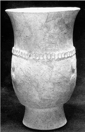
Mayapan Cehac-Hunacti Composite Censer with appliqué fillets (photo courtesy Instituto Nacional de Antropología e Historia).
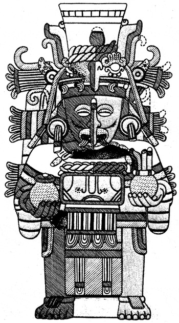
Chen Mul Modeled effigy censer depicting a Mayapan god with maize foliation on a flaring headdress (after Smith 1971:II:Figure 32n).
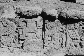
Reused Puuc stones on a bench in Mayapan's Q151 show stones placed without regard to the original designs (photograph courtesy Instituto Nacional de Antropología e Historia).
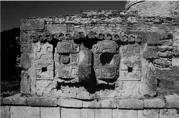
Hall of Chaac Masks (Q151) at Mayapan displays Chaac masks possibly brought from Kabah (photograph by Susan Milbrath).
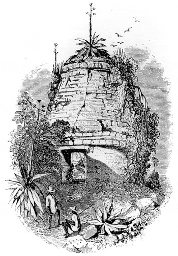
Two cornice moldings are pictured in Catherwood's nineteenth-century drawing of Mayapan's Round Temple, made before a lightning strike in 1869 caused Q152 to collapse (after Stephens 1963).
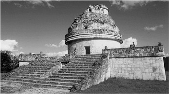
Caracol at Chichen Itza, a round structure that served as an astronomical observatory between a.d. 800 and 1100/1200 (photograph by Susan Milbrath).
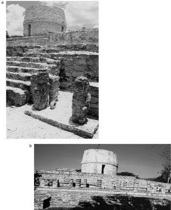
(a) View from the southwest of the Round Temple at Mayapan (Q152) with four doors similar to the Caracol at Chichen Itza. The ring stone in the pavement and squatting figures in the foreground were added relatively late in Mayapan's history. (b) View from the south with Q151 in foreground (photographs by Susan Milbrath).
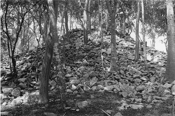
The Round Temple resembled a mountain of stones when INAH began work on the building in 1997 (photograph courtesy Instituto Nacional de Antropología e Historia).
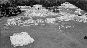
The earliest round structure in the ceremonial precinct of Mayapan, Q84, now almost completely buried in the Central Plaza. To the left is the Q77 Platform. On the north side of the plaza is the Temple of the Niches (Q80), and beyond the plaza to the right is the Temple of the Fisherman (Q95) with a modern roof covering the murals (photograph by Susan Milbrath).
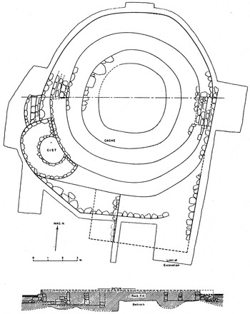
Carnegie's plan of the round platform (Q84) shows a series of concentric circular walls (after Adams 1953:Figure 5).
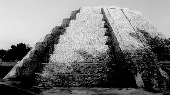
Mayapan's Castillo, with a 5° east of north orientation, has a serpent balustrade that displays triangular shadows (serpent markings?) at sunset around the winter solstice (photograph by Susan Milbrath).
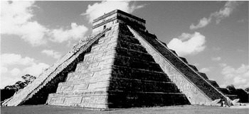
Chichen Itza's Castillo, a radial pyramid with a 21|SD east of north orientation (photograph by Susan Milbrath).
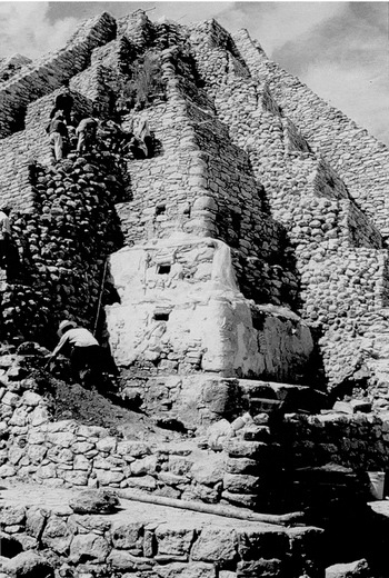
INAH excavations of the southeast corner of the Castillo's inner pyramid (Q162a) has stucco reliefs depicting birds and human figures, three with their heads replaced by a niche to hold a human skull (photograph courtesy Instituto Nacional de Antropología e Historia).
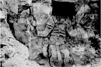
Detail of one skeletal figure on Mayapan's Q162a with niche to hold a human skull (photograph courtesy Instituto Nacional de Antropología e Historia).
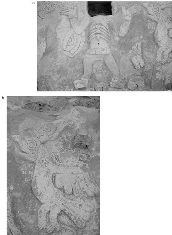
(a) On the southeast corner of Q162a, the east side depicts a skeletal “bee god” and vulture figures resembling ones from Postclassic Maya codices. (b) Detail of vulture on Q162a pyramid (photographs by Susan Milbrath).
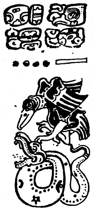
The Dresden Codex 36, believed to date from a.d. 1200–1250, depicts a vulture that compares with Mayapan reliefs (after Villacorta and Villacorta 1977).
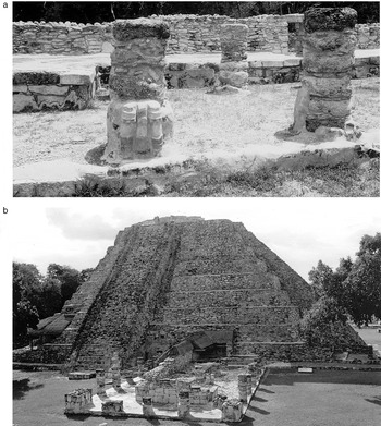
(a) The colonnaded hall (Q163) on the west side of the Castillo with stucco feet of some atlantid figures still in situ (photograph by Susan Milbrath). (b) West side of Castillo showing colonnaded hall (Q163) and Q163a colonnade with bench and niche covered by a modern roof (photograph courtesy Instituto Nacional de Antropología e Historia).

Deity heads found in INAH excavations of Q163 include Xipe Totec, a god closely associated with human sacrifice among the Aztecs (photograph courtesy Instituto Nacional de Antropología e Historia).
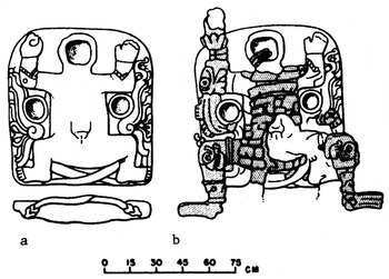
A stucco-covered limestone altar sculpture from Structure H18a (after Chowning 1956:Figure 1b). (a) Earlier altar shows feathered serpents and female goddess. (b) Later remodeling has serpents covered over and added traits of the Aztec earth monster.
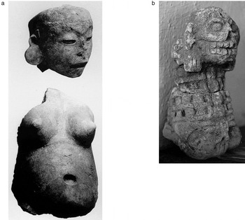
(a) Pregnant figure from Q163 colonnade, possibly representing a counterpart to the Aztec goddess of childbirth, Tlazolteotl (photograph courtesy Instituto Nacional de Antropología e Historia). (b) A small skeletal figure from Mayapan evokes comparisons with the Aztec Cihuateteo (photograph by Susan Milbrath).
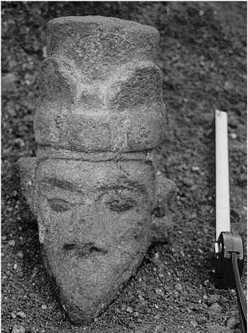
Limestone head of Ehecatl from the INAH's excavation of Q163a suggests links with Central Mexico (photograph courtesy Instituto Nacional de Antropología e Historia).

One of five miniature temples represented in the murals of Room 1 in the Temple of the Niches (Q80). Polychrome color cells outlined in black closely resemble those in Mixteca-Puebla style codices (after Proskouriakoff 1962a:Figure 3d).
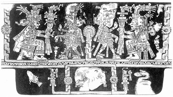
Mixteca-Puebla painting in Structure 5 at Tulum, dating about a.d. 1400 (after Miller 1986:Figure 6.2).
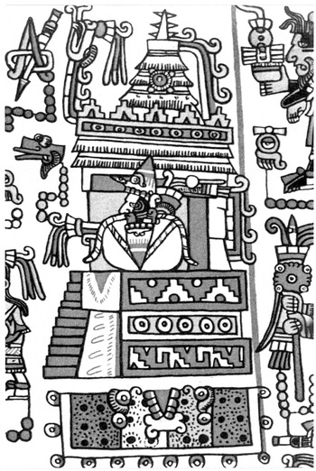
Codex Nuttall 15 depicts temple variously identified as Quetzalcoatl's Temple of Turquoise possibly in Acatlan, Puebla, or the round “wind temple” associated with the Place of the Red and White Bundle in the Mixteca Alta of Oaxaca (after Codex Nuttall 1975).
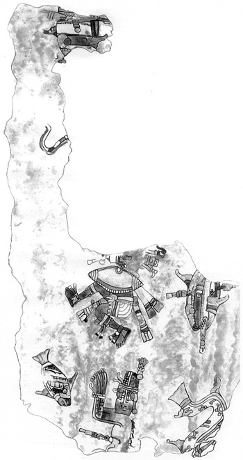
The Temple of the Fisherman (Q95) depicts an elaborately dressed male “fisherman” with speared fish, a bound crocodile, and a marine snake (painting by Anne Deane; courtesy Marilyn Masson).
Mural in situ on the floor of Q95, known as the Temple of the Fisherman (photograph courtesy Instituto Nacional de Antropología e Historia).
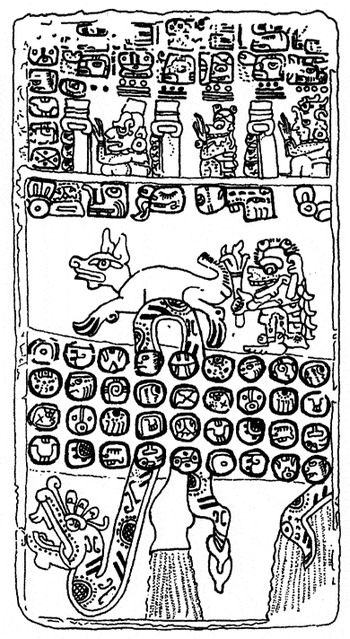
Madrid Codex 16 showing Chicchan Serpent (after Villacorta and Villacorta 1977).

(a) Mayapan's Hall of Frescos (Q161) displays one of a pair of standard-bearers framing a sun disk resembling Central Mexican imagery. (b) One of the eight sun disks and solar companions forming the mural program of Q161, possibly representing the eight-year Venus almanac (photographs by Susan Milbrath).
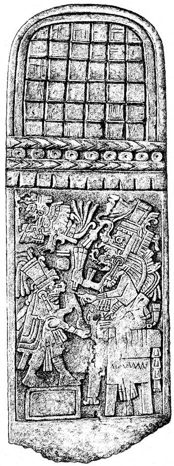
Mayapan Stela 1 dated to the Katun ending 10 Ahau (a.d. 1441; after Proskouriakoff 1962a:Figure 12a).
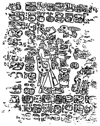
Paris Codex 6 depicts a Katun ceremony with God K head presented to a figure seated on a bound crocodile on a skyband throne (after Villacorta and Villacorta 1977).
A limestone jaguar with maize foliation on back and 3 Ahau date on side from a shrine at Mayapan (drawing courtesy Instituto Nacional de Antropología e Historia).
 You have
Access
- 49
- Cited by