To save content items to your account,
please confirm that you agree to abide by our usage policies.
If this is the first time you use this feature, you will be asked to authorise Cambridge Core to connect with your account.
Find out more about saving content to .
To save content items to your Kindle, first ensure no-reply@cambridge.org
is added to your Approved Personal Document E-mail List under your Personal Document Settings
on the Manage Your Content and Devices page of your Amazon account. Then enter the ‘name’ part
of your Kindle email address below.
Find out more about saving to your Kindle.
Note you can select to save to either the @free.kindle.com or @kindle.com variations.
‘@free.kindle.com’ emails are free but can only be saved to your device when it is connected to wi-fi.
‘@kindle.com’ emails can be delivered even when you are not connected to wi-fi, but note that service fees apply.
Chinese and European maps displayed divergent and sometimes overlapping mathematical, visual and functional aspects. European maps continued the tradition of Ptolemy, applying the mathematics of heavenly bodies to the Earth’s surface. Each point on Earth was made to correspond with an overlapped grid of latitude and longitude coordinates. In China, while the idea of a spherical Earth and the notions of latitude and longitude (the warp and the wheft) were used in astronomy and astrology, cartographers operated with different notions. Chinese maps assumed the Earth to be square and flat, covered by the canopy of heaven. Respecting certain principles of cartographic drawing, maps ensured accuracy by overlaying a grid specifying distances between points.
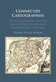
In the 'Age of Discovery', explorers brought a wealth of information about new and strange lands from across the oceans. Yet, even as the Americas appeared on new world maps, China remained a cartographic mystery. How was the puzzle of China's geography unravelled? Connected Cartographies demonstrates that knowledge about China was generated differently, not through exploration but through a fascinating bi-directional cross-cultural exchange of knowledge. Florin-Stefan Morar shows that interactions between Chinese and Western cartographic traditions led to the creation of a new genre of maps that incorporated features from both. This genre included works by renowned cartographers such as Abraham Ortelius and Matteo Ricci and other less-known works, 'black tulips of cartography,' hidden in special collections. Morar builds upon original sources in multiple languages from archives across three continents, producing a pioneering reconstruction of Sino-Western cartographic exchanges that shaped the modern world map and our shared global perspective.
Recommend this
Email your librarian or administrator to recommend adding this to your organisation's collection.