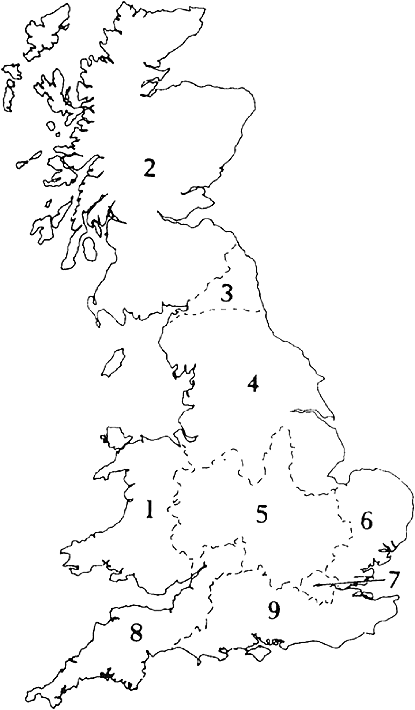
Key to numbered sections of Part I (Sites Explored).

Please note that only the most significant sites and discoveries for each region are included here; for further information see the Supplementary Material for each region available at https://doi.org/10.1017/S0068113X18000302; https://doi.org/10.1017/S0068113X18000314; https://doi.org/10.1017/S0068113X18000326; https://doi.org/10.1017/S0068113X1800034X; https://doi.org/10.1017/S0068113X18000351; https://doi.org/10.1017/S0068113X18000363; https://doi.org/10.1017/S0068113X18000375; https://doi.org/10.1017/S0068113X18000387; https://doi.org/10.1017/S0068113X18000399
CARDIFF
(1) Llanedeyrn, St Edeyrn's (ST 22232 82422): a programme of evaluation trenching, followed by localised excavation, revealed a potential temple or shrine site. It consisted of an enclosure ditch with internal bank, with the internal dimensions consistent with known examples of temple or shrine sites in the Roman Empire, and seemingly too small for domestic use. The ditches formed the temenos or sacred enclosure. There was little evidence for any internal structures as the area had been heavily truncated by modern ploughing, as evidenced by the missing south-eastern side of the enclosure. The location of significant amounts of pottery would indicate a concentration of activity in the south-west side of the enclosure. The earliest material on the site would suggest activity from the second century, but more likely focused on the third century. The enclosure overlooks the Rhymney River valley and would have been visible on the forward slope of the hill from the Roman road from Caerleon to Cardiff, on the high ground to the south, with the putative entrance easily viewed by any road users.Footnote 1
FLINTSHIRE
(1) Pentre Ffwrndan (SJ 2596 7190): review of existing evidence and small-scale community excavations and survey highlighted the growing evidence for a Roman settlement along the coastal road between Chester and Caernarfon (Segontium). The settlement occupation spans the later first to early fourth centuries and extends for at least 900 m between a complex of buildings at Pentre Farm in the north-west, thought to be an official residence associated with lead mining in the district, and a small cremation cemetery near Leadbrook Drive in the south-east. While the settlement may have developed on a piecemeal basis, there is evidence for a degree of formal planning. Excavation on a section of a presumed Roman road north of the Chester/Caernarfon road, revealed a 3.1 m wide section of road surface, flanked by at least one drainage ditch. The combination of geophysical survey and trial excavation helped to confirm the alignment of a Roman side road thought to be leading east to a quayside along the Dee estuary. Sadly, its projected line suggests that the location of the quay may have been largely lost beneath the railway line.Footnote 2
ISLE OF ANGLESEY
(1) Llanddona community (SH 59 80): a hoard of 97 denarii and radiates, Septimius Severus to Carausius, deposited a.d. 286/7 or later, was found by use of a metal-detector. Denarii: Septimius Severus, 1; Plautilla, 1; Julia Maesa, 2; Severus Alexander, 3. Radiates: Gordian III, 7; Philip I, 3; Otacilia Severa, 1; Trebonianus Gallus, 1; joint reign of Valerian and Gallienus, 6 (Gallienus, 2; Salonina, 2; Valerian II, 1; Saloninus, 1); Gallienus (sole reign), 9; Salonina (sole reign), 1; Claudius II, 1; Divus Claudius II, 1; Probus, 1; Postumus, 2; Victorinus, 13; Tetricus I, 15; Tetricus II, 4; uncertain Tetrici, 3; irregular Gallic, 2; Carausius?, 1; irregular Carausius, 1; uncertain, 9.Footnote 3
MONMOUTHSHIRE
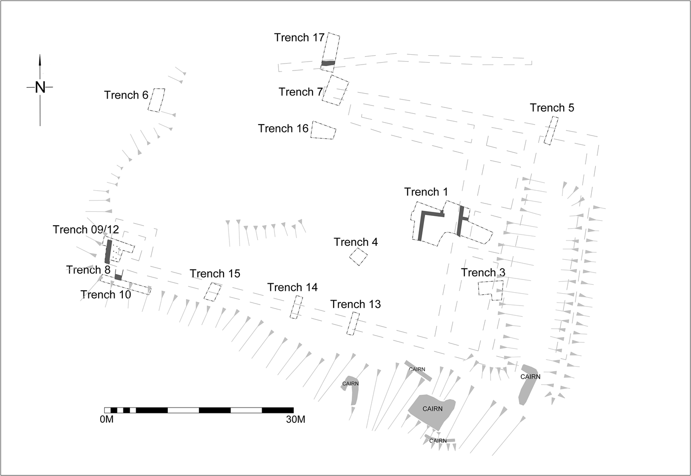
(1) Caerwent, Whitewall Brake, MOD Caerwent Training Area (ST 4753 9114): evaluation trenches confirmed that the site, on an elevation overlooking the Roman town of Venta Silurum, was occupied by a building or buildings of considerable pretension. The complex covered a roughly rectangular area of c. 30–35 m north–south by at least 60 m east–west (fig. 2); its main south facade wall, in coursed mortared masonry, continued west into the Victorian quarry which had led to its original discovery. The south-west corner of the surviving area (trench 9/12) contained at least one, and probably two, hypocaust rooms; the excavated example produced fragments of polychrome mosaic, while an unstratified fragment of dwarf column was found nearby. Excavation at the east end of the site (trench 1) revealed more good masonry walls, their construction and orientation suggesting a single planned complex rather than an agglomeration of structures. Material culture was, however, sparse for a Romano-British site, while the hypocaust showed no sign of ever having been fired. The few finds and the mosaic fragments all point towards a late Roman date, corroborated by the style of the stone roofing slates, identical to those used in the fourth century for the forum basilica of Venta Silurum. The complex could have been residential, or, given its location on a prominence overlooking the Severn basin, might perhaps have been a short-lived, never-completed, sanctuary site analogous to Lydney. Dry-stone structures and possible grave cuts overlying the east part of the site may attest sub-Roman or early medieval reuse.Footnote 4
Caerwent, Whitewall Brake plan.

(2) Llanfihangel Rogiet, Green Farm (ST 45280 87750): an archaeological evaluation revealed two possible fourth-century Roman buildings, represented by robbed wall foundation trenches, and a contemporary kiln. It is one of only three known fourth-century kiln sites in the region.Footnote 5
VALE OF GLAMORGAN
(1) Whitton, Roman villa and environs (ST 08112 71298):Footnote 6 excavation of the western third of the villa showed that the assumed poor preservation of the site was not the case. The exposed portions of the ranges and perimeter ditch were preserved in a very similar condition to when they were last excavated. Previous excavations had investigated the foundations of the west range, but those of the north and south ranges appeared not to have been sampled. The initial phase of construction for both the north and south ranges consisted of foundations of small pitched stones overlain by slabs of limestone. The west and south walls of the north range were rebuilt in a different position using a stepped foundation rather than the previous technique of pitched stones. Both ranges had a sunken room added to their west ends, which in the southern range had previously been interpreted as an unfired hypocaust, however no evidence was found to support this. The current excavations proved that the north wall of the north range belonged to the initial phase of building, which had previously been surmised from a misalignment between walls. The west range was constructed entirely differently from the other two, having been built in one phase with rubble and mortar foundations.
The current excavation also included fields to the north and south of the villa, which allowed the examination of field-systems that accompanied the villa site, and included three secondary metal-working areas. These areas consisted of two to four, regularly spaced, shallow, sub-rectangular depressions around a central area of heat-affected clay. Slag within the depressions and hammerscale in the surrounding area indicate secondary smithing activity. To the south of the villa was a series of extended field-systems, with seemingly four separate phases, all of which contained broadly dated Roman pottery between the second and fourth centuries. Further field-systems located over 500 m north of the villa are also likely to be associated with it, although no dating evidence was retrieved. A T-shaped grain-dryer was found to the south, and three large pits with in-situ burning in the northern field-systems could also be associated grain- or hop-dryers. A large boundary ditch was located to the immediate north of the villa; however, this did not appear to enclose any further features, and may have been for corralling livestock. Five inhumations, one a putative late fourth- to fifth-century military burial, and five cremations were found in the fields directly to the south of the villa.Footnote 7
SUPPLEMENTARY MATERIAL: CONTENTS
For Supplementary Material for this article please visit https://doi.org/10.1017/S0068113X18000302